


MLS Number : 5571137
Sold $185,000 - Hunting & Recreation
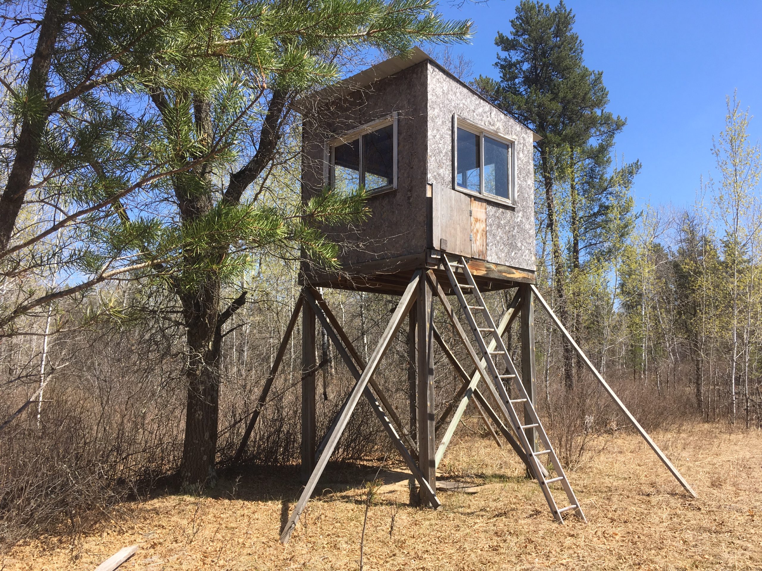
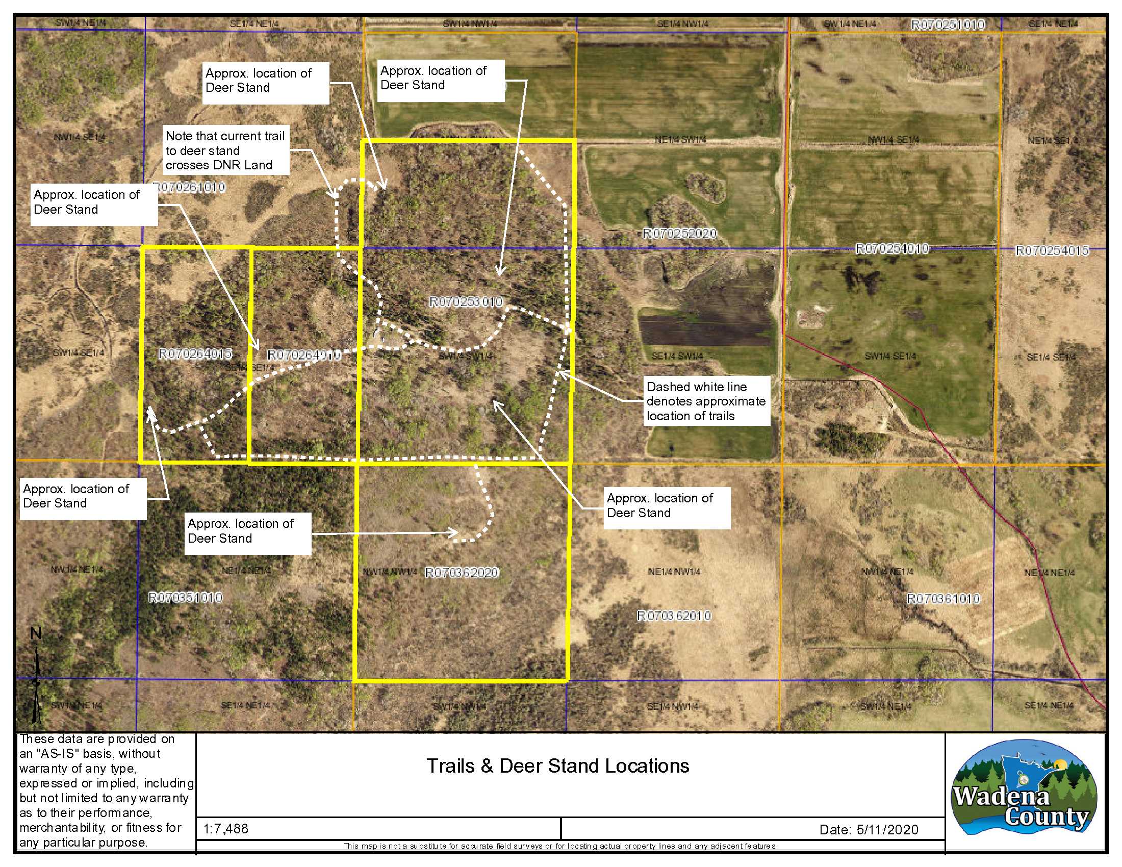
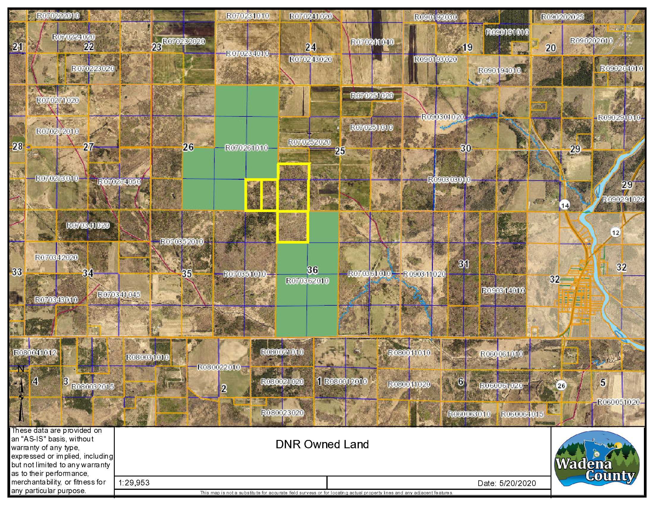
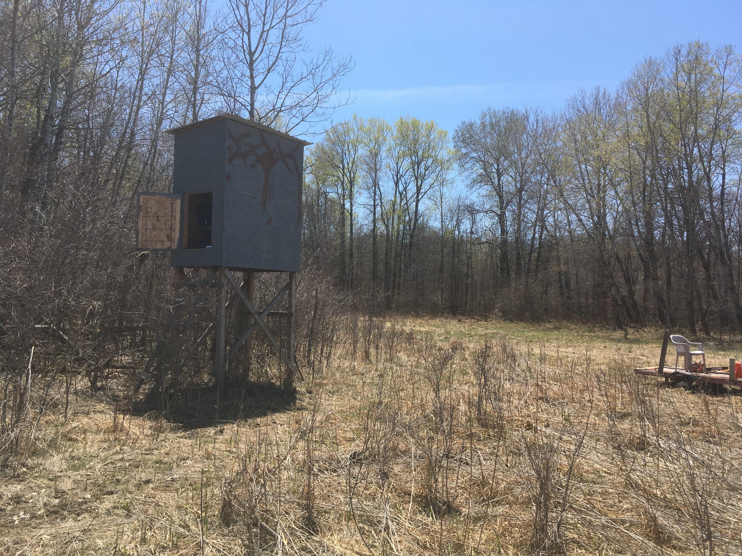
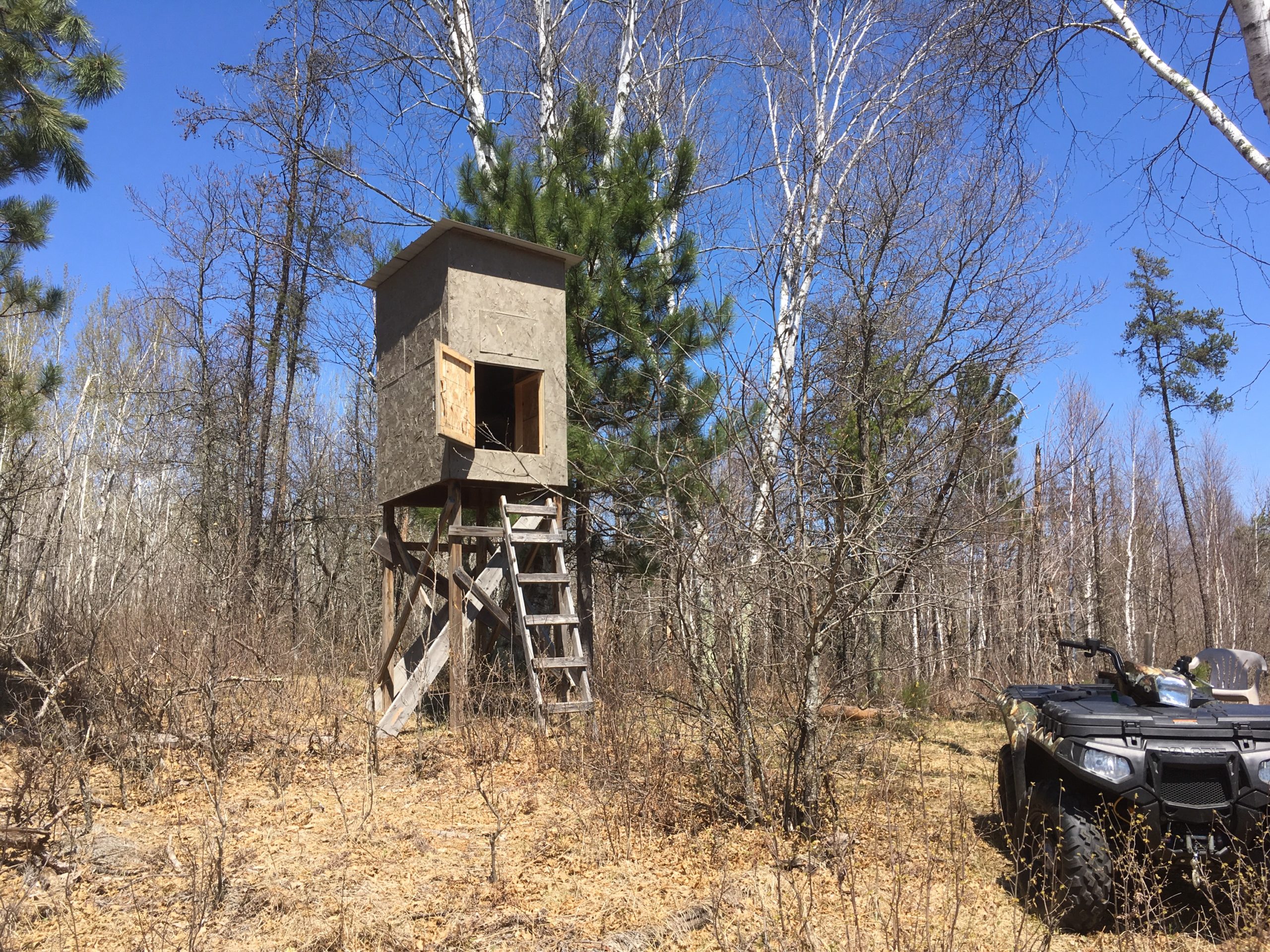
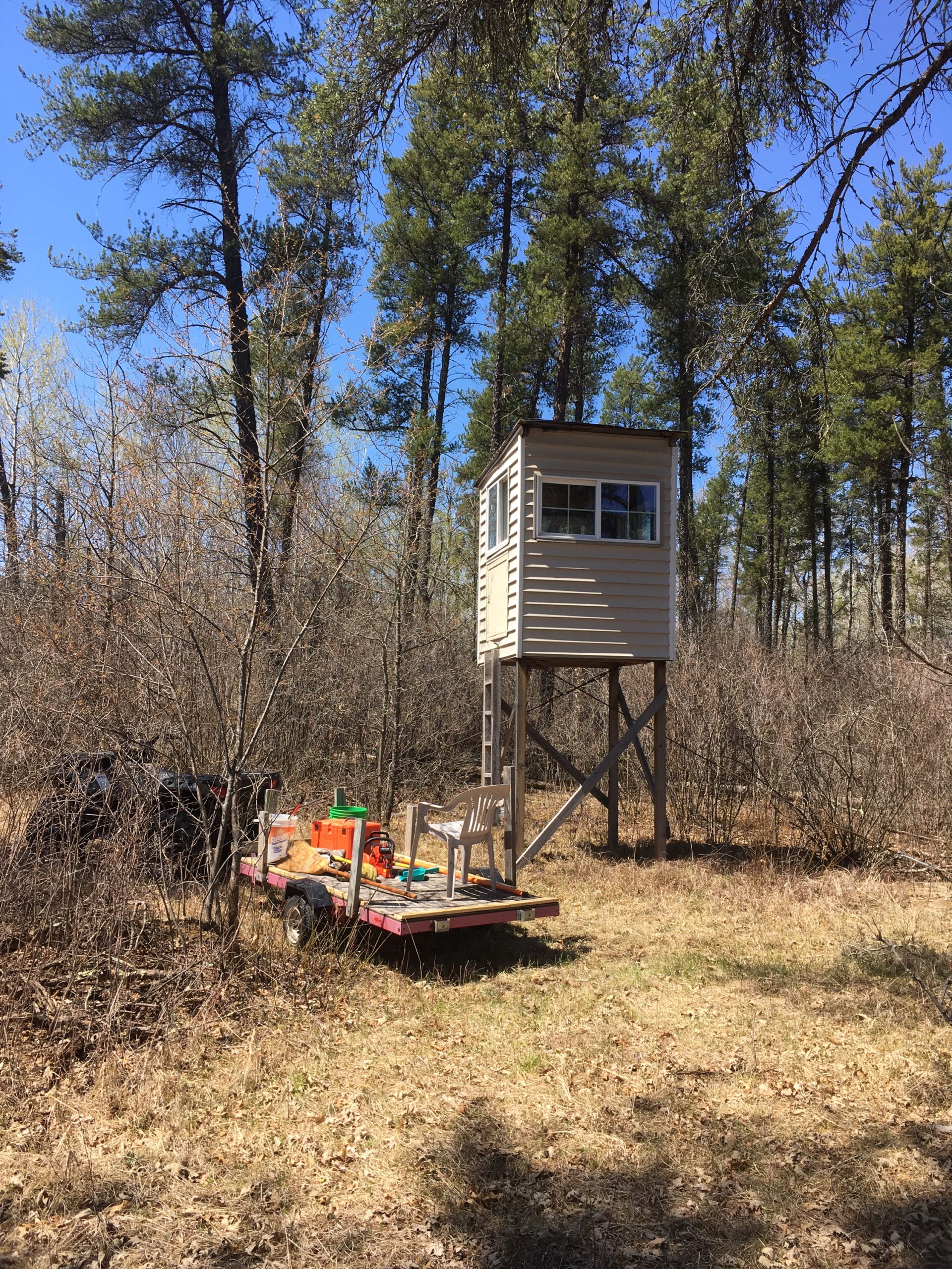
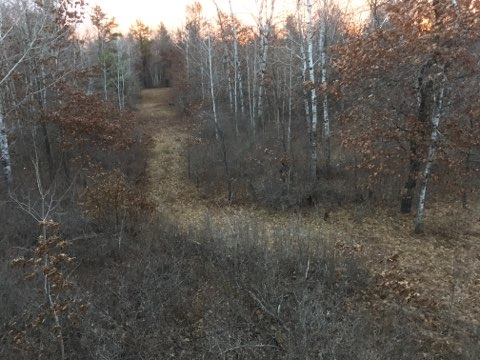
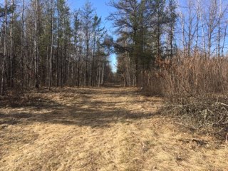
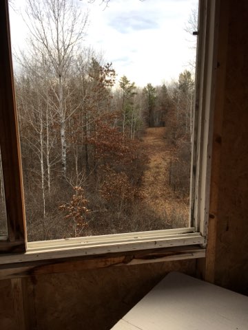
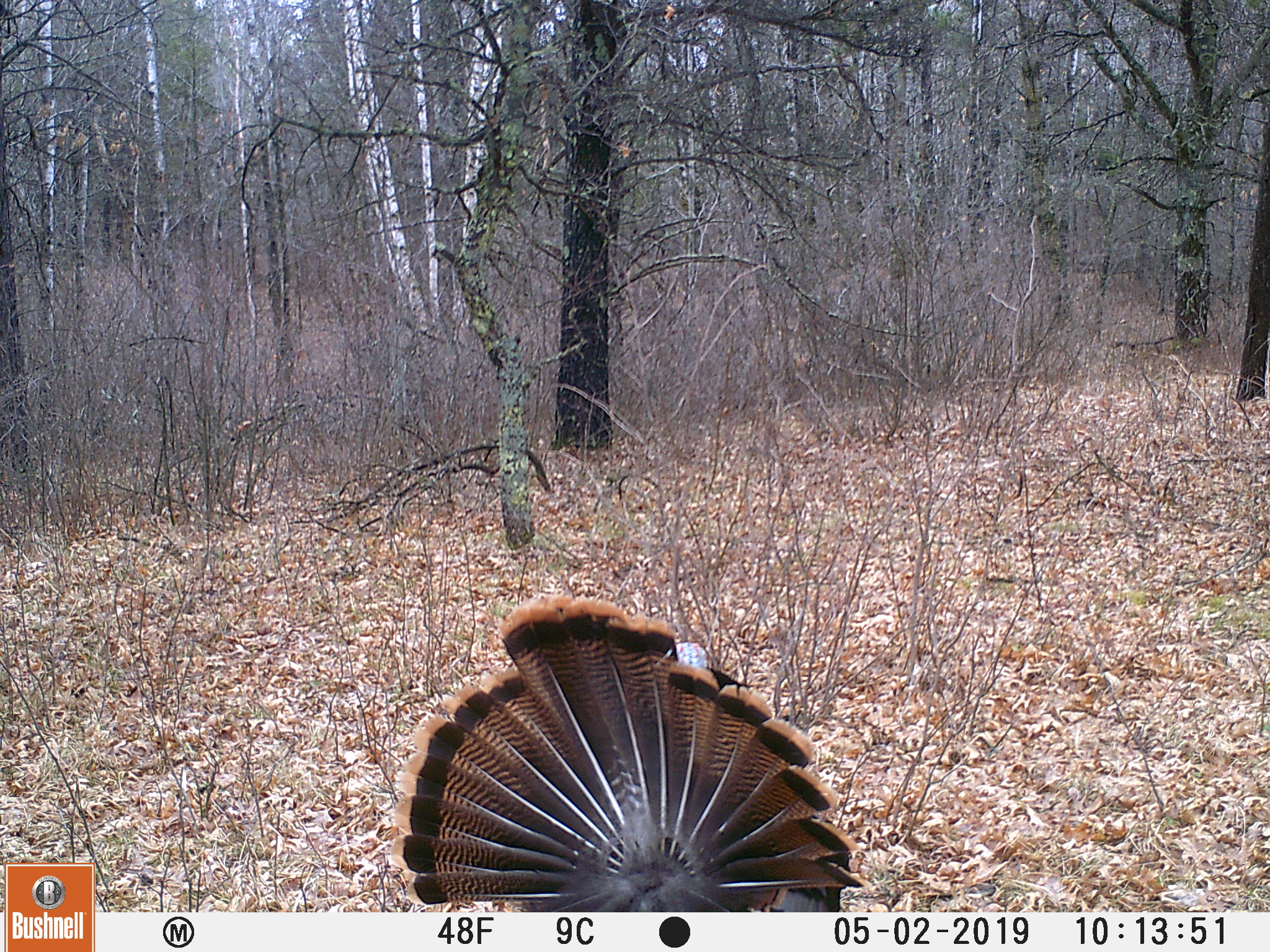
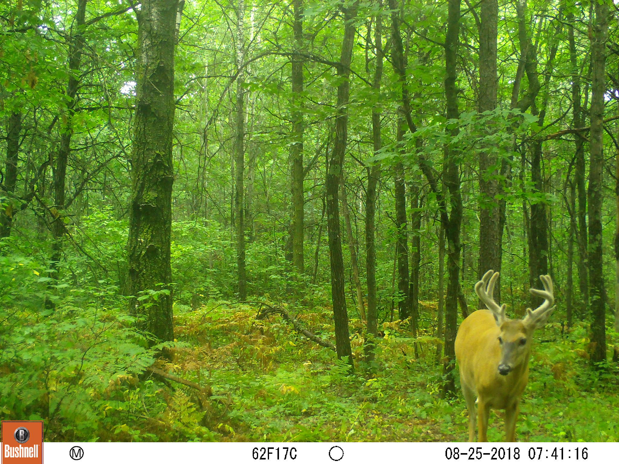
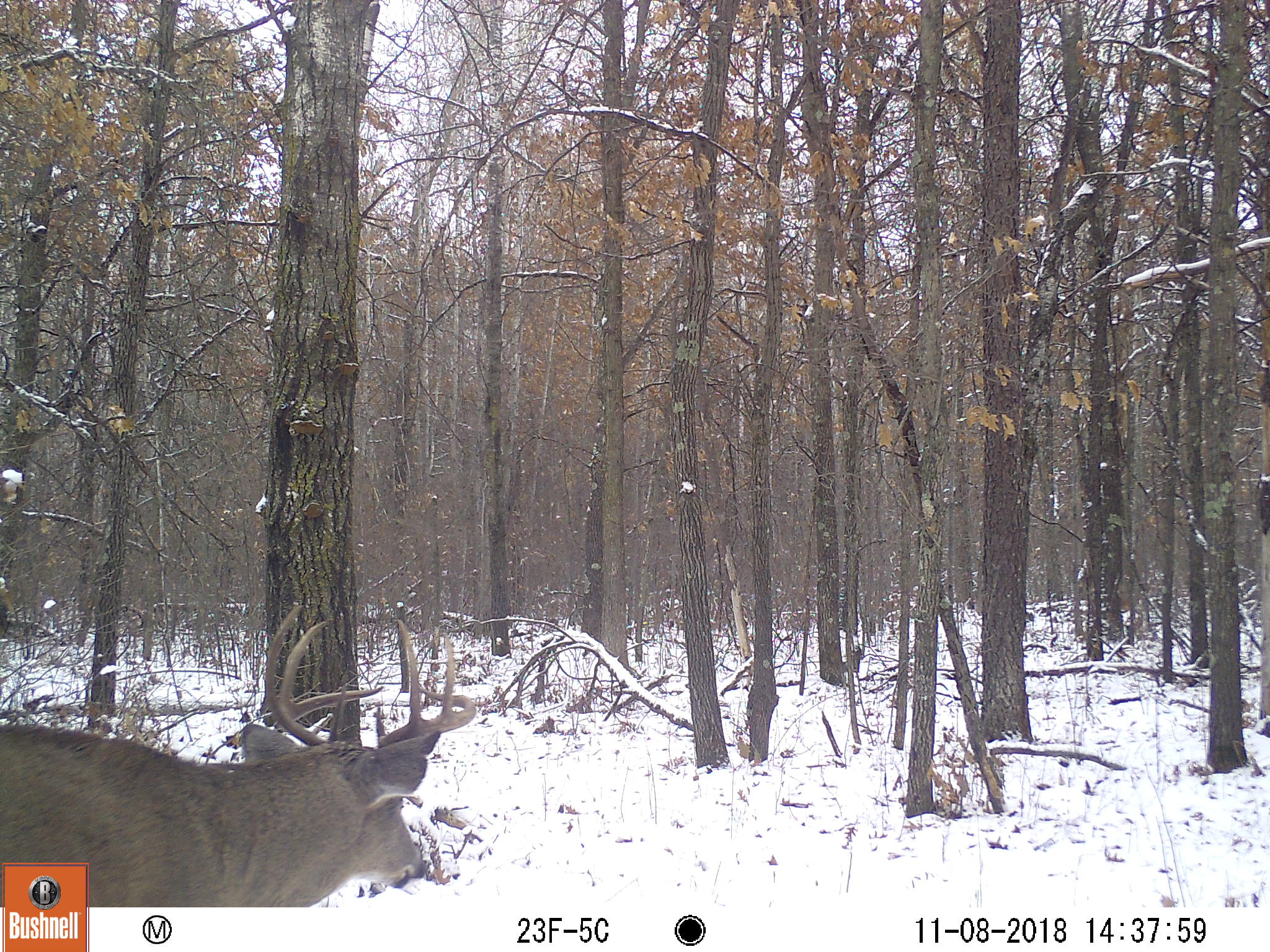
140+/- acres of total privacy in an area known for great Whitetail, bear and turkey hunting. Well maintained trails throughout provide easy access to several well-placed deer stands. The gentle rolling topography, mature forest, grassy areas and wetlands provide a variety of terrain and trees for great wildlife habitat. It also adjoins several hundred acres of DNR managed land and is near the Crow Wing River Corridor WMA, Strike WMA and Crow Wing River State Water Trail for additional recreation possibilities. Just a few minutes northwest of Nimrod this property will provide many great opportunities to establish long-lasting family memories.
Main Property Info
Property ID
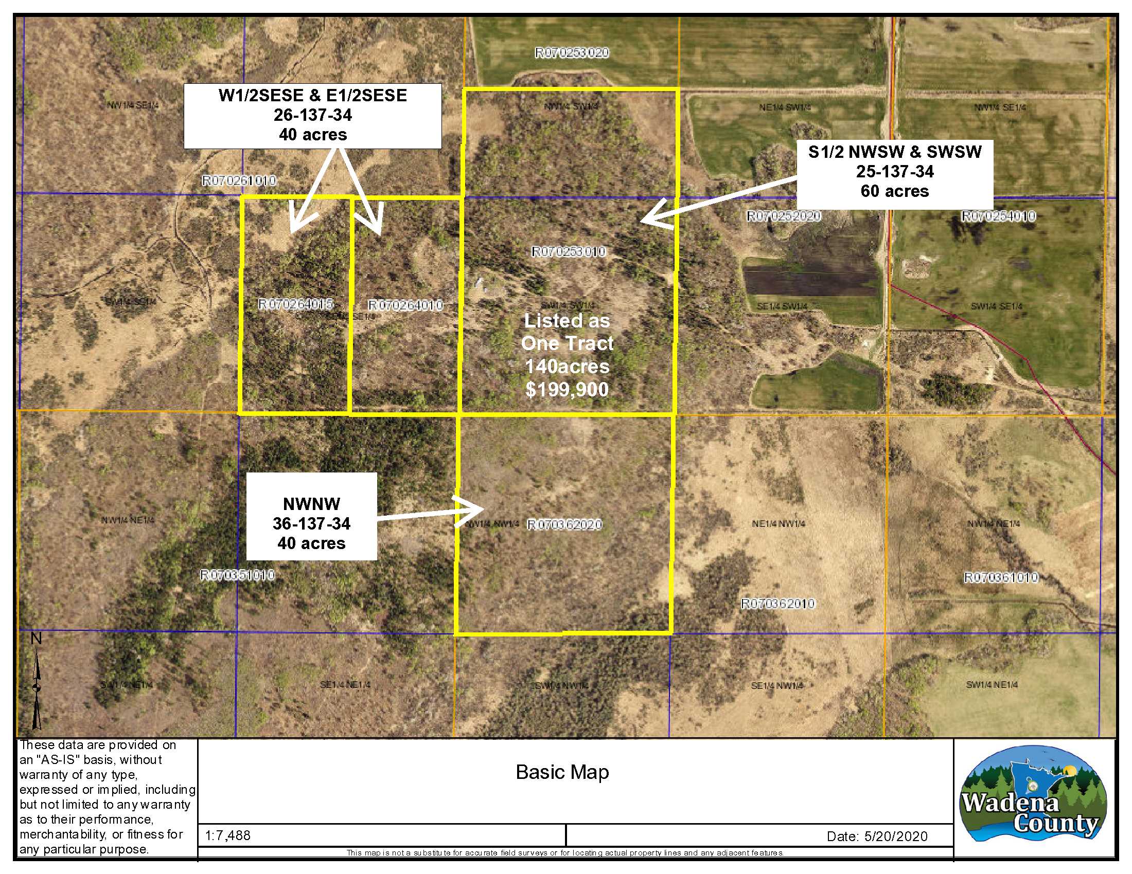
R070253010, R070264010, R070362020 & R070264015
R070253010, R070264010, R070362020 & R070264015
MLS Number
5571137
5571137
Status
Sold
Sold
List Price
$199,900
$199,900
Selling Price
$185,000
$185,000
Acres
140
140
Zoning
A-2
A-2
City
Sebeka
Sebeka
Township
Meadow Twp
Meadow Twp
State
MN
MN
Zip Code
56477
56477
County
Wadena
Wadena
Legal Description
W1/2 SW less N1/2 NWSW, 25-137-34 AND SESE, 26-137-34 AND NWNW 36-137-34, Wadena County, MN, Together with a roadway easement as set forth in Book 123, Pages 261 to 263, Document No. 179033. Subject to any other easements, restrictions and reservations of record. See attached Exhibit A in supplements for full legal description.
W1/2 SW less N1/2 NWSW, 25-137-34 AND SESE, 26-137-34 AND NWNW 36-137-34, Wadena County, MN, Together with a roadway easement as set forth in Book 123, Pages 261 to 263, Document No. 179033. Subject to any other easements, restrictions and reservations of record. See attached Exhibit A in supplements for full legal description.
Property Location
Directions
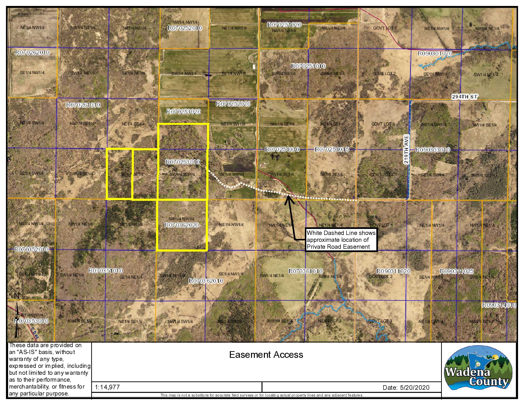
From Nimrod take County Road 14 approx. 1 mile north, turn west onto 294th Street and follow to a minimum maintenance road (219th Ave) continue for approx. 1mile, at the farm gate continue west approx. 3/4 mile along an easement road, watch for culvert crossing a drainage ditch. Property begins at a small grassy clearing near an old metal gate.
From Nimrod take County Road 14 approx. 1 mile north, turn west onto 294th Street and follow to a minimum maintenance road (219th Ave) continue for approx. 1mile, at the farm gate continue west approx. 3/4 mile along an easement road, watch for culvert crossing a drainage ditch. Property begins at a small grassy clearing near an old metal gate.
Access
Property is accessed via a private easement road from 294th Street.
Property is accessed via a private easement road from 294th Street.
GPS Coordinates
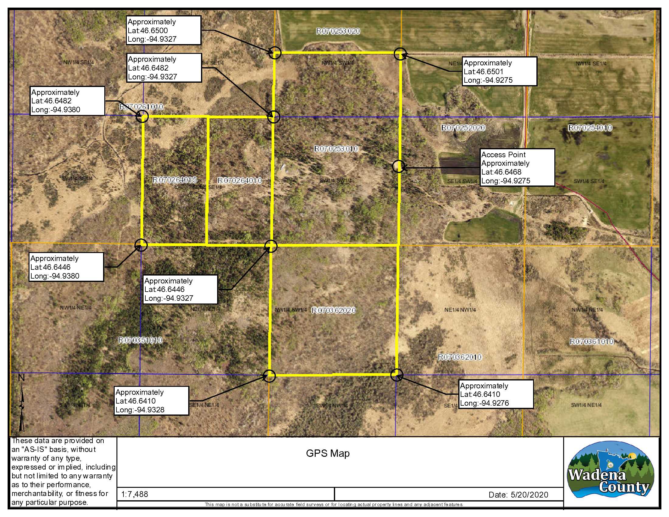
Coordinates to approximate corners/points based on county mapping: NW: 46.6482, -94.9380 NE: 46.6501, -94.9275 SE: 46.6410, -94.9276 SW: 46.6446, -94.9380
Coordinates to approximate corners/points based on county mapping: NW: 46.6482, -94.9380 NE: 46.6501, -94.9275 SE: 46.6410, -94.9276 SW: 46.6446, -94.9380
Address
TBD 294th Street, Sebeka, MN 56477
TBD 294th Street, Sebeka, MN 56477
School District
Sebeka - 820
Sebeka - 820
Property Details
Wooded Acres
110
110
Dimensions (approx)
1320' x 2930' x 2715' x 3300'
1320' x 2930' x 2715' x 3300'
Utilities
Available Utilities
None
None
On Site Utilities
None
None
Waterfront
Waterfront Name
N/A
N/A
Waterfront Number
N/A
N/A
Waterfront Feet (approx)
N/A
N/A
Taxes & Fees
Has Association Fee
No
No
Association Fee
$0
$0
Association Fee Includes
0
0
Tax Amount
$2,190
$2,190
Assessment Amount
0
0
Tax With Assessments
$2,190
$2,190
Assessment Pending
No
No
Assessment Description
N/A
N/A
Tax Year
2020
2020
Other Details
Section Number
25, 26 & 36
25, 26 & 36
Township Number
137
137
Range Number
34
34
Estimated Upland %
95
95
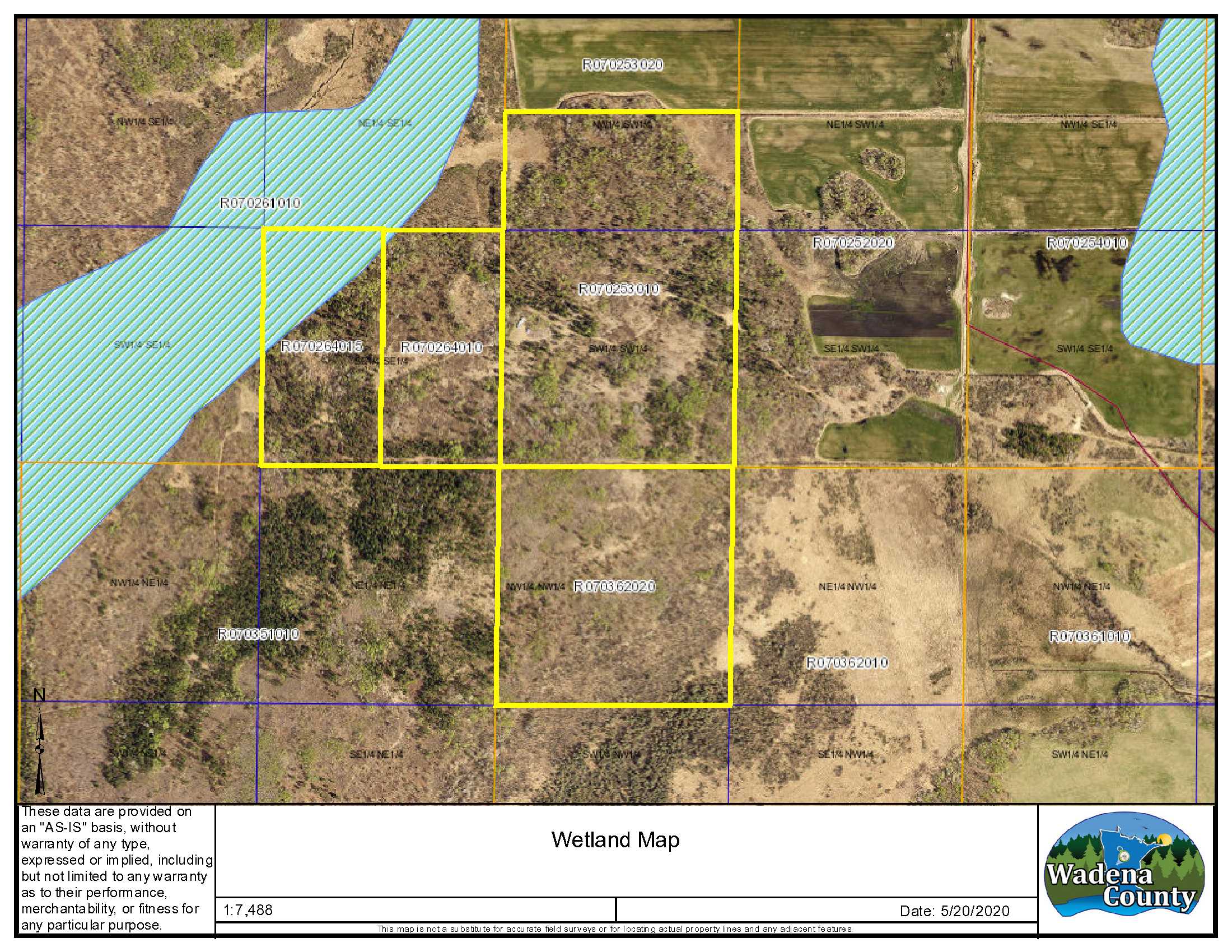
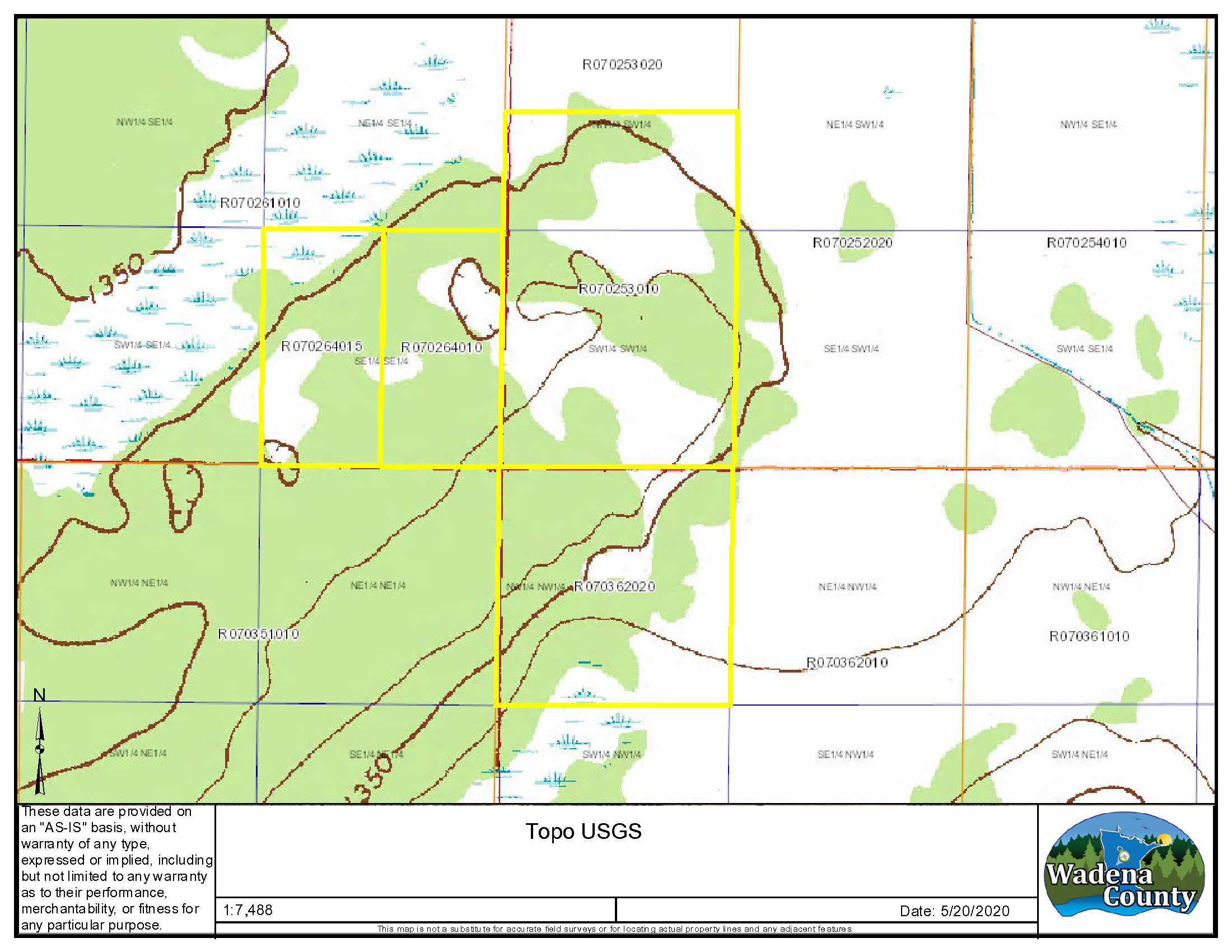
Estimated Wetland %
5
5
Additional Comments
Timber Comments
Mature forest. Tree variety includes coniferous, mixed hardwoods and deciduous trees.
Mature forest. Tree variety includes coniferous, mixed hardwoods and deciduous trees.
Hunting Comments
Deer Permit Area: 246
Deer Permit Area: 246
Disclosures
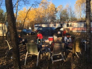
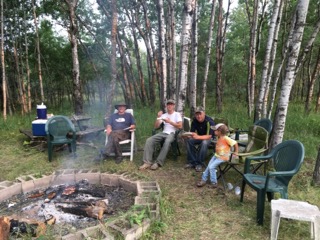
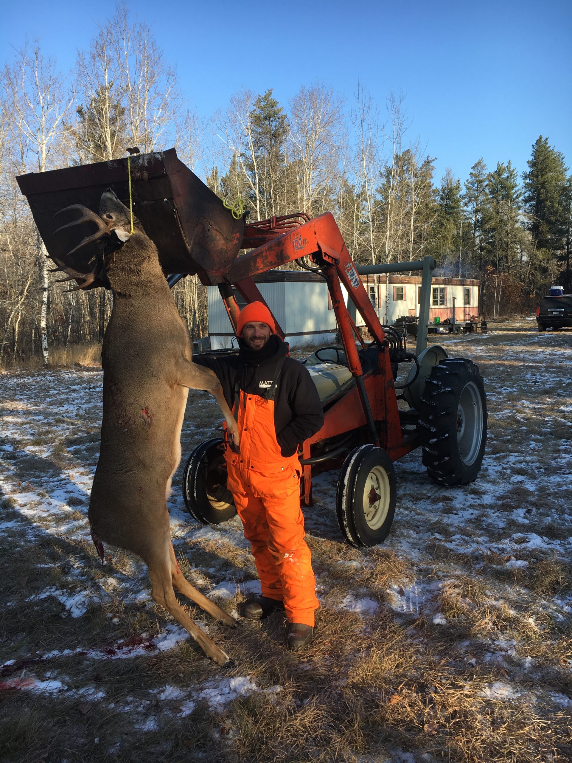
A private road easement affects this property. See Exhibit A legal description, Road Easement in Supplements and maps for details. Property is being sold as one parcel and will not be split. There is an approximately 65 ft. mobile home with a wood stove and a 1981 camper that have been used as bunk houses during hunting season. They will go with the property and are being sold AS-IS. There is some evidence of previous roof leaks on both the mobile home and camper. There is a tractor with loader and mower on the property that is negotiable. This property is enrolled in SFIA, which provides payments to landowners in return for maintaining the property for forestry uses. Reserved out of the SFIA Agreement is approximtely 3 acres that has been allowed for a building site. See SFIA information in supplements. Shared easements affect this property and easements granted and reserved/retained will include terms governing shared use of the easements. See legal description and maps for details. Acreage, dimensions, and taxes estimated based on county data and mapping or seller data; county disclaimers included by reference; subject to split approval if necessary. Not surveyed. Photos/maps and GPS coordinates for convenience only and not guaranteed; physically inspect prior to purchase.
A private road easement affects this property. See Exhibit A legal description, Road Easement in Supplements and maps for details. Property is being sold as one parcel and will not be split. There is an approximately 65 ft. mobile home with a wood stove and a 1981 camper that have been used as bunk houses during hunting season. They will go with the property and are being sold AS-IS. There is some evidence of previous roof leaks on both the mobile home and camper. There is a tractor with loader and mower on the property that is negotiable. This property is enrolled in SFIA, which provides payments to landowners in return for maintaining the property for forestry uses. Reserved out of the SFIA Agreement is approximtely 3 acres that has been allowed for a building site. See SFIA information in supplements. Shared easements affect this property and easements granted and reserved/retained will include terms governing shared use of the easements. See legal description and maps for details. Acreage, dimensions, and taxes estimated based on county data and mapping or seller data; county disclaimers included by reference; subject to split approval if necessary. Not surveyed. Photos/maps and GPS coordinates for convenience only and not guaranteed; physically inspect prior to purchase.


