


MLS Number : 000000
$49,900 - Hunting & Recreation
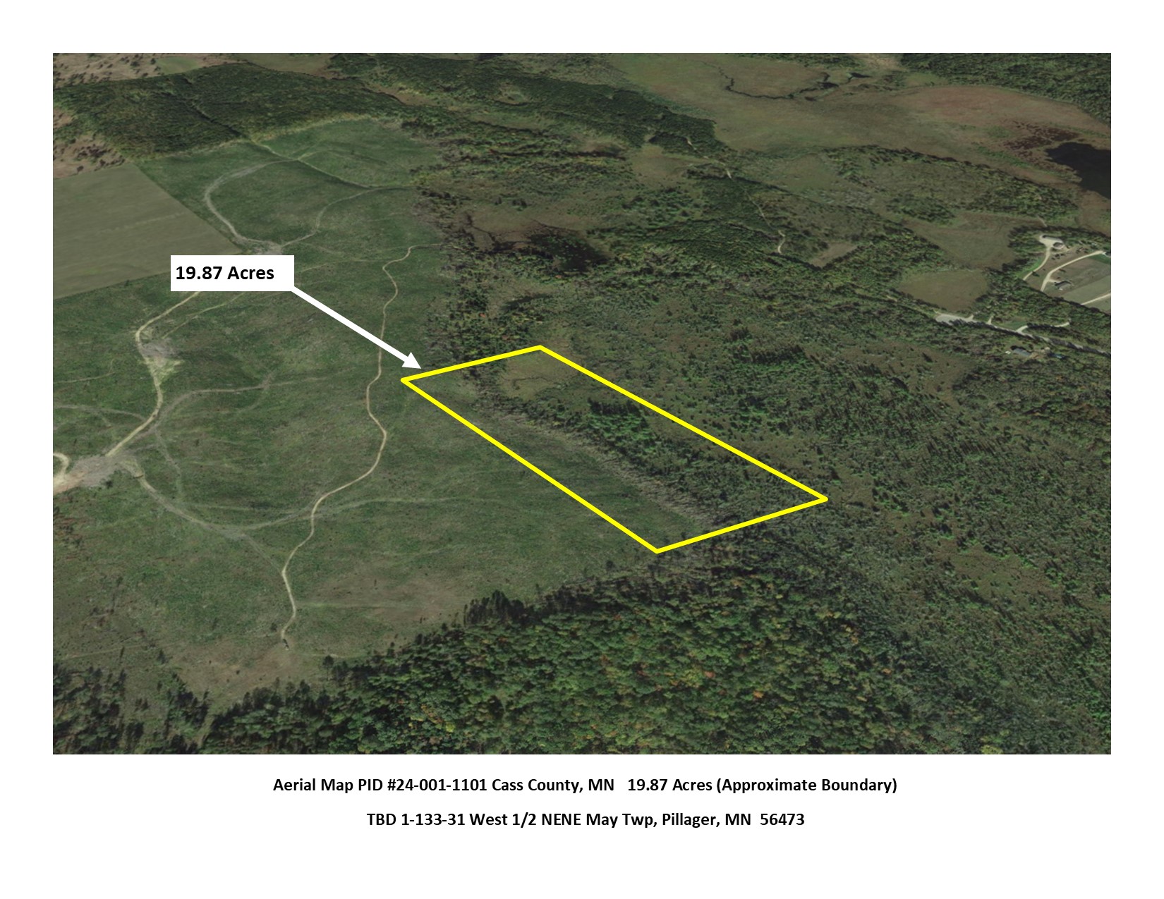
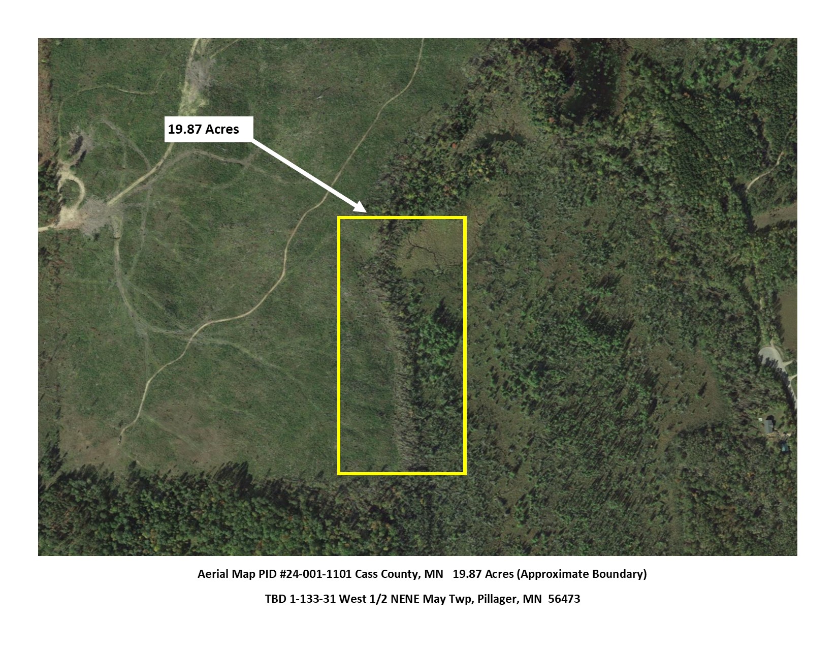
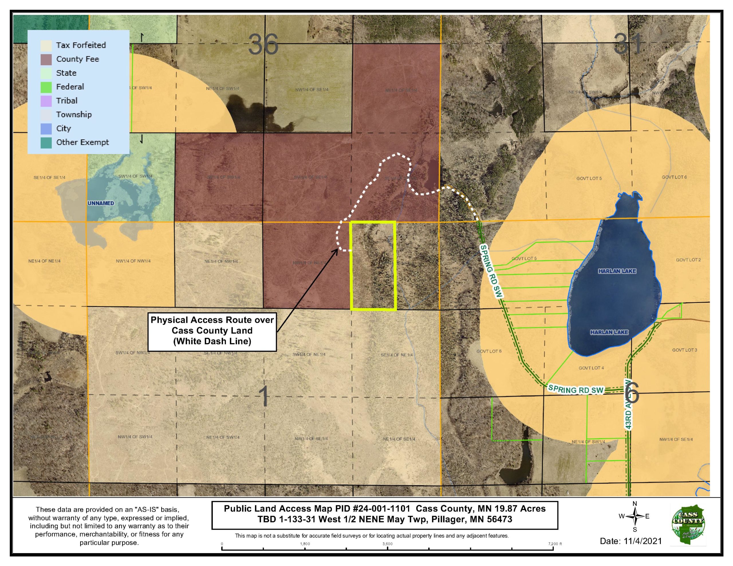
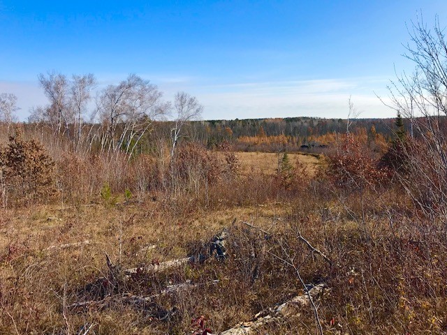
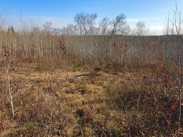
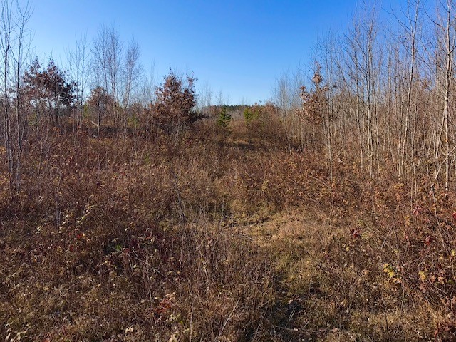
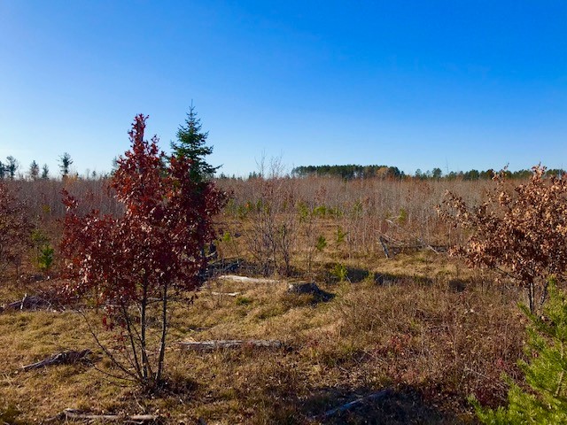
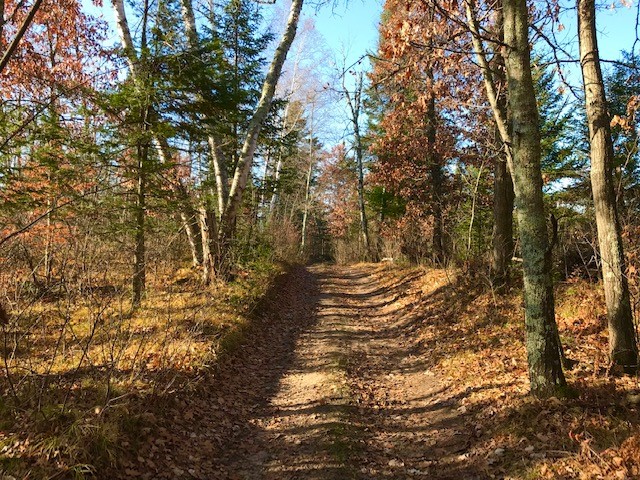
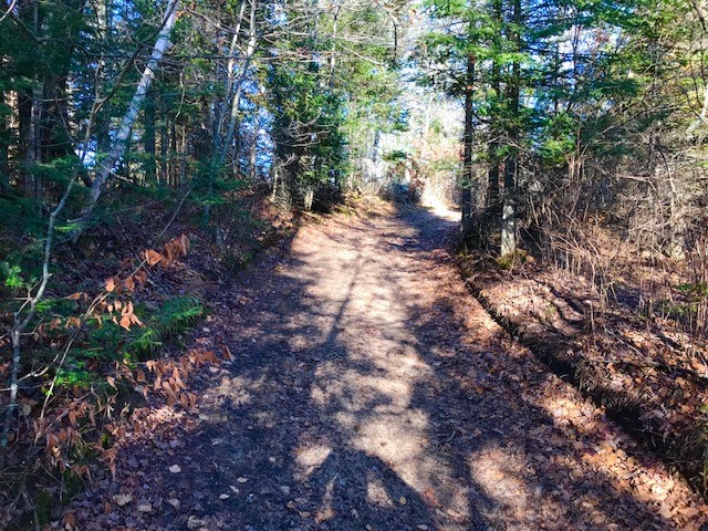
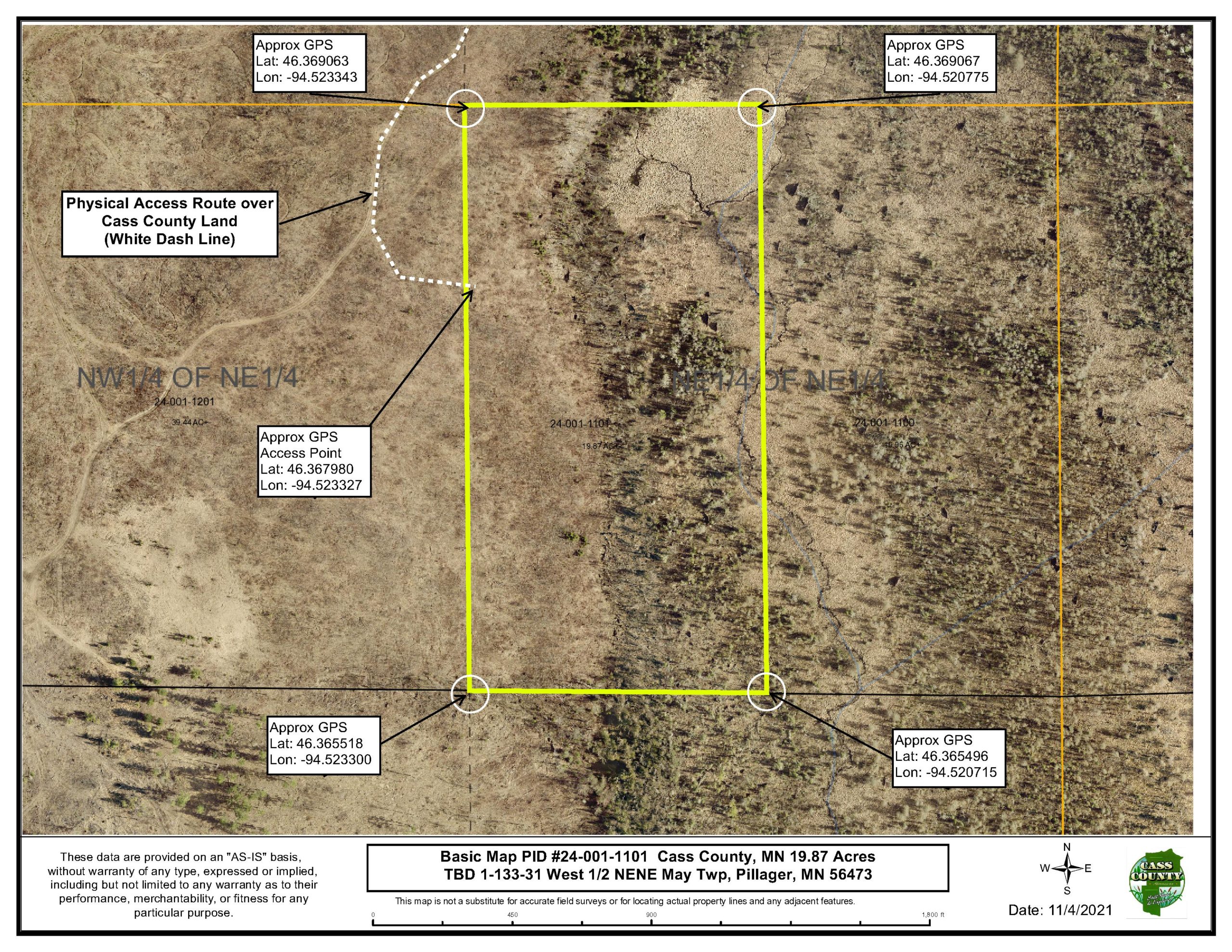
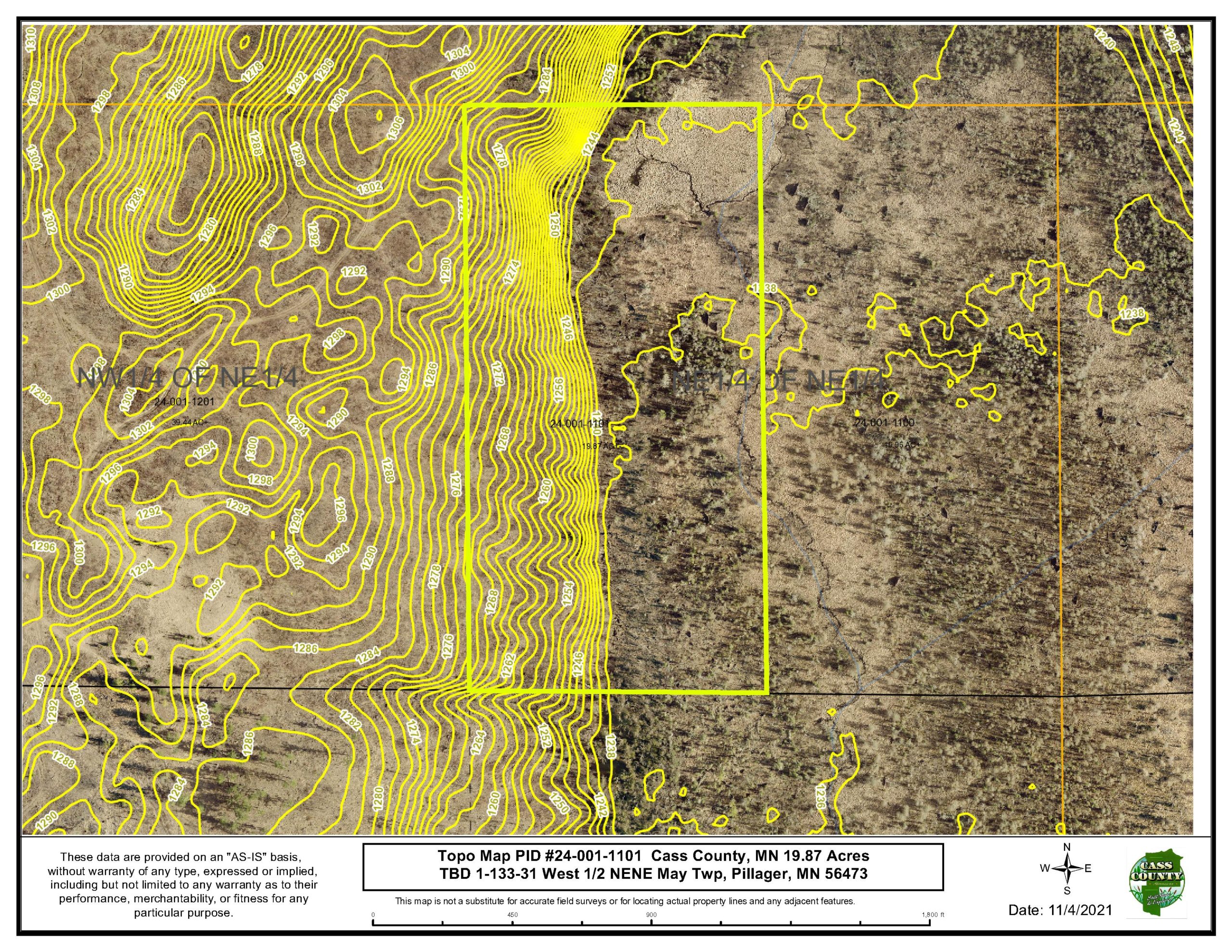
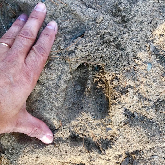
OFF MARKET Beautiful Hunting/Recreational Land just 5 miles NW of Pillager in MAY Twp near Harlan Lake. This 19.87 Acre Parcel sits in the heart of over 500 acres of additional public land to hunt and play on! With a mix of Aspen, Pine, Tamarack, some hardwoods and a water source throughout, this makes for a perfect habitat for Whitetail Deer, Bear, Turkey and other land and water birds. This tract is situated perfectly along a wildlife pinch point from all the adjoining public land with the easterly wetlands and overlooks. Paved road right up to the remaining 0.9 mile of Conservation and County Land roadway access to parcel. “Remoteness Within Reach!”
Main Property Info
Property ID
240011101
240011101
MLS Number
000000
000000
List Price
$49,900
$49,900
Acres
19.87
19.87
Zoning
AG/Forestry
AG/Forestry
City
Pillager
Pillager
Township
May Twp
May Twp
State
MN
MN
Zip Code
56473
56473
County
Cass
Cass
Legal Description
W1/2 OF NENE, 01-133-31 Cass County, MN. (Full Legal to Govern).
W1/2 OF NENE, 01-133-31 Cass County, MN. (Full Legal to Govern).
Property Location
Directions
Directions From Pillager, at the Intersection of Co Rd 1 and Hwy 210, Go west on Hwy 210 for 1.1mi Turn right (N) on 43rd Ave SW. Go 1.5mi Turn Left (W) on Spring Rd SW & go 0.6mi. to road end. Cont north on dirt route over conservation and county land (keep left at intersections) for 0.8mi. Land on Left (E).
Directions From Pillager, at the Intersection of Co Rd 1 and Hwy 210, Go west on Hwy 210 for 1.1mi Turn right (N) on 43rd Ave SW. Go 1.5mi Turn Left (W) on Spring Rd SW & go 0.6mi. to road end. Cont north on dirt route over conservation and county land (keep left at intersections) for 0.8mi. Land on Left (E).
Access
"Physical Access" is over 0.9 Mile of Conservation and County Land. (Legal access TBD by buyer). Recommend 4 wheel drive or better to visit and/or walk in over some parts of the county & parcel land. Approximate GPS Point of Access: Lat: 46.367980, Lon:-94.523327.
"Physical Access" is over 0.9 Mile of Conservation and County Land. (Legal access TBD by buyer). Recommend 4 wheel drive or better to visit and/or walk in over some parts of the county & parcel land. Approximate GPS Point of Access: Lat: 46.367980, Lon:-94.523327.
GPS Coordinates
Coordinates to approximate corners/points based on county mapping: NW Lat:46.369063, Lon:-94.523343 NE Lat:46.369067, Lon:-94.520775 SE Lat:46.365496, Lon:-94.520715 SW Lat:46.365518, Lon:-94.523300
Coordinates to approximate corners/points based on county mapping: NW Lat:46.369063, Lon:-94.523343 NE Lat:46.369067, Lon:-94.520775 SE Lat:46.365496, Lon:-94.520715 SW Lat:46.365518, Lon:-94.523300
Address
TBD Access From Spring Rd SW, Pillager
TBD Access From Spring Rd SW, Pillager
School District
Pillager - 116
Pillager - 116
Property Details
Wooded Acres
15
15
Dimensions (approx)
660'x1320'x660'x1320'
660'x1320'x660'x1320'
Utilities
Available Utilities
None
None
On Site Utilities
None
None
Taxes & Fees
Has Association Fee
No
No
Tax Amount
$132
$132
Assessment Amount
0.00
0.00
Tax With Assessments
$132
$132
Assessment Pending
No
No
Tax Year
2021
2021
Other Details
Section Number
01
01
Township Number
133
133
Range Number
31
31
Estimated Upland %
70
70
Estimated Wetland %
30
30
Additional Comments
Timber Comments
Mix of Pine, Aspen, Tamarack, Young Hardwoods.
Mix of Pine, Aspen, Tamarack, Young Hardwoods.
Hunting Comments
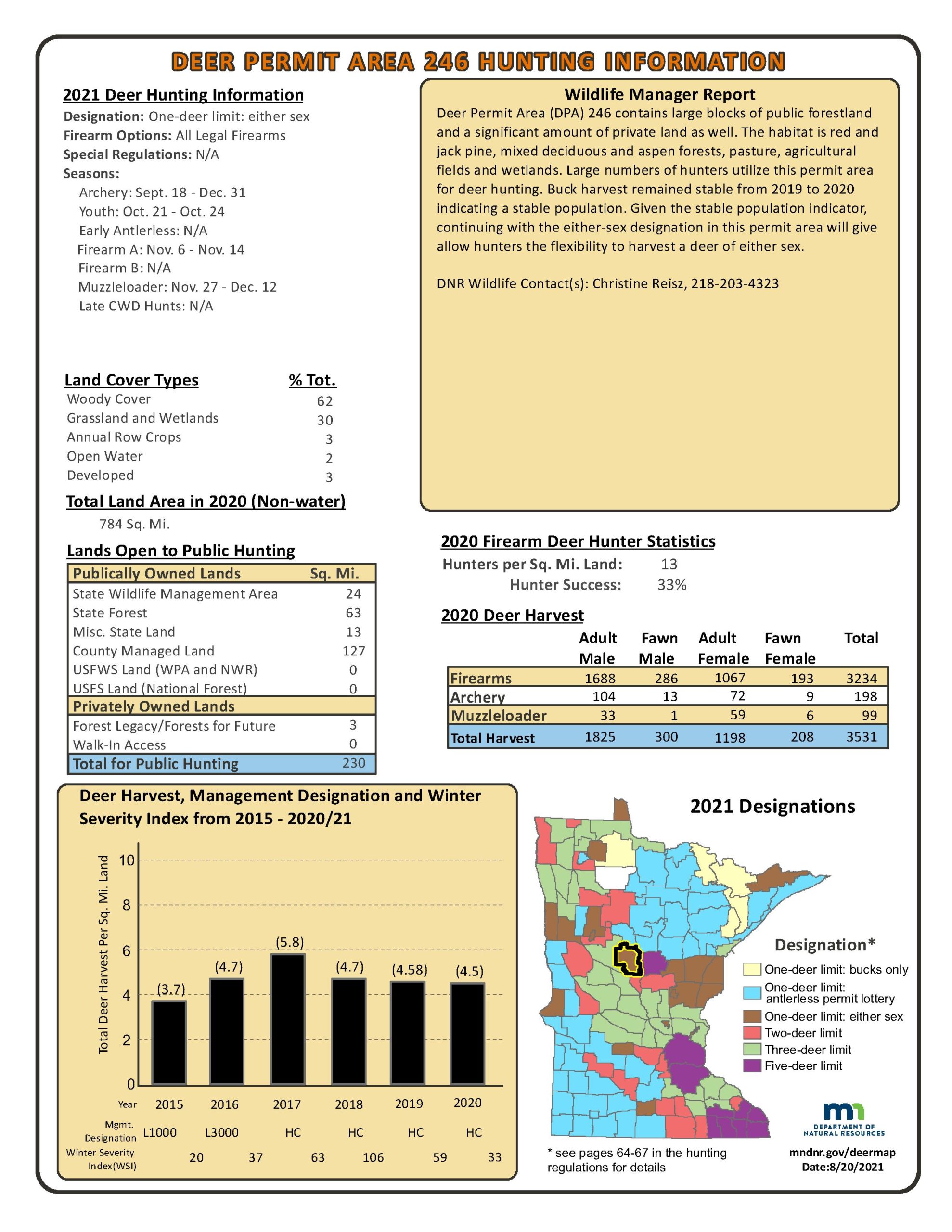
Deer Permit Area 246
Deer Permit Area 246
Disclosures
"Physical Access" is over Conservation and County Land. (Legal access TBD by buyer). Recommend 4 wheel drive or better to visit and/or walk in over some parts of the county & parcel land. Seller may consider "Seller Financing Contract For Deed", see agent.
"Physical Access" is over Conservation and County Land. (Legal access TBD by buyer). Recommend 4 wheel drive or better to visit and/or walk in over some parts of the county & parcel land. Seller may consider "Seller Financing Contract For Deed", see agent.

