


MLS Number : 5632028
Sold $70,000 - Hunting & Recreation
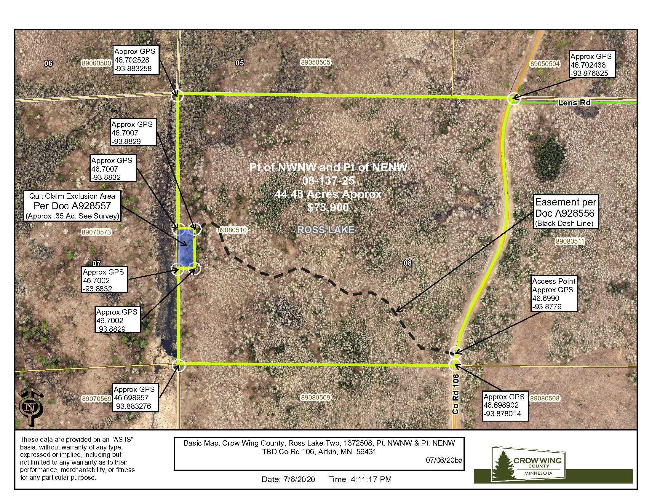
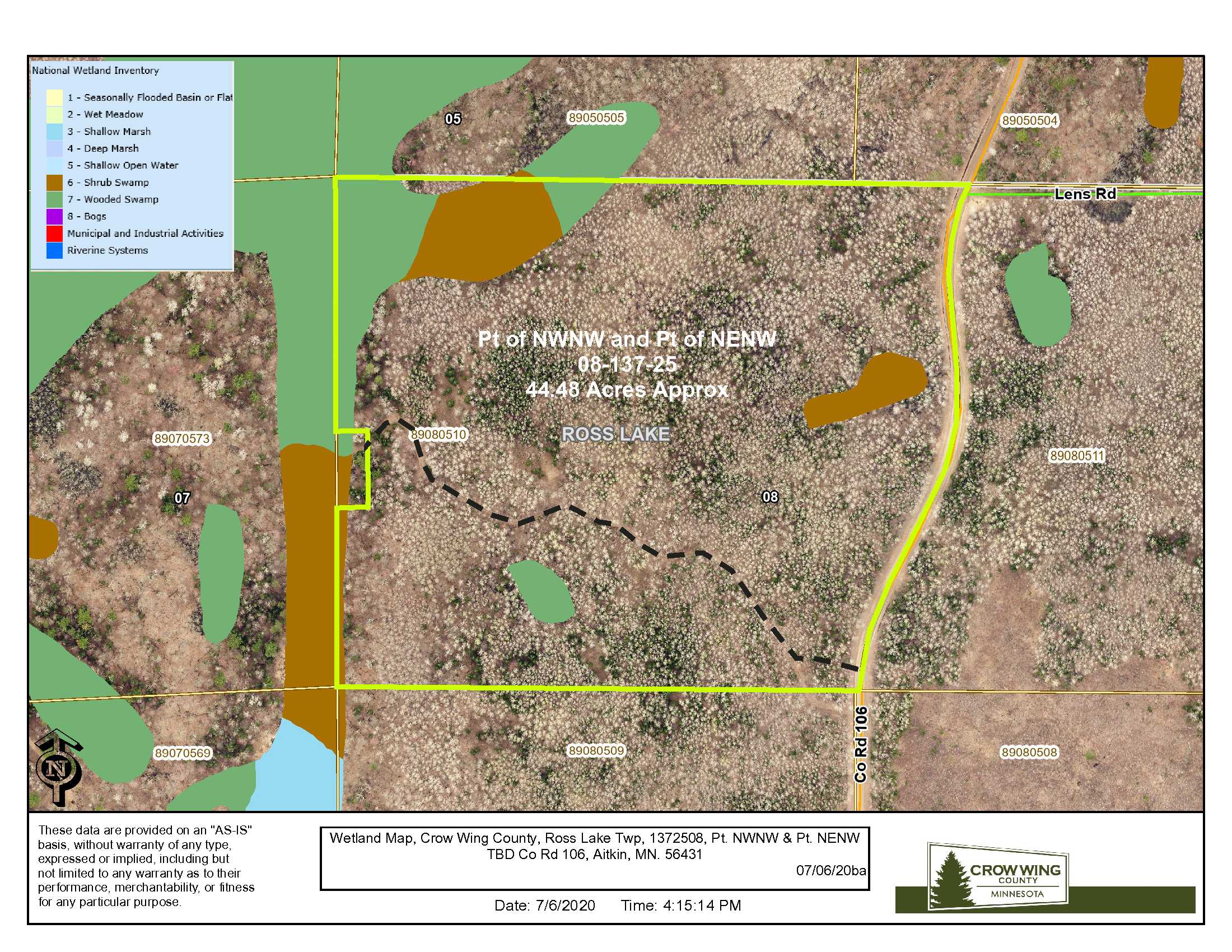
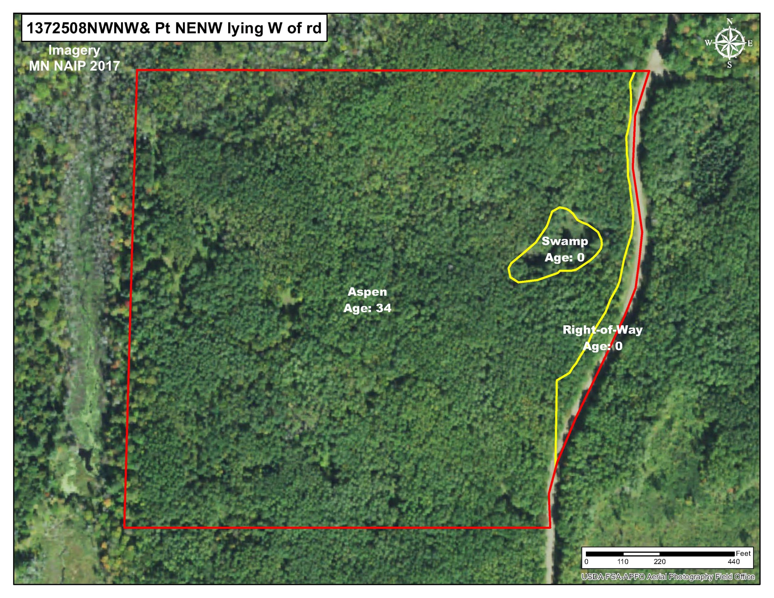
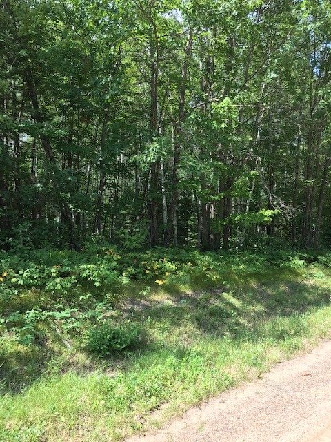
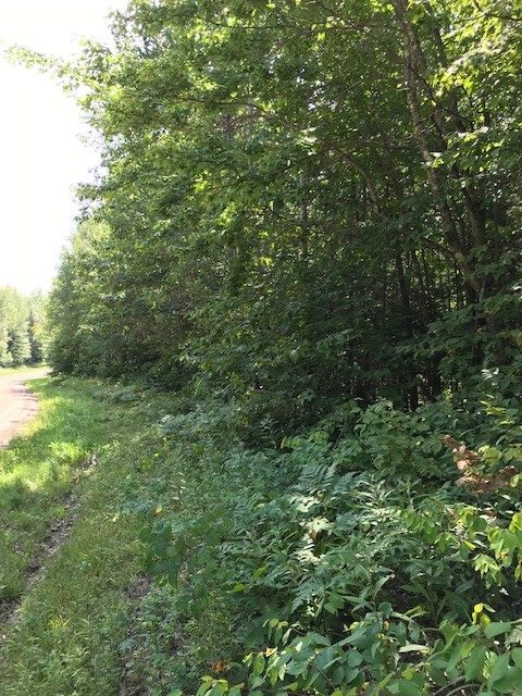
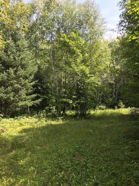
This is a 44+ acre parcel of Potlatch Deltic land near Island Lake, southeast of Emily. Mostly upland wooded with 36 year old aspen slopes toward the wetland on the western border. Gravel county road along the east side for access. Hundreds of acres of public land approx 1/4 mile north for additional hunting space. Snowmobile trail runs through the public land to the north, and public access to Island Lake is less than two miles south for fishing and water recreation.
Main Property Info
Property ID
89080510
89080510
MLS Number
5632028
5632028
Status
Sold
Sold
List Price
$73,900
$73,900
Selling Price
$70,000
$70,000
Acres
45
45
Zoning
RR20
RR20
City
Aitkin
Aitkin
Township
Ross Lake Twp
Ross Lake Twp
State
MN
MN
Zip Code
56431
56431
County
Crow Wing
Crow Wing
Legal Description
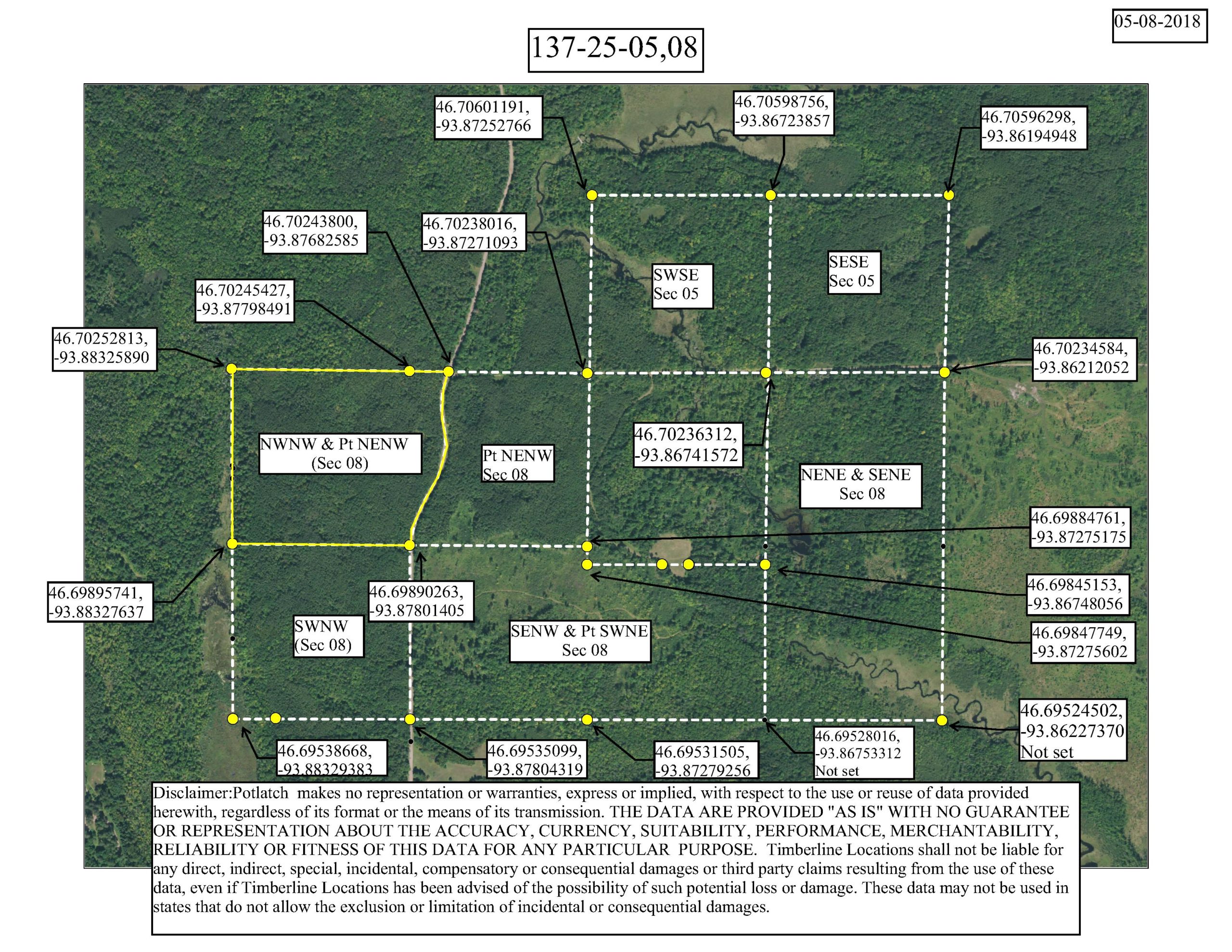
Pt. NWNW & Pt. NENW, 08-137-25. See EXHIBIT A. Subject to easements, restrictions and reservations of record. Easements granted and reserved/retained will include terms governing shared use of the easements.
Pt. NWNW & Pt. NENW, 08-137-25. See EXHIBIT A. Subject to easements, restrictions and reservations of record. Easements granted and reserved/retained will include terms governing shared use of the easements.
Property Location
Directions
From Crosby MN at the corner of Hwy 210 and Hwy 6 continue N on Hwy 6 for 12.9 miles. Turn right (E) on Hwy 36 for 3.7 miles where it curves left (N). Continue on Hwy 36 for 5 miles and continue straight onto Co Rd 106 for 2 miles to property access on the left (W). (Approx GPS Access location: 46.6990, -93.8779)
From Crosby MN at the corner of Hwy 210 and Hwy 6 continue N on Hwy 6 for 12.9 miles. Turn right (E) on Hwy 36 for 3.7 miles where it curves left (N). Continue on Hwy 36 for 5 miles and continue straight onto Co Rd 106 for 2 miles to property access on the left (W). (Approx GPS Access location: 46.6990, -93.8779)
Access
Access is right off Co Rd 106. (Approx GPS Access location: 46.6990, -93.8779)
Access is right off Co Rd 106. (Approx GPS Access location: 46.6990, -93.8779)
GPS Coordinates
Coordinates to approximate corners/points based on county mapping: 46.702528, -93,883258 46.702438, -93.876825 46.698902, -93.878014 46.698957, -93.883276
Coordinates to approximate corners/points based on county mapping: 46.702528, -93,883258 46.702438, -93.876825 46.698902, -93.878014 46.698957, -93.883276
Address
TBD Co Rd 106, Aitkin, MN. 56431
TBD Co Rd 106, Aitkin, MN. 56431
School District
Aitkin - 1
Aitkin - 1
Property Details
Pasture Acres
0
0
Tillable Acres
0
0
Wooded Acres
43
43
Dimensions (approx)
1325’ x 1300’ x 1614’ x 1343’
1325’ x 1300’ x 1614’ x 1343’
Utilities
Available Utilities
None
None
On Site Utilities
None
None
Power Company
Mille Lacs Energy Cooperative (1-800-450-2191)
Mille Lacs Energy Cooperative (1-800-450-2191)
Waterfront
Waterfront Name
N/A
N/A
Waterfront Number
N/A
N/A
Waterfront Feet (approx)
N/A
N/A
Taxes & Fees
Has Association Fee
No
No
Association Fee
$0
$0
Association Fee Includes
0
0
Tax Amount
$336
$336
Assessment Amount
0
0
Tax With Assessments
$336
$336
Assessment Pending
No
No
Assessment Description
N/A
N/A
Tax Year
2020
2020
Other Details
Section Number
08
08
Township Number
137
137
Range Number
25
25
Estimated Upland %
88
88
Estimated Wetland %
12
12
Additional Comments
Timber Comments
Aspen 36 Yrs. of Age.
Aspen 36 Yrs. of Age.
Hunting Comments
Deer Permit Area: #604
Deer Permit Area: #604
Disclosures
Approximate corners have been flagged per map. Easement(s) affect this property. See legal description and maps for details. Shared easements affect this property and easements granted and reserved/retained will include terms governing shared use of the easements. A 75’ x 200’ (.35 ac) portion on the west border has been deeded to the adjoining landowners cabin location and the described easement path provides access to this. See legal description and maps for details. Acreage, dimensions, and taxes estimated based on county data and mapping or seller data; county disclaimers included by reference; subject to split approval if necessary. Not surveyed. Photos/maps and GPS coordinates for convenience only and not guaranteed; physically inspect prior to purchase. Any deer stands on the land are not property of seller and are not included in sale. Use seller-approved PA and Addendum; closing dates the 3rd Wednesday each month. Seller is Potlatch Lake States Timberlands LLC, a business entity under the laws of the State of Delaware.
Approximate corners have been flagged per map. Easement(s) affect this property. See legal description and maps for details. Shared easements affect this property and easements granted and reserved/retained will include terms governing shared use of the easements. A 75’ x 200’ (.35 ac) portion on the west border has been deeded to the adjoining landowners cabin location and the described easement path provides access to this. See legal description and maps for details. Acreage, dimensions, and taxes estimated based on county data and mapping or seller data; county disclaimers included by reference; subject to split approval if necessary. Not surveyed. Photos/maps and GPS coordinates for convenience only and not guaranteed; physically inspect prior to purchase. Any deer stands on the land are not property of seller and are not included in sale. Use seller-approved PA and Addendum; closing dates the 3rd Wednesday each month. Seller is Potlatch Lake States Timberlands LLC, a business entity under the laws of the State of Delaware.


