

MLS Number : 5215503
Sold $102,900 - Hunting & Recreation
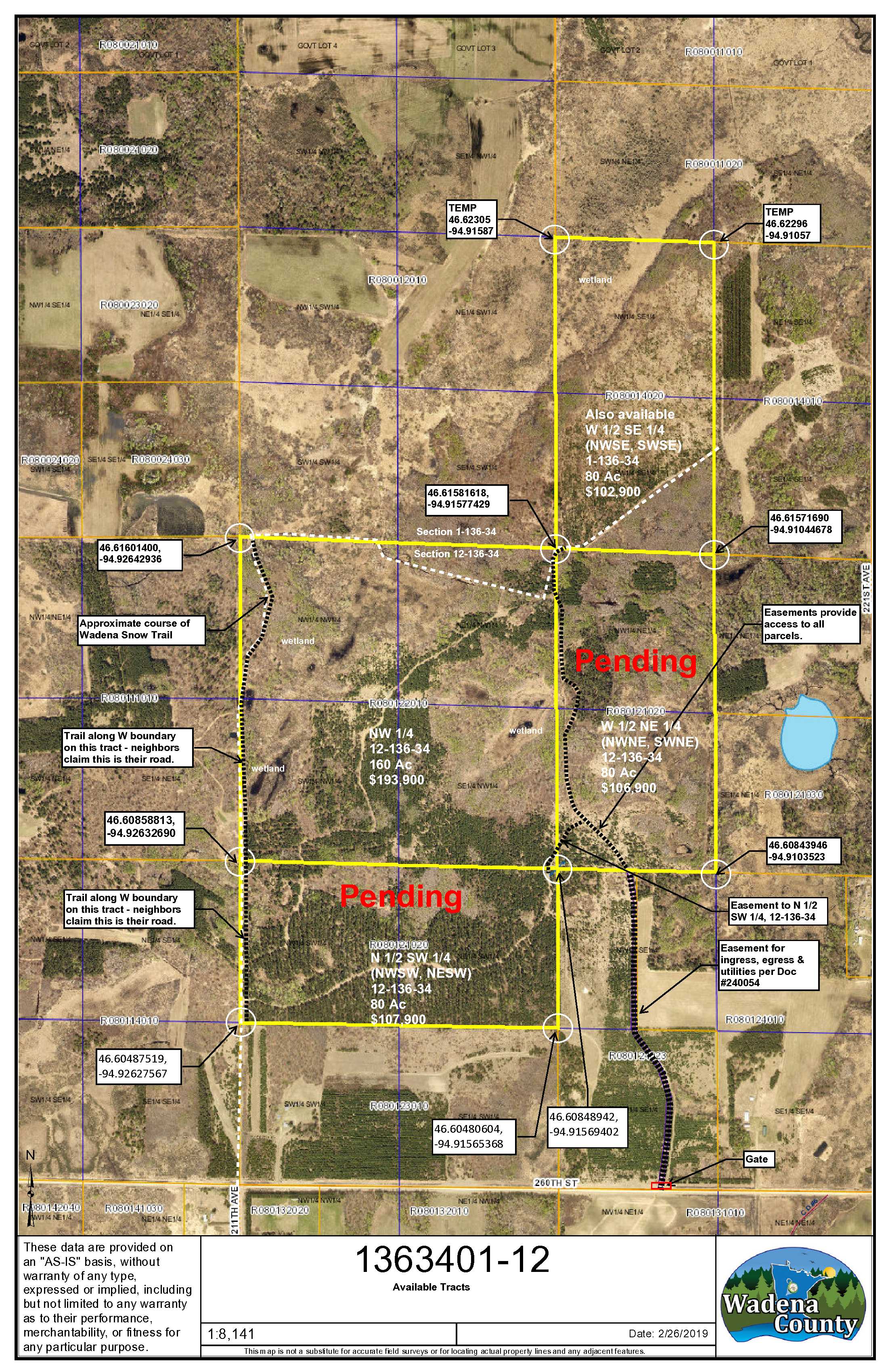
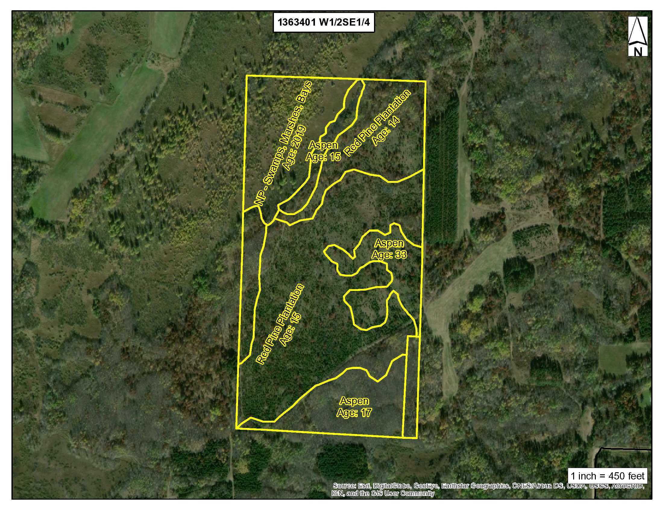
80 acres near Nimrod features a mixed forest and level ground. More remote than many PotlatchDeltic tracts, this one is a mile off Township Road 260th Street on an established easement road. Conveniently located less than 4.5 miles from Nimrod in Wadena County. The forest consists of 14-year old red pine and aspen that’s 14 to 32 years old providing a nice mix of feed and cover for deer. The property is in hunting zone 246. Additional acres are also for sale. Area amenities include Nimrod Bar & Grill, Hub 71 and Wahoo Valley Bar & Grill. Campgrounds in the area are Frames Landing Campground and Anderson’s Crossing Campground for camping, trails, swimming and river tubing. Strike Lake WMA is nearby and consists of 300+ acres with deer, bear, small game, forest upland birds, and waterfowl for additional hunting opportunities. Approximate corners have been flagged. Showings by appointment only; contact LandRadar.com at 1-866-403-5263.
.
Main Property Info
R080014020
5215503
Sold
$102,900
$102,900
80
A2 (Agriculture)
Nimrod
North Germany Twp
MN
56477
Wadena
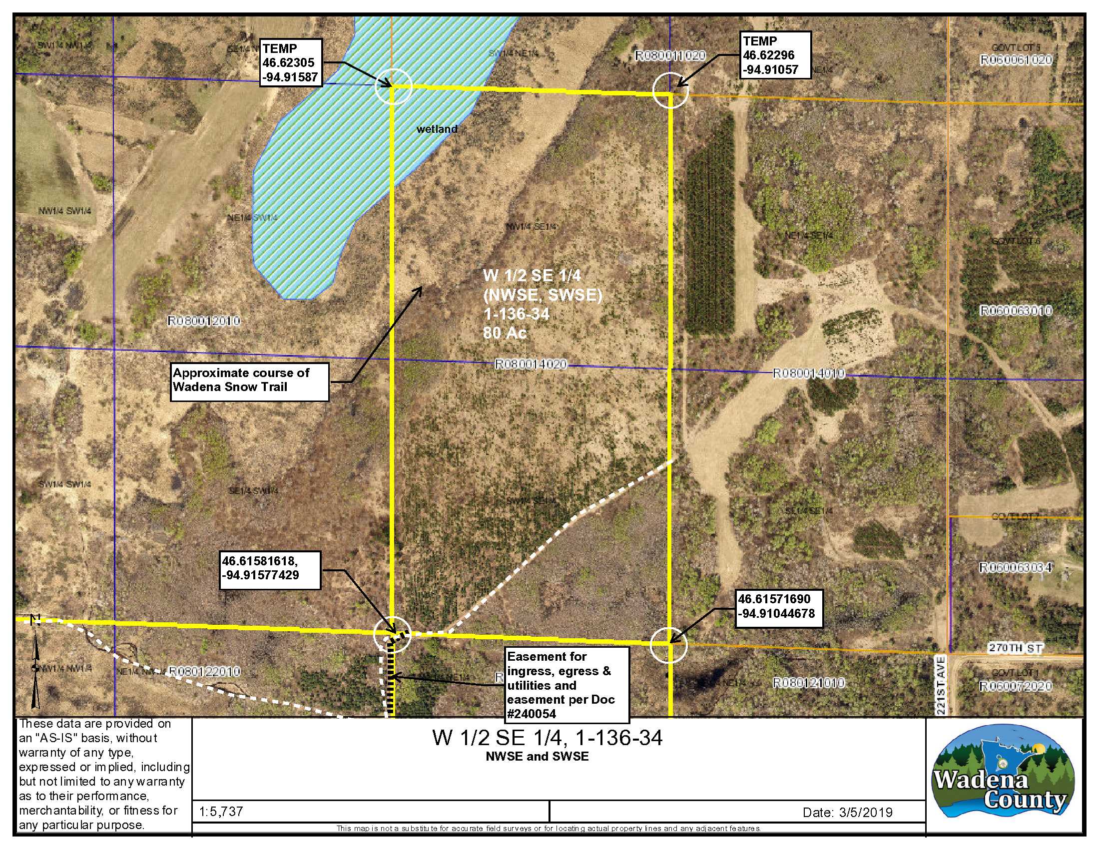
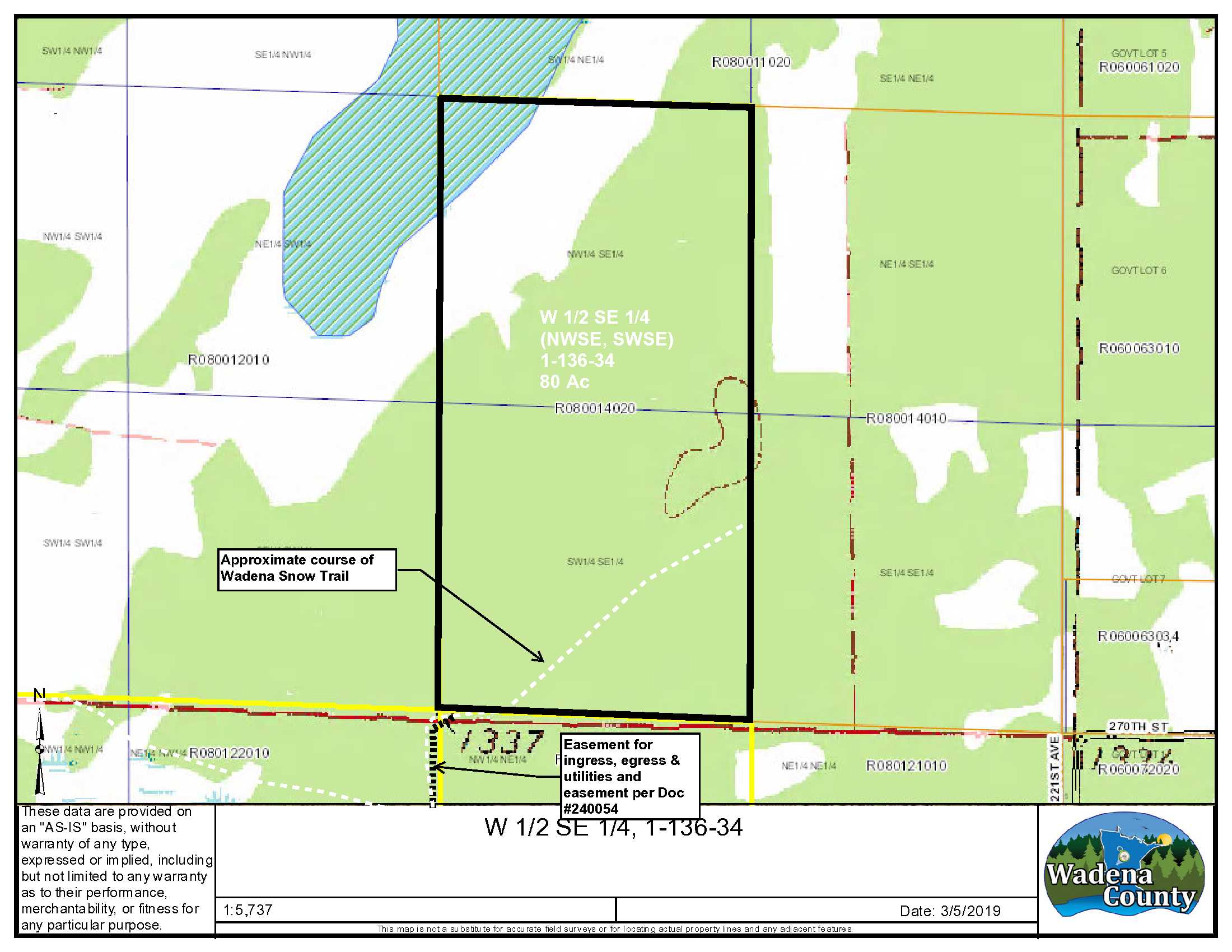
NWSE & SWSE, 1-136-34, Wadena County, MN; See attached EXHIBIT A. Together with easement in Doc 240054 and easement shown and described in attached EASEMENT SKETCH and EASEMENT DESCRIPTION. Subject to any easements, restrictions, or reservations of record. NOTE: Easement(s) granted and/or reserved will include terms governing shared use of the easement(s).
Property Location
From Nimrod, MN, at the intersection of Co. Rd. 8 (280th St.) and Co. Rd. 26; South on Co. Rd. 26 2-miles to Co. Rd. 10 (260th St.); West 1.28 miles to an easement trail on the North side of the road (the trail is gated and locked); North on the trail 1 mile to the south boundary of the property in the SW corner of the tract. Showings by appointment only; contact LandRadar.com at 1-866-403-5263.
Access is via an easement over private property from 260th St. to the southerly end of property owned by the Seller – Document #240054. The trail to this tract continues northerly for ½ mile to the SW corner of this tract. There is a locked gate at 260th St. with locks for each party having access. Make prior arrangements through listing agent to view the property.
Coordinates to approximate corners/points based on county mapping: NW: Temp 46.62305, -94.91587 NE: Temp 46.62296, -94.91057 SE: 46.6157690, -94.91044678 SW: 46.61581618, -94.91577429
W1/2 SE, 1-136-34, 260th Street, Nimrod
Sebeka - 820
Property Details
0
0
67
1,320 x 2,640 x 1,320 x 2,640
Utilities
None
None
Todd-Wadena Electric (1-800-320-8932)
Waterfront
N/A
N/A
N/A
N/A
Taxes & Fees
No
$0
N/A
$1,144
0
$1,144
No
N/A
2020
Other Details
01
136
34
15
85
Additional Comments
Red pine and aspen mixed forest; red pine is generally from the SW to NE corner of the property and aspen is along the west, east and south sides. The southerly portion of the red pine has taken well and other areas are thinner.
Hunting zone 246. For details see: https://files.dnr.state.mn.us/recreation/hunting/deer/dpa/DPA246.pdf
Access via easement in Doc# 240054 and an easement through the Seller’s property to provide this parcel with insurable access. Wadena Snow Trail runs from the SW corner northeasterly through the property and exits the property on the east side. Acreage, dimensions, and taxes estimated based on county data and mapping or seller data; county disclaimers included by reference; subject to split approval if necessary. Not surveyed. Photos/maps and GPS coordinates for convenience only and not guaranteed; physically inspect prior to purchase. Any deer stands on the land are not property of seller and are not included in sale. Easements affect the property. See Map and Easement Supplements for details.


