


MLS Number : 5143514
Sold $102,500 - Hunting & Recreation
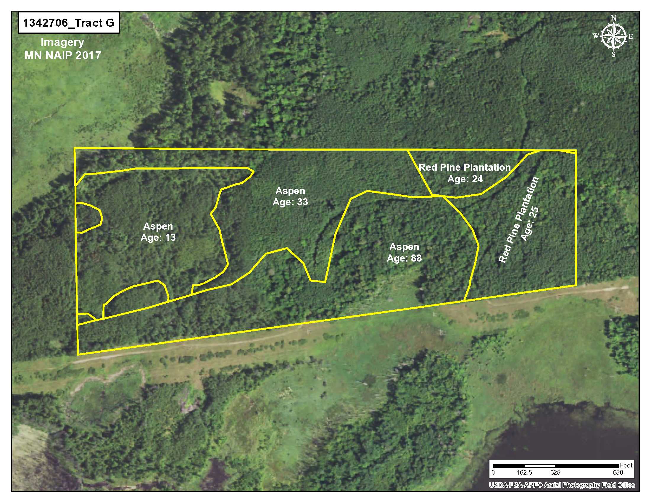
Escape to this 54.7-acre tract in the Brainerd area for hunting or recreation. Parcel has nicely rolling terrain and is heavily wooded with aspen of various ages and a red pine plantation. An shared easement trail from Sorenson Lake Road provides access. The tract also has easy access to a snowmobile trail along the southern border. Public land adjoins on the west side to increase your hunting opportunities. Located near numerous lakes with boat access including Bass, North Long, Lake Edward, and Pelican for fishing and boating enjoyment. Merrifield is just minutes away and has a SuperAmerica for fuel and minor groceries and also hosts several places to eat such as Andy’s, Harpo’s and The Woods. The Brainerd/Baxter area is just a bit further with shopping, employment, entertainment, restaurants and dining, a Regional Airport, hospitality. There are also several medical facilities nearby. Adjoining land is also available. Property is within the Brainerd School District.
Main Property Info
Part of PID 510062400A00009 & Part of PID 510061300A00009
5143514
Sold
$109,900
$102,500
54.7
RR 2.5 & Shoreland
Merrifield
Center Twp
MN
56465
Crow Wing
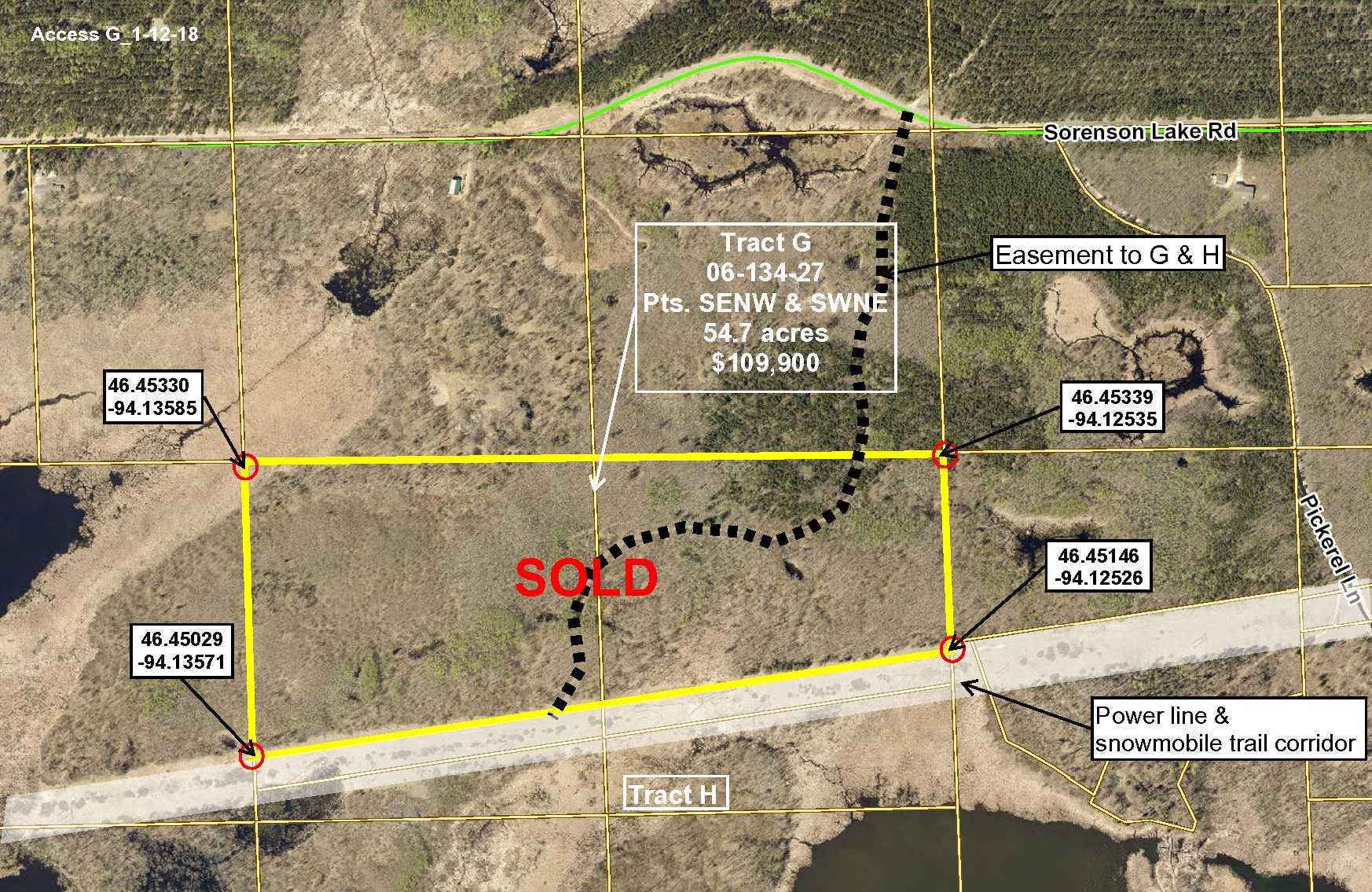
Tract G, 06-134-27, Pts SENW & SWNE. See tract legal description as Exhibit A in Supplements. Subject to easements, restrictions and reservations of record, if any.
Property Location
In east Brainerd, from the intersection of Hwy 210 and Co Rd 3 (Mill Ave); north on Co Rd 3 6.7 miles; east on Sorenson Lake Rd 2.35 miles to a shared easement trail on the south (right) side of the road. The trail is the shared easement to the property – the north boundary of the tract is about 1,320 feet south of Sorenson Lake Rd.
Access is a shared easement trail off of Sorenson Lake Road. Sorenson Lake Road is paved and township maintained.
Coordinates to approximate corners/points based on county mapping: NW: 46.45330/-94.13585, NE: 46.45339/-94.12535, SE: 46.45146/-94.12526, SW: 46.45029/-94.13571
TBD Sorenson Lk Rd, Merrifield
Brainerd - 181
Property Details
56
N 2644, E 716, S 2663, W 1084
Utilities
Electric, Telephone and Cable nearby
None
Crow Wing Power (1-800-648-9401)
Taxes & Fees
No
$0
N/A
$496
122
$618
No
Paving Sorenson Lk Rd & Rebel Rd
2018
Other Details
06
134
27
98
2
Additional Comments
This parcel is nicely wooded with 15, 35 and 90-year-old aspen and a 26-27 year-old red pine plantation.
Deer Permit Area: 604 This is a popular whitetail deer, grouse and turkey hunting area. Public land adjoins property on the west side for additional hunting and recreation opportunities.
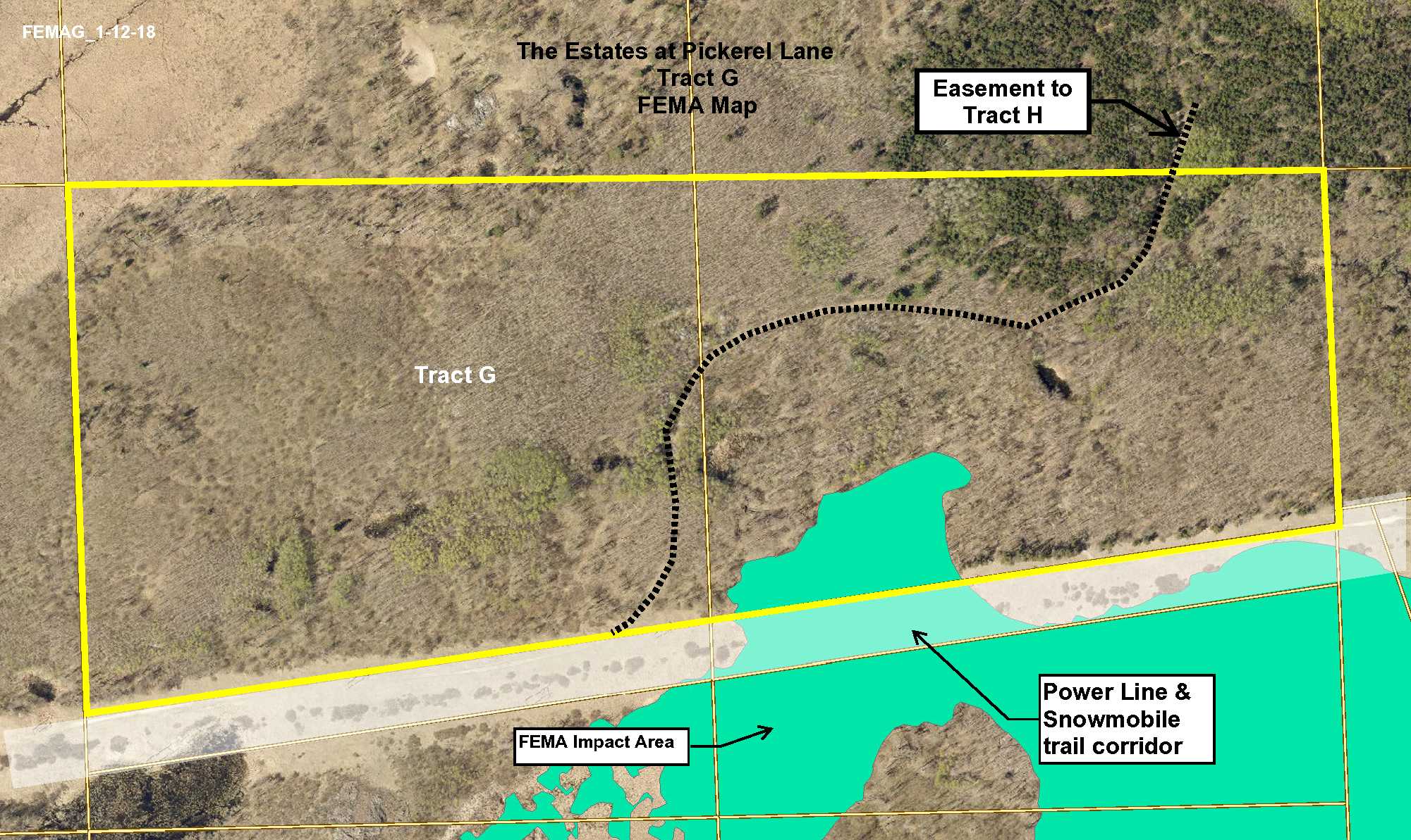
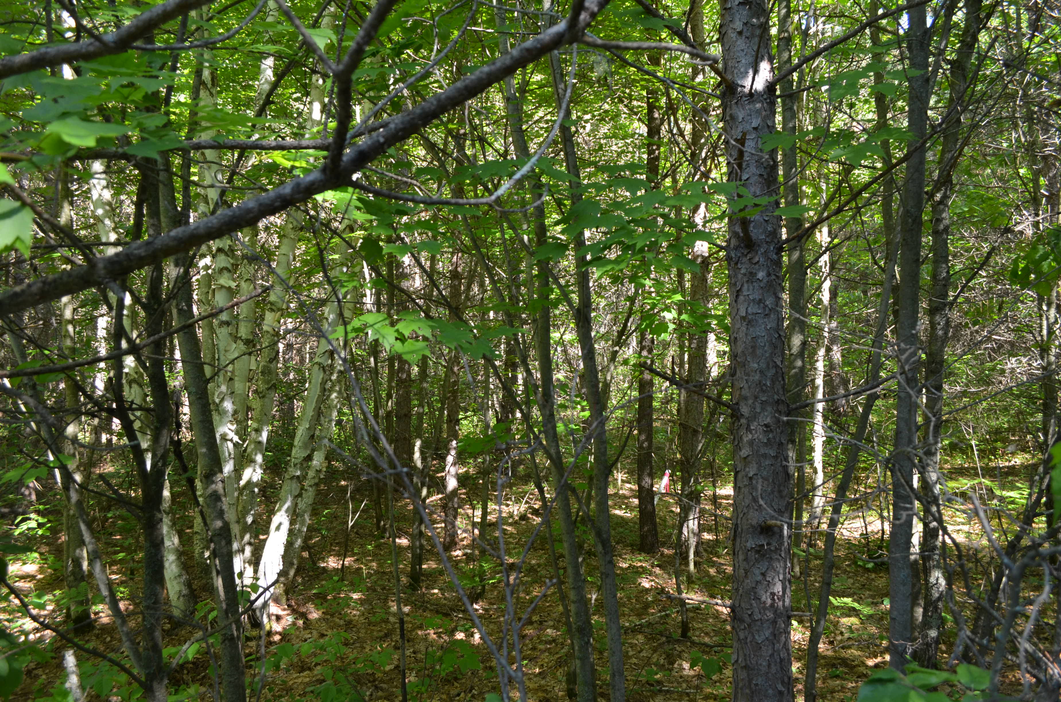
Real estate taxes have been estimated. The property has been surveyed with survey pins and white stakes marking the corners. This tract is subject to the Center Township Subordinate Service District for paving of Sorenson Lake Road and Rebel Road. See Supplement, for more information, contact Coralea Borden, Center Twp Clerk, 218-765-3397, MCBorden@brainerd.net. The shared easement trail is used by several parcels. A portion of this property is in a potential cultural artifact area. See information available at: http://www.dot.state.mn.us/culturalresources/regulations.html. There is a fixed snowmobile trail easement, Document A-909769, that runs along the MP&L power line easement adjoining this property. A small portion of the property is affected by FEMA. Photos/maps & GPS coordinates are for convenience only and are not guaranteed; tree cover may be different than depicted; physically inspect prior to purchase. Any deer stands on the land are not property of seller and are not included in sale. Use seller-approved PA and addendum; closing dates the 3rd Wednesday of each month. Easements affect the property. See Map Easement Supplements for details.


