

MLS Number : 4757444
Sold $50,000 - Hunting & Recreation
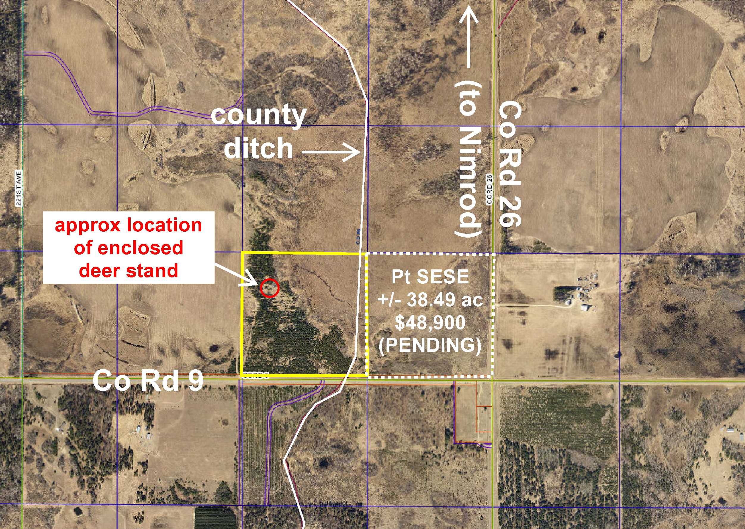
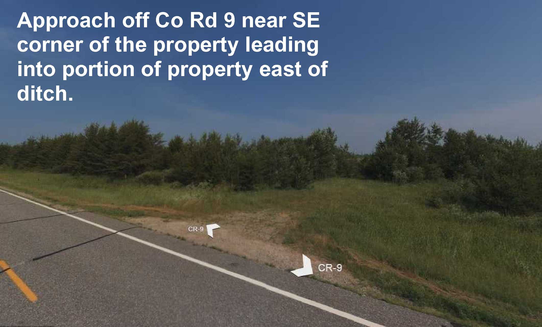
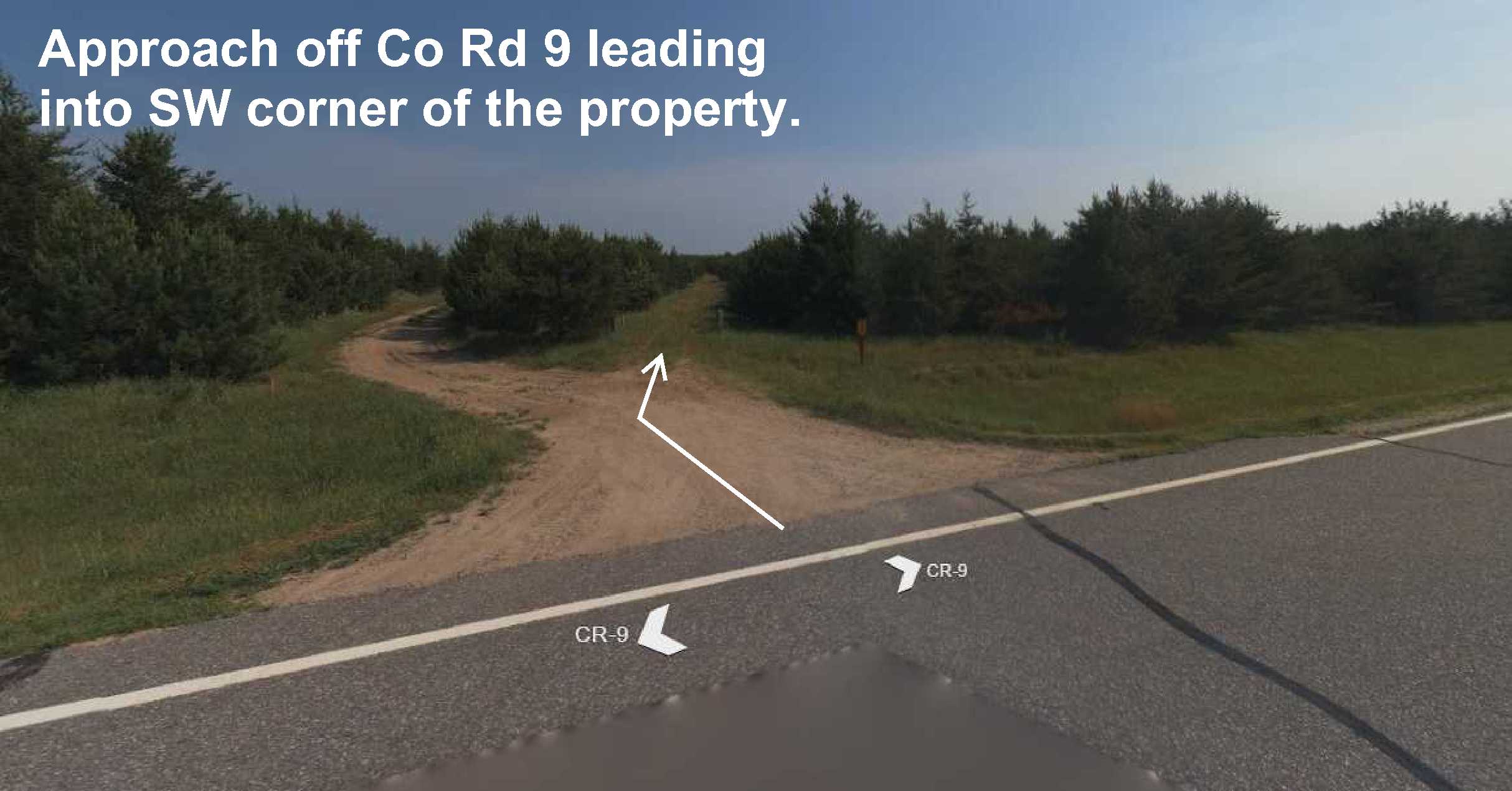
Approx 38 acres of prime hunting land conveniently located less than 5 miles from Nimrod. Paved county road along the south side, an approach near the SW corner with a trail that runs near the west side; and an approach near the SE corner that accesses the small bit of land east of the county ditch that runs near the east side. There’s an enclosed deer stand in the northwest section of the property. Fairly level topography. Beautiful red pines cover the majority of the acreage, and seller says the wetland area in the northeast corner attracts large whitetail deer. Strike Wildlife Management Area (WMA) only 3 miles away offers additional deer, bear, small game, forest game birds, and waterfowl hunting options. There are two public accesses to the Crow Wing River within 5 miles as well for canoeing, tubing, and other water enjoyment.
Main Property Info
Pt 060194030
4757444
Sold
$54,900
$50,000
38.49
A-2 Mixed Agriculture
Verndale
Lyons Twp
MN
56481
Wadena
SWSE except the south 50 feet, 19-136-33. Subject to any easements, restrictions, or reservations of record.
Property Location
From the intersection of State Hwy 227 and Co Rd 26 at the south edge of Nimrod, south on Co Rd 26 for 4 1/10 miles. Right on Co Rd 9 for 3/4 mile to trail on right leading into the property (across the road from and approx 1/10 mile past address/fire # 22735).
Paved Co Rd 9 runs along the south side of this property. There's an approach near the SW corner with a trail running northerly near the west side of the property. There's also an approach near the SE corner that accesses the small portion of property east of the ditch.
Coordinates to approximate corners/points based on county mapping: SE corner along Co Rd 9 = 46.5721, -94.8904; SW corner along Co Rd 9 (near trail leading into property) = 46.5721, -94.8956; NW corner = 46.5756, -94.8956; NE corner = 46.5756, -94.8904.
PtSWSE County Road 9
Sebeka - 820
Property Details
1320 x 1270 x 1320 x 1270
Utilities
Todd-Wadena Electric (1-800-320-8932)
Taxes & Fees
$330
0
$330
2016
Other Details
19
136
33
60
40
Additional Comments
The property is moderately wooded with beautiful red pines. If timber value is important to you, seek the advice of a competent forester to determine species, volumes and values.
This property is near public land--including Strike WMA only 3 miles away--in MN Firearms Deer Zone 246. Seller has indicated that the wetland area in the northeast portion of the parcel attracts large whitetail deer.
Deer stand sold in as-is condition without warranties or guarantees. Parcel split; acreage, dimensions, and taxes estimated based on county data and mapping; county disclaimers included by reference; subject to split approval. Not surveyed. Photos/maps for convenience only and not guaranteed; tree cover may be different than depicted; physically inspect prior to purchase.


