

MLS Number : 4701425
Sold $84,900 - Hunting & Recreation
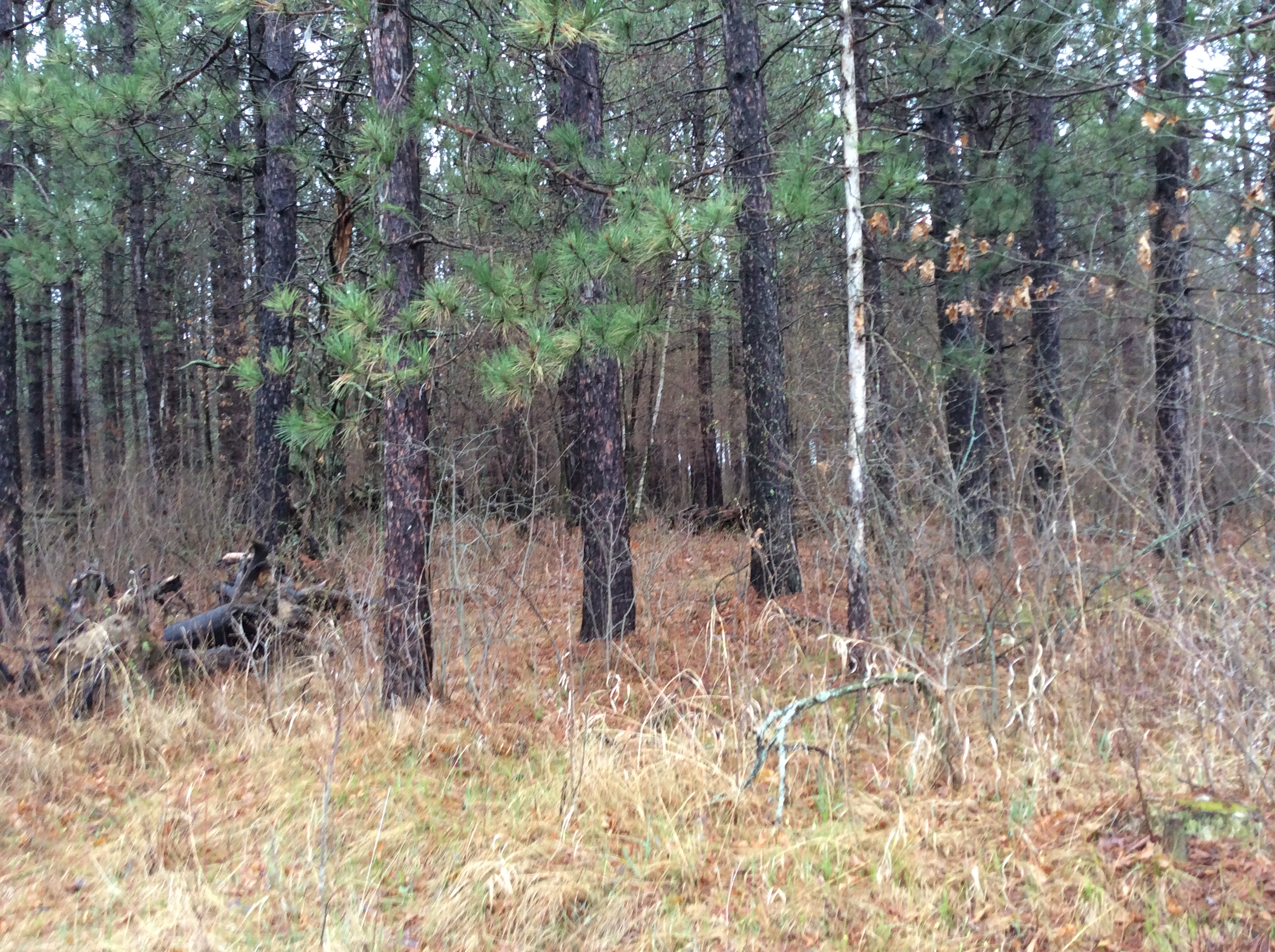
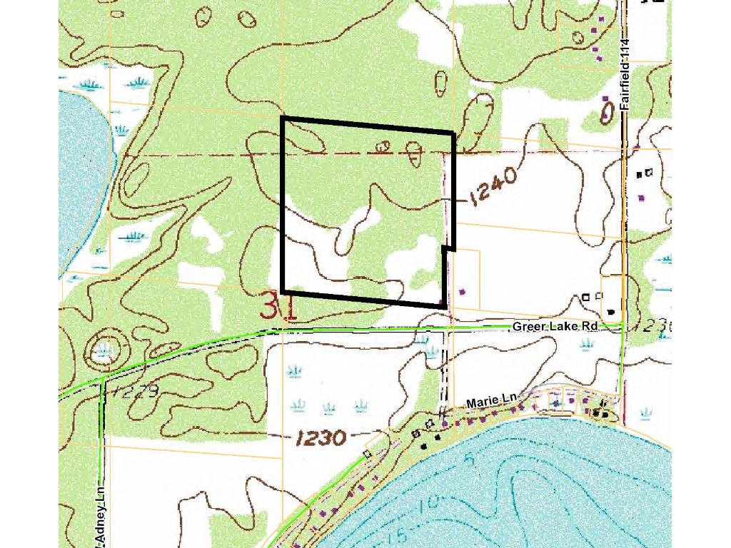
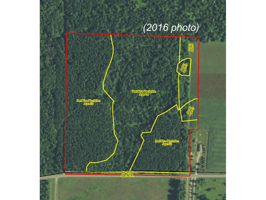
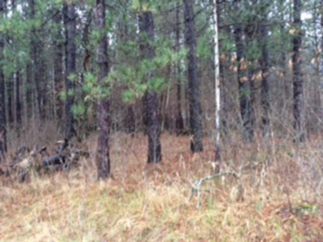
Secluded Potlatch acreage near Adney Lake and Bass Lake northwest of Crosby. Fairly-level high ground is primarily wooded with red pine along with some aspen along the east side. Access is via an easement from Greer Lake Rd, and an easement trail through the west side provides access to interior portions of the land. The land is remote but only a short drive to/from Crosslake, Emily, or Crosby for necessities and amenities.
Main Property Info
Property ID
600311300000009
600311300000009
MLS Number
4701425
4701425
Status
Sold
Sold
List Price
$84,900
$84,900
Selling Price
$84,900
$84,900
Acres
38.550
38.550
Zoning
Rural Residential 5
Rural Residential 5
City
Emily
Emily
Township
Fairfield Twp
Fairfield Twp
State
MN
MN
Zip Code
56447
56447
County
Crow Wing
Crow Wing
Legal Description
SWNE except the east 68 ft of the south 448.03 ft, 31-137-26. Together with easement in Doc# 0766553. Subject to easements in Doc# 0217564, Doc# 0766553, and Doc# 0798478; and any other easements, restrictions, and reservations of record.
SWNE except the east 68 ft of the south 448.03 ft, 31-137-26. Together with easement in Doc# 0766553. Subject to easements in Doc# 0217564, Doc# 0766553, and Doc# 0798478; and any other easements, restrictions, and reservations of record.
Property Location
Directions
From intersection of State Hwy 6 and Co Rd 36 north of Crosby, west on Co Rd 36 for 3 miles. Left on Co Rd 114 for 1 1/2 miles. Right on Greer Lake Rd for 1/2 mile. Right on easement trail approx 260 ft into SW corner of the property. (Easement trail continues northerly through the west side.)
From intersection of State Hwy 6 and Co Rd 36 north of Crosby, west on Co Rd 36 for 3 miles. Left on Co Rd 114 for 1 1/2 miles. Right on Greer Lake Rd for 1/2 mile. Right on easement trail approx 260 ft into SW corner of the property. (Easement trail continues northerly through the west side.)
Access
Access is via easements off Greer Lake Rd, a gravel township road.
Access is via easements off Greer Lake Rd, a gravel township road.
GPS Coordinates
Coordinates to approx corners based on county mapping: SW corner where easement trail enters south boundary = 46.6376, -94.0199; NW corner near where easement trail exits the tract = 46.6413, -94.0199; NE corner = 46.6409, -94.0148; northeasterly-most corner of exception area = 46.6385, -94.0148; northwesterly-most corner of exception area = 46.6385, -94.0150; SE corner = 46.6373, -94.0151.
Coordinates to approx corners based on county mapping: SW corner where easement trail enters south boundary = 46.6376, -94.0199; NW corner near where easement trail exits the tract = 46.6413, -94.0199; NE corner = 46.6409, -94.0148; northeasterly-most corner of exception area = 46.6385, -94.0148; northwesterly-most corner of exception area = 46.6385, -94.0150; SE corner = 46.6373, -94.0151.
Address
PtSWNE Greer Lake Road
PtSWNE Greer Lake Road
School District
Crosby-Ironton - 182
Crosby-Ironton - 182
Property Details
Dimensions (approx)
1252x1320x1320x1320
1252x1320x1320x1320
Utilities
Available Utilities
Electric
Electric
On Site Utilities
None
None
Power Company
Crow Wing Power (1-800-648-9401)
Crow Wing Power (1-800-648-9401)
Taxes & Fees
Association Fee
$0
$0
Tax Amount
$468
$468
Tax With Assessments
$468
$468
Tax Year
2016
2016
Other Details
Section Number
31
31
Township Number
137
137
Range Number
26
26
Estimated Upland %
99
99
Estimated Wetland %
1
1
Additional Comments
Timber Comments
This property has been managed according to Forest Stewardship Council (FSC) standards. It's primarily wooded with red pine along with some aspen along the east side. If timber value is important to you, seek the advice of a competent forester to determine species, volumes and values.
This property has been managed according to Forest Stewardship Council (FSC) standards. It's primarily wooded with red pine along with some aspen along the east side. If timber value is important to you, seek the advice of a competent forester to determine species, volumes and values.
Hunting Comments
This property adjoins public land in MN Firearms Deer Zone 247.
This property adjoins public land in MN Firearms Deer Zone 247.
Disclosures
Together with easement in Doc# 0803754. Subject to easement in Doc# 0766553; easement benefitting S1/2SW, SENW, and NESW; and any other easements, restrictions, and reservations of record. Not surveyed; acreage/dimensions approx based on county data and mapping; disclaimers included by reference. GPS coordinates to approx corners available from listing agent. Photos/maps for convenience only and not guaranteed; tree cover may be different than depicted; physically inspect prior to purchase. Any deer stands on the land are not property of seller and are not included in sale. Use seller-approved PA and addendum; closing dates the 2nd Wednesday each month.
Together with easement in Doc# 0803754. Subject to easement in Doc# 0766553; easement benefitting S1/2SW, SENW, and NESW; and any other easements, restrictions, and reservations of record. Not surveyed; acreage/dimensions approx based on county data and mapping; disclaimers included by reference. GPS coordinates to approx corners available from listing agent. Photos/maps for convenience only and not guaranteed; tree cover may be different than depicted; physically inspect prior to purchase. Any deer stands on the land are not property of seller and are not included in sale. Use seller-approved PA and addendum; closing dates the 2nd Wednesday each month.


