
MLS Number : 5027044
Sold $26,700 - Hunting & Recreation
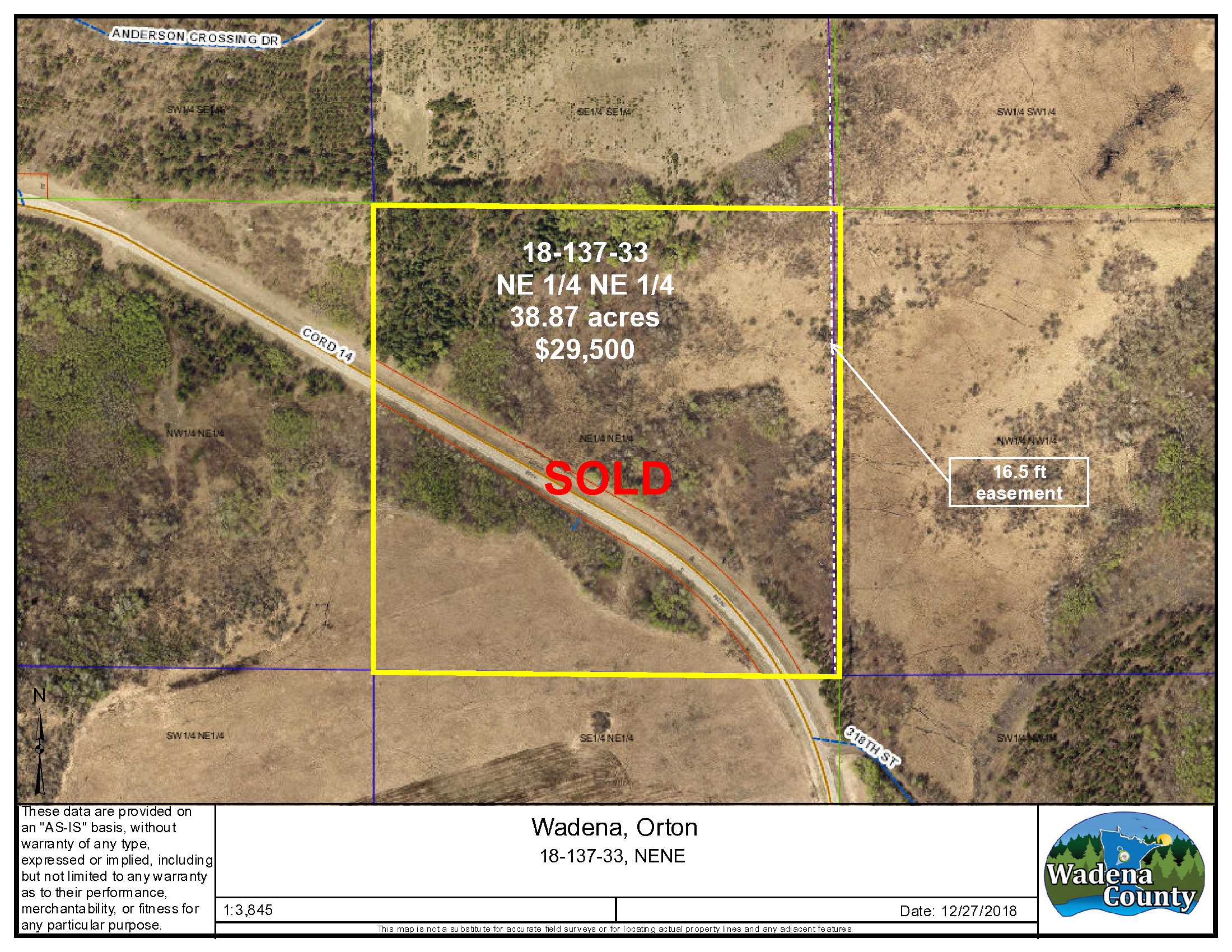
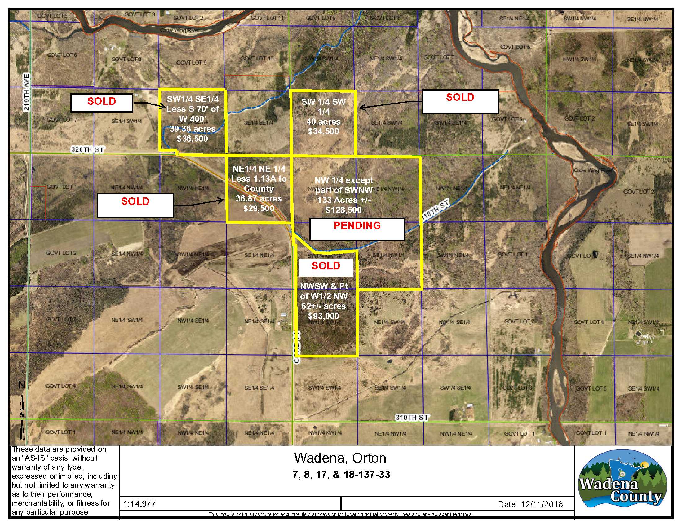
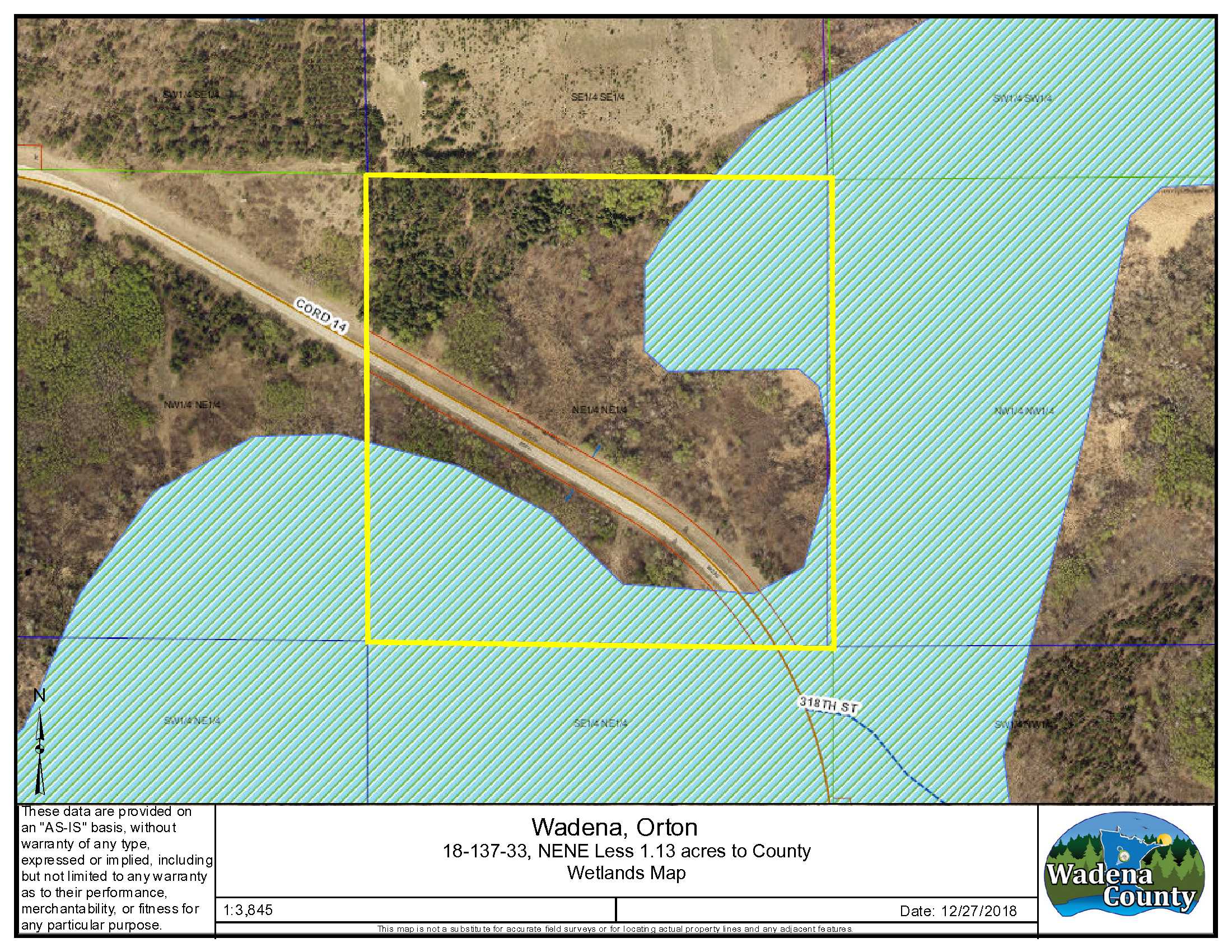
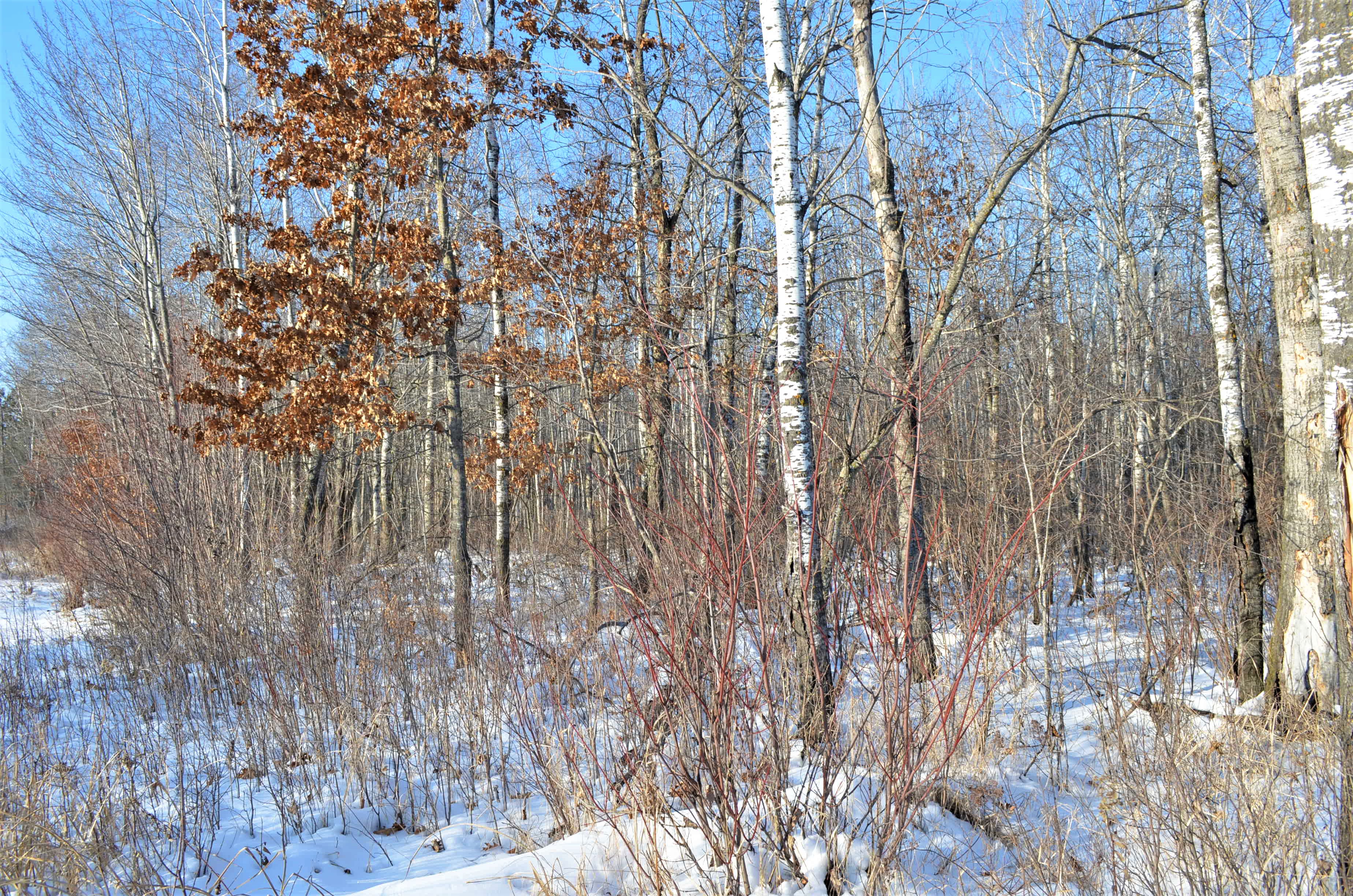
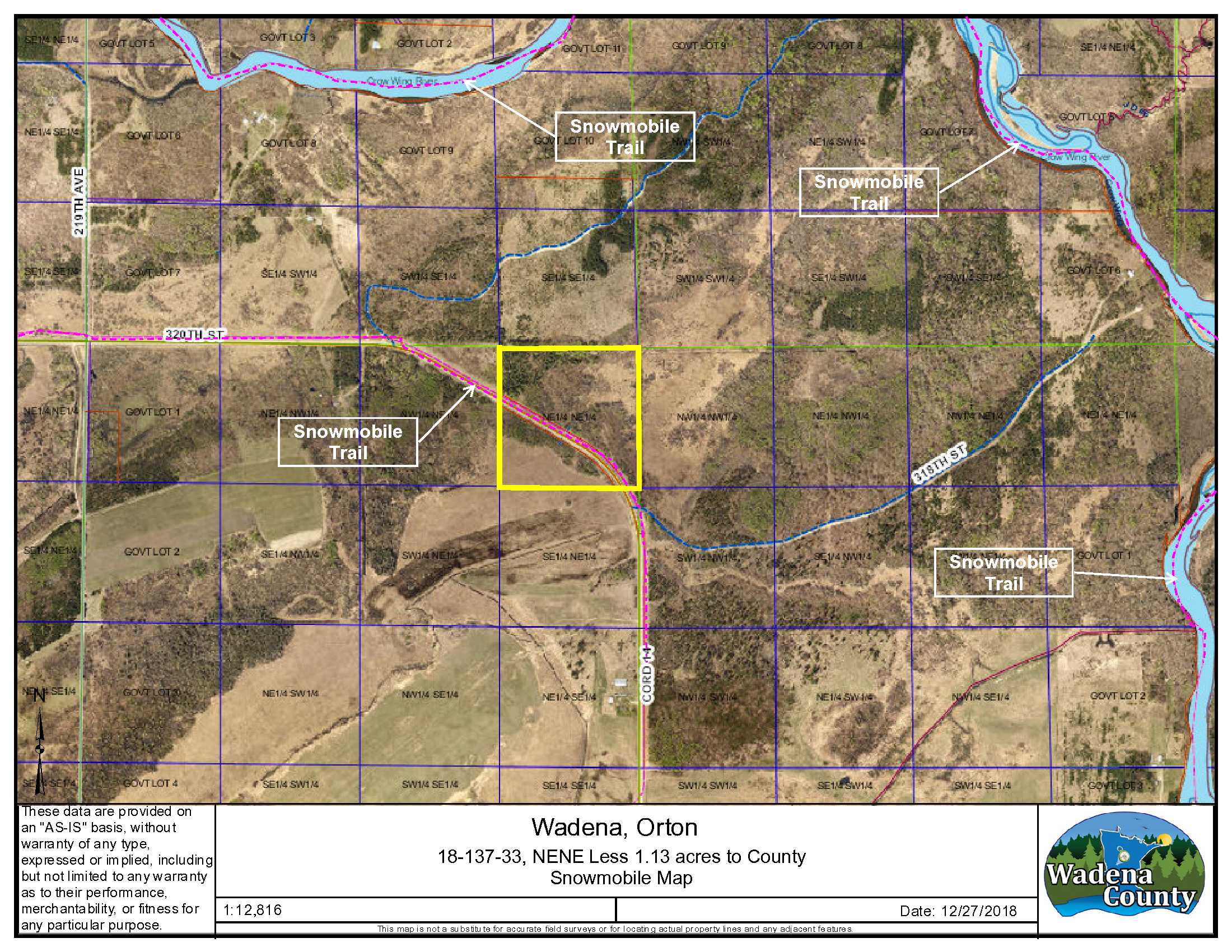
Price reduced from $46,900 to $29,500! This approx. 38+ acres is bisected by Co Rd 14 and features an upland/wetland mix. Pine and mixed hardwoods cover the upland in this area great for deer and upland hunting. It’s close to the Crow Wing River, public lands and WMA’s. The property is enrolled in SFIA, generating income for the landowner. SFIA will be terminated in January 2024. Adjoins additional land for sale by the same owner
Main Property Info
Property ID
R090181010
R090181010
MLS Number
5027044
5027044
Status
Sold
Sold
List Price
$29,500
$29,500
Selling Price
$26,700
$26,700
Acres
38.87
38.87
Zoning
Agricultural
Agricultural
City
Nimrod
Nimrod
Township
Orton Twp
Orton Twp
State
MN
MN
Zip Code
56478
56478
County
Wadena
Wadena
Legal Description
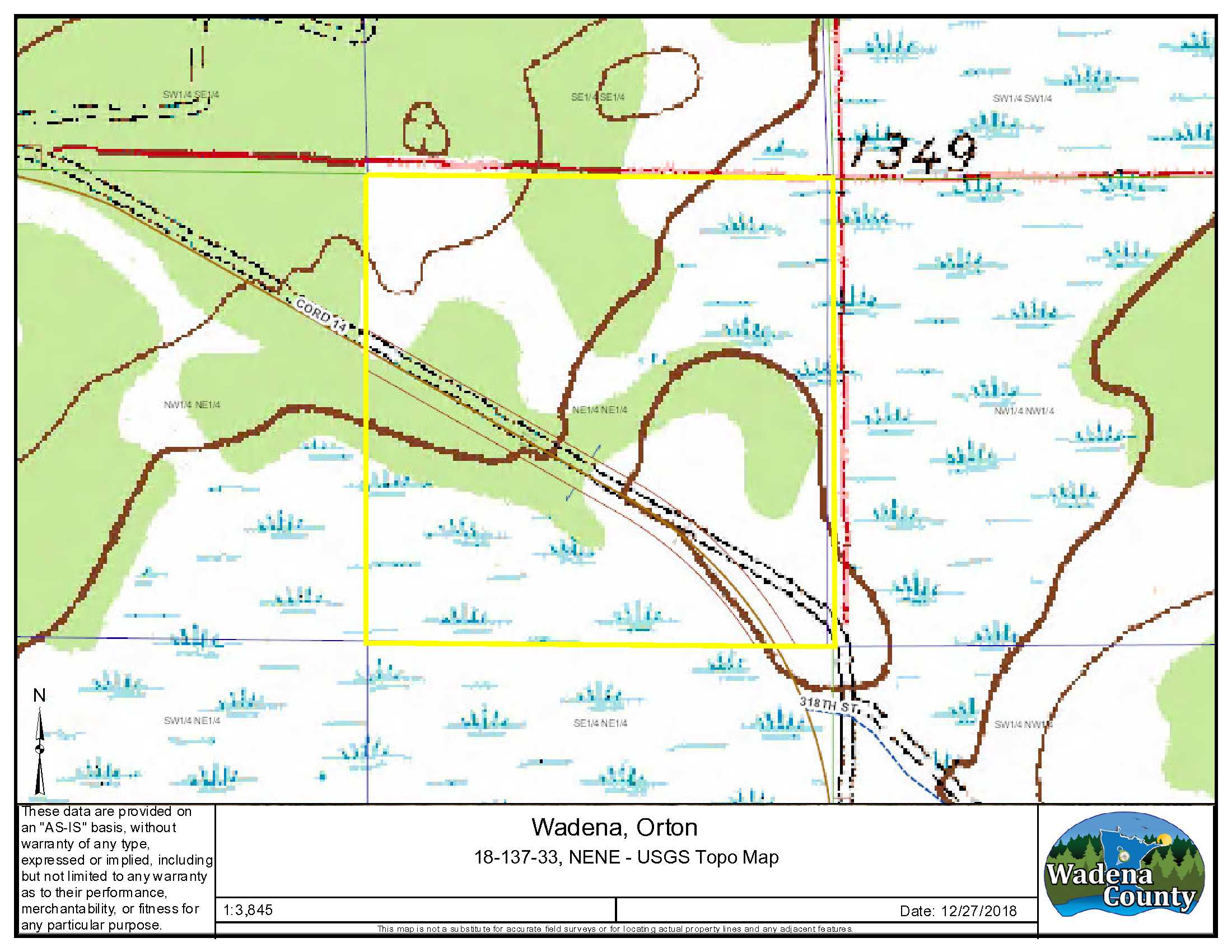
NENE, 18-137-33, Wadena County, except County Rd 4 ROW and subject to any easements, restrictions or reservations of record.
NENE, 18-137-33, Wadena County, except County Rd 4 ROW and subject to any easements, restrictions or reservations of record.
Property Location
Directions
In Nimrod MN, from the intersection of Co Rd 12 and Co Rd 14, North on Co. Rd 14 about 3 miles to the southerly boundary of the property. Continue north/west about .25 mile to the westerly boundary. See GPS coordinates for assistance in locating boundaries and approximate property corners.
In Nimrod MN, from the intersection of Co Rd 12 and Co Rd 14, North on Co. Rd 14 about 3 miles to the southerly boundary of the property. Continue north/west about .25 mile to the westerly boundary. See GPS coordinates for assistance in locating boundaries and approximate property corners.
Access
Paved road frontage along Co Rd 14 but there’s no existing approach off the county road.
Paved road frontage along Co Rd 14 but there’s no existing approach off the county road.
GPS Coordinates
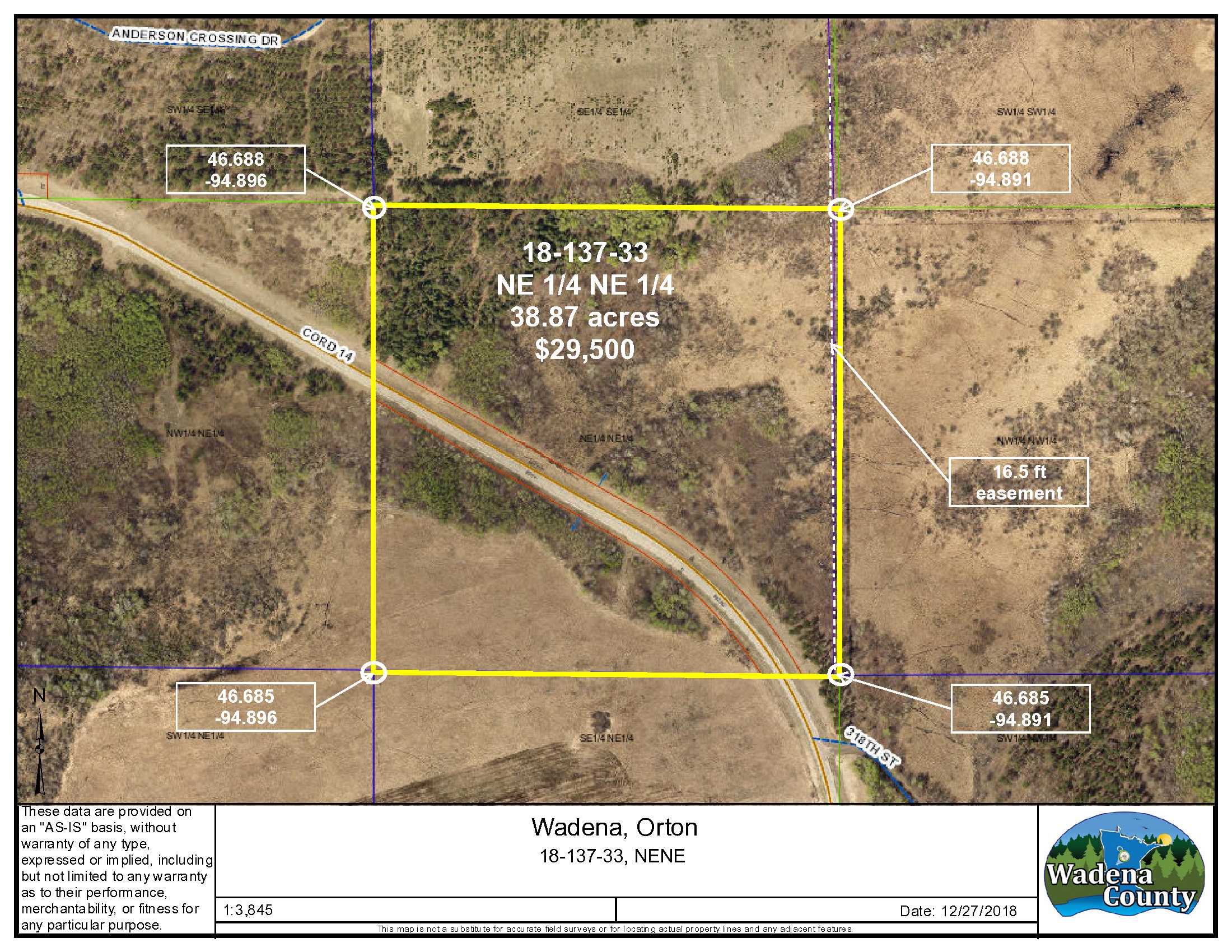
Coordinates to approximate corners/points based on county mapping: NE: 46.688/-94.891, SE: 46.685/-94.891, SW: 46.685/-94.896, NW: 46.688/-94.896,
Coordinates to approximate corners/points based on county mapping: NE: 46.688/-94.891, SE: 46.685/-94.891, SW: 46.685/-94.896, NW: 46.688/-94.896,
Address
TBD County Road 14, Nimrod
TBD County Road 14, Nimrod
School District
Sebeka - 820
Sebeka - 820
Property Details
Wooded Acres
19
19
Dimensions (approx)
1320 x 1320 x 1320 x 1320
1320 x 1320 x 1320 x 1320
Utilities
Available Utilities
Electric & Telephone
Electric & Telephone
Power Company
Todd-Wadena Electric (1-800-320-8932)
Todd-Wadena Electric (1-800-320-8932)
Taxes & Fees
Tax Amount
$520
$520
Tax With Assessments
$520
$520
Tax Year
2020
2020
Other Details
Section Number
18
18
Township Number
137
137
Range Number
33
33
Estimated Upland %
62
62
Estimated Wetland %
38
38
Additional Comments
Timber Comments
Mixture of pine and hardwoods. There was some harvesting on the property about 2017.
Mixture of pine and hardwoods. There was some harvesting on the property about 2017.
Hunting Comments
This area is known for whitetail deer, turkey and grouse hunting. Located in deer hunting area 246.
This area is known for whitetail deer, turkey and grouse hunting. Located in deer hunting area 246.
Disclosures
This property is enrolled in SFIA (Sustainable Forest Incentive Act), which provides payments to landowners in return for maintaining the property for forestry uses. SFIA will be terminated in January 2024. This property has not been surveyed and if accurate corner location is important to you use, it’s recommended you get a registered land survey. Photos/maps/GPS coordinates are for convenience only and not guaranteed; tree cover may be different than depicted; physically inspect prior to purchase. Any deer stands on the land may not be property of seller and are not included in sale. A portion of the property was harvested in 2017; see timber harvest supplement for more information. Note the 16.5 ft easement along the easterly boundary which provides insurable access to a property further north and does not materially affect the use of this property. See attached Doc203391 for more details.
This property is enrolled in SFIA (Sustainable Forest Incentive Act), which provides payments to landowners in return for maintaining the property for forestry uses. SFIA will be terminated in January 2024. This property has not been surveyed and if accurate corner location is important to you use, it’s recommended you get a registered land survey. Photos/maps/GPS coordinates are for convenience only and not guaranteed; tree cover may be different than depicted; physically inspect prior to purchase. Any deer stands on the land may not be property of seller and are not included in sale. A portion of the property was harvested in 2017; see timber harvest supplement for more information. Note the 16.5 ft easement along the easterly boundary which provides insurable access to a property further north and does not materially affect the use of this property. See attached Doc203391 for more details.


