


MLS Number : 4863955
Sold $59,900 - Hunting & Recreation
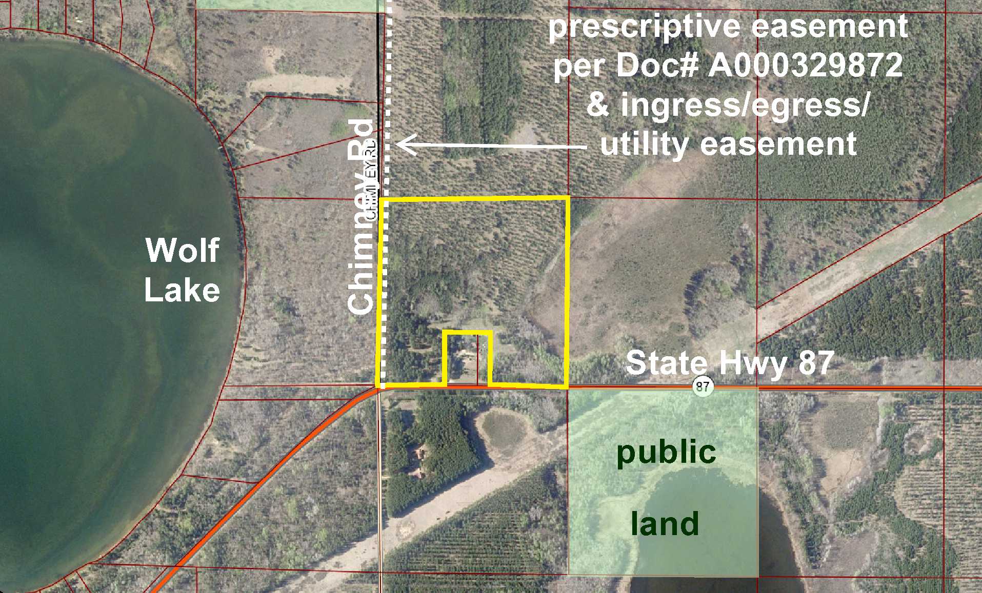
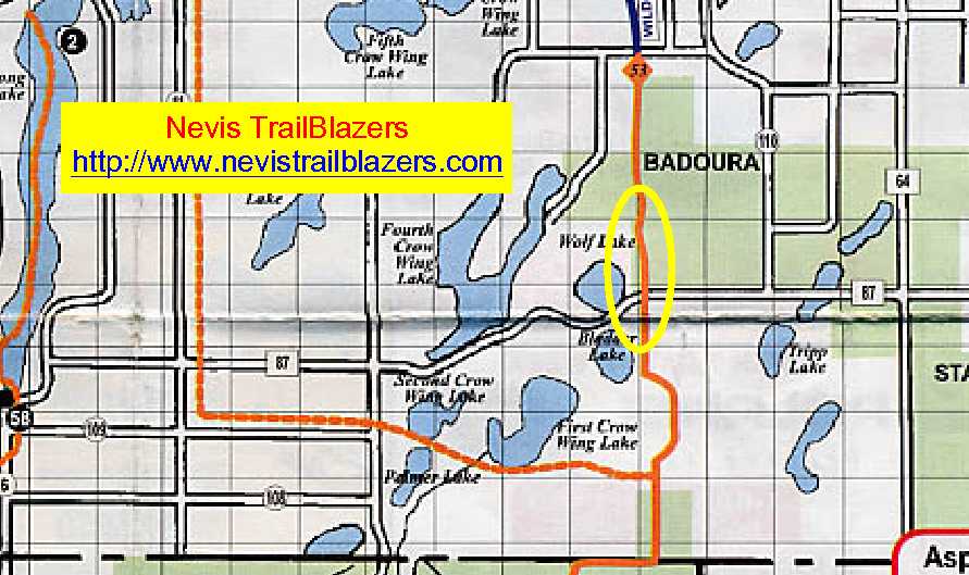
Potlatch land by Wolf Lake south of Akeley and Nevis. Upland wooded with red pine and jack pine slopes toward wetland in the east side. State Hwy 87 provides access along the south side and Chimney Rd and an easement trail provide access along the west side and to adjoining tracts to the north. A snowmobile trail along the west side is part of a Nevis Trailblazers trail system containing majestic trails in the Paul Bunyan State Forest and connecting to the Heartland State Trail which allows riders to access the Bemidji snowmobile trail system. Public land to the southeast and public Badoura State Forest land 1/4 mile to the northwest offer more hunting space, and with public boat accesses to the Crow Wing Chain and other lakes within a few miles, this property offers seasonal enjoyment throughout the year.
Main Property Info
061200110
4863955
Sold
$59,900
$59,900
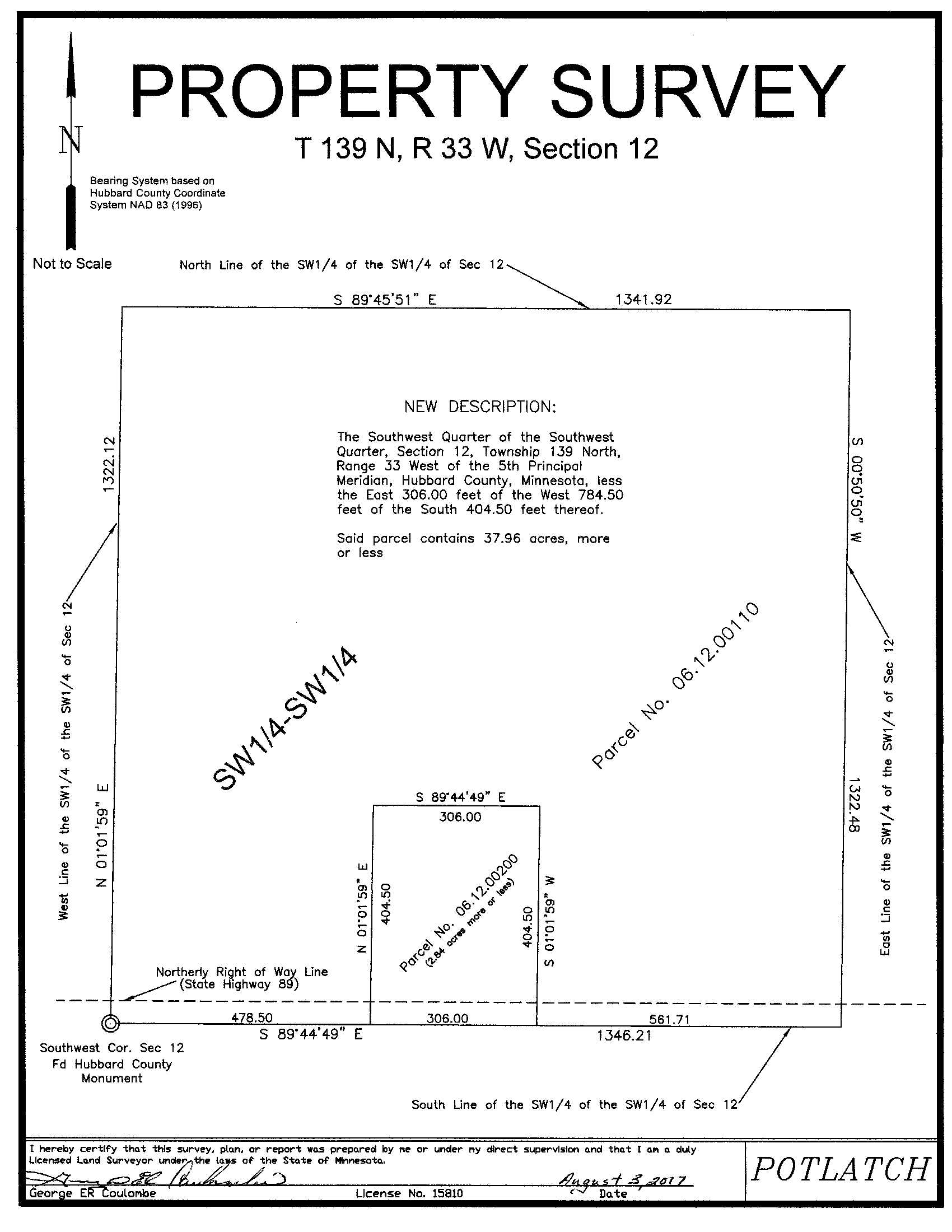
37.96
not zoned
Nevis
Crow Wing Lake Twp
MN
56467
Hubbard
SWSW, 12-139-33, less the east 306 ft of the west 784.50 ft of the south 404.50 ft thereof. Subject to prescriptive easement per Doc# A000329872, easement over west 33 ft, snowmobile trail, and any other easements, restrictions, or reservations of record.
Property Location
From the intersection of State Hwy 64 and State Hwy 87 approx 10 miles south of Akeley, west on State Hwy 87 for 3 8/10 miles to southeast corner of the property. Continue another 1/4 mile and turn right on Chimney Rd (also known as Mucky Creek Rd) to go along the west side of the tract.
Access is via paved State Hwy 87 along the south side and unpaved Chimney Rd (also known as Mucky Creek Rd) and an easement along the west side.
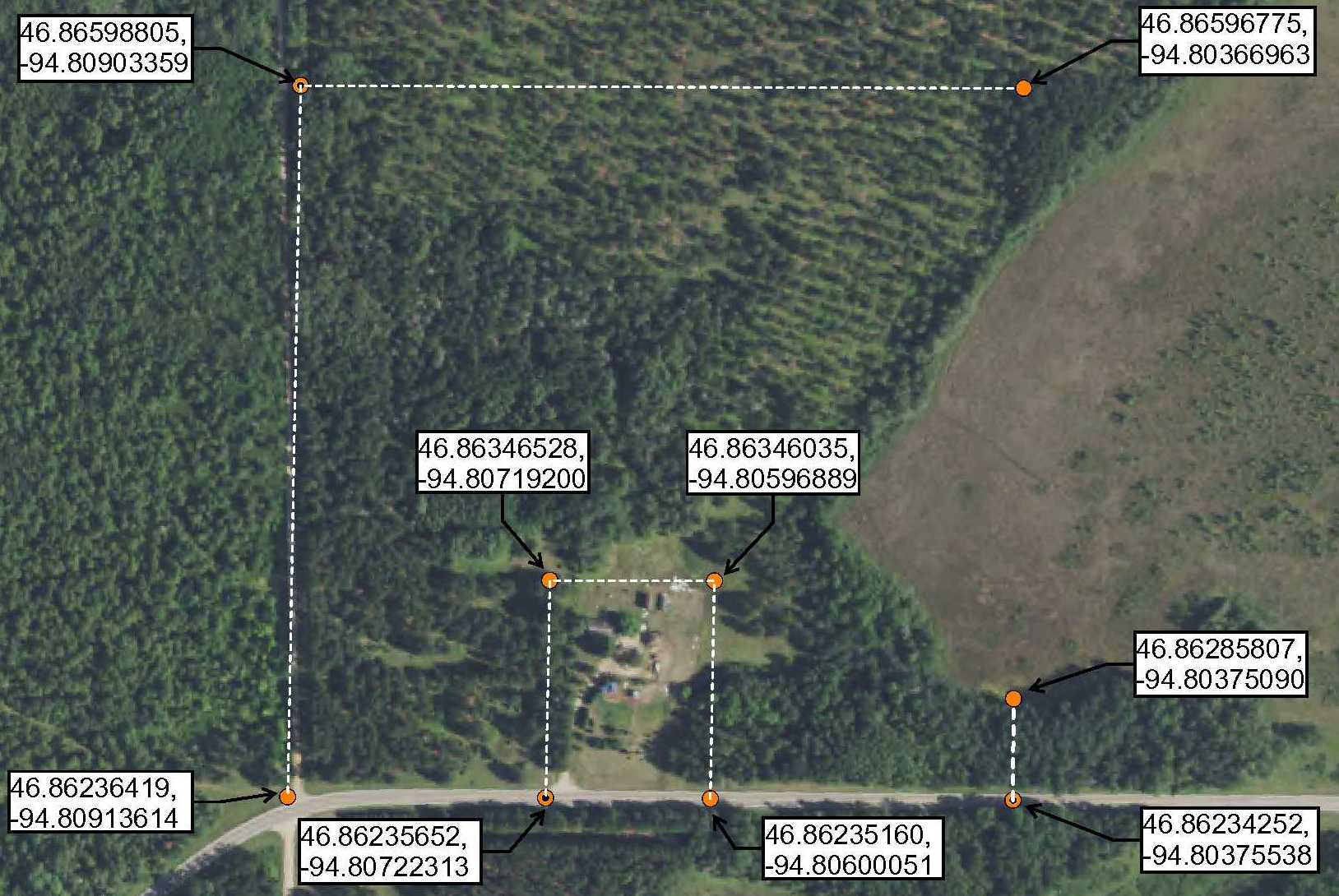
See map for coordinates to flagged approximate corners/points.
State Hwy 87 & Chimney Rd
Nevis - 308
Property Details
561 x 404 x 306 x 404 x 478 x 1322 x 1341 x 1322 (See survey for exact dimensions)
Utilities
Itasca-Mantrap Co-op (1-888-713-3377)
Taxes & Fees
$0
2017
Other Details
12
139
33
75
25
Additional Comments
This property has been managed according to Forest Stewardship Council (FSC) standards. Timber includes red pine and jack pine, If timber value is important to you, seek the advice of a competent forester to determine species, volumes and values.
This property is near public land in MN Firearms Deer Zone 259.
See survey for exact dimensions. Survey indicates acreage is 37.96; county parcel info shows acreage of 38.83. Photos/maps for convenience only and not guaranteed; physically inspect prior to purchase. Any deer stands on the land are not property of seller and are not included in sale. Use seller-approved PA and addendum; closing dates the 2nd Wednesday each month.


