


MLS Number : 4904752
Sold $104,900 - Hunting & Recreation
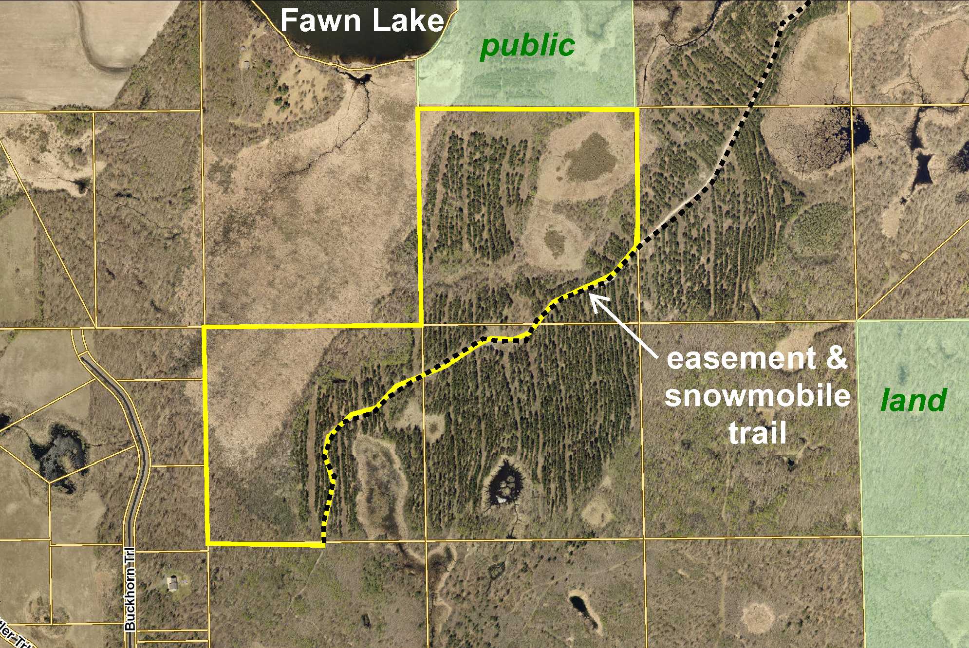
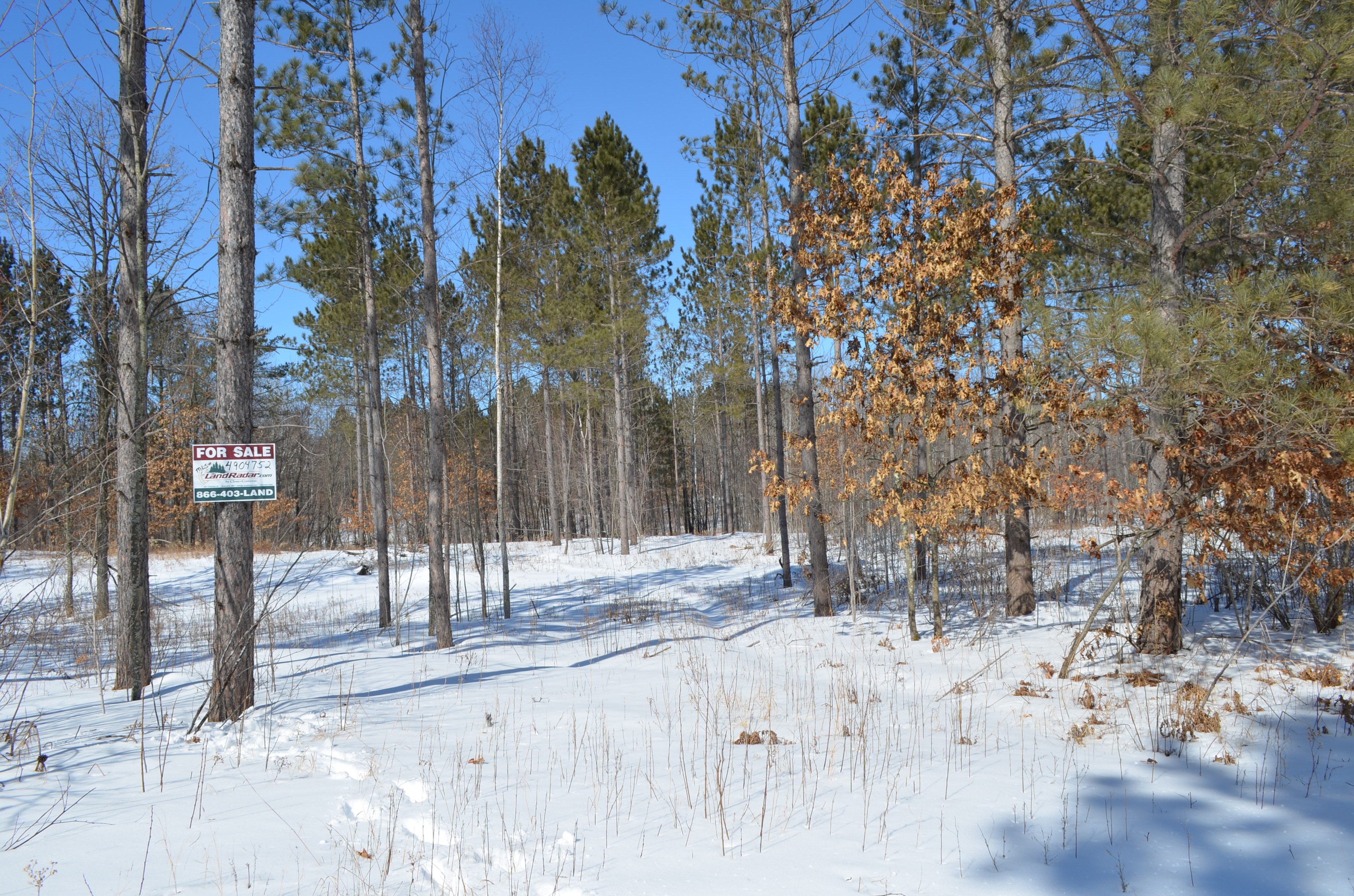
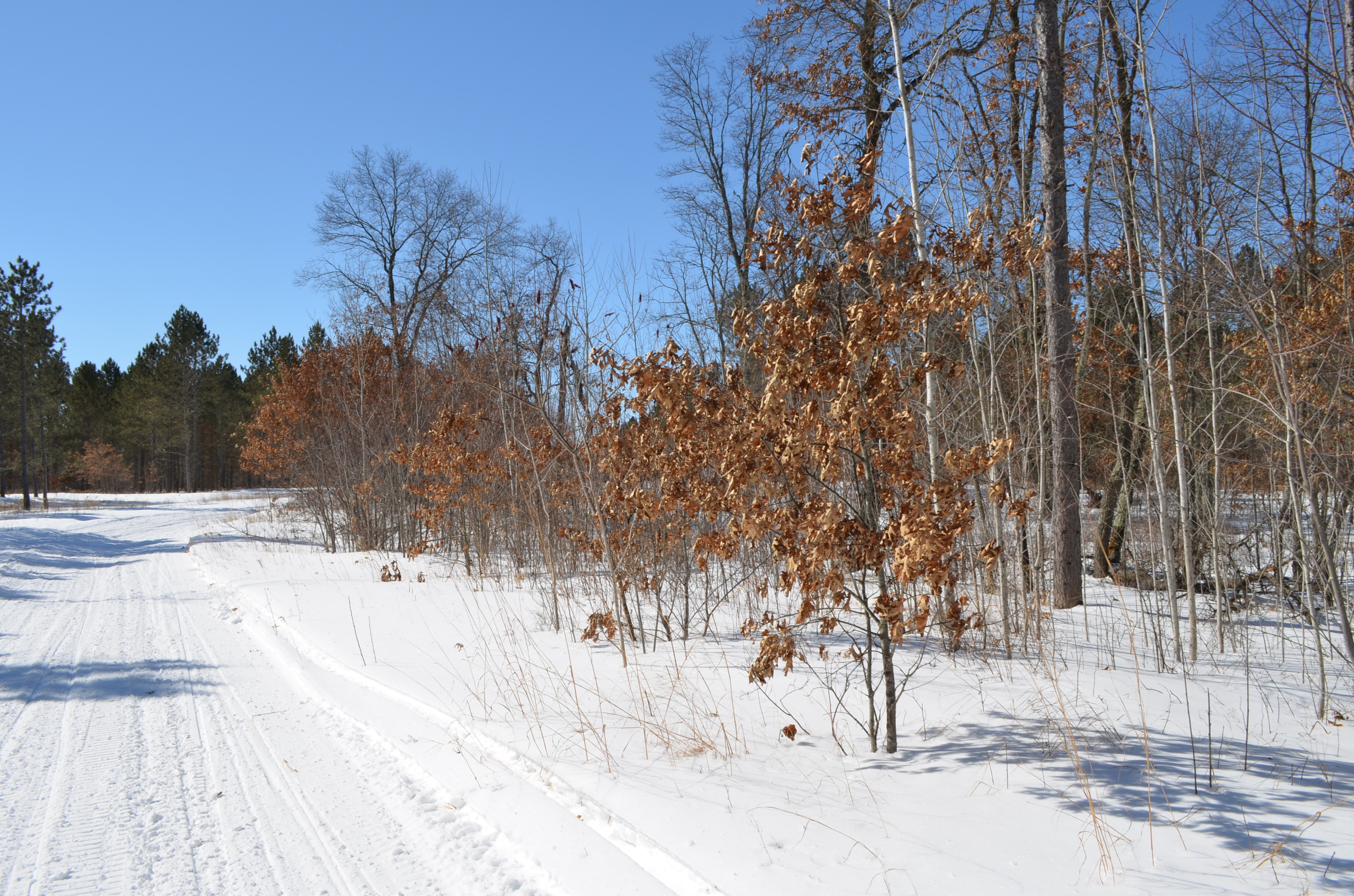
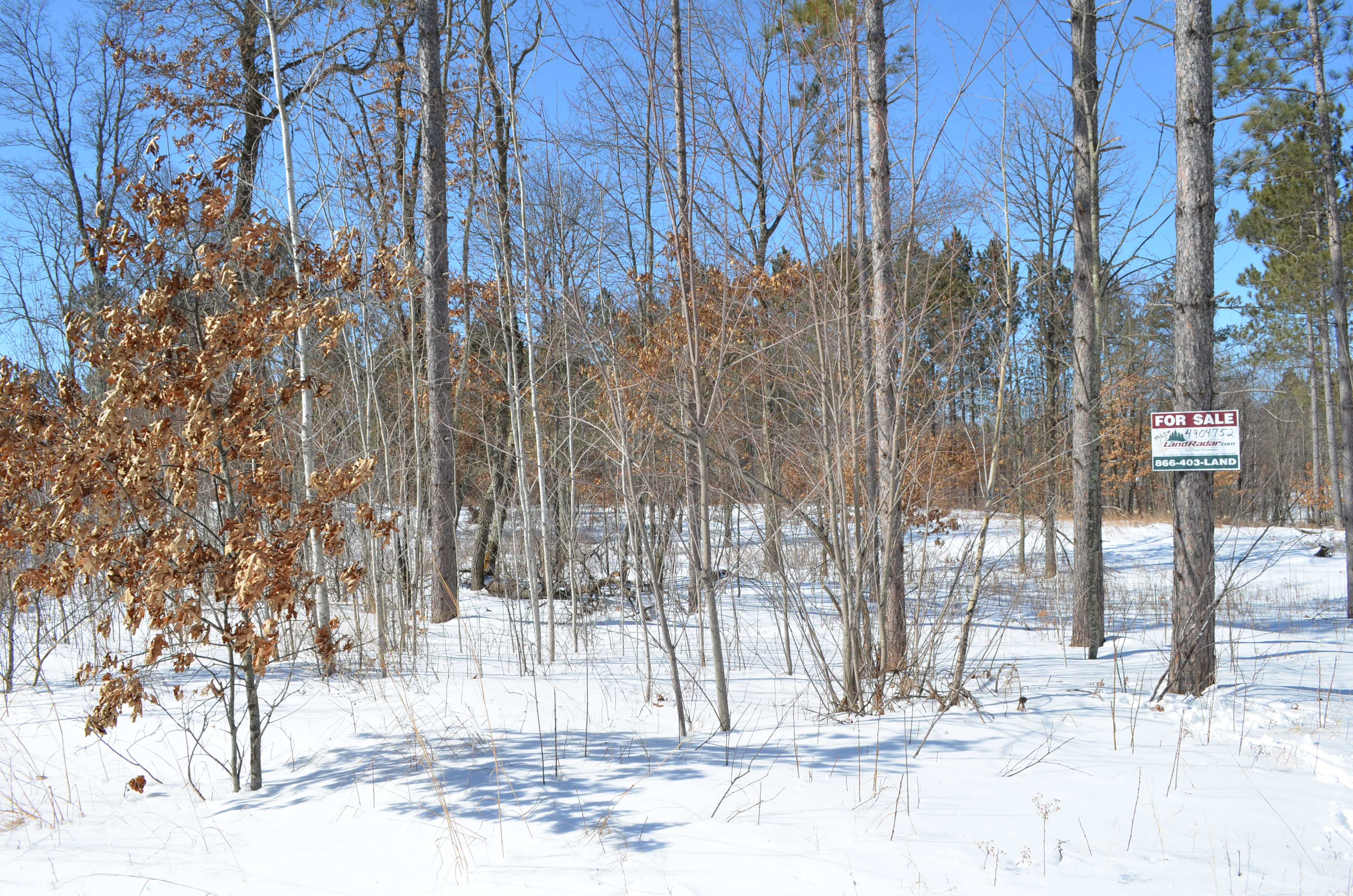
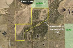
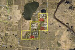
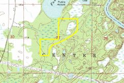
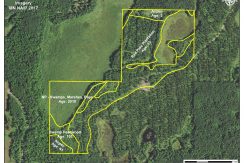
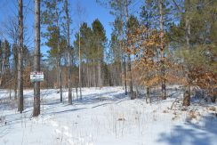
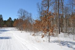
Well-located tract of Potlatch land by Fawn Lake east of Merrifield. Approx 67 acres of level terrain combines upland wooded with red pine, aspen, and swamp hardwood with wetlands in the east and west sides. An easement trail off Antler Rd provides access along the entire southeast boundary. A state snowmobile trail (#114) maintained by the Merrifield Marathons runs along the easement trail as well. Fawn Lake public access is about 1 mile away. Public land adjoining the north provides additional hunting/recreational space. Nearby utilities offer potential for building a country home only minutes away from all the amenities of the Brainerd Lakes Area.
Main Property Info
Property ID
Pt 520291300000009 & Pt 520293100000009 & Pt 520294200000009
Pt 520291300000009 & Pt 520293100000009 & Pt 520294200000009
MLS Number
4904752
4904752
Status
Sold
Sold
List Price
$104,900
$104,900
Selling Price
$104,900
$104,900
Acres
67
67
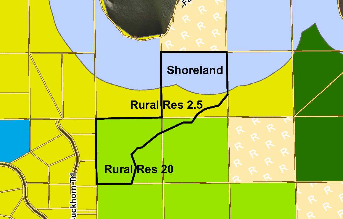
Zoning
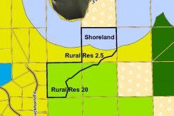
Shoreland & Rural Res 2.5 & Rural Res 20
Shoreland & Rural Res 2.5 & Rural Res 20
City
Merrifield
Merrifield
Township
Center Twp
Center Twp
State
MN
MN
Zip Code
56465
56465
County
Crow Wing
Crow Wing
Legal Description
Pts NESW & NWSE & SWNE, 29-135-27. Subject to snowmobile trail, easement in Doc A899476, and any other easements, restrictions, or reservations of record. Subject to and together with easement for ingress, egress, and utilities. (See full description in Supplements.)
Pts NESW & NWSE & SWNE, 29-135-27. Subject to snowmobile trail, easement in Doc A899476, and any other easements, restrictions, or reservations of record. Subject to and together with easement for ingress, egress, and utilities. (See full description in Supplements.)
Property Location
Directions
From the intersection of Co Rd 3 and Co Rd 4 north of Merrifield, right on Co Rd 3 for 2 miles. Right on Co Rd 19 for 2 1/10 miles. Right on Antler Rd 1 1/10 mile. Right on easement trail 4/10 mile to property on the right.
From the intersection of Co Rd 3 and Co Rd 4 north of Merrifield, right on Co Rd 3 for 2 miles. Right on Co Rd 19 for 2 1/10 miles. Right on Antler Rd 1 1/10 mile. Right on easement trail 4/10 mile to property on the right.
Access
An easement off Antler Rd provides access along the southeast side of the tract.
An easement off Antler Rd provides access along the southeast side of the tract.
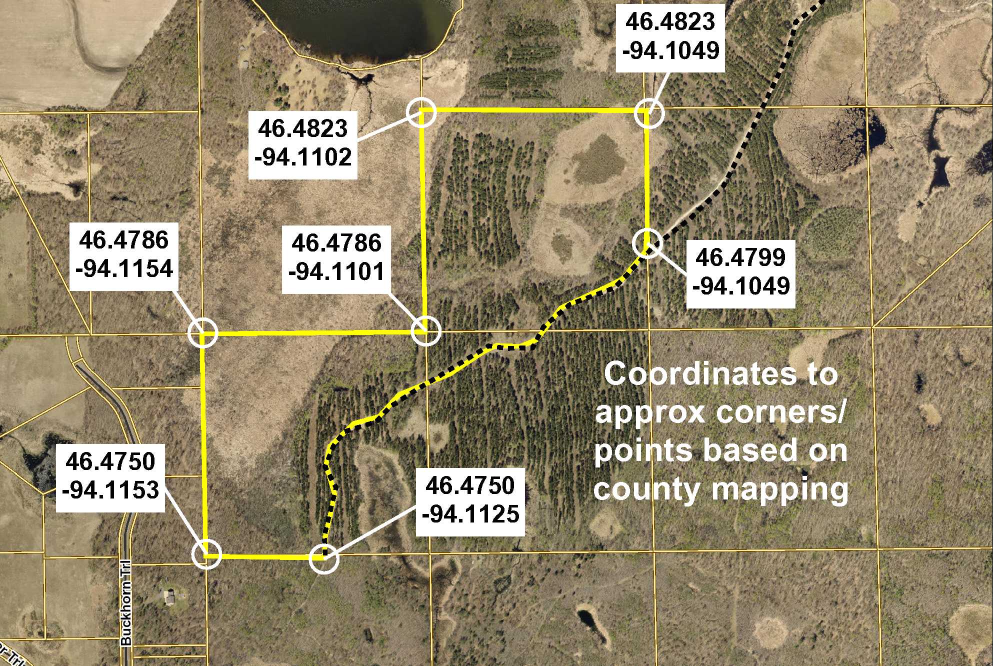
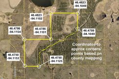
GPS Coordinates
See map for coordinates to approximate corners/points based on county mapping.
See map for coordinates to approximate corners/points based on county mapping.
Address
Antler Rd
Antler Rd
School District
Brainerd - 181
Brainerd - 181
Property Details
Dimensions (approx)
2690 x 694 x 1320 x 1320 x 1320 x 1320 x 868 IRR
2690 x 694 x 1320 x 1320 x 1320 x 1320 x 868 IRR
Utilities
Power Company
Crow Wing Power (1-800-648-9401)
Crow Wing Power (1-800-648-9401)
Taxes & Fees
Tax Amount
$587
$587
Tax Year
2018
2018
Other Details
Section Number
29
29
Township Number
135
135
Range Number
27
27
Estimated Upland %
65
65
Estimated Wetland %
35
35
Additional Comments
Timber Comments
This property has been managed according to Forest Stewardship Council (FSC) standards. Timber includes aspen, red pine, and swamp hardwood. If timber value is important to you, seek the advice of a competent forester to determine species, volumes, and values.
This property has been managed according to Forest Stewardship Council (FSC) standards. Timber includes aspen, red pine, and swamp hardwood. If timber value is important to you, seek the advice of a competent forester to determine species, volumes, and values.
Hunting Comments
This tract adjoins public land in MN Firearms Deer Permit Area: 604
This tract adjoins public land in MN Firearms Deer Permit Area: 604
Disclosures
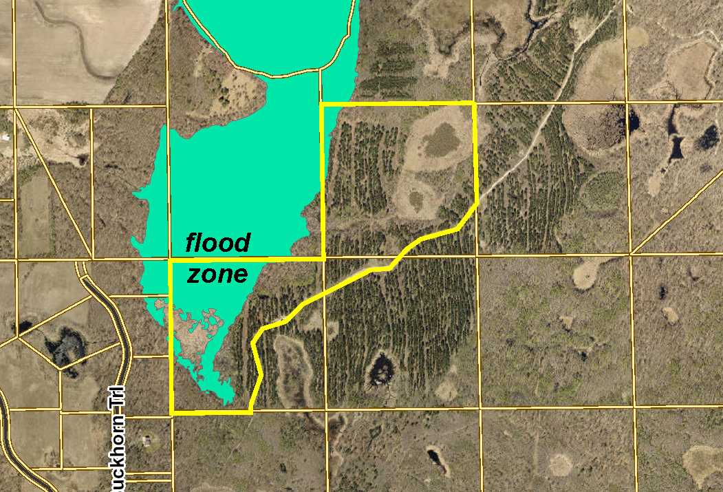
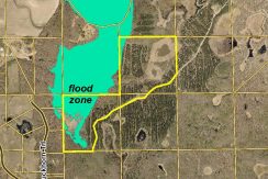
Portions of the tract fall within FEMA flood zone. Parcel split; acreage, dimensions, and taxes estimated based on county data and mapping; county disclaimers included by reference; subject to split approval if necessary. There will be additional information available on the easement prior to closing. Not surveyed. Photos/maps for convenience only and not guaranteed; physically inspect prior to purchase. Any deer stands on the land are not property of seller and are not included in sale. Use seller-approved PA and addendum; closing dates the 3rd Wednesday each month.
Portions of the tract fall within FEMA flood zone. Parcel split; acreage, dimensions, and taxes estimated based on county data and mapping; county disclaimers included by reference; subject to split approval if necessary. There will be additional information available on the easement prior to closing. Not surveyed. Photos/maps for convenience only and not guaranteed; physically inspect prior to purchase. Any deer stands on the land are not property of seller and are not included in sale. Use seller-approved PA and addendum; closing dates the 3rd Wednesday each month.


