

MLS Number : 5143691
Sold $100,000 - Hunting & Recreation
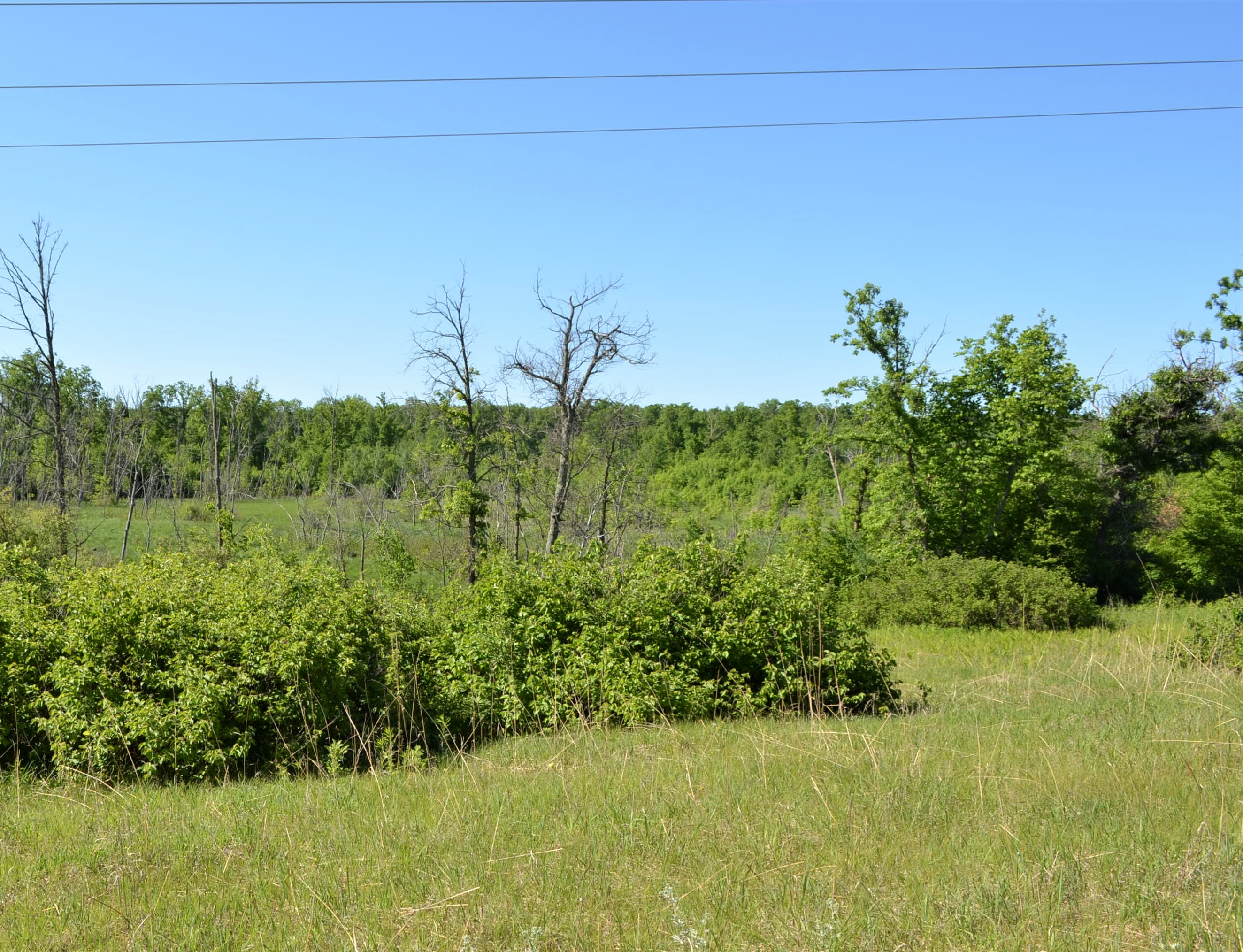
This 109 acre tract of land has a lot to offer the sportsman. Lots of rolling topography, wetlands, some open water, a snowmobile trail and a small creek combine to make this Brainerd area tract a must-see. Located in an area of whitetail deer, grouse and turkey hunting plus a small pond for waterfowl possibilities. Located off Sorenson Lake Road near Merrifield, an easement road provides access. Merrifield is just minutes away for food and fuel. There is a SuperAmerica for fuel and groceries with dining available at Andy’s, Harpo’s or The Woods. Merrifield also gives access to the Paul Bunyan Trail. Brainerd/Baxter is just a bit further with a variety of shopping, dining/food/beverage, employment, a Regional Airport, hospitality and medical facilities. It’s also home to the Northland Arboretum for additional outside activities. Adjoining land is also available. Property is in the Brainerd School District.
Main Property Info
Pt of PID# 510064200000009, Pt of PID# 510063100000009, PID# 510061300B00009 & PID# 510062400B00009
5143691
Sold
$119,900
$100,000
109.4
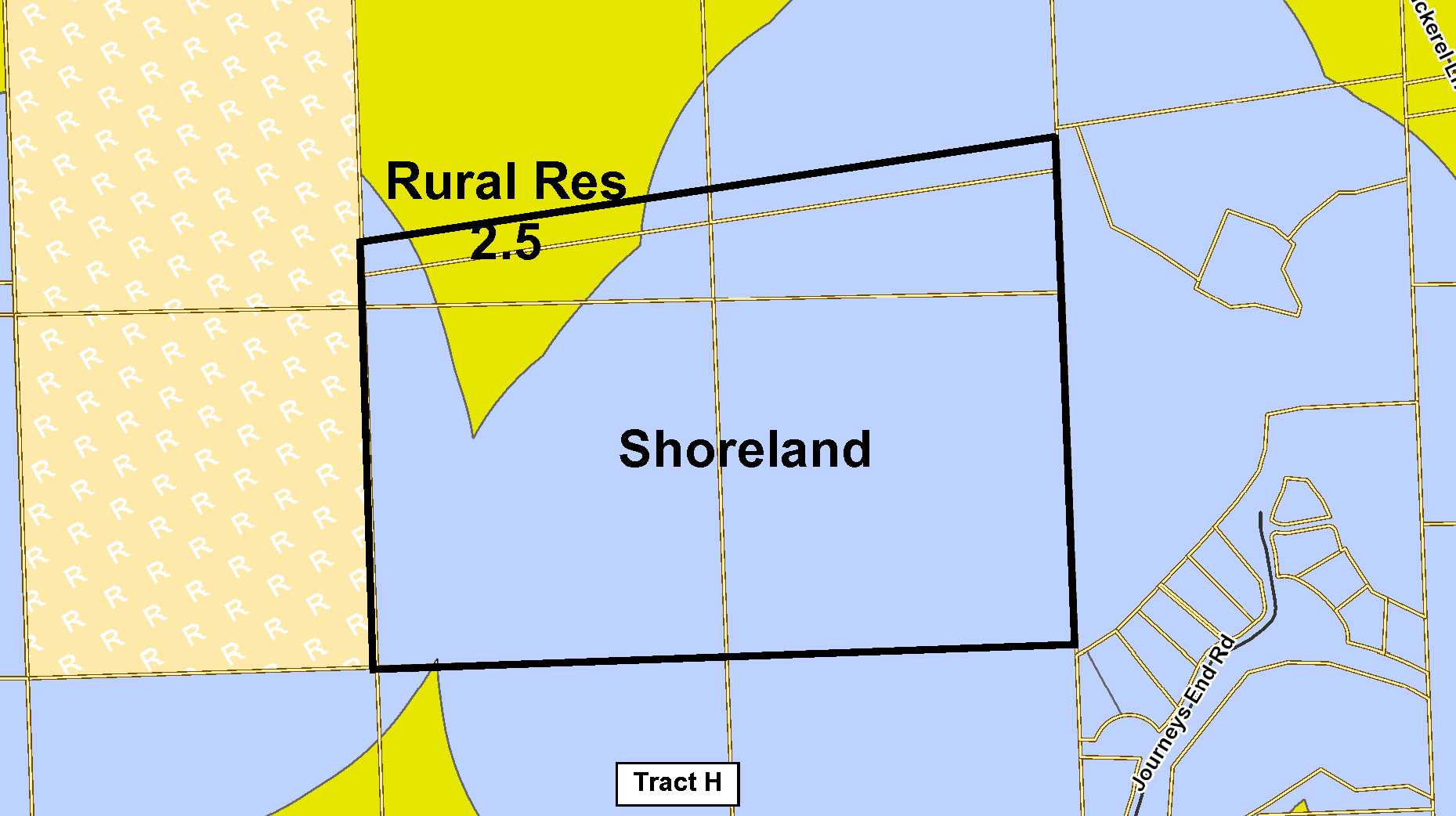
RR 2.5 and Shoreland
Merrifield
Center Twp
MN
56465
Crow Wing
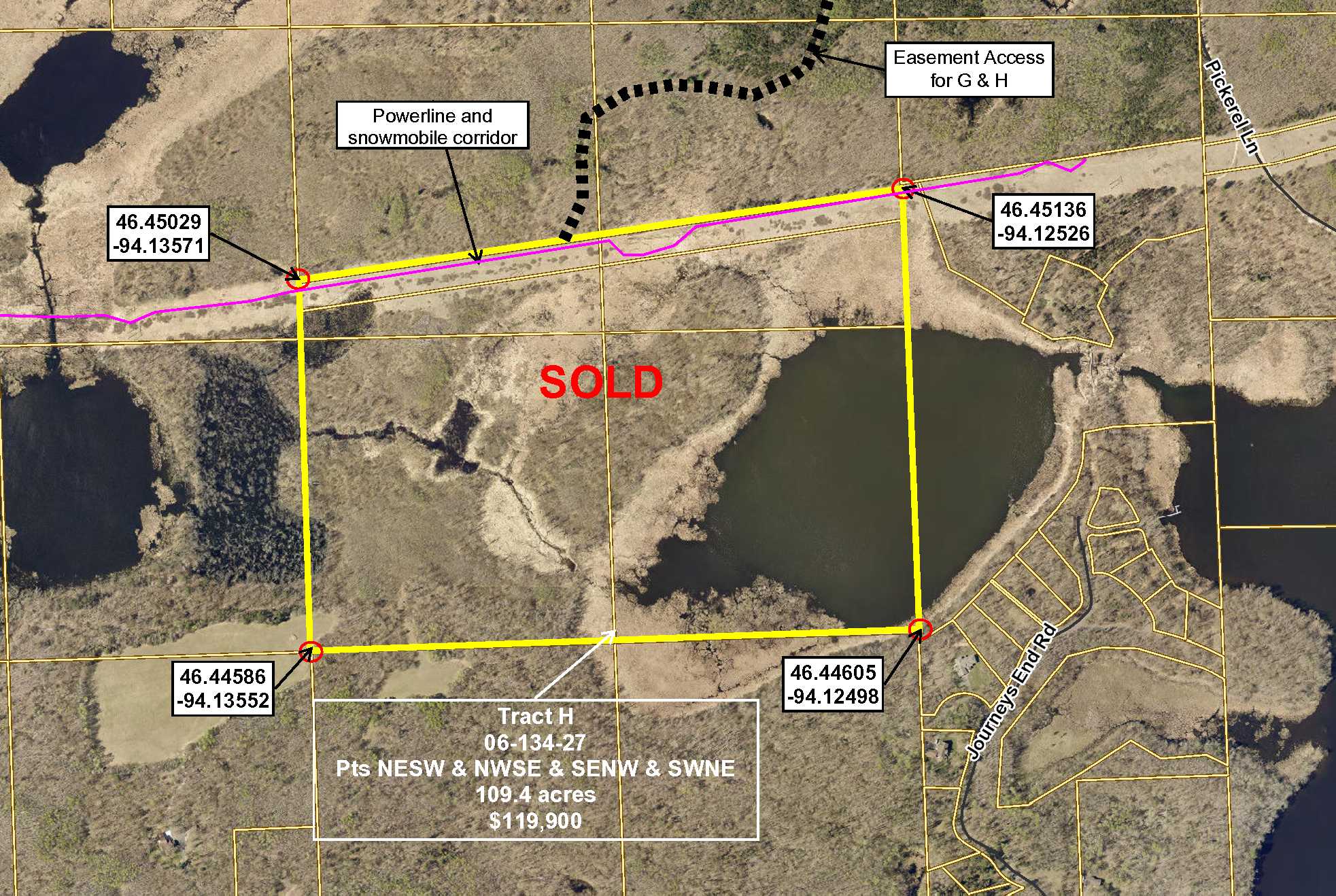
Tract H, 06-134-27, Pts NESW & NWSE & SENW & SWNE. See tract legal description as Exhibit A in Supplements. Subject to easements, restrictions and reservations of record, if any.
Property Location
In east Brainerd, from the intersection of Hwy 210 and Co Rd 3 (Mill Ave); north on Co Rd 3 6.7 miles; east on Sorenson Lake Rd 2.35 miles to a trail on the south (right) side of the road. The trail is a shared easement access to the property – the north boundary of the tract is about .6 mile south of Sorenson Lake Rd.
Access is a shared easement trail off of Sorenson Lake Road. Sorenson Lake Road is paved and township maintained.
Coordinates to approximate corners/points based on county mapping: NW: 46.45029/-94.13571, NE: 46.45136/-94.12526, SE: 46.44605/-94.12498, SW: 46.44586/-94.13552
TBD Sorenson Lk Rd, Merrifield
Brainerd - 181
Property Details
Approx. 48
N 2663, E 1958, S 2649, W 1640
Utilities
Electric, Telephone and Cable nearby
None
Crow Wing Power (1-800-648-9401)
Waterfront
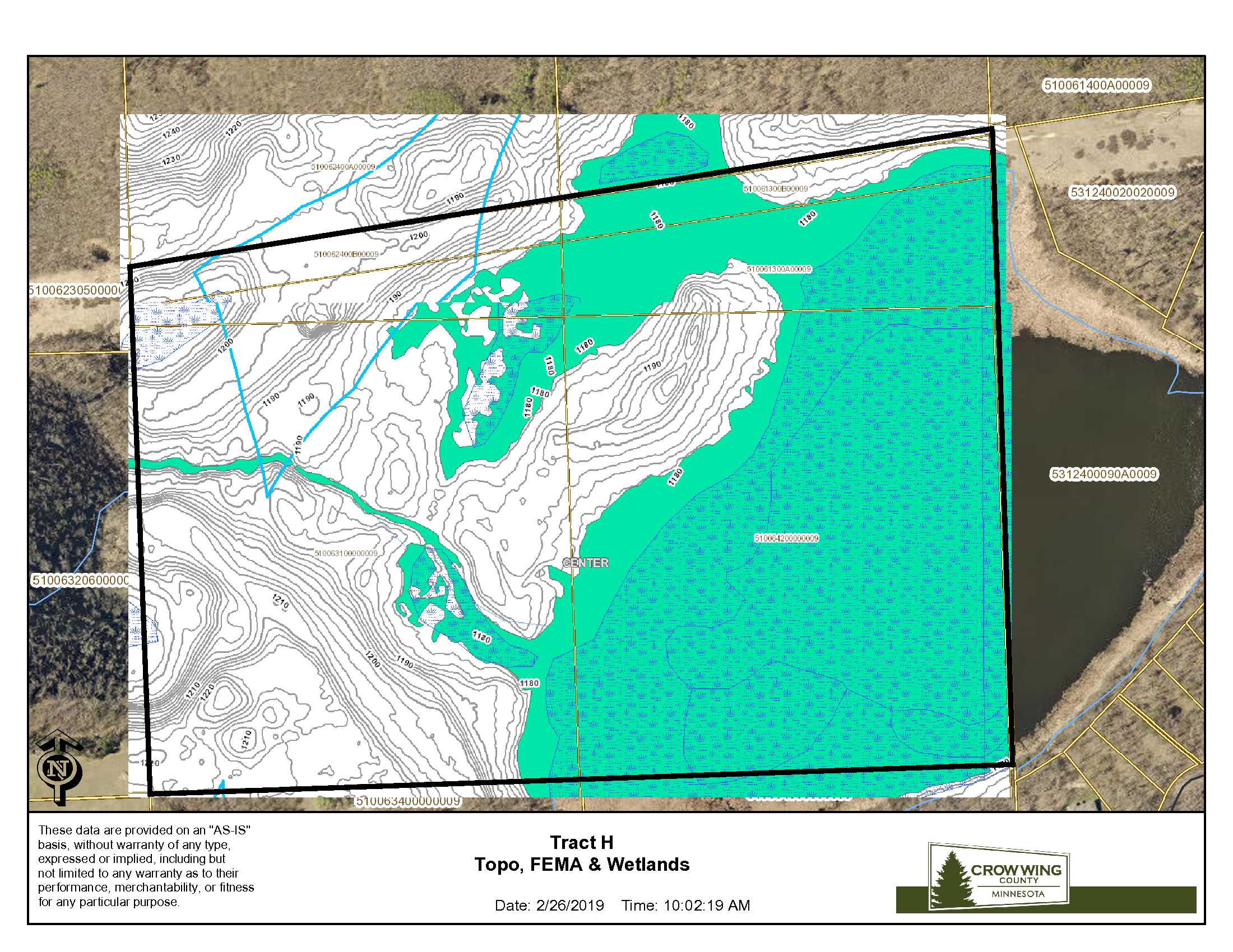
There is a small pond and creek running through the property
Taxes & Fees
No
$0
N/A
$993
122
$1,115
No
Paving Sorenson Lk Rd & Rebel Rd
2018
Other Details
06
134
27
45
55
Additional Comments
A mix of various aged aspen and some hardwoods.
Deer Permit Area: 604 This is a popular whitetail deer, grouse and turkey hunting area. The small pond on the southeast corner may provide some waterfowl hunting opportunities.
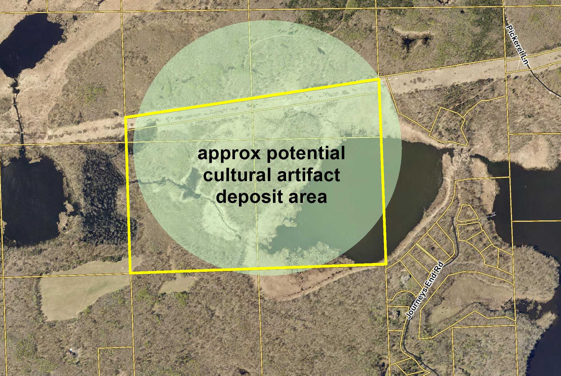
Real estate taxes have been estimated. The property has been surveyed with survey pins and white stakes are marking the corners. This tract is subject to the Center Township Subordinate Service District for paving of Sorenson Lake Road and Rebel Road. See Supplement, for more information, contact Coralea Borden, Center Twp Clerk, 218-765-3397, MCBorden@brainerd.net. A powerline easement and snowmobile trail easement (Document A-909769) run along the northerly boundary. The shared easement trail is used by several parcels. Most of the property is in a potential cultural artifact area. See information available at: http://www.dot.state.mn.us/culturalresources/regulations.html A powerline easement and snowmobile trail easement (Document A-909769) runs along the northerly boundary. Much of the tract is affected by FEMA mapping. See survey – a debris pile is on the SW corner of the property and will not be removed by Seller. Photos/maps & GPS coordinates are for convenience only and not guaranteed; tree cover may be different than depicted; physically inspect prior to purchase. Any deer stands on the land are not property of seller and are not included in sale. Use seller-approved PA and addendum; closing dates the 3rd Wednesday each month. Multiple easements affect the property. See Map Easement Supplements for details.


