

MLS Number : 5224783
Sold $97,000 - Home & Cabin Sites, Hunting & Recreation
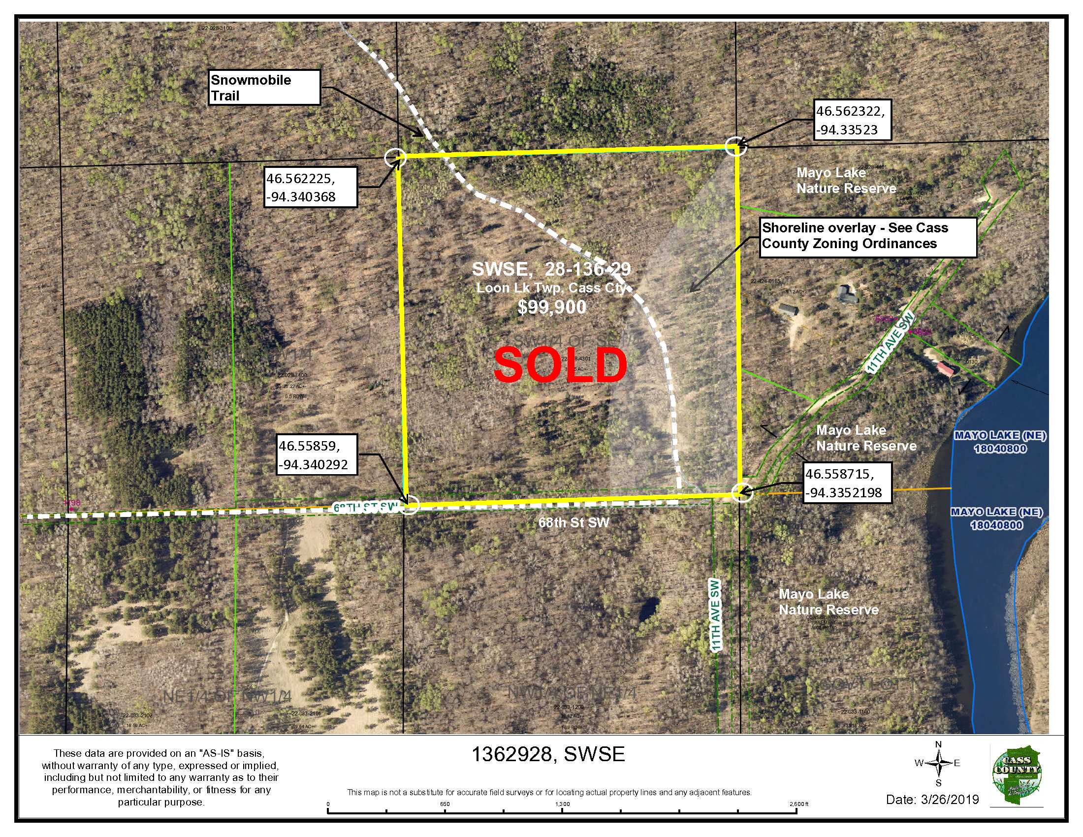
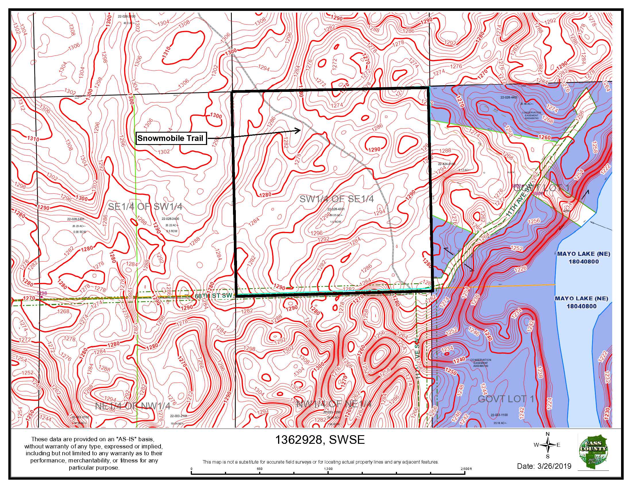
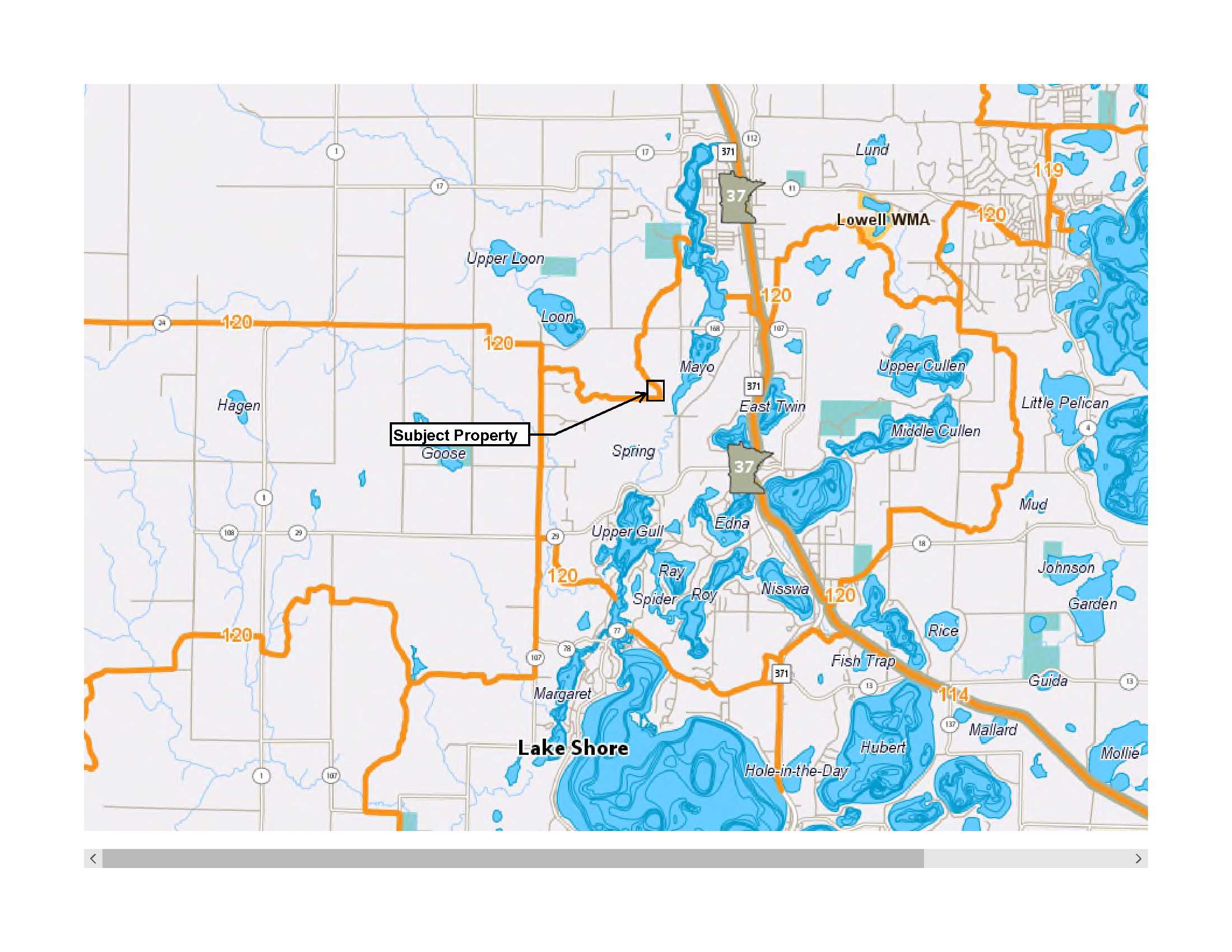
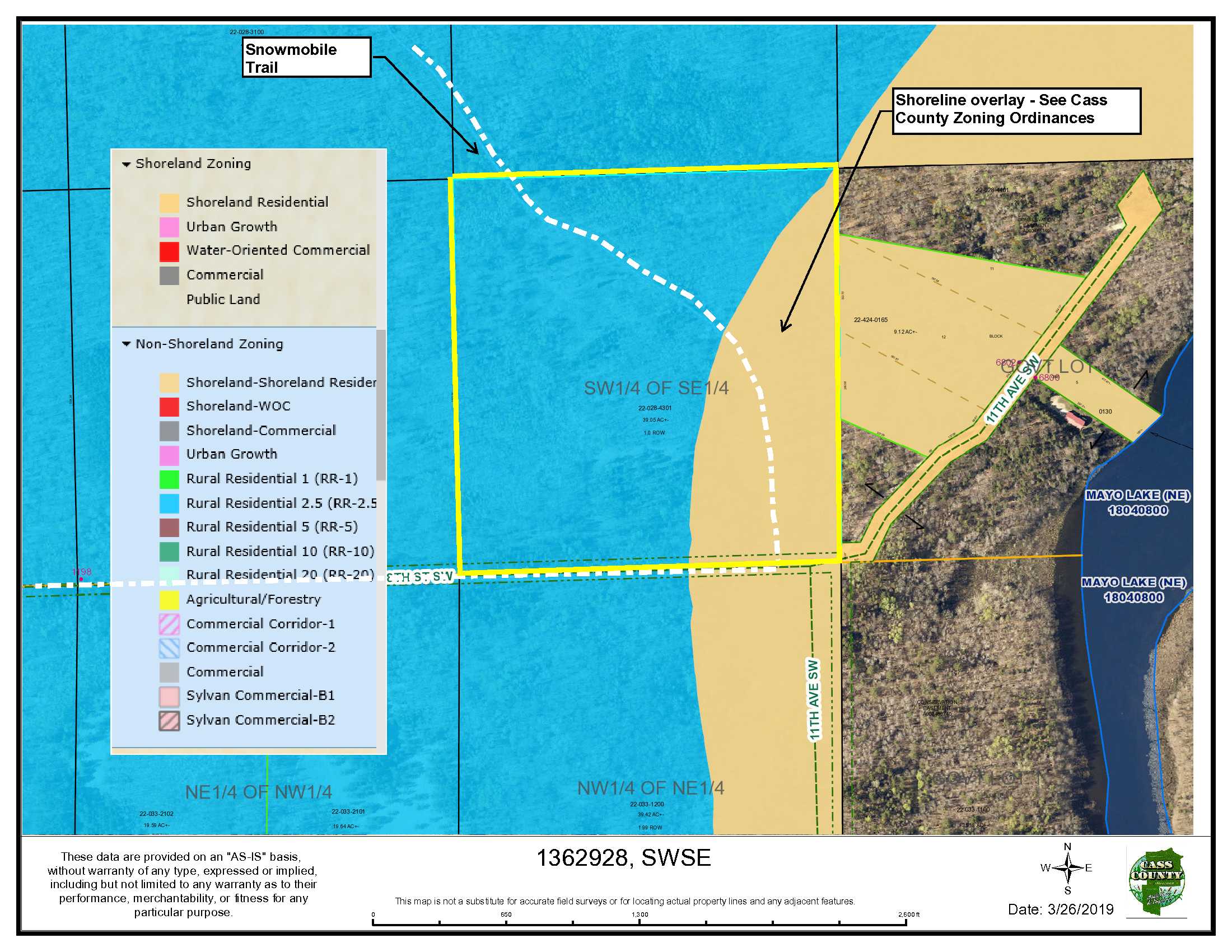
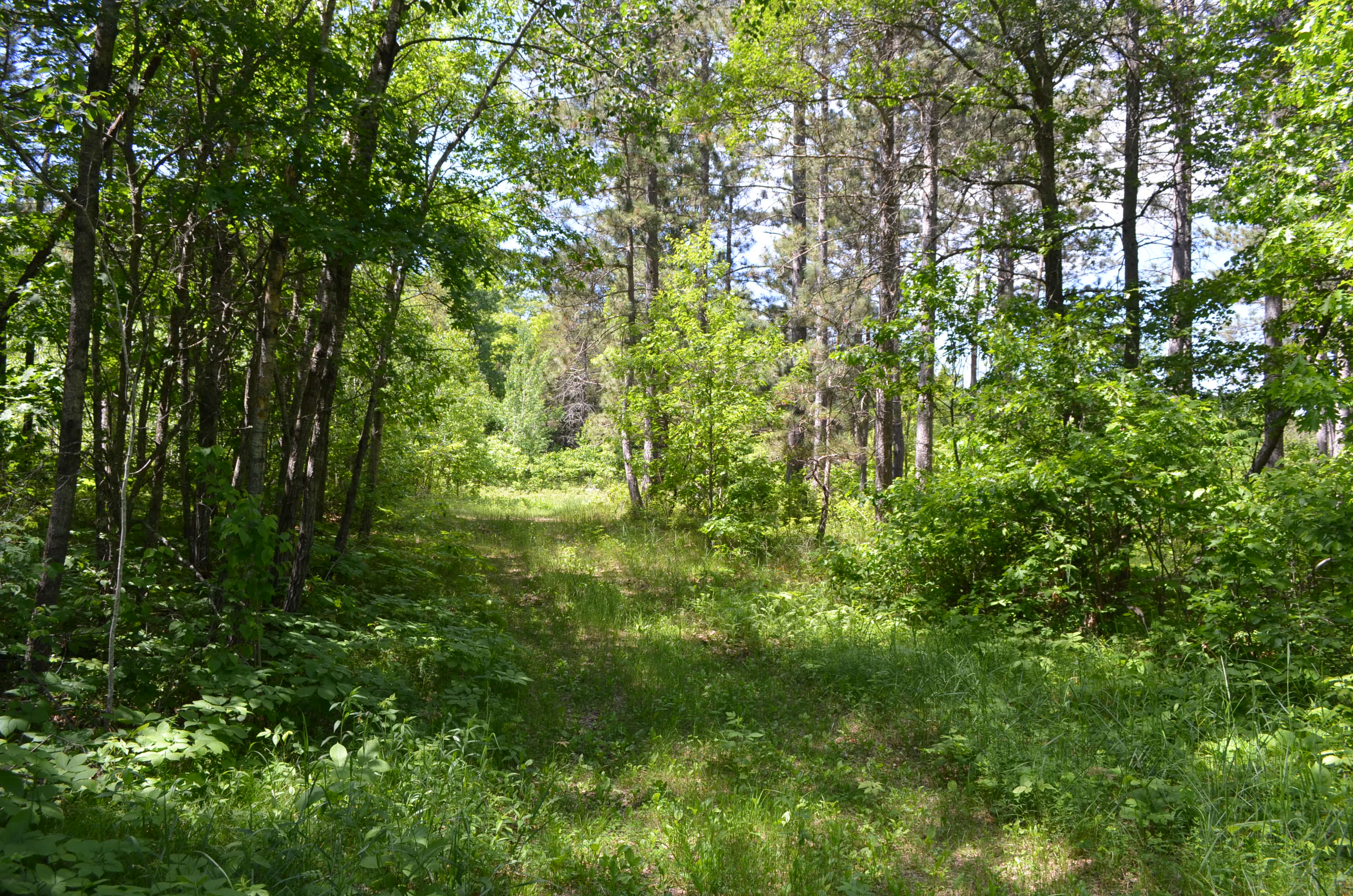
Forty forested acres very well located near Nisswa and Pequot Lakes. The property has convenient access on a township road but is tucked away out of the main traffic. Rolling topography combines with the mostly hardwood and pine forest to make this a great hunting spot with abundant wildlife including Whitetail deer, grouse and turkey. With utilities nearby, it could also be a building site for a new home or cabin. The Gull Lake Drifters snowmobile trail runs along the southerly boundary and northwesterly through the parcel. This parcel is located in the center of the Brainerd lakes area with easy access to so many amenities. The Paul Bunyan Trail, Gull and Whitefish Chain, Hunt’s Point Gun Club and several golf courses are nearby. Mayo Lake Nature Reserve adjoins this property and encompasses much of south Mayo Lake for added privacy. Stony Brook AMA is also nearby for stream trout fishing.
Main Property Info
22-028-4301
5224783
Sold
$99,900
$97,000
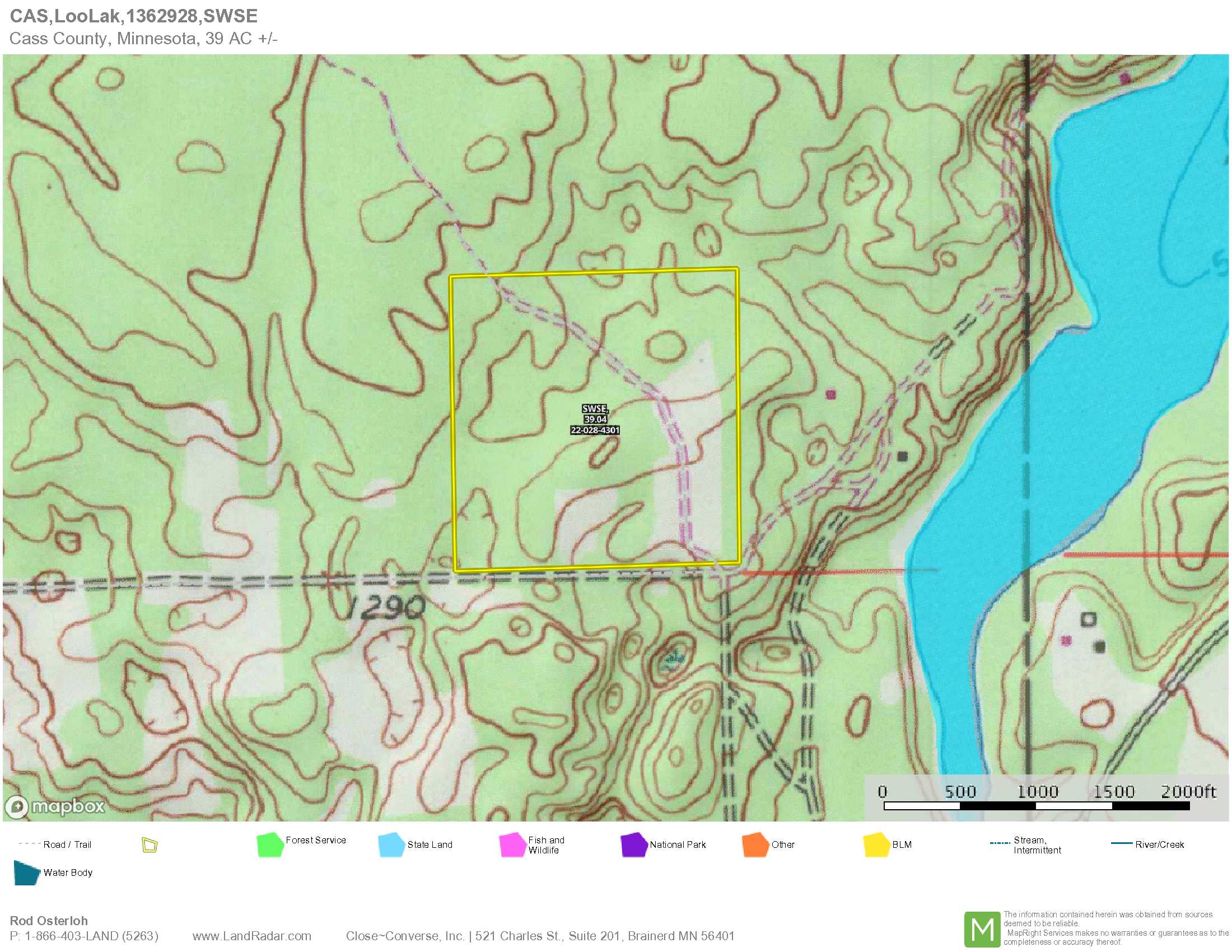
39.05
RR 2.5 & Shoreland Residential
Pequot Lakes
Loon Lake Twp
MN
56472
Cass
SWSE, 28-136-29, Cass County MN
Property Location
From Nisswa at the traffic light on Hwy 371 and Smiley Road; North on Hwy 371 3.3 miles to Co Rd 29; West (left) on Co Rd 29 1 mile to 9th Ave SW; North (right) .9 mile to 69th St SW; West(left) on 69th St SW for ¼ mile to 11th Ave SW; North (right) on 11th Ave SW 1/4 mile to 68th St SW and the SE corner of this property.
Portions of the road to this property are paved and others are township gravel roads. 68th St SW runs westerly along the southerly boundary of this tract.
Coordinates to approximate corners/points based on county mapping: NW: 46.562225, -94.3403684 NE: 46.562322, -94.33523 SE: 46.558715, -94.3352198 SW: 46.55859, -94.340292
SWSE 28-136-29 68th St SW, Pequot Lakes
Pequot Lakes - 186
Property Details
0
0
39
1,320 x 1,320 x 1,320 x 1,320
Utilities
Electricity and phone
None
Crow Wing Power (1-800-648-9401)
Waterfront
None
None
None
Taxes & Fees
No
$0
0
$484
0
$484
No
None
2019
Other Details
28
136
29
99
1
Additional Comments
Mix of hardwoods, including aspen and pine
Deer Permit Area: 604
A snowmobile trail traverses this tract. Acreage, dimensions, and taxes estimated based on county data and mapping or seller data; county disclaimers included by reference; subject to split approval if necessary. Not surveyed. Photos/maps and GPS coordinates for convenience only and not guaranteed; physically inspect prior to purchase.


