

MLS Number : 5026986
Sold $31,300 - Hunting & Recreation
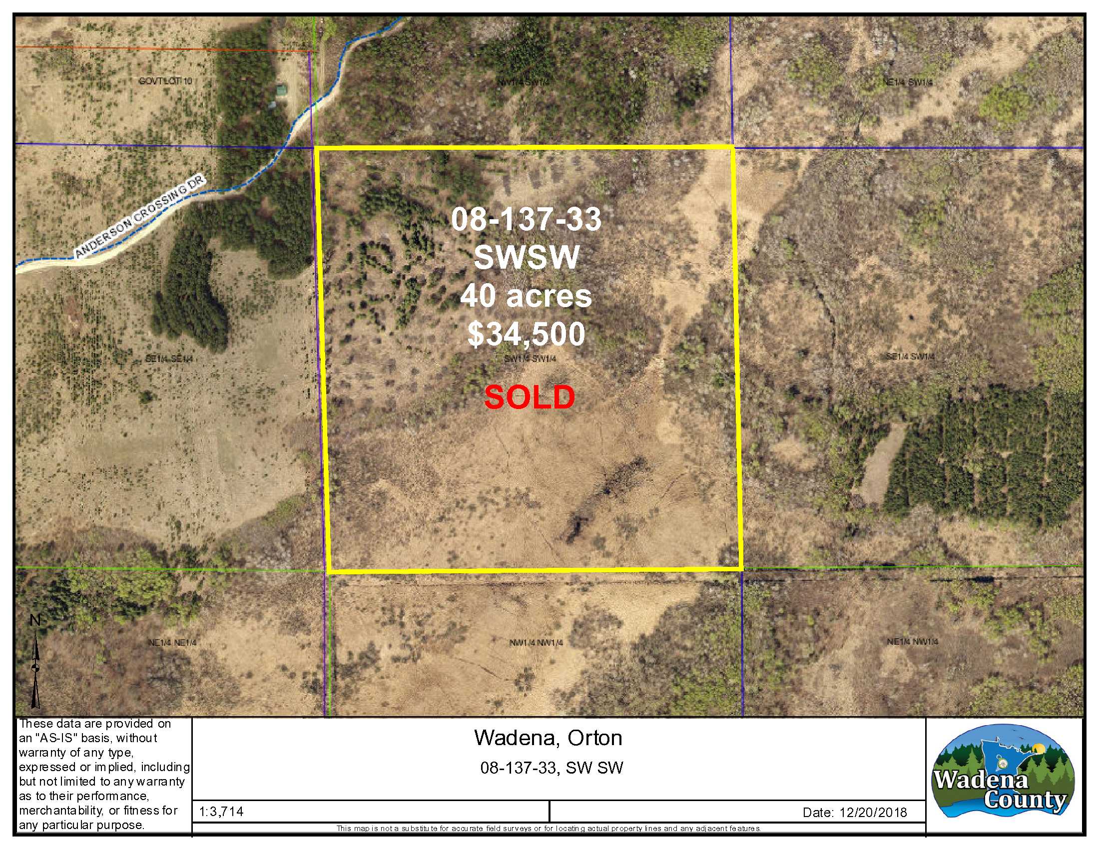
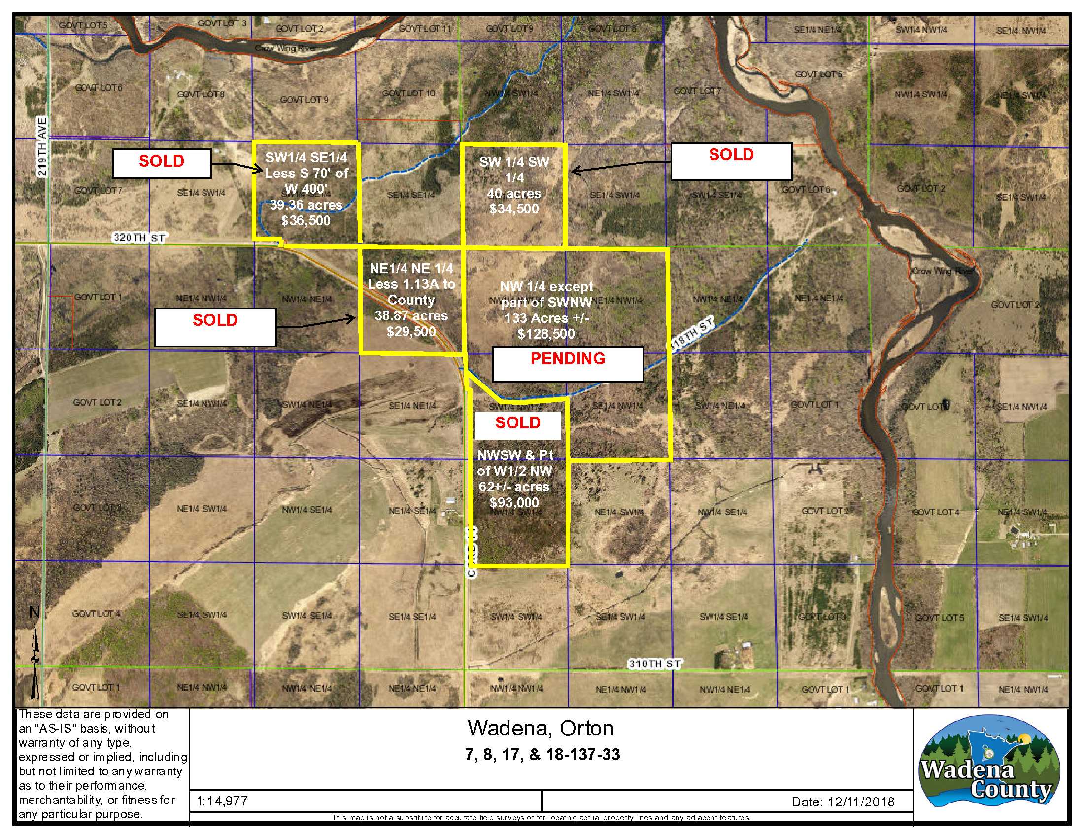
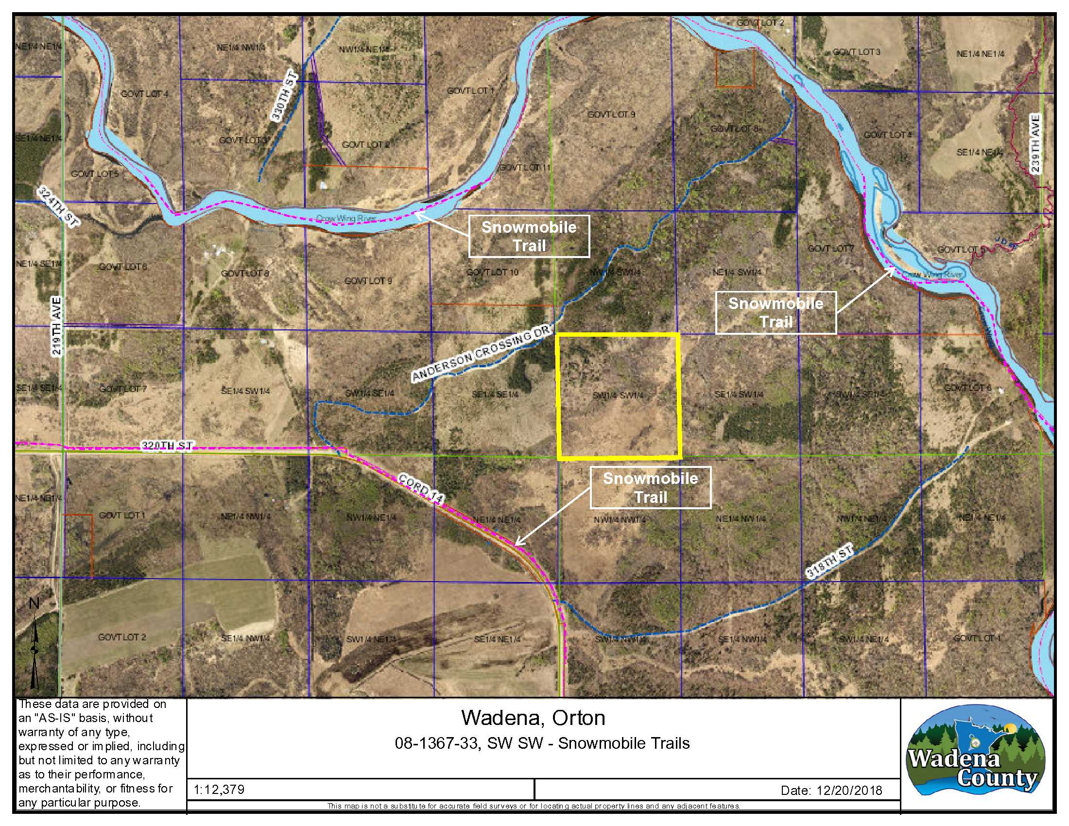
Reduced from $51,900 to $34,500! Take advantage of the great whitetail deer and upland bird hunting in the Nimrod area. This approx. 40-acre parcel adjoins county-owned land and is located near Nimrod. The property is fairly level and has upland with tall pines in the NW corner. Wildlife habitat is on approximately 2/3 of the property, ranging from wetland to brush land – ideal deer hunting territory. Canoe/kayak access at Anderson Crossing is less than a mile away and Nimrod is about 4.5 miles away. The property is enrolled in SFIA, generating income for the landowner. SFIA will be terminated in January 2024. Adjoins additional land for sale by the same owner.
Main Property Info
Property ID
R090083010
R090083010
MLS Number
5026986
5026986
Status
Sold
Sold
List Price
$34,500
$34,500
Selling Price
$31,300
$31,300
Acres
40
40
Zoning
Agriculture
Agriculture
City
Nimrod
Nimrod
Township
Orton Twp
Orton Twp
State
MN
MN
Zip Code
56478
56478
County
Wadena
Wadena
Legal Description
SWSW, 08-137-33, Wadena County, subject to any easements, restrictions or reservations of record. Note: this parcel does not have an insurable access from Anderson Crossing Dr. Buyer is directed to Wadena County which owns the parcel immediately north of this parcel and through which Anderson Crossing Dr passes.
SWSW, 08-137-33, Wadena County, subject to any easements, restrictions or reservations of record. Note: this parcel does not have an insurable access from Anderson Crossing Dr. Buyer is directed to Wadena County which owns the parcel immediately north of this parcel and through which Anderson Crossing Dr passes.
Property Location
Directions
In Nimrod MN, from the intersection of Co Rd 12 and Co Rd 14, North on Co. Rd 14 3.75 miles to Anderson Crossing Dr.; north and east on Anderson Crossing Dr approximately .7 mile to just past the driveway to E911 Address 22606. The NW corner of the property is approximately 140 feet south of Anderson Crossing Dr. Refer to maps. See GPS coordinates for assistance in locating boundaries and approximate property corners.
In Nimrod MN, from the intersection of Co Rd 12 and Co Rd 14, North on Co. Rd 14 3.75 miles to Anderson Crossing Dr.; north and east on Anderson Crossing Dr approximately .7 mile to just past the driveway to E911 Address 22606. The NW corner of the property is approximately 140 feet south of Anderson Crossing Dr. Refer to maps. See GPS coordinates for assistance in locating boundaries and approximate property corners.
Access
Note: This parcel does not have insurable (legal) access from a public road right of way. An insurable access may be secured by getting an easement from Wadena County, if desired. Walk-in access to the property is available to the NW corner of the parcel by following the directions contained herein. See GPS coordinates for assistance in locating boundaries and approximate property corners.
Note: This parcel does not have insurable (legal) access from a public road right of way. An insurable access may be secured by getting an easement from Wadena County, if desired. Walk-in access to the property is available to the NW corner of the parcel by following the directions contained herein. See GPS coordinates for assistance in locating boundaries and approximate property corners.
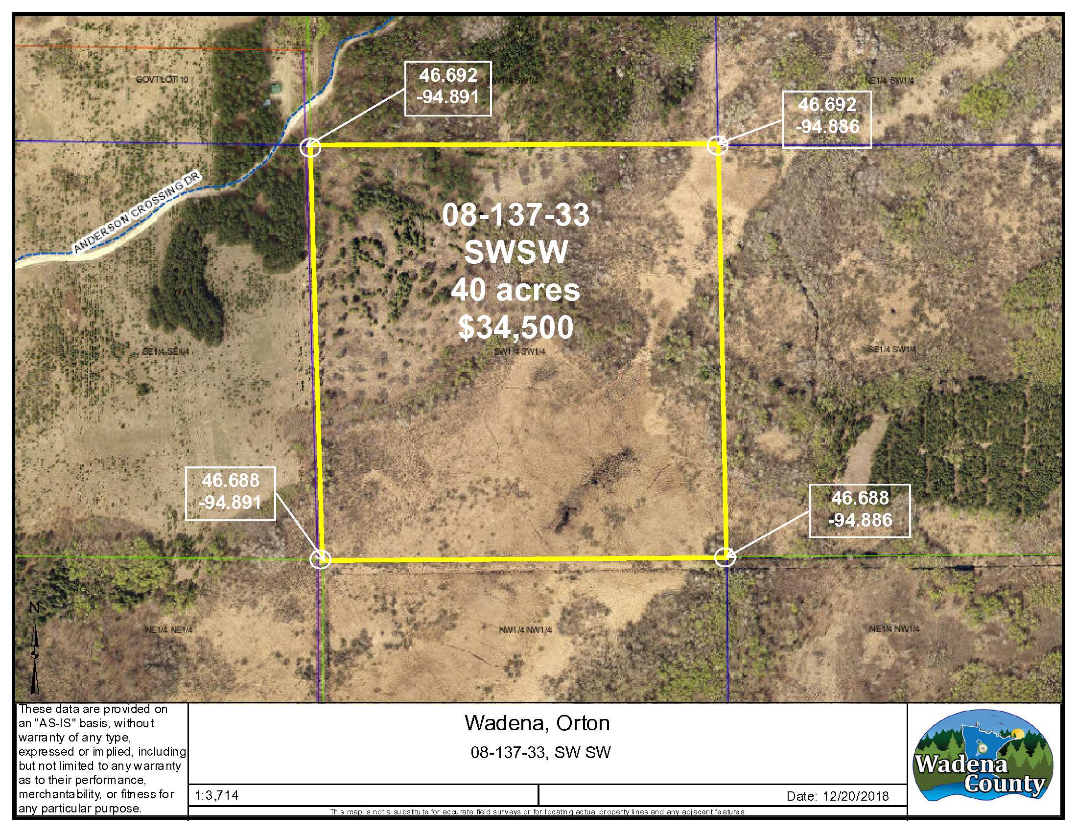
GPS Coordinates
Coordinates to approximate corners/points based on county mapping: NE: 46.692/-94.886, NW: 46.692/-94.891, SW: 46.688/-94.891, SE: 46.688/-94.886
Coordinates to approximate corners/points based on county mapping: NE: 46.692/-94.886, NW: 46.692/-94.891, SW: 46.688/-94.891, SE: 46.688/-94.886
Address
Directly across from E911 address 22606 Anderson Crossing Drive, Nimrod
Directly across from E911 address 22606 Anderson Crossing Drive, Nimrod
School District
Sebeka - 820
Sebeka - 820
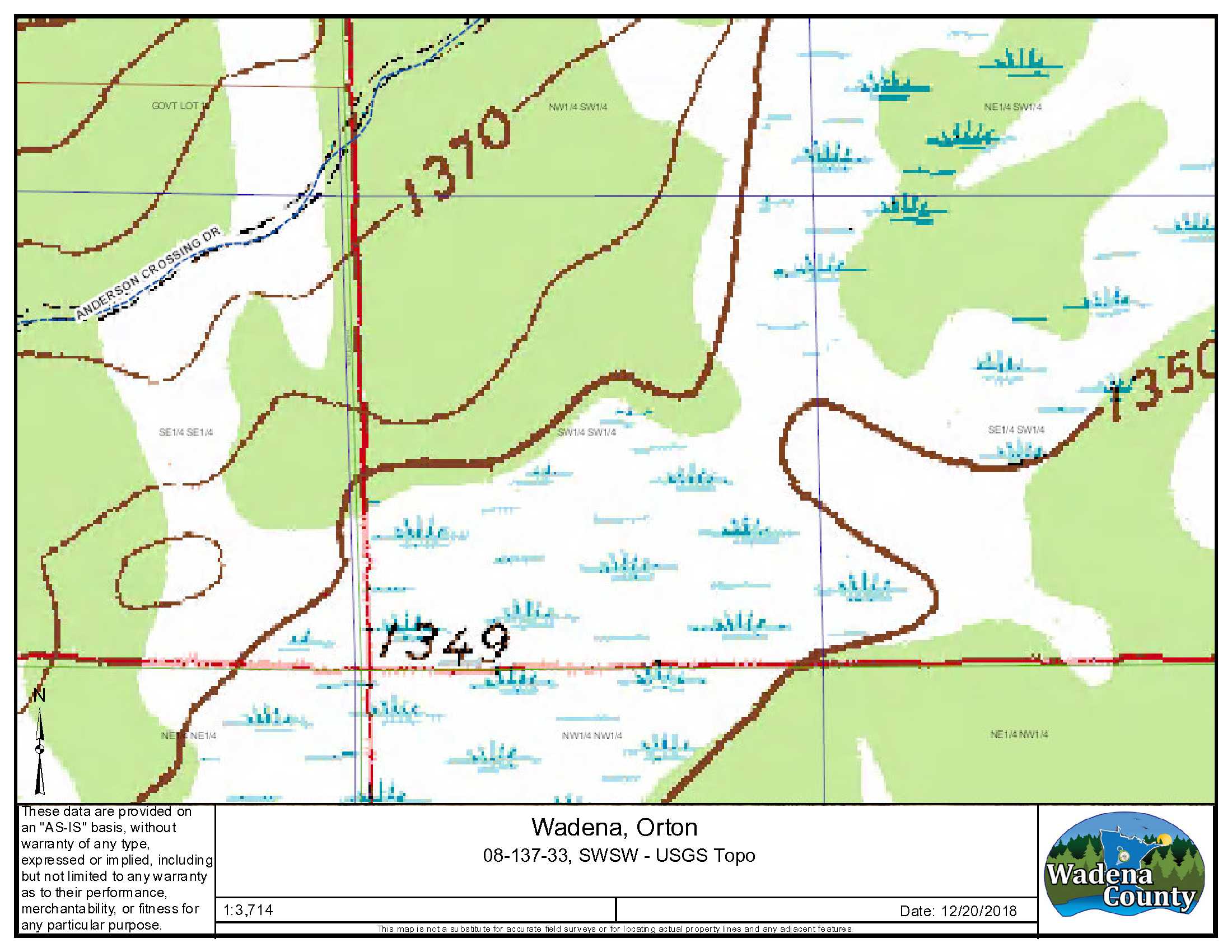
Property Details
Wooded Acres
15
15
Dimensions (approx)
1320 x 1320 x 1320 x 1320
1320 x 1320 x 1320 x 1320
Utilities
Available Utilities
Electric
Electric
On Site Utilities
None
None
Power Company
Todd-Wadena Electric (1-800-320-8932)
Todd-Wadena Electric (1-800-320-8932)
Taxes & Fees
Tax Amount
$424
$424
Tax With Assessments
$424
$424
Tax Year
2020
2020
Other Details
Section Number
08
08
Township Number
137
137
Range Number
33
33
Estimated Upland %
45
45
Estimated Wetland %
55
55
Additional Comments
Timber Comments
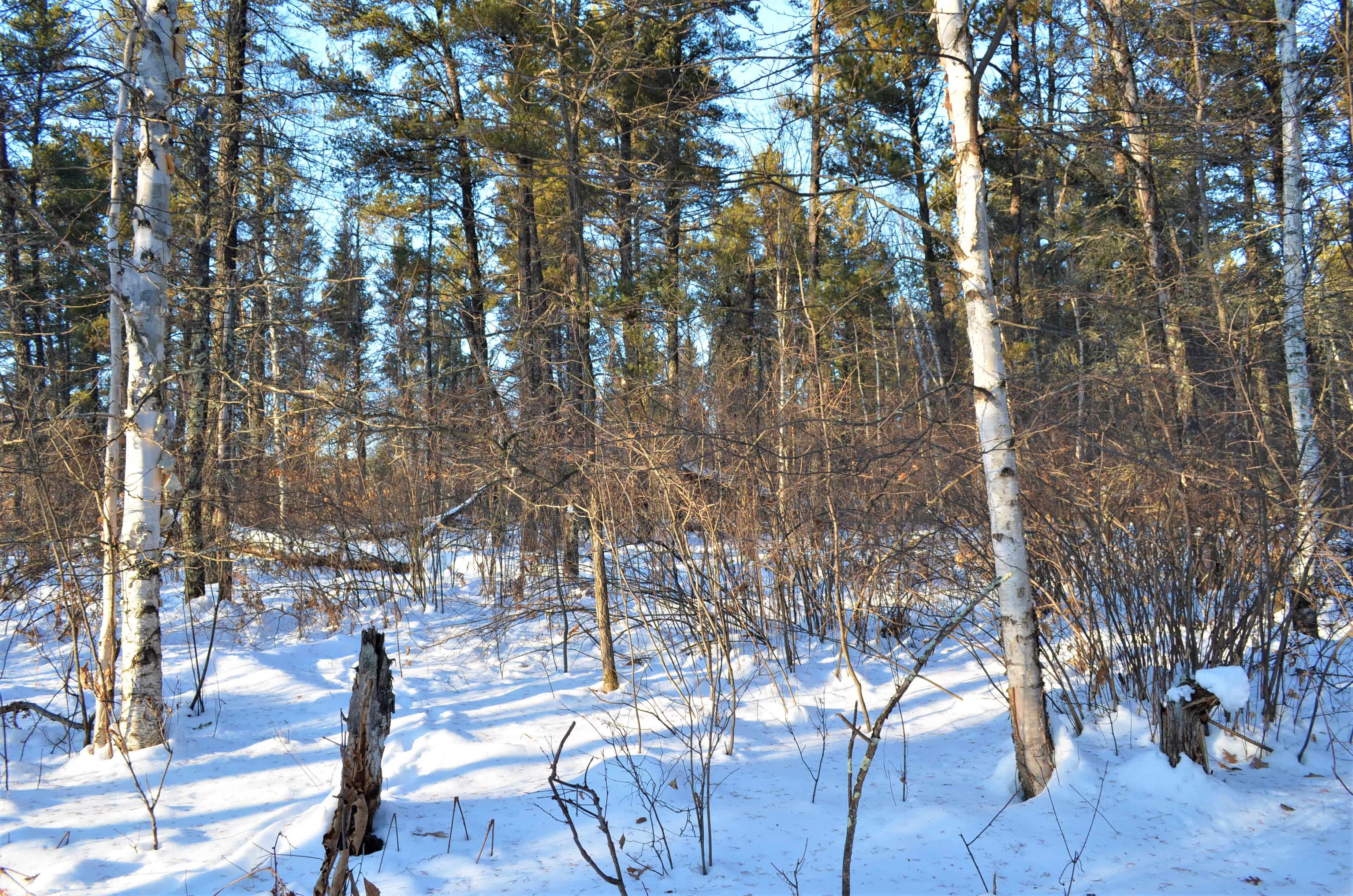
This property features large pine trees and mixed hardwoods. Inspect the property prior to purchasing if timber cover is important to your use. A small portion of the property was harvested about 2017.
This property features large pine trees and mixed hardwoods. Inspect the property prior to purchasing if timber cover is important to your use. A small portion of the property was harvested about 2017.
Hunting Comments
Hunting zone: 246. This area is known for whitetail deer, turkey and grouse hunting.
Hunting zone: 246. This area is known for whitetail deer, turkey and grouse hunting.
Disclosures
There is no insurable access to this property from a public road right of way. See access comments for more details. Anderson Crossing Dr. in indicated on County GIS as a township road but does not meet township road specifications. Inquire of Orton Twp regarding maintenance and use questions. This property is enrolled in SFIA (Sustainable Forest Incentive Act), which provides payments to landowners in return for maintaining the property for forestry uses. SFIA will be terminated in January 2024. See attached information regarding SFIA or search the internet for Minnesota Sustainable Forest Incentive Act. A portion of the property was harvested in 2017; see timber harvest supplement for more information. This property has not been surveyed and if accurate corner location is important to your use, it's recommended you get a registered land survey. Acreage is approx. Photos/maps/GPS coordinates are for convenience only and are not guaranteed; tree cover map be different than depicted; physically inspect prior to purchase. Any deer stands on the land may not be property of seller and are not included in the sale.
There is no insurable access to this property from a public road right of way. See access comments for more details. Anderson Crossing Dr. in indicated on County GIS as a township road but does not meet township road specifications. Inquire of Orton Twp regarding maintenance and use questions. This property is enrolled in SFIA (Sustainable Forest Incentive Act), which provides payments to landowners in return for maintaining the property for forestry uses. SFIA will be terminated in January 2024. See attached information regarding SFIA or search the internet for Minnesota Sustainable Forest Incentive Act. A portion of the property was harvested in 2017; see timber harvest supplement for more information. This property has not been surveyed and if accurate corner location is important to your use, it's recommended you get a registered land survey. Acreage is approx. Photos/maps/GPS coordinates are for convenience only and are not guaranteed; tree cover map be different than depicted; physically inspect prior to purchase. Any deer stands on the land may not be property of seller and are not included in the sale.


