
MLS Number : 5265564
Sold $64,900 - Home & Cabin Sites, Hunting & Recreation
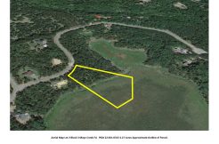
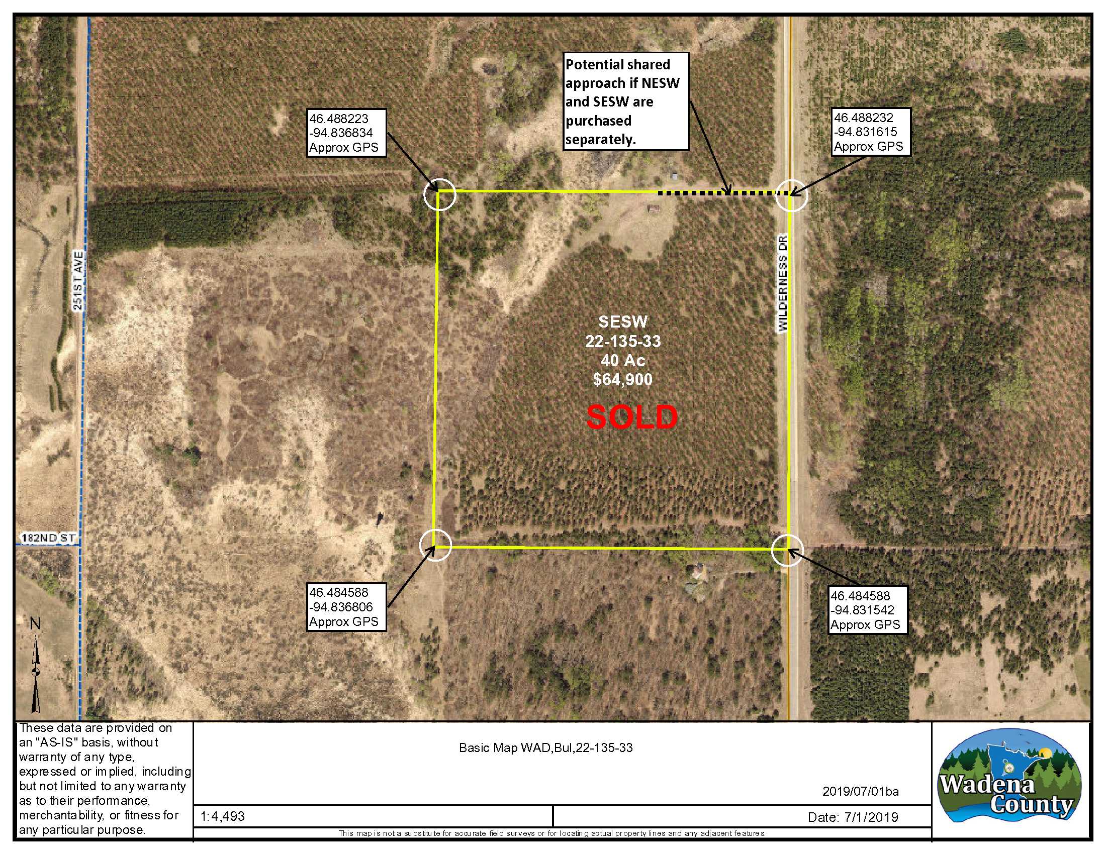
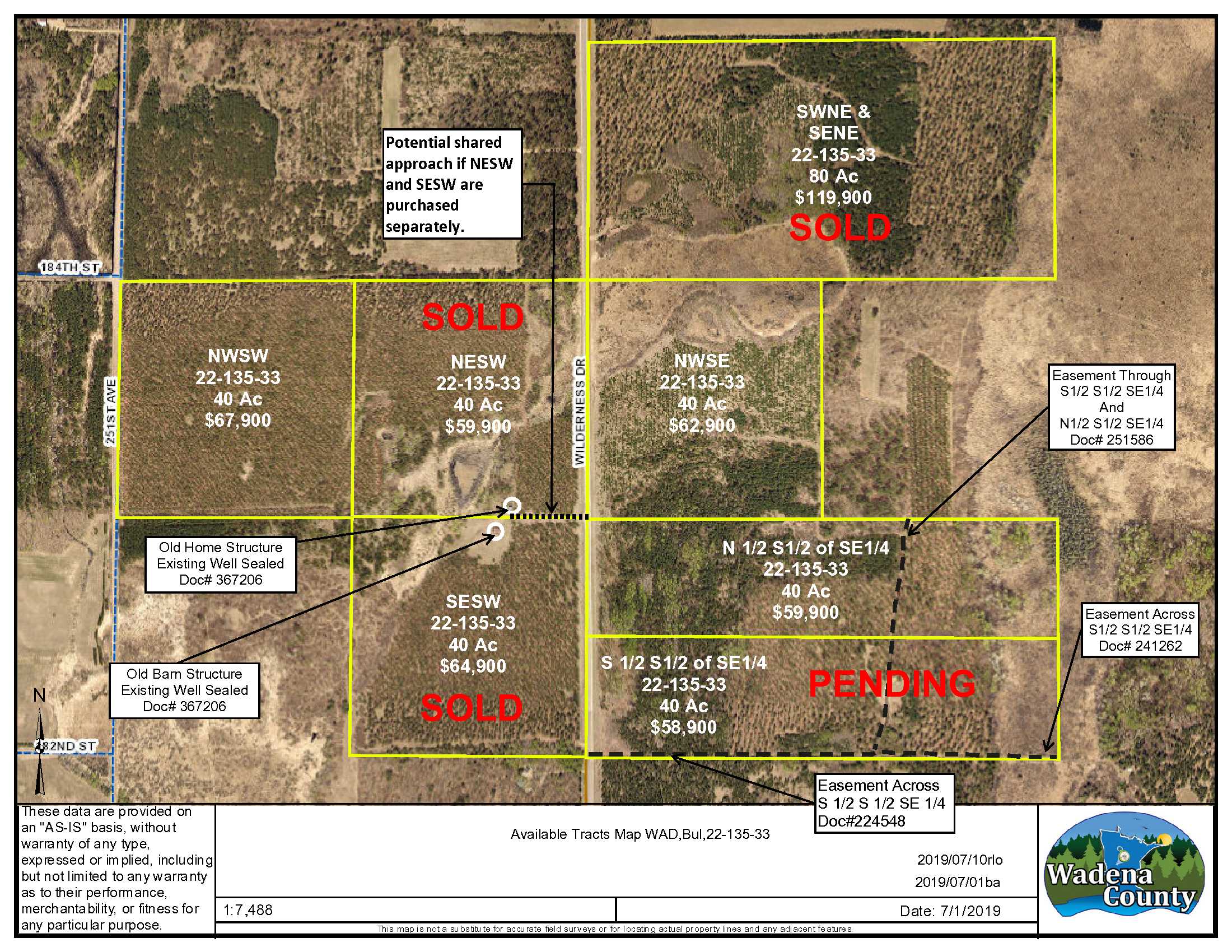
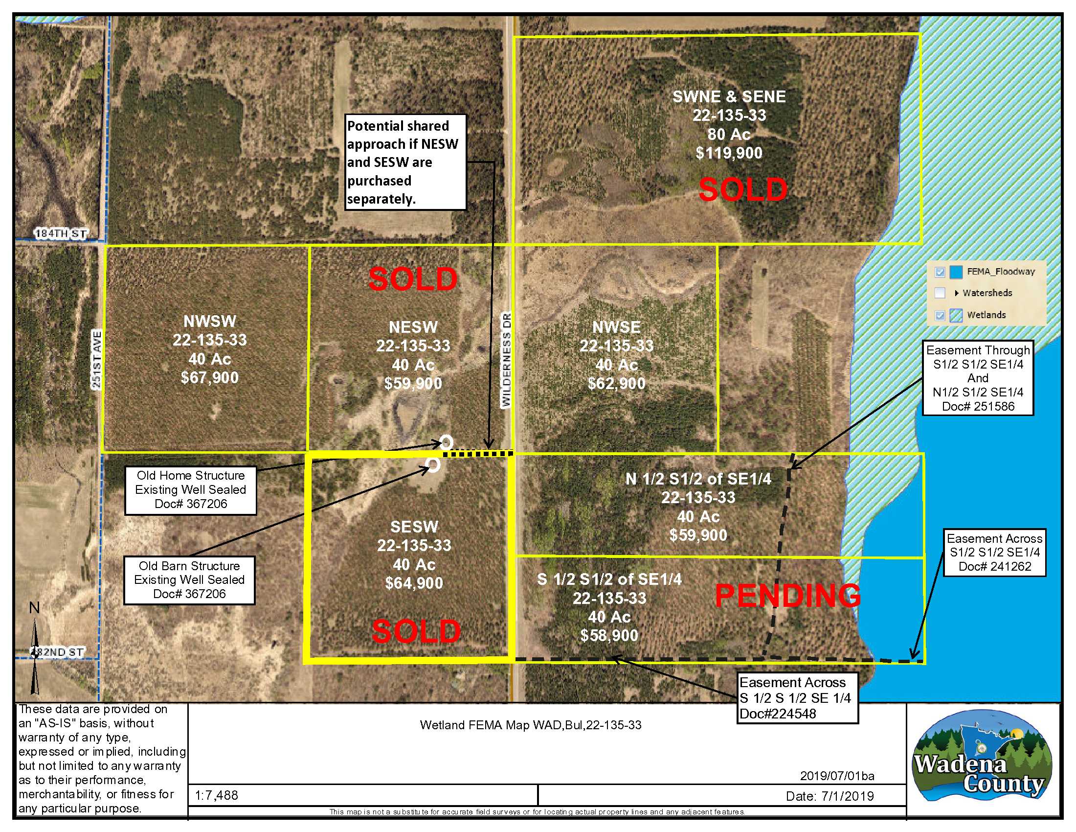
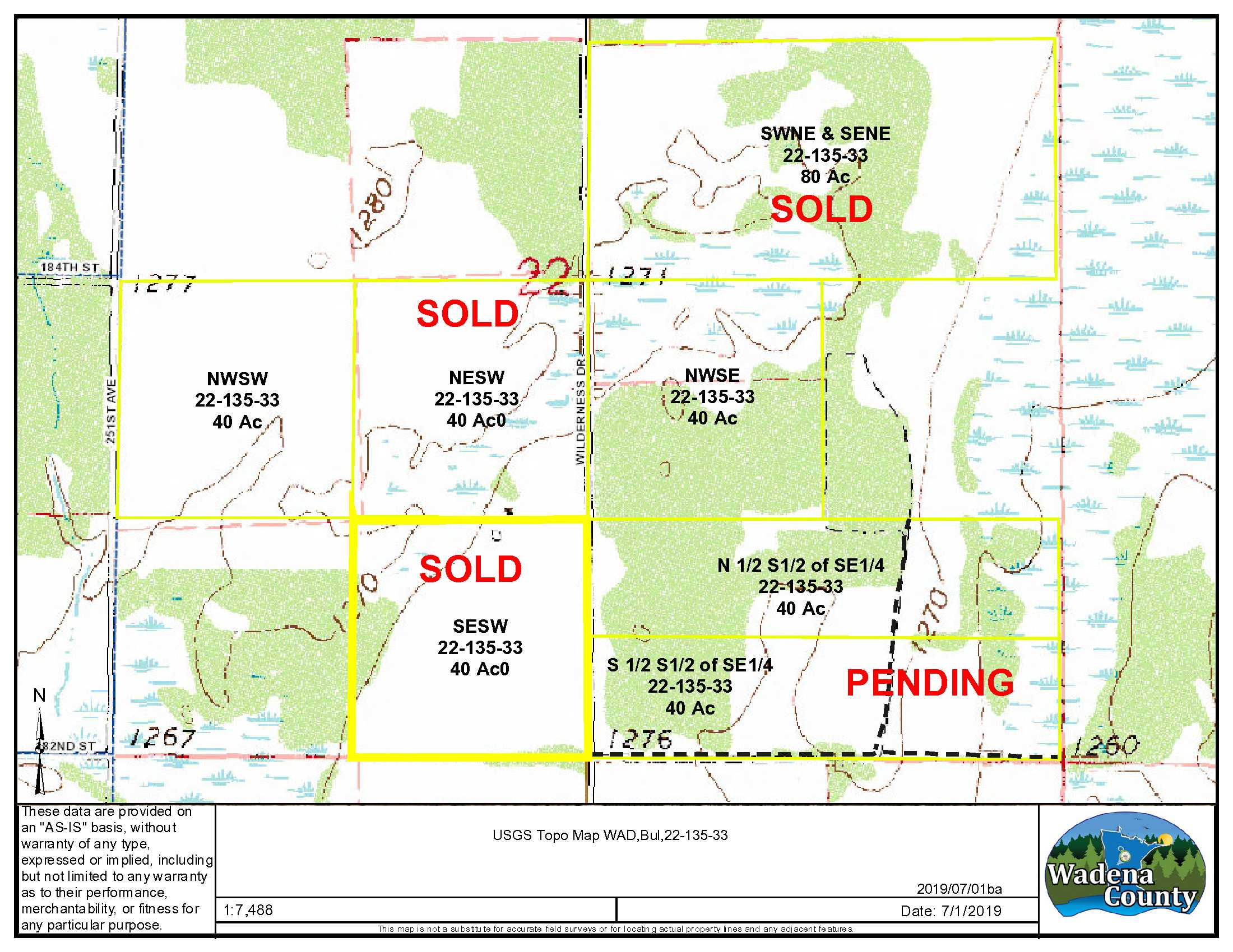
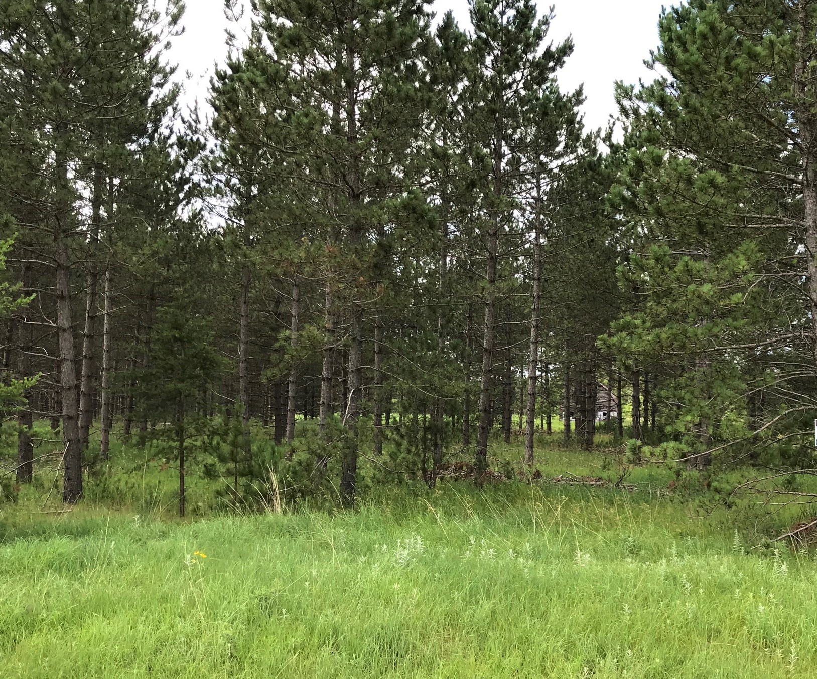
This 40 acres of mature forest is off paved Wilderness Drive via an existing potential shared approach. This level tract consists primarily of wooded areas conducive to wildlife habitat for your hunting/recreation enjoyment and excellent timber income potential. An old barn building structure remains with a recently sealed well. Dining at Wahoo Valley and access to the Crow Wing river are just minutes away. This property is just a short drive north of Staples with additional adjoining/adjacent tracts available for sale!
Main Property Info
Property ID
Pt. R030223010
Pt. R030223010
MLS Number
5265564
5265564
Status
Sold
Sold
List Price
$64,900
$64,900
Selling Price
$64,900
$64,900
Acres
40
40
Zoning
Agriculture
Agriculture
City
Staples
Staples
Township
Bullard Twp
Bullard Twp
State
MN
MN
Zip Code
56479
56479
County
Wadena
Wadena
Legal Description
SESW, 22-135-33, Wadena County, Minnesota. Subject to easements, restrictions and reservations of record.
SESW, 22-135-33, Wadena County, Minnesota. Subject to easements, restrictions and reservations of record.
Property Location
Directions
Approximately 2 miles north of Staples at the intersection of Co. Rd. 2 and Co. Rd. 30, go northeast on Co. Rd. 30 9.4 miles. Turn left (west) on Co. Rd. 7 and go 1.7 miles. Turn left (south) Co. Rd. 29 (Wilderness Dr.) and go 0.6 mile to property access on the right (west). (Approx. GPS Potential Point of Access: Lat: 46.488, Lon: -94.831)
Approximately 2 miles north of Staples at the intersection of Co. Rd. 2 and Co. Rd. 30, go northeast on Co. Rd. 30 9.4 miles. Turn left (west) on Co. Rd. 7 and go 1.7 miles. Turn left (south) Co. Rd. 29 (Wilderness Dr.) and go 0.6 mile to property access on the right (west). (Approx. GPS Potential Point of Access: Lat: 46.488, Lon: -94.831)
Access
Access is a potential shared approach with the NESW (Approx. GPS Point of Access: Lat: 46.488, Lon: -94.831.)
Access is a potential shared approach with the NESW (Approx. GPS Point of Access: Lat: 46.488, Lon: -94.831.)
GPS Coordinates
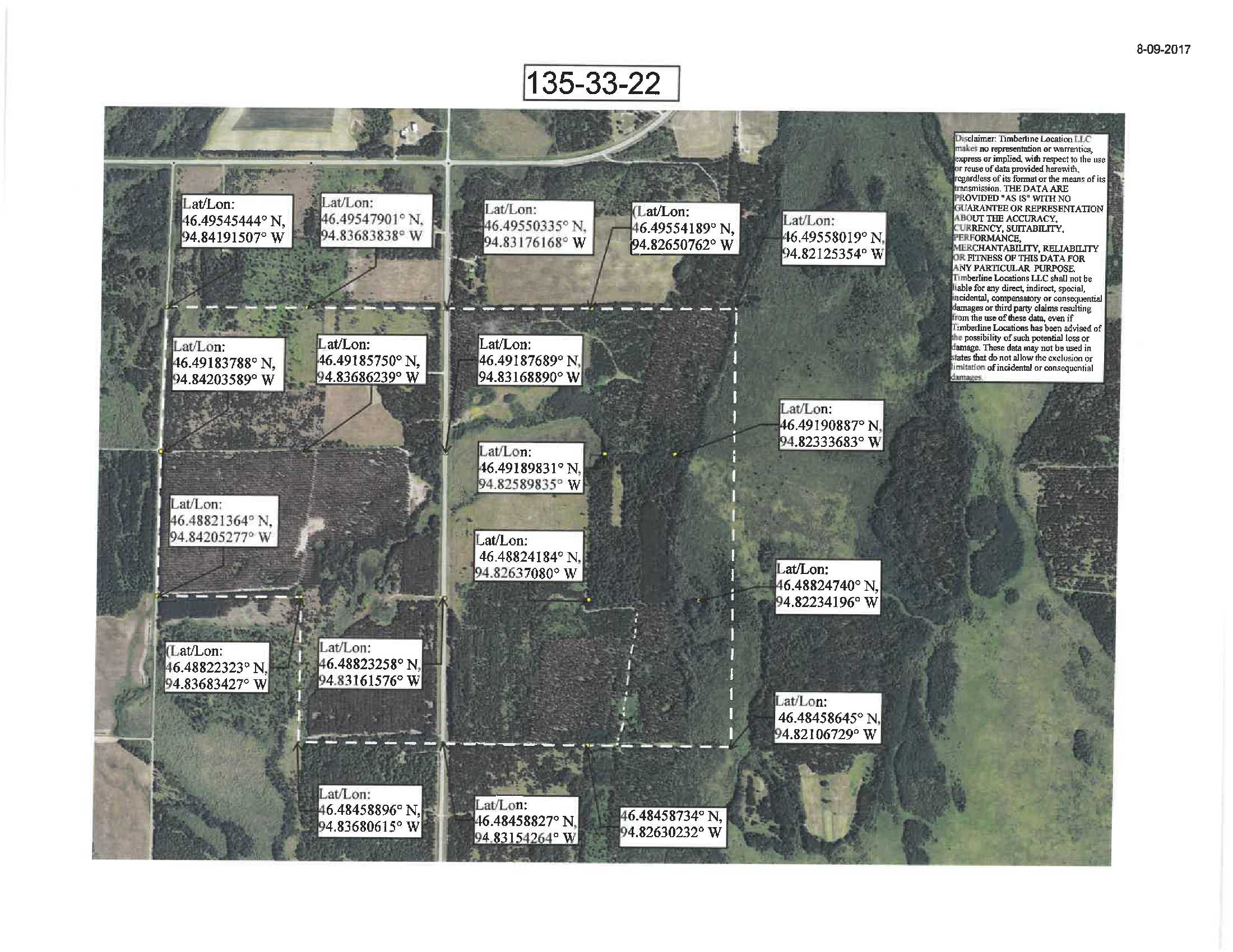
Coordinates to approximate corners/points based on county mapping: NW: 46.488223, -94.836834 NE: 46.488232, -94.831615 SE: 46.484588, -94.831542 SW: 46.484588, -94.836806
Coordinates to approximate corners/points based on county mapping: NW: 46.488223, -94.836834 NE: 46.488232, -94.831615 SE: 46.484588, -94.831542 SW: 46.484588, -94.836806
Address
TBD SESW Wilderness Dr. Staples, MN. 56479
TBD SESW Wilderness Dr. Staples, MN. 56479
School District
Staples-Motley - 2170
Staples-Motley - 2170
Property Details
Pasture Acres
0
0
Wooded Acres
33
33
Dimensions (approx)
1320 x 1320 x 1320 x 1320
1320 x 1320 x 1320 x 1320
Utilities
Available Utilities
Electric, Phone
Electric, Phone
On Site Utilities
None
None
Power Company
Todd-Wadena Electric (1-800-320-8932)
Todd-Wadena Electric (1-800-320-8932)
Waterfront
Waterfront Name
N/A
N/A
Waterfront Number
N/A
N/A
Waterfront Feet (approx)
N/A
N/A
Waterfront Comments
N/A
N/A
Taxes & Fees
Has Association Fee
No
No
Association Fee
$0
$0
Association Fee Includes
N/A
N/A
Tax Amount
$573
$573
Assessment Amount
0
0
Tax With Assessments
$573
$573
Assessment Pending
No
No
Assessment Description
N/A
N/A
Tax Year
2019
2019
Other Details
Section Number
22
22
Township Number
135
135
Range Number
33
33
Estimated Upland %
95
95
Estimated Wetland %
5
5
Additional Comments
Timber Comments
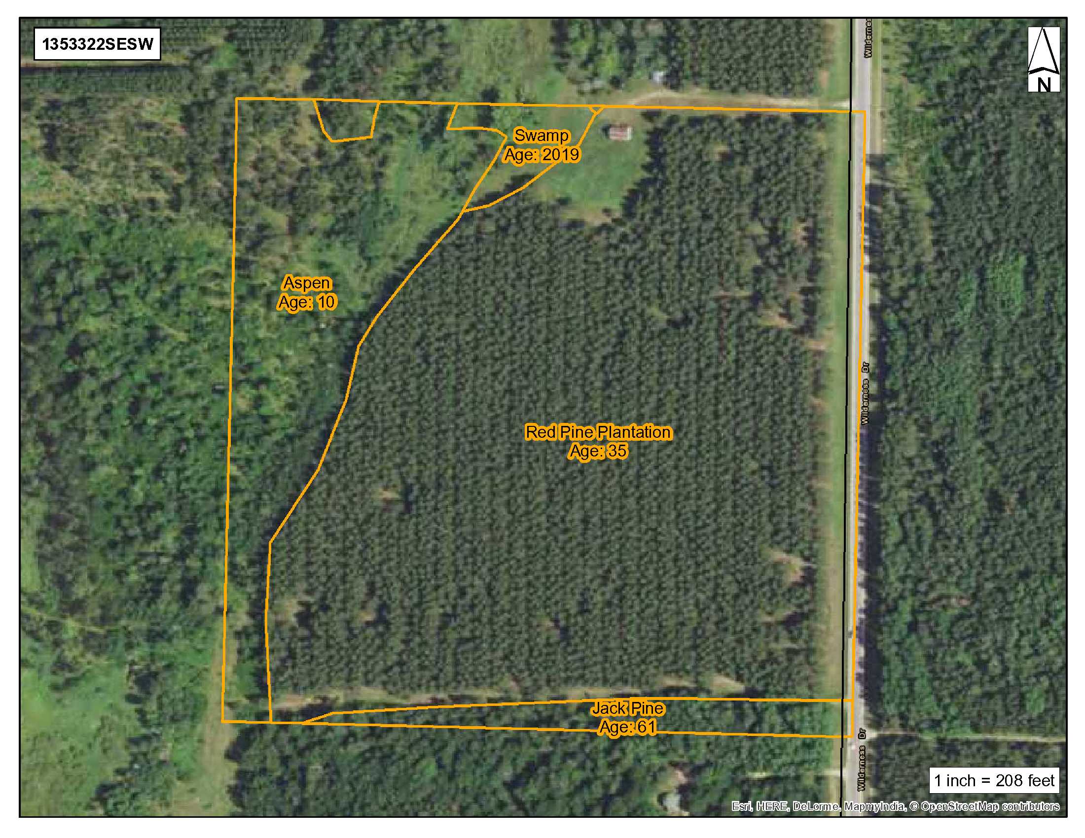
Red Pine 35 yrs. old, Jack Pine 61 yrs. old, & Aspen 10 yrs. old. This property has been managed according to Forest Stewardship Council (FSC) standards. If Timber value is important to you, seek the advice of a competent forester to determine species, volumes and values.
Red Pine 35 yrs. old, Jack Pine 61 yrs. old, & Aspen 10 yrs. old. This property has been managed according to Forest Stewardship Council (FSC) standards. If Timber value is important to you, seek the advice of a competent forester to determine species, volumes and values.
Hunting Comments
Deer Permit Area: 241
Deer Permit Area: 241
Disclosures
Approximate corners have been flagged. Acreage, dimensions, and taxes estimated based on county data and mapping or seller data; county disclaimers included by reference; subject to split approval if necessary. Not surveyed. Photos/maps and GPS coordinates for convenience only and not guaranteed; physically inspect prior to purchase. Any deer stands on the land are not property of seller and are not included in sale. Use seller-approved PA and addendum; closing dates the 3rd Wednesday each month. Structures are not represented to be fit for any purpose and are being sold in their current "As-Is" condition. The physical condition is unknown. Enter at your own risk.
Approximate corners have been flagged. Acreage, dimensions, and taxes estimated based on county data and mapping or seller data; county disclaimers included by reference; subject to split approval if necessary. Not surveyed. Photos/maps and GPS coordinates for convenience only and not guaranteed; physically inspect prior to purchase. Any deer stands on the land are not property of seller and are not included in sale. Use seller-approved PA and addendum; closing dates the 3rd Wednesday each month. Structures are not represented to be fit for any purpose and are being sold in their current "As-Is" condition. The physical condition is unknown. Enter at your own risk.