
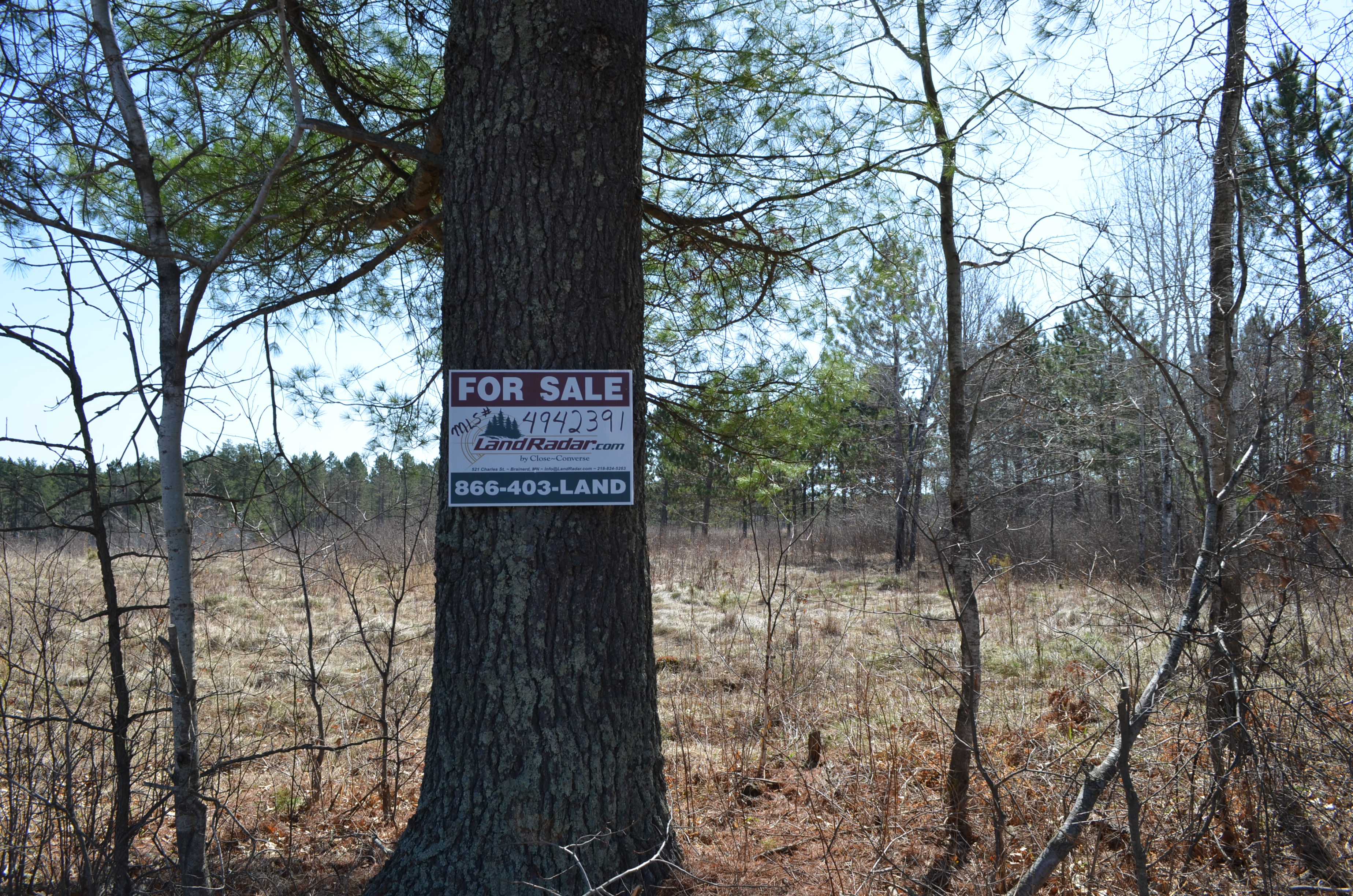

MLS Number : 4942391
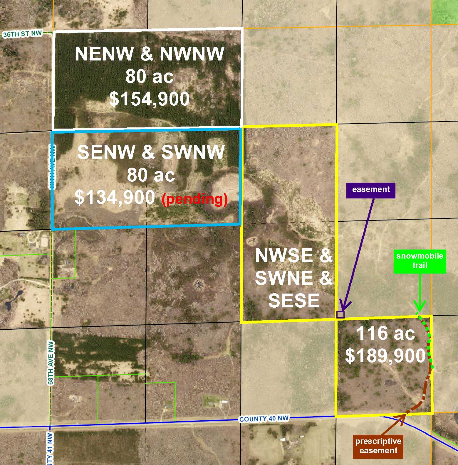
Sold $121,500 - Hunting & Recreation
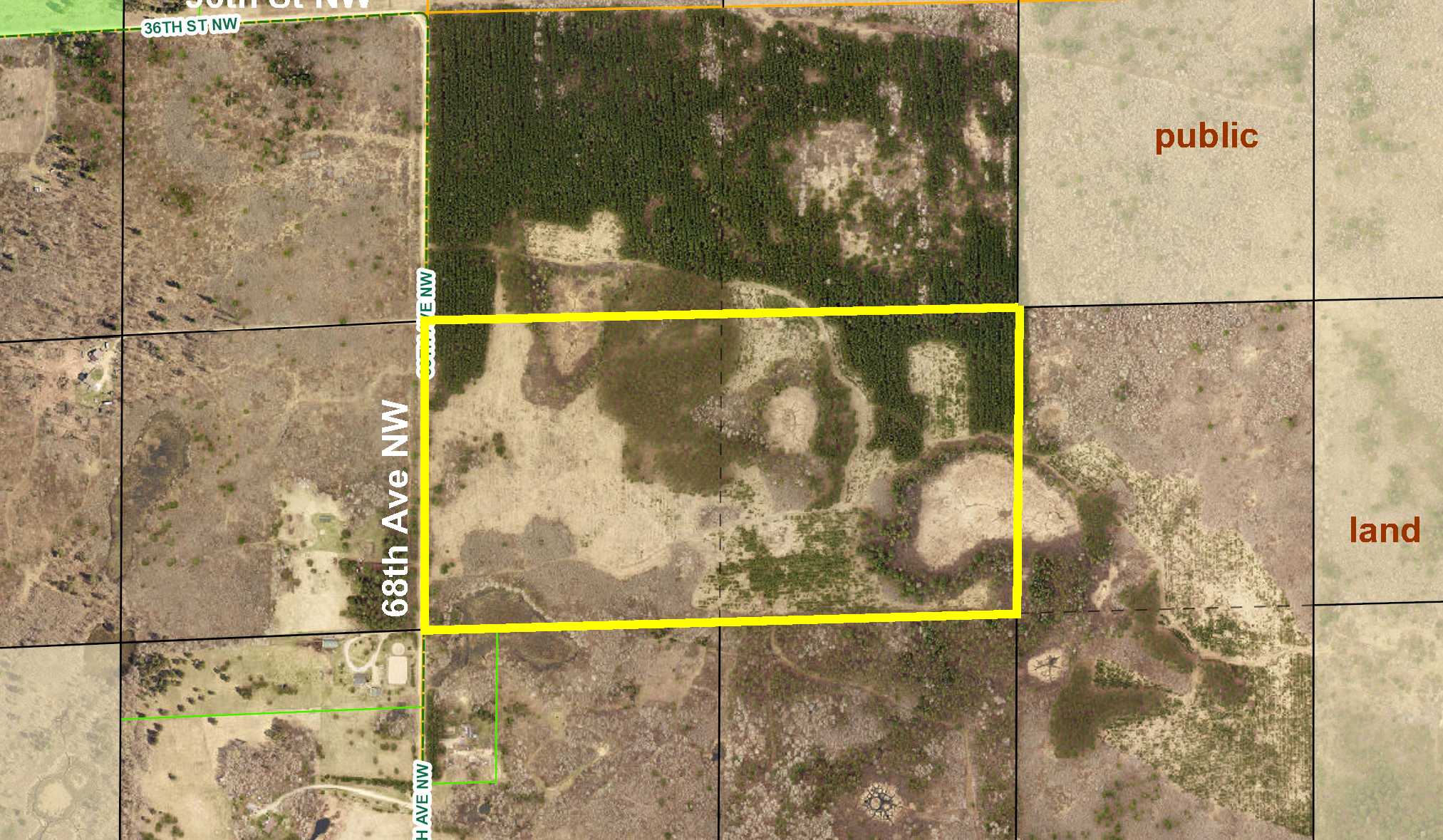
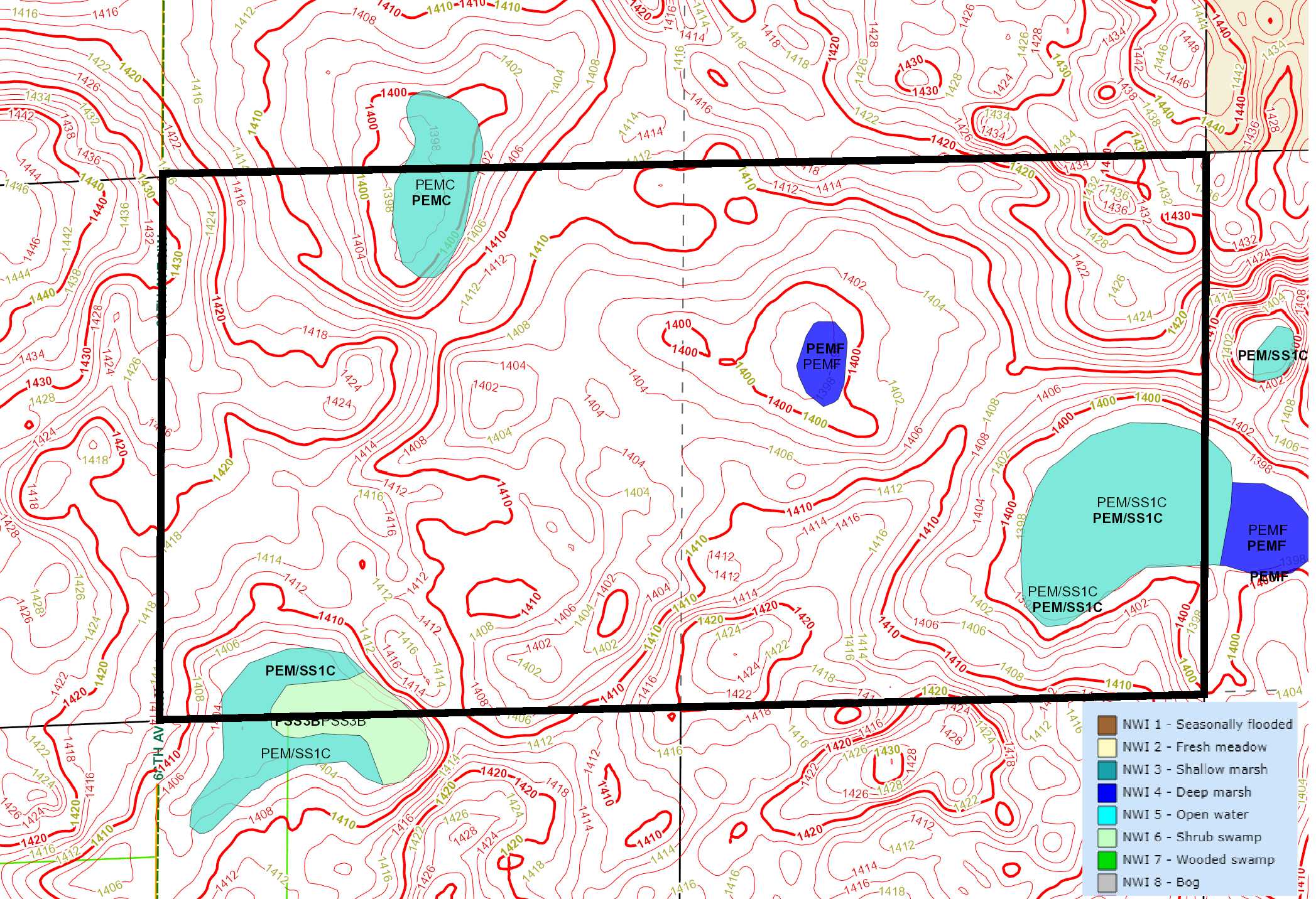
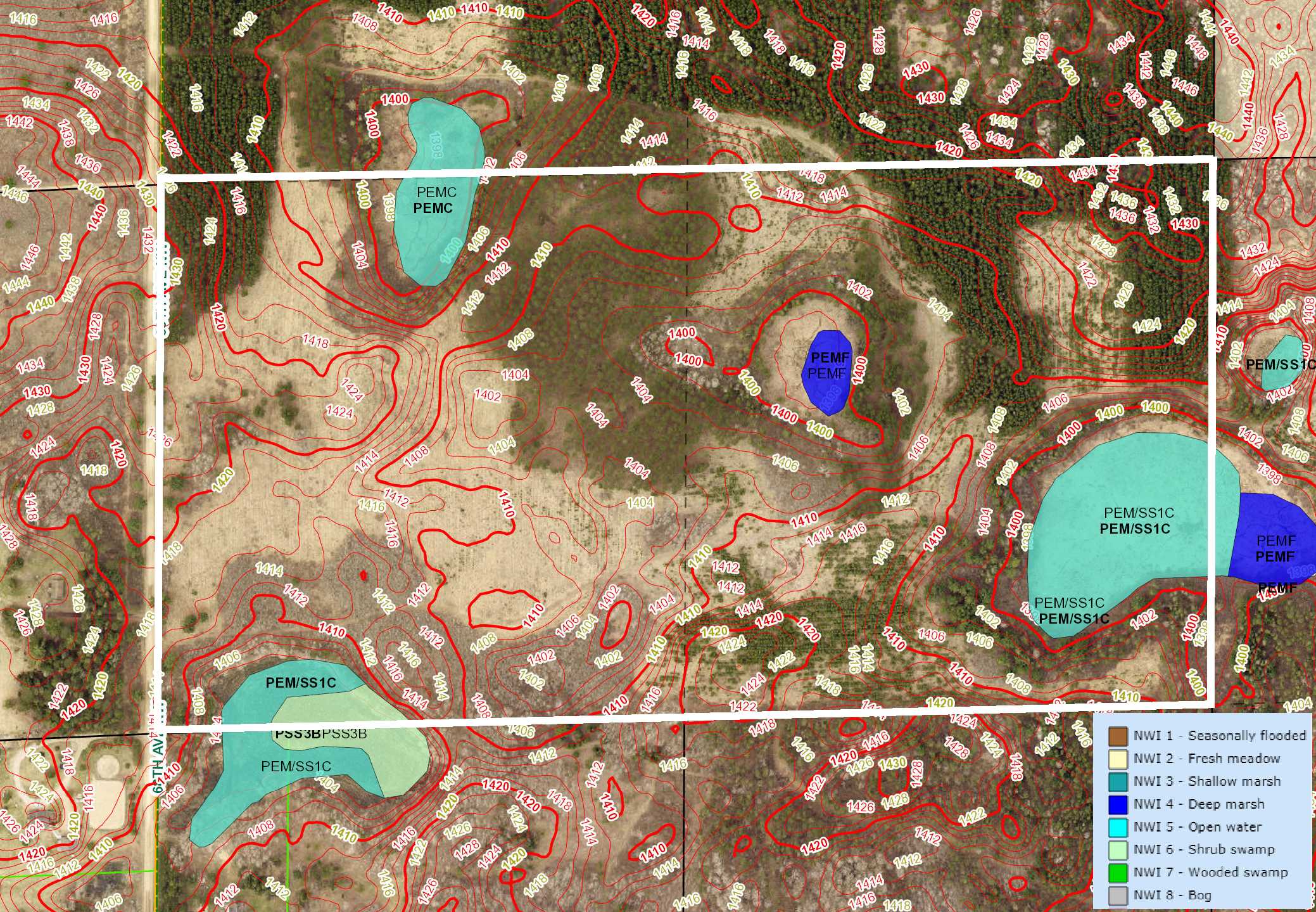
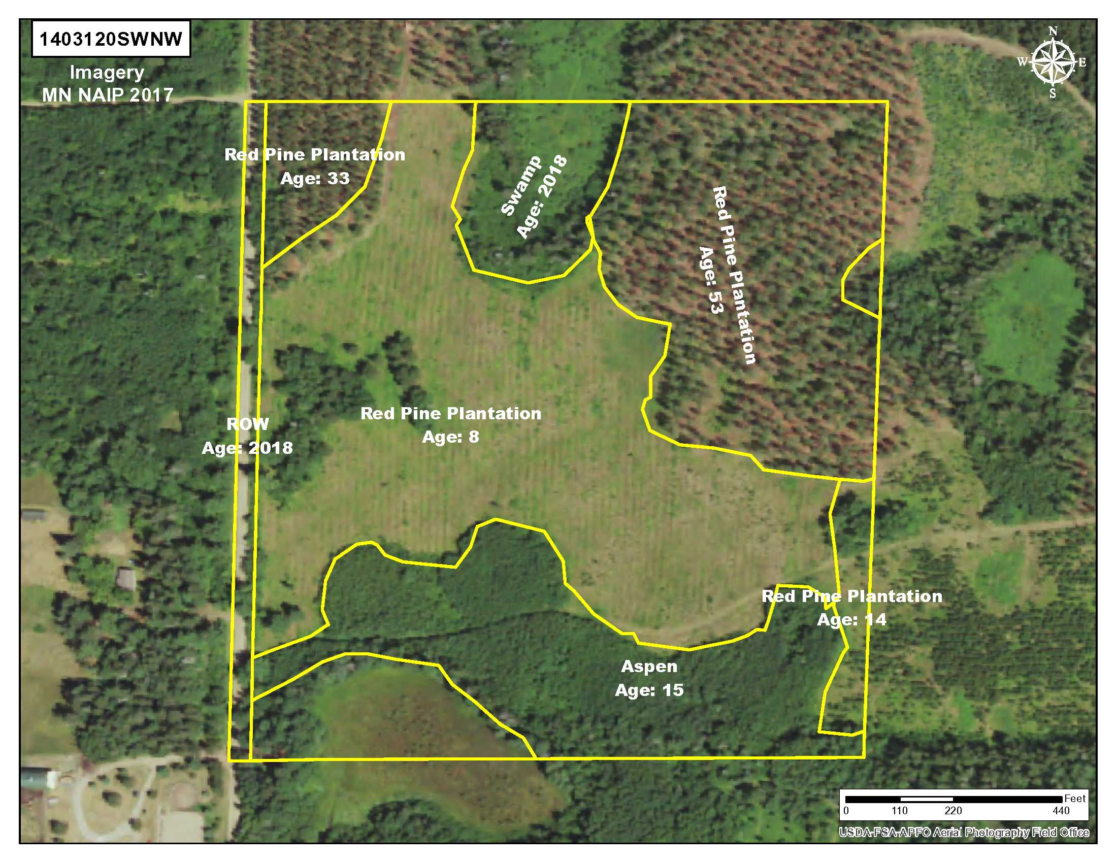
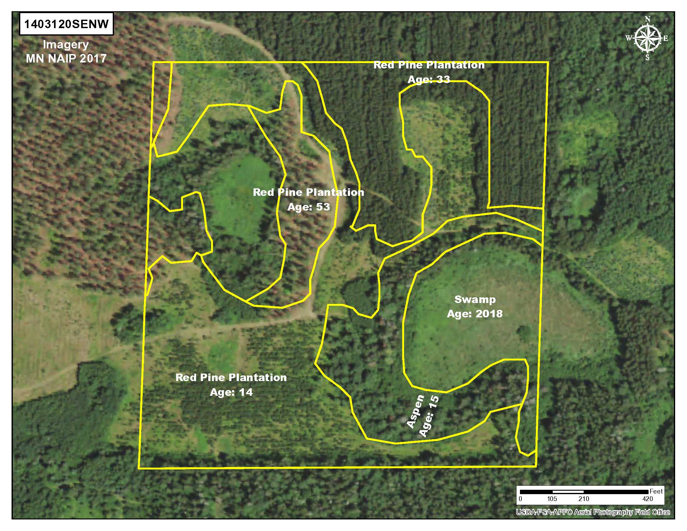
PotlatchDeltic land near Chub and Jackpine Lake west of Hackensack. Hilly upland wooded with red pine and aspen accented with patches of wetlands. Gravel township road along the west side and trails meandering throughout. Public land adjoining the northeast corner connects to thousands of acres of public Foothills State Forest land for plenty of hunting space. Snoway #1 Snowmobile Trail (also used for ATV riding) runs through the public land. Public access to Ten Mile Lake about 5 miles away. Homes across the road mean utilities are available.
Main Property Info
Property ID
Pt 160201300
Pt 160201300
MLS Number
4942391
4942391
Status
Sold
Sold
List Price
$134,900
$134,900
Selling Price
$121,500
$121,500
Acres
80
80
Zoning
Rural Residential 2.5
Rural Residential 2.5
City
Hackensack
Hackensack
Township
Hiram Twp
Hiram Twp
State
MN
MN
Zip Code
56433
56433
County
Cass
Cass
Legal Description
SENW & SWNW, 20-140-31. Subject to 68th Ave NW (Hiram Twp 5) and any easements, restrictions, or reservations of record.
SENW & SWNW, 20-140-31. Subject to 68th Ave NW (Hiram Twp 5) and any easements, restrictions, or reservations of record.
Property Location
Directions
From the intersection of State Hwy 64 and Co Rd 19 south of Akeley, east on Co Rd 19 (which turns into Co Rd 40 NW) for 4 miles. Left on 68th Ave NW (Hiram Twp 5) for 1/2 mile to southwest corner of the property. (Property is across the road from address #3409).
From the intersection of State Hwy 64 and Co Rd 19 south of Akeley, east on Co Rd 19 (which turns into Co Rd 40 NW) for 4 miles. Left on 68th Ave NW (Hiram Twp 5) for 1/2 mile to southwest corner of the property. (Property is across the road from address #3409).
Access
Gravel 68th Ave NW (Hiram Twp 5) is along the west side.
Gravel 68th Ave NW (Hiram Twp 5) is along the west side.
GPS Coordinates
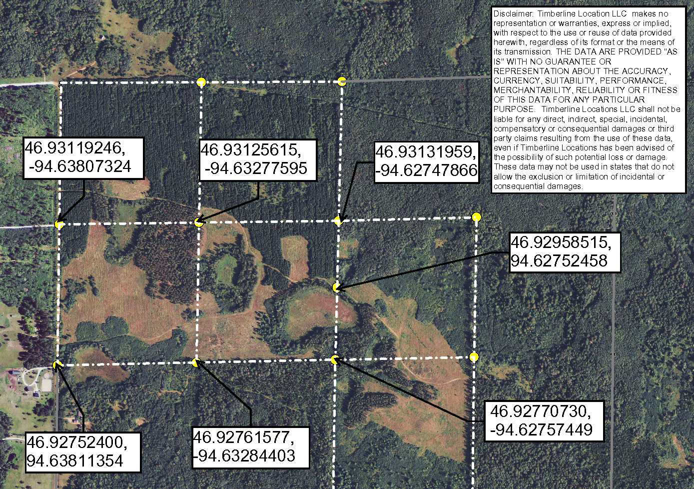
Coordinates to flagged approximate corners/points: SW corner along 68th Ave NW (Hiram Twp 5) = 46.9275, -94.6381; NW corner along 68th Ave NW (Hiram Twp 5) = 46.9311, -94.6380; NE corner = 46.9313, -94.6274; SE corner = 46.9277, -94.6275.
Coordinates to flagged approximate corners/points: SW corner along 68th Ave NW (Hiram Twp 5) = 46.9275, -94.6381; NW corner along 68th Ave NW (Hiram Twp 5) = 46.9311, -94.6380; NE corner = 46.9313, -94.6274; SE corner = 46.9277, -94.6275.
Address
68th Ave NW (Hiram Twp 5)
68th Ave NW (Hiram Twp 5)
School District
Walker-Hackensack-Akeley - 113
Walker-Hackensack-Akeley - 113
Property Details
Dimensions (approx)
1320 x 2640
1320 x 2640
Utilities
Power Company
Itasca-Mantrap Co-op (1-888-713-3377)
Itasca-Mantrap Co-op (1-888-713-3377)
Taxes & Fees
Tax Amount
$553
$553
Tax Year
2018
2018
Other Details
Section Number
20
20
Township Number
140
140
Range Number
31
31
Estimated Upland %
95
95
Estimated Wetland %
5
5
Additional Comments
Timber Comments
This property has been managed according to Forest Stewardship Council (FSC) standards and is wooded with red pine and aspen. If timber value is important to you, seek the advice of a competent forester to determine species, volumes, and values.
This property has been managed according to Forest Stewardship Council (FSC) standards and is wooded with red pine and aspen. If timber value is important to you, seek the advice of a competent forester to determine species, volumes, and values.
Hunting Comments
This property adjoins public land in MN Firearms Deer Zone 259.
This property adjoins public land in MN Firearms Deer Zone 259.
Disclosures
County mapping shows "altered public waters" ditch crossing the property; however, county has indicated it is outdated information and is not applicable. Parcel split; acreage, dimensions, and taxes estimated based on county data and mapping; county disclaimers included by reference; subject to split approval if necessary. Not surveyed. Photos/maps for convenience only and not guaranteed; physically inspect prior to purchase. Any deer stands on the land are not property of seller and are not included in sale. Use seller-approved PA and addendum; closing dates the 3rd Wednesday each month.
County mapping shows "altered public waters" ditch crossing the property; however, county has indicated it is outdated information and is not applicable. Parcel split; acreage, dimensions, and taxes estimated based on county data and mapping; county disclaimers included by reference; subject to split approval if necessary. Not surveyed. Photos/maps for convenience only and not guaranteed; physically inspect prior to purchase. Any deer stands on the land are not property of seller and are not included in sale. Use seller-approved PA and addendum; closing dates the 3rd Wednesday each month.


