


MLS Number : 4953175
Sold $52,900 - Hunting & Recreation
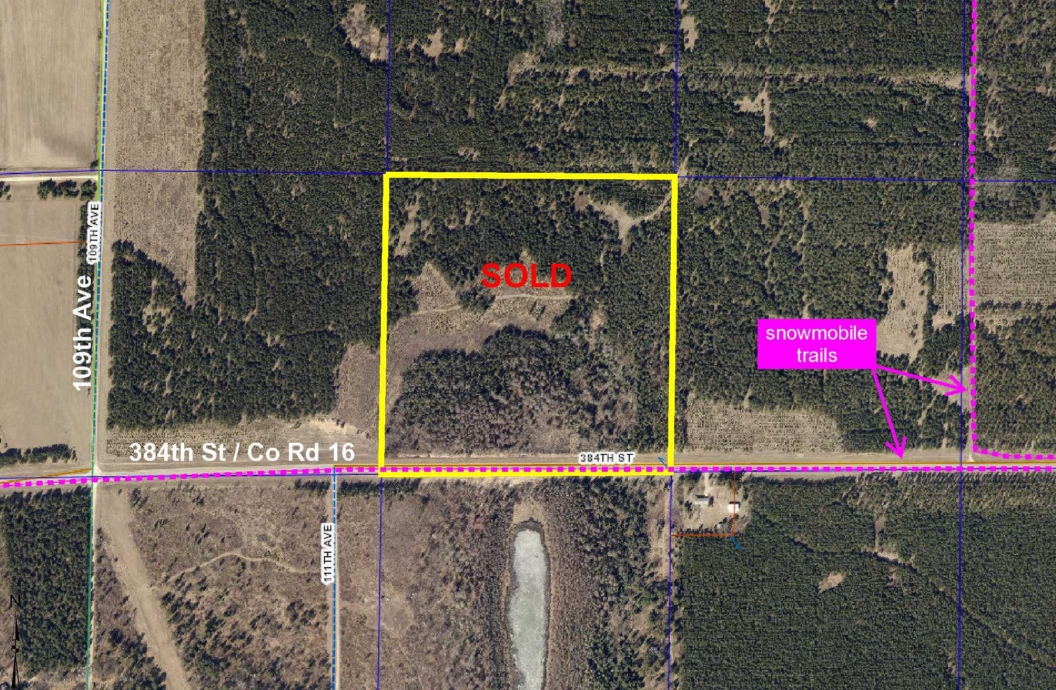
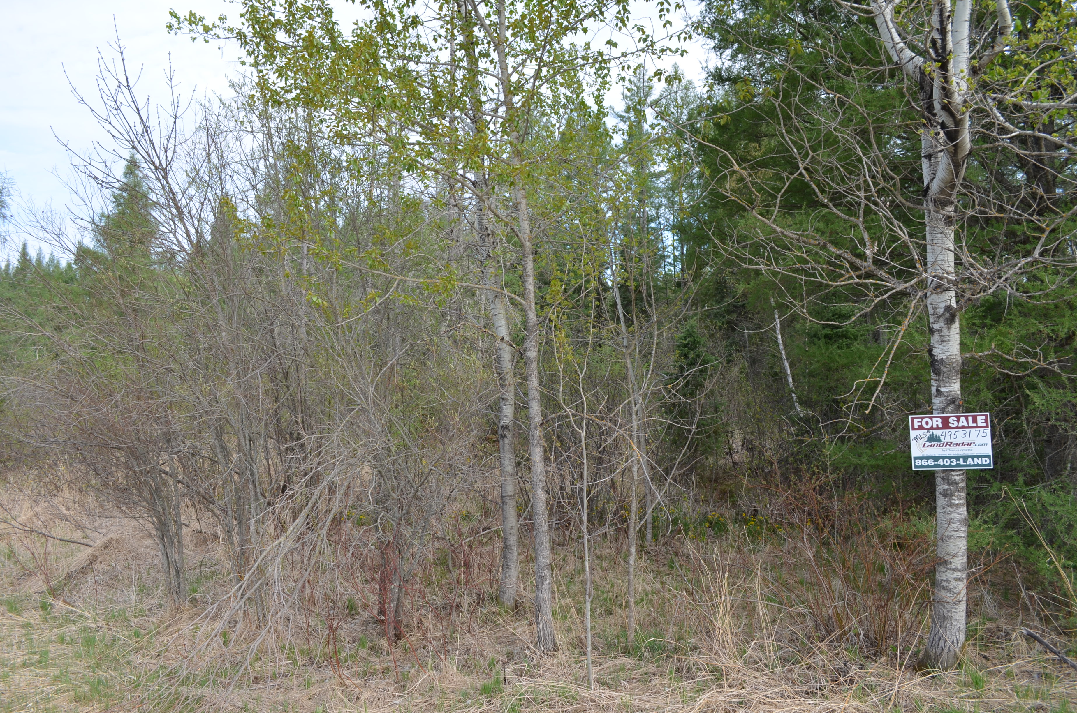
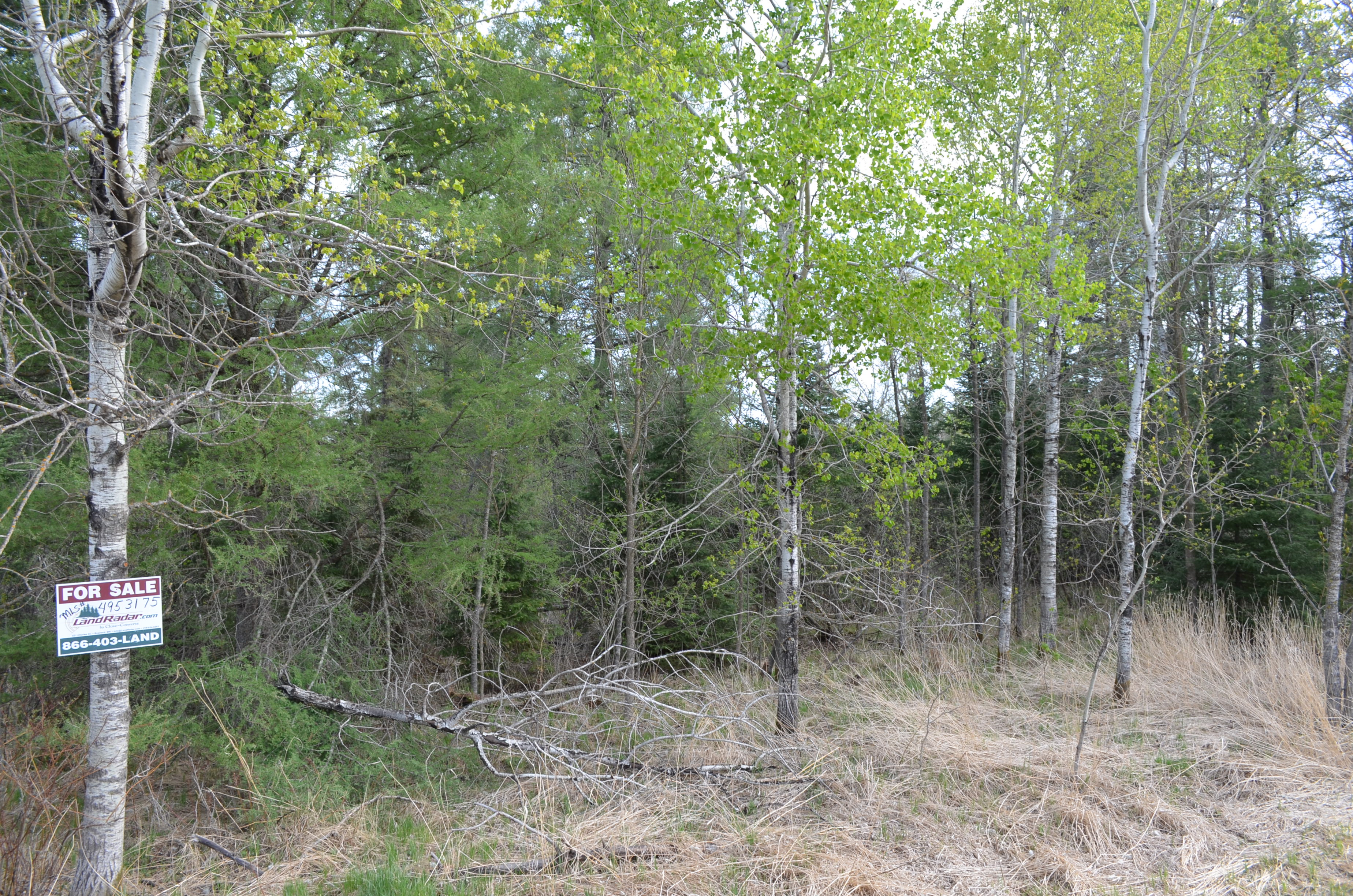
BACK ON MARKET! PotlatchDeltic land by Blueberry Pines Golf Course north of Menahga. Level upland wooded with red pine and spruce/fir as well as a low/wetland area wooded with tamarack in the south half. Only 1 mile off US Hwy 71 with paved county road along the south side. Snowmobile trail along the road connects to the MnUSA Corridor #69 and is part of the Trail Breakers Inc. system with over 200 miles of groomed state Grant-In-Aid trails. Public access to Blueberry Lake less than 5 miles away for fishing, and Menahga less than 5 miles away for dining, entertainment, shopping, and necessities.
Main Property Info
Property ID
Pt 020082010
Pt 020082010
MLS Number
4953175
4953175
Status
Sold
Sold
List Price
$58,900
$58,900
Selling Price
$52,900
$52,900
Acres
40
40
Zoning
A-2 Mixed Agriculture
A-2 Mixed Agriculture
City
Menahga
Menahga
Township
Blueberry Twp
Blueberry Twp
State
MN
MN
Zip Code
56464
56464
County
Wadena
Wadena
Legal Description
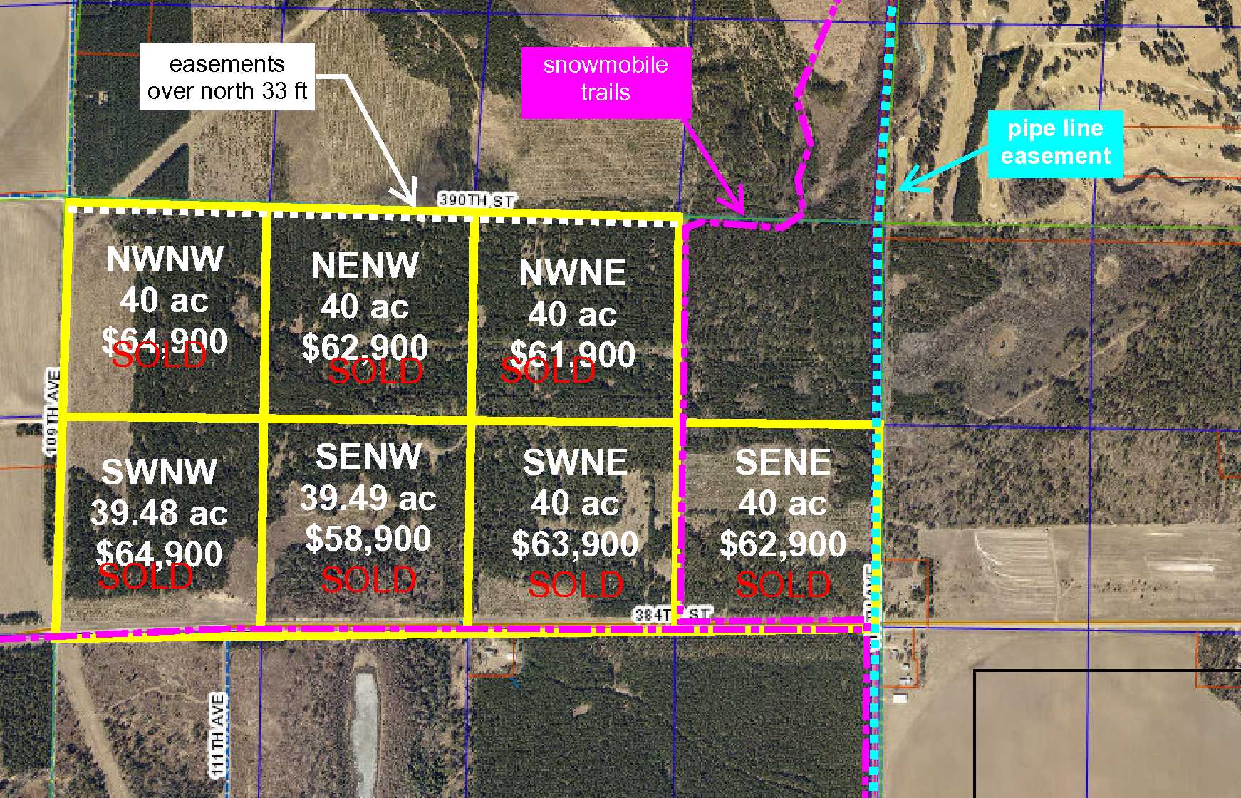
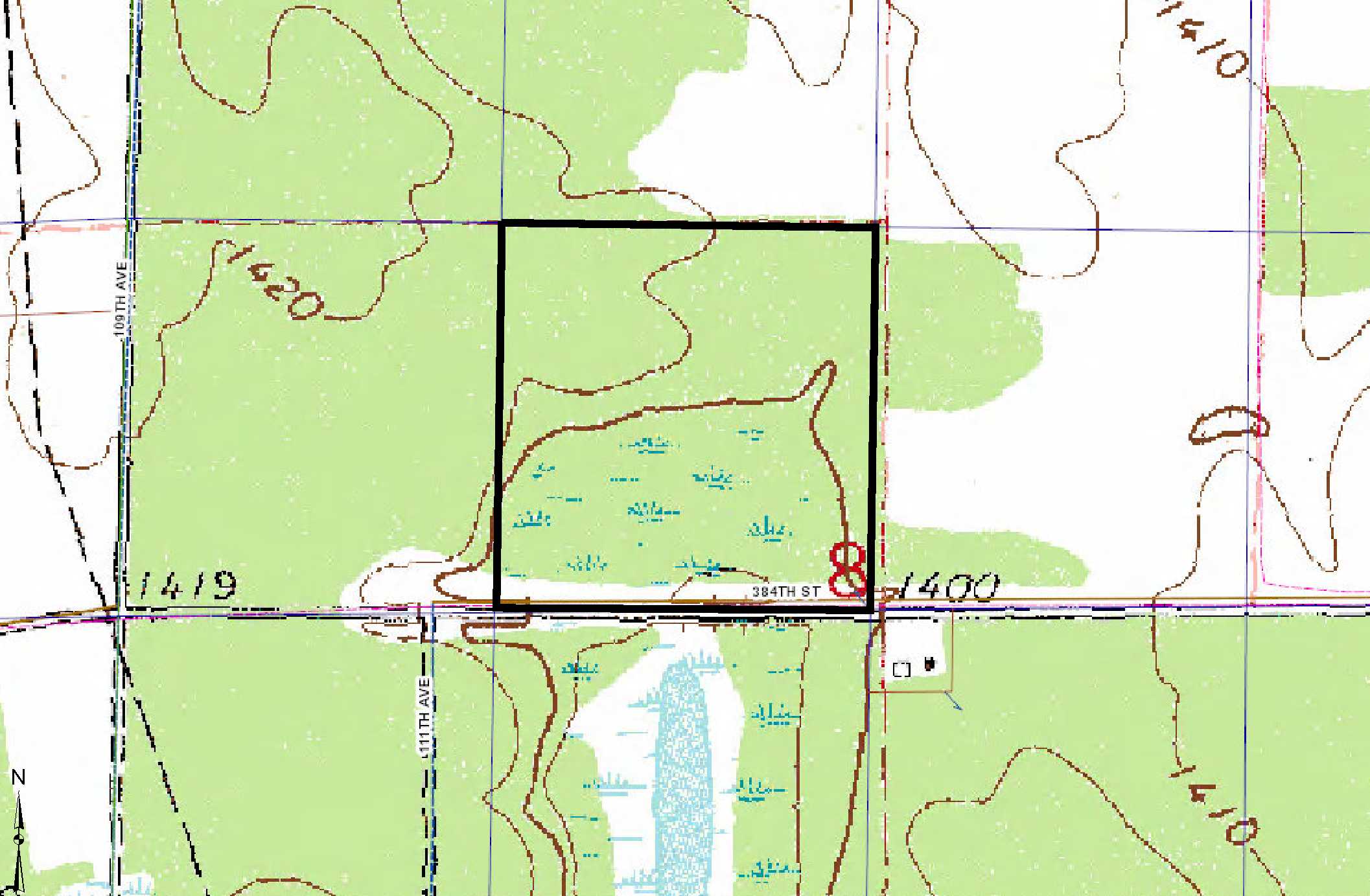
SENW, 8-138-35. Subject to 384th St (Co Rd 16), snowmobile trail, and any other easements, restrictions, or reservations of record.
SENW, 8-138-35. Subject to 384th St (Co Rd 16), snowmobile trail, and any other easements, restrictions, or reservations of record.
Property Location
Directions
From the intersection of US Hwy 71 and Main Street in Menahga, northwest on US Hwy 71 for 2 2/10 miles. Left on 384th St approx 1 mile to property on right (across the road from and approx 200 ft past #11417).
From the intersection of US Hwy 71 and Main Street in Menahga, northwest on US Hwy 71 for 2 2/10 miles. Left on 384th St approx 1 mile to property on right (across the road from and approx 200 ft past #11417).
Access
Paved 384th St (Co Rd 16) is along the south side of the property.
Paved 384th St (Co Rd 16) is along the south side of the property.
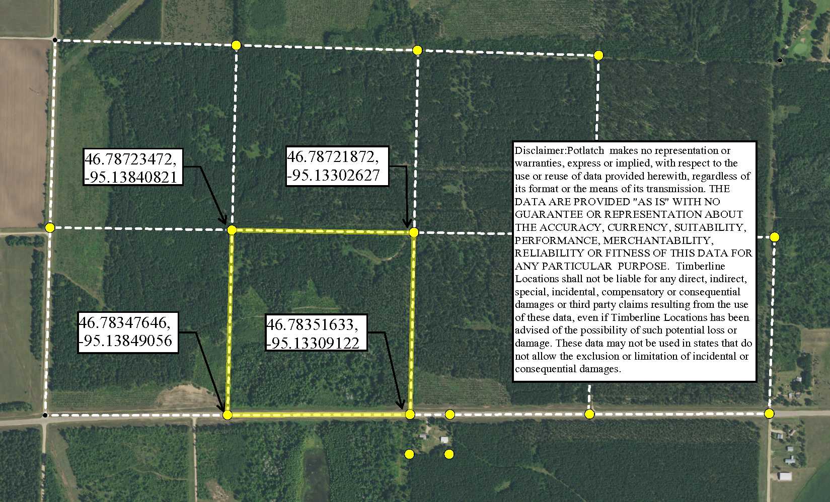
GPS Coordinates
Coordinates to flagged approx corners/points: SE corner along 384th St (Co Rd 16) = 46.7835, -95.1330; SW corner along 384th St (Co Rd 16) = 46.7834, -95.1384; NW corner = 46.7872, -95.1384; NE corner = 46.7872, -95.1330.
Coordinates to flagged approx corners/points: SE corner along 384th St (Co Rd 16) = 46.7835, -95.1330; SW corner along 384th St (Co Rd 16) = 46.7834, -95.1384; NW corner = 46.7872, -95.1384; NE corner = 46.7872, -95.1330.
Address
384th St (Co Rd 16)
384th St (Co Rd 16)
School District
Menahga - 821
Menahga - 821
Property Details
Dimensions (approx)
1320 x 1320
1320 x 1320
Utilities
Power Company
Todd-Wadena Electric (1-800-320-8932)
Todd-Wadena Electric (1-800-320-8932)
Taxes & Fees
Has Association Fee
No
No
Tax Amount
$642
$642
Assessment Amount
0
0
Tax With Assessments
$642
$642
Assessment Pending
No
No
Tax Year
2019
2019
Other Details
Section Number
08
08
Township Number
138
138
Range Number
35
35
Estimated Upland %
70
70
Estimated Wetland %
30
30
Additional Comments
Timber Comments
This property has been managed according to Forest Stewardship Council (FSC) standards and includes red pine, spruce/fir, and tamarack. If timber value is important to you, seek the advice of a competent forester to determine species, volumes and values.
This property has been managed according to Forest Stewardship Council (FSC) standards and includes red pine, spruce/fir, and tamarack. If timber value is important to you, seek the advice of a competent forester to determine species, volumes and values.
Hunting Comments
This property is in MN Firearms Deer Zone 241.
This property is in MN Firearms Deer Zone 241.
Disclosures
Parcel split; acreage, dimensions, and taxes estimated based on county data and mapping; county disclaimers included by reference; subject to split approval if necessary. Not surveyed. Photos/maps for convenience only and not guaranteed; physically inspect prior to purchase. Any deer stands on the land are not property of seller and are not included in sale. Use seller-approved PA and addendum; closing dates the 3rd Wednesday each month.
Parcel split; acreage, dimensions, and taxes estimated based on county data and mapping; county disclaimers included by reference; subject to split approval if necessary. Not surveyed. Photos/maps for convenience only and not guaranteed; physically inspect prior to purchase. Any deer stands on the land are not property of seller and are not included in sale. Use seller-approved PA and addendum; closing dates the 3rd Wednesday each month.


