


MLS Number : 4878746
Sold $84,000 - Hunting & Recreation
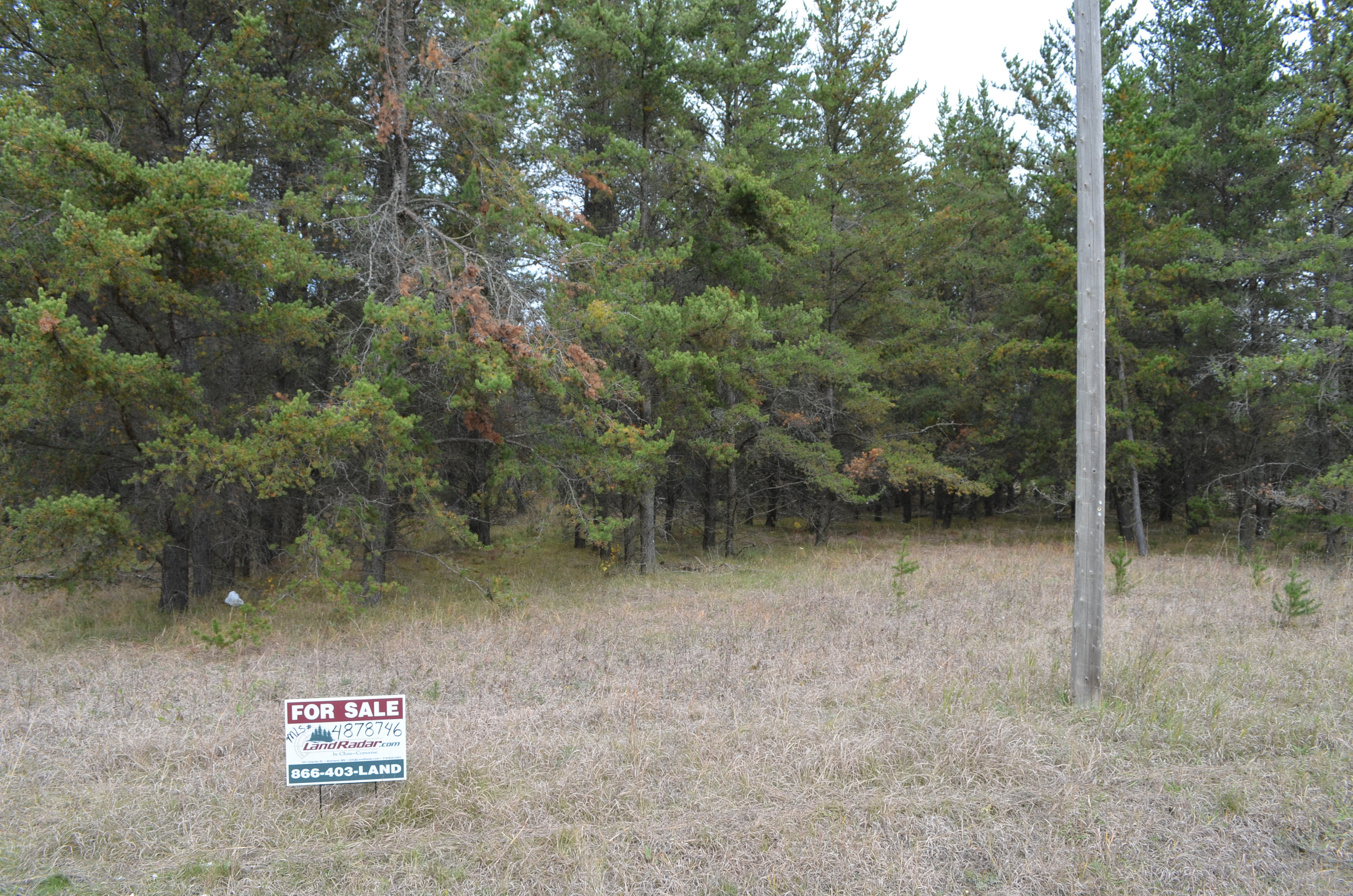
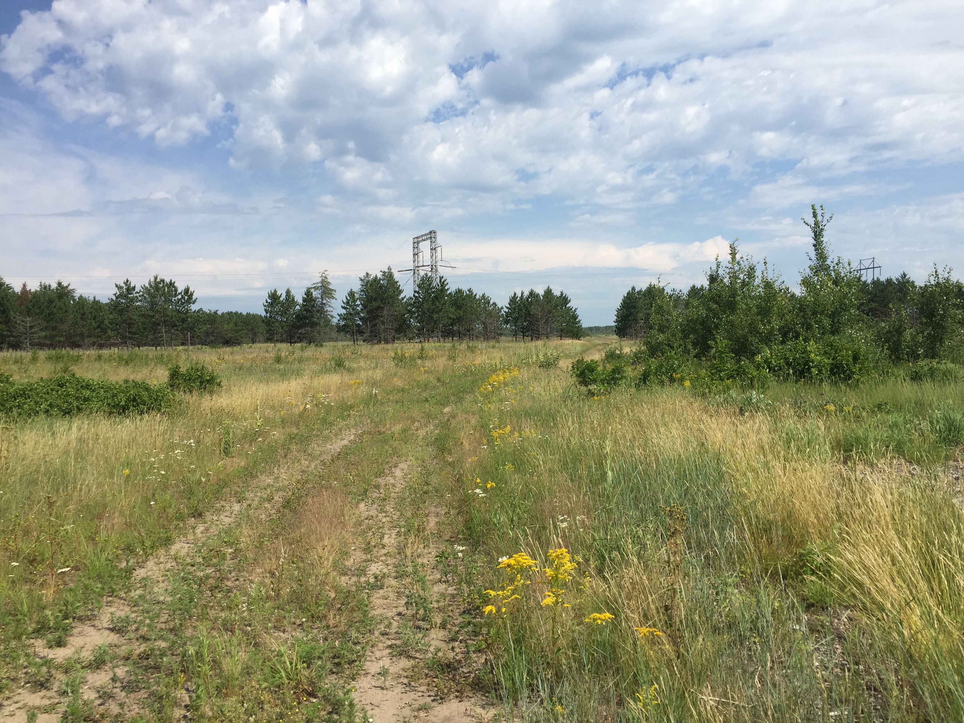
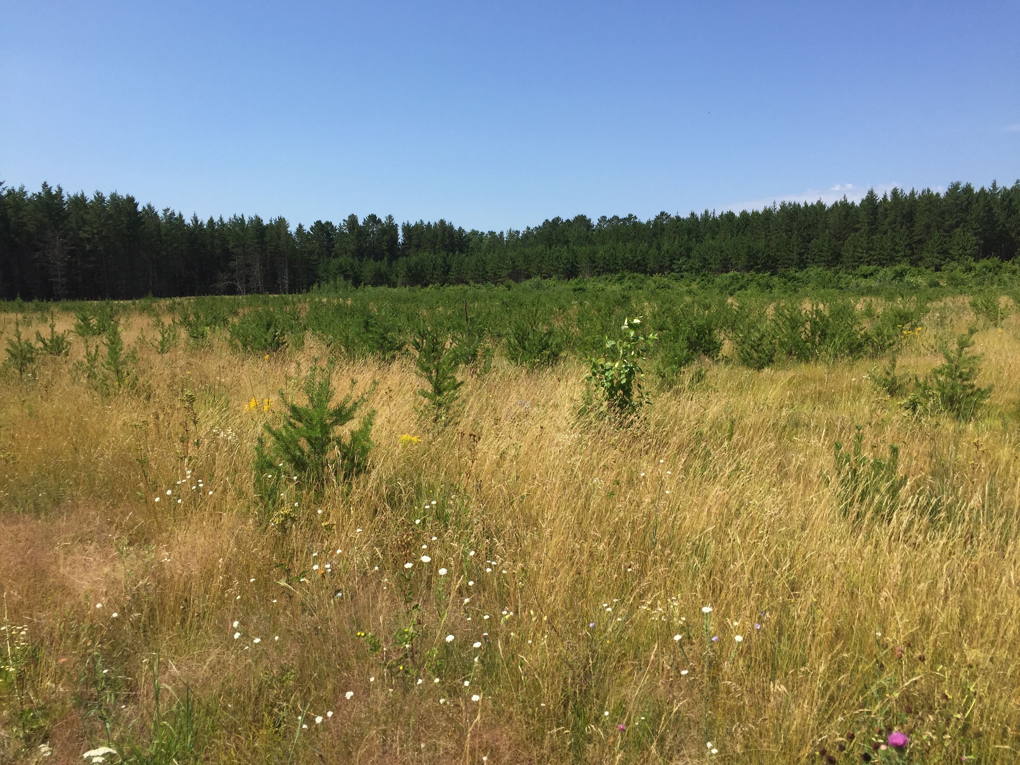
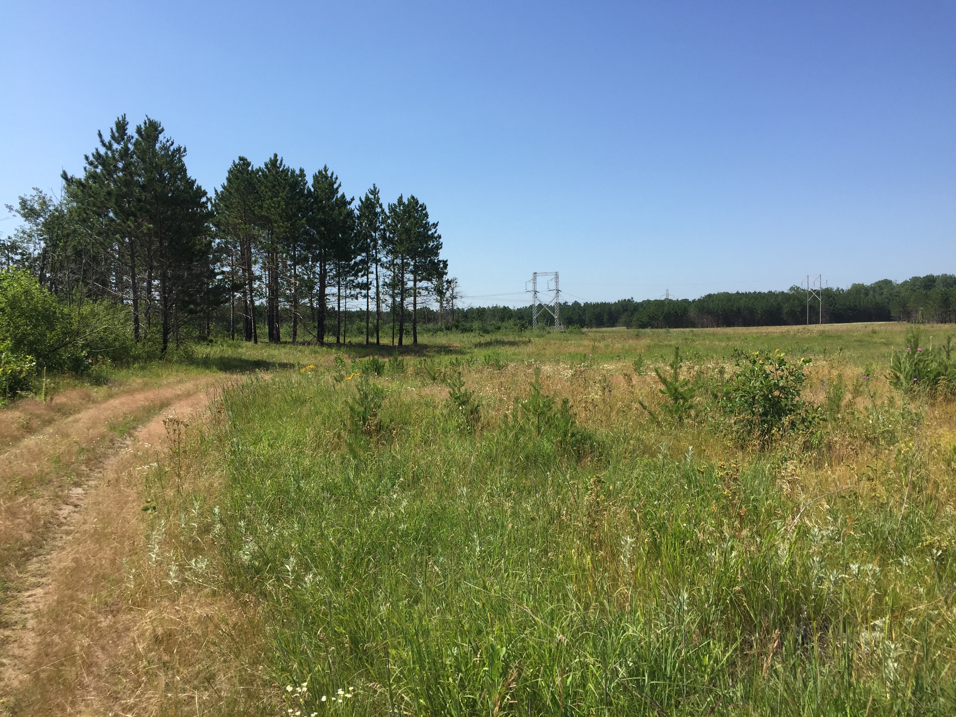
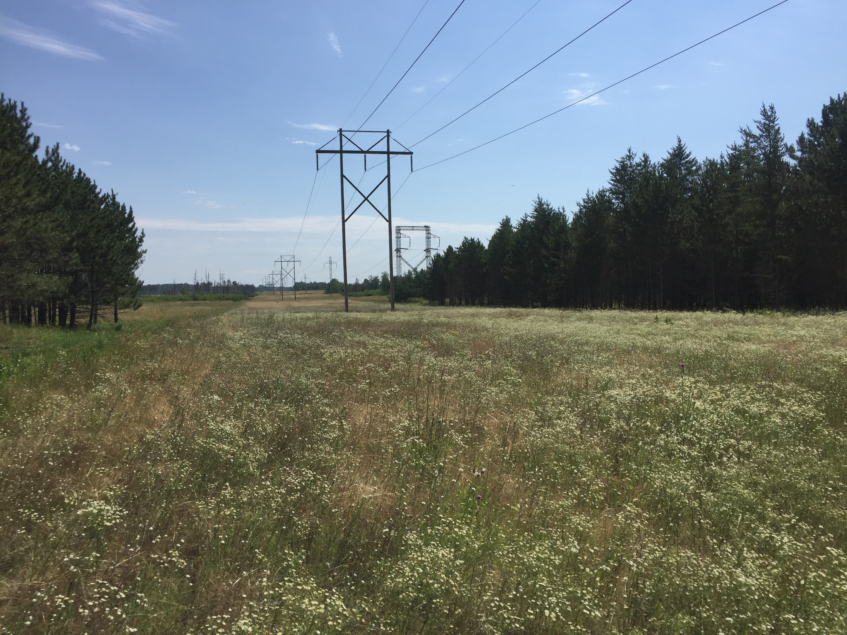
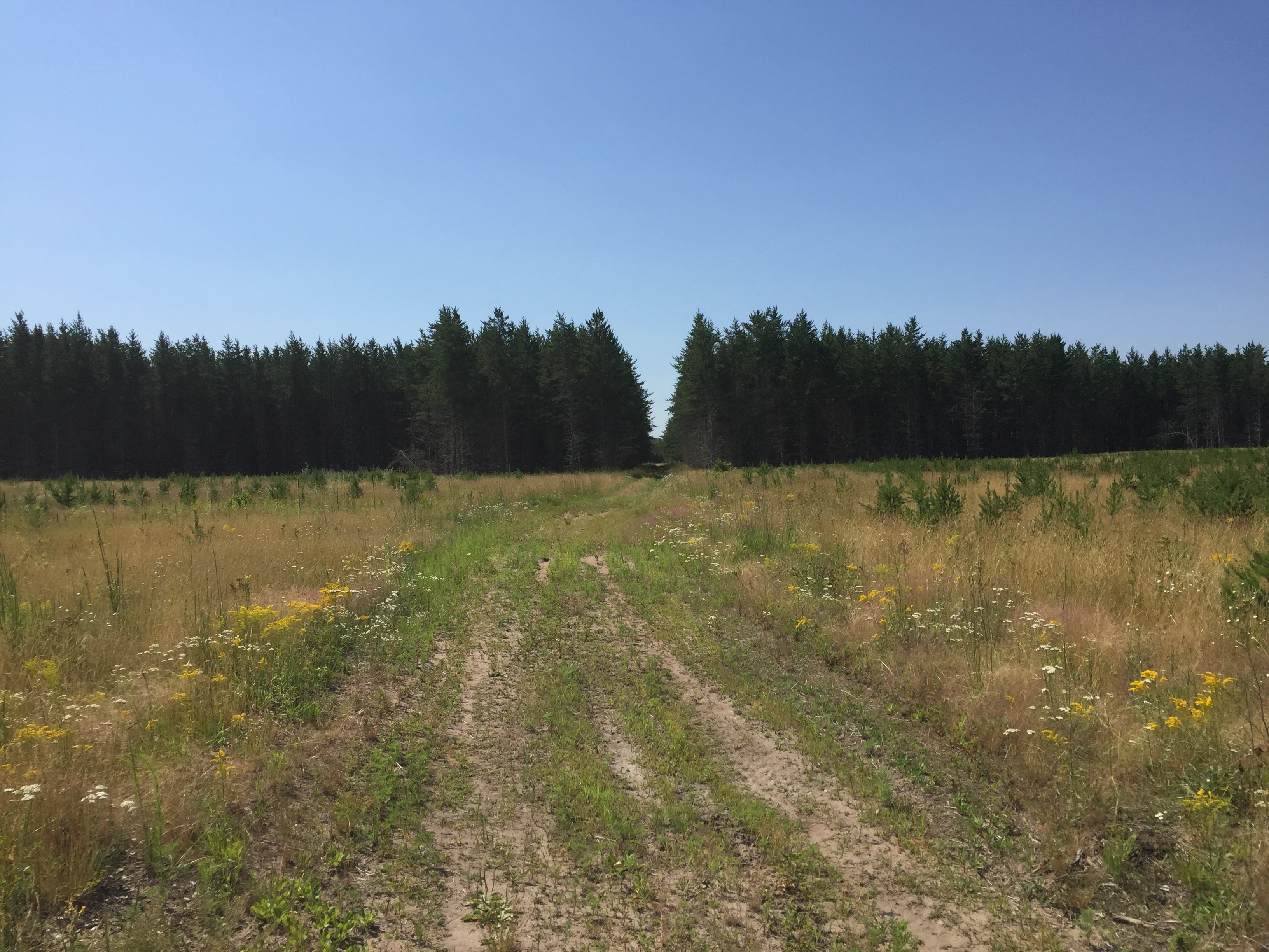
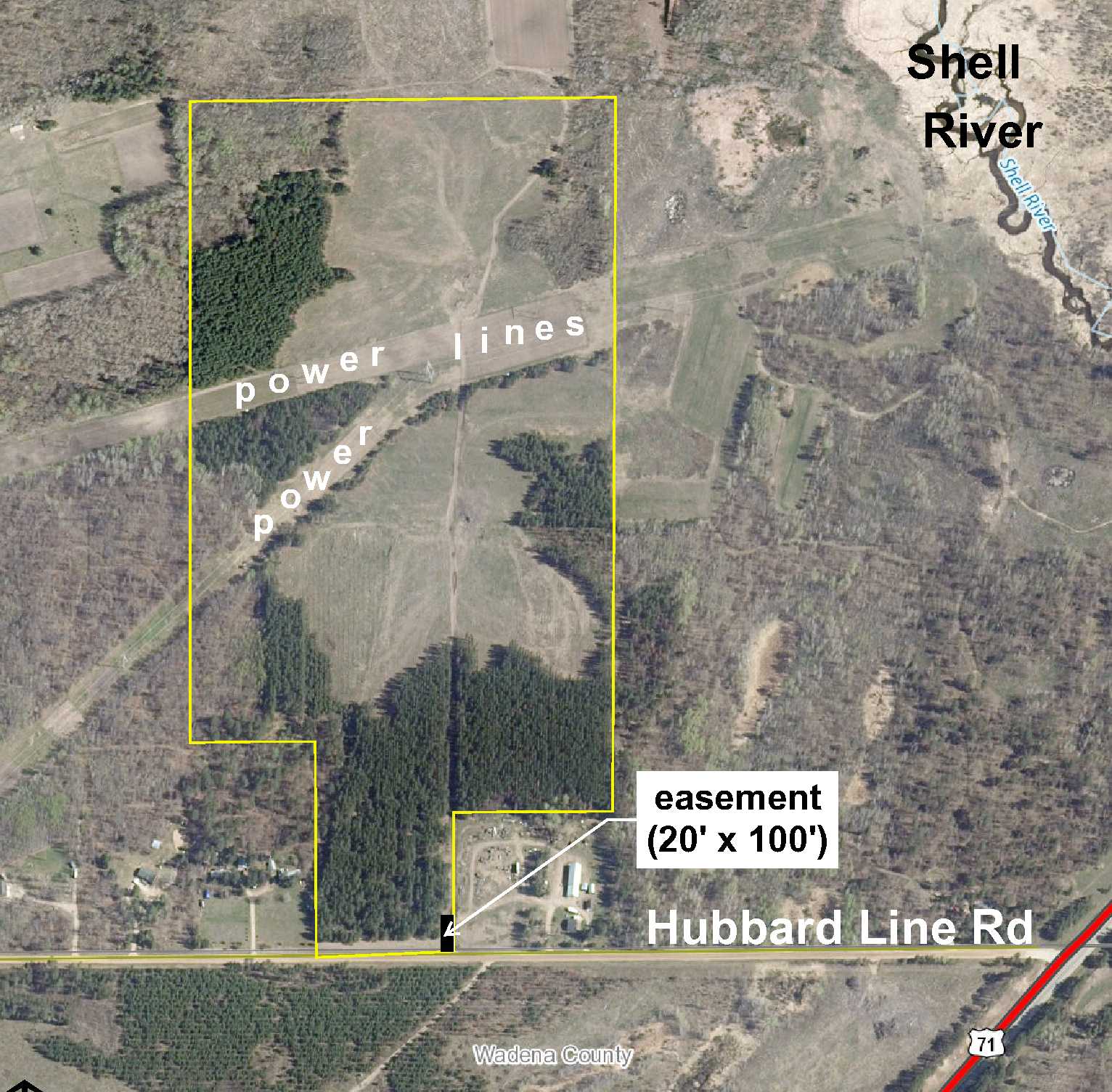
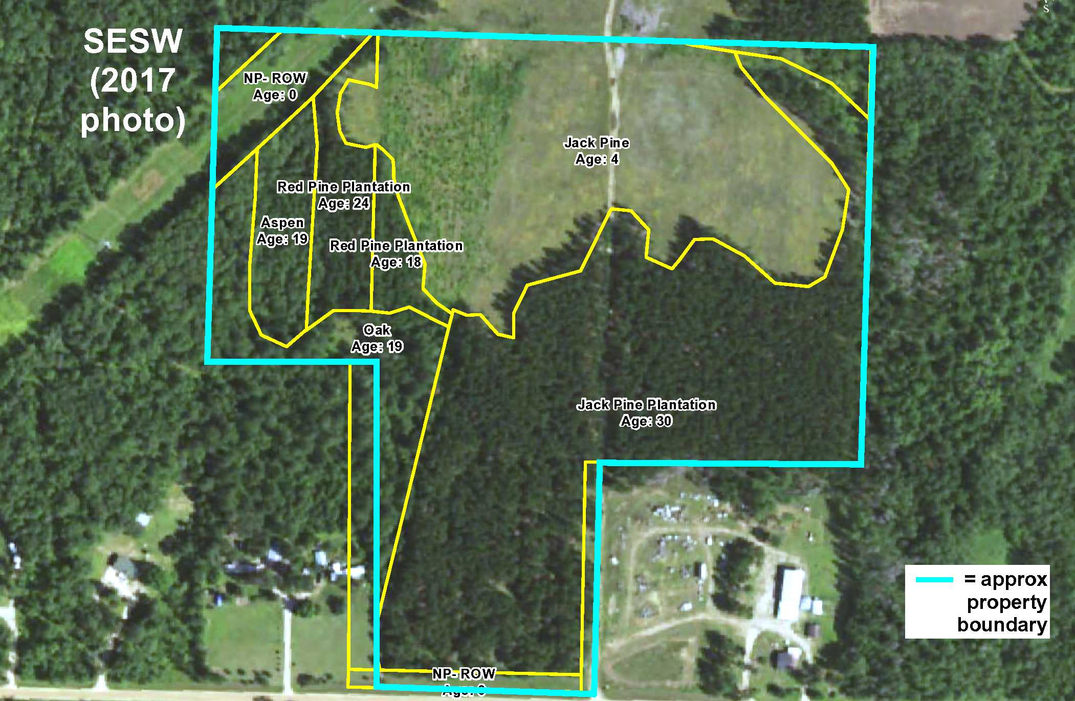
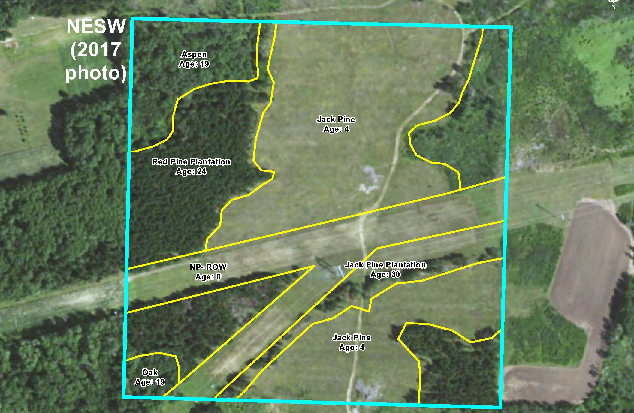
Potlatch land just off US Hwy 71 only 1 mile from championship 18-hole Blueberry Pines Golf Course! Fairly level high ground is a mixture of open area and areas wooded with jack pine, red pine, oak, and aspen. Power lines provide great shooting lanes for hunting. Gravel road along the south side and a trail makes the entire acreage accessible. Great turkey hunting area. Public accesses to Blueberry Lake and the Shell River only 3 miles away. Lowe State WMA less than 3 miles away for additional deer, small game, upland bird, and waterfowl hunting. Menahga only about 4 miles away for schools, shopping, and community events.
Main Property Info
Property ID
253300700 & 253301200
253300700 & 253301200
MLS Number
4878746
4878746
Status
Sold
Sold
List Price
$94,900
$94,900
Selling Price
$84,000
$84,000
Acres
65.91
65.91
Zoning
not zoned
not zoned
City
Menahga
Menahga
Township
Straight River Twp
Straight River Twp
State
MN
MN
Zip Code
56464
56464
County
Hubbard
Hubbard
Legal Description
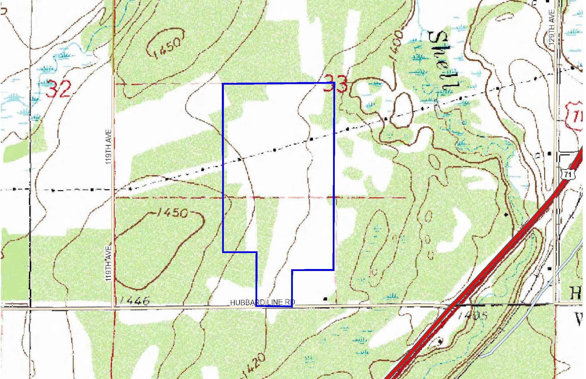
NESW and pt SESW, 33-139-35. Subject to Hubbard Line Rd, easements for power lines, easement in Doc A000393191, and any other easements, restrictions, or reservations of record. (See full legal description in Supplements.)
NESW and pt SESW, 33-139-35. Subject to Hubbard Line Rd, easements for power lines, easement in Doc A000393191, and any other easements, restrictions, or reservations of record. (See full legal description in Supplements.)
Property Location
Directions
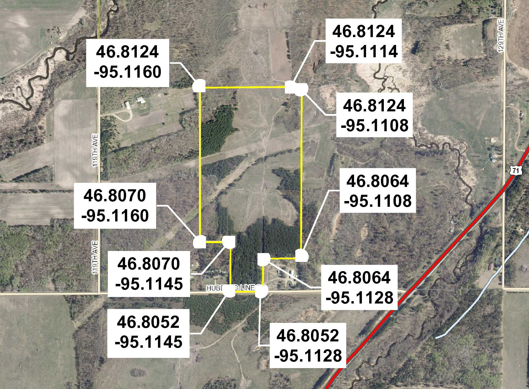
From the intersection of US Hwy 71 and State Hwy 87 in Menahga, north on US Hwy 71 for 3 7/10 miles. Left on Hubbard Line Rd 4/10 mile to trail on right (at address #12398).
From the intersection of US Hwy 71 and State Hwy 87 in Menahga, north on US Hwy 71 for 3 7/10 miles. Left on Hubbard Line Rd 4/10 mile to trail on right (at address #12398).
Access
Gravel Hubbard Line Rd along the south, and a trail leads through the entire acreage.
Gravel Hubbard Line Rd along the south, and a trail leads through the entire acreage.
GPS Coordinates
See map for coordinates to approx corners/points based on county mapping.
See map for coordinates to approx corners/points based on county mapping.
Address
Hubbard Line Rd
Hubbard Line Rd
School District
Menahga - 821
Menahga - 821
Property Details
Dimensions (approx)
420 x 660 x 390 x 1980 x 1320 x 2190 x 495 x 435 IRR
420 x 660 x 390 x 1980 x 1320 x 2190 x 495 x 435 IRR
Utilities
Available Utilities
Electric
Electric
On Site Utilities
None
None
Power Company
Itasca-Mantrap Co-op (1-888-713-3377)
Itasca-Mantrap Co-op (1-888-713-3377)
Taxes & Fees
Association Fee
$0
$0
Tax Amount
$738
$738
Assessment Amount
0
0
Tax With Assessments
$738
$738
Tax Year
2017
2017
Other Details
Section Number
33
33
Township Number
139
139
Range Number
35
35
Estimated Upland %
99
99
Estimated Wetland %
1
1
Additional Comments
Timber Comments
This property has been managed according to Forest Stewardship Council (FSC) standards. Timber includes mixture of jack pine, red pine, aspen, and oak. If timber value is important to you, seek the advice of a competent forester to determine species, volumes and values.
This property has been managed according to Forest Stewardship Council (FSC) standards. Timber includes mixture of jack pine, red pine, aspen, and oak. If timber value is important to you, seek the advice of a competent forester to determine species, volumes and values.
Hunting Comments
This property is in MN firearms deer zone 241. Turkeys are plentiful.
This property is in MN firearms deer zone 241. Turkeys are plentiful.
Disclosures
Not surveyed; acreage and dimensions approximate based on county data and mapping; county disclaimers included by reference. Photos/maps for convenience only and not guaranteed; physically inspect prior to purchase. Any deer stands on the land are not property of seller and are not included in sale. Use seller-approved PA and addendum; closing dates the 2nd Wednesday each month.
Not surveyed; acreage and dimensions approximate based on county data and mapping; county disclaimers included by reference. Photos/maps for convenience only and not guaranteed; physically inspect prior to purchase. Any deer stands on the land are not property of seller and are not included in sale. Use seller-approved PA and addendum; closing dates the 2nd Wednesday each month.
Additional Details
Additional Utility Information:
There is buried fiber optic along State Hwy 71, and a sign near the power line states that gas and fiber optic are by West Central Telephone Co.
There is buried fiber optic along State Hwy 71, and a sign near the power line states that gas and fiber optic are by West Central Telephone Co.


