

MLS Number : 4986281
Sold $43,000 - Home & Cabin Sites, Hunting & Recreation, Price Reduced, Waterfront Properties
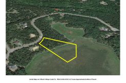
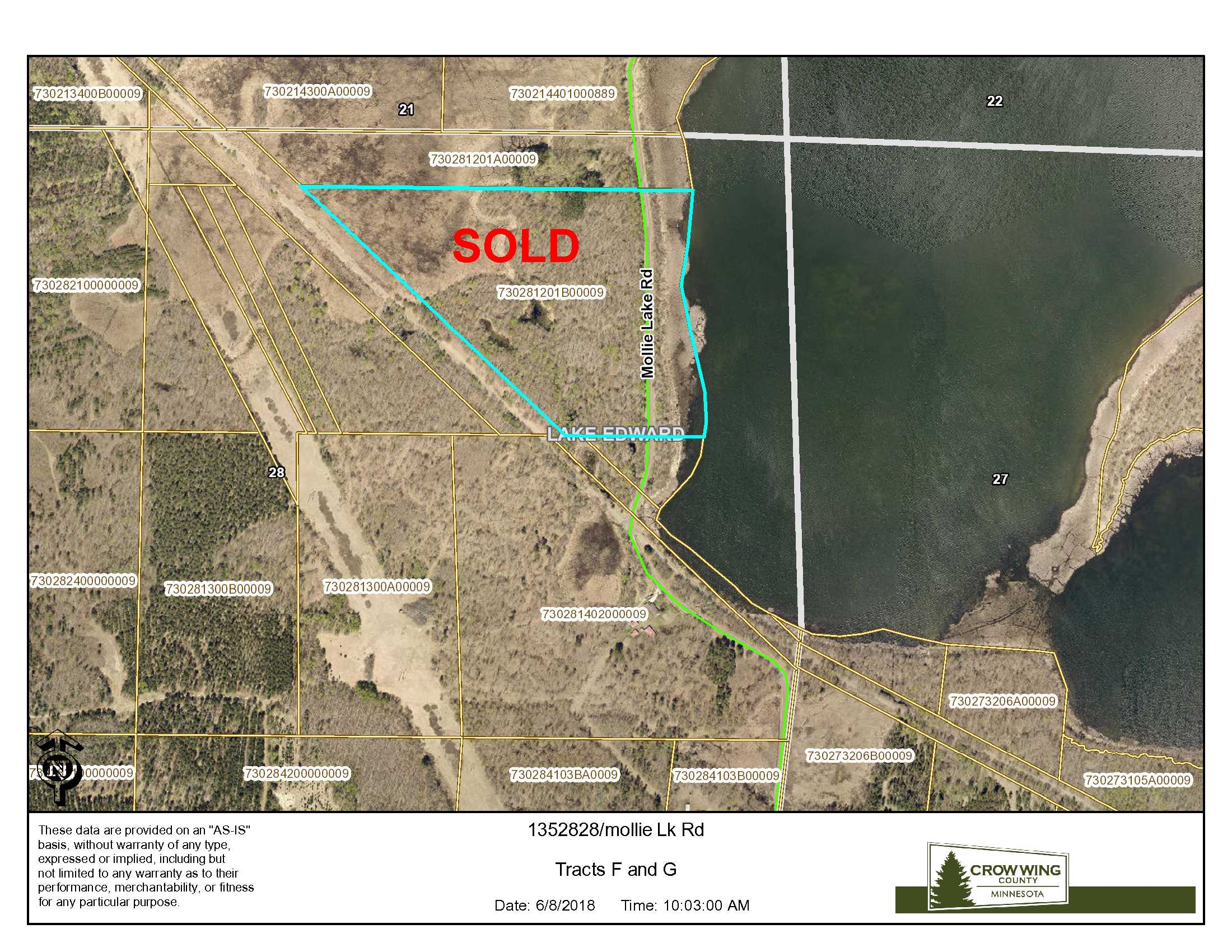
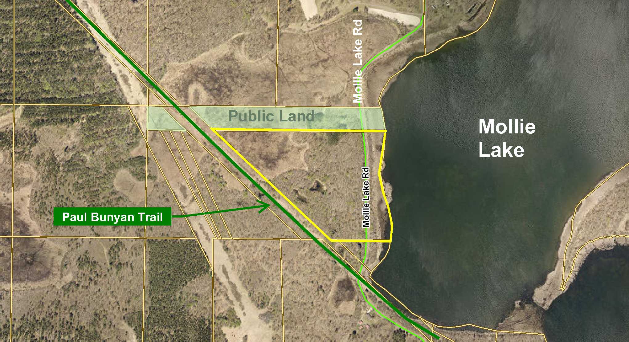
Price Reduced! PotlatchDeltic land on Mollie Lake southeast of Nisswa. This property has 1100+ feet of shoreline on Mollie Lake. A lake that is approximately 334 acres and gives you the opportunity to catch crappies, bluegill, walleye or bullheads. A paved township road runs through the east side of the property and the Paul Bunyan Trail for walking, biking, snowmobiling and other recreation is along the west side. Access to Mollie Lake is on the east side of the township road to the undeveloped lakeshore. With this location, you’re a short drive to golf courses, restaurants, or any of the adventures that the Brainerd Lakes Area has to offer!
Main Property Info
Property ID
Pt 730281201B00009
Pt 730281201B00009
MLS Number
4986281
4986281
Status
Sold
Sold
List Price
$69,500
$69,500
Selling Price
$43,000
$43,000
Acres
34.46
34.46
Zoning
Rural Res 20 & Shoreland
Rural Res 20 & Shoreland
City
Nisswa
Nisswa
Township
Lake Edward Twp
Lake Edward Twp
State
MN
MN
Zip Code
56468
56468
County
Crow Wing
Crow Wing
Legal Description
Pt GL1 lying east of Paul Bunyan Trail, 28-135-28. Subject to Mollie Lake Rd and any easements, restrictions, or reservations of record.
Pt GL1 lying east of Paul Bunyan Trail, 28-135-28. Subject to Mollie Lake Rd and any easements, restrictions, or reservations of record.
Property Location
Directions
From the intersection of Hwy 210 and Co Rd 3 in east Brainerd, head east on Co Rd 3 for 7 miles, turn west on Township Road 127 for 1.5 miles, turn right (north) onto Mollie Lake Rd N crossing Paul Bunyan Trail after .7 miles. The southeast corner of the property will be on the west side of the road of the road.
From the intersection of Hwy 210 and Co Rd 3 in east Brainerd, head east on Co Rd 3 for 7 miles, turn west on Township Road 127 for 1.5 miles, turn right (north) onto Mollie Lake Rd N crossing Paul Bunyan Trail after .7 miles. The southeast corner of the property will be on the west side of the road of the road.
Access
Mollie Lake Rd, a paved township road, runs through the east side of this property.
Mollie Lake Rd, a paved township road, runs through the east side of this property.
GPS Coordinates
GPS coordinates to approx corners/points based on county mapping: SE corner = 46.4821, -94.2042; SW corner = 46.4821, -94.2037; NW corner = 46.4852, -94.2114; NE corner = 46.4851, -94.2044.
GPS coordinates to approx corners/points based on county mapping: SE corner = 46.4821, -94.2042; SW corner = 46.4821, -94.2037; NW corner = 46.4852, -94.2114; NE corner = 46.4851, -94.2044.
Address
Mollie Lake Rd
Mollie Lake Rd
School District
Brainerd - 181
Brainerd - 181
Property Details
Dimensions (approx)
1134 x 625 x 1634 x 1744 IRR
1134 x 625 x 1634 x 1744 IRR
Utilities
Power Company
Crow Wing Power (1-800-648-9401)
Crow Wing Power (1-800-648-9401)
Waterfront
Waterfront Name
Mollie Lake
Mollie Lake
Waterfront Number
18335
18335
Waterfront Feet (approx)
1100
1100
Taxes & Fees
Tax Amount
$285
$285
Assessment Amount
189 est
189 est
Tax With Assessments
$474
$474
Assessment Description
Ditch 13
Ditch 13
Tax Year
2018
2018
Other Details
Section Number
28
28
Township Number
135
135
Range Number
28
28
Estimated Upland %
82
82
Estimated Wetland %
18
18
Additional Comments
Timber Comments
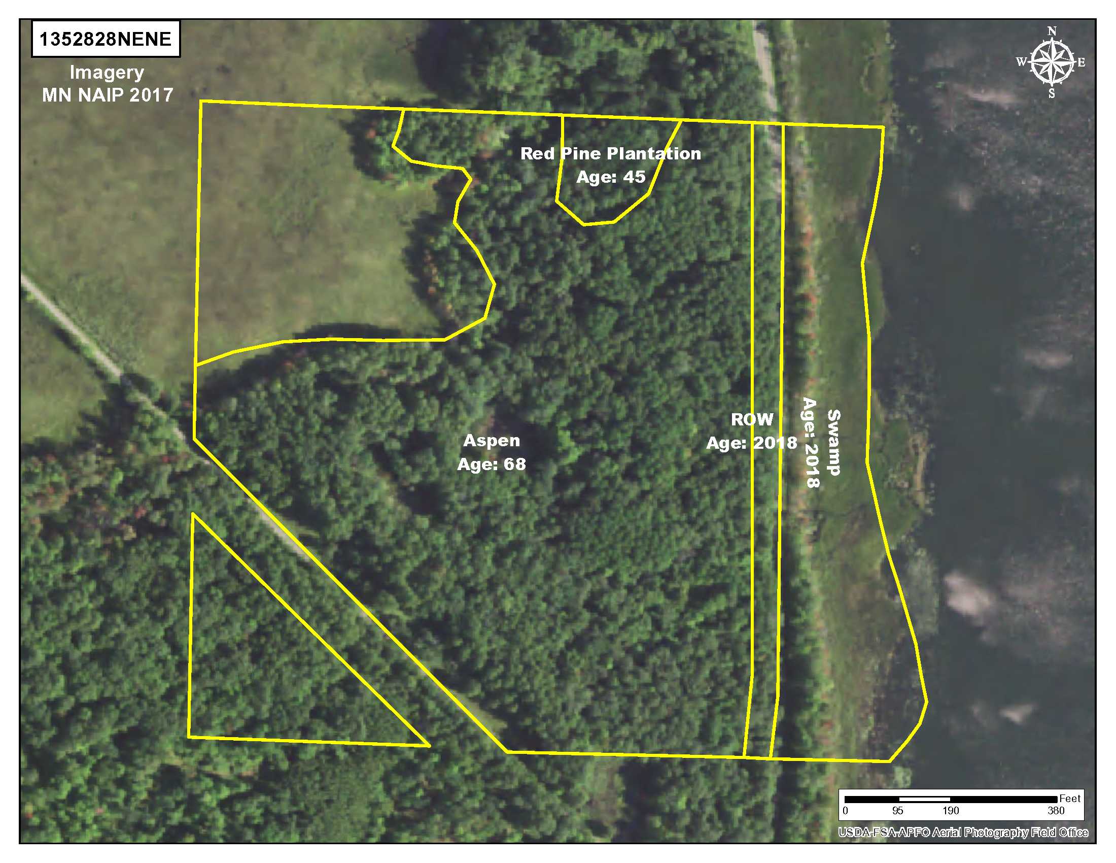
This property has been managed according to Forest Stewardship Council (FSC) standards and is wooded with red pine and aspen. If timber value is important to you, seek the advice of a competent forester to determine species, volumes, and values.
This property has been managed according to Forest Stewardship Council (FSC) standards and is wooded with red pine and aspen. If timber value is important to you, seek the advice of a competent forester to determine species, volumes, and values.
Hunting Comments
This property adjoins public land in MN Firearms Deer Zone 242.
This property adjoins public land in MN Firearms Deer Zone 242.
Disclosures
The land is within Ditch 13 Assessment Area and is subject to related special assessments. Portions of the landfall within FEMA Flood Zone A. It has been identified as a site of Blanding’s Turtles and/or their habitat and are subject to any restrictions or recommendations for avoiding/minimizing impact to their lives/habitat. Parcel split; acreage, dimensions, and taxes estimated based on county data and mapping; county disclaimers included by reference; subject to split approval if necessary. Not surveyed. Photos/maps for convenience only and not guaranteed; physically inspect prior to purchase. Any deer stands on the land are not property of seller and are not included in sale. Use seller-approved PA and addendum; closing dates the 3rd Wednesday each month.
The land is within Ditch 13 Assessment Area and is subject to related special assessments. Portions of the landfall within FEMA Flood Zone A. It has been identified as a site of Blanding’s Turtles and/or their habitat and are subject to any restrictions or recommendations for avoiding/minimizing impact to their lives/habitat. Parcel split; acreage, dimensions, and taxes estimated based on county data and mapping; county disclaimers included by reference; subject to split approval if necessary. Not surveyed. Photos/maps for convenience only and not guaranteed; physically inspect prior to purchase. Any deer stands on the land are not property of seller and are not included in sale. Use seller-approved PA and addendum; closing dates the 3rd Wednesday each month.