
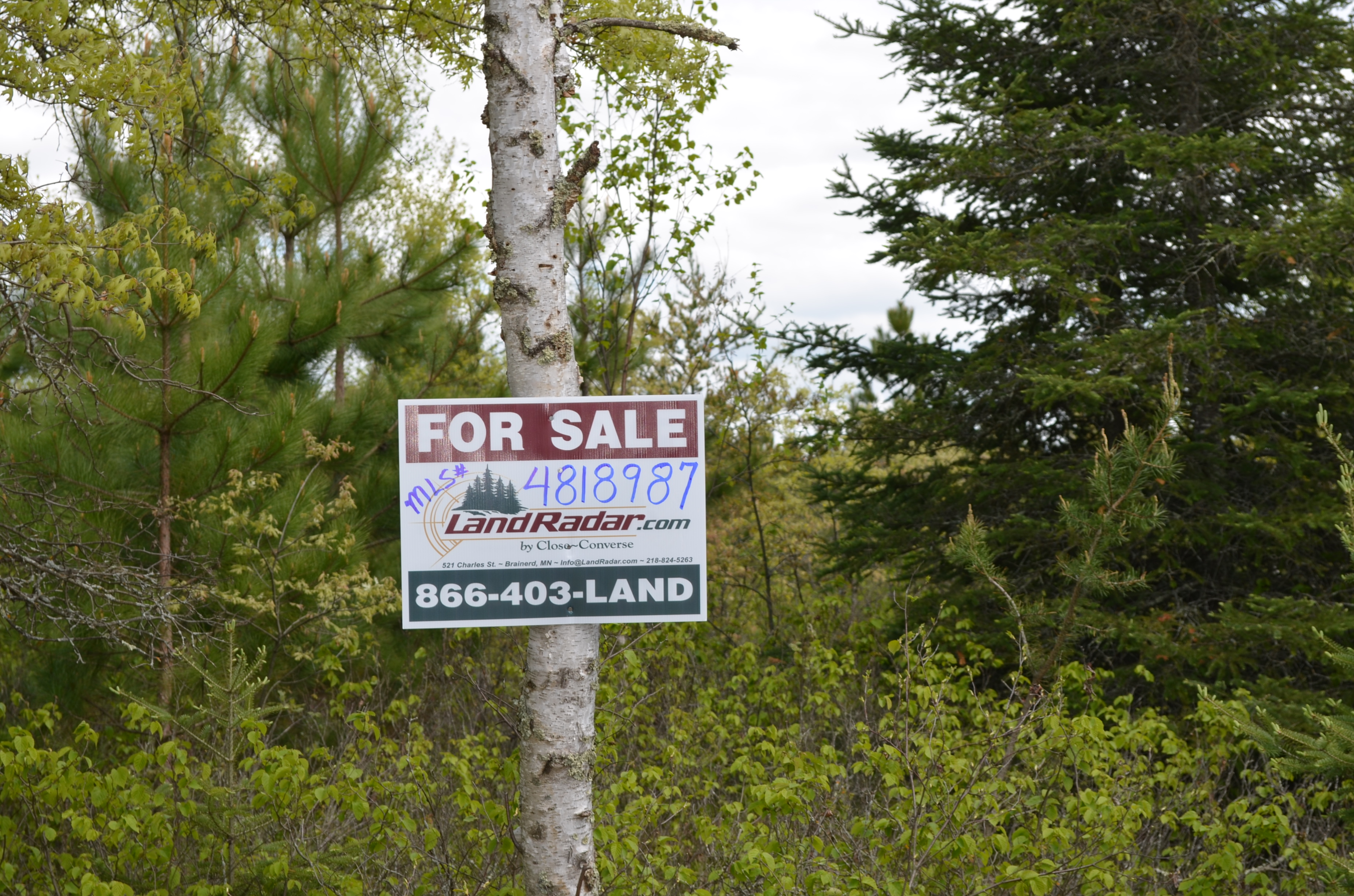
MLS Number : 4818987
Sold $117,000 - Hunting & Recreation
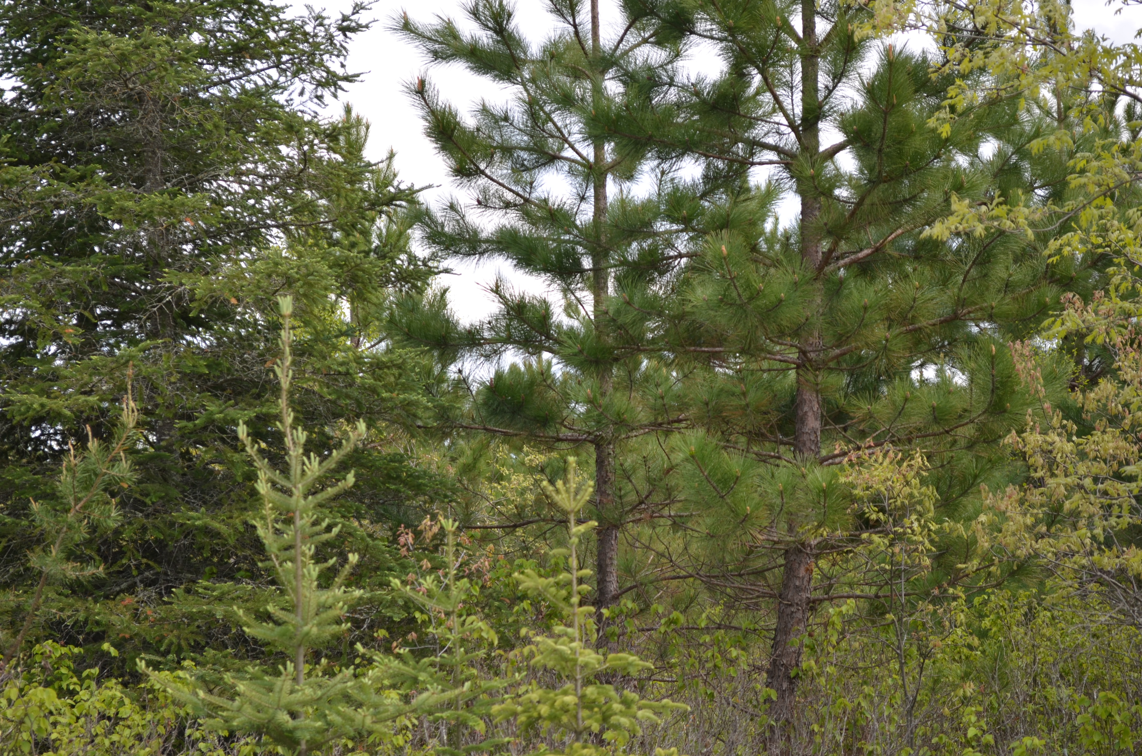
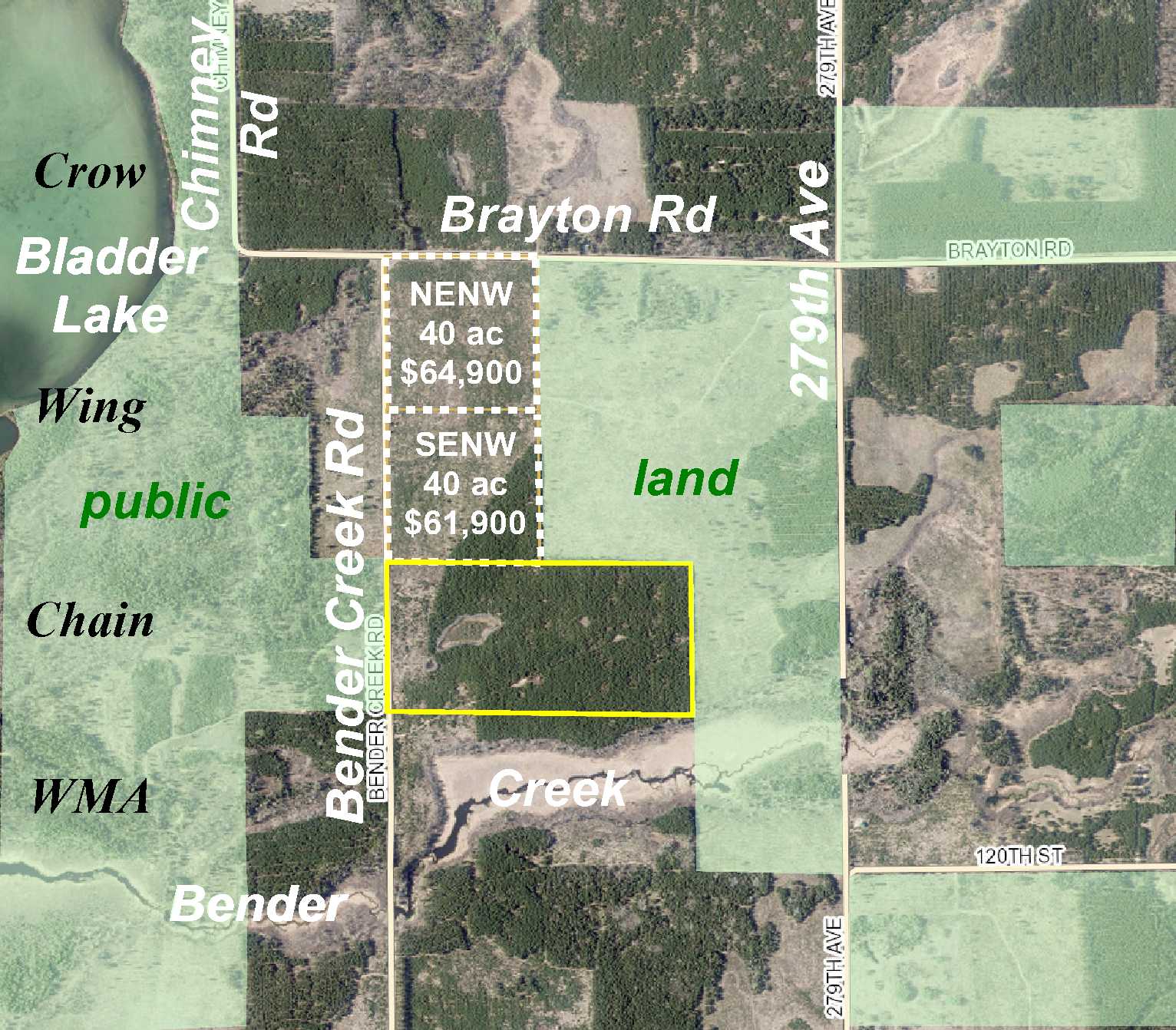
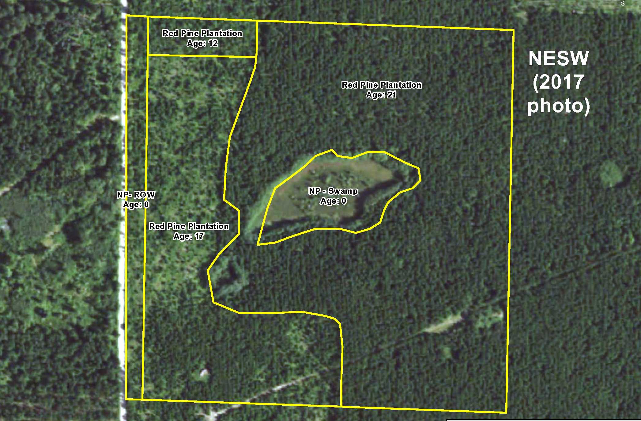
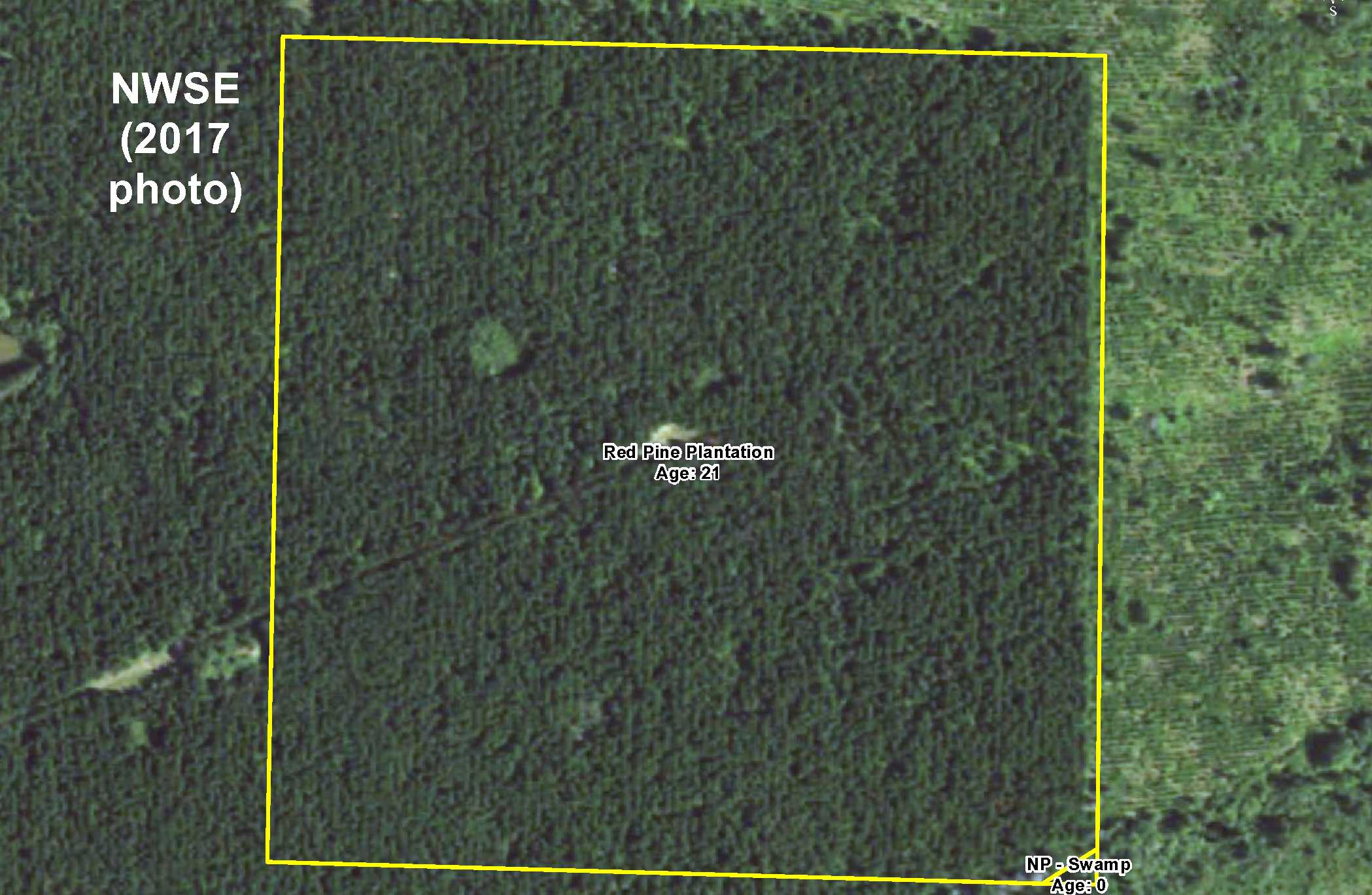
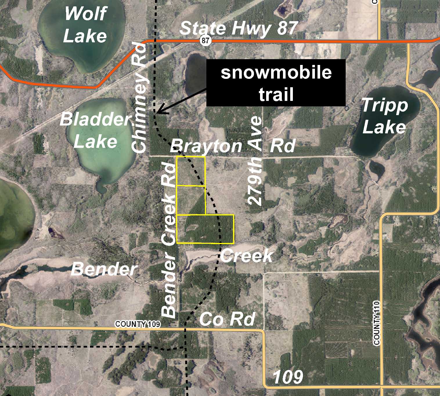
Potlatch land by Bladder Lake and Crow Wing Chain WMA south of Nevis. Level upland wooded with red pine is accented with a small wetland area in the middle of the westerly 40 acres. Township road along the west side for access, and a snowmobile trail crossing through the easterly 40 acres for winter recreation. Hundreds of acres of public land adjoin the east side, and there has been emphasis on enhancing waterfowl nesting and food production on the WMA across the road, so this would be your private hunting haven in prime hunting country!
Main Property Info
Property ID
062400600 & 062400800
062400600 & 062400800
MLS Number
4818987
4818987
Status
Sold
Sold
List Price
$123,900
$123,900
Selling Price
$117,000
$117,000
Acres
80
80
Zoning
not zoned
not zoned
City
Nevis
Nevis
Township
Crow Wing Lake Twp
Crow Wing Lake Twp
State
MN
MN
Zip Code
56467
56467
County
Hubbard
Hubbard
Legal Description
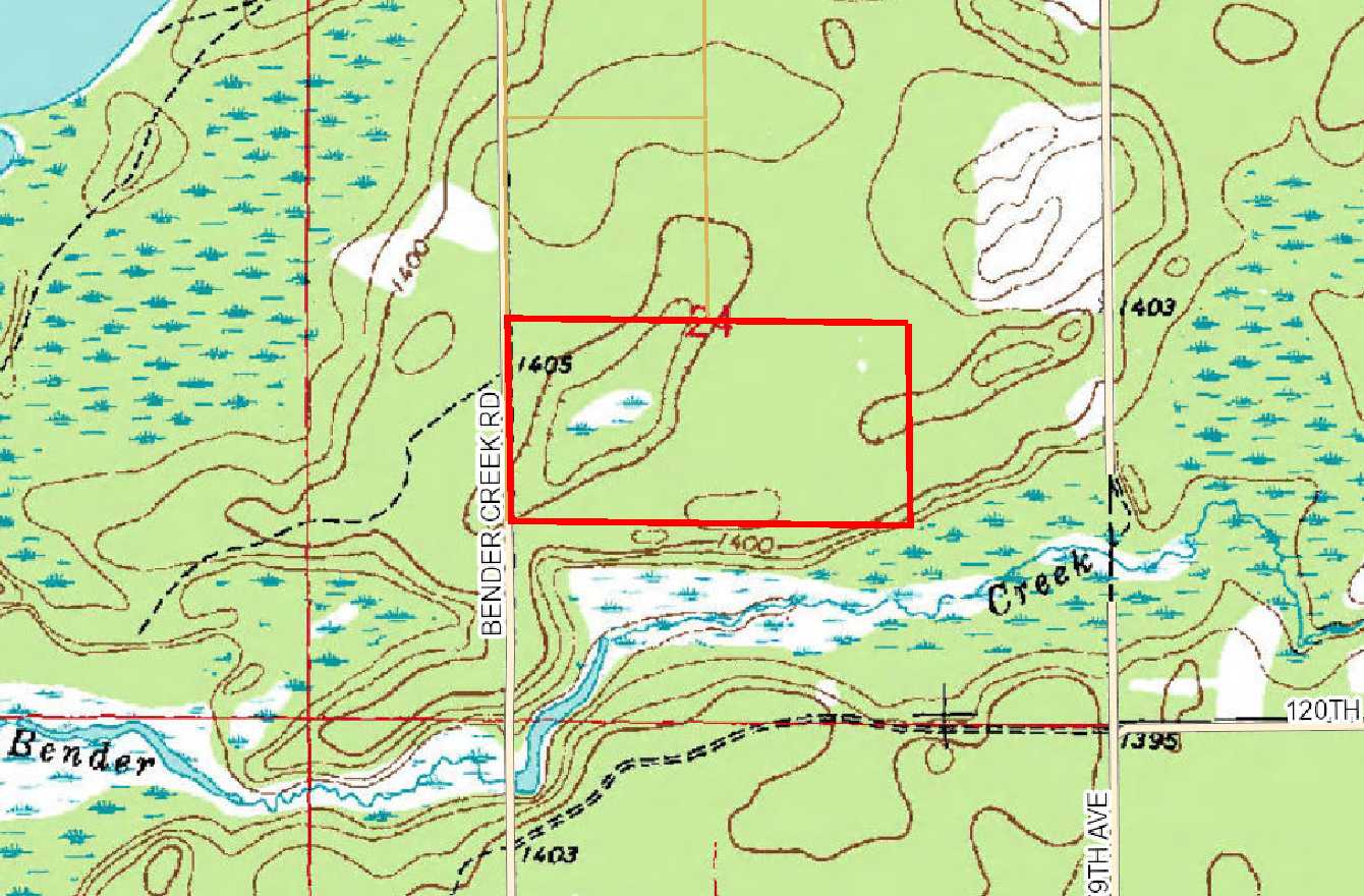
NESW & NWSE, 24-139-33. Subject to Bender Creek Rd and any easements, restrictions, and reservations of record.
NESW & NWSE, 24-139-33. Subject to Bender Creek Rd and any easements, restrictions, and reservations of record.
Property Location
Directions
From State Hwy 64 & State Hwy 87 south of Akeley, west on State Hwy 87 for 4 1/10 miles. Left on Chimney Rd 1 mile. Curve left onto Brayton Rd 1/4 mile. Right on Bender Creek Rd 1/2 mile to NW corner of the property on the left.
From State Hwy 64 & State Hwy 87 south of Akeley, west on State Hwy 87 for 4 1/10 miles. Left on Chimney Rd 1 mile. Curve left onto Brayton Rd 1/4 mile. Right on Bender Creek Rd 1/2 mile to NW corner of the property on the left.
Access
Bender Creek Rd, a township road, provides access along the west side.
Bender Creek Rd, a township road, provides access along the west side.
GPS Coordinates
GPS coordinates to flagged approximate corners: NW corner along Bender Creek Rd =46.8404, -94.8035; NE corner = 46.8403, -94.7929; SE corner = 46.8367, -94.7929; SW corner along Bender Creek Rd = 46.8368, -94.8034.
GPS coordinates to flagged approximate corners: NW corner along Bender Creek Rd =46.8404, -94.8035; NE corner = 46.8403, -94.7929; SE corner = 46.8367, -94.7929; SW corner along Bender Creek Rd = 46.8368, -94.8034.
Address
Bender Creek Road
Bender Creek Road
School District
Nevis - 308
Nevis - 308
Property Details
Dimensions (approx)
1320 x 2640 x 1320 x 2640
1320 x 2640 x 1320 x 2640
Utilities
Power Company
Itasca-Mantrap Co-op (1-888-713-3377)
Itasca-Mantrap Co-op (1-888-713-3377)
Taxes & Fees
Tax Amount
$778
$778
Tax With Assessments
$778
$778
Tax Year
2017
2017
Other Details
Section Number
24
24
Township Number
139
139
Range Number
33
33
Estimated Upland %
95
95
Estimated Wetland %
5
5
Additional Comments
Timber Comments
This property has been managed according to Forest Stewardship Council (FSC) standards and is wooded with red pine, a small part of which has been thinned/harvested. If timber value is important to you, seek the advice of a competent forester to determine species, volumes and values.
This property has been managed according to Forest Stewardship Council (FSC) standards and is wooded with red pine, a small part of which has been thinned/harvested. If timber value is important to you, seek the advice of a competent forester to determine species, volumes and values.
Hunting Comments
This property adjoins public land on the east and is in MN Firearms Deer Zone 246. There has been emphasis on enhancing waterfowl nesting and food production on the Crow Wing Chain WMA across the road; hunting options include deer, bear, small game, forest game birds, and waterfowl.
This property adjoins public land on the east and is in MN Firearms Deer Zone 246. There has been emphasis on enhancing waterfowl nesting and food production on the Crow Wing Chain WMA across the road; hunting options include deer, bear, small game, forest game birds, and waterfowl.
Disclosures
Not surveyed; acreage and dimensions approximate based on county data and mapping; county disclaimers included by reference. Photos/maps for convenience only and not guaranteed; tree cover may be different than depicted; physically inspect prior to purchase. Any deer stands on the land are not property of seller and are not included in sale. Use seller-approved PA and addendum; closing dates the 2nd Wednesday each month.
Not surveyed; acreage and dimensions approximate based on county data and mapping; county disclaimers included by reference. Photos/maps for convenience only and not guaranteed; tree cover may be different than depicted; physically inspect prior to purchase. Any deer stands on the land are not property of seller and are not included in sale. Use seller-approved PA and addendum; closing dates the 2nd Wednesday each month.


