


MLS Number : 4941316
Sold $48,000 - Hunting & Recreation
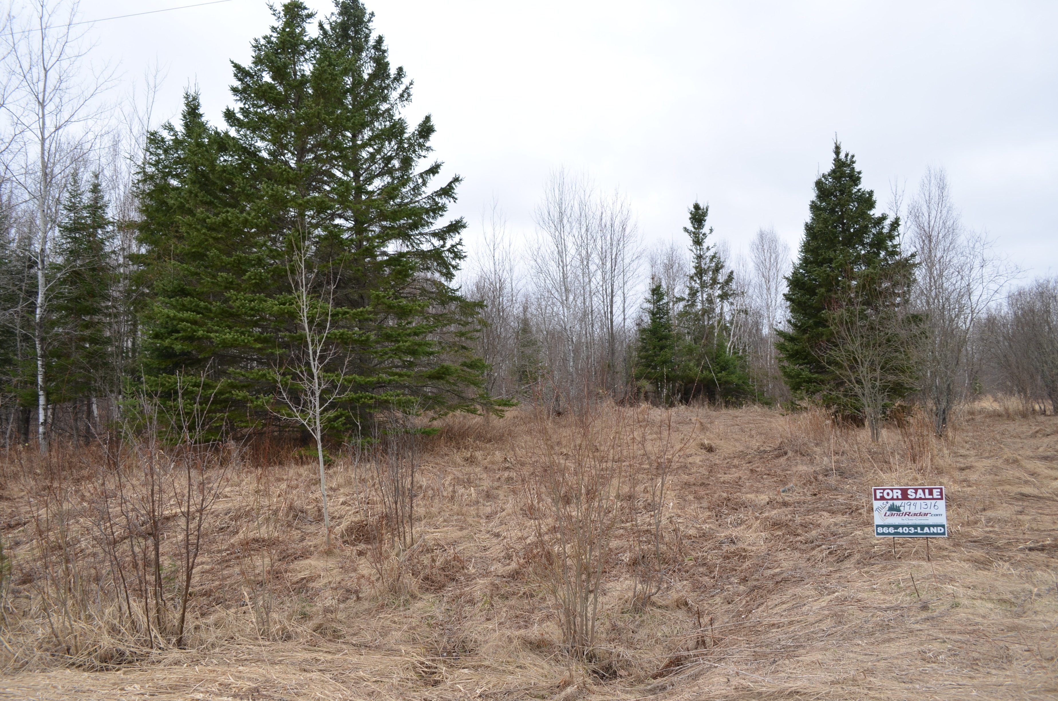
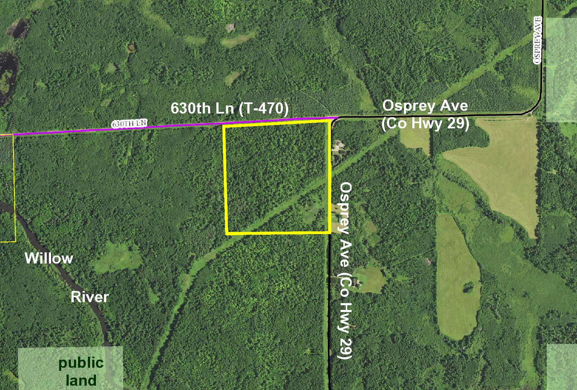
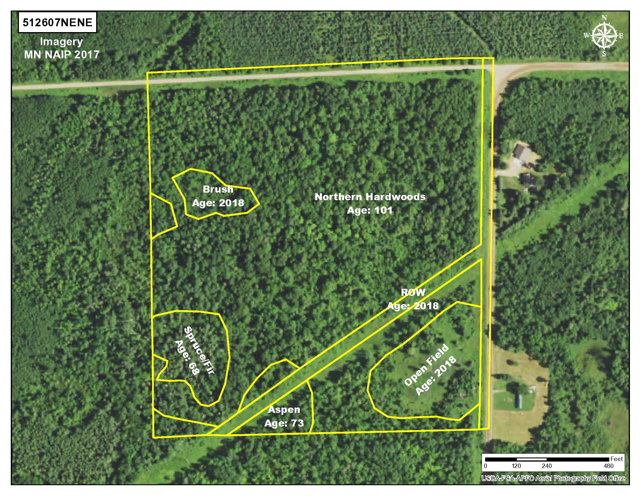
Rural PotlatchDeltic land by the Willow River southwest of Hill City. Gently-sloping upland terrain is wooded with northern hardwoods accented by areas of spruce/fir and aspen. Open power line area provides good site lines for hunting. Gravel county and townships roads provides access along east and north sides. Hundreds of acres of public land connecting to hundreds more acres of public Hill River State Forest land is only 1/2 mile away for plenty of hunting and recreational space. Connection to Soo Line Trail for snowmobiling and ATV riding is approximately 2 miles to the south. Utilities are available so this could be a great home or cabin building site.
Main Property Info
Property ID
200009700
200009700
MLS Number
4941316
4941316
Status
Sold
Sold
List Price
$53,900
$53,900
Selling Price
$48,000
$48,000
Acres
40
40
Zoning
Farm Residential
Farm Residential
City
Swatara
Swatara
Township
Macville Twp
Macville Twp
State
MN
MN
Zip Code
55785
55785
County
Aitkin
Aitkin
Legal Description
NENE, 7-051-26. Subject to Osprey Ave (Co Rd 29), 630th Ln (T-470), power line easements in Doc 306720 and Book 4 Misc, pg 207, and any other easements, restrictions, or reservations of record.
NENE, 7-051-26. Subject to Osprey Ave (Co Rd 29), 630th Ln (T-470), power line easements in Doc 306720 and Book 4 Misc, pg 207, and any other easements, restrictions, or reservations of record.
Property Location
Directions
From the intersection of US Hwy 169 and State Hwy 200 in Hill City, west on State Hwy 200 for 3 miles. Left (south and west) on Osprey Ave (Co Rd 29) 4 1/2 miles to NE corner of the tract at intersection of Osprey Ave (Co Rd 29) and 630th Ln (T-470). (Property is across the road from address #62612 and #62516 Osprey Ave.)
From the intersection of US Hwy 169 and State Hwy 200 in Hill City, west on State Hwy 200 for 3 miles. Left (south and west) on Osprey Ave (Co Rd 29) 4 1/2 miles to NE corner of the tract at intersection of Osprey Ave (Co Rd 29) and 630th Ln (T-470). (Property is across the road from address #62612 and #62516 Osprey Ave.)
Access
Gravel Osprey Ave (Co Rd 29) is along the east side and gravel 630th Ln (T-470) is along the north side.
Gravel Osprey Ave (Co Rd 29) is along the east side and gravel 630th Ln (T-470) is along the north side.
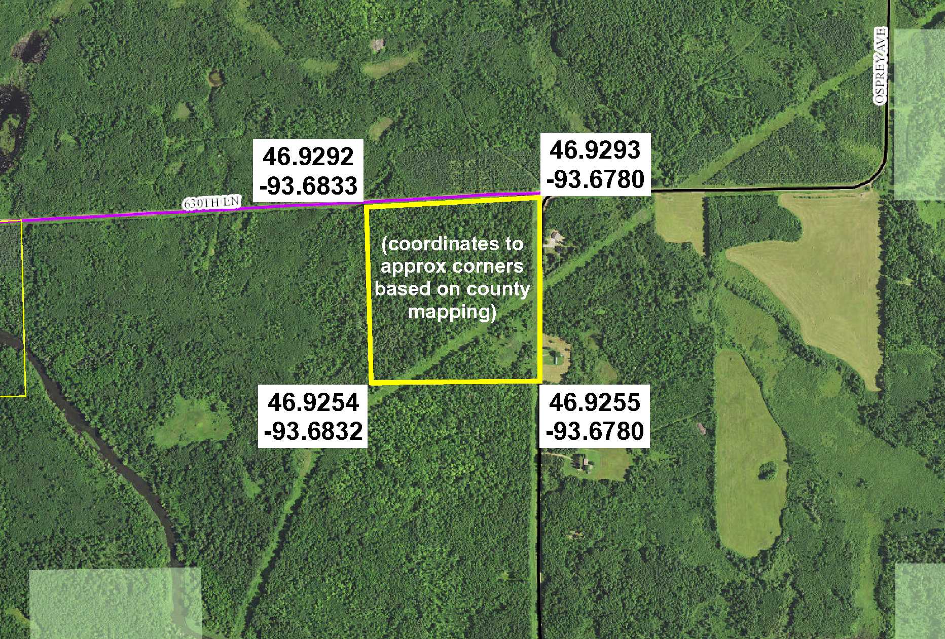
GPS Coordinates
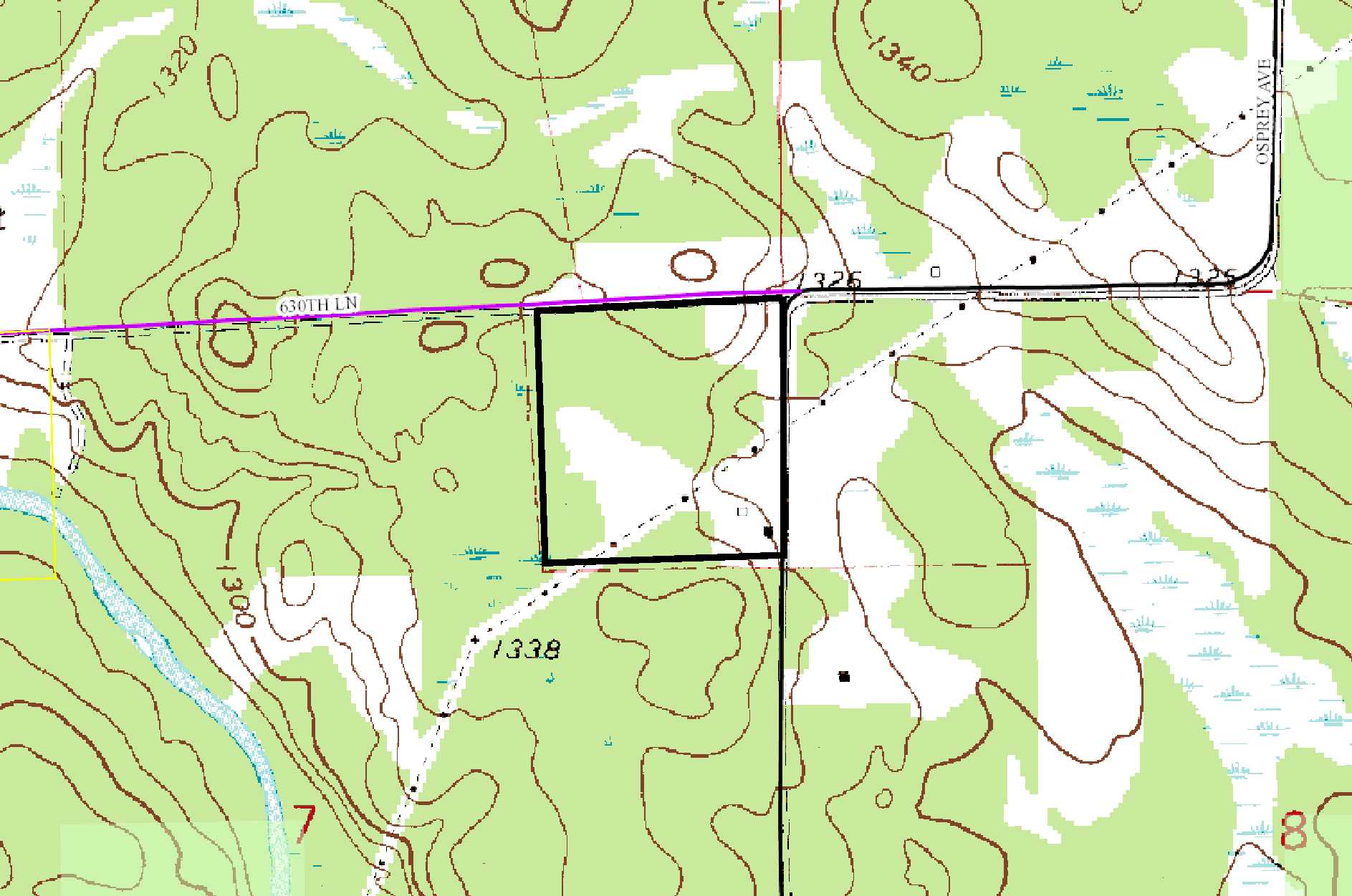
Coordinates to approximate corners/points based on county mapping: NE corner at intersection of Osprey Ave (Co Rd 29) & 630th Ln (T-470) = 46.9293, -93.6780; SE corner along Osprey Ave (Co Rd 29) = 46.9255, -93.6780; SW corner = 46.9254, -93.6832; NW corner along 630th Ln (T-470) = 46.9292, -93.6833.
Coordinates to approximate corners/points based on county mapping: NE corner at intersection of Osprey Ave (Co Rd 29) & 630th Ln (T-470) = 46.9293, -93.6780; SE corner along Osprey Ave (Co Rd 29) = 46.9255, -93.6780; SW corner = 46.9254, -93.6832; NW corner along 630th Ln (T-470) = 46.9292, -93.6833.
Address
Osprey Ave (Co Rd 29) & 630th Ln (T-470)
Osprey Ave (Co Rd 29) & 630th Ln (T-470)
School District
Hill City - 2
Hill City - 2
Property Details
Dimensions (approx)
1405 x 1315 x 1385 x 1325
1405 x 1315 x 1385 x 1325
Utilities
Power Company
Lake Country Power (1-800-421-9959)
Lake Country Power (1-800-421-9959)
Taxes & Fees
Tax Amount
$432
$432
Tax Year
2018
2018
Other Details
Section Number
07
07
Township Number
051
051
Range Number
26
26
Estimated Upland %
95
95
Estimated Wetland %
5
5
Additional Comments
Timber Comments
This property has been managed according to Forest Stewardship Council (FSC) standards and is wooded with northern hardwoods, spruce/fir, and aspen. If timber value is important to you, seek the advice of a competent forester to determine species, volumes, and values.
This property has been managed according to Forest Stewardship Council (FSC) standards and is wooded with northern hardwoods, spruce/fir, and aspen. If timber value is important to you, seek the advice of a competent forester to determine species, volumes, and values.
Hunting Comments
This property is near public land in MN Firearms Deer Zone 171.
This property is near public land in MN Firearms Deer Zone 171.
Disclosures
There is an abandoned house on this property; the property is being sold as-is with no warranties or guarantees on the house structure. Not surveyed; acreage and dimensions approximate based on county data and mapping; county disclaimers included by reference. Photos/maps for convenience only and not guaranteed; physically inspect prior to purchase. Any deer stands on the land are not property of seller and are not included in sale. Use seller-approved PA and addendum; closing dates the 3rd Wednesday each month.
There is an abandoned house on this property; the property is being sold as-is with no warranties or guarantees on the house structure. Not surveyed; acreage and dimensions approximate based on county data and mapping; county disclaimers included by reference. Photos/maps for convenience only and not guaranteed; physically inspect prior to purchase. Any deer stands on the land are not property of seller and are not included in sale. Use seller-approved PA and addendum; closing dates the 3rd Wednesday each month.

