


MLS Number : 4703447
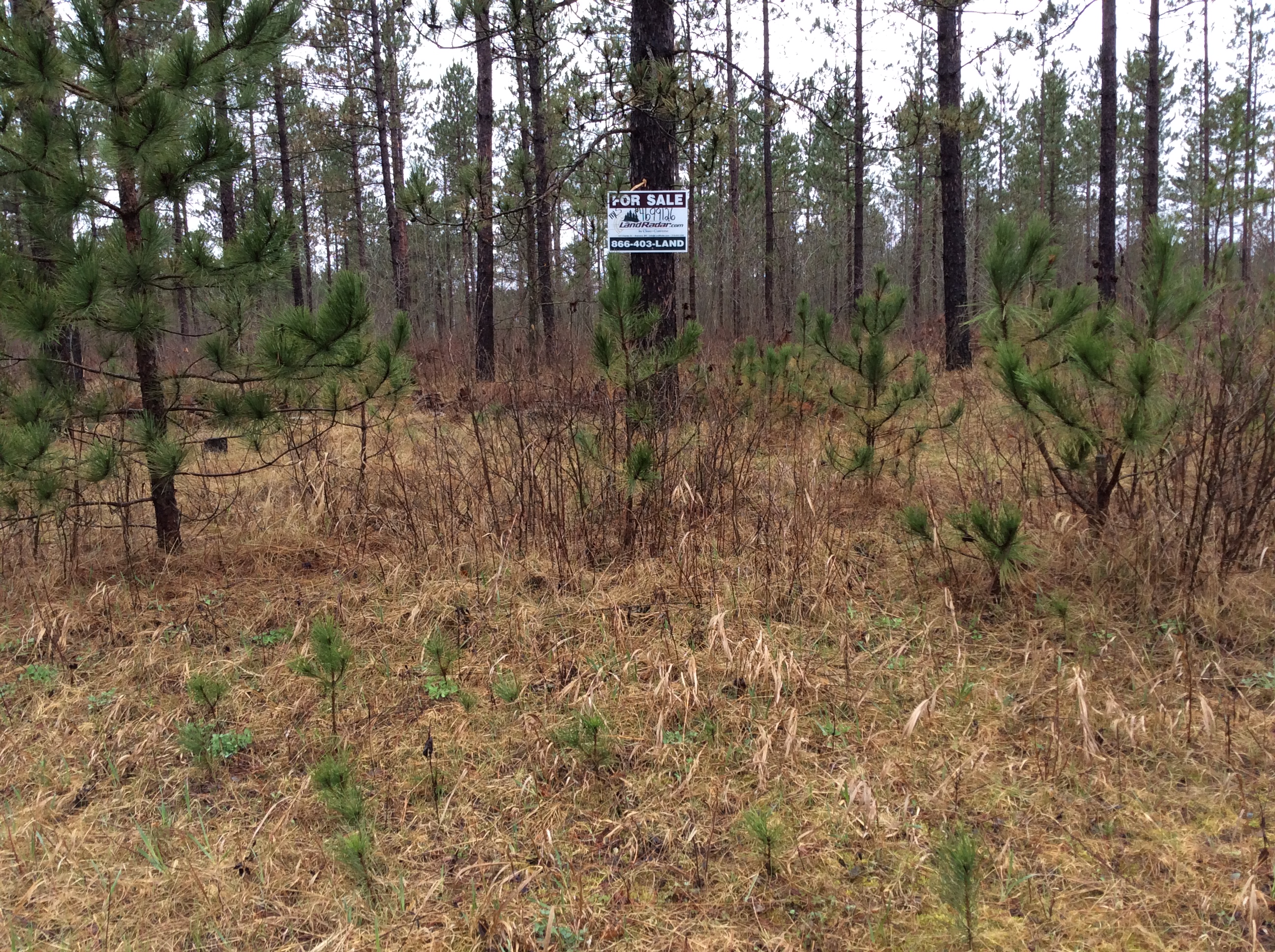
Sold $110,000 - Hunting & Recreation
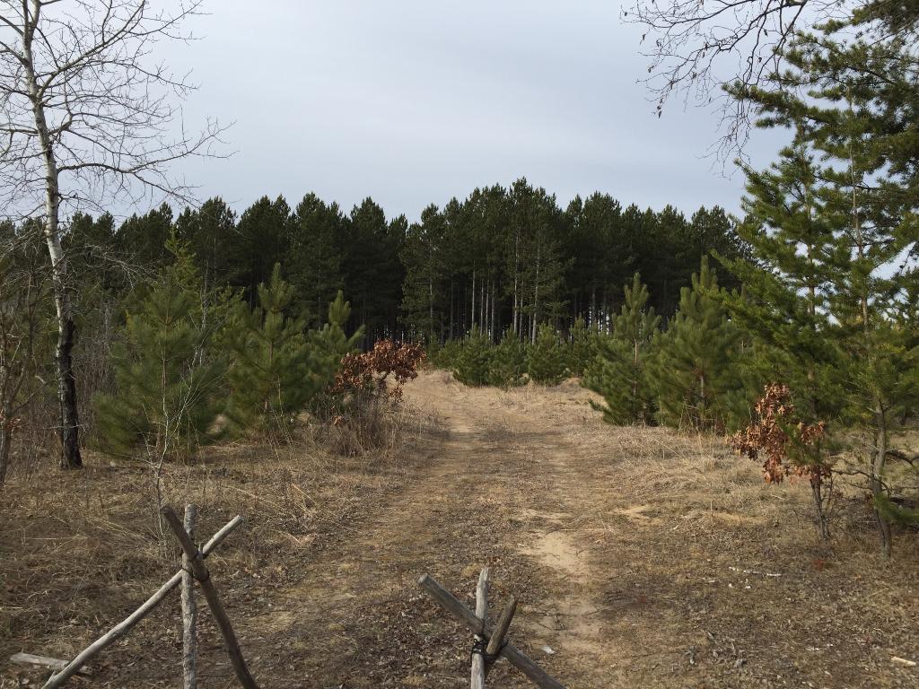
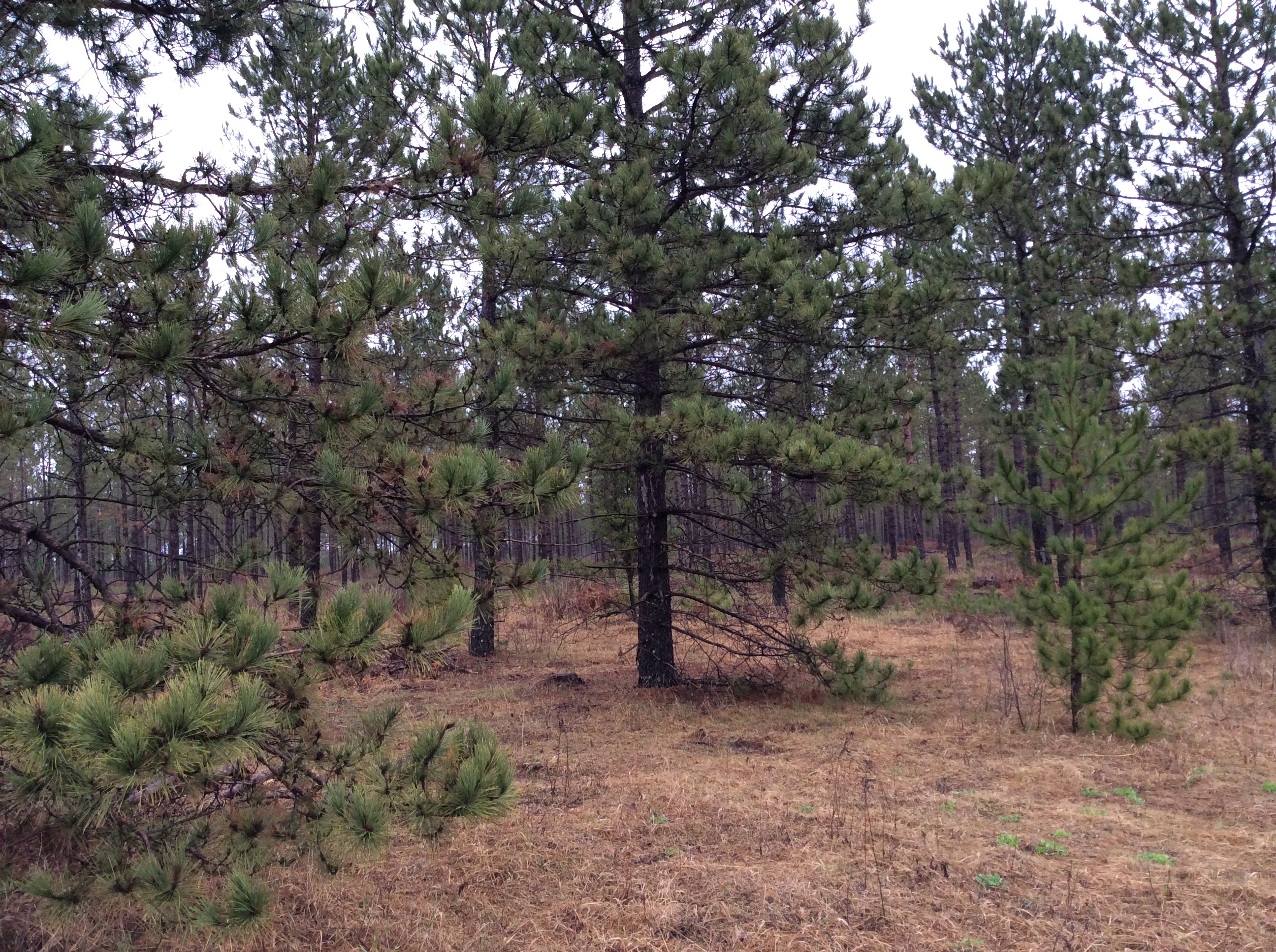
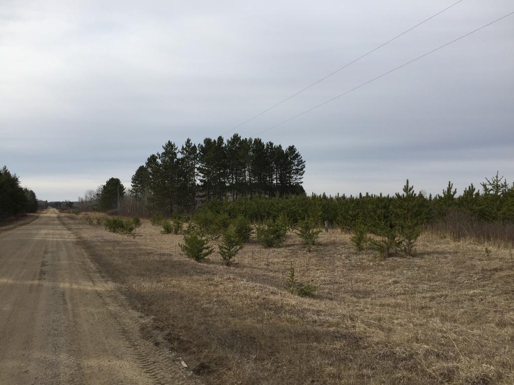
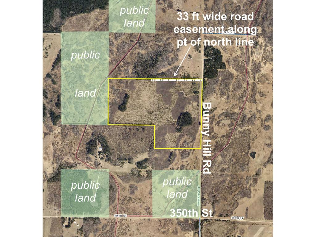
Remote Potlatch land northeast of Nimrod. Fairly level upland. Gravel county road access along the east side with a trail traversing east-west through the tract. An easement trail along a portion of the north boundary benefits NWNE. Public Huntersville State Forest land adjoins the west side. Burgen Lake Prairie WMA and thousands more acres of public forestland are less than 2 miles away for for hunting deer, bear, small game, forest game birds, waterfowl, and prairie chickens.
Main Property Info
Property ID
040261040, 040261030
040261040, 040261030
MLS Number
4703447
4703447
Status
Sold
Sold
List Price
$129,900
$129,900
Selling Price
$110,000
$110,000
Acres
100.000
100.000
Zoning
A-2 Mixed Agriculture
A-2 Mixed Agriculture
City
Sebeka
Sebeka
Township
Huntersville Township
Huntersville Township
State
MN
MN
Zip Code
56477
56477
County
Wadena
Wadena
Legal Description
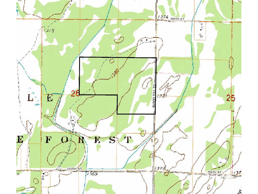
N2NESE & SENE & SWNE, 26-138-33. Subject to Bunny Hill Rd (Co Rd 155); easement along portion of north line; and any other easements, restrictions, or reservations of record.
N2NESE & SENE & SWNE, 26-138-33. Subject to Bunny Hill Rd (Co Rd 155); easement along portion of north line; and any other easements, restrictions, or reservations of record.
Property Location
Directions
From US Hwy 71 and State Hwy 227 (E Minnesota Ave) in Sebeka, east on State Hwy 227 thru Nimrod. Right onto Co Rd 12 for 4/10 mile. Left on Huntersville Rd 6 6/10 miles. Right on 350th St 2 miles. Left on Bunny Hill Rd (Co Rd 155) for 6/10 mile to trail on left leading into the property.
From US Hwy 71 and State Hwy 227 (E Minnesota Ave) in Sebeka, east on State Hwy 227 thru Nimrod. Right onto Co Rd 12 for 4/10 mile. Left on Huntersville Rd 6 6/10 miles. Right on 350th St 2 miles. Left on Bunny Hill Rd (Co Rd 155) for 6/10 mile to trail on left leading into the property.
Access
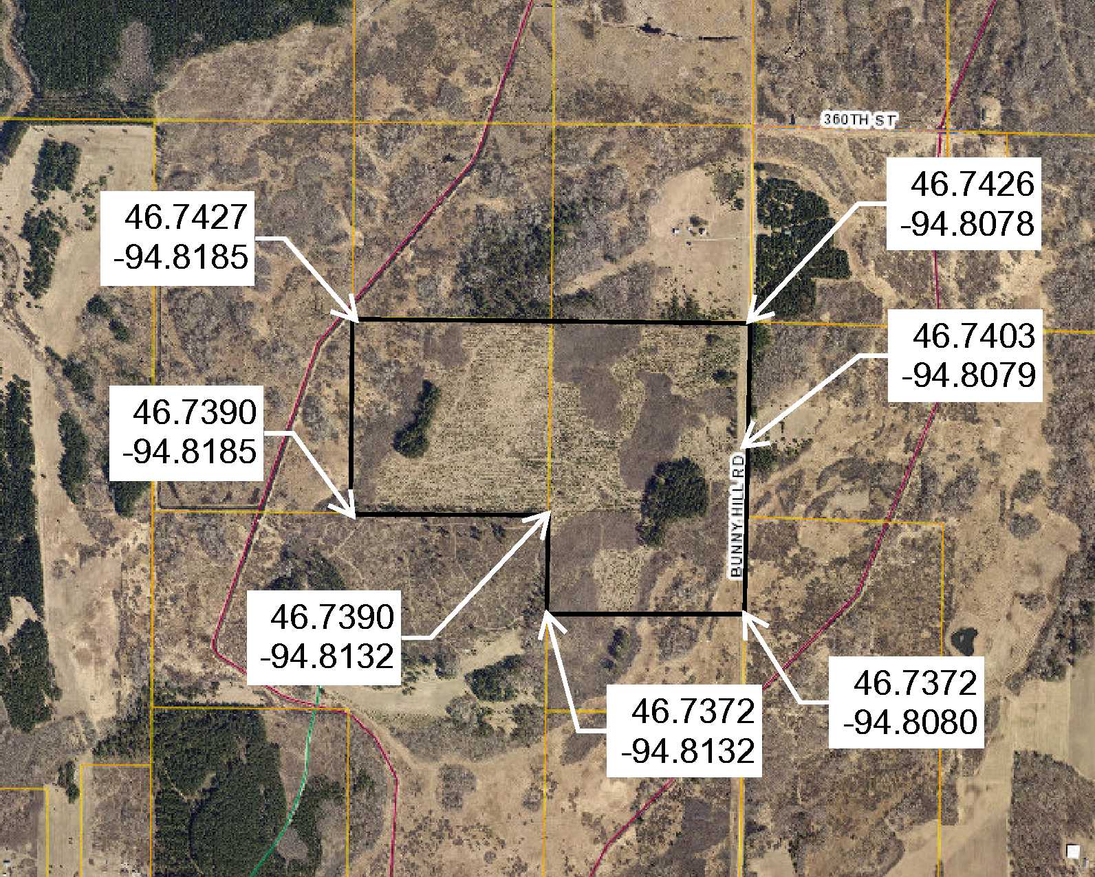
Gravel Bunny Hill Rd (Co Rd 155) runs along the east side of the property with a trail traversing east-west through the tract. There is also an easement trail along a portion of the north boundary, which benefits adjoining property to the north.
Gravel Bunny Hill Rd (Co Rd 155) runs along the east side of the property with a trail traversing east-west through the tract. There is also an easement trail along a portion of the north boundary, which benefits adjoining property to the north.
GPS Coordinates
See map for coordinates to approx corners and points based on county mapping.
See map for coordinates to approx corners and points based on county mapping.
Address
N2NESE&S2NE Bunny Hill Road
N2NESE&S2NE Bunny Hill Road
School District
Menahga - 821
Menahga - 821
Property Details
Dimensions (approx)
1980x1320x3300x2640
1980x1320x3300x2640
Utilities
Available Utilities
Electric
Electric
On Site Utilities
None
None
Power Company
Todd-Wadena Electric (1-800-320-8932)
Todd-Wadena Electric (1-800-320-8932)
Taxes & Fees
Association Fee
$0
$0
Tax Amount
$1,512
$1,512
Tax With Assessments
$1,512
$1,512
Tax Year
2016
2016
Other Details
Section Number
26
26
Township Number
138
138
Range Number
33
33
Estimated Upland %
99
99
Estimated Wetland %
1
1
Additional Comments
Timber Comments
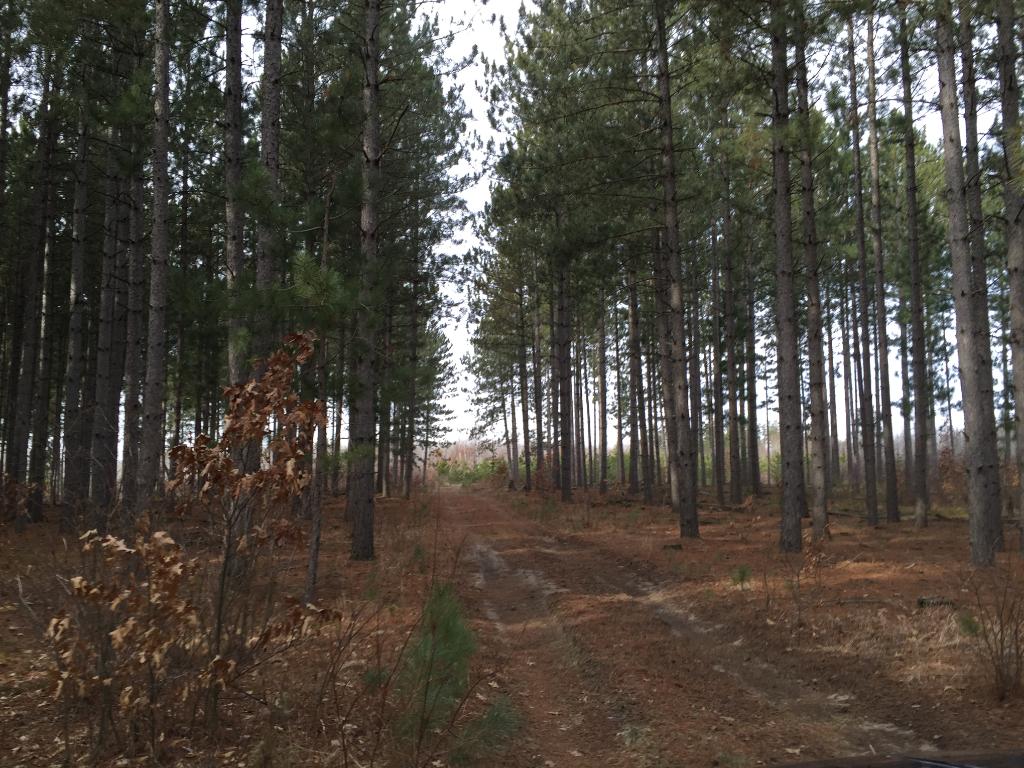
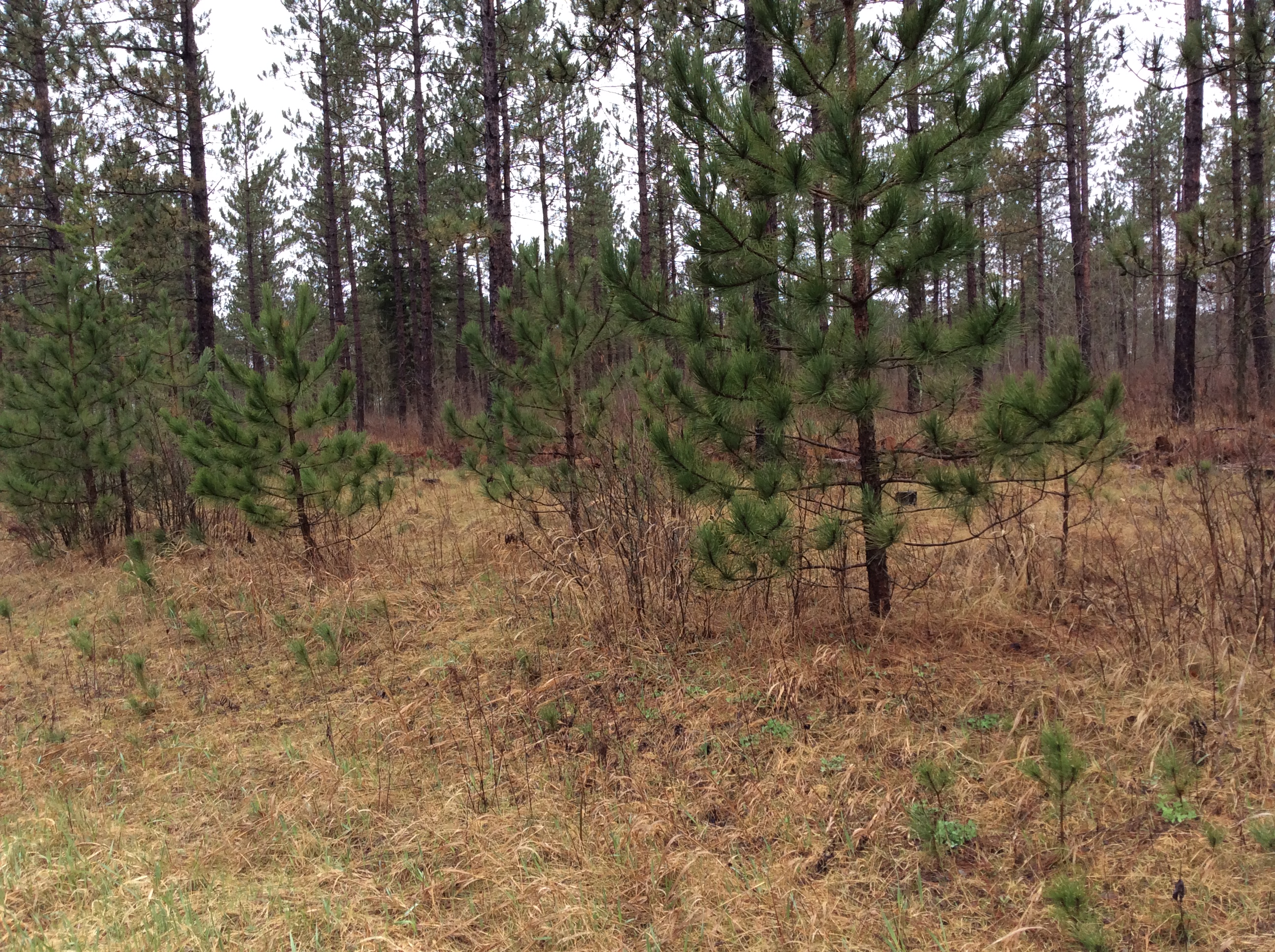
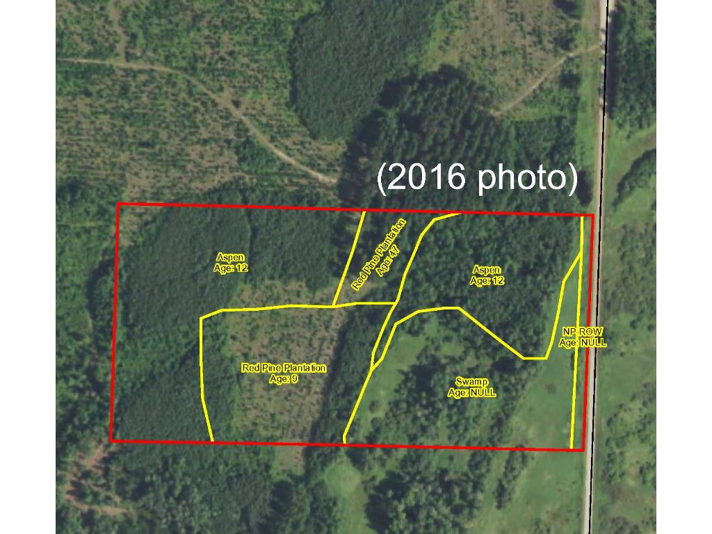
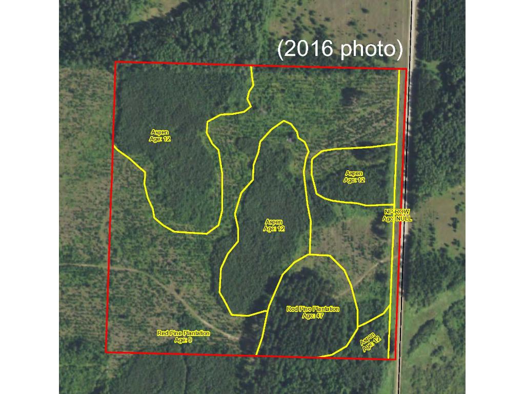
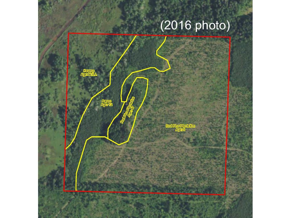
This property has been managed according to Forest Stewardship Council (FSC) standards. Timber includes intermingled stands of varying ages of red pine and aspen. If timber value is important to you, seek the advice of a competent forester to determine species, volumes and values.
This property has been managed according to Forest Stewardship Council (FSC) standards. Timber includes intermingled stands of varying ages of red pine and aspen. If timber value is important to you, seek the advice of a competent forester to determine species, volumes and values.
Hunting Comments
This property adjoins public land in MN Firearms Deer Zone 246.
This property adjoins public land in MN Firearms Deer Zone 246.
Disclosures
Not surveyed; acreage and dimensions approximate based on county data and mapping; county disclaimers included by reference. Photos/maps for convenience only and not guaranteed; tree cover may be different than depicted; physically inspect prior to purchase. Any deer stands on the land are not property of seller and are not included in sale. Use seller-approved PA and addendum; closing dates the 2nd Wednesday each month.
Not surveyed; acreage and dimensions approximate based on county data and mapping; county disclaimers included by reference. Photos/maps for convenience only and not guaranteed; tree cover may be different than depicted; physically inspect prior to purchase. Any deer stands on the land are not property of seller and are not included in sale. Use seller-approved PA and addendum; closing dates the 2nd Wednesday each month.


