

MLS Number : 4731359
Sold $72,500 - Hunting & Recreation
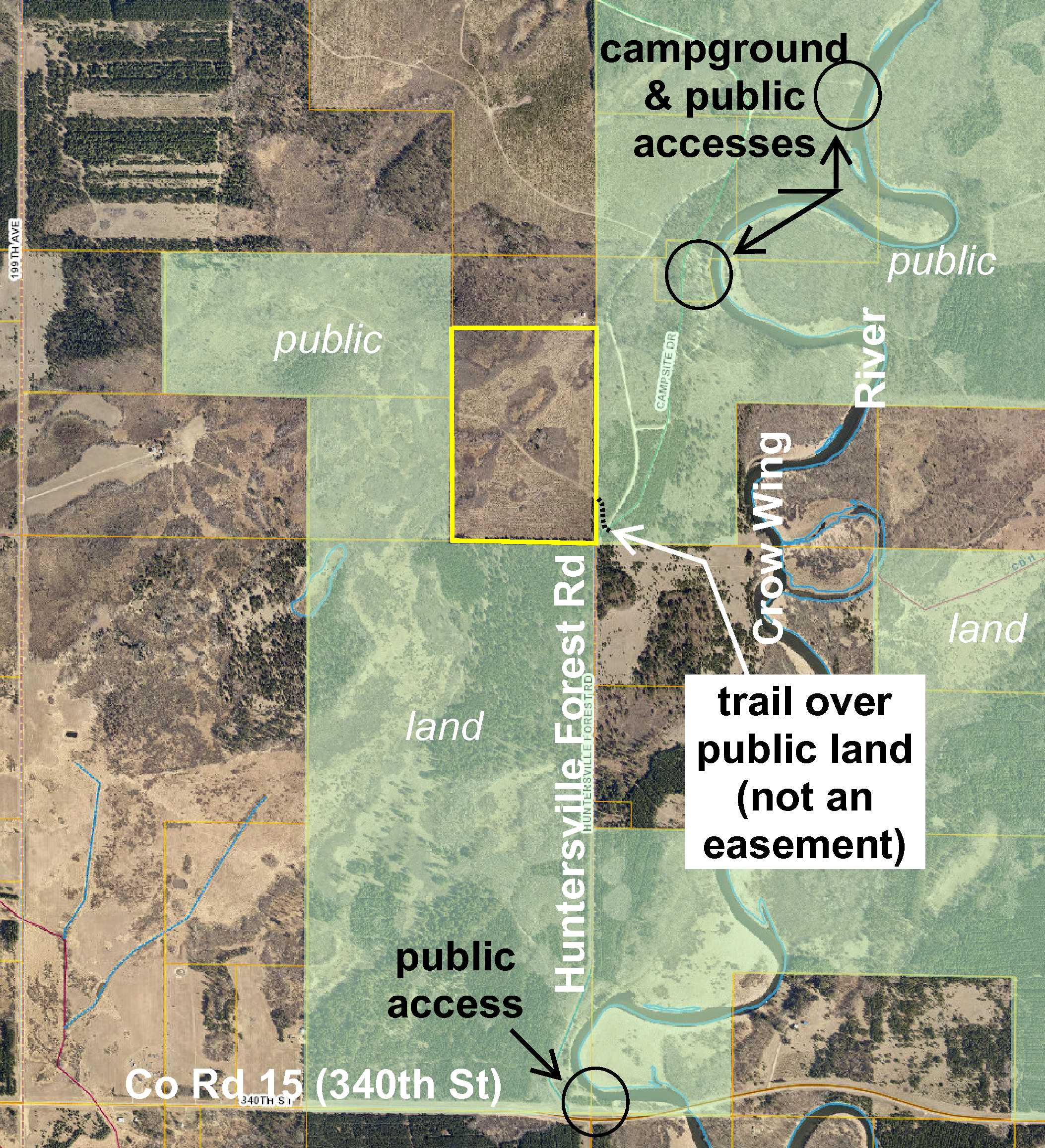
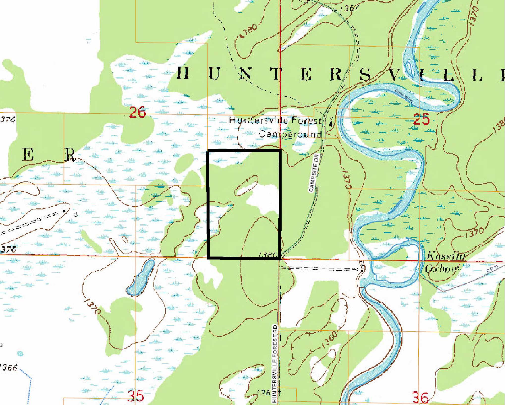
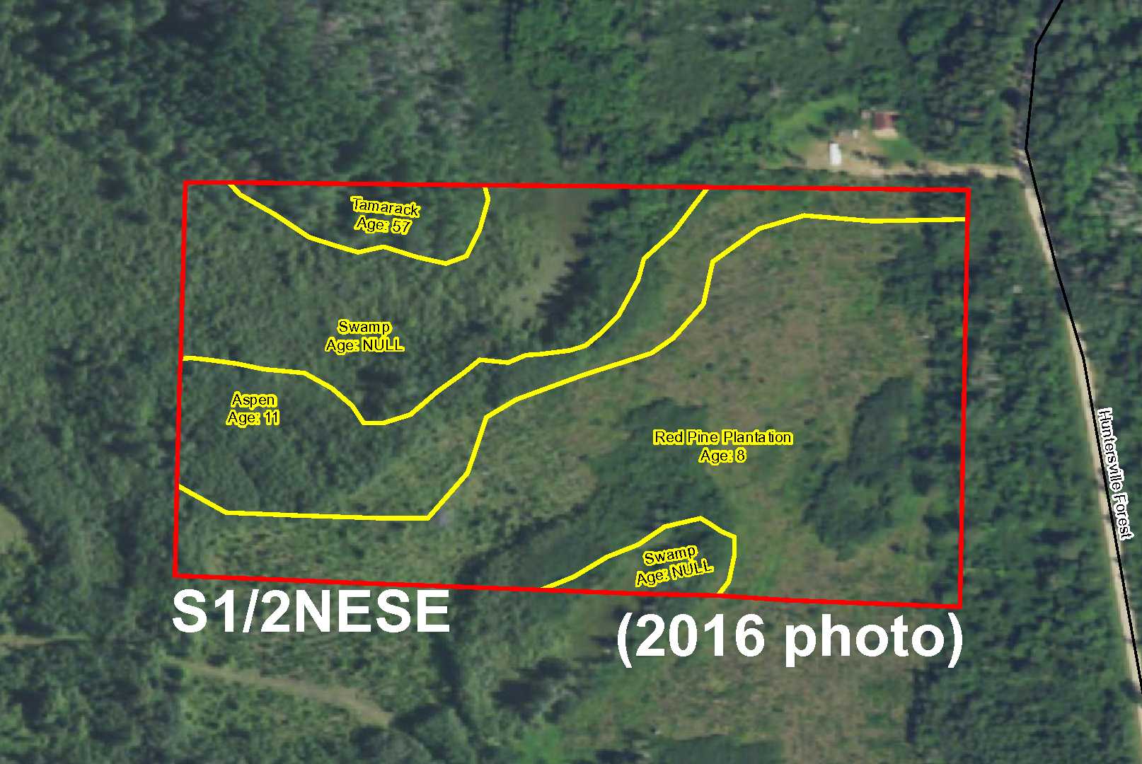
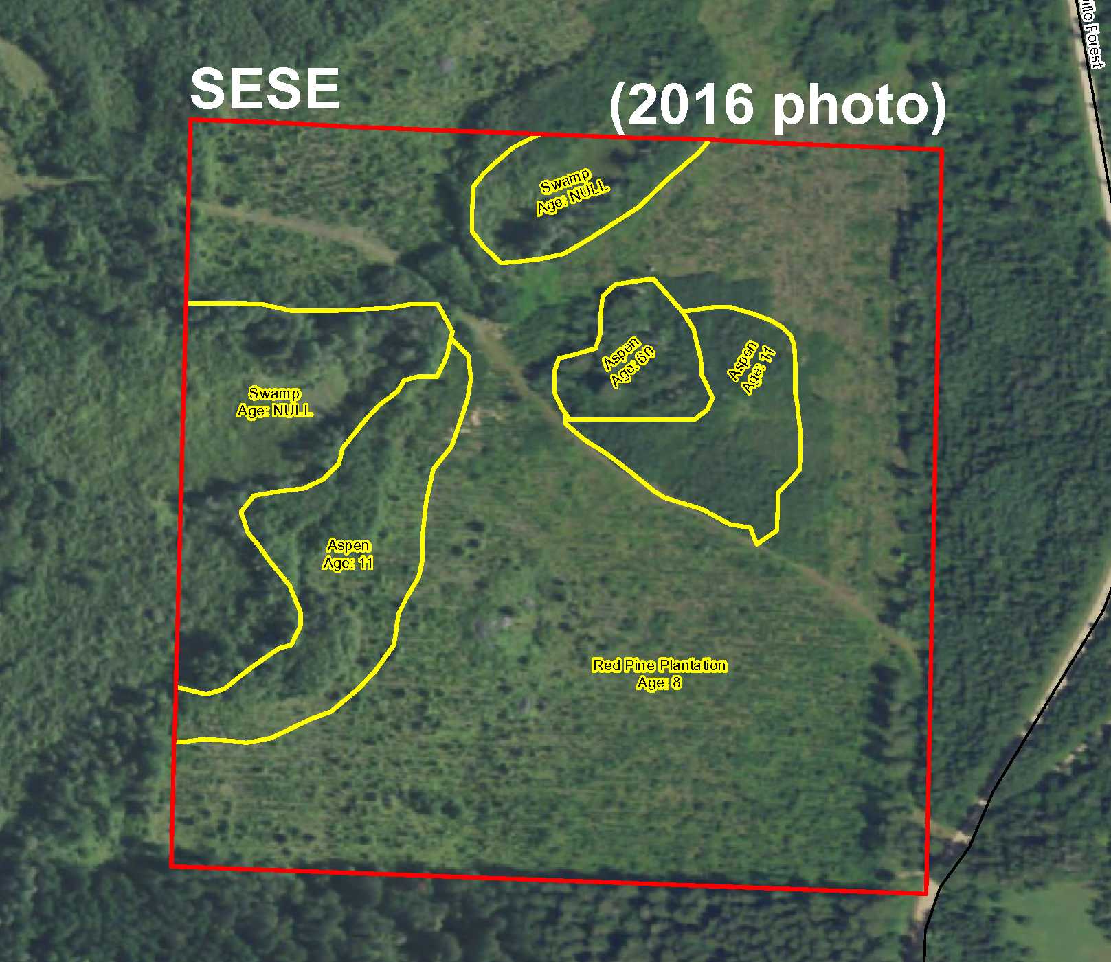
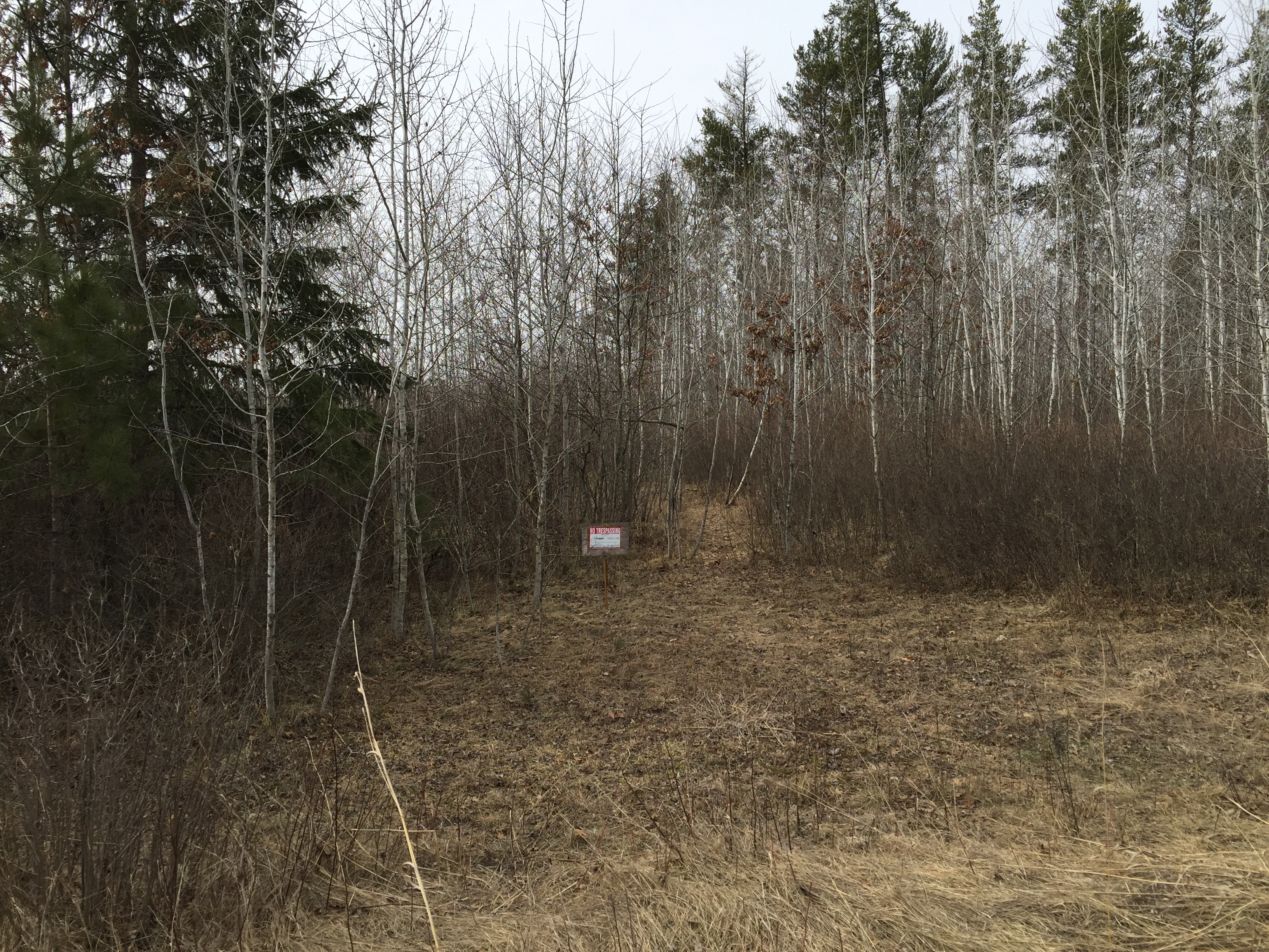
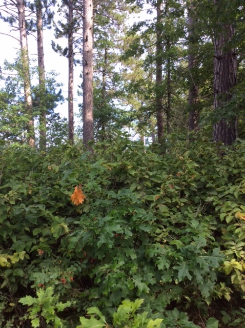
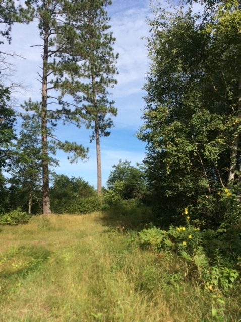
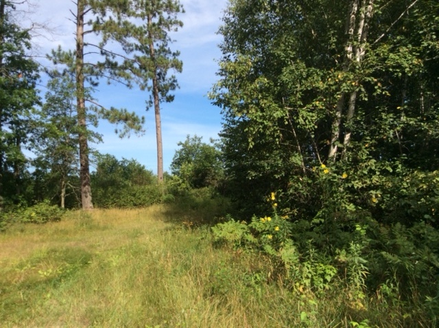
Potlatch acreage by the Crow Wing River east of Menahga. Fairly level topo with wetland along west side and in northwest corner and upland wooded with red pine, aspen, and tamarack. Public Huntersville State Forest land adjoins three sides. Huntersville Forest Rd touches SE corner, but trail over public land provides physical access (not an easement). Trail continues westerly through the entire tract. Huntersville Campground and three public accesses to the river are all within one mile.
Main Property Info
Property ID
120264040
120264040
MLS Number
4731359
4731359
Status
Sold
Sold
List Price
$79,900
$79,900
Selling Price
$72,500
$72,500
Acres
60
60
Zoning
A-2 Mixed Agriculture
A-2 Mixed Agriculture
City
Menahga
Menahga
Township
Shell River Twp
Shell River Twp
State
MN
MN
Zip Code
56464
56464
County
Wadena
Wadena
Legal Description
S1/2NESE & SESE, 26-138-34. Subject to Huntersville Forest Rd and any easements, restrictions, or reservations of record.
S1/2NESE & SESE, 26-138-34. Subject to Huntersville Forest Rd and any easements, restrictions, or reservations of record.
Property Location
Directions
From intersect of US Hwy 71 & CR 31/Co Rd 148/3rd St SE in Menahga, east on CR 31/CR 148 for 4 1/10 mile. Right on CR 23/Hubbard Rd 1 1/2 mile. Left on CR 15/340th St 4 mile. Left on Huntersville Forest Rd 1 mile to SE corner of the property. Continue approx 100 ft and take trail on left approx 350 ft through public land into the east side of the property.
From intersect of US Hwy 71 & CR 31/Co Rd 148/3rd St SE in Menahga, east on CR 31/CR 148 for 4 1/10 mile. Right on CR 23/Hubbard Rd 1 1/2 mile. Left on CR 15/340th St 4 mile. Left on Huntersville Forest Rd 1 mile to SE corner of the property. Continue approx 100 ft and take trail on left approx 350 ft through public land into the east side of the property.
Access
Legal access is via Huntersville Forest Rd which touches the SE corner of the property. Physical access is via a trail through public land (not an easement) approx 100 ft north of the SE corner. The trail enters the east side of the property and continues westerly through the entire tract.
Legal access is via Huntersville Forest Rd which touches the SE corner of the property. Physical access is via a trail through public land (not an easement) approx 100 ft north of the SE corner. The trail enters the east side of the property and continues westerly through the entire tract.
GPS Coordinates
Coordinates to approximate corners and points based on county mapping: SE corner where Huntersville Forest Rd touches = 46.7321, -94.9327; point where trail through public land enters east side near the SE corner = 46.7333, -94.9327; NE corner = 46.7376, -94.9327; NW corner = 46.7377, -94.9381; point where trail exits west side of the tract = 46.7354, -94.9380; SW corner = 46.7322, -94.9380.
Coordinates to approximate corners and points based on county mapping: SE corner where Huntersville Forest Rd touches = 46.7321, -94.9327; point where trail through public land enters east side near the SE corner = 46.7333, -94.9327; NE corner = 46.7376, -94.9327; NW corner = 46.7377, -94.9381; point where trail exits west side of the tract = 46.7354, -94.9380; SW corner = 46.7322, -94.9380.
Address
S2NESE&SESE Huntersville Forest Road
S2NESE&SESE Huntersville Forest Road
School District
Menahga - 821
Menahga - 821
Property Details
Dimensions (approx)
1980 x 1320 x 1980 x 1320
1980 x 1320 x 1980 x 1320
Utilities
Available Utilities
Electric
Electric
On Site Utilities
None
None
Power Company
Todd-Wadena Electric (1-800-320-8932)
Todd-Wadena Electric (1-800-320-8932)
Waterfront
Waterfront Name
Crow Wing River
Crow Wing River
Waterfront Number
S9990942
S9990942
Waterfront Feet (approx)
360
360
Taxes & Fees
Association Fee
$0
$0
Tax Amount
$1,172
$1,172
Assessment Amount
0
0
Tax With Assessments
$1,172
$1,172
Tax Year
2016
2016
Other Details
Section Number
26
26
Township Number
138
138
Range Number
34
34
Estimated Upland %
90
90
Estimated Wetland %
10
10
Additional Comments
Timber Comments
This property has been managed according to Forest Stewardship Council (FSC) standards. Timber includes aspen, red pine, and some tamarack. If timber value is important to you, seek the advice of a competent forester to determine species, volumes and values.
This property has been managed according to Forest Stewardship Council (FSC) standards. Timber includes aspen, red pine, and some tamarack. If timber value is important to you, seek the advice of a competent forester to determine species, volumes and values.
Hunting Comments
This property adjoins public land in MN Firearms Deer Zone 246.
This property adjoins public land in MN Firearms Deer Zone 246.
Disclosures
Legal access is via Huntersville Forest Rd which touches the SE corner of the property; however, physical access is via a trail through public land (not an easement). Not surveyed; acreage and dimensions approximate based on county data and mapping; county disclaimers included by reference. Photos/maps for convenience only and not guaranteed; tree cover may be different than depicted; physically inspect prior to purchase. Any deer stands on the land are not property of seller and are not included in sale. Use seller-approved PA and addendum; closing dates the 2nd Wednesday each month.
Legal access is via Huntersville Forest Rd which touches the SE corner of the property; however, physical access is via a trail through public land (not an easement). Not surveyed; acreage and dimensions approximate based on county data and mapping; county disclaimers included by reference. Photos/maps for convenience only and not guaranteed; tree cover may be different than depicted; physically inspect prior to purchase. Any deer stands on the land are not property of seller and are not included in sale. Use seller-approved PA and addendum; closing dates the 2nd Wednesday each month.


