
MLS Number : 6386364
Sold $35,000 - Home & Cabin Sites
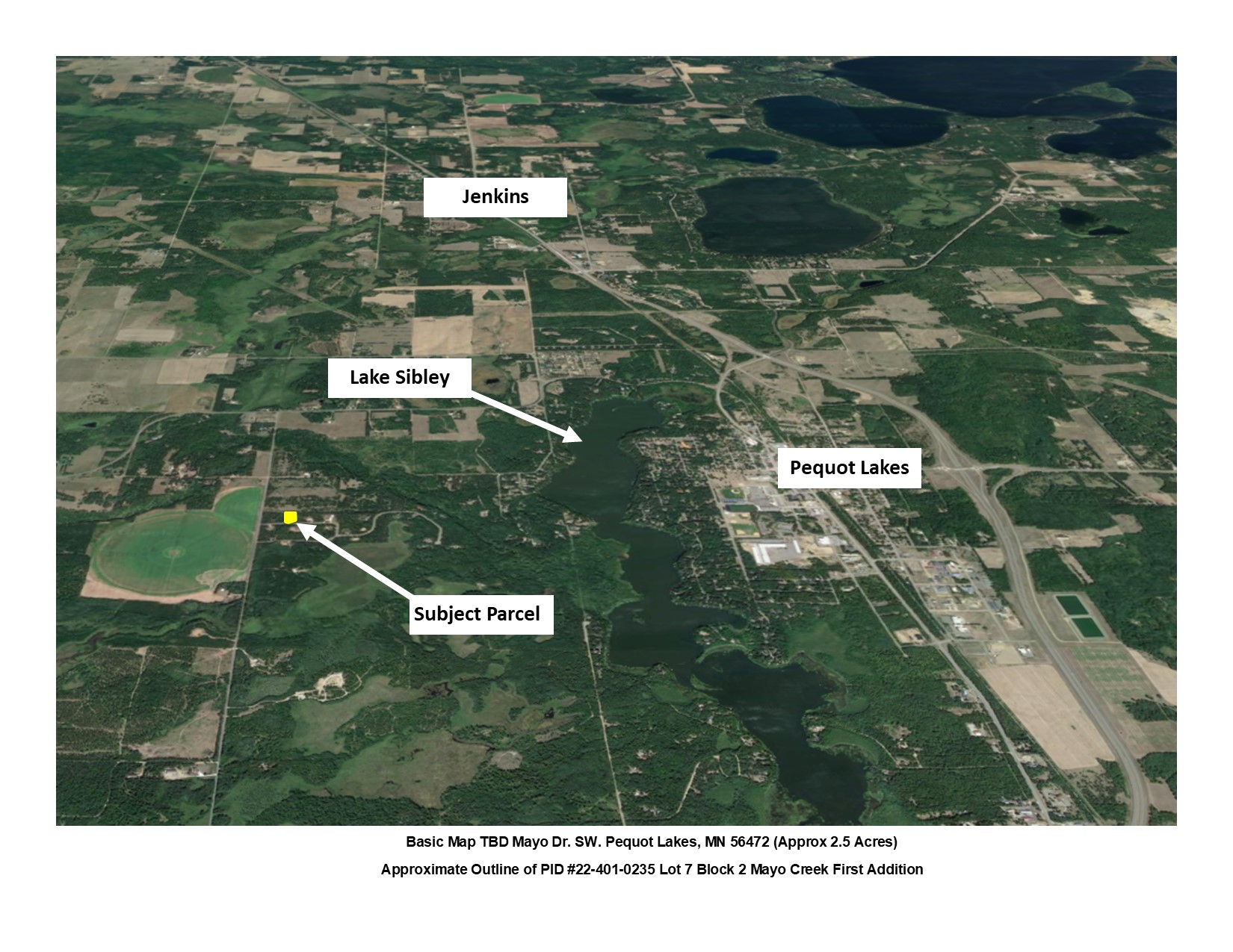
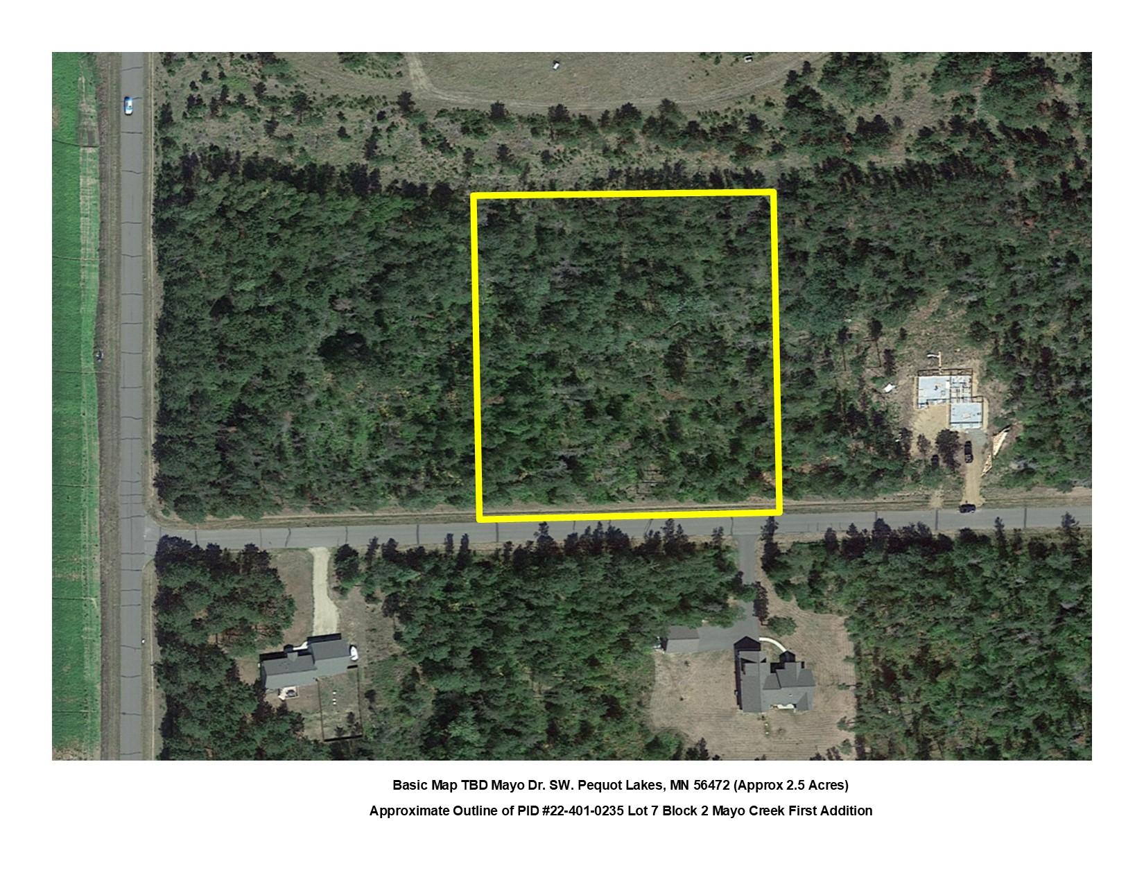
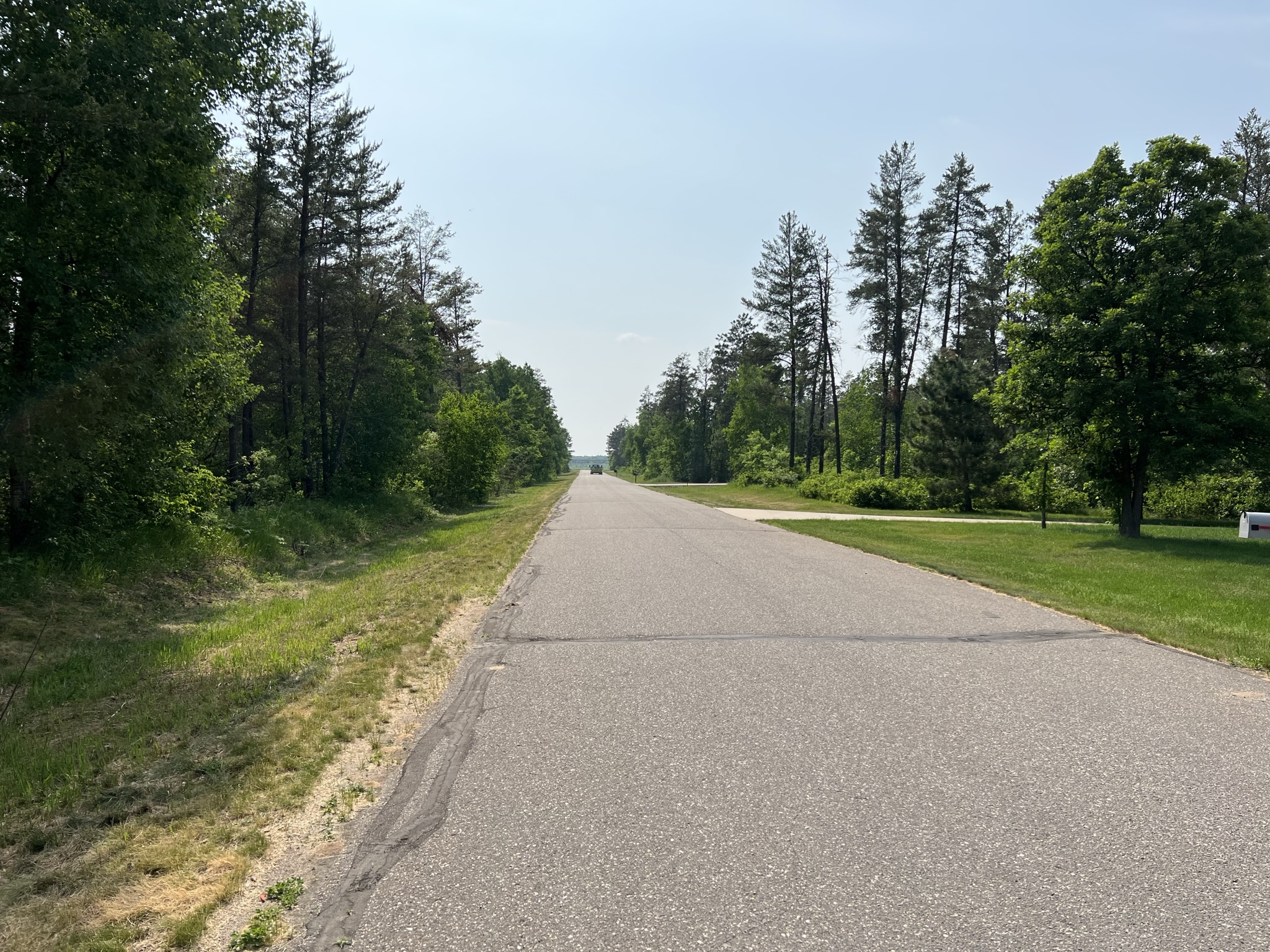
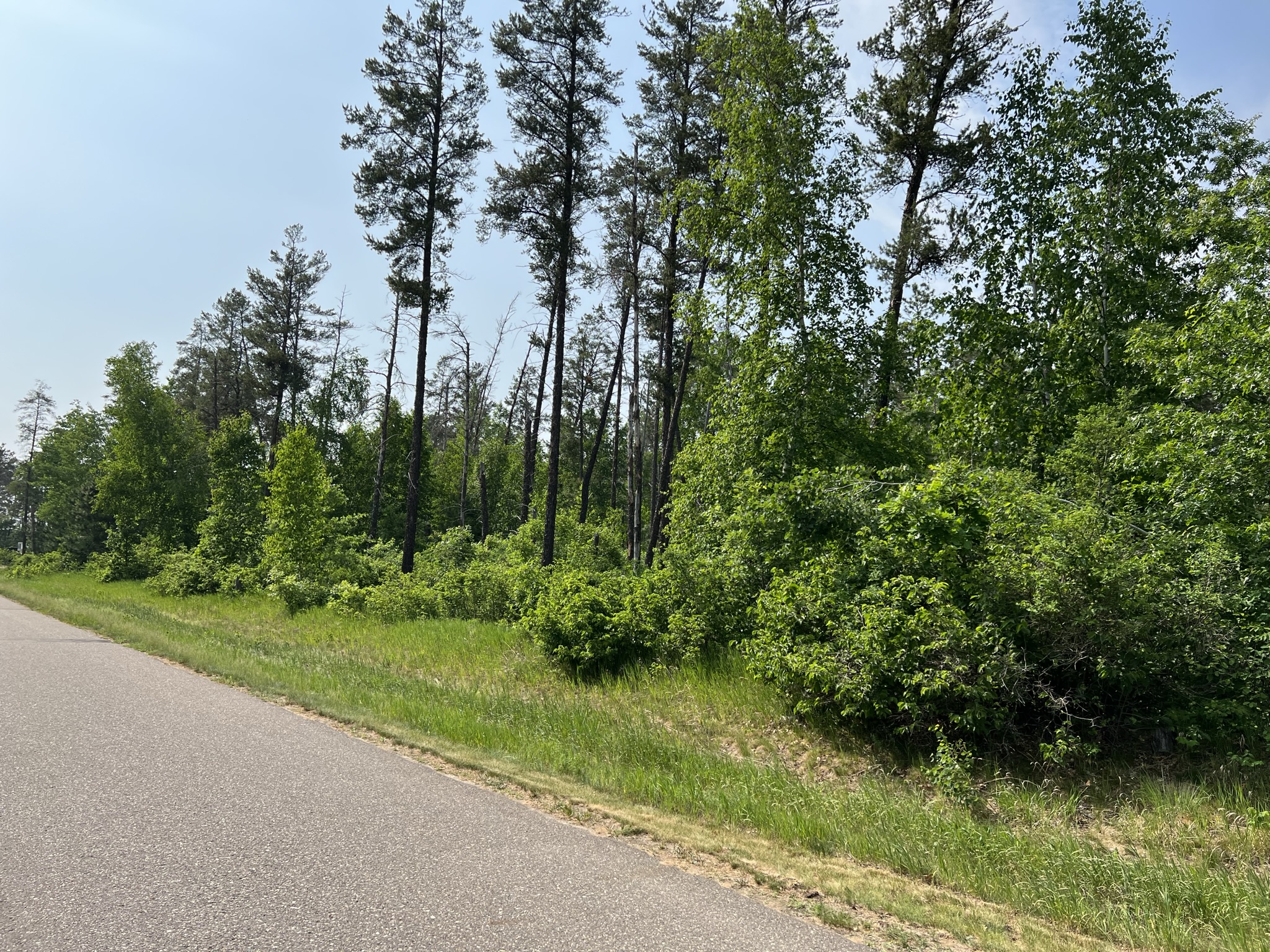
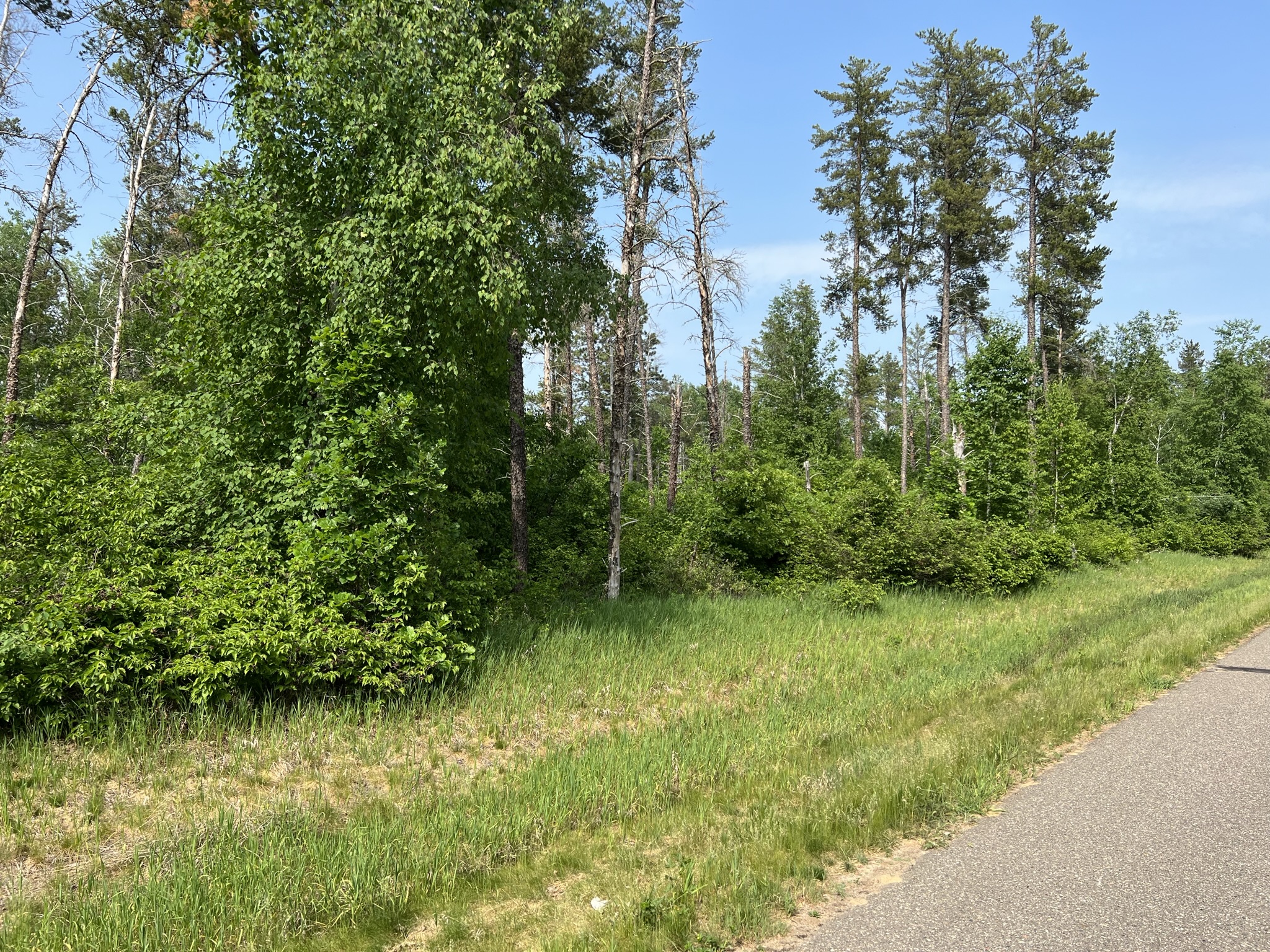
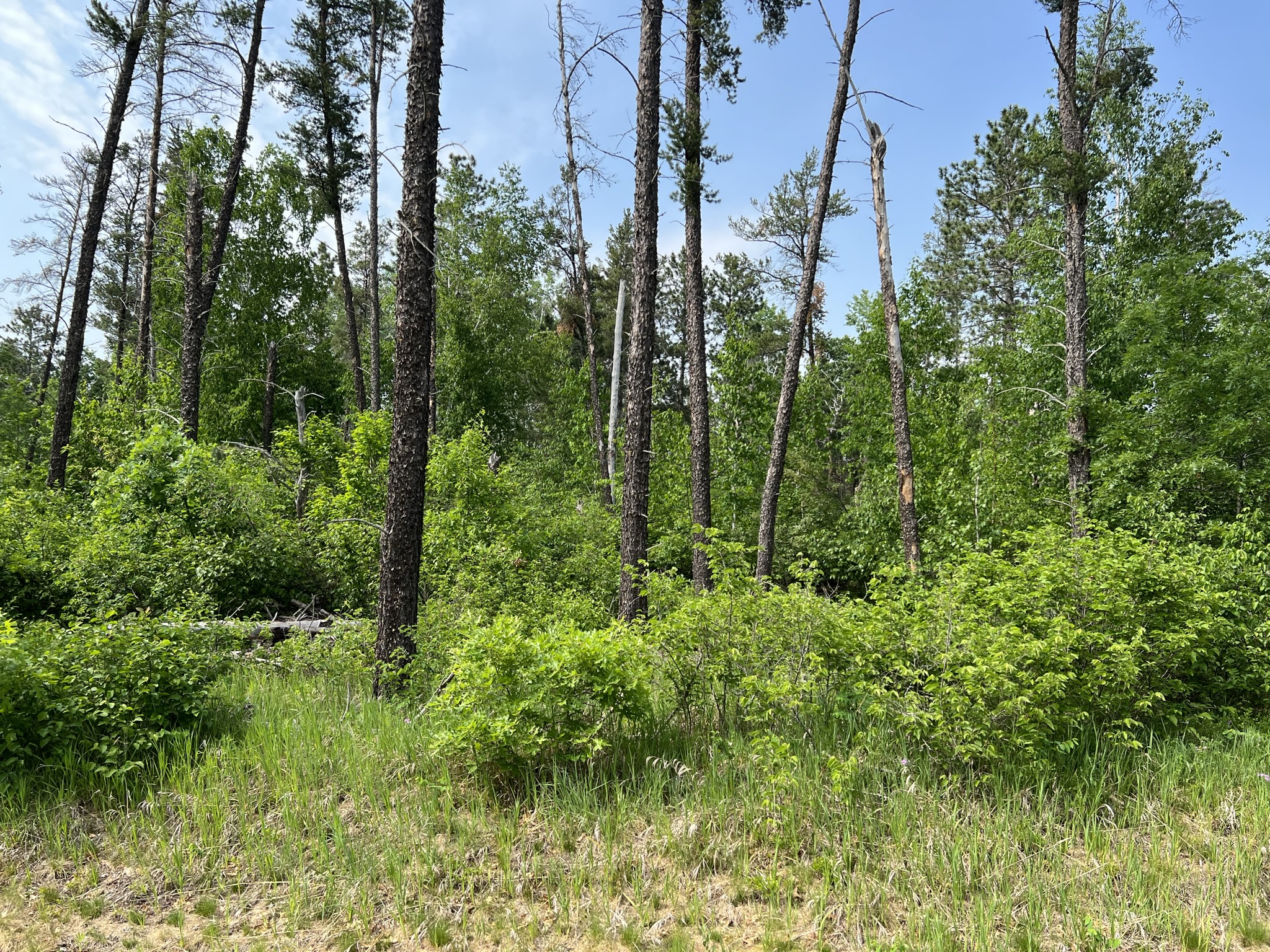
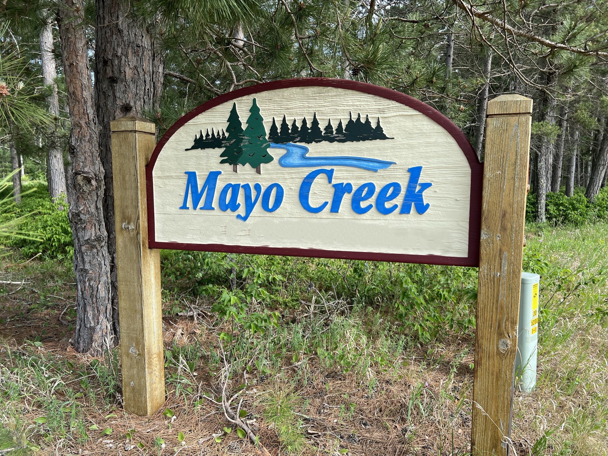
Price reduced from $44,000 to $39,700! Great building site on a 2.5 acre rural residential lot! This property benefits from a paved road with mature trees consisting of red pine, jack pine, oak and aspen. Nicely situated in a country setting just 3.5 miles west of Pequot Lakes. Close to lakes, trails, golf, dining, shopping and schools. This Mayo Creek residential development includes protective covenants to preserve the integrity of the neighborhood.
Main Property Info
Property ID
224010235
224010235
MLS Number
6386364
6386364
Status
Sold
Sold
List Price
$39,700
$39,700
Selling Price
$35,000
$35,000
Acres
2.5
2.5
Zoning
RR 2.5
RR 2.5
City
Pequot Lakes
Pequot Lakes
Township
Loon Lake Twp
Loon Lake Twp
State
MN
MN
Zip Code
56472
56472
County
Cass
Cass
Legal Description
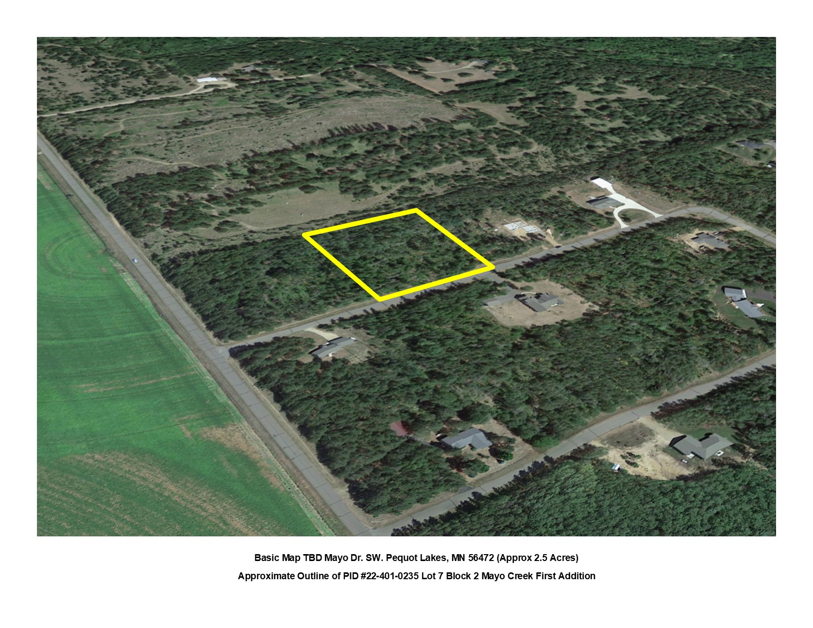
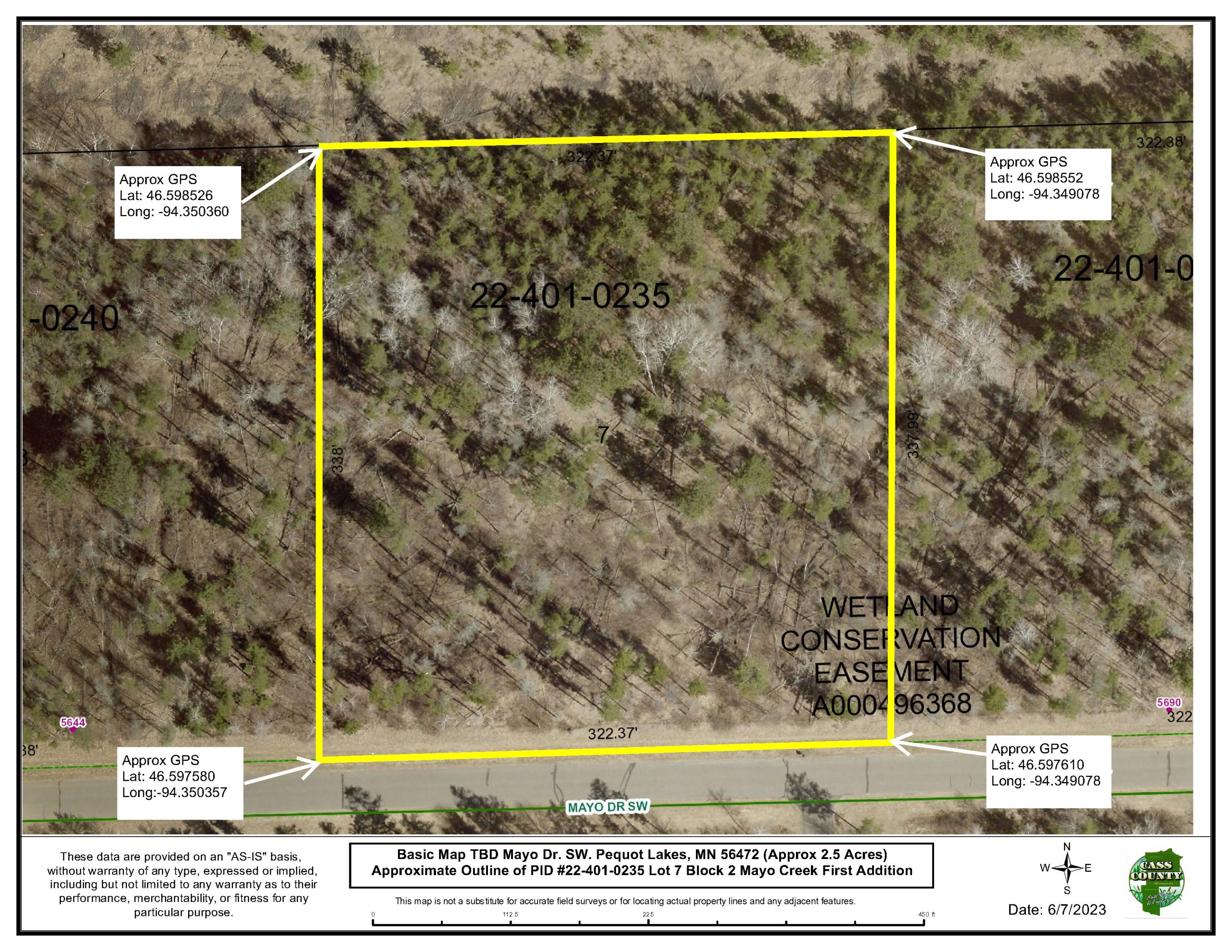
LOT 7, BLK 2 MAYO CREEK FIRST ADDITION, 16-136-29 Cass County MN. Subject to Covenants DOC# A000496908, Wetland Conservation Easement DOC# A000496368 and any restrictions or reservations of record. (Full Legal to Govern. PID# 224010235.)
LOT 7, BLK 2 MAYO CREEK FIRST ADDITION, 16-136-29 Cass County MN. Subject to Covenants DOC# A000496908, Wetland Conservation Easement DOC# A000496368 and any restrictions or reservations of record. (Full Legal to Govern. PID# 224010235.)
Property Location
Directions
From State Hwy 371 & Co Rd 17 intersection on the north edge of Pequot, Go west on Co Rd 17 for 1.9 mi. Turn Left (south) on 13th Ave SW go 0.7 mi. Turn Left (east) on Mayo Dr. SW. Go 1/8 Mile to Lot 7, Block 2 on the left side (N) of the road.
From State Hwy 371 & Co Rd 17 intersection on the north edge of Pequot, Go west on Co Rd 17 for 1.9 mi. Turn Left (south) on 13th Ave SW go 0.7 mi. Turn Left (east) on Mayo Dr. SW. Go 1/8 Mile to Lot 7, Block 2 on the left side (N) of the road.
Access
North side of Mayo Dr. SW
North side of Mayo Dr. SW
GPS Coordinates
Coordinates to approximate corners/points based on county mapping: NW: Lat: 46.598526 Long: -94.350360 NE: Lat: 46.598552 Long: -94.349078 SE: Lat: 46.597610 Long: -94.349078 SW: Lat: 46.597580 Long:-94.350357
Coordinates to approximate corners/points based on county mapping: NW: Lat: 46.598526 Long: -94.350360 NE: Lat: 46.598552 Long: -94.349078 SE: Lat: 46.597610 Long: -94.349078 SW: Lat: 46.597580 Long:-94.350357
Address
TBD Mayo Dr. SW, Pequot Lakes
TBD Mayo Dr. SW, Pequot Lakes
Neighborhood
Mayo Creek
Mayo Creek
School District
Pequot Lakes - 186
Pequot Lakes - 186
Property Details
Wooded Acres
2.4
2.4
Dimensions (approx)
322'x338'x322'x337'
322'x338'x322'x337'
Utilities
Available Utilities
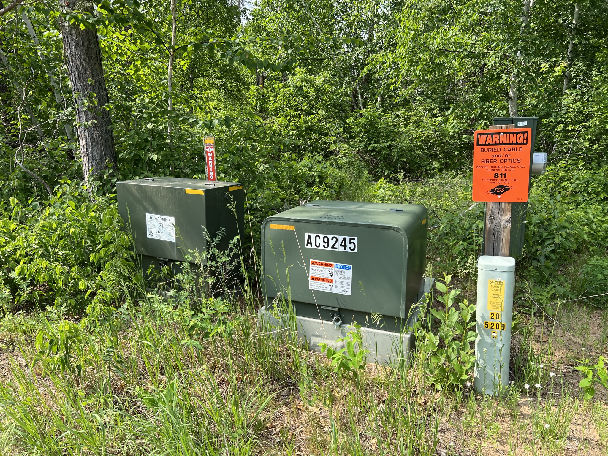
Electricity, Fiber Optic, Phone
Electricity, Fiber Optic, Phone
On Site Utilities
None
None
Power Company
Crow Wing Power (1-800-648-9401)
Crow Wing Power (1-800-648-9401)
Taxes & Fees
Tax Amount
$210
$210
Tax With Assessments
$210
$210
Tax Year
2023
2023
Other Details
Section Number
16
16
Township Number
136
136
Range Number
29
29
Estimated Upland %
99
99
Additional Comments
Timber Comments
Mature trees consisting of red pine, jack pine, oak and aspen.
Mature trees consisting of red pine, jack pine, oak and aspen.
Hunting Comments
Deer Permit Area 246
Deer Permit Area 246
Disclosures
Covenants are provided regarding uses and construction. (See DOC# A000496908) A Wetland Easement affects this property. (See DOC# A000496368) Acreage, dimensions, and taxes estimated based on county data and mapping or seller data; county disclaimers included by reference. Photos/maps and GPS coordinates for convenience only and not guaranteed; physically inspect prior to purchase.
Covenants are provided regarding uses and construction. (See DOC# A000496908) A Wetland Easement affects this property. (See DOC# A000496368) Acreage, dimensions, and taxes estimated based on county data and mapping or seller data; county disclaimers included by reference. Photos/maps and GPS coordinates for convenience only and not guaranteed; physically inspect prior to purchase.


