

MLS Number : 4694824
Sold $63,900 - Hunting & Recreation
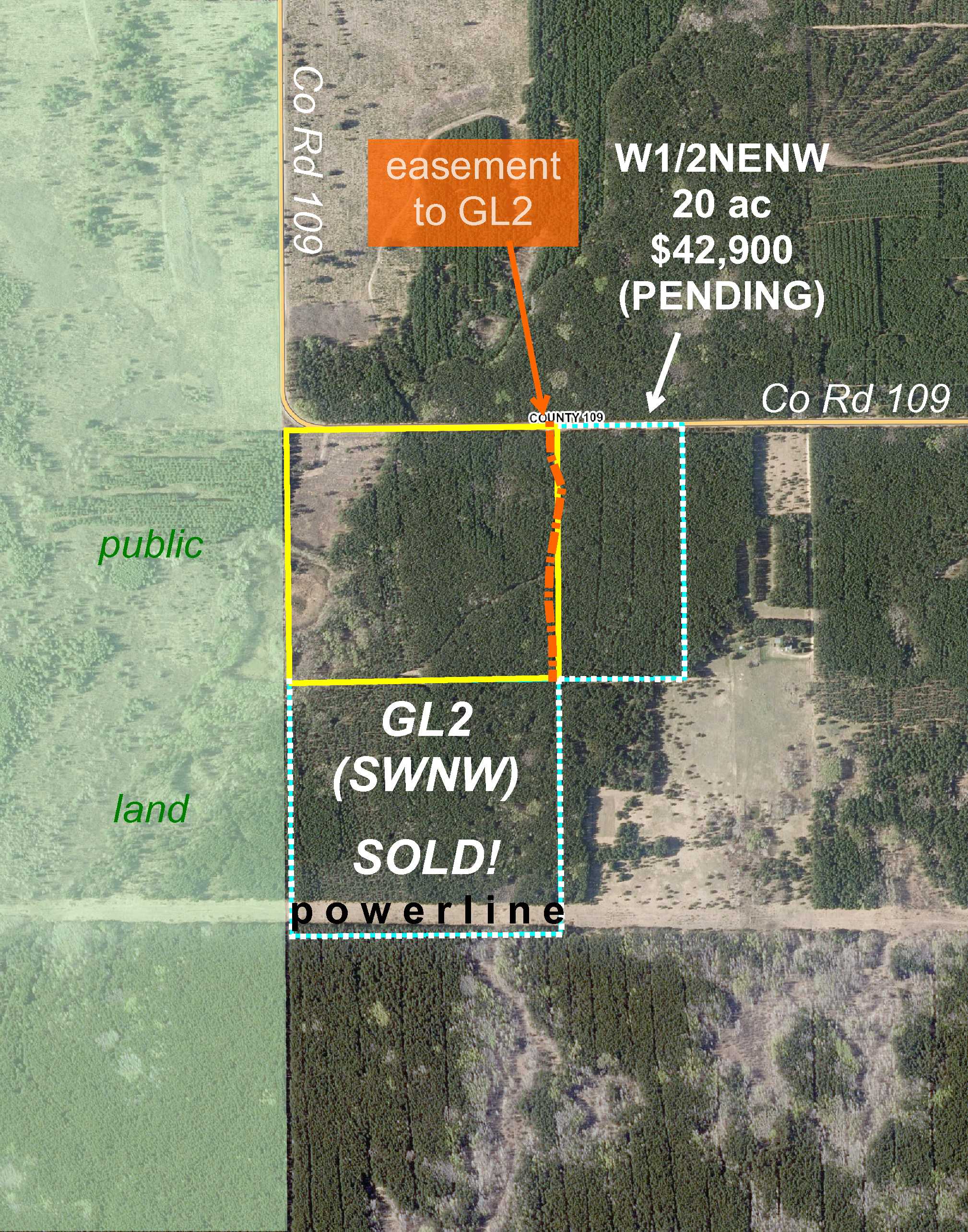
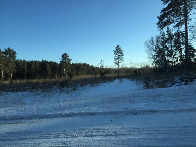
Potlatch land just outside Badoura State Forest south of Akeley. Generally-level upland w/ touch of wetland on the west side. Good access via gravel county road less than 3 miles west of State Hwy 64, and trails make interior areas of the land accessible. The west side adjoins thousands of acres of public land. Only a short drive from the Crow Wing Chain of Lakes and Crow Wing Chain WMA, and there are numerous snowmobile trails in the area as well.
Main Property Info
Property ID
033100700
033100700
MLS Number
4694824
4694824
Status
Sold
Sold
List Price
$69,900
$69,900
Selling Price
$63,900
$63,900
Acres
42.950
42.950
Zoning
not zoned
not zoned
City
Menahga
Menahga
Township
Badoura Twp
Badoura Twp
State
MN
MN
Zip Code
56464
56464
County
Hubbard
Hubbard
Legal Description
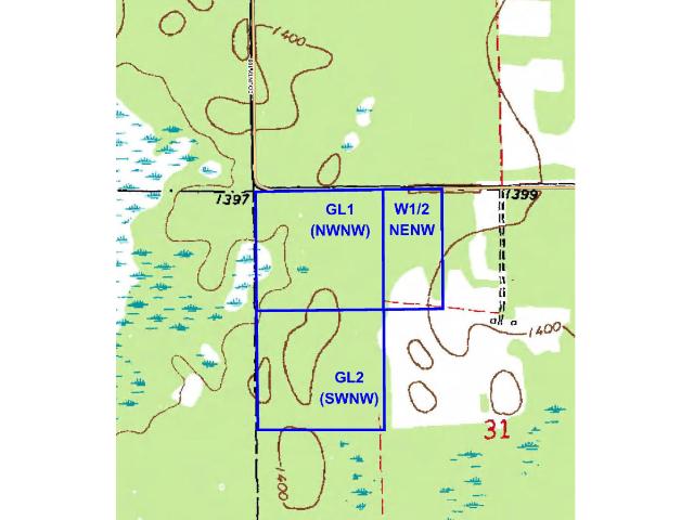
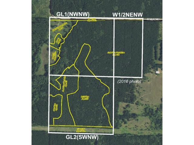
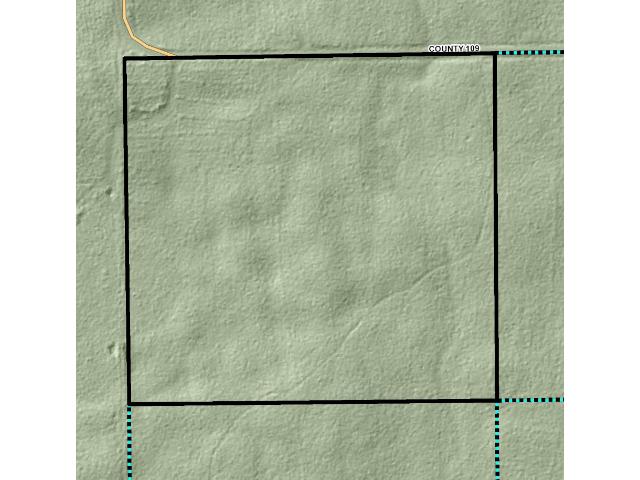
GL1(NWNW), 31-139-32. Subject to Co Rd 109; easement over existing trail on the east side (see Supplements); and any other easements, restrictions, or reservations of record.
GL1(NWNW), 31-139-32. Subject to Co Rd 109; easement over existing trail on the east side (see Supplements); and any other easements, restrictions, or reservations of record.
Property Location
Directions
From State Hwy 34 & State Hwy 64 in Akeley, south on State Hwy 64 (Marie Ave SE) 13 miles. Right on CR 109 approx 2 3/4 miles to trail on the left leading into the northeast corner and along the east side of the property.
From State Hwy 34 & State Hwy 64 in Akeley, south on State Hwy 64 (Marie Ave SE) 13 miles. Right on CR 109 approx 2 3/4 miles to trail on the left leading into the northeast corner and along the east side of the property.
Access
Access is via a gravel Co Rd 109 along the north boundary. An easement trail near the east boundary provides access through the property to adjoining tracts, and the trail branches off to the west as well making interior areas of this property accessible.
Access is via a gravel Co Rd 109 along the north boundary. An easement trail near the east boundary provides access through the property to adjoining tracts, and the trail branches off to the west as well making interior areas of this property accessible.
GPS Coordinates
Coordinates to approx corners & points based on county mapping: NE corner along Co Rd 109 (near entrance of easement trail) = 46.8185, -94.7816; SE corner = 46.8148, -94.7815; point where easement trail exits south boundary = 46.8148, -94.7820; SW corner = 46.8148, -94.7872; NW corner = 46.8185, -94.7873.
Coordinates to approx corners & points based on county mapping: NE corner along Co Rd 109 (near entrance of easement trail) = 46.8185, -94.7816; SE corner = 46.8148, -94.7815; point where easement trail exits south boundary = 46.8148, -94.7820; SW corner = 46.8148, -94.7872; NW corner = 46.8185, -94.7873.
Address
GL1(NWNW) County Road 109
GL1(NWNW) County Road 109
School District
Walker-Hackensack-Akeley - 113
Walker-Hackensack-Akeley - 113
Property Details
Dimensions (approx)
1320x1320x1320x1320
1320x1320x1320x1320
Utilities
Available Utilities
Electric
Electric
On Site Utilities
None
None
Power Company
Itasca-Mantrap Co-op (1-888-713-3377)
Itasca-Mantrap Co-op (1-888-713-3377)
Taxes & Fees
Association Fee
$0
$0
Tax Amount
$466
$466
Tax With Assessments
$466
$466
Tax Year
2016
2016
Other Details
Section Number
31
31
Township Number
139
139
Range Number
32
32
Estimated Upland %
95
95
Estimated Wetland %
5
5
Additional Comments
Timber Comments
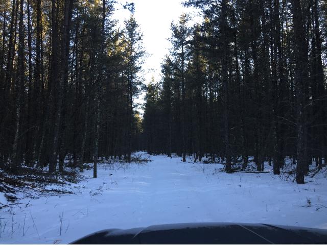
This property has been managed according to Forest Stewardship Council (FSC) standards. It is mostly wooded with jack pine along with spots of red pine and aspen. If timber value is important to you, seek the advice of a competent forester to determine species, volumes and values.
This property has been managed according to Forest Stewardship Council (FSC) standards. It is mostly wooded with jack pine along with spots of red pine and aspen. If timber value is important to you, seek the advice of a competent forester to determine species, volumes and values.
Hunting Comments
This property adjoins public land in MN Firearms Deer Zone 246. There are thousands of acres of the adjoining public land, and the Crow Wing Chain Wildlife Management Area (WMA) is just a short drive away as well.
This property adjoins public land in MN Firearms Deer Zone 246. There are thousands of acres of the adjoining public land, and the Crow Wing Chain Wildlife Management Area (WMA) is just a short drive away as well.
Disclosures
Subject to easement over existing trail along the east side. Not surveyed; acreage and dimensions approximate based on county data and mapping; county disclaimers included by reference. Photos/maps for convenience only and not guaranteed; tree cover may be different than depicted; physically inspect prior to purchase. Any deer stands on the land are not property of seller and are not included in sale. Use seller-approved PA and addendum; closing dates the 2nd Wednesday each month.
Subject to easement over existing trail along the east side. Not surveyed; acreage and dimensions approximate based on county data and mapping; county disclaimers included by reference. Photos/maps for convenience only and not guaranteed; tree cover may be different than depicted; physically inspect prior to purchase. Any deer stands on the land are not property of seller and are not included in sale. Use seller-approved PA and addendum; closing dates the 2nd Wednesday each month.


