


MLS Number : 6452014
Active $299,500 - Home & Cabin Sites, Hunting & Recreation
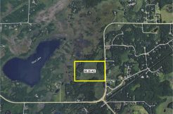
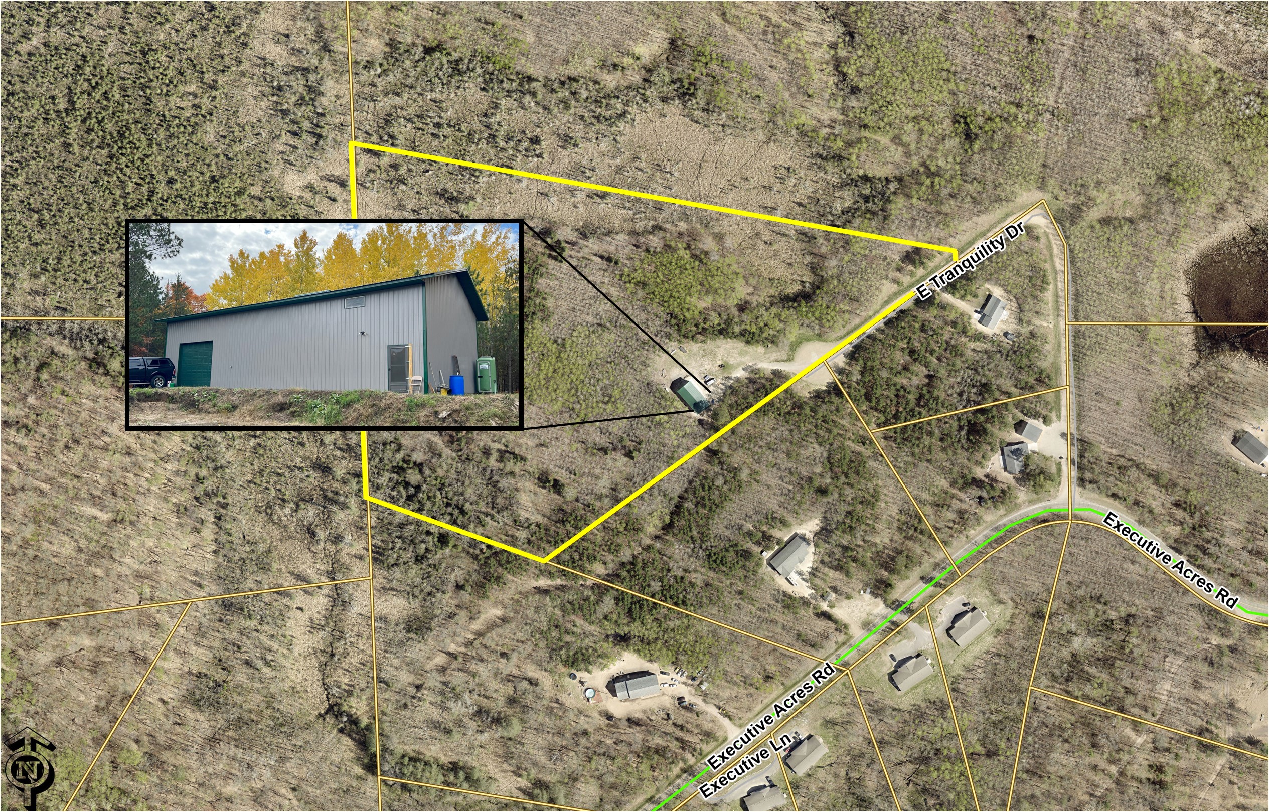
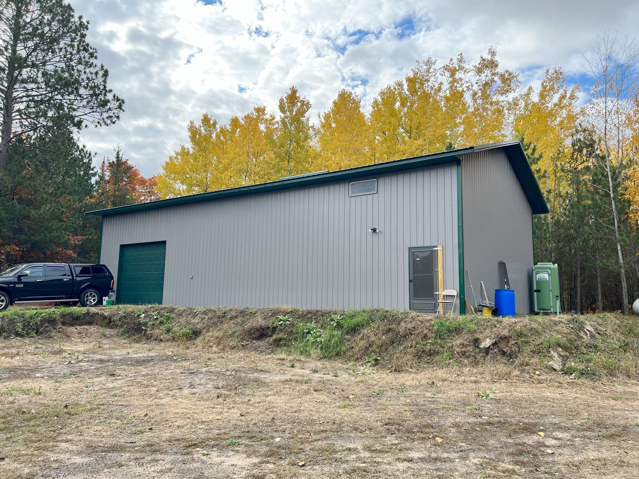
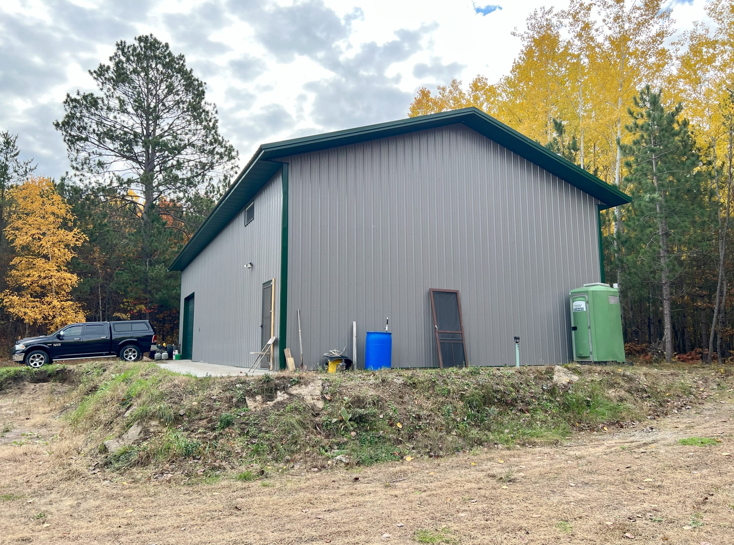
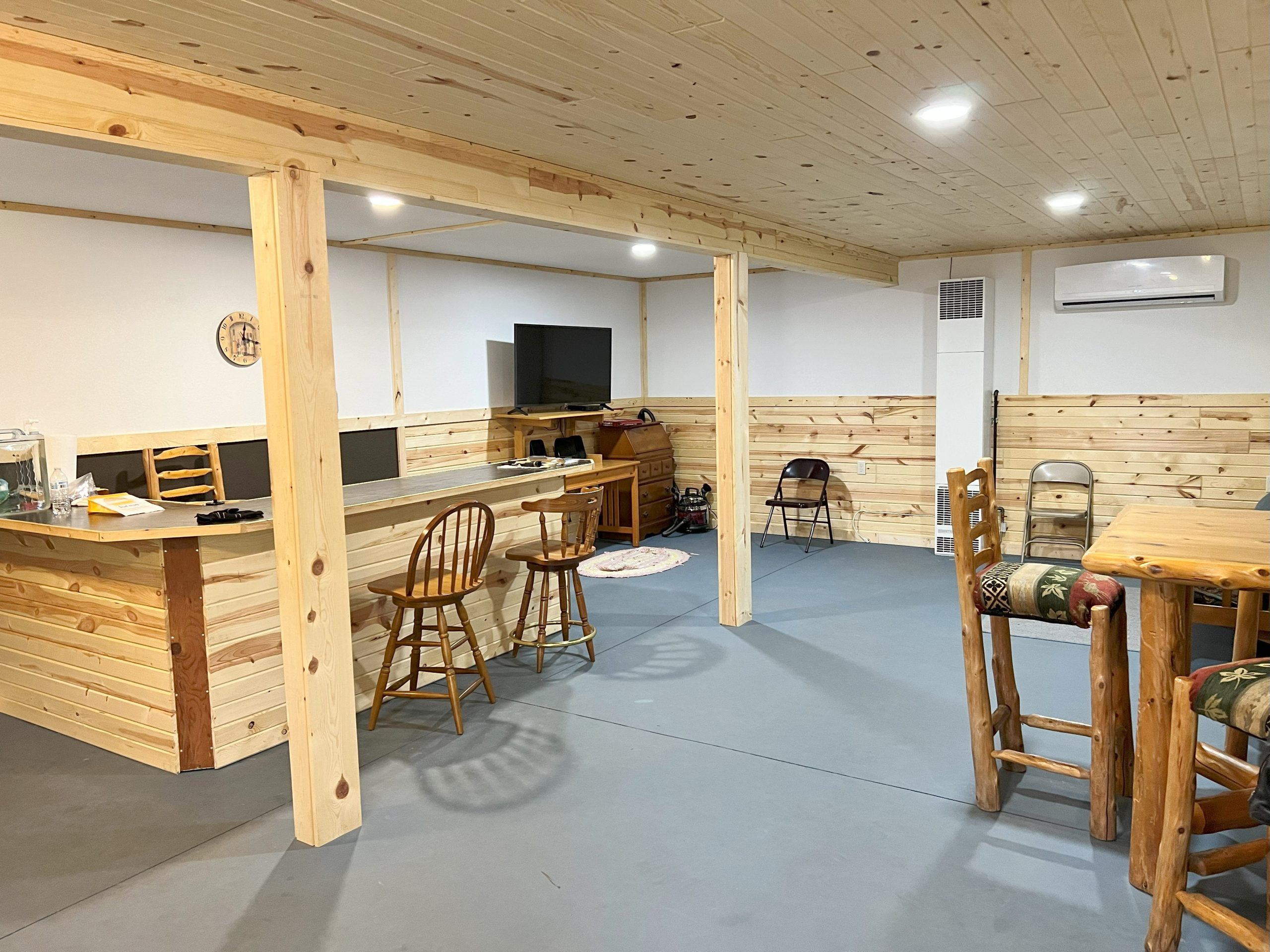
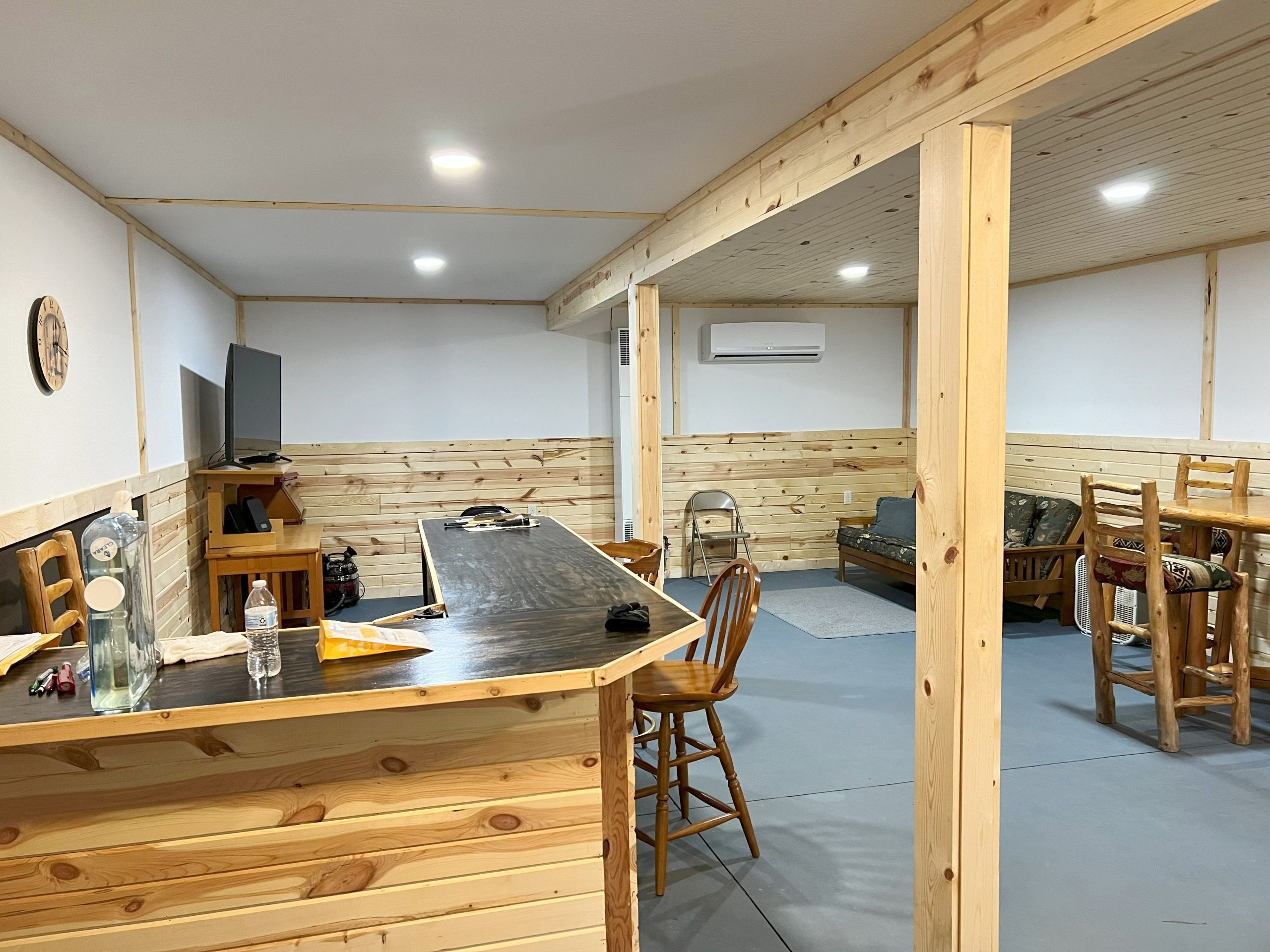
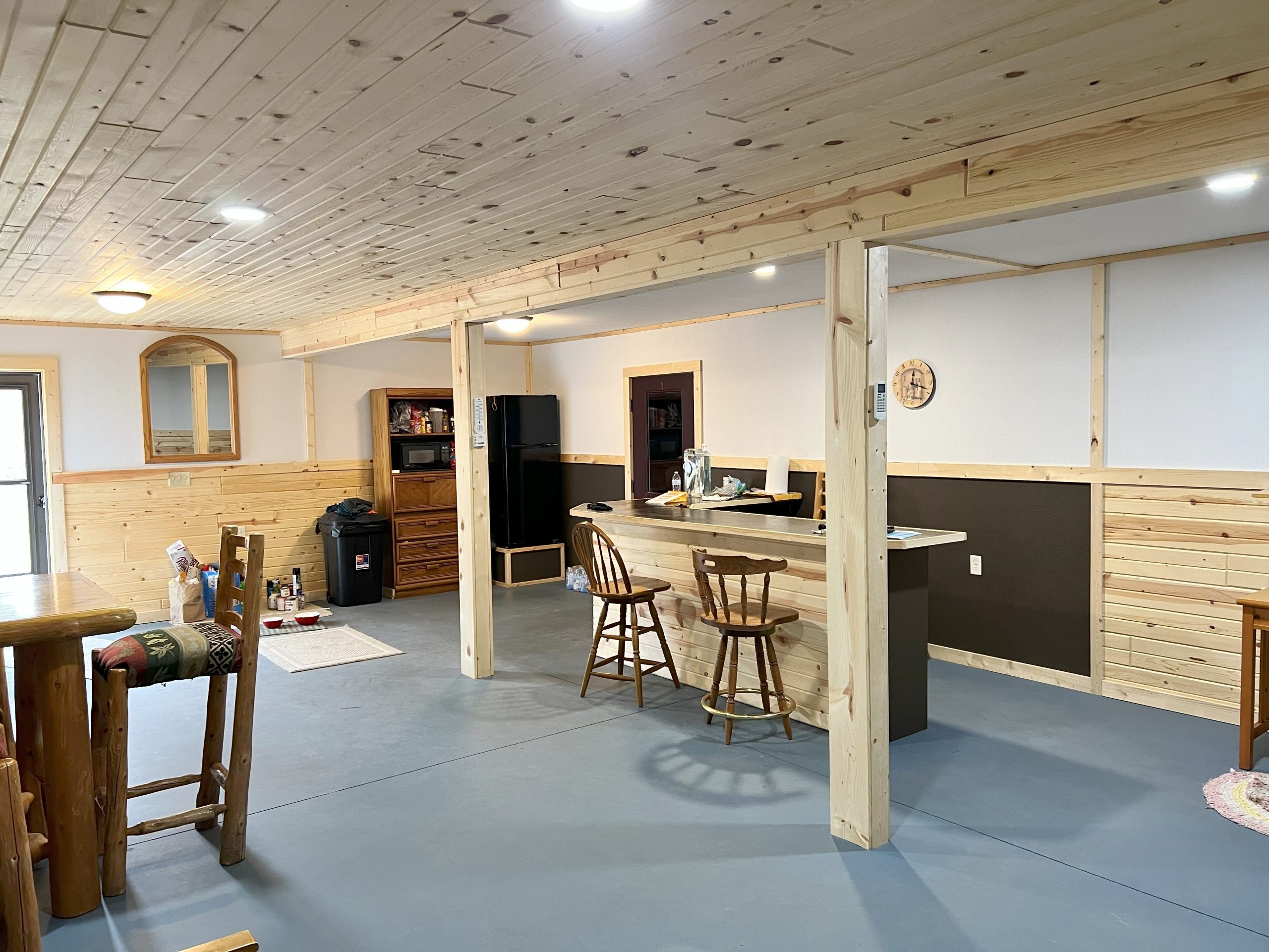
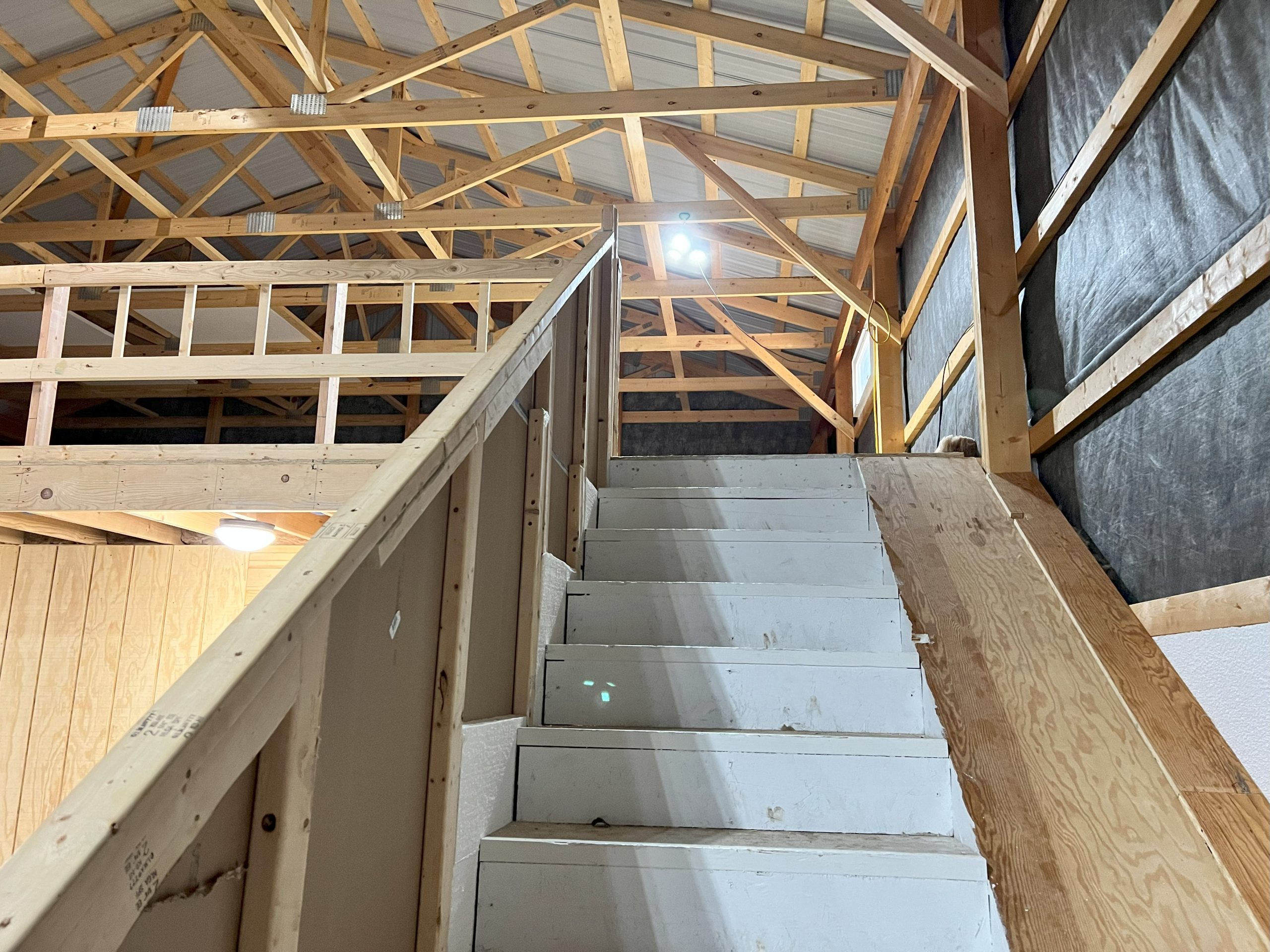
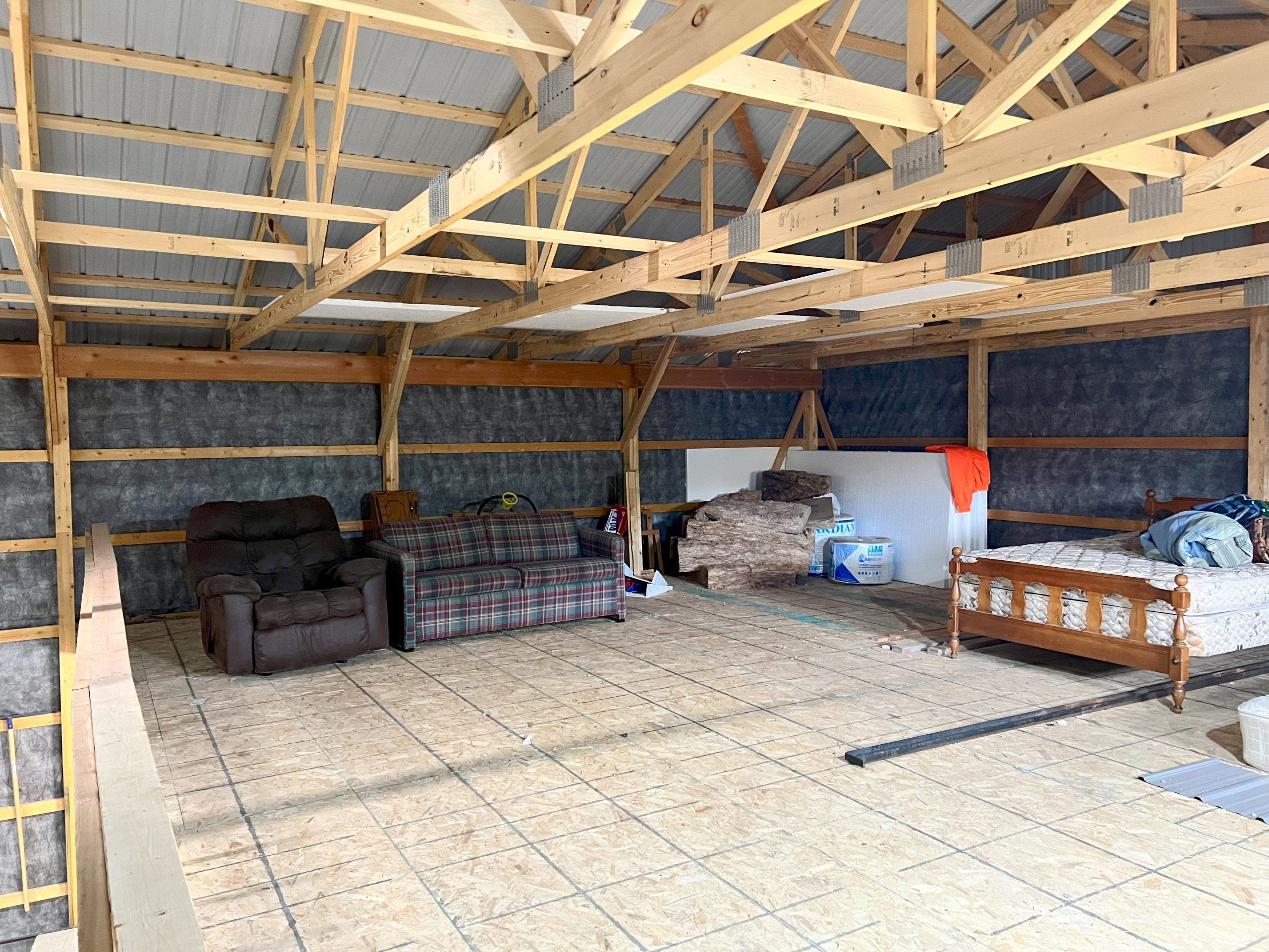
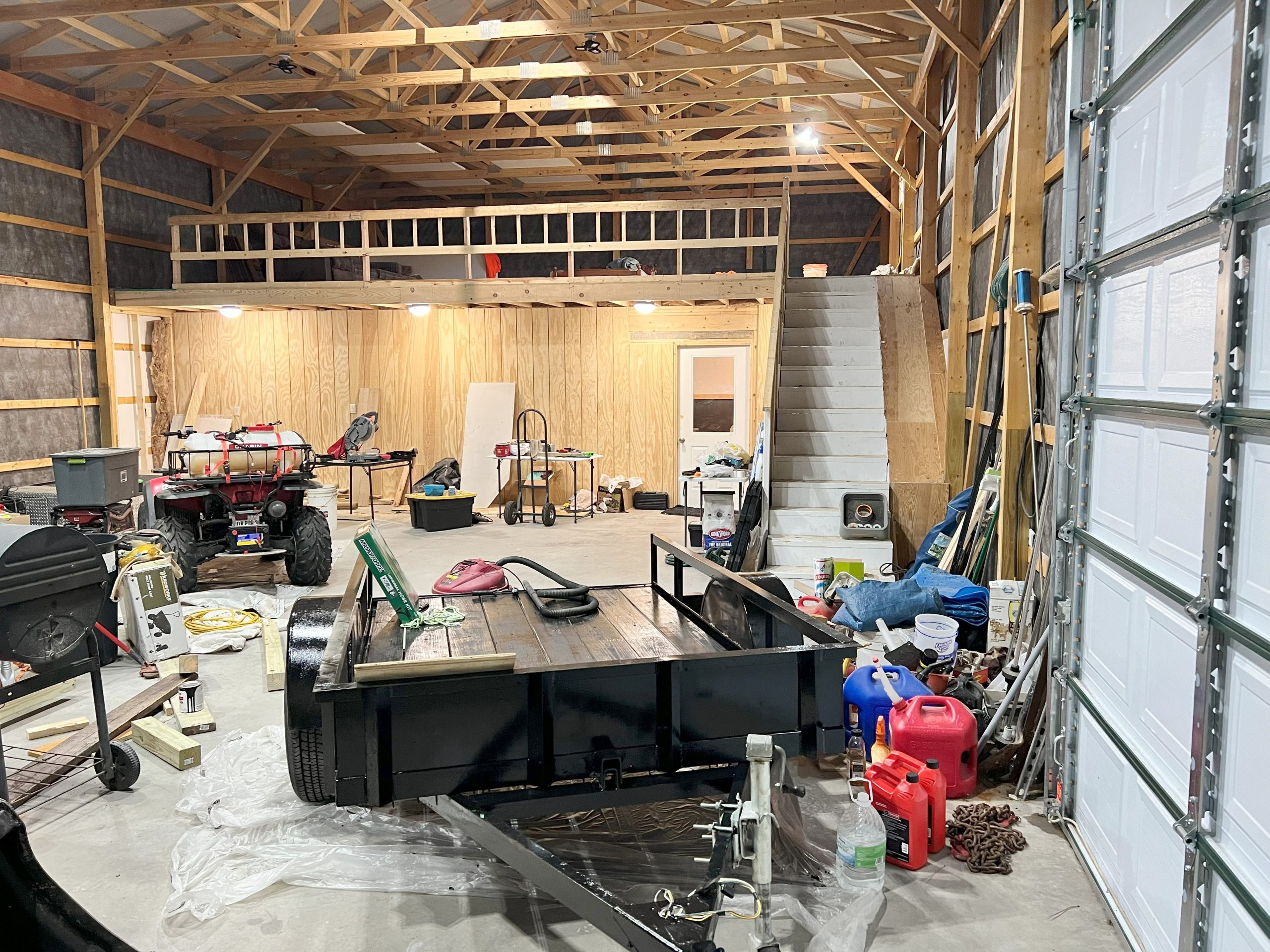
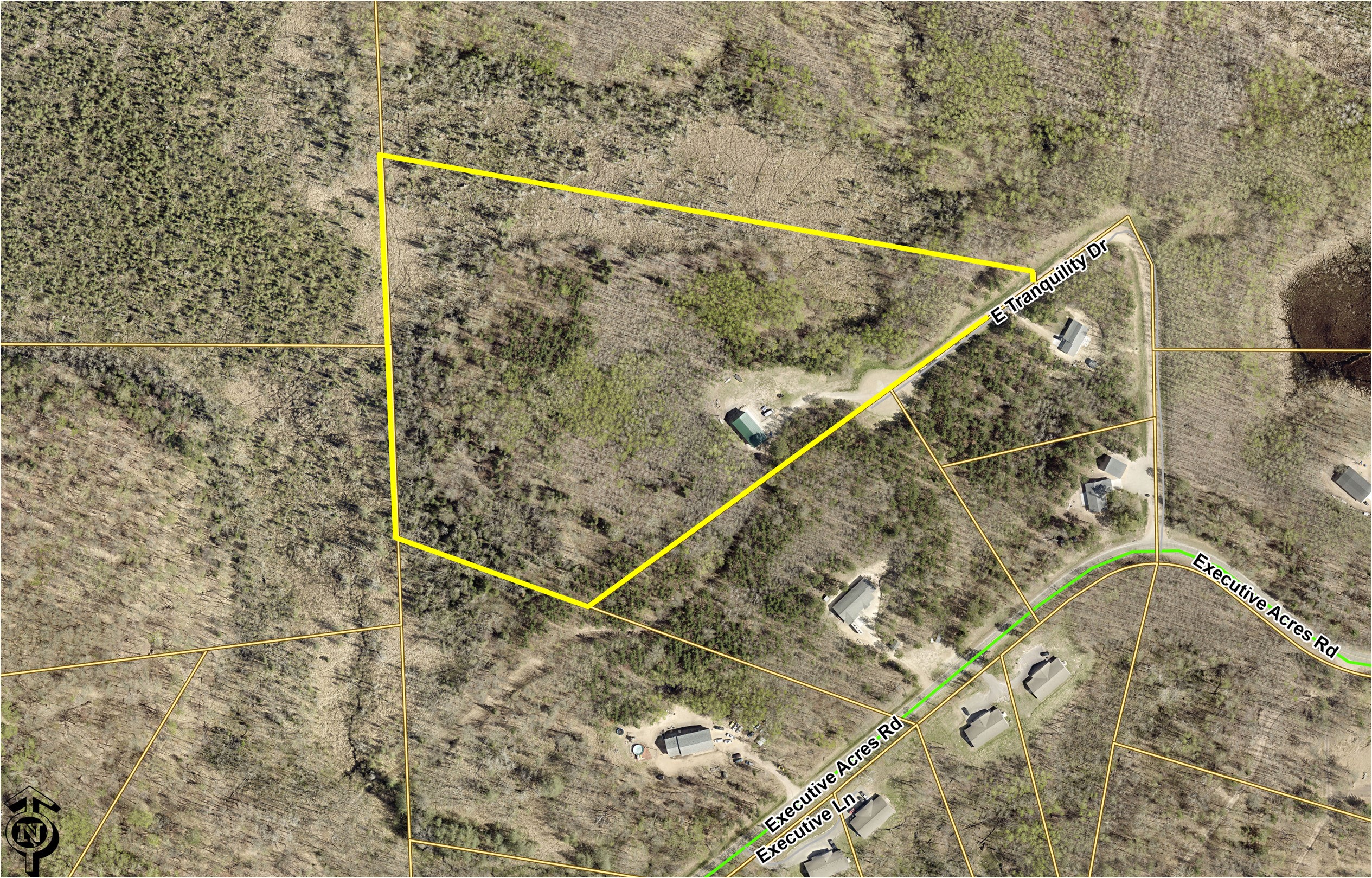
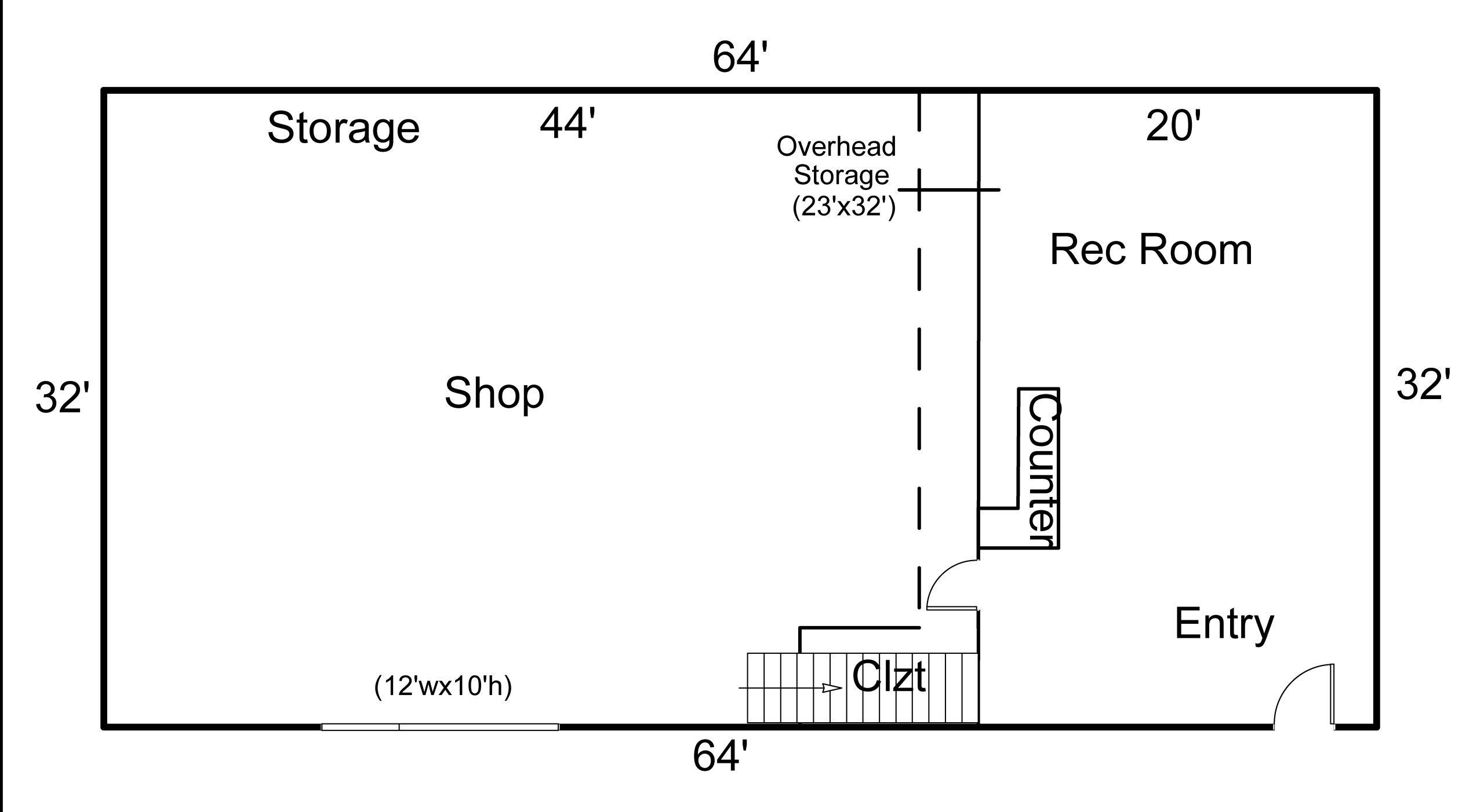
Nestled in a tranquil setting, this 16-acre property offers endless possibilities. Whether it’s starting a small farm, creating a private oasis, or simply enjoying the serenity of nature. One particular highlight is the versatile pole building that encompasses both practicality and leisure. The spacious 32′ x 64′ shop section provides ample room to house your equipment and tools, while the high ceilings and overhead door make it suitable for storing large items such as boats, RVs, or tractors. Adjacent to the shop area, the rec room is the perfect retreat for relaxation and entertainment.
Main Property Info
Property ID
99120655
99120655
MLS Number
6452014
6452014
Status
Active
Active
List Price
$299,500
$299,500
Acres
16.20
16.20
Zoning
Rural Residential 2.5 & Rural Residential 5
Rural Residential 2.5 & Rural Residential 5
City
Brainerd
Brainerd
Township
First Assessment Twp
First Assessment Twp
State
MN
MN
Zip Code
56401
56401
County
Crow Wing
Crow Wing
Legal Description
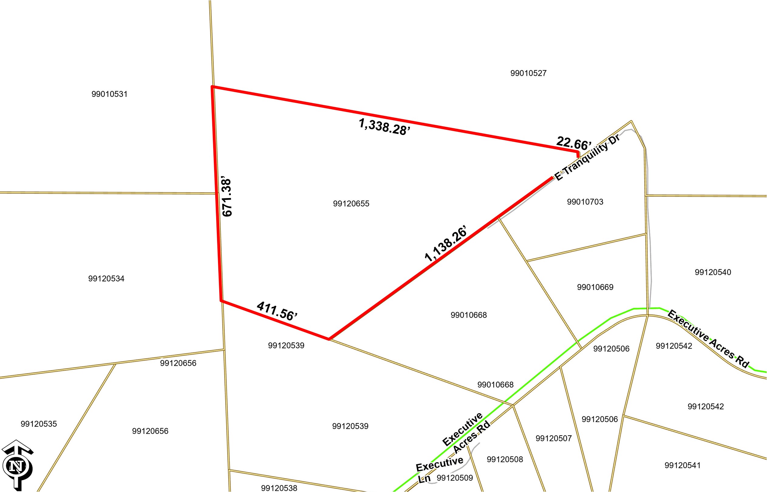
Pt of NW 1/4 of NE 1/4 Sec 12 Twp 134 Rng 28 & pt of SE 1/4 of SE 1/4 & pt of SW 1/4 of SE 1/4 of Sec 1 Twp 134 Rng 28 desc as fol comm at NW cor of Lot 1 Executive Acres W line of sd lot one bears S 03D 02’ 00” E then S 72D 35’ 45” alg S’ly ROW line of Executive Acres Rd Nelson’s River Woods 92.03 ft then S 73D 01’ 54” W alg sd ROW 428.1 ft then W’ly alg sd ROW 339.73 ft alg a tang curve concave to NE rad 353 ft & C/A of 55D 08’ 31” then N 51D 49’ 35” W alg sd ROW tang to sd curve 180.3 ft then W’ly 139.3 ft alg tang curve concave to S rad 212 ft C/A of 37D 38’ 52” alg sd ROW to point referred to as point A then cont W’ly 124.03 ft alg sd 212 ft rad curve concave to S C/A of 33D 31’ 15” then S 57D 00’ 18” tang to last desc curve 72.47 ft alg sd ROW then S 50D 38’ 06” W 395.65 alg sd ROW to point referred to as point B then rev N 50D 38’ 06” E 395.65 then N 57D 00’ 18” E 72.47 ft then E’ly 124.03 ft alg a tang curve concave to S rad 212 ft C/A 33D 31’ 15” to sd point A then N 01D 00’ 34” W 601.77 ft then N 26D 28’ 37” W 108.53 ft then S 54D 00’ 57” W 1138.26 ft to line which bears N 70D 10’ 44” W from sd point B then N 70D 10’ 44” W 411.56 to W line of NW 1/4 of NE 1/4 then N 02D 10’ 40” W 386.42 alg sd W line of NWNE to NW cor of sd NWNE then N 02D 26’ 44” W 384.96 ft alg W line of sd SW 1/4 of SE 1/4 to line that bears N 79D 46’ 43” W from POB then S 79D 46’ 43” E 1360.94 ft to POB tog/w esmnt of rec.
Pt of NW 1/4 of NE 1/4 Sec 12 Twp 134 Rng 28 & pt of SE 1/4 of SE 1/4 & pt of SW 1/4 of SE 1/4 of Sec 1 Twp 134 Rng 28 desc as fol comm at NW cor of Lot 1 Executive Acres W line of sd lot one bears S 03D 02’ 00” E then S 72D 35’ 45” alg S’ly ROW line of Executive Acres Rd Nelson’s River Woods 92.03 ft then S 73D 01’ 54” W alg sd ROW 428.1 ft then W’ly alg sd ROW 339.73 ft alg a tang curve concave to NE rad 353 ft & C/A of 55D 08’ 31” then N 51D 49’ 35” W alg sd ROW tang to sd curve 180.3 ft then W’ly 139.3 ft alg tang curve concave to S rad 212 ft C/A of 37D 38’ 52” alg sd ROW to point referred to as point A then cont W’ly 124.03 ft alg sd 212 ft rad curve concave to S C/A of 33D 31’ 15” then S 57D 00’ 18” tang to last desc curve 72.47 ft alg sd ROW then S 50D 38’ 06” W 395.65 alg sd ROW to point referred to as point B then rev N 50D 38’ 06” E 395.65 then N 57D 00’ 18” E 72.47 ft then E’ly 124.03 ft alg a tang curve concave to S rad 212 ft C/A 33D 31’ 15” to sd point A then N 01D 00’ 34” W 601.77 ft then N 26D 28’ 37” W 108.53 ft then S 54D 00’ 57” W 1138.26 ft to line which bears N 70D 10’ 44” W from sd point B then N 70D 10’ 44” W 411.56 to W line of NW 1/4 of NE 1/4 then N 02D 10’ 40” W 386.42 alg sd W line of NWNE to NW cor of sd NWNE then N 02D 26’ 44” W 384.96 ft alg W line of sd SW 1/4 of SE 1/4 to line that bears N 79D 46’ 43” W from POB then S 79D 46’ 43” E 1360.94 ft to POB tog/w esmnt of rec.
Property Location
Directions
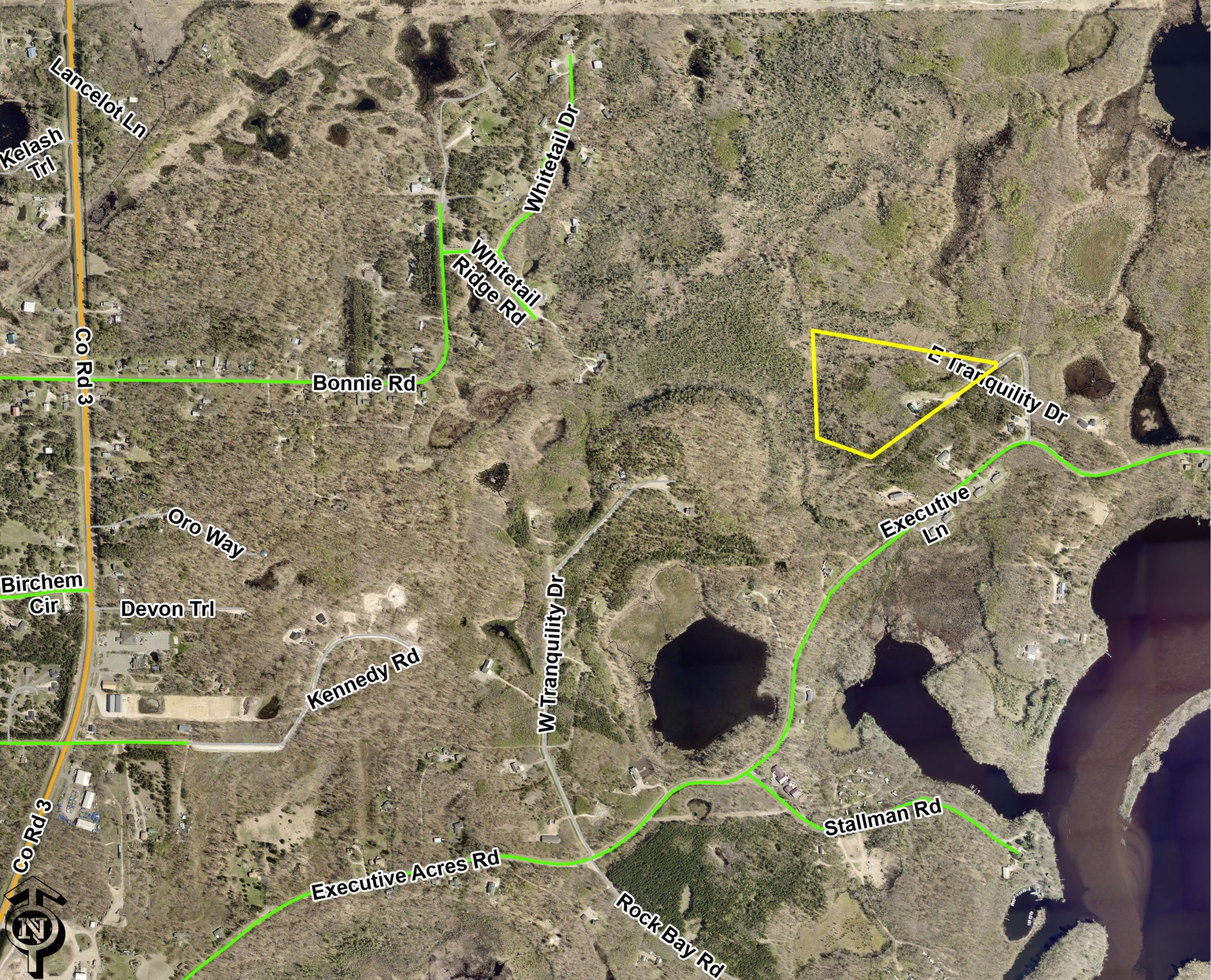
From Brainerd - North on County Road 3 (Mill Avenue) - East on Executive Acres Road - North on E Tranquility Drive to the address 20163
From Brainerd - North on County Road 3 (Mill Avenue) - East on Executive Acres Road - North on E Tranquility Drive to the address 20163
Access
E Tranquility Dr, a private easement road, provides access to the northwest corner.
E Tranquility Dr, a private easement road, provides access to the northwest corner.
GPS Coordinates
Coordinates to approximate corners/points: Point on the northwesterly "ROW" line of E Tranquility Dr near NE corner of tract = 46.4424, -94.1458; point where southeasterly boundary meets end of cul-de-sac = 46.4416, -94.1471; southerlymost corner = 46.4405, -94.1493; SW corner = 46.4409, -94.1508; NW corner = 46.4430, -94.1509.
Coordinates to approximate corners/points: Point on the northwesterly "ROW" line of E Tranquility Dr near NE corner of tract = 46.4424, -94.1458; point where southeasterly boundary meets end of cul-de-sac = 46.4416, -94.1471; southerlymost corner = 46.4405, -94.1493; SW corner = 46.4409, -94.1508; NW corner = 46.4430, -94.1509.
Address
20163 E Tranquility Drive, Brainerd,
20163 E Tranquility Drive, Brainerd,
Neighborhood
Tranquility
Tranquility
School District
Brainerd - 181
Brainerd - 181
Property Details
Wooded Acres
13
13
Dimensions (approx)
1138x411x671x1338x22
1138x411x671x1338x22
Utilities
Available Utilities
Power, Phone, Internet, Propane
Power, Phone, Internet, Propane
On Site Utilities
Power, Phone, Internet, Propane
Power, Phone, Internet, Propane
Power Company
Crow Wing Power (1-800-648-9401)
Crow Wing Power (1-800-648-9401)
Taxes & Fees
Has Association Fee
Yes
Yes
Association Fee
$0
$0
Association Fee Includes
Road Maint, Etc
Road Maint, Etc
Tax Amount
$462
$462
Tax Year
2023
2023
Other Details
Section Number
01
01
Township Number
134
134
Range Number
28
28
Estimated Upland %
85
85
Estimated Wetland %
15
15
Additional Comments
Timber Comments
Red Pine, Tamarack, Aspen and some Hardwoods.
Red Pine, Tamarack, Aspen and some Hardwoods.
Disclosures
Tract is subject to declarations and road maintenance agreement wherein the owner will automatically become member of a road maintenance and storm water management association; see the declaration and road maintenance agreement document for details. A small portion of Tract may lie within Zone A of the FEMA flood hazard area. Photos/maps may utilize county mapping and are for convenience only; not guaranteed; county disclaimers are included by reference. Physically inspect the property prior to purchase.
Tract is subject to declarations and road maintenance agreement wherein the owner will automatically become member of a road maintenance and storm water management association; see the declaration and road maintenance agreement document for details. A small portion of Tract may lie within Zone A of the FEMA flood hazard area. Photos/maps may utilize county mapping and are for convenience only; not guaranteed; county disclaimers are included by reference. Physically inspect the property prior to purchase.