MLS Number : 4771519
Sold $310,000 - Hunting & Recreation, Premier & Development
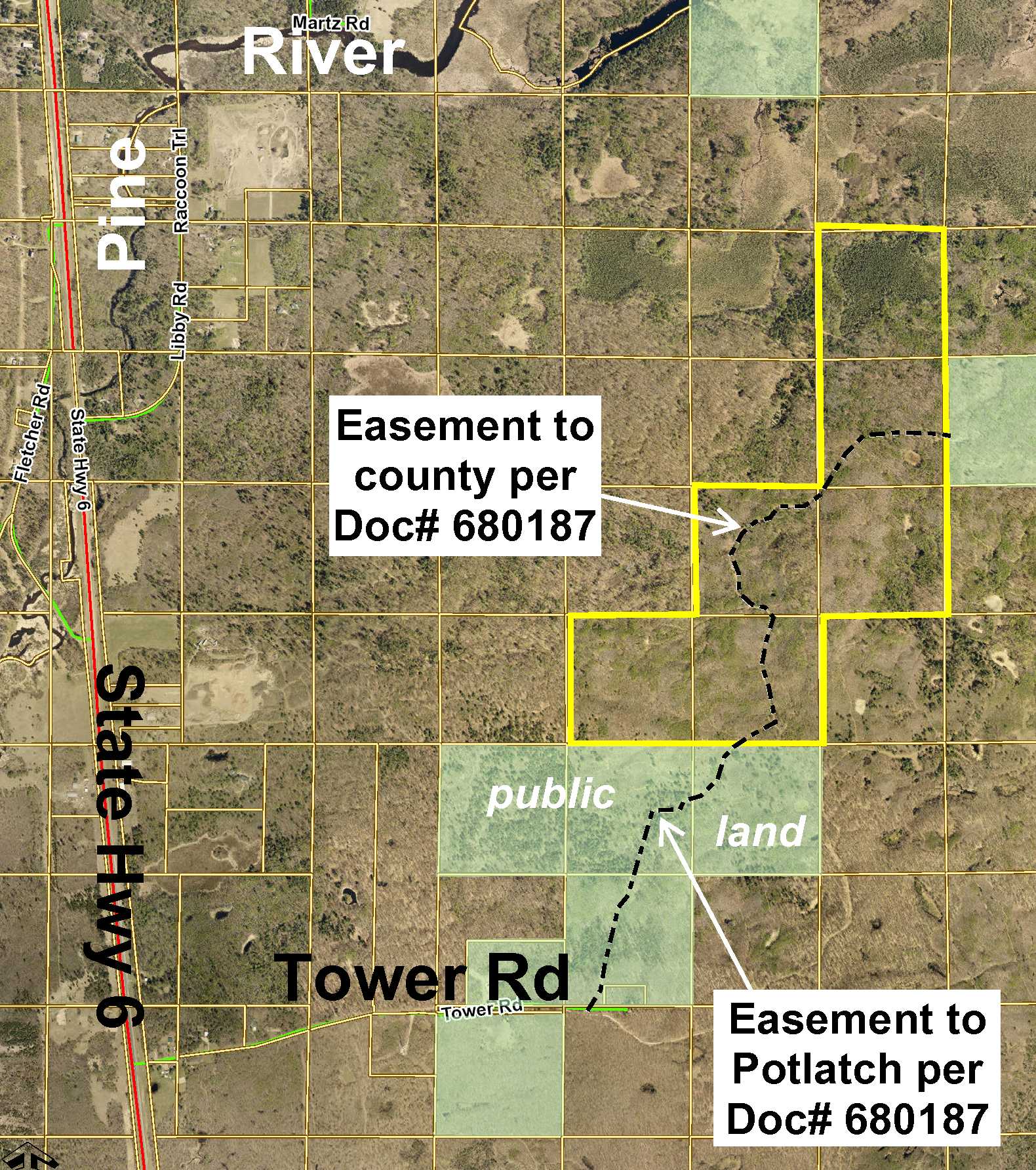
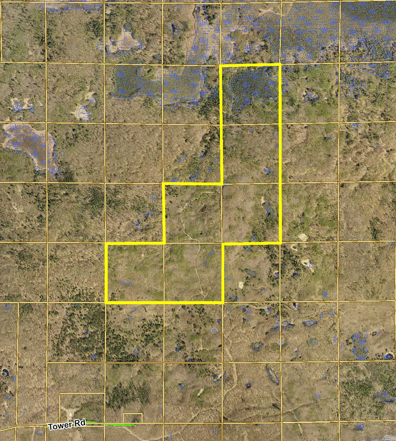
Secluded expanse of Potlatch acreage just off State Hwy 6 southeast of Emily. Gently rolling high ground mottled with small spots of wetland. Access via an easement trail from Tower Rd through public land adjoining the south. The easement trail continues through the land providing access to public land adjoining the east. Excellent hunting and legacy land.
Main Property Info
Property ID
600114100000009 & 600114300000009 & 600114400000009 & 600122200000009 & 600122300000009 & 600123200000009
600114100000009 & 600114300000009 & 600114400000009 & 600122200000009 & 600122300000009 & 600123200000009
MLS Number
4771519
4771519
Status
Sold
Sold
List Price
$345,900
$345,900
Selling Price
$310,000
$310,000
Acres
240
240
Zoning
Ag/Forestry
Ag/Forestry
City
Emily
Emily
Township
Fairfield Twp
Fairfield Twp
State
MN
MN
Zip Code
56447
56447
County
Crow Wing
Crow Wing
Legal Description
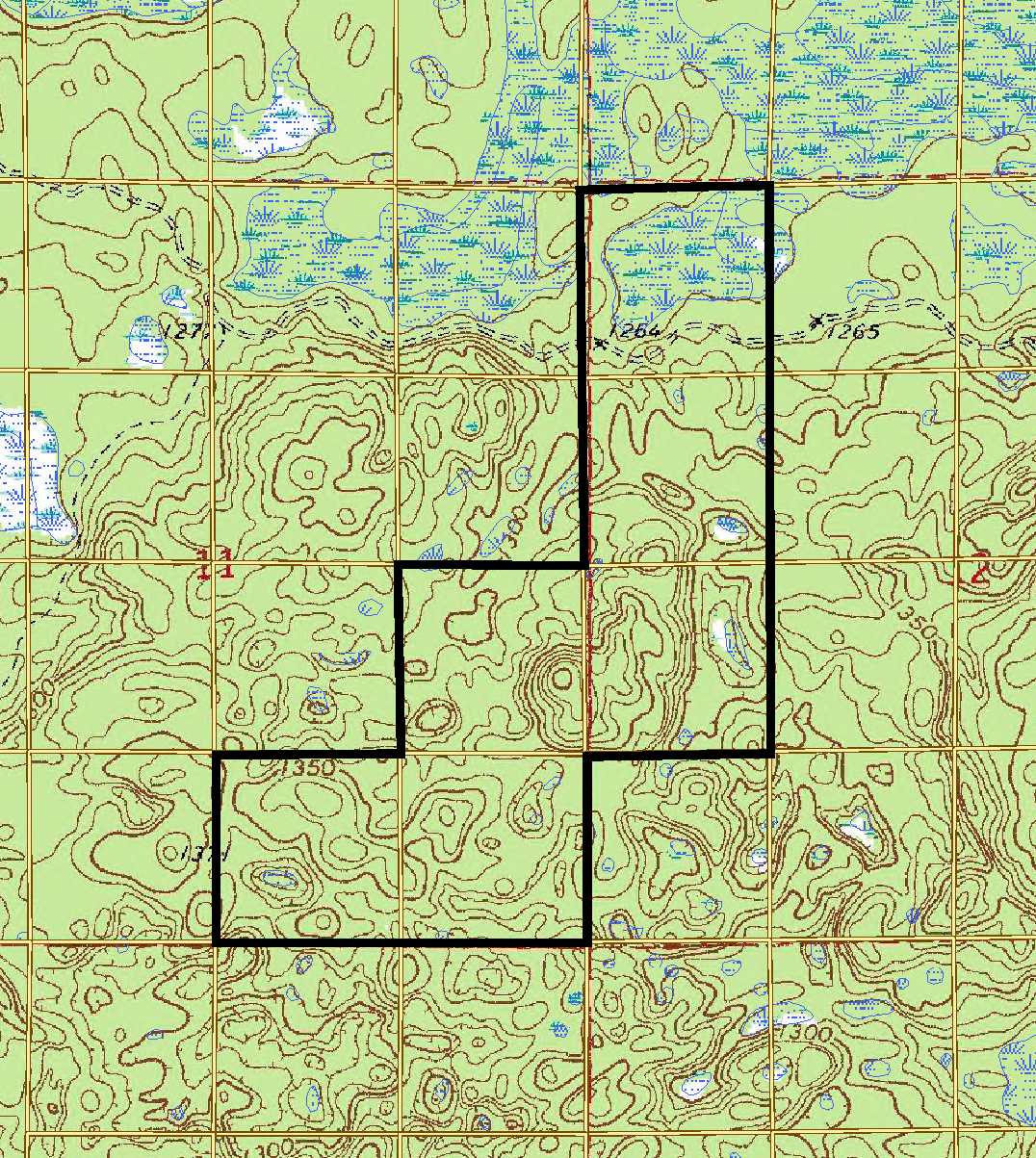
NESE & SESE & SWSE, 11-137-26, and NWNW & NWSW & SWNW, 12-137-26. Subject to and together with easement in Doc# 680187 and subject to any other easements, restrictions, or reservations of record.
NESE & SESE & SWSE, 11-137-26, and NWNW & NWSW & SWNW, 12-137-26. Subject to and together with easement in Doc# 680187 and subject to any other easements, restrictions, or reservations of record.
Property Location
Directions
From the intersection of State Hwy 6 & Co Rd 1 in Emily, south on State Hwy 6 for 3 7/10 miles. Left on Tower Rd 9/10 mile. Left on easement trail approx 7/10 mile into south boundary of the property.
From the intersection of State Hwy 6 & Co Rd 1 in Emily, south on State Hwy 6 for 3 7/10 miles. Left on Tower Rd 9/10 mile. Left on easement trail approx 7/10 mile into south boundary of the property.
Access
Access is via an easement trail through public land as described/depicted in Doc# 680187.
Access is via an easement trail through public land as described/depicted in Doc# 680187.
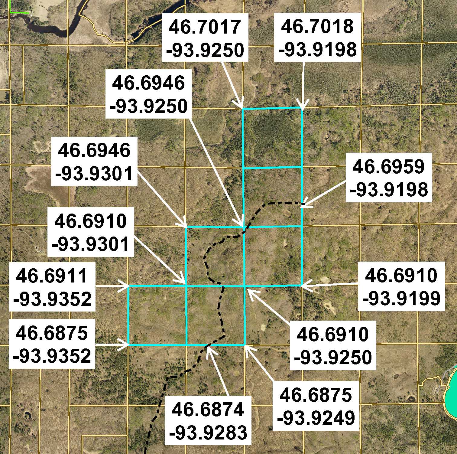
GPS Coordinates
See map for coordinates to approximate corners/points based on county mapping.
See map for coordinates to approximate corners/points based on county mapping.
Address
Sec11&12 Tower Road, Emily
Sec11&12 Tower Road, Emily
School District
Crosby-Ironton - 182
Crosby-Ironton - 182
Property Details
Dimensions (approx)
2640 x 1320 x 1320 x 1320 x 1320 x 2640 x 1320 x 3960 x 1320 x 1320 IRR
2640 x 1320 x 1320 x 1320 x 1320 x 2640 x 1320 x 3960 x 1320 x 1320 IRR
Utilities
Power Company
Crow Wing Power (1-800-648-9401)
Crow Wing Power (1-800-648-9401)
Taxes & Fees
Tax Amount
$2,580
$2,580
Assessment Amount
0
0
Tax With Assessments
$2,580
$2,580
Tax Year
2016
2016
Other Details
Section Number
11 & 12
11 & 12
Township Number
137
137
Range Number
26
26
Estimated Upland %
90
90
Estimated Wetland %
10
10
Additional Comments
Timber Comments
This property has been managed according to Forest Stewardship Council (FSC) standards. If timber value is important to you, seek the advice of a competent forester to determine species, volumes and values.
This property has been managed according to Forest Stewardship Council (FSC) standards. If timber value is important to you, seek the advice of a competent forester to determine species, volumes and values.
Hunting Comments
This property adjoins public land in MN Firearms Deer Zone 171.
This property adjoins public land in MN Firearms Deer Zone 171.
Disclosures
Not surveyed; acreage and dimensions approximate based on county data and mapping; county disclaimers included by reference. Photos/maps for convenience only and not guaranteed; tree cover may be different than depicted; physically inspect prior to purchase. Any deer stands on the land are not property of seller and are not included in sale. Use seller-approved PA and addendum; closing dates the 2nd Wednesday each month.
Not surveyed; acreage and dimensions approximate based on county data and mapping; county disclaimers included by reference. Photos/maps for convenience only and not guaranteed; tree cover may be different than depicted; physically inspect prior to purchase. Any deer stands on the land are not property of seller and are not included in sale. Use seller-approved PA and addendum; closing dates the 2nd Wednesday each month.