MLS Number : 4767221
Sold $29,000 - Home & Cabin Sites, Hunting & Recreation
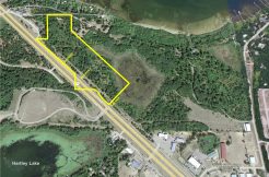
Secluded tract of Potlatch land off Co Rd 3 northeast of Brainerd. Gently-rolling high ground is wooded with red pine. Located at the end of an easement road for utmost privacy. The property has been surveyed and would be a fantastic site for a country home in the woods yet close to all the amenities of Brainerd and Baxter.
Main Property Info
Property ID
Pt 970154400000009
Pt 970154400000009
MLS Number
4767221
4767221
Status
Sold
Sold
List Price
$29,900
$29,900
Selling Price
$29,000
$29,000
Acres
10.02
10.02
Zoning
Rural Res 2.5
Rural Res 2.5
City
Brainerd
Brainerd
Township
First Assessment Twp
First Assessment Twp
State
MN
MN
Zip Code
56401
56401
County
Crow Wing
Crow Wing
Legal Description
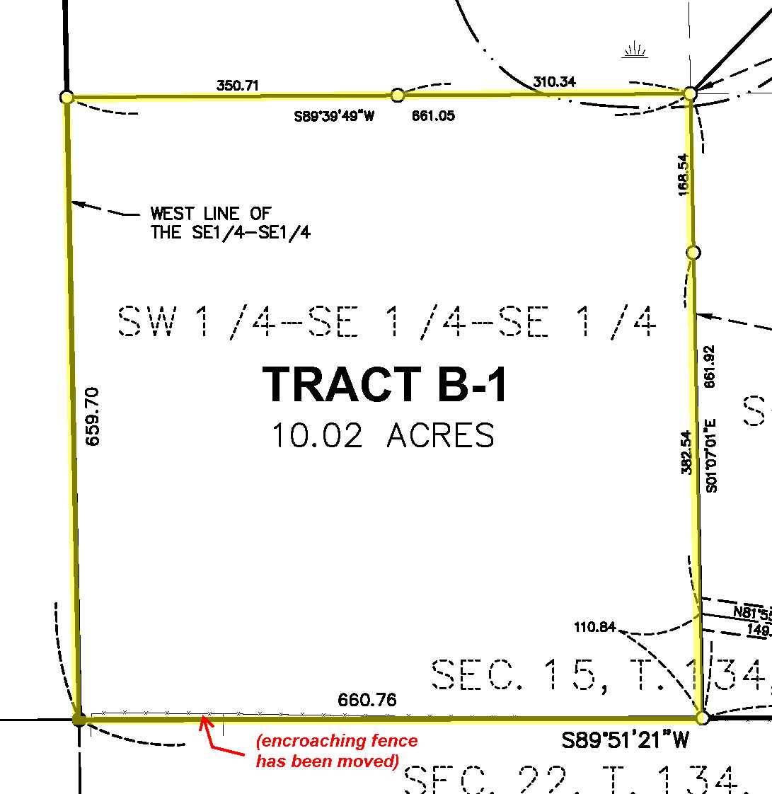
SWSESE, 15-134-28. Together with easements for ingress, egress, and utilities. Subject to any easements, restrictions, or reservations of record. (Tract B-1 shown on Certificate of Survey. See full desc in Supplements.)
SWSESE, 15-134-28. Together with easements for ingress, egress, and utilities. Subject to any easements, restrictions, or reservations of record. (Tract B-1 shown on Certificate of Survey. See full desc in Supplements.)
Property Location
Directions
From the intersection of Co Rd 3 and Co Rd 49 (Wise Rd) northeast of Brainerd, north on Co Rd 3 for 8/10 mile. Left on Prairie View Dr (a private easement road) and continue west, north, and west on easement trail approx 9/10 mile into SE corner of the tract.
From the intersection of Co Rd 3 and Co Rd 49 (Wise Rd) northeast of Brainerd, north on Co Rd 3 for 8/10 mile. Left on Prairie View Dr (a private easement road) and continue west, north, and west on easement trail approx 9/10 mile into SE corner of the tract.
Access
Access is via easements over lands to the east and southeast.
Access is via easements over lands to the east and southeast.
GPS Coordinates
Coordinates to approximate corners based on county mapping: Point where easement trail enters east side of property = 46.4136, -94.1837; SE corner = 46.4133, -94.1837; SW corner = 46.4133, -94.1863; NW corner = 46.4151, -94.1864; NE corner = 46.4151, -94.1838.
Coordinates to approximate corners based on county mapping: Point where easement trail enters east side of property = 46.4136, -94.1837; SE corner = 46.4133, -94.1837; SW corner = 46.4133, -94.1863; NW corner = 46.4151, -94.1864; NE corner = 46.4151, -94.1838.
Address
Tract B-1(SWSESE) Prairie View Dr
Tract B-1(SWSESE) Prairie View Dr
School District
Brainerd - 181
Brainerd - 181
Property Details
Dimensions (approx)
661 x 660 x 659 x 661
661 x 660 x 659 x 661
Utilities
Power Company
Crow Wing Power (1-800-648-9401)
Crow Wing Power (1-800-648-9401)
Taxes & Fees
Tax Amount
$100
$100
Assessment Amount
0
0
Tax With Assessments
$100
$100
Tax Year
2016
2016
Other Details
Section Number
15
15
Township Number
134
134
Range Number
28
28
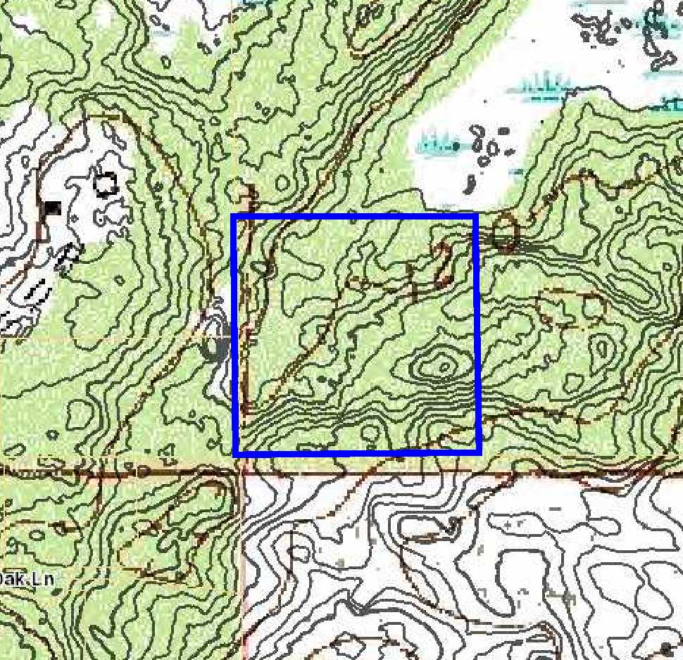
Estimated Upland %
99
99
Estimated Wetland %
1
1
Additional Comments
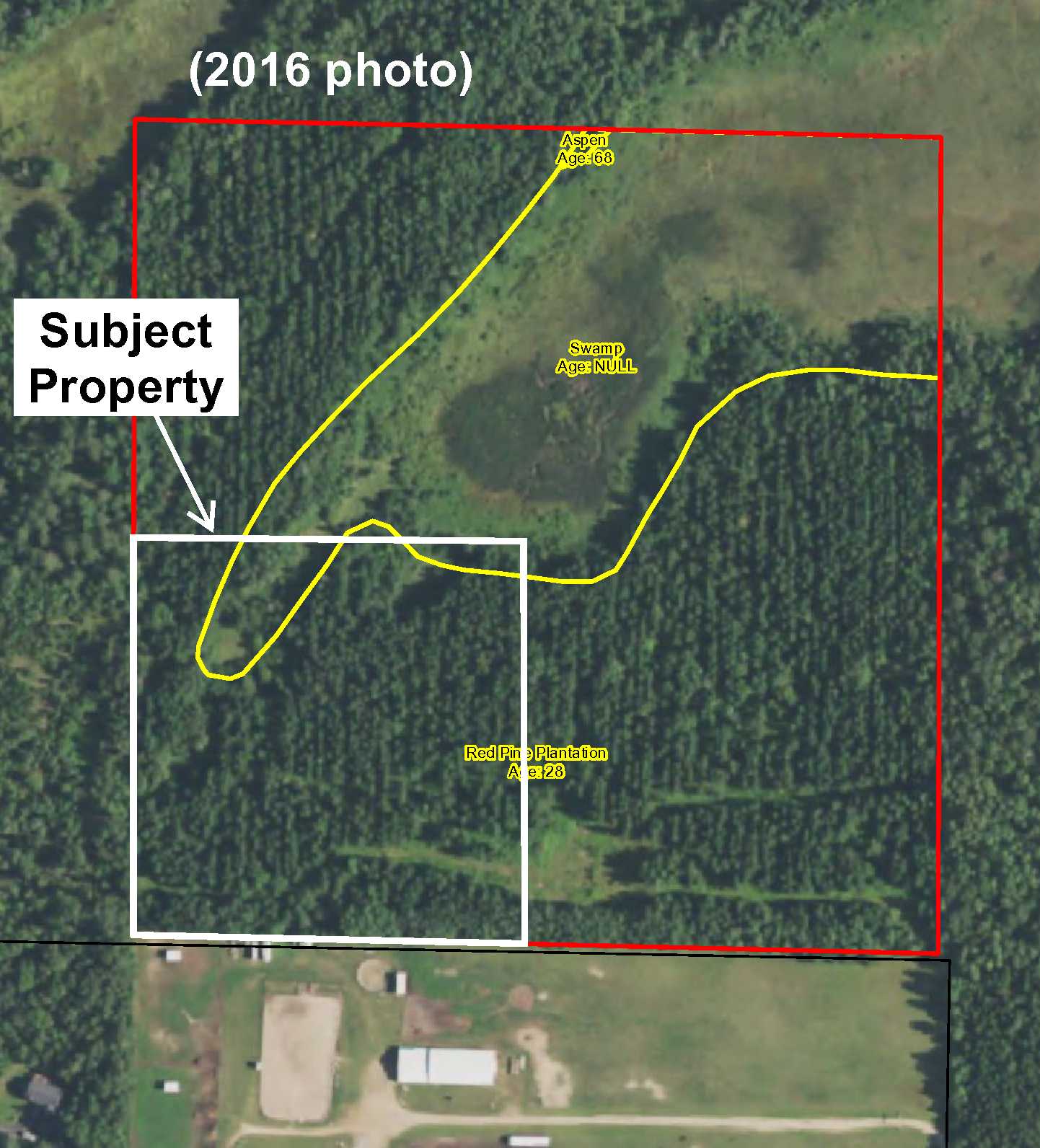
Timber Comments
This property has been managed according to Forest Stewardship Council (FSC) standards. If timber value is important to you, seek the advice of a competent forester to determine species, volumes and values.
This property has been managed according to Forest Stewardship Council (FSC) standards. If timber value is important to you, seek the advice of a competent forester to determine species, volumes and values.
Disclosures
Survey shows fence encroachment on south boundary, but seller understands fence has been moved. See survey for exact acreage and dimensions. Parcel split; taxes estimated. Photos/maps for convenience only and not guaranteed; tree cover may be different than depicted; physically inspect prior to purchase. Any deer stands on the land are not property of seller and are not included in sale. Use seller-approved PA and addendum; closing dates the 2nd Wednesday each month.
Survey shows fence encroachment on south boundary, but seller understands fence has been moved. See survey for exact acreage and dimensions. Parcel split; taxes estimated. Photos/maps for convenience only and not guaranteed; tree cover may be different than depicted; physically inspect prior to purchase. Any deer stands on the land are not property of seller and are not included in sale. Use seller-approved PA and addendum; closing dates the 2nd Wednesday each month.