


MLS Number : 4294015
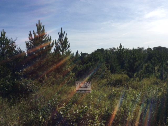
Sold $52,000 - Hunting & Recreation
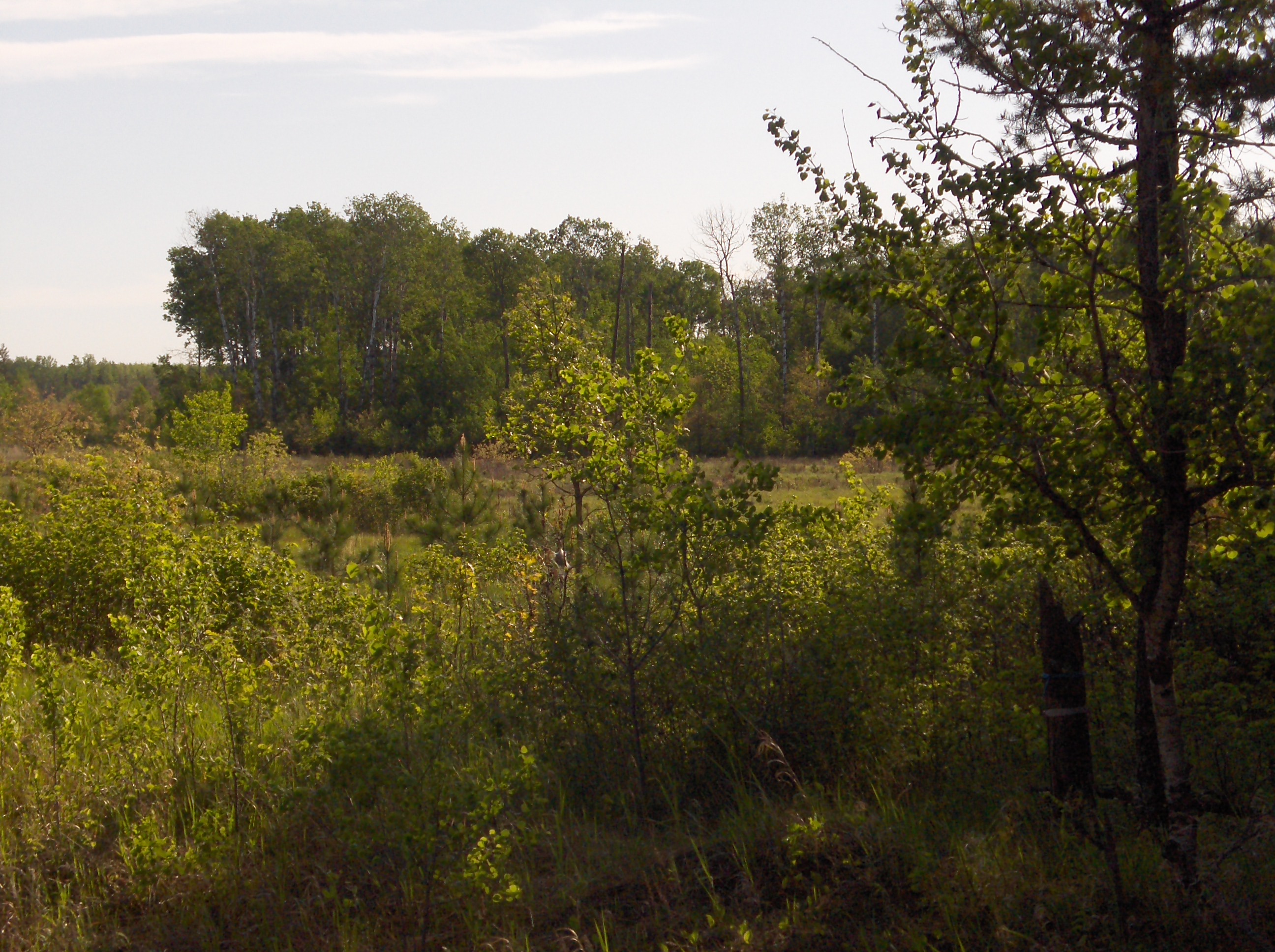
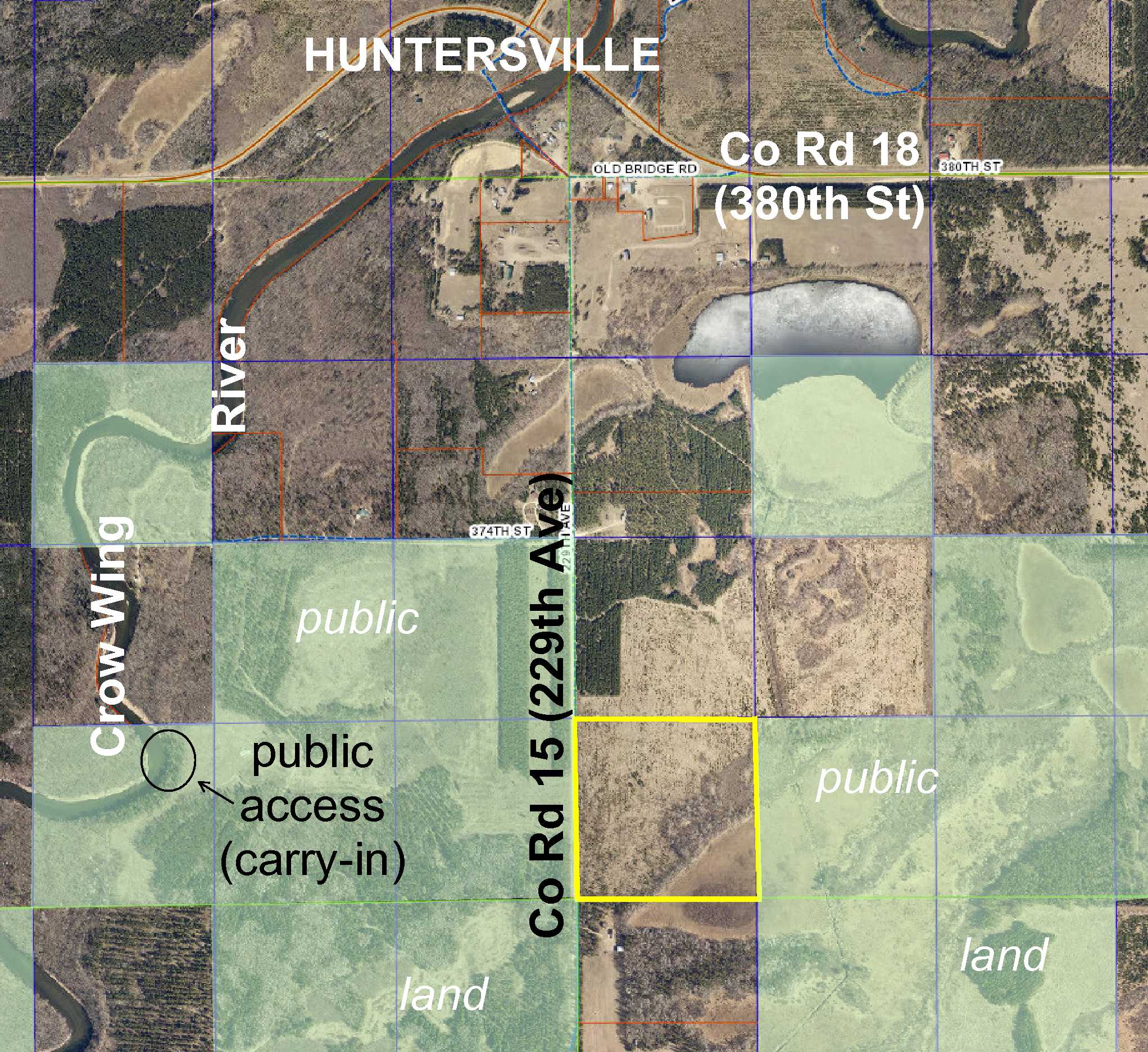
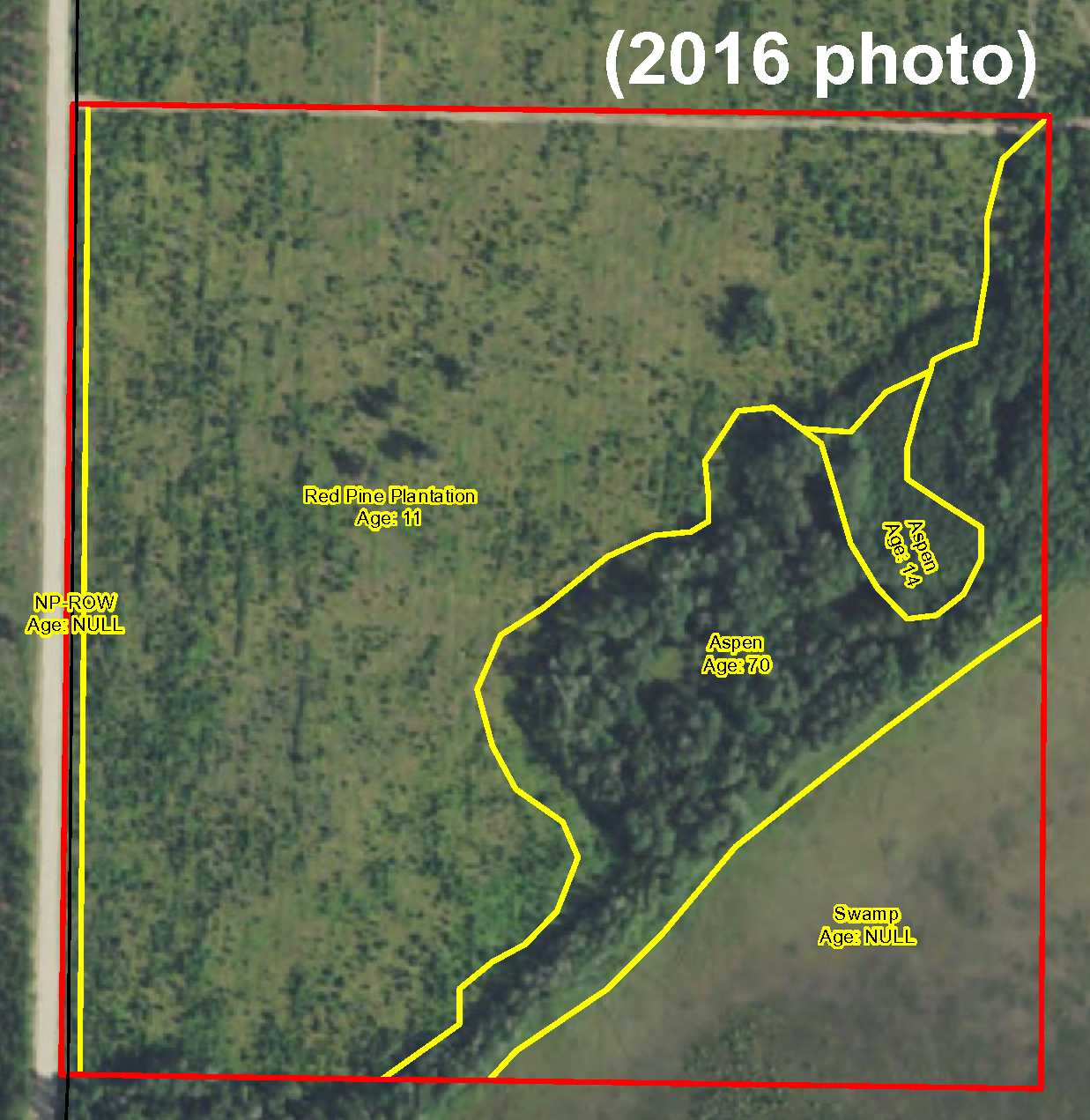
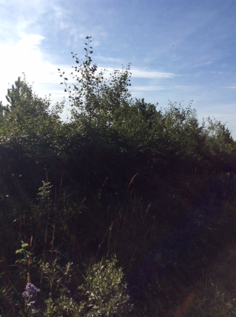
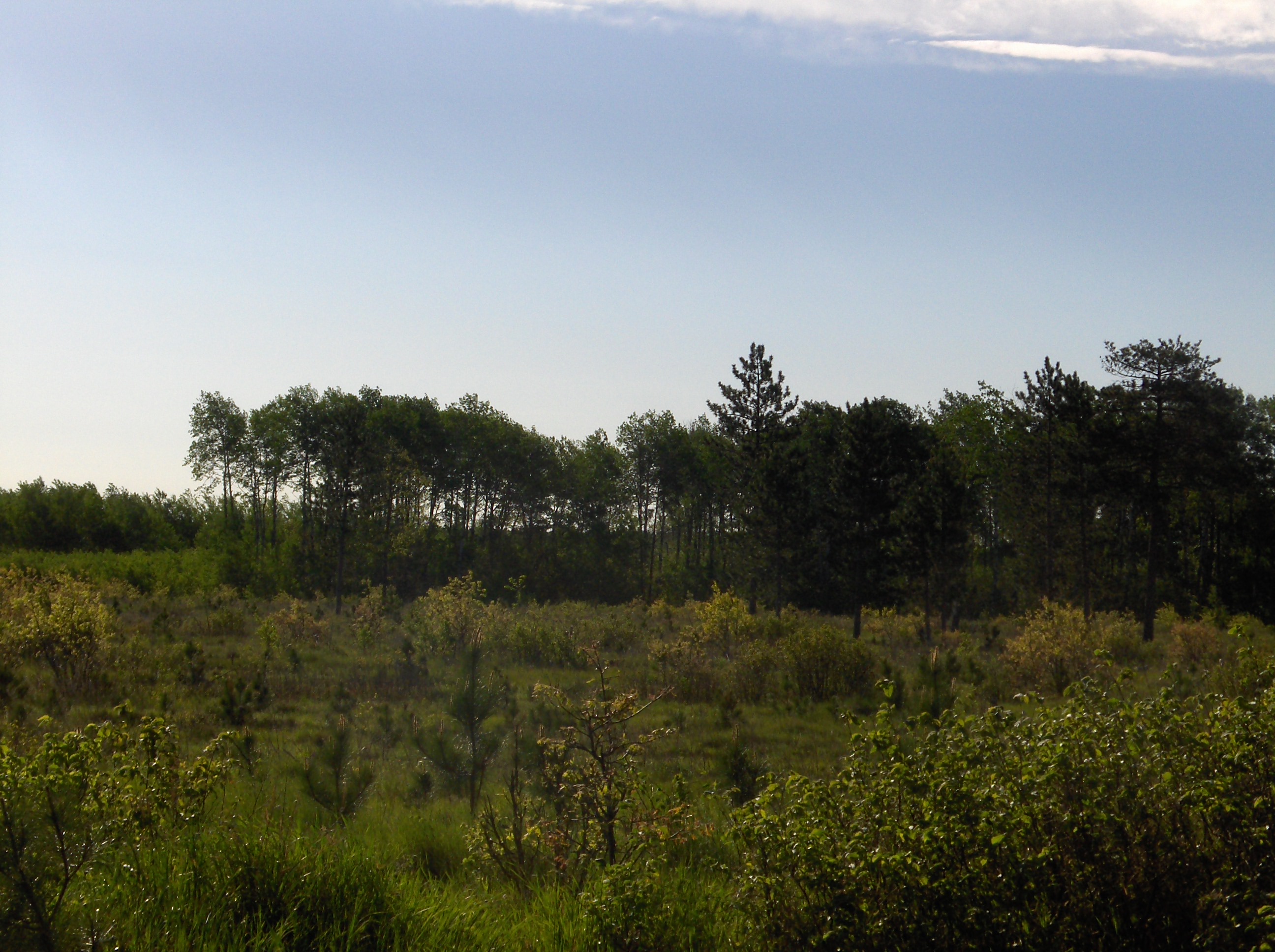
A great Potlatch “40” conveniently located only 1 mile from Huntersville. Level topography combines aspen and red pine wooded upland with wetland in the southeast corner for great wildlife habitat. Gravel county road along the west side. Hundreds of acres of public Huntersville State Forest land adjoin the east and west sides, and carry-in public access to the Crow Wing River is only one mile away.
Main Property Info
Property ID
040172020
040172020
MLS Number
4294015
4294015
Status
Sold
Sold
List Price
$56,900
$56,900
Selling Price
$52,000
$52,000
Acres
40
40
Zoning
A-2 Mixed Agriculture
A-2 Mixed Agriculture
City
Menahga
Menahga
Township
Huntersville Twp
Huntersville Twp
State
MN
MN
Zip Code
56464
56464
County
Wadena
Wadena
Legal Description
SWSW, 17-138-33. Subject to Co Rd 15 (229th Ave) and any easements, restrictions, or reservations of record.
SWSW, 17-138-33. Subject to Co Rd 15 (229th Ave) and any easements, restrictions, or reservations of record.
Property Location
Directions
From the intersection of Co Rd 18 (380th St) and Old Bridge Rd on the east side of Huntersville, west on Old Bridge Rd 2/10 mile. Left on Co Rd 15 (229th Avenue) 8/10 mile to NW corner of the property.
From the intersection of Co Rd 18 (380th St) and Old Bridge Rd on the east side of Huntersville, west on Old Bridge Rd 2/10 mile. Left on Co Rd 15 (229th Avenue) 8/10 mile to NW corner of the property.
Access
Gravel Co Rd 15 (229th Ave) is along the west side of this property.
Gravel Co Rd 15 (229th Ave) is along the west side of this property.
GPS Coordinates
Coordinates to approximate corners and points based on county mapping: NW corner along Co Rd 15 (229th Ave) = 46.7650, -94.8926; NE corner = 46.7650, -94.8874; SE corner = 46.7614, -94.8873; SW corner along Co Rd 15 (229th Ave) = 46.7614, -94.8926.
Coordinates to approximate corners and points based on county mapping: NW corner along Co Rd 15 (229th Ave) = 46.7650, -94.8926; NE corner = 46.7650, -94.8874; SE corner = 46.7614, -94.8873; SW corner along Co Rd 15 (229th Ave) = 46.7614, -94.8926.
Address
SWSW 229th Avenue
SWSW 229th Avenue
School District
Menahga - 821
Menahga - 821
Property Details
Dimensions (approx)
1320 x 1320 x 1320 x 1320
1320 x 1320 x 1320 x 1320
Utilities
Available Utilities
Electric
Electric
On Site Utilities
None
None
Power Company
Todd-Wadena Electric (1-800-320-8932)
Todd-Wadena Electric (1-800-320-8932)
Taxes & Fees
Association Fee
$0
$0
Tax Amount
$554
$554
Assessment Amount
0
0
Tax With Assessments
$554
$554
Tax Year
2016
2016
Other Details
Section Number
17
17
Township Number
138
138
Range Number
33
33
Estimated Upland %
80
80
Estimated Wetland %
20
20
Additional Comments
Timber Comments
This property has been managed according to Forest Stewardship Council (FSC) standards. Timber includes aspen and red pine. If timber value is important to you, seek the advice of a competent forester to determine species, volumes and values.
This property has been managed according to Forest Stewardship Council (FSC) standards. Timber includes aspen and red pine. If timber value is important to you, seek the advice of a competent forester to determine species, volumes and values.
Hunting Comments
This property adjoins public land in MN Firearms Deer Zone 246.
This property adjoins public land in MN Firearms Deer Zone 246.
Disclosures
Not surveyed; acreage and dimensions approximate based on county data and mapping; county disclaimers included by reference. Photos/maps for convenience only and not guaranteed; tree cover may be different than depicted; physically inspect prior to purchase. Any deer stands on the land are not property of seller and are not included in sale. Use seller-approved PA and addendum; closing dates the 2nd Wednesday each month.
Not surveyed; acreage and dimensions approximate based on county data and mapping; county disclaimers included by reference. Photos/maps for convenience only and not guaranteed; tree cover may be different than depicted; physically inspect prior to purchase. Any deer stands on the land are not property of seller and are not included in sale. Use seller-approved PA and addendum; closing dates the 2nd Wednesday each month.


