
MLS Number : 4624440
Sold $55,000 - Hunting & Recreation, Price Reduced
Price lowered from $62,900 to $56,500! Secluded Potlatch land adjoining Huntersville Wildlife Management Area west of Menahga. Level land with red pine pine and aspen that could offer potential future timber income in about 10 years. County road access and easement trail through tract. Secure for next hunting season!
Main Property Info
Property ID
040143010
040143010
MLS Number
4624440
4624440
Status
Sold
Sold
List Price
$56,500
$56,500
Selling Price
$55,000
$55,000
Acres
40
40
Zoning
A-2 Mixed Agriculture
A-2 Mixed Agriculture
City
Menahga
Menahga
Township
Huntersville Twp
Huntersville Twp
State
MN
MN
Zip Code
56464
56464
County
Wadena
Wadena
Legal Description
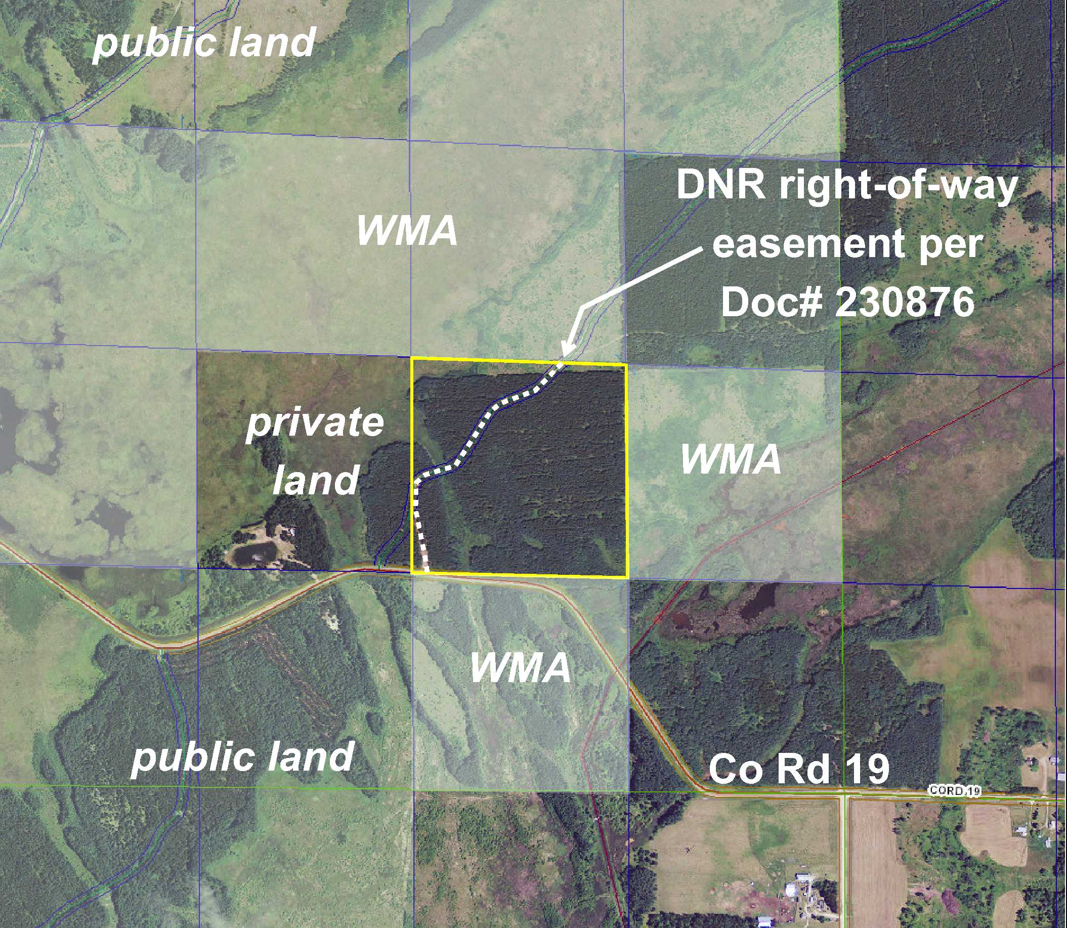
NWSE, 14-138-33. Subject to Co Rd 19; DNR Right-of-Way Easement in Doc# 230876; and any other easements, restrictions, or reservations of record.
NWSE, 14-138-33. Subject to Co Rd 19; DNR Right-of-Way Easement in Doc# 230876; and any other easements, restrictions, or reservations of record.
Property Location
Directions
From CR18(380th St) & CR25(229th Ave) in Huntersville, SE on CR18(380th St) 1 3/4 mi. Curve right(S) on CR18 for 3/10 mi. Left(E) on CR19 for 1 1/2 mi to trail entrance on left (N) side of rd.
From CR18(380th St) & CR25(229th Ave) in Huntersville, SE on CR18(380th St) 1 3/4 mi. Curve right(S) on CR18 for 3/10 mi. Left(E) on CR19 for 1 1/2 mi to trail entrance on left (N) side of rd.
Access
Paved Co Rd 19 runs along a portion of the south side of this tract, and a trail near the southwest corner leads up and connects to a DNR easement trail that ventures northeasterly.
Paved Co Rd 19 runs along a portion of the south side of this tract, and a trail near the southwest corner leads up and connects to a DNR easement trail that ventures northeasterly.
GPS Coordinates
GPS coordinates to approx corners and points based on county mapping: Point where trail off Co Rd 19 enters near the SW corner = 46.7644, -94.8184; SW corner along Co Rd 19 = 46.7644, -94.8186; NW corner = 46.7681, -94.8187; approx point where easement trail exits north side = 46.7680, -94.8149; NE corner = 46.7680, -94.8134; SE corner = 46.7643, -94.8133
GPS coordinates to approx corners and points based on county mapping: Point where trail off Co Rd 19 enters near the SW corner = 46.7644, -94.8184; SW corner along Co Rd 19 = 46.7644, -94.8186; NW corner = 46.7681, -94.8187; approx point where easement trail exits north side = 46.7680, -94.8149; NE corner = 46.7680, -94.8134; SE corner = 46.7643, -94.8133
Address
NWSE County Road 19
NWSE County Road 19
School District
Menahga - 821
Menahga - 821
Property Details
Dimensions (approx)
1320x1320x1320x1320
1320x1320x1320x1320
Utilities
Available Utilities
Electric
Electric
On Site Utilities
None
None
Power Company
Todd-Wadena Electric (1-800-320-8932)
Todd-Wadena Electric (1-800-320-8932)
Taxes & Fees
Tax Amount
$532
$532
Tax Year
2018
2018
Other Details
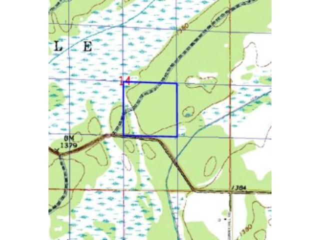
Section Number
14
14
Township Number
138
138
Range Number
33
33
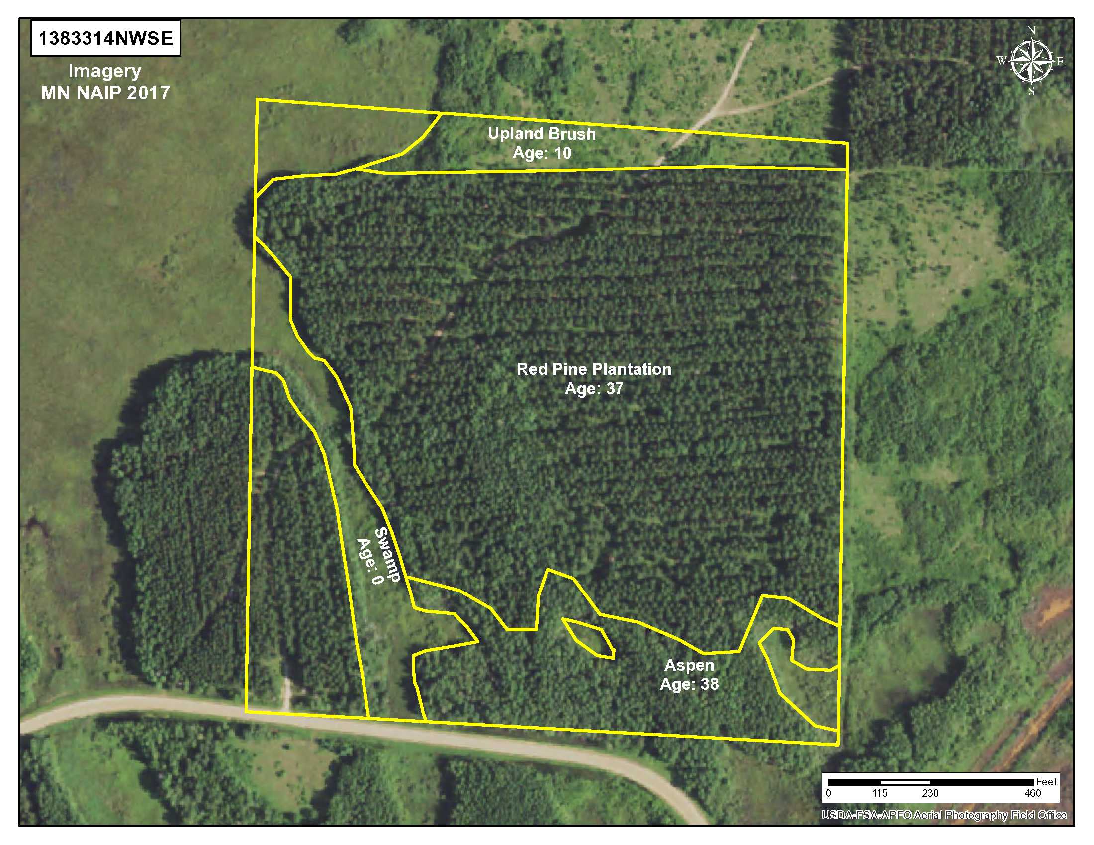
Estimated Upland %
90
90
Estimated Wetland %
10
10
Additional Comments
Timber Comments
This property has been managed according to Forest Stewardship Council (FSC) standards. Timber includes red pine that could be thinned, and aspen that could be harvested in about 10 years for potential future timber income. If timber value is important to you, seek the advice of a competent forester to determine species, volumes and values.
This property has been managed according to Forest Stewardship Council (FSC) standards. Timber includes red pine that could be thinned, and aspen that could be harvested in about 10 years for potential future timber income. If timber value is important to you, seek the advice of a competent forester to determine species, volumes and values.
Hunting Comments
This property adjoins public land in MN Firearms Deer Zone 246. It's a very popular area for hunting whitetail deer and bear. Huntersville WMA (Wildlife Management Area) adjoins the north, east, and south sides.
This property adjoins public land in MN Firearms Deer Zone 246. It's a very popular area for hunting whitetail deer and bear. Huntersville WMA (Wildlife Management Area) adjoins the north, east, and south sides.
Disclosures
Not surveyed; acreage and dimensions approximate based on county data and mapping; county disclaimers included by reference. Photos/maps for convenience only and not guaranteed; physically inspect prior to purchase. Any deer stands on the land are not property of seller and are not included in sale. Use seller-approved PA and addendum; closing dates the 3rd Wednesday each month.
Not surveyed; acreage and dimensions approximate based on county data and mapping; county disclaimers included by reference. Photos/maps for convenience only and not guaranteed; physically inspect prior to purchase. Any deer stands on the land are not property of seller and are not included in sale. Use seller-approved PA and addendum; closing dates the 3rd Wednesday each month.


