

MLS Number : 4400250
Sold $29,000 - Hunting & Recreation
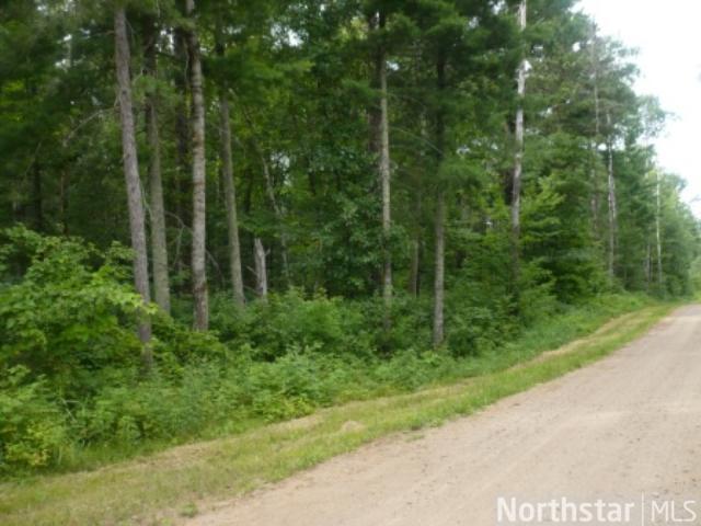
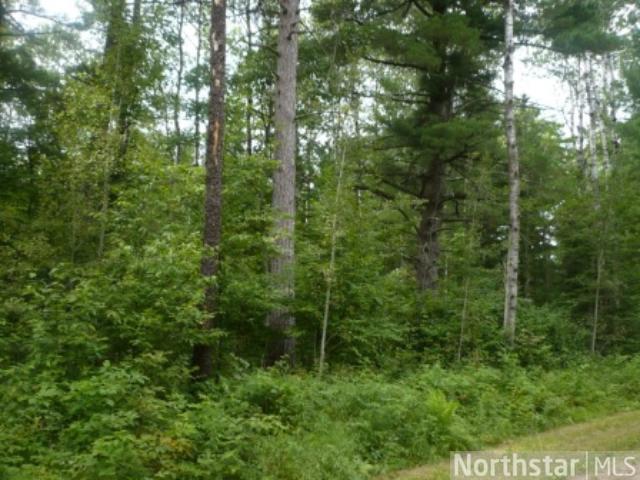
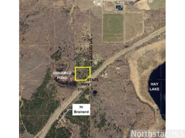
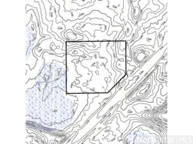
Wooded 5+ acre tract of land overlooking a pond northeast of Brainerd. Beautiful “up north” rural setting less than 5 miles from town. Primarily upland. Adjoins 2,000+ acres of county-owned “Mississippi Northwoods” land for future trails and recreation.
Main Property Info
Property ID
800351400AA0009
800351400AA0009
MLS Number
4400250
4400250
Status
Sold
Sold
List Price
$29,900
$29,900
Selling Price
$29,000
$29,000
Acres
5.69
5.69
Zoning
Rural Residential 5
Rural Residential 5
City
Brainerd
Brainerd
Township
Oak Lawn Twp
Oak Lawn Twp
State
MN
MN
Zip Code
56401
56401
County
Crow Wing
Crow Wing
Legal Description
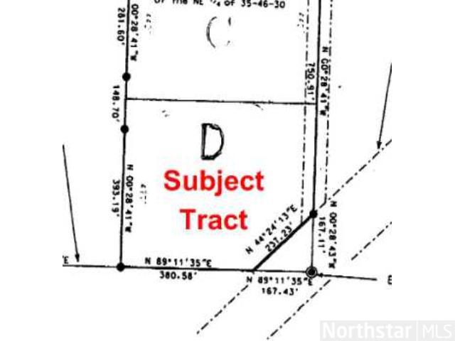
The east 548 ft of SENE, 35-46-30, except hwy and except part to State of MN shown as Parcel 244A on MNDOT ROW Plat 18-9 and except the north 458 ft of the south 1376 ft of the east 548 ft of NE1/4 and except the north 440 ft of the south 918 ft of the east 548 ft of NE1/4. (Legal description of record to govern.) Subject to Sploezens Rd and any easements, restrictions, or reservations of record.
The east 548 ft of SENE, 35-46-30, except hwy and except part to State of MN shown as Parcel 244A on MNDOT ROW Plat 18-9 and except the north 458 ft of the south 1376 ft of the east 548 ft of NE1/4 and except the north 440 ft of the south 918 ft of the east 548 ft of NE1/4. (Legal description of record to govern.) Subject to Sploezens Rd and any easements, restrictions, or reservations of record.
Property Location
Directions
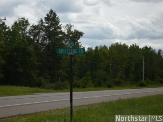
From intersection of Co Rd 3 & State Hwy 210 in Brainerd, approx 7 miles northeast on State Hwy 210 (past Brainerd Lakes Regional Airport) to southeast corner of the property.
From intersection of Co Rd 3 & State Hwy 210 in Brainerd, approx 7 miles northeast on State Hwy 210 (past Brainerd Lakes Regional Airport) to southeast corner of the property.
Access
This property fronts paved State Hwy 210 in the southeast corner and unpaved Sploezens Rd along the east boundary.
This property fronts paved State Hwy 210 in the southeast corner and unpaved Sploezens Rd along the east boundary.
GPS Coordinates
Coordinates to approximate corners/points based on county mapping: Southernmost SE corner along the hwy = 46.4238, -94.0838; SW corner = 46.4238, -94.0852; NW corner = 46.4252, -94.0852; NE corner = 46.4252, -94.0830; northernmost SE corner along the hwy = 46.4244, -94.0830
Coordinates to approximate corners/points based on county mapping: Southernmost SE corner along the hwy = 46.4238, -94.0838; SW corner = 46.4238, -94.0852; NW corner = 46.4252, -94.0852; NE corner = 46.4252, -94.0830; northernmost SE corner along the hwy = 46.4244, -94.0830
Address
PtSENE Sploezens Road
PtSENE Sploezens Road
School District
Crosby-Ironton - 182
Crosby-Ironton - 182
Property Details
Dimensions (approx)
237x481x380x548
237x481x380x548
Utilities
Available Utilities
Electric
Electric
On Site Utilities
None
None
Power Company
Minnesota Power (1-800-228-4966)
Minnesota Power (1-800-228-4966)
Waterfront
Waterfront Name
N/A
N/A
Waterfront Number
999999999
999999999
Waterfront Feet (approx)
280
280
Taxes & Fees
Association Fee
$0
$0
Tax Amount
$128
$128
Tax Year
2018
2018
Other Details
Section Number
35
35
Township Number
46
46
Range Number
30
30
Estimated Upland %
99
99
Estimated Wetland %
1
1
Additional Comments
Disclosures
Some survey monuments may be present; see attached partial survey drawing. Acreage and dimensions approximate based on county data and mapping; county disclaimers included by reference. Photos/maps for convenience only and not guaranteed; tree cover may be different than depicted; physically inspect prior to purchase.
Some survey monuments may be present; see attached partial survey drawing. Acreage and dimensions approximate based on county data and mapping; county disclaimers included by reference. Photos/maps for convenience only and not guaranteed; tree cover may be different than depicted; physically inspect prior to purchase.
Additional Details
Waterfront Comments:
Property overlooks an unnamed pond that weaves into the southwest corner.
Property overlooks an unnamed pond that weaves into the southwest corner.


