


MLS Number : 4203255
Sold $63,000 - Hunting & Recreation, Price Reduced
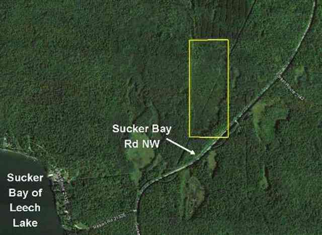
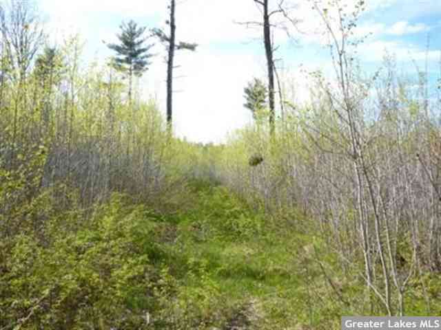
Price lowered from $74,500 to $66,500! Potlatch land situated amidst thousands of acres of public forestland, yet conveniently located on a paved road just miles from the shores of Leech Lake. Gently-sloped topography with wetlands along the west side. Primarily aspen timber with Northern Hardwoods in the southeast corner by the road.
Main Property Info
Property ID
281191100 & 281191402
281191100 & 281191402
MLS Number
4203255
4203255
Status
Sold
Sold
List Price
$66,500
$66,500
Selling Price
$63,000
$63,000
Acres
57.000
57.000
Zoning
Ag/Forestry
Ag/Forestry
City
Cass Lake
Cass Lake
Township
Otter Tail Peninsula Twp
Otter Tail Peninsula Twp
State
MN
MN
Zip Code
56633
56633
County
Cass
Cass
Legal Description
E1/2NE1/4, 19-144-29. Subject to Sucker Bay Rd NW and any easements, restrictions, or reservations of record.
E1/2NE1/4, 19-144-29. Subject to Sucker Bay Rd NW and any easements, restrictions, or reservations of record.
Property Location
Directions
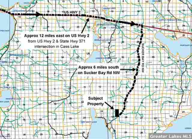
From US Hwy 2 & State Hwy 371 intersection in Cass Lake, east on Hwy 2 approx 12 miles. Right/south on Sucker Bay Rd NW approx 6 miles. Sucker Bay Rd NW goes through SE corner of the subject property.
From US Hwy 2 & State Hwy 371 intersection in Cass Lake, east on Hwy 2 approx 12 miles. Right/south on Sucker Bay Rd NW approx 6 miles. Sucker Bay Rd NW goes through SE corner of the subject property.
Access
Access is off paved Sucker Bay Rd NW which runs diagonally through the southeast corner of the property.
Access is off paved Sucker Bay Rd NW which runs diagonally through the southeast corner of the property.
GPS Coordinates
Coordinates to approximate corners/points based on county mapping: Point where Sucker Bay Rd NW enters the east side of the property near the SE corner = 47.275, -94.3914; SE corner = 47.2744, -94.3914; point where Sucker Bay Rd NW exits the south side of the property near the SE corner = 47.2744, -94.3922; SW corner = 47.2745, -94.3951; NW corner = 47.2817, -94.3947; NE corner = 47.2816, -94.3908
Coordinates to approximate corners/points based on county mapping: Point where Sucker Bay Rd NW enters the east side of the property near the SE corner = 47.275, -94.3914; SE corner = 47.2744, -94.3914; point where Sucker Bay Rd NW exits the south side of the property near the SE corner = 47.2744, -94.3922; SW corner = 47.2745, -94.3951; NW corner = 47.2817, -94.3947; NE corner = 47.2816, -94.3908
Address
E2NE Sucker Bay Road
E2NE Sucker Bay Road
School District
Cass Lake-Bena - 115
Cass Lake-Bena - 115
Property Details
Dimensions (approx)
965x965x2635x2635
965x965x2635x2635
Utilities
Available Utilities
Electric
Electric
On Site Utilities
None
None
Power Company
Lake Country Power (1-800-421-9959)
Lake Country Power (1-800-421-9959)
Taxes & Fees
Association Fee
$0
$0
Tax Amount
$238
$238
Assessment Amount
0
0
Tax With Assessments
$238
$238
Tax Year
2016
2016
Other Details
Section Number
19
19
Township Number
144
144
Range Number
29
29
Estimated Upland %
97
97
Estimated Wetland %
3
3
Additional Comments
Timber Comments
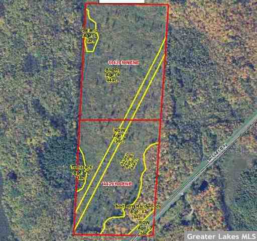
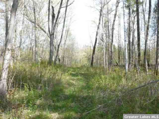
This property has been managed according to Forest Stewardship Council (FSC) standards and a portion of it has been harvested. Timber includes aspen regeneration, an area of beautiful northern hardwoods in the southeast corner, and a patch of tamarack along the lower west boundary.
This property has been managed according to Forest Stewardship Council (FSC) standards and a portion of it has been harvested. Timber includes aspen regeneration, an area of beautiful northern hardwoods in the southeast corner, and a patch of tamarack along the lower west boundary.
Hunting Comments
The subject property adjoins public land on all four sides. This is prime area for hunting deer, bear, grouse, rabbits, squirrels, fox, beaver, mink, and muskrats. MN Hunting Zone 197.
The subject property adjoins public land on all four sides. This is prime area for hunting deer, bear, grouse, rabbits, squirrels, fox, beaver, mink, and muskrats. MN Hunting Zone 197.
Disclosures
Not surveyed; acreage and dimensions approximate based on county data and mapping; county disclaimers included by reference. Photos/maps for convenience only and not guaranteed; tree cover may be different than depicted; physically inspect prior to purchase. Any deer stands on the land are not property of seller and are not included in sale. Use seller-approved PA and addendum; closing dates the 2nd Wednesday each month.
Not surveyed; acreage and dimensions approximate based on county data and mapping; county disclaimers included by reference. Photos/maps for convenience only and not guaranteed; tree cover may be different than depicted; physically inspect prior to purchase. Any deer stands on the land are not property of seller and are not included in sale. Use seller-approved PA and addendum; closing dates the 2nd Wednesday each month.


