

MLS Number : 5236230
Sold $160,000 - Hunting & Recreation, Waterfront Properties
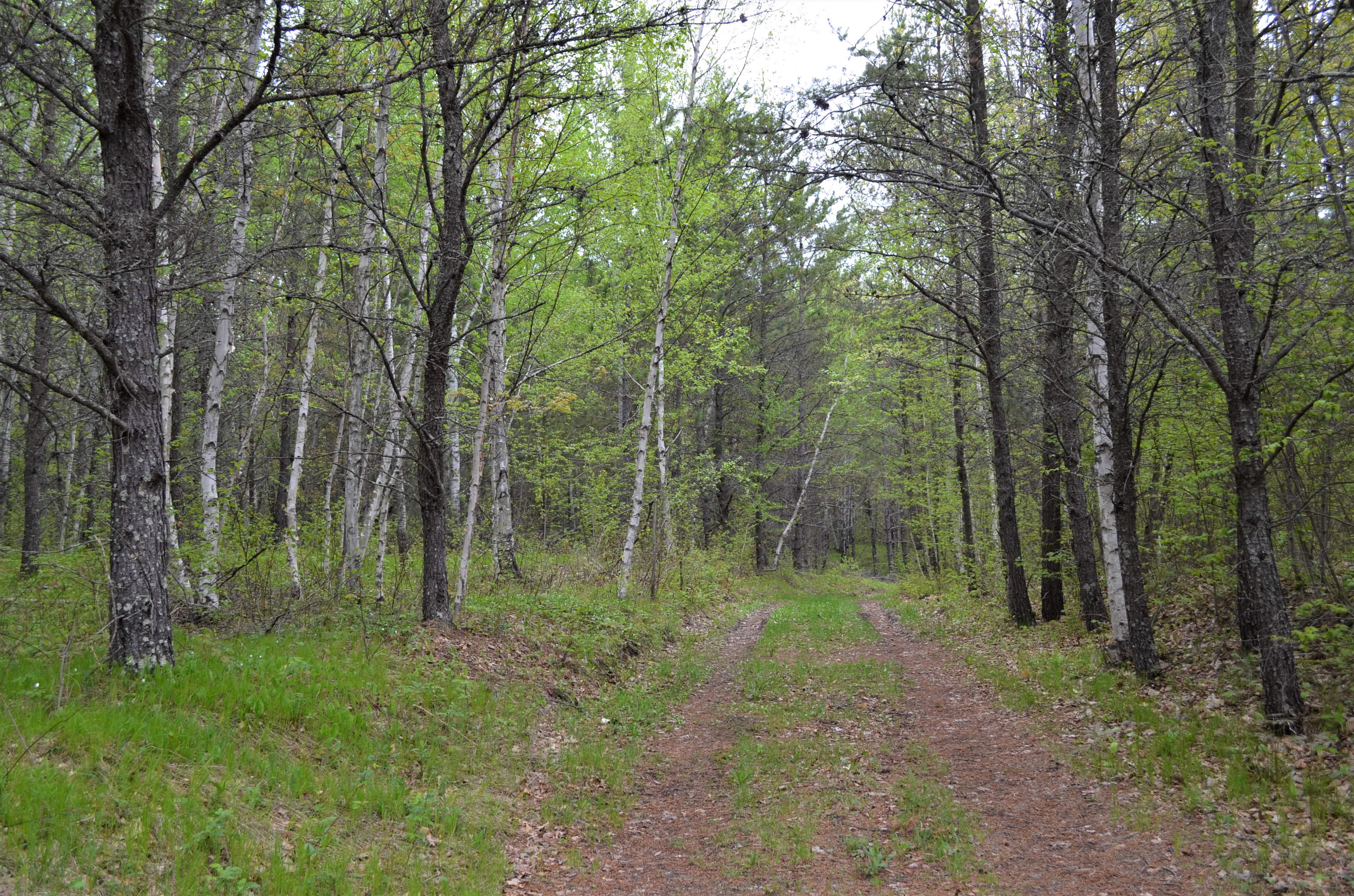
Feel far away without the long trip. This 120-acre PotlatchDeltic tract is minutes away from Crosslake, Emily and Crosby. Yet, when you’re there, it seems like you’re a world apart. Gently rolling terrain, frontage on the Little Pine River and a mature forest with a mix of red pine, jack pine and aspen make this an excellent hunting/recreational land investment. Big Al’s Bar and Grill is just minutes away at the intersection of Co Rd 36 and Hwy 6 and Crosslake is a little more than 7 miles to the west with restaurants, shopping, boat accesses on the Whitefish Chain and medical. Property adjoins the Crow Wing State Forest, approximately 600 acres, on the north and west to increase your privacy and hunting opportunities. Additional adjoining land is also available for purchase. Camping equipment on the property is not owned by the seller and will be removed prior to closing. The creek running through the property has a soft bed and vehicular crossing is not recommended.
Main Property Info
60150513, (Legacy 600153200000009) 60150512, (Legacy 600153300000009) 60150511, (Legacy 600153400000009
5236230
Sold
$182,900
$160,000
120.72
RR10, Shoreland & RR 2.5
Crosby
Fairfield Twp
MN
56441
Crow Wing
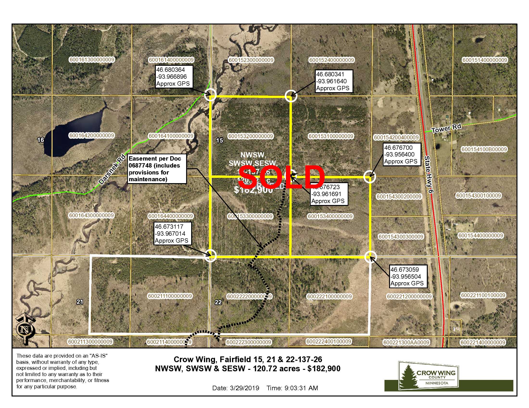
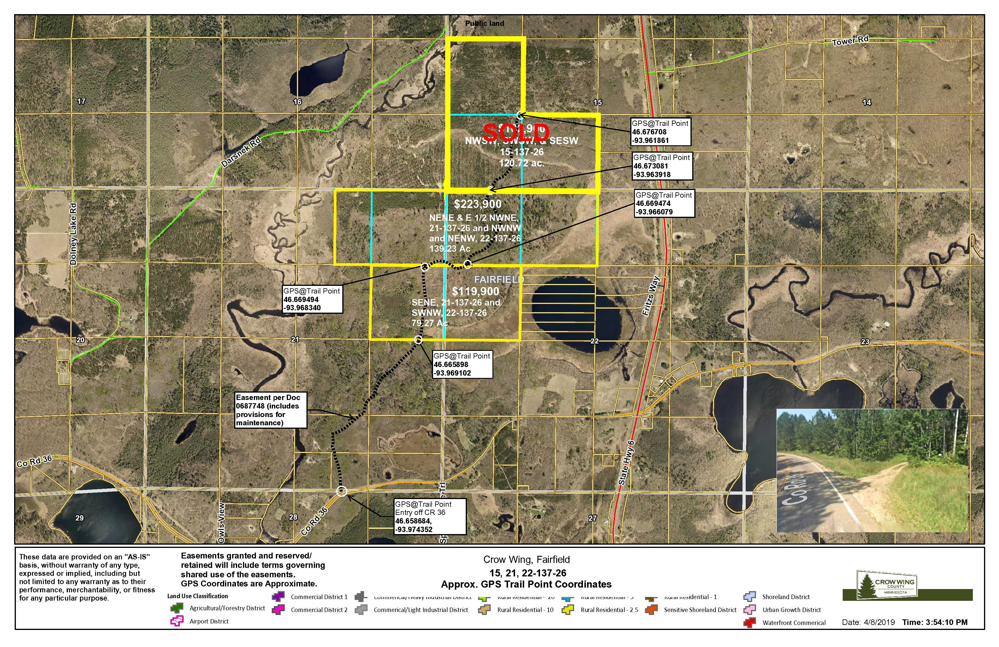
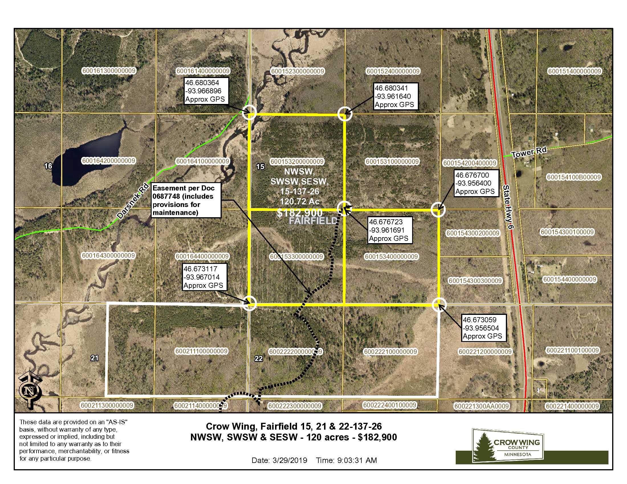
NWSW & SESW & SWSW, 15-137-26, Crow Wing County, Minnesota. Together with and subject to easement in Doc 0687748. Subject to any other easements, restrictions, or reservations of record. Note: Easement(s) granted and/or reserved will include terms governing shared use of the easement(s).
Property Location
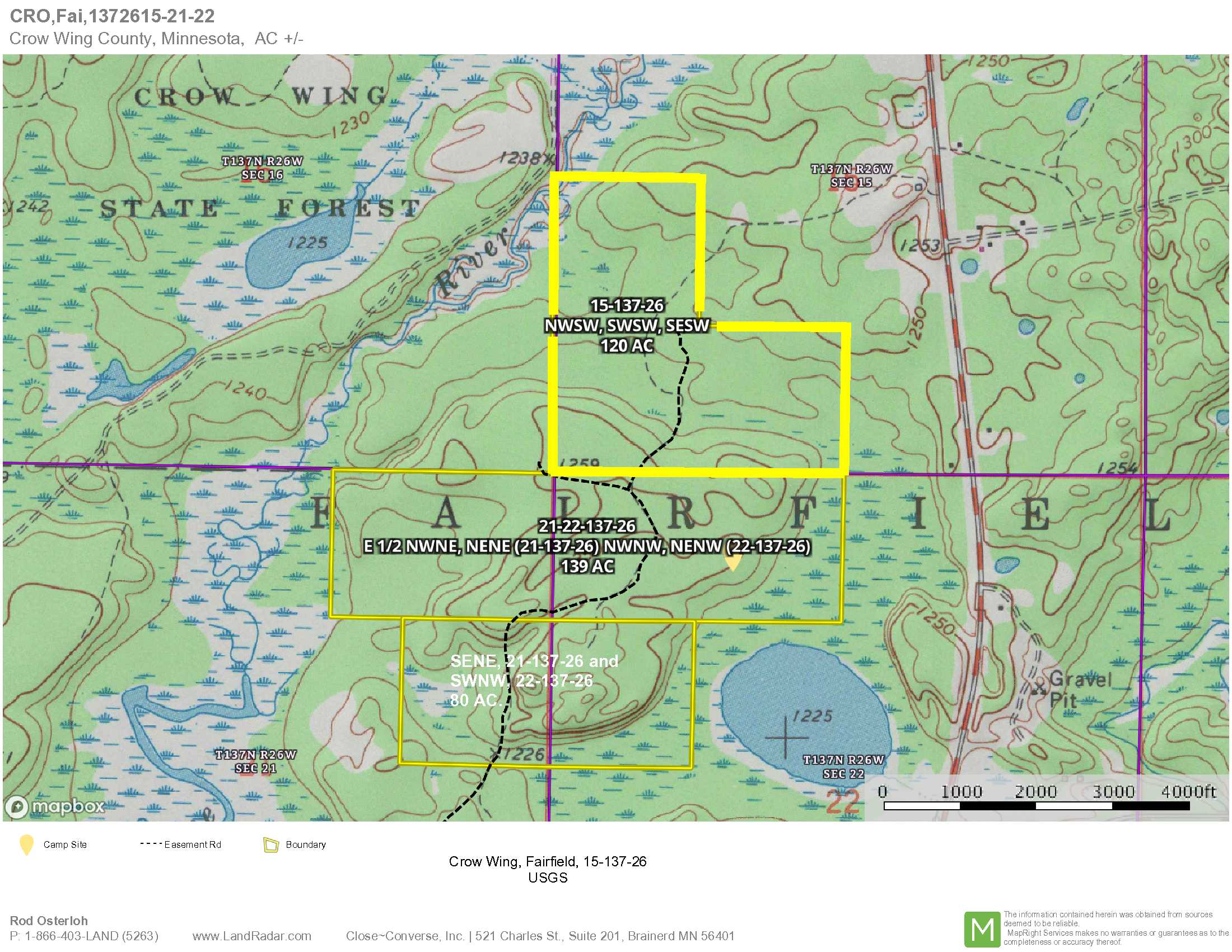
From the intersection of Hwy 6 and Co Rd 36 (12.9 miles north of Crosby MN); West on Co Rd 36 1.2 miles to easement road on the North side of Co Rd 36; Northerly and Easterly on the easement road 1.4 miles to the southerly boundary of the tract. Approximate GPS coordinate to this location is: 46.673081, -93.963918.
Access is via private easements over private property, as described in Document #0687748, from Co Rd 36 (about 1.2 miles west of State Hwy 6). See mapping for the course of the easement road. The creek running through the property has a soft bed and vehicular crossing is not recommended.
Coordinates to approximate corners/points based on county mapping: NW: 46.680364, -93.966896 NE: 46.680341, -93.961640 SE: 46.673059, -93.956504 SW: 46.673117, -93.967014
TBD PT 15-137-26, Co Rd 36, Crosby
Crosby-Ironton - 182
Property Details
0
110
1320 x 1320 x 1320, 1320 x 2640 x 2640
Utilities
None
None
Crow Wing Power (1-800-648-9401)
Waterfront
Little Pine River
DNR ID #S9990209
200+
The Little Pine River flows out of Lake Emily and continues on to the Mississippi.
Taxes & Fees
No
$1,136
0
$1,136
No
2019
Other Details
15
137
26
90
10
Additional Comments
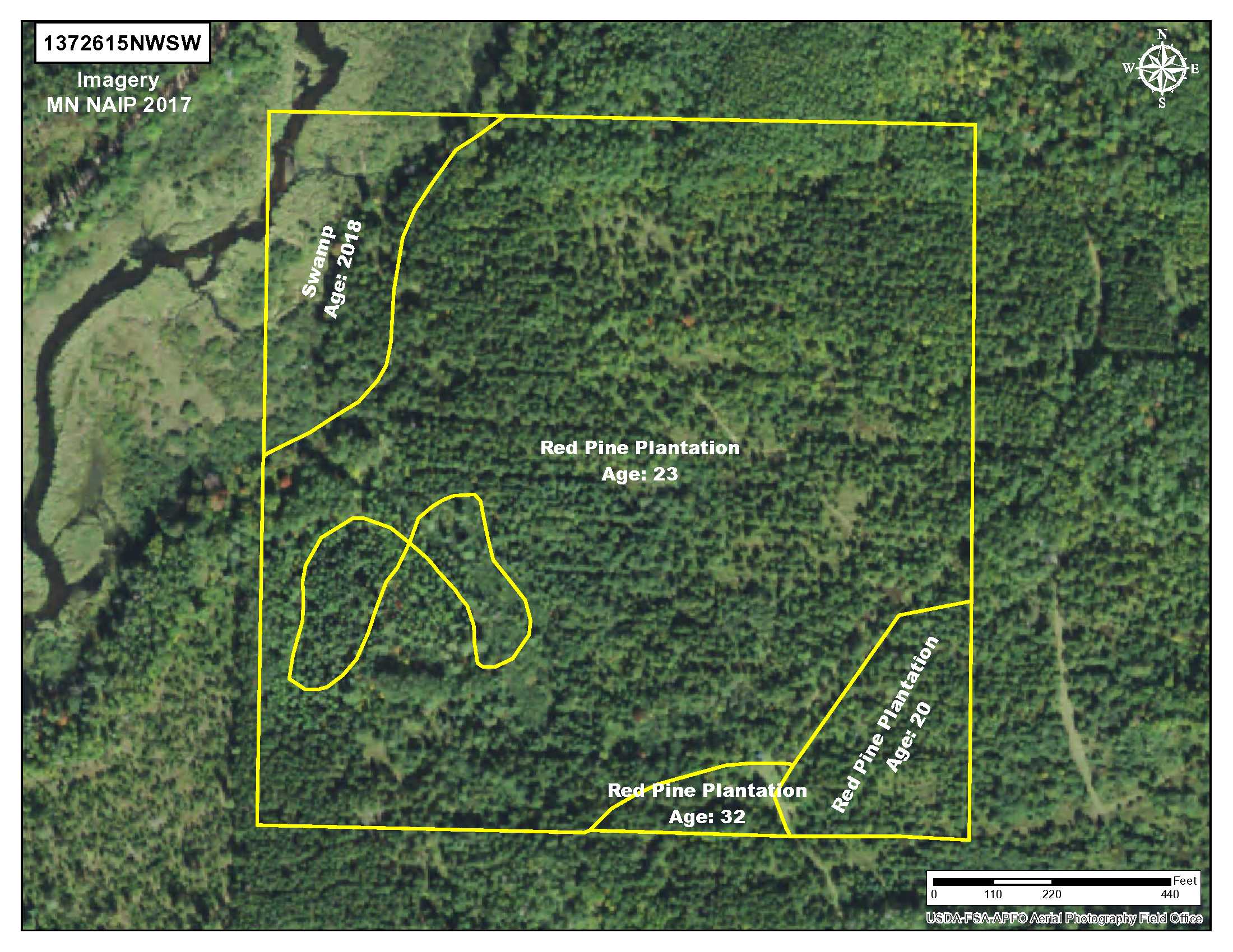
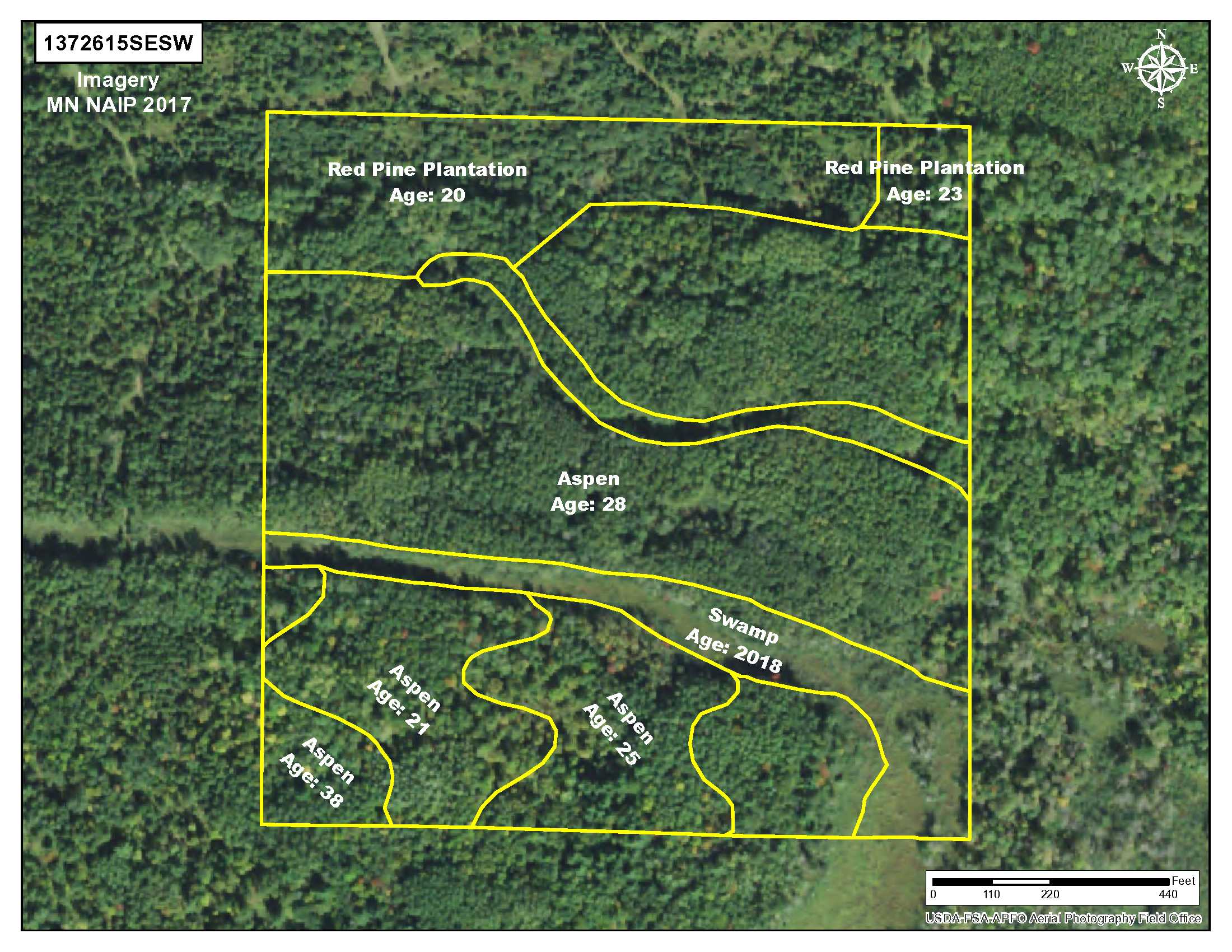
This tract boasts timber cover of various ages: Red pine 29, 23, 31 & 32-years-old; jack pine 31-years-old; aspen 21, 25, & 38-years-old.
Deer Permit Area: 247 http://files.dnr.state.mn.us/recreation/hunting/deer/dpa/DPA247.pdf
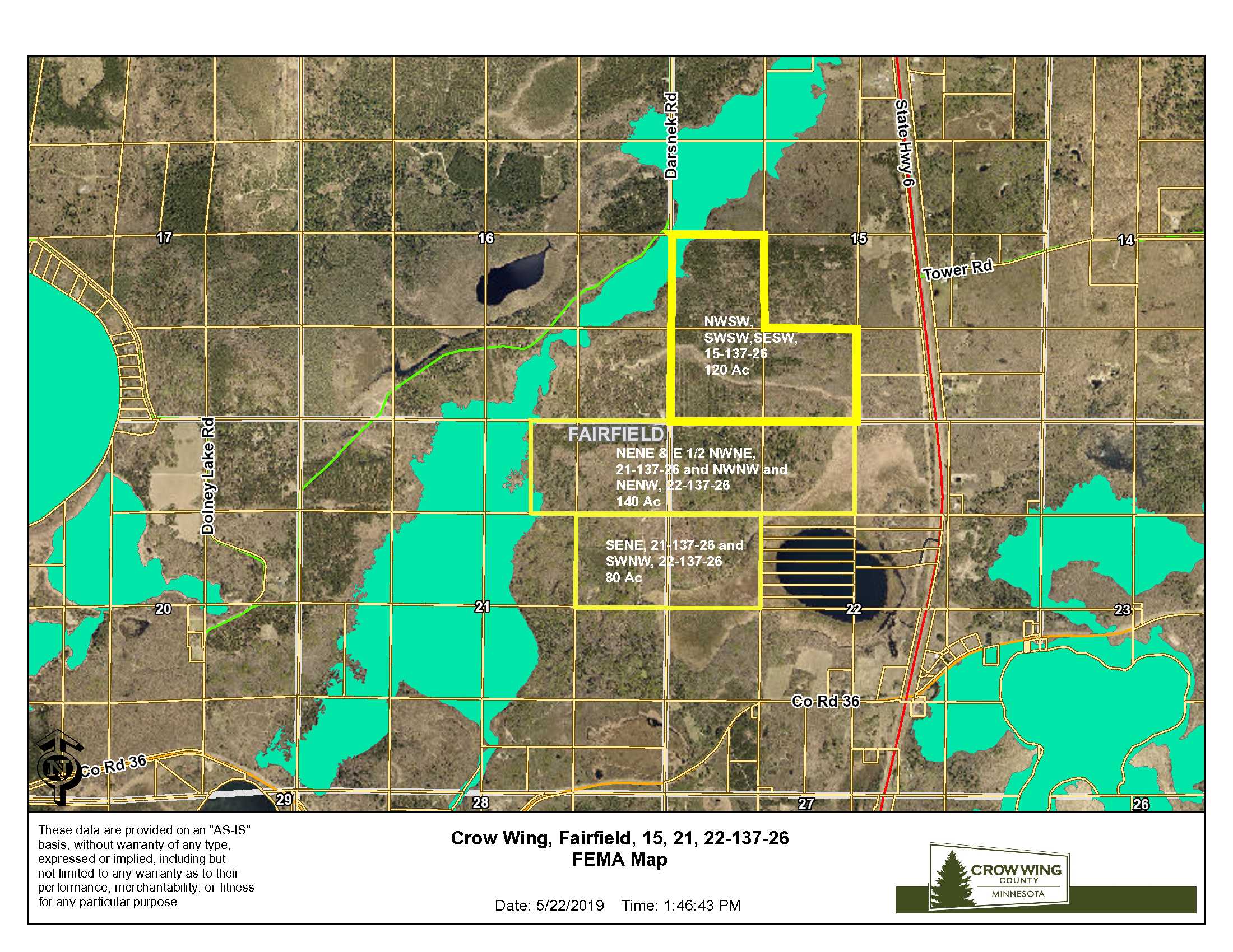
Easement(s) affect this property. See legal description and maps for details. Shared easements affect this property and easements granted and reserved/retained will include terms governing shared use of the easements. Acreage, dimensions, and taxes estimated based on county data and mapping or seller data; county disclaimers included by reference; subject to split approval if necessary. Not surveyed. Photos/maps and GPS coordinates for convenience only and not guaranteed; physically inspect prior to purchase. Any deer stands on the land are not property of seller and are not included in sale. Use seller approved Purchase Agreement. Closing dates are the 3rd Wednesday of each month. Camping equipment on the property is not owned by the seller and will be removed prior to closing. The creek running through the property has a soft bed and vehicular crossing is not advised. FEMA may affect this property.


