


MLS Number : 5137162
Sold $119,900 - Hunting & Recreation
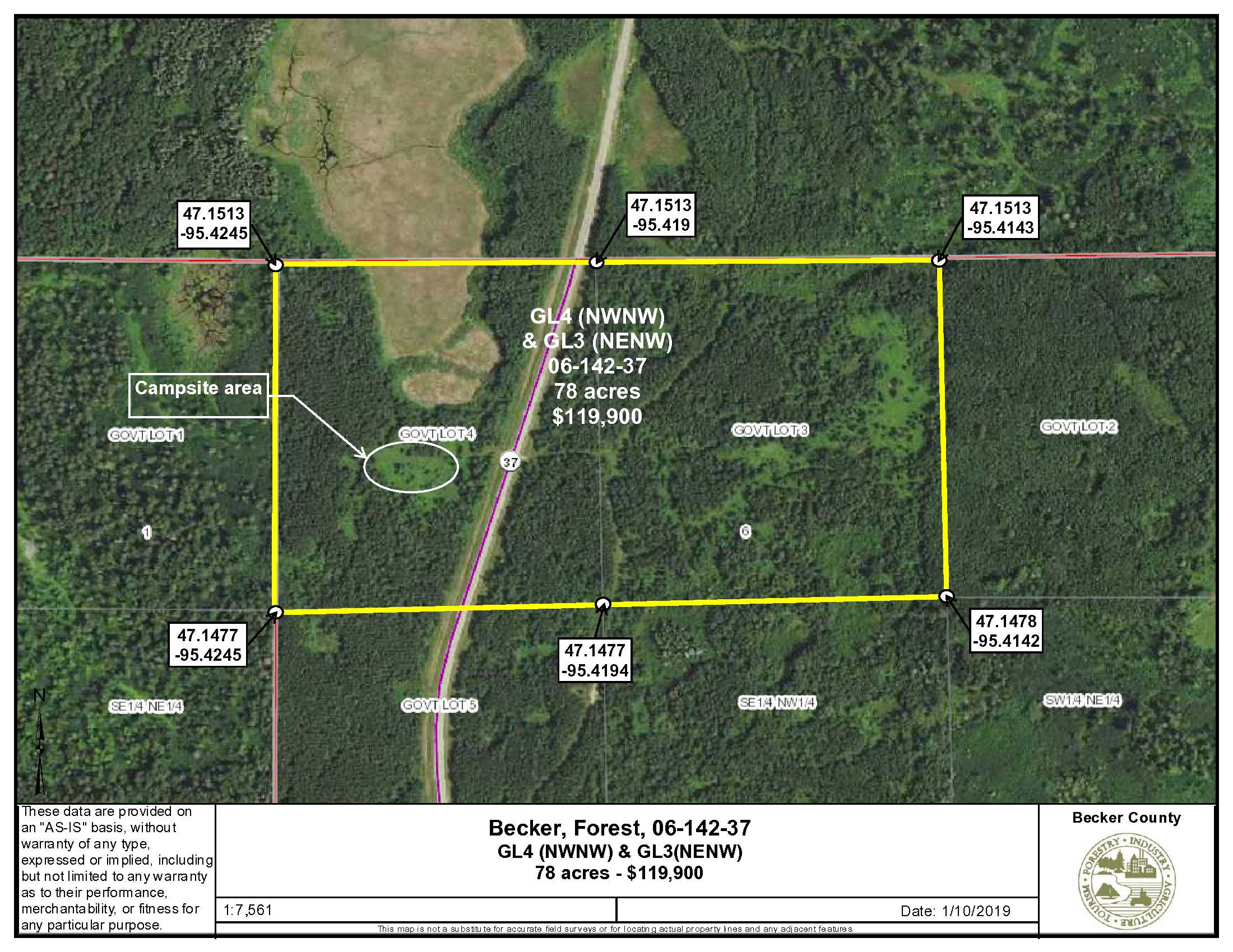
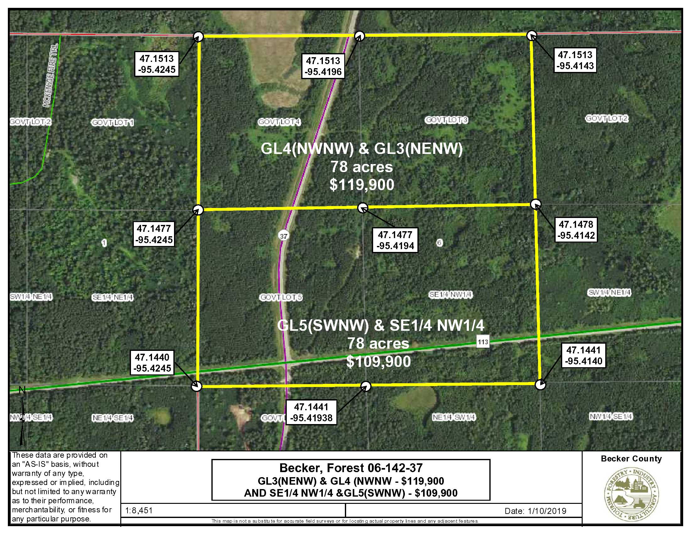
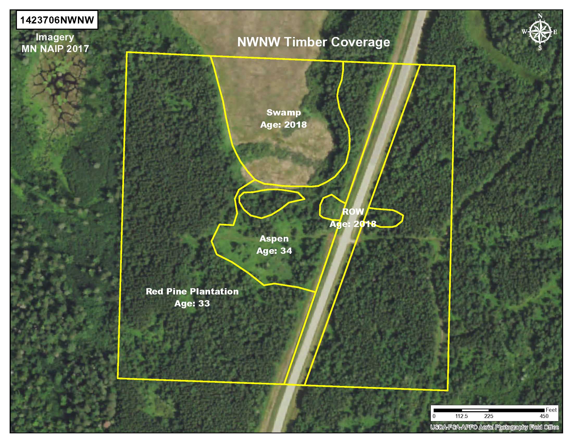
Attractive 78 acre tract features a campsite and convenient location on County Road 37 in Becker County. Owned by PotlatchDeltic and managed for timber. The North Country Trail, SE Mahnomen County Snow Trail and Forest Rider Trails are all in the vicinity. A map showing access to all the snowmobile trails in Becker County can be accessed at: Becker County Trails. This hunting land is primarily upland with rolling topography and forested with 33-34-year-old red pine and aspen. It’s 6 miles from Itasca State Park and less than 2 miles to the Bad Medicine Lake access. Other lakes are in the area, include Long Lost, Juggler, Pickerel and Elbow. This acreage is virtually surrounded by County and State Lake and is near to the Shelly Island, Pickerel and Hubbel Pond WMAs. The town of Elbow Lake is approximately 18 miles west. Another 78 acre parcel adjoins this tract on the south. MLS #5137337
Main Property Info
Part of R120041010
5137162
Sold
$119,900
$119,900
78
Agriculture
Elbow Lake
Forest Twp
MN
56531
Becker
GL 3 (also known as NENW) & GL 4 (also known as NWNW), 6-142-37, subject to Co Rd 37 (aka Lost Lake Rd) and subject to easements, restrictions and reservations of record, if any.
Property Location
From Park Rapids, intersection of Hwy 34 and Hwy 71; North on Hwy 71 17.3 miles; West on Co Rd 113 13.5 miles; North on Long Lost Lake Rd (Co Rd 37) .25 miles to the property on both sides of the road. At 1/3 mile north of the intersection of 113/37 are driveways on both sides of the road.
Paved road access to the property with driveways on both sides of Co Rd 37. The driveway to the west leads to an area that’s been used as campsite.
Coordinates to approximate corners/points based on county mapping: SW 47.1477/-95.4245, NW 47.1513/-95.4245, NE 47.1513/-95.4143, SE 47.1478/-95.4142
TBD County Road 37, Elbow Lake
Waubun-Ogema-White Earth - 435
Property Details
89%
2640 x 1320 x 2640 x 1320
Utilities
There are no utilities available
none
Taxes & Fees
$545
$545
2020
Other Details
6
142
37
89%
11%
Additional Comments
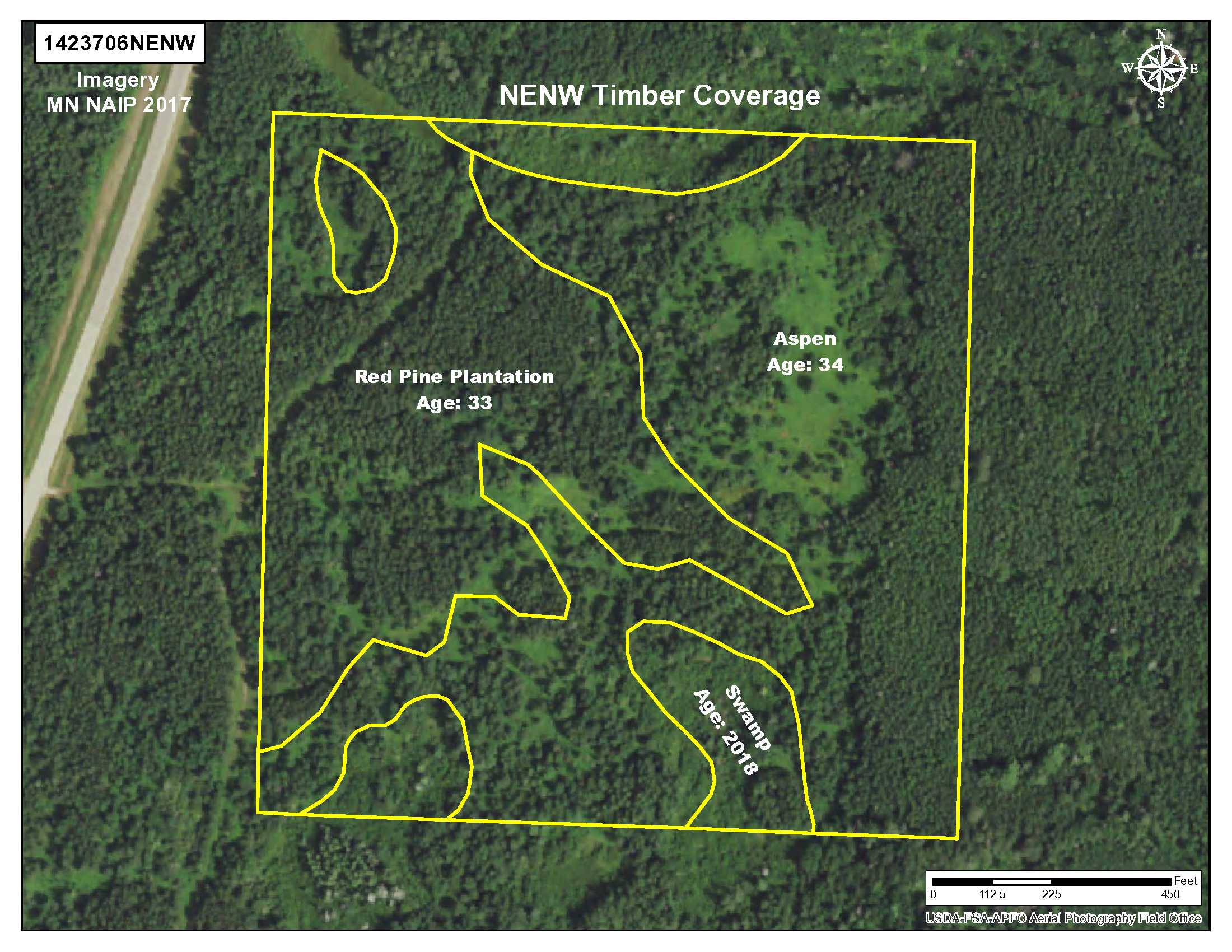
This property has been managed according to Forest Stewardship Council (FSC) standards. If timber value is important to you, seek the advice of a competent forester to determine species, volumes, and values. Predominately 33 year old, thinned red pine plantation with the balance being 34 year old aspen.
Hunting zone: GL3 (NENW) and GL4 (NWNW) are in permit area 184. According to DNR reports, in 2017 4.65 deer were harvested per square mile in this zone.
Nearest utilities are approx. 1 mile away. This parcel represents a split of PID #120041010; taxes were estimated to be ½ of the total taxes for the entire parcel. Zoned Agriculture. Acreage, dimensions and taxes are estimated based on county data and mapping; county disclaimers included by reference; subject to split approval if necessary. The property has not been surveyed. Photos and maps are for convenience only and are not guaranteed; physically inspect prior to purchase. Any deer stands on the land are not property of seller and are not included in sale. Use seller-approved PA and addendum; closing dates the 3rd Wednesday each month.


