

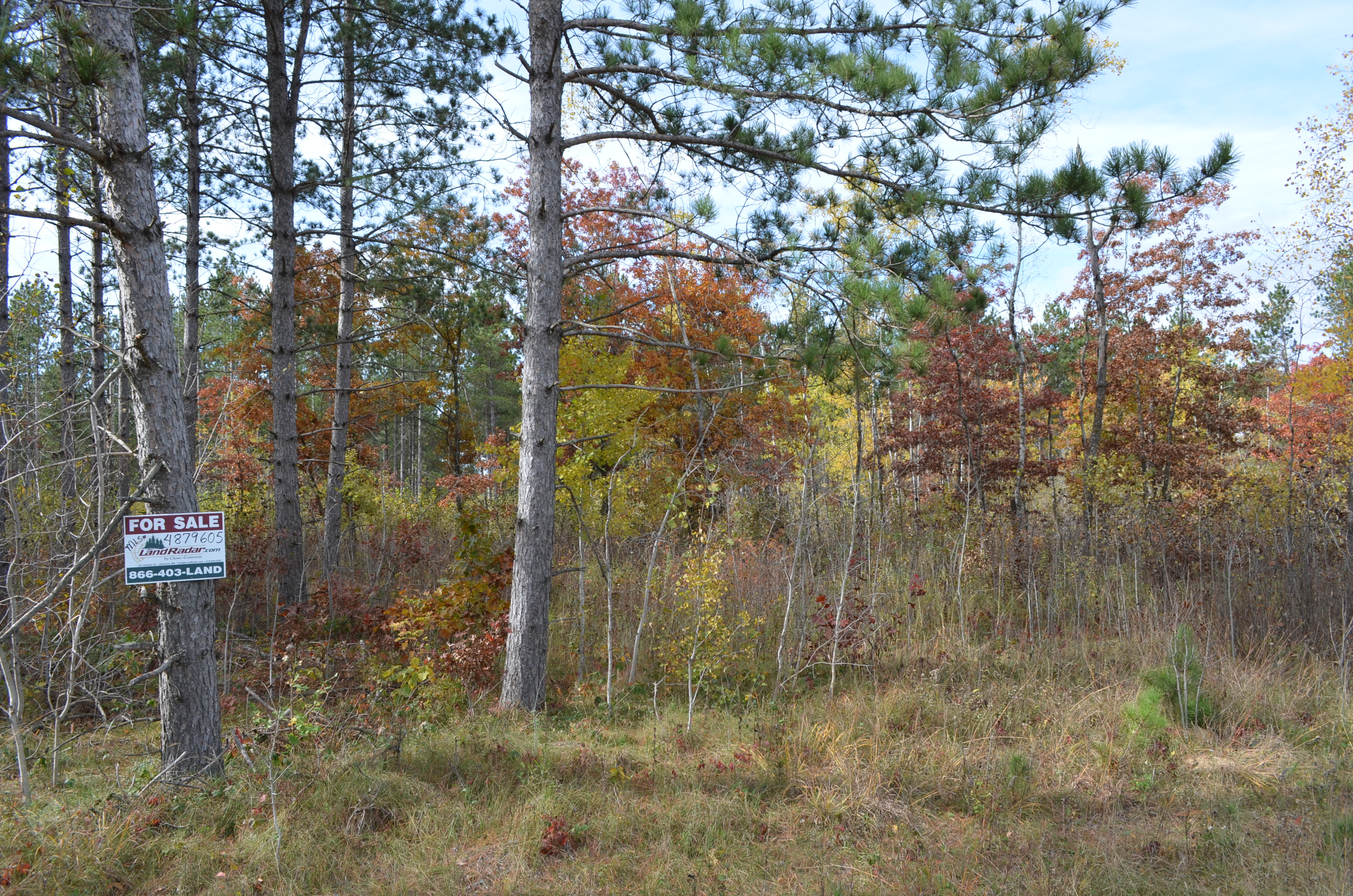
MLS Number : 4879605
Sold $97,000 - Hunting & Recreation
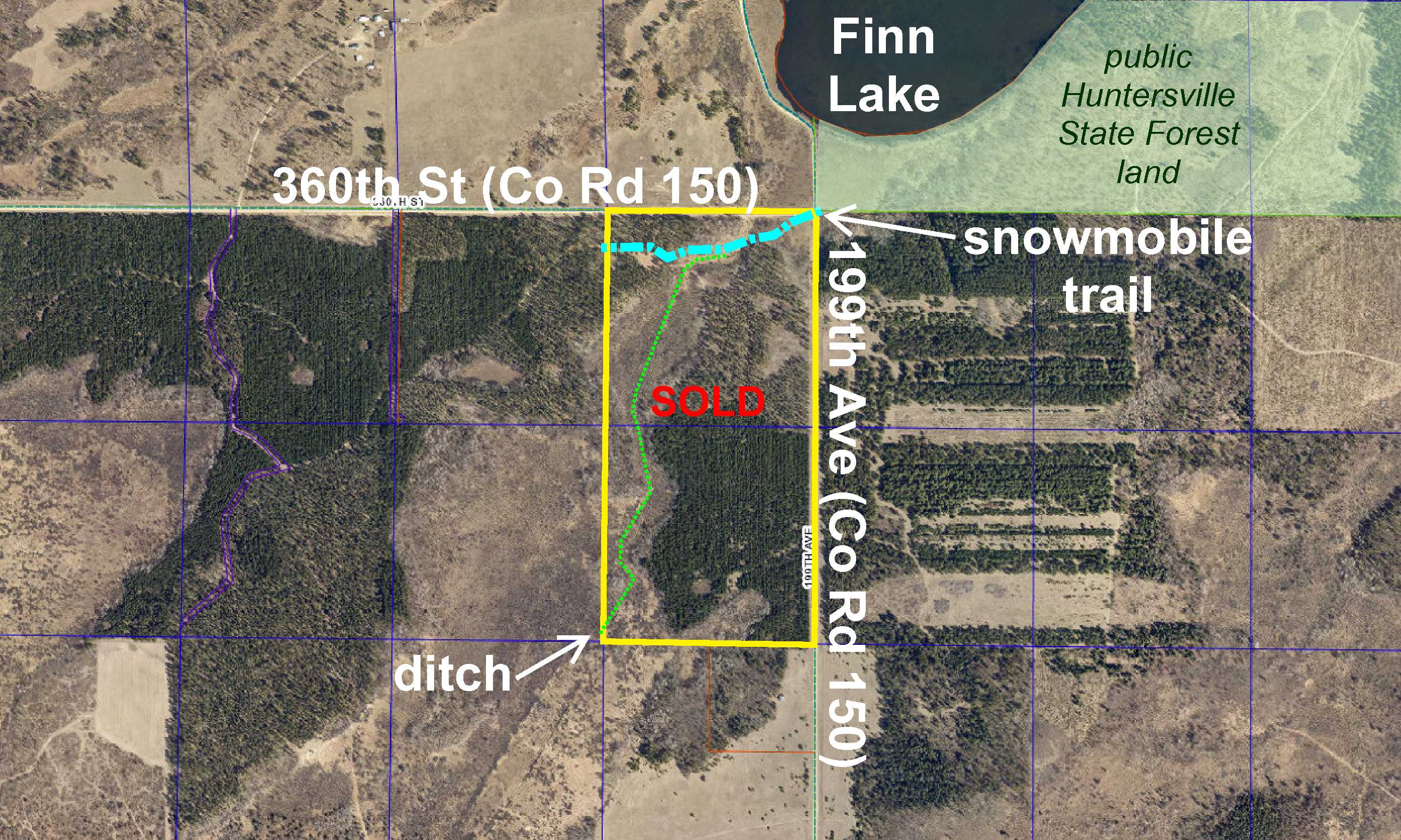
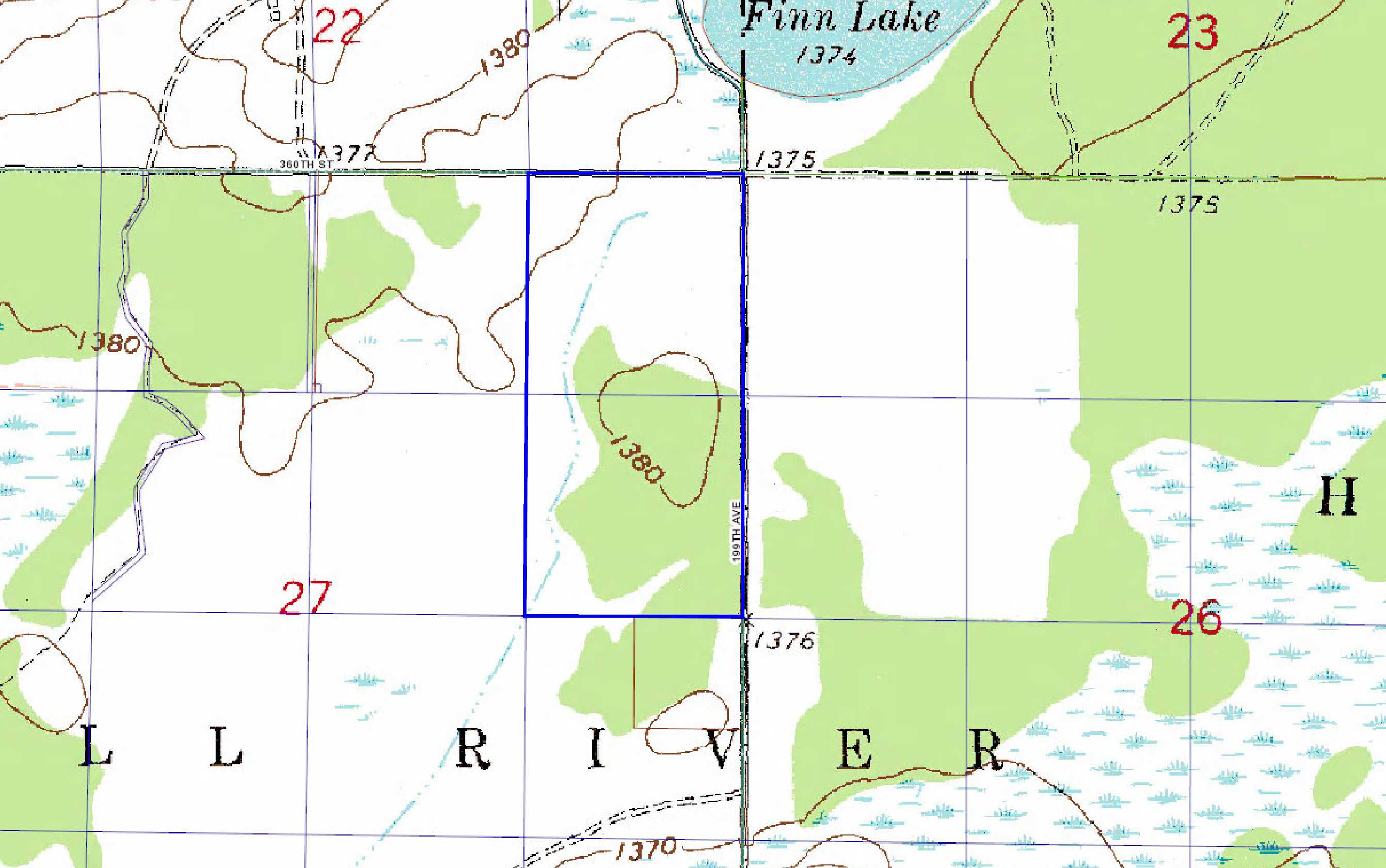
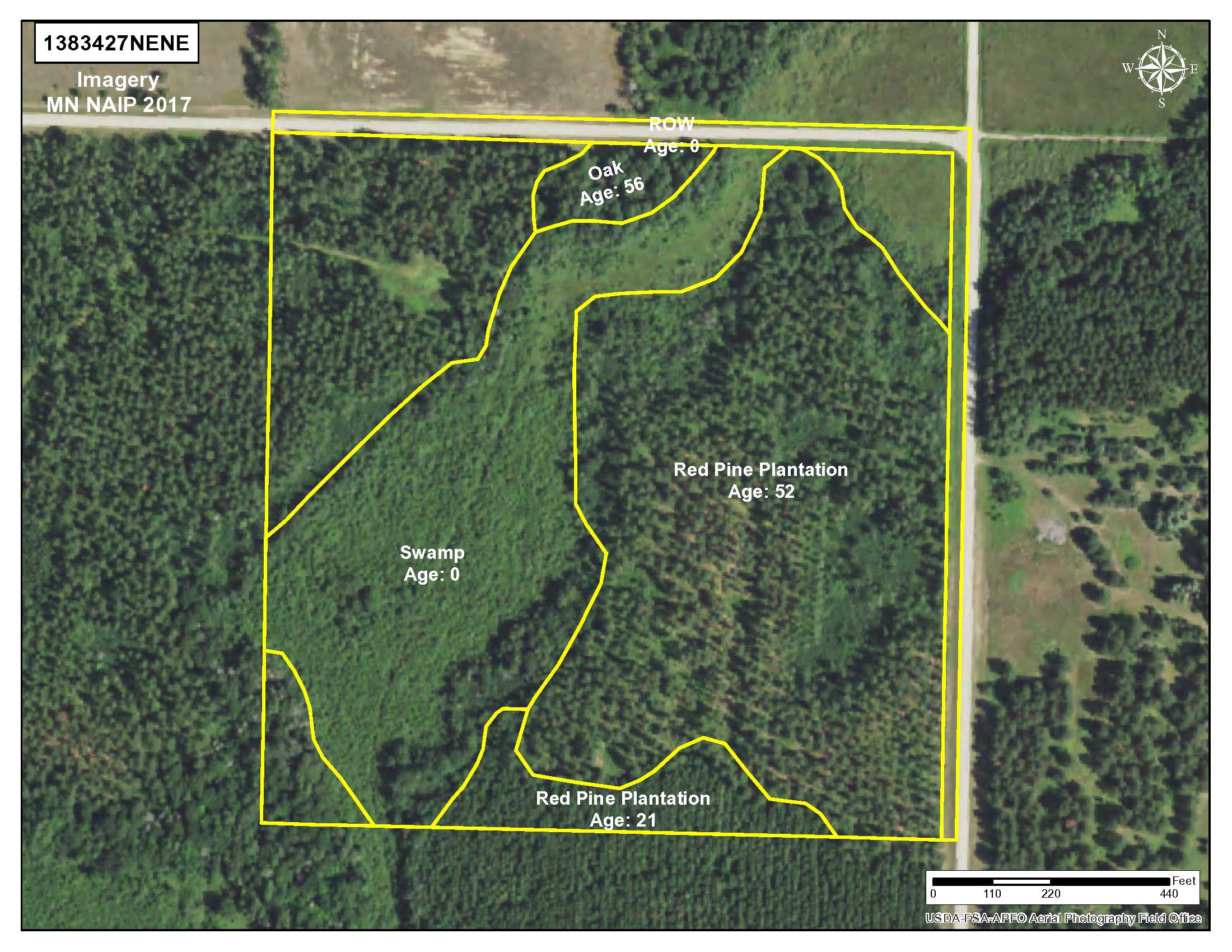
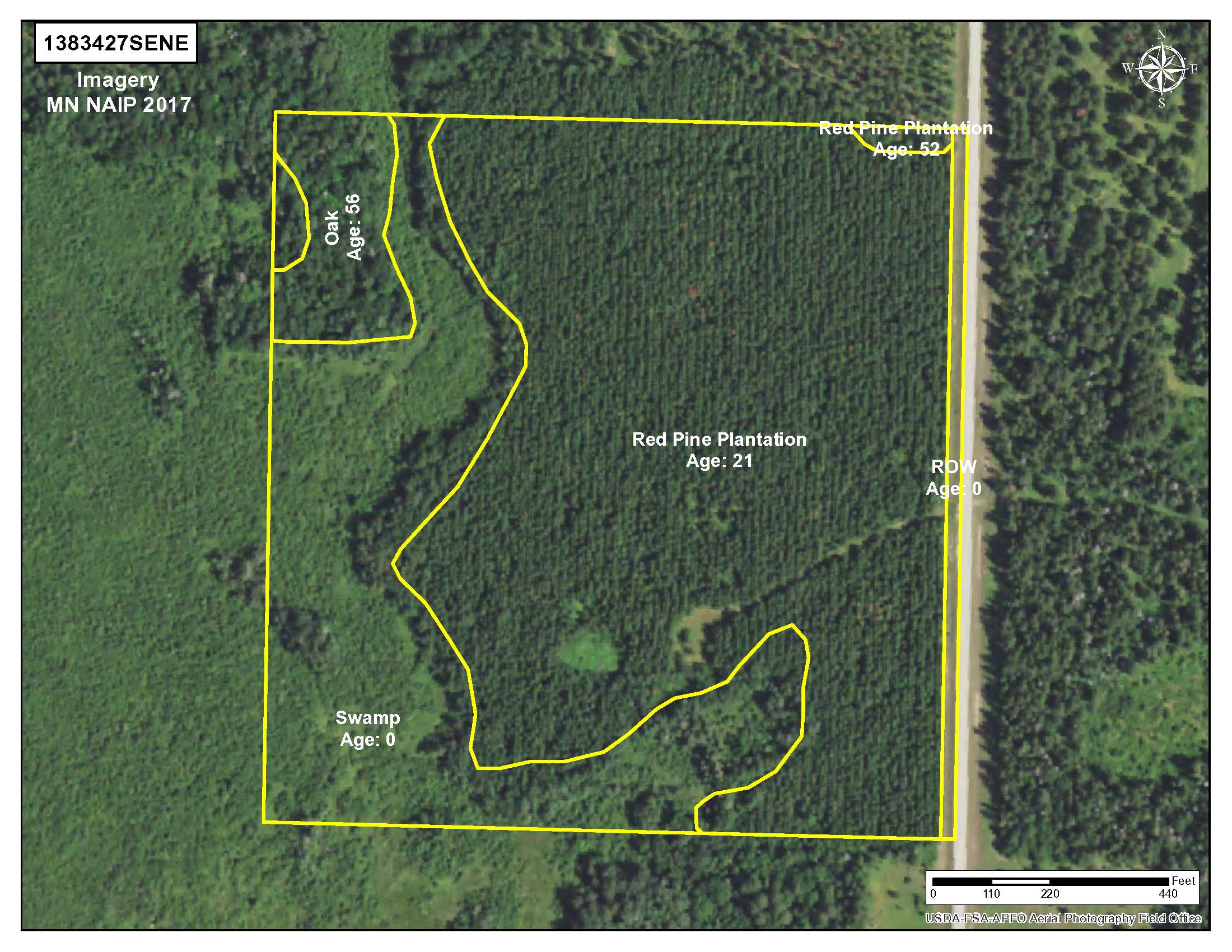
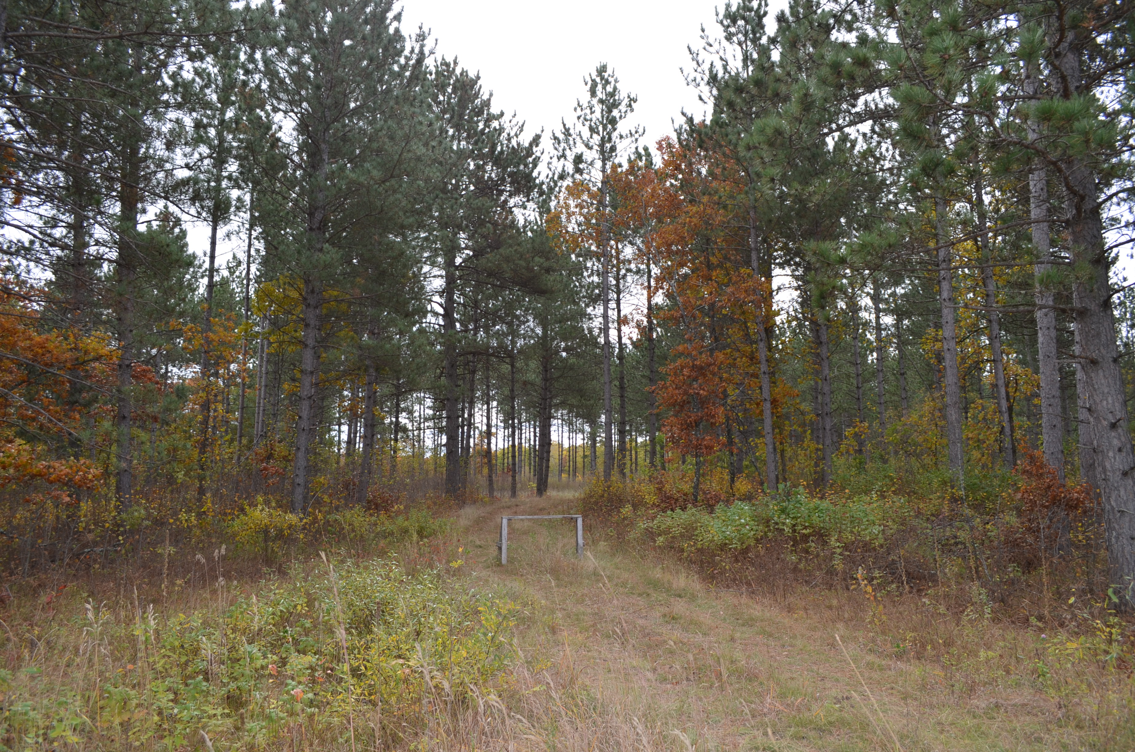
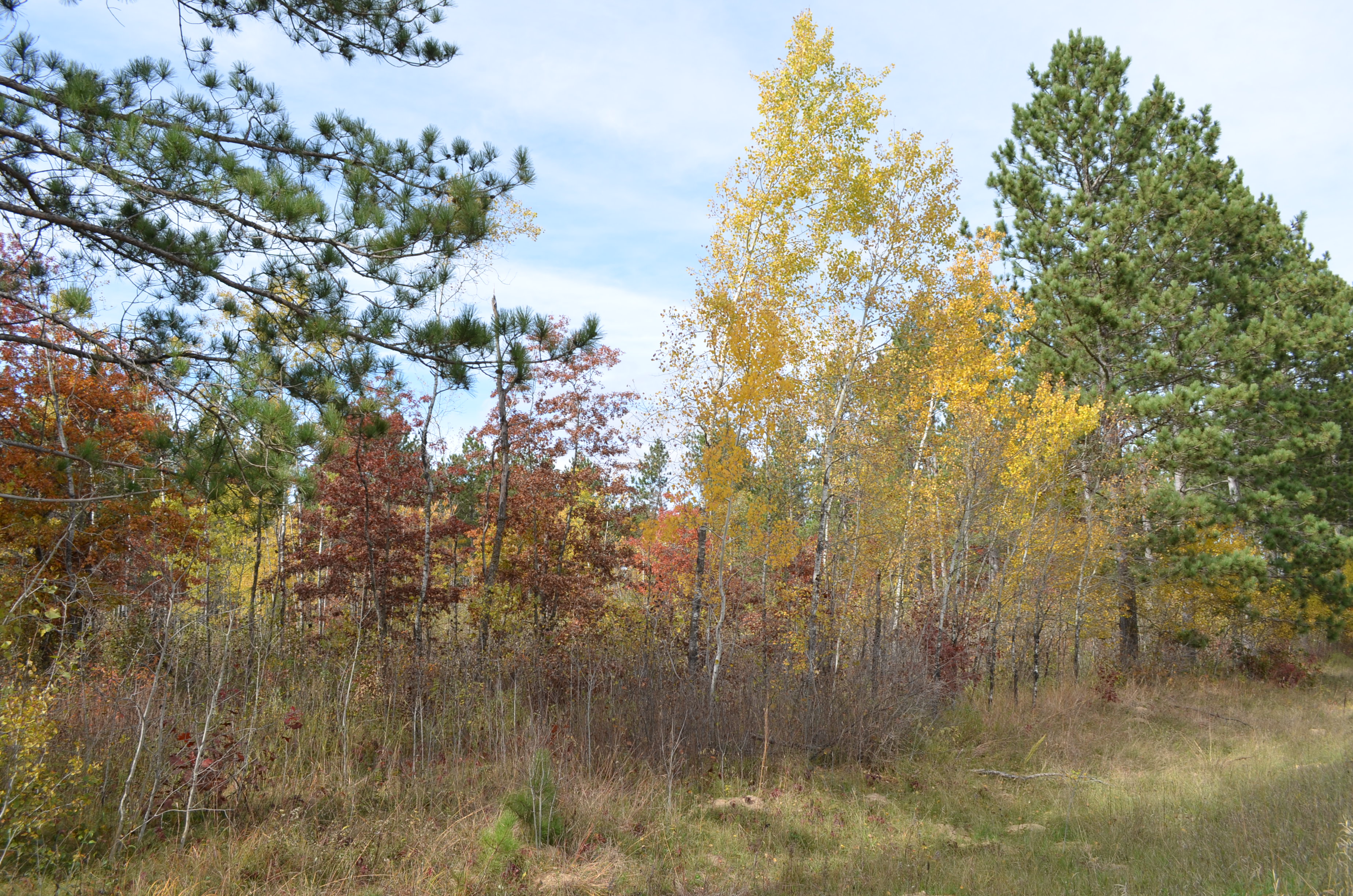
Potlatch land by Finn Lake east of Menahga. Level terrain wooded with red pine and oak. Wetland and ditch weave through the north portion and along the west side. Great access with gravel county roads along the north and east sides. A snowmobile trail near the north boundary is part of the Trail Breakers Inc. system with over 200 miles of groomed state Grant-In-Aid trails. Hundreds of acres of public Huntersville State Forest land adjoin the northeast corner (across the intersection) for plenty of hunting area, and public access to the Crow Wing River is just over 1 mile away for fishing, canoeing, tubing, and other water recreation.
Main Property Info
Property ID
Pt 120271010
Pt 120271010
MLS Number
4879605
4879605
Status
Sold
Sold
List Price
$107,900
$107,900
Selling Price
$97,000
$97,000
Acres
80
80
Zoning
A-2 Mixed Agriculture with S-1 Shoreland Overlay in the NE corner
A-2 Mixed Agriculture with S-1 Shoreland Overlay in the NE corner
City
Menahga
Menahga
Township
Shell River Twp
Shell River Twp
State
MN
MN
Zip Code
56464
56464
County
Wadena
Wadena
Legal Description
NENE & SENE, 27-138-34. Subject to 360th St (Co Rd 150), 199th Ave (Co Rd 150), snowmobile trail, ditch, and any other easements, restrictions, or reservations of record.
NENE & SENE, 27-138-34. Subject to 360th St (Co Rd 150), 199th Ave (Co Rd 150), snowmobile trail, ditch, and any other easements, restrictions, or reservations of record.
Property Location
Directions
From the intersection of US Hwy 71 and Co Rd 31 (3rd St SE) in Menahga, east and southeast on Co Rd 31 for 4 1/10 miles. Continue straight on E Hall Rd for 1 2/10 miles. Left on 179th Ave then right on 360th St (Co Rd 150) for 1 8/10 miles to trail on right into northwest corner of the property.
From the intersection of US Hwy 71 and Co Rd 31 (3rd St SE) in Menahga, east and southeast on Co Rd 31 for 4 1/10 miles. Continue straight on E Hall Rd for 1 2/10 miles. Left on 179th Ave then right on 360th St (Co Rd 150) for 1 8/10 miles to trail on right into northwest corner of the property.
Access
Access is via gravel 360th St (Co Rd 150) along the north and gravel 199th Ave (Co Rd 150) along the east.
Access is via gravel 360th St (Co Rd 150) along the north and gravel 199th Ave (Co Rd 150) along the east.
GPS Coordinates
Coordinates to approximate corners/points based on county mapping: NW corner along 360th St (Co Rd 150) = 46.7468, -94.9593; NE corner at intersection of 360th St (Co Rd 150) & 199th Ave (Co Rd 150) = 46.7468, -94.9541; SE corner along 199th Ave (Co Rd 150) = 46.7395, -94.9541; SW corner = 46.7396, -94.9593 .
Coordinates to approximate corners/points based on county mapping: NW corner along 360th St (Co Rd 150) = 46.7468, -94.9593; NE corner at intersection of 360th St (Co Rd 150) & 199th Ave (Co Rd 150) = 46.7468, -94.9541; SE corner along 199th Ave (Co Rd 150) = 46.7395, -94.9541; SW corner = 46.7396, -94.9593 .
Address
360th St (Co Rd 150) & 199th Ave (Co Rd 150)
360th St (Co Rd 150) & 199th Ave (Co Rd 150)
School District
Menahga - 821
Menahga - 821
Property Details
Dimensions (approx)
1320 x 2640 x 1320 x 2640
1320 x 2640 x 1320 x 2640
Utilities
Power Company
Todd-Wadena Electric (1-800-320-8932)
Todd-Wadena Electric (1-800-320-8932)
Taxes & Fees
Tax Amount
$1,180
$1,180
Tax Year
2019
2019
Other Details
Section Number
27
27
Township Number
138
138
Range Number
34
34
Estimated Upland %
65
65
Estimated Wetland %
35
35
Additional Comments
Timber Comments
This property has been managed according to Forest Stewardship Council (FSC) standards and is wooded with red pine and oak. If timber value is important to you, seek the advice of a competent forester to determine species, volumes and values.
This property has been managed according to Forest Stewardship Council (FSC) standards and is wooded with red pine and oak. If timber value is important to you, seek the advice of a competent forester to determine species, volumes and values.
Hunting Comments
This property adjoins public land in MN Firearms Deer Zone 246.
This property adjoins public land in MN Firearms Deer Zone 246.
Disclosures
Parcel split; acreage, dimensions, and taxes estimated based on county data and mapping; county disclaimers included by reference; subject to split approval if necessary. Not surveyed. Photos/maps for convenience only and not guaranteed; physically inspect prior to purchase. Any deer stands on the land are not property of seller and are not included in sale. Use seller-approved PA and addendum; closing dates the 3rd Wednesday each month.
Parcel split; acreage, dimensions, and taxes estimated based on county data and mapping; county disclaimers included by reference; subject to split approval if necessary. Not surveyed. Photos/maps for convenience only and not guaranteed; physically inspect prior to purchase. Any deer stands on the land are not property of seller and are not included in sale. Use seller-approved PA and addendum; closing dates the 3rd Wednesday each month.


