
MLS Number : 5578977
Sold $116,000 - Home & Cabin Sites, Hunting & Recreation
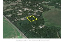
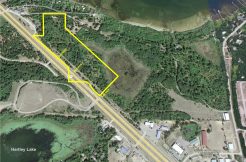
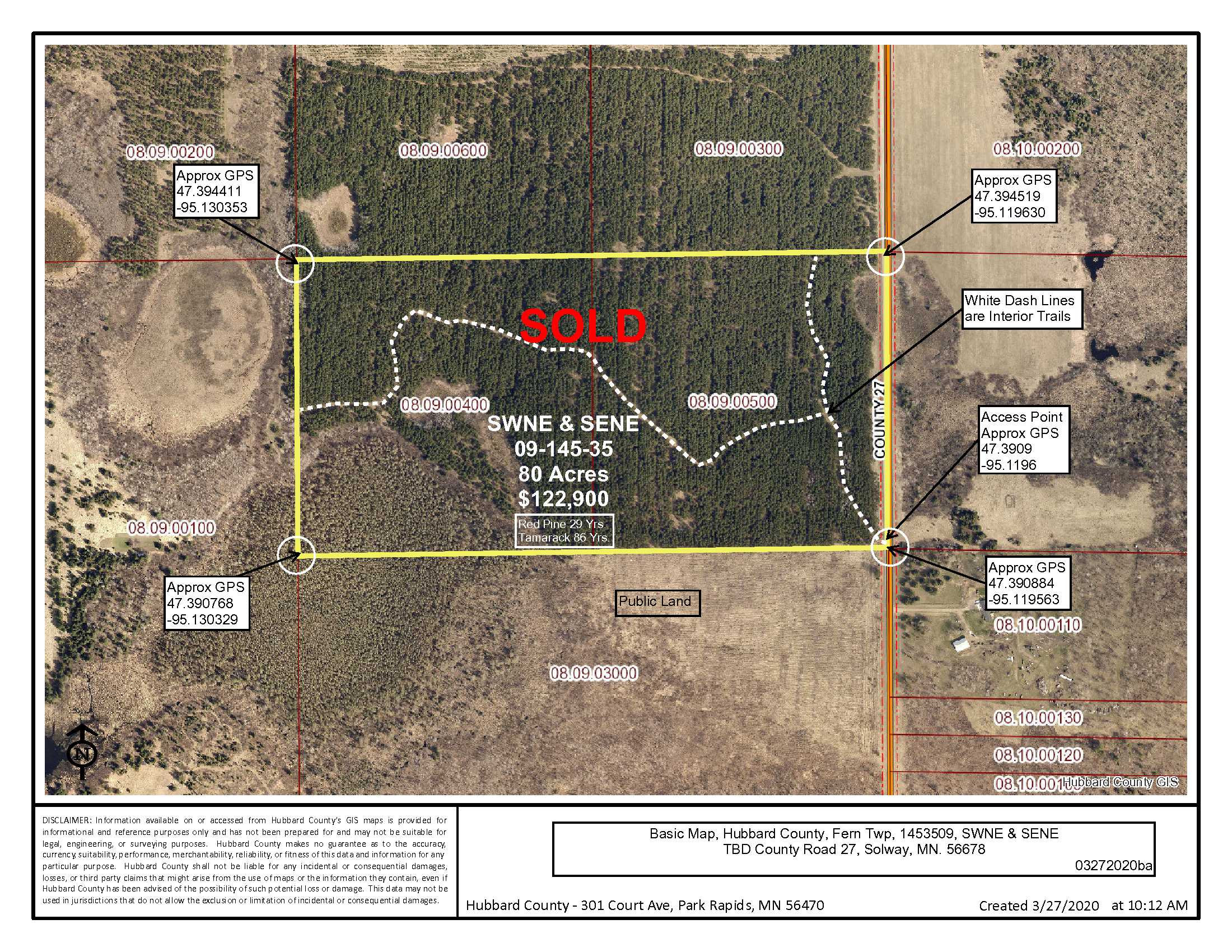
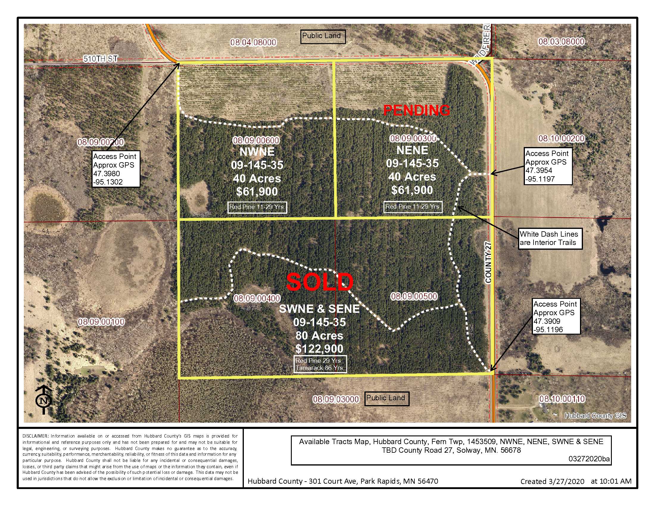
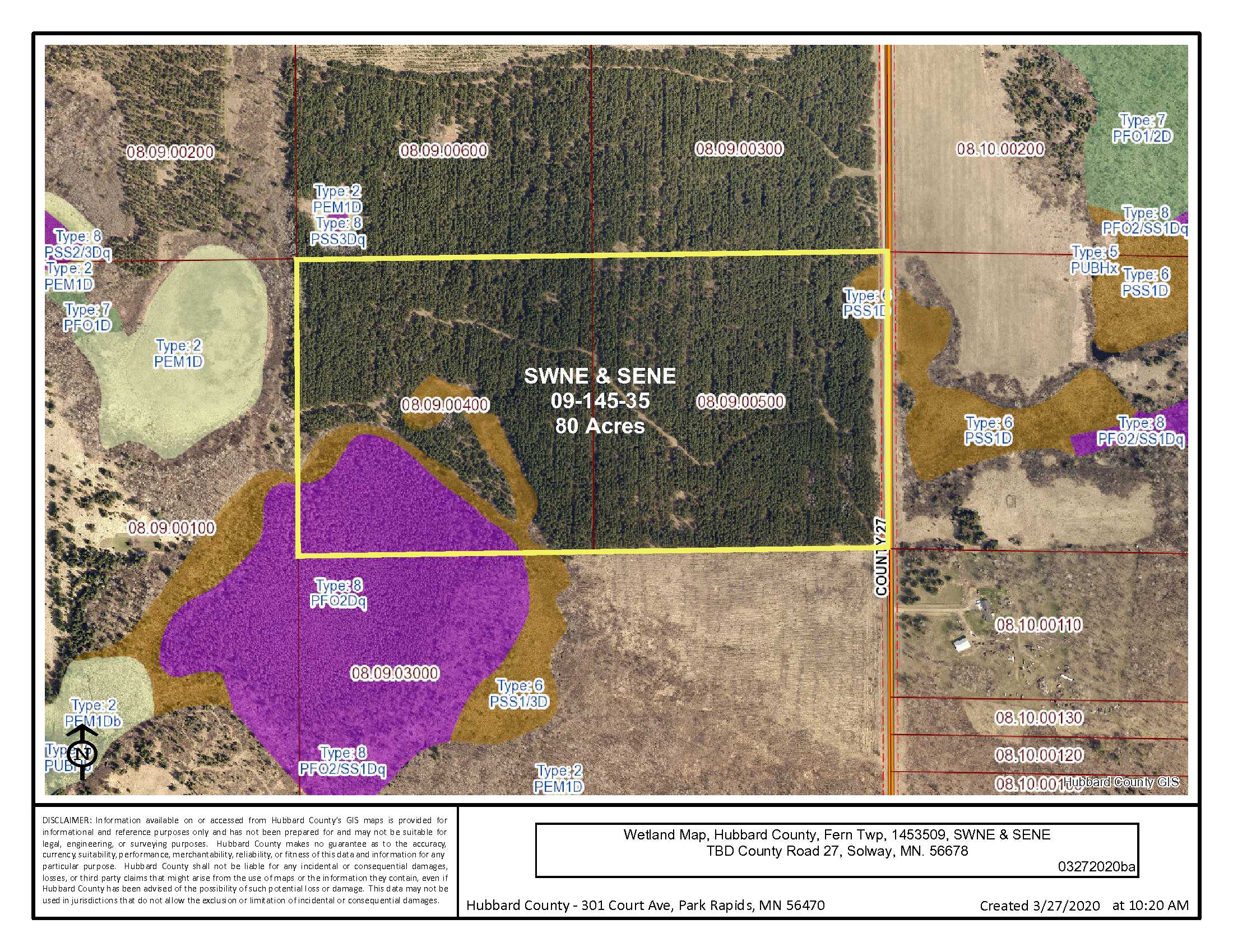
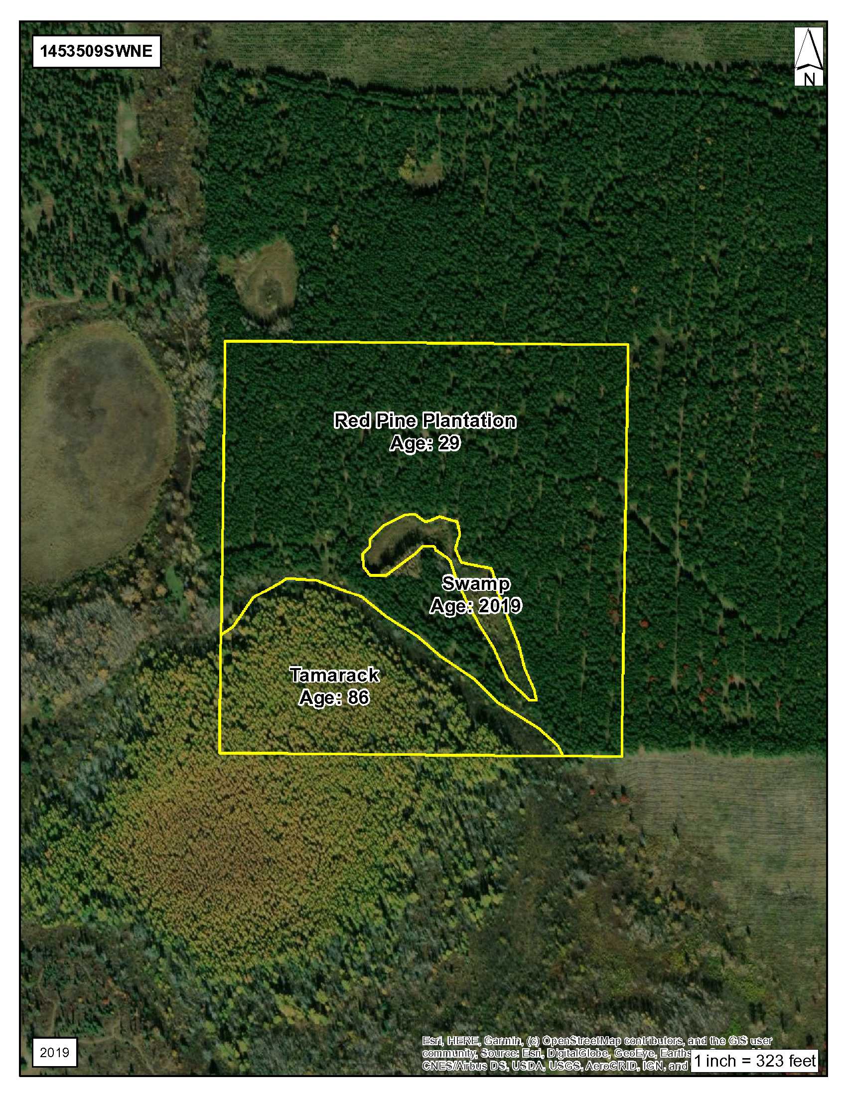
Great acreage for a homesite or recreation. Easy access off of County Road 27 near Solway leads into 80 acres of a beautiful 29-year old Red Pine Plantation with 86-year old Tamarack in the southwest corner. There is public land to the south, La Salle and Crystal lakes nearby, as well as the La Salle Lake State Recreation Area and Coffee Pot Landing to further your outdoor interests.
Main Property Info
Property ID
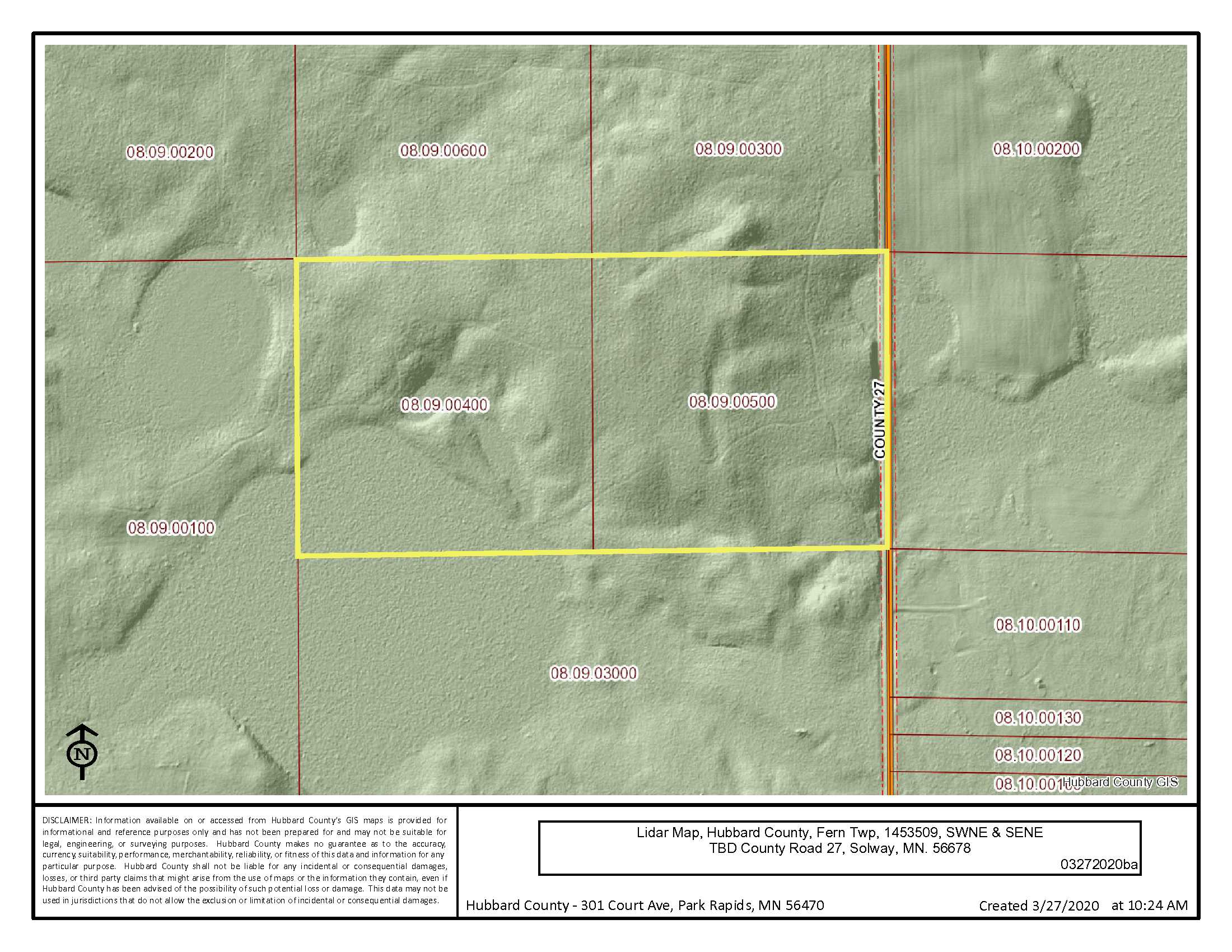
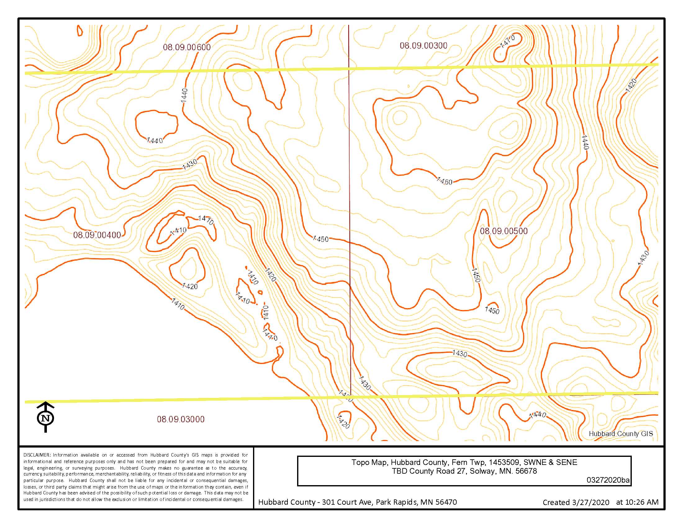
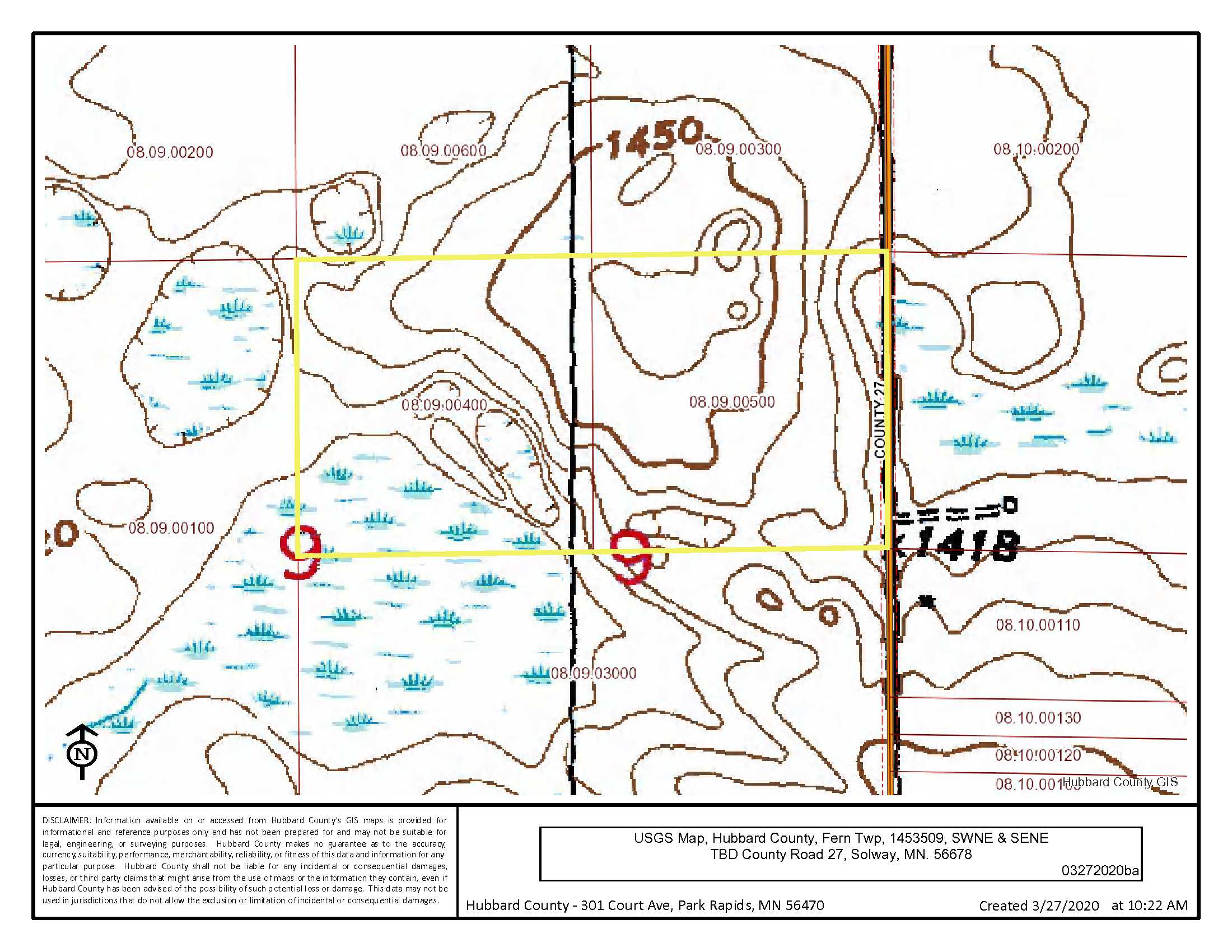
08.09.00400 & 08.09.00500
08.09.00400 & 08.09.00500
MLS Number
5578977
5578977
Status
Sold
Sold
List Price
$122,900
$122,900
Selling Price
$116,000
$116,000
Acres
80
80
Zoning
Hubbard County does not zone non-waterfront properties
Hubbard County does not zone non-waterfront properties
City
Solway
Solway
Township
Fern Twp
Fern Twp
State
MN
MN
Zip Code
56678
56678
County
Hubbard
Hubbard
Legal Description
SWNE & SENE, 09-145-35. Subject to Co Rd 27 and any easements, restrictions, or reservations of record.
SWNE & SENE, 09-145-35. Subject to Co Rd 27 and any easements, restrictions, or reservations of record.
Property Location
Directions
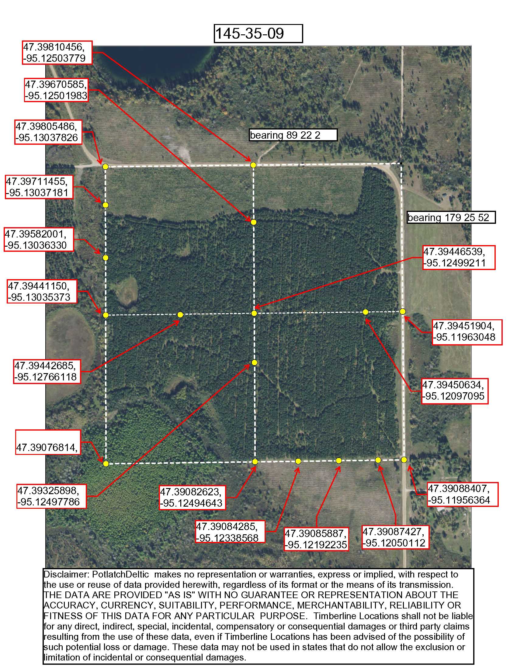
From Solway MN. at the intersection of Hwy 2 and Co Rd 5 (Centerline Rd. N) Go south on Co Rd 5 7.4 mi to where the road becomes Co Rd 27 (Unpaved). Continue on Co Rd 27 2.3mi to access of tract on right (W). Approx GPS Point of Access: 47.3909, -95.1196
From Solway MN. at the intersection of Hwy 2 and Co Rd 5 (Centerline Rd. N) Go south on Co Rd 5 7.4 mi to where the road becomes Co Rd 27 (Unpaved). Continue on Co Rd 27 2.3mi to access of tract on right (W). Approx GPS Point of Access: 47.3909, -95.1196
Access
Unpaved County Road #27: Approx GPS Point of Access: 47.3909, -95.1196
Unpaved County Road #27: Approx GPS Point of Access: 47.3909, -95.1196
GPS Coordinates
Coordinates to approximate corners/points based on county mapping: NW: 47.394411, -95.130353 NE: 47.394519, -95.119630 SE: 47.390884, -95.119563 SW: 47.39078, -95.130329
Coordinates to approximate corners/points based on county mapping: NW: 47.394411, -95.130353 NE: 47.394519, -95.119630 SE: 47.390884, -95.119563 SW: 47.39078, -95.130329
Address
SWNE & SENE, TBD Co Rd 27, Solway, MN 56678
SWNE & SENE, TBD Co Rd 27, Solway, MN 56678
School District
Bemidji - 31
Bemidji - 31
Property Details
Pasture Acres
0
0
Tillable Acres
0
0
Wooded Acres
66
66
Dimensions (approx)
1320 x 2640 x 1320 x 2640
1320 x 2640 x 1320 x 2640
Utilities
Available Utilities
Electric, Telephone
Electric, Telephone
On Site Utilities
None
None
Power Company
Beltrami Electric (1-800-955-6083)
Beltrami Electric (1-800-955-6083)
Waterfront
Waterfront Name
N/A
N/A
Waterfront Number
N/A
N/A
Waterfront Feet (approx)
N/A
N/A
Taxes & Fees
Has Association Fee
No
No
Association Fee
$0
$0
Association Fee Includes
N/A
N/A
Tax Amount
$884
$884
Assessment Amount
0
0
Tax With Assessments
$884
$884
Assessment Pending
No
No
Assessment Description
N/A
N/A
Tax Year
2020
2020
Other Details
Section Number
35
35
Township Number
145
145
Range Number
09
09
Estimated Upland %
67
67
Estimated Wetland %
13
13
Additional Comments
Timber Comments
29-year old Red Pine Plantation. 86-year old Tamarack. This property has been managed according to Forest Stewardship Council (FSC) standards. If Timber value is important to you, seek the advice of a competent forester to determine species, volumes and values.
29-year old Red Pine Plantation. 86-year old Tamarack. This property has been managed according to Forest Stewardship Council (FSC) standards. If Timber value is important to you, seek the advice of a competent forester to determine species, volumes and values.
Hunting Comments
Deer Permit Area: 184
Deer Permit Area: 184
Disclosures
Approximate corners have been flagged. Acreage, dimensions, and taxes estimated based on county data and mapping or seller data; county disclaimers included by reference; subject to split approval if necessary. Not surveyed. Photos/maps and GPS coordinates for convenience only and not guaranteed; physically inspect prior to purchase. Any deer stands on the land are not property of seller and are not included in sale. Use seller-approved PA and addendum; closing dates the 3rd Wednesday each month. Seller is Potlatch Minnesota Timberlands LLC, a business entity under the laws of the State of Delaware.
Approximate corners have been flagged. Acreage, dimensions, and taxes estimated based on county data and mapping or seller data; county disclaimers included by reference; subject to split approval if necessary. Not surveyed. Photos/maps and GPS coordinates for convenience only and not guaranteed; physically inspect prior to purchase. Any deer stands on the land are not property of seller and are not included in sale. Use seller-approved PA and addendum; closing dates the 3rd Wednesday each month. Seller is Potlatch Minnesota Timberlands LLC, a business entity under the laws of the State of Delaware.