MLS Number : 5131773
Sold $92,500 - Hunting & Recreation, Waterfront Properties
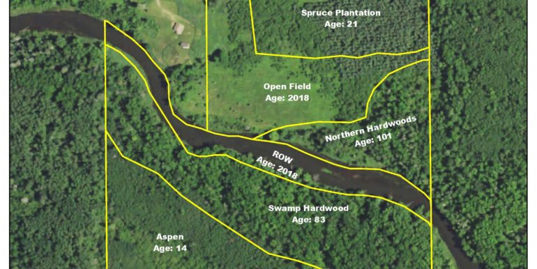
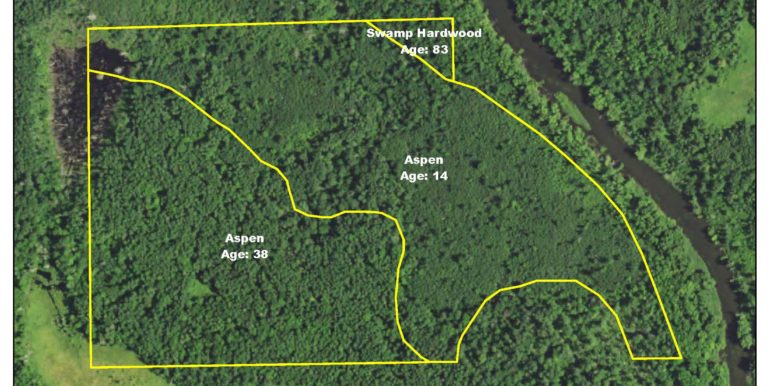
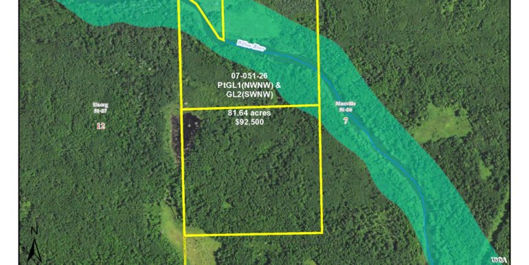
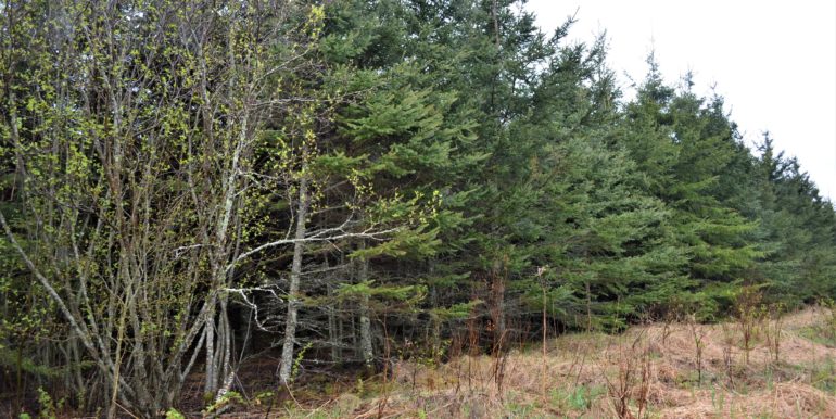
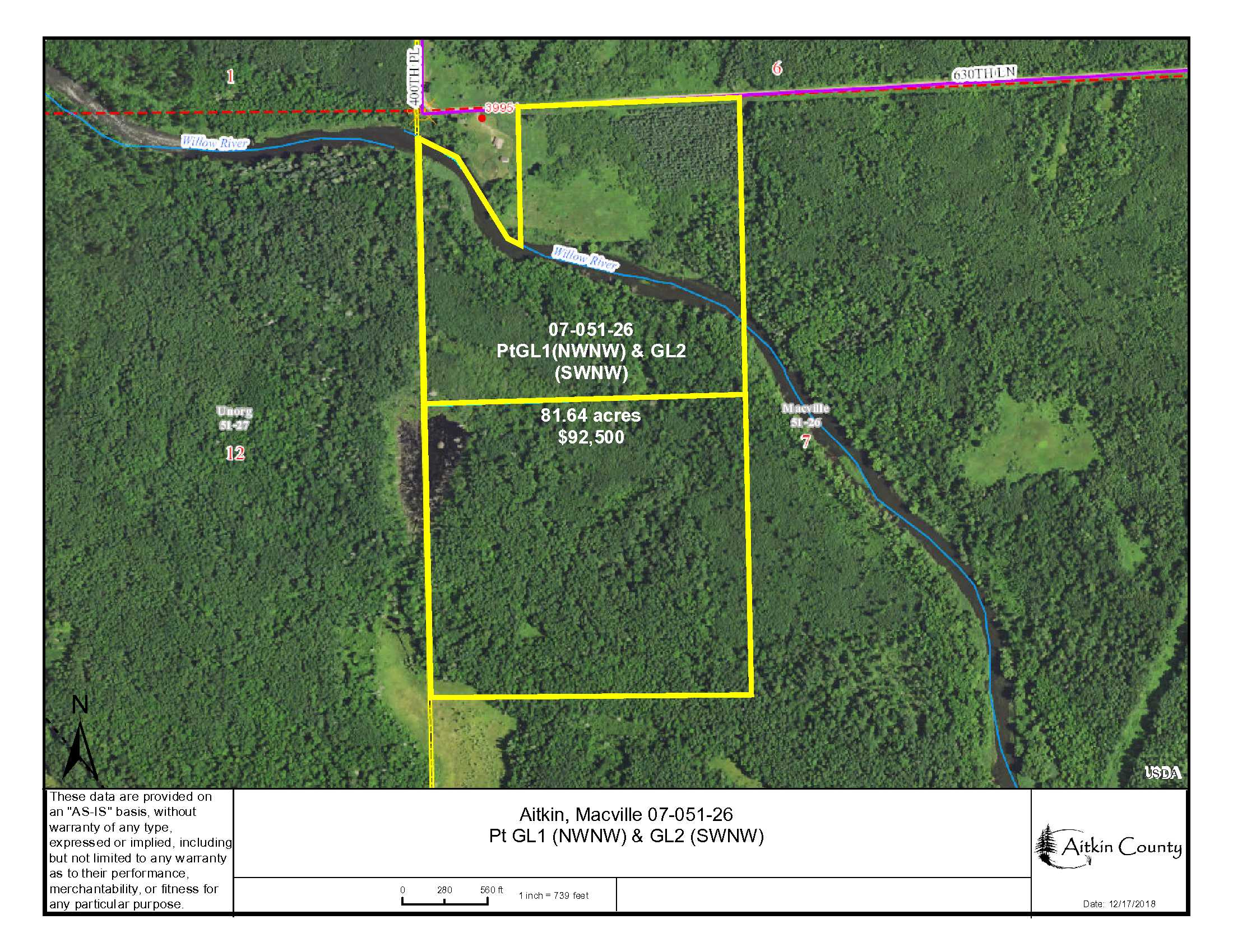
Rural PotlatchDeltic Land on the Willow River southwest of Hill City. High ground accented with wetlands slopes toward approx. 1,756 ft. of river frontage. Timber includes spruce, aspen, northern hardwoods and swamp hardwoods. Gravel township road along the north side. Hundreds of acres of public land adjoin west side. Connection to Soo Line Trail is approximately 3 miles away for snowmobiling and ATV riding. Little Willow River WMA is nearby also. Utilities are available on 630th Ln.
Main Property Info
Property ID
TBD
TBD
MLS Number
5131773
5131773
Status
Sold
Sold
List Price
$92,500
$92,500
Selling Price
$92,500
$92,500
Acres
81.64
81.64
Zoning
Open & Shoreland
Open & Shoreland
City
Swatara
Swatara
Township
Macville Twp
Macville Twp
State
MN
MN
Zip Code
55785
55785
County
Aitkin
Aitkin
Legal Description
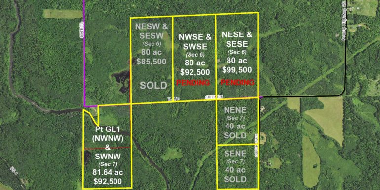
GL1(also known as NWNW) less west 450 ft lying north of Willow River as described in Doc 328245, 7-051-26 AND GL2(also known as SWNW). Subject to 630th Lane (T-470) and any easements, restrictions, or reservations of record.
GL1(also known as NWNW) less west 450 ft lying north of Willow River as described in Doc 328245, 7-051-26 AND GL2(also known as SWNW). Subject to 630th Lane (T-470) and any easements, restrictions, or reservations of record.
Property Location
Directions
From the intersection of US Hwy 169 and State Hwy 200 in Hill City, west on State Hwy 200 for 3 miles. Left (south and west) on Osprey Avenue (Co Rd 29) 4 1/2. Continue straight on 630th Lane (T-470) for 3/4 mile to northeast corner of the property (before address #39951).
From the intersection of US Hwy 169 and State Hwy 200 in Hill City, west on State Hwy 200 for 3 miles. Left (south and west) on Osprey Avenue (Co Rd 29) 4 1/2. Continue straight on 630th Lane (T-470) for 3/4 mile to northeast corner of the property (before address #39951).
Access
630th Lane
630th Lane
GPS Coordinates
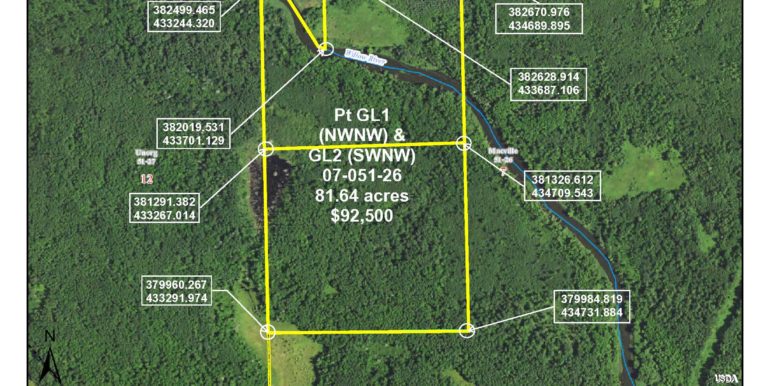
GPS Coordinates to approximate corners/points based on county mapping: NE: 382670.97/434689.89, NW: 382499.46/433244320, SW: 379960.26/433291.97, SE 379984.81/434731.88
GPS Coordinates to approximate corners/points based on county mapping: NE: 382670.97/434689.89, NW: 382499.46/433244320, SW: 379960.26/433291.97, SE 379984.81/434731.88
Address
TBD 630th Lane, Swatara
TBD 630th Lane, Swatara
School District
Hill City - 2
Hill City - 2
Property Details
Dimensions (approx)
993.02 x 612.44 x 658.84 x 2640 x 1320 x 2640
993.02 x 612.44 x 658.84 x 2640 x 1320 x 2640
Utilities
Available Utilities
Electric
Electric
On Site Utilities
None
None
Power Company
Lake Country Power (1-800-421-9959)
Lake Country Power (1-800-421-9959)
Waterfront
Waterfront Name
Willow River
Willow River
Waterfront Feet (approx)
1,756
1,756
Taxes & Fees
Tax Amount
$850
$850
Tax With Assessments
$850
$850
Tax Year
2020
2020
Other Details
Section Number
07
07
Township Number
051
051
Range Number
26
26
Estimated Upland %
80%
80%
Estimated Wetland %
20%
20%
Additional Comments
Timber Comments
Timber includes spruce, aspen, northern hardwoods and swamp hardwoods.
Timber includes spruce, aspen, northern hardwoods and swamp hardwoods.
Hunting Comments
Wildlife abounds on this property! Whitetail deer, bear, turkey, grouse and various species of waterfowl are common in this area. Great opportunity for hunting during several different seasons.
Wildlife abounds on this property! Whitetail deer, bear, turkey, grouse and various species of waterfowl are common in this area. Great opportunity for hunting during several different seasons.
Disclosures
This property is zoned Open and Shoreland. Portions fall within FEMA flood Zone A. The property has not been surveyed; acreage/dimensions are approximate based on county data/mapping; disclaimers included by reference. GPS coordinates/ photos/maps are not guaranteed. You should physically inspect the property prior to purchase. Any deer stands that may be on the property do not belong to the seller and are not included in the sale. Use seller-approved PA & Addendum; closings the 3rd Wednesday of each month.
This property is zoned Open and Shoreland. Portions fall within FEMA flood Zone A. The property has not been surveyed; acreage/dimensions are approximate based on county data/mapping; disclaimers included by reference. GPS coordinates/ photos/maps are not guaranteed. You should physically inspect the property prior to purchase. Any deer stands that may be on the property do not belong to the seller and are not included in the sale. Use seller-approved PA & Addendum; closings the 3rd Wednesday of each month.
