MLS Number : 5328441
Sold $189,800 - Home & Cabin Sites, Hunting & Recreation
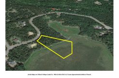
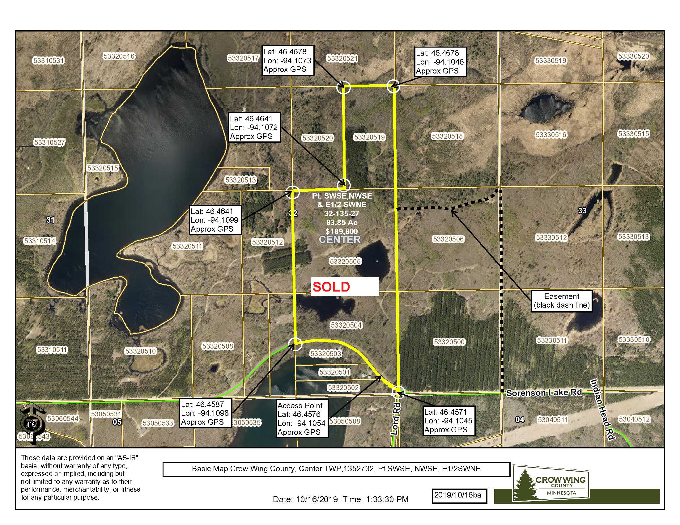
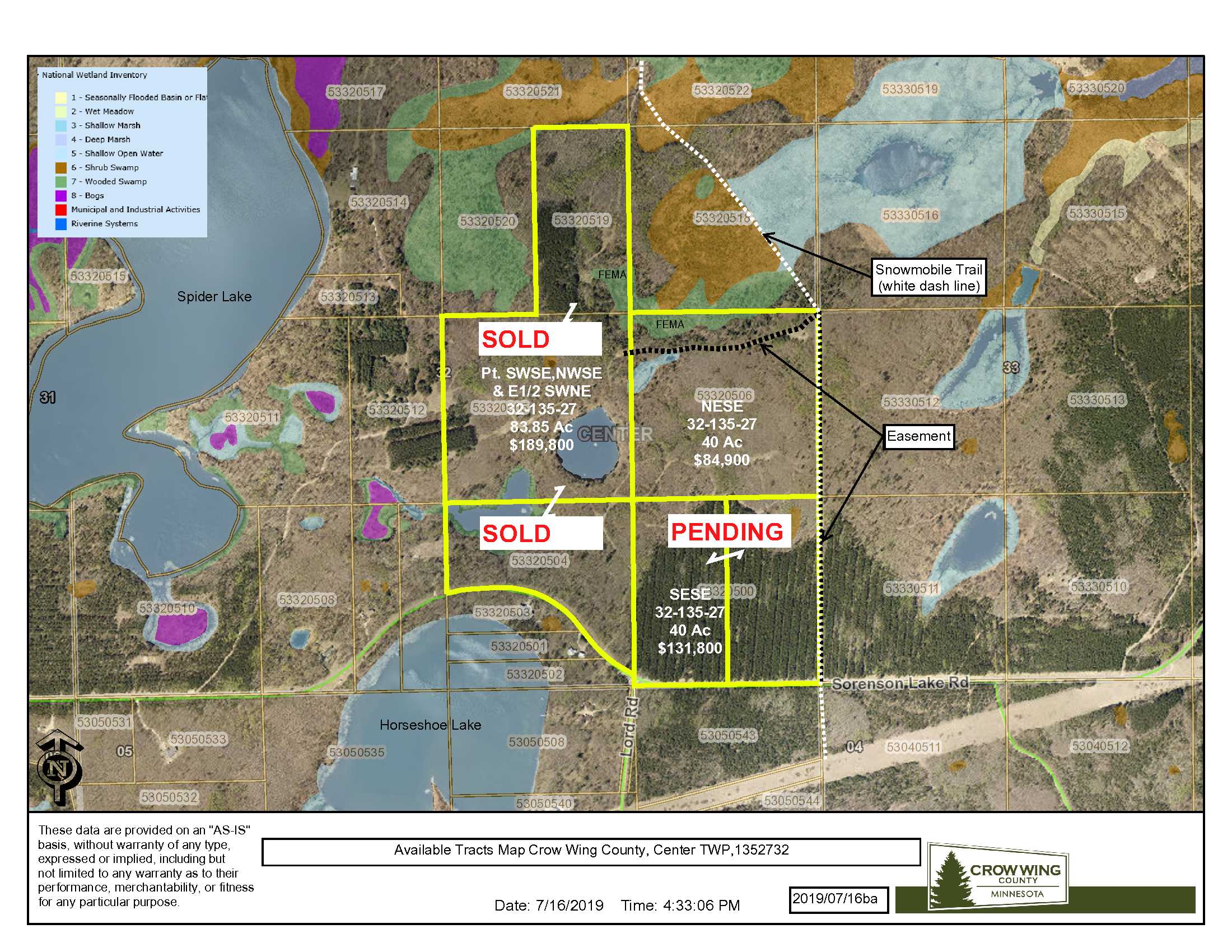
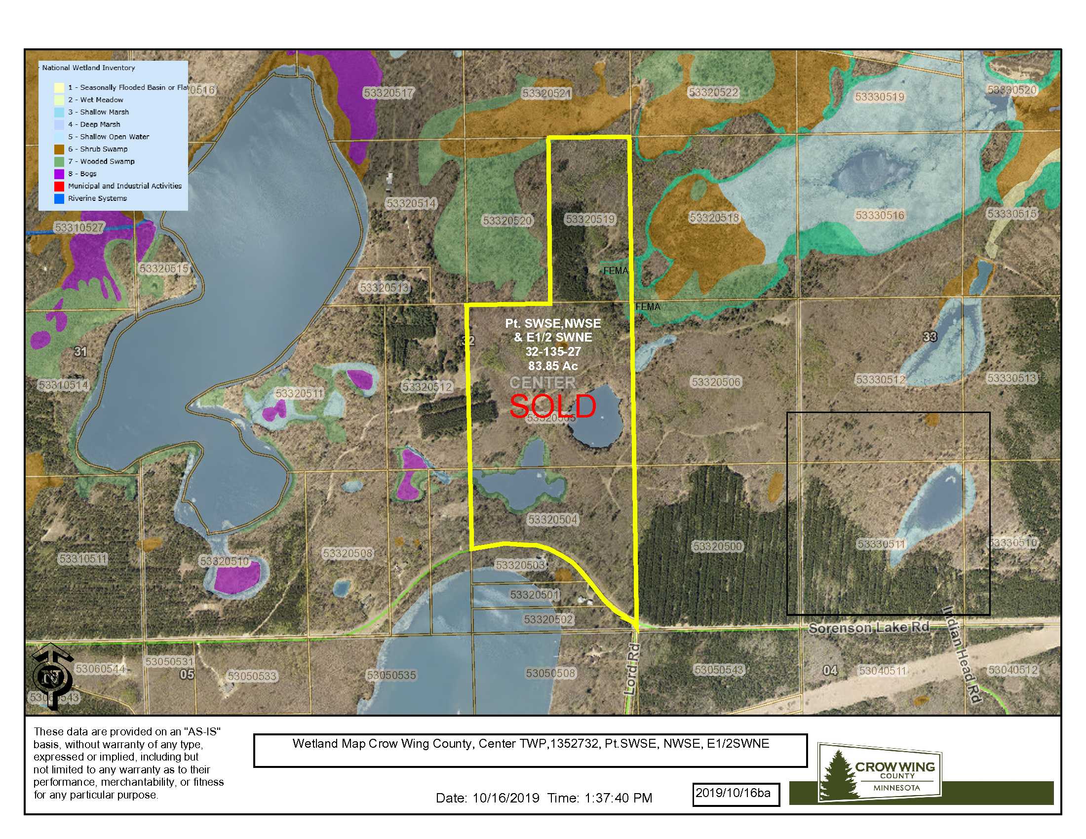
Nicely located just 3 miles east of Merrifield. This primarily upland tract boasts mature tree cover and water features just perfect for your next hunting/recreation adventure and/or homestead. Two access points: one right off paved Sorenson Lake Rd, the second is via a shared easement to the northeast portion of the tract. Lake recreation and snowmobile trail access is close by.
Main Property Info
Property ID
53320519, 53320505, 53320504
53320519, 53320505, 53320504
MLS Number
5328441
5328441
Status
Sold
Sold
List Price
$189,800
$189,800
Selling Price
$189,800
$189,800
Acres
83.85
83.85
Zoning
RR 20, RR 5, RR 2.5, Shoreland District
RR 20, RR 5, RR 2.5, Shoreland District
City
Merrifield
Merrifield
Township
Center Twp
Center Twp
State
MN
MN
Zip Code
56465
56465
County
Crow Wing
Crow Wing
Legal Description
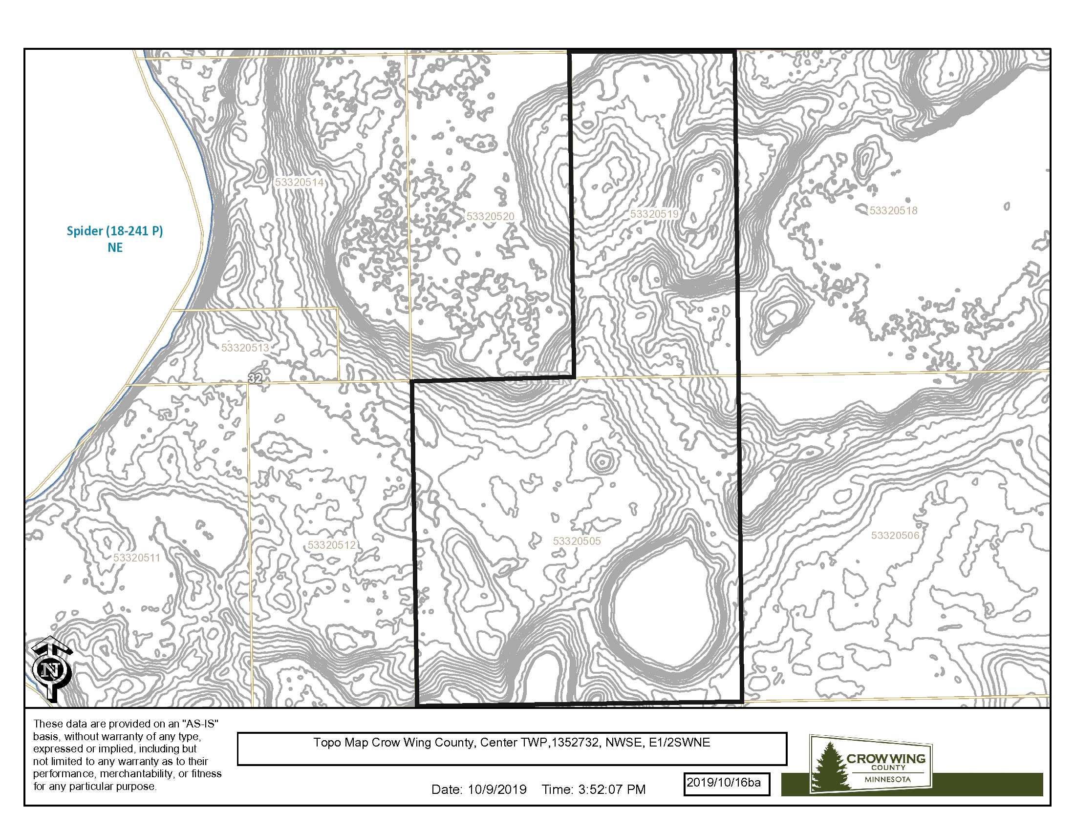
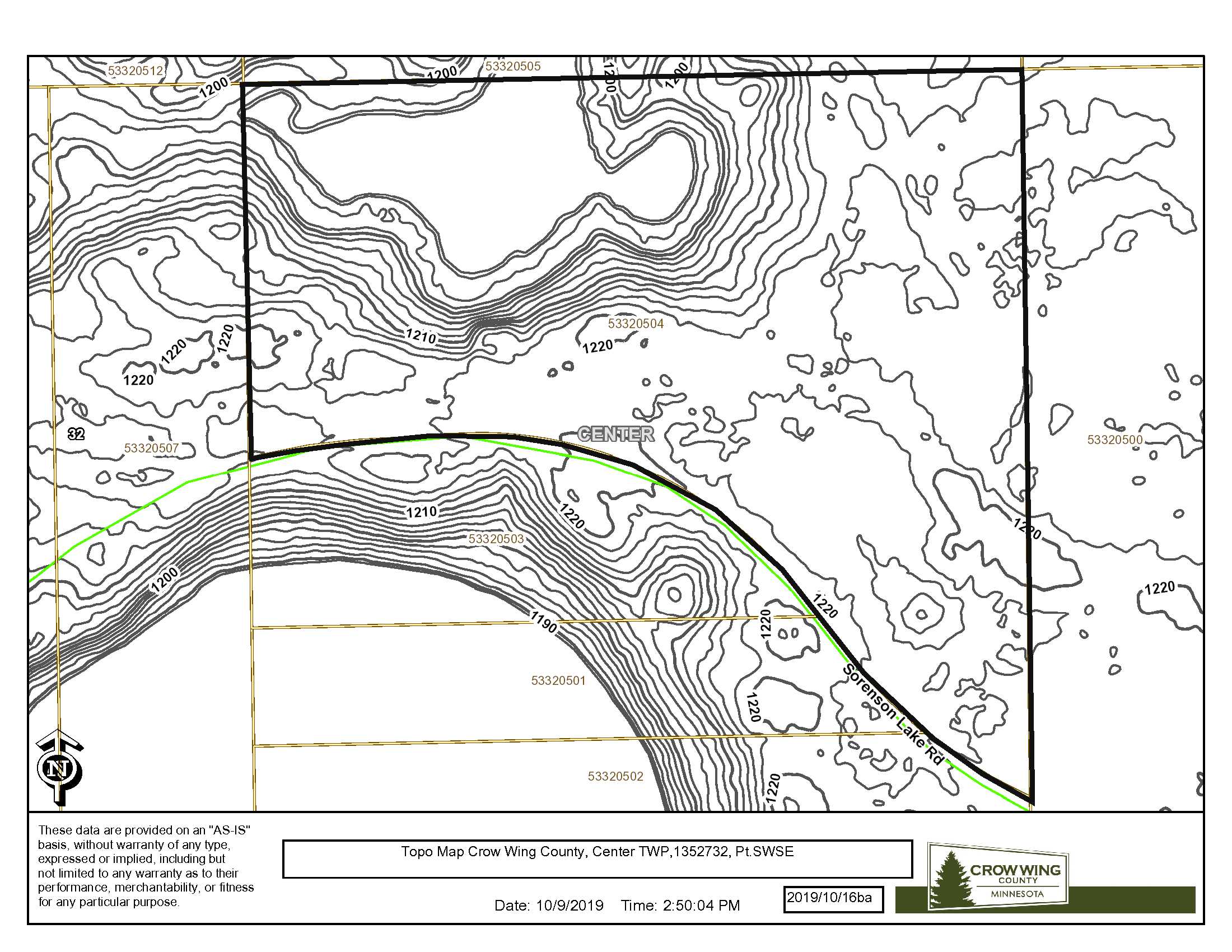
E1/2SWNE,NWSE & Pt. SWSE N’ly of Twp Rd 204, 32-135-27. Exhibit A in file/supplements. Subject to Sorenson Lake Rd and any easements, restrictions and reservations of record.
E1/2SWNE,NWSE & Pt. SWSE N’ly of Twp Rd 204, 32-135-27. Exhibit A in file/supplements. Subject to Sorenson Lake Rd and any easements, restrictions and reservations of record.
Property Location
Directions
In east Brainerd, from the intersection of Hwy 210 and Co Rd 3 (Mill Ave); north on Co Rd #3 6.7 miles; east on Sorenson Lake Road 3.3 miles to access point on left (N). (Approx. GPS Lat: 46.4576, Lon: -94.1054)
In east Brainerd, from the intersection of Hwy 210 and Co Rd 3 (Mill Ave); north on Co Rd #3 6.7 miles; east on Sorenson Lake Road 3.3 miles to access point on left (N). (Approx. GPS Lat: 46.4576, Lon: -94.1054)
Access
Access right off northeast side of Sorenson Lake Road. (Approx. GPS Lat: 46.4576, Lon: -94.1054)
Access right off northeast side of Sorenson Lake Road. (Approx. GPS Lat: 46.4576, Lon: -94.1054)
GPS Coordinates
Coordinates to approximate corners/points based on county mapping: NW: 46.4678, -94.1073 NE: 46.4678, -94.1046 SE: 46.4571, -94.1045 SW: 46.4587, -94.1098
Coordinates to approximate corners/points based on county mapping: NW: 46.4678, -94.1073 NE: 46.4678, -94.1046 SE: 46.4571, -94.1045 SW: 46.4587, -94.1098
Address
TBD Sorenson Lake Rd., Merrifield, MN 56465
TBD Sorenson Lake Rd., Merrifield, MN 56465
School District
Brainerd - 181
Brainerd - 181
Property Details
Pasture Acres
0
0
Wooded Acres
68
68
Dimensions (approx)
1872 x 3872 x 1542 x 1962
1872 x 3872 x 1542 x 1962
Utilities
Available Utilities
Electric, Telephone, Cable T.V. & Internet
Electric, Telephone, Cable T.V. & Internet
On Site Utilities
None
None
Power Company
Crow Wing Power (1-800-648-9401)
Crow Wing Power (1-800-648-9401)
Waterfront
Waterfront Name
N/A
N/A
Waterfront Number
N/A
N/A
Waterfront Feet (approx)
N/A
N/A
Taxes & Fees
Has Association Fee
No
No
Association Fee
$0
$0
Association Fee Includes
0
0
Tax Amount
$854
$854
Assessment Amount
366
366
Tax With Assessments
$1,220
$1,220
Assessment Pending
No
No
Assessment Description
Sorenson Lake Rd and Rebel Rd road assessment
Sorenson Lake Rd and Rebel Rd road assessment
Tax Year
2019
2019
Other Details
Section Number
32
32
Township Number
135
135
Range Number
27
27
Estimated Upland %
85
85
Estimated Wetland %
15
15
Additional Comments
Timber Comments
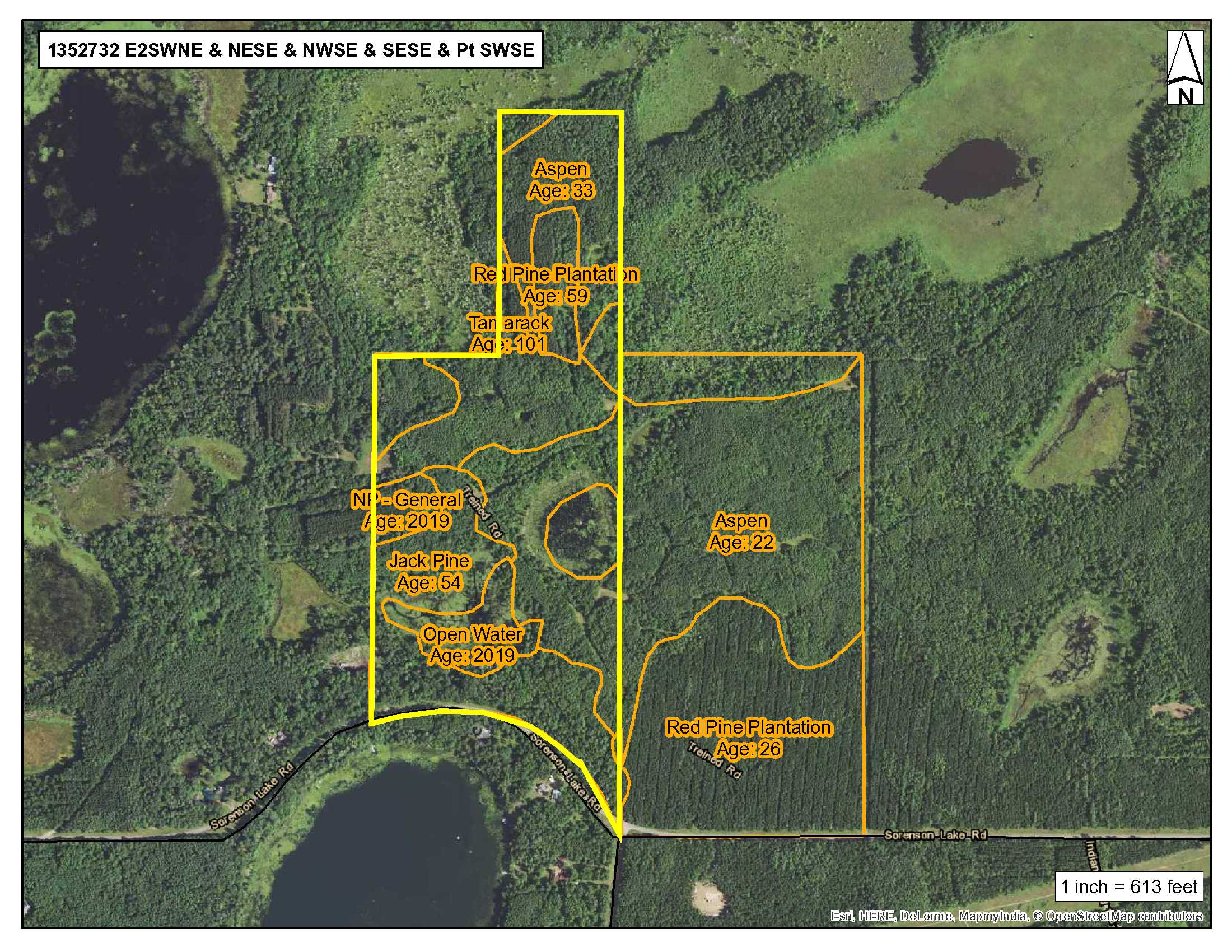
Red Pine 59 yrs., Jack Pine 54 yrs., Aspen 22-33 yrs., Tamarack 100 yrs. This property has been managed according to Forest Stewardship Council (FSC) standards. If Timber value is important to you, seek the advice of a competent forester to determine species, volumes and values.
Red Pine 59 yrs., Jack Pine 54 yrs., Aspen 22-33 yrs., Tamarack 100 yrs. This property has been managed according to Forest Stewardship Council (FSC) standards. If Timber value is important to you, seek the advice of a competent forester to determine species, volumes and values.
Hunting Comments
Deer Permit Area: #604 Special hunting area, see permit info for regulations/restrictions.
Deer Permit Area: #604 Special hunting area, see permit info for regulations/restrictions.
Disclosures
Shared easements affect this property and easements granted and reserved/retained will include terms governing shared use of the easements. See legal description and maps for details. Acreage, dimensions, and taxes estimated based on county data and mapping or seller data; county disclaimers included by reference; subject to split approval if necessary. Not surveyed. Photos/maps and GPS coordinates for convenience only and not guaranteed; physically inspect prior to purchase. Any deer stands on the land are not property of seller and are not included in sale. Use seller-approved PA and addendum; closing dates the 3rd Wednesday each month. Seller is Potlatch Lake States Timberlands LLC, a business entity under the laws of the State of Delaware.
Shared easements affect this property and easements granted and reserved/retained will include terms governing shared use of the easements. See legal description and maps for details. Acreage, dimensions, and taxes estimated based on county data and mapping or seller data; county disclaimers included by reference; subject to split approval if necessary. Not surveyed. Photos/maps and GPS coordinates for convenience only and not guaranteed; physically inspect prior to purchase. Any deer stands on the land are not property of seller and are not included in sale. Use seller-approved PA and addendum; closing dates the 3rd Wednesday each month. Seller is Potlatch Lake States Timberlands LLC, a business entity under the laws of the State of Delaware.