
MLS Number : 5641690
Sold $236,000 - Home & Cabin Sites, Hunting & Recreation
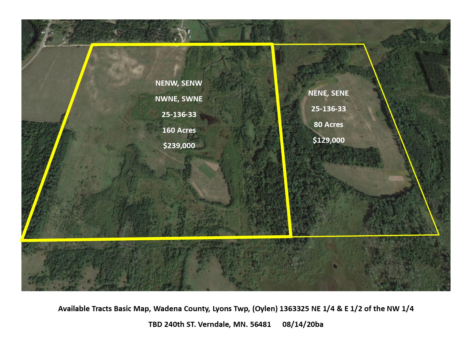
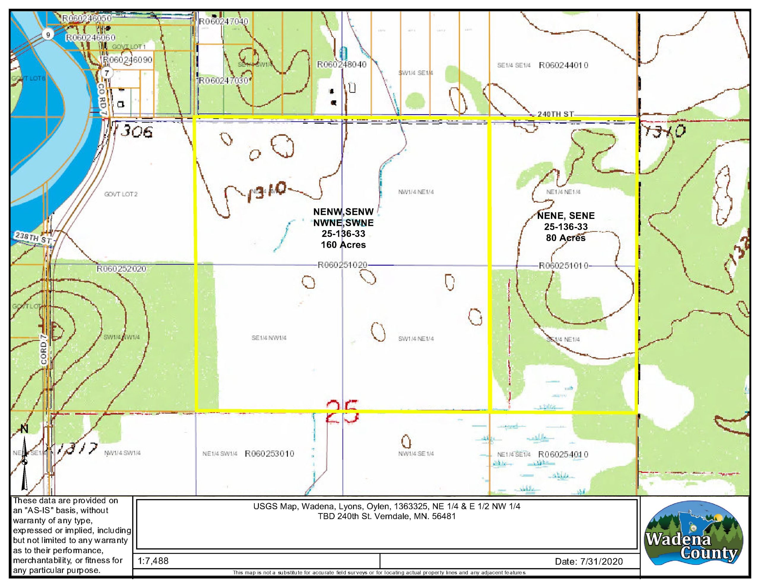
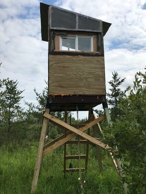
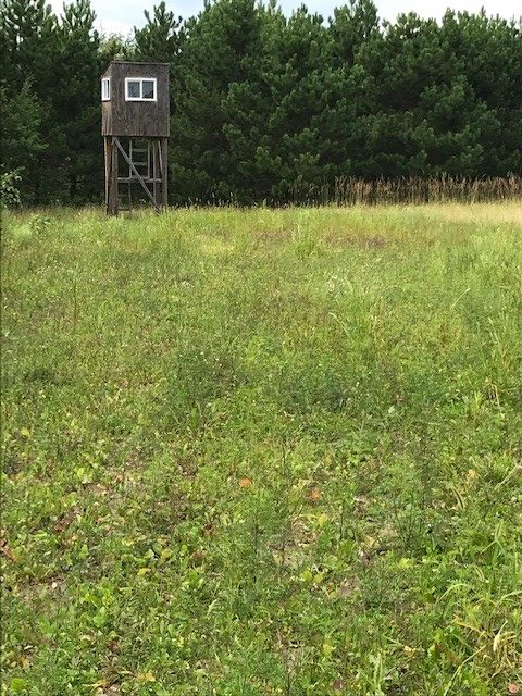
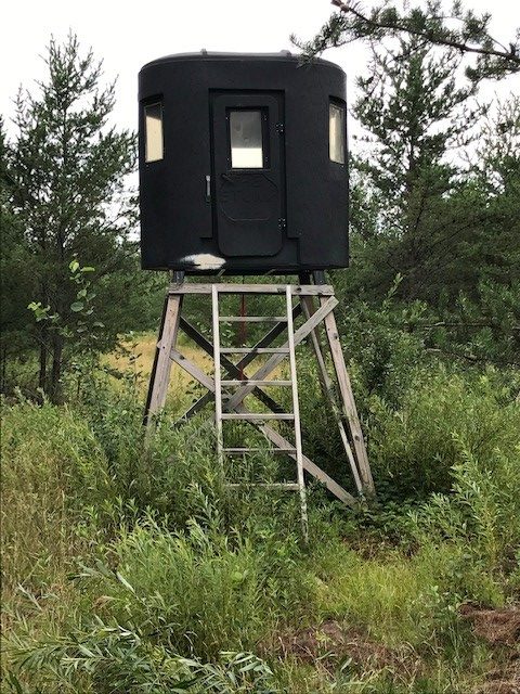
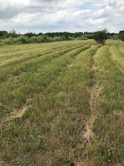
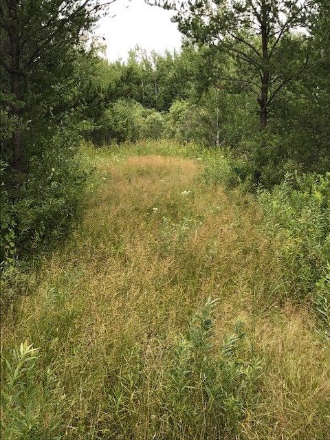
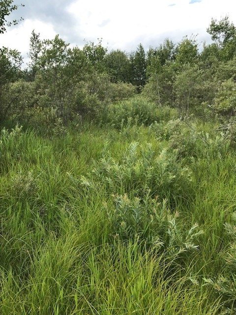
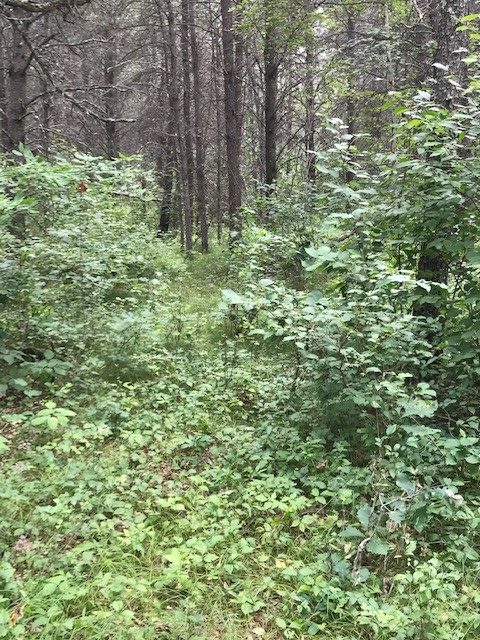
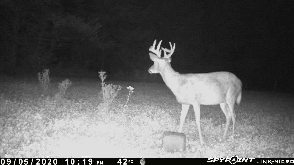
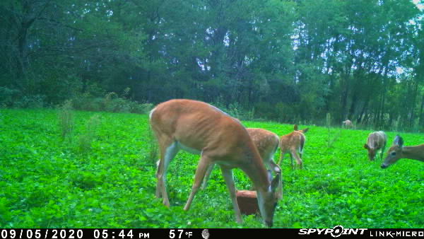
| This 160 acre parcel with great access right on the east side of the Township of Oylen (just 17 miles north of Staples, MN.) is near to several hundred acres of public and tax forfeited land. Excellent hunting and recreation await you on this well managed and trail groomed tract of land! With a great history of Whitetail Buck, Bear, Turkey and Grouse, this mix of upland and wetland is perfect for wildlife habitat. Multiple permanent deer stands go with the property along with multiple food plot areas of clover, rye, buckwheat and chicory… all you need to do is show up to hunt! The forested areas consist of a variety of pine, aspen and hardwoods of varies ages and species along with a water source creek. Access to the Crow Wing River is just 1 mile away and the recreation areas of Cottingham Park and Wahoo Valley are just a bit to the west. This parcel also adjoins an additional 80 acres being sold, so the opportunity to own 240 total acres with great access is hard to find! Close to power, this also provides one with the option to build a residence or hunting cabin right there. Just in time for hunting season, don’t wait on taking ownership of this one! |
Main Property Info
Property ID
060251020
060251020
MLS Number
5641690
5641690
Status
Sold
Sold
List Price
$239,000
$239,000
Selling Price
$236,000
$236,000
Acres
160
160
Zoning
A2
A2
City
Motley, Staples, Verndale
Motley, Staples, Verndale
Township
Lyons Twp
Lyons Twp
State
MN
MN
Zip Code
56481
56481
County
Wadena
Wadena
Legal Description
W1/2 NE1/4 & E1/2 NW1/4, 25-136-33, Wadena County, MN. Subject to 240th St and any restrictions, reservations and/or easements of record.
W1/2 NE1/4 & E1/2 NW1/4, 25-136-33, Wadena County, MN. Subject to 240th St and any restrictions, reservations and/or easements of record.
Property Location
Directions
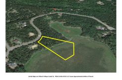
From Staples MN head north on Airport road for 1 mile to Co Rd 30. Continue 1.5 mi and veer right to stay on Co Rd 30. Cont N on Co Rd 30 for 9.4 mi. Turn Right (E) on Co Rd 7 and go 4.4 mi. Turn Right (E) onto 240th St. Go 0.3 mi to arrive at access on Right (S). (Approx GPS Access location: 46.5719, -94.7917)
From Staples MN head north on Airport road for 1 mile to Co Rd 30. Continue 1.5 mi and veer right to stay on Co Rd 30. Cont N on Co Rd 30 for 9.4 mi. Turn Right (E) on Co Rd 7 and go 4.4 mi. Turn Right (E) onto 240th St. Go 0.3 mi to arrive at access on Right (S). (Approx GPS Access location: 46.5719, -94.7917)
Access
Access is right off 240th St. (Approx GPS Access location: 46.5719, -94.7917)
Access is right off 240th St. (Approx GPS Access location: 46.5719, -94.7917)
GPS Coordinates
Coordinates to approximate corners/points based on county mapping: NW 46.5720 -94.7956, NE 46.5720 -94.7850, SE 46.5647 -94.7849, SW 46.5647 -94.7955
Coordinates to approximate corners/points based on county mapping: NW 46.5720 -94.7956, NE 46.5720 -94.7850, SE 46.5647 -94.7849, SW 46.5647 -94.7955
Address
TBD 240th St, Verndale,
TBD 240th St, Verndale,
School District
Staples-Motley - 2170
Staples-Motley - 2170
Property Details
Tillable Acres
30
30
Wooded Acres
110
110
Dimensions (approx)
2640’ x 2640’ x 2640’ x 2640’
2640’ x 2640’ x 2640’ x 2640’
Utilities
Available Utilities
Power, Phone, Internet
Power, Phone, Internet
On Site Utilities
None
None
Power Company
Todd-Wadena Electric (1-800-320-8932)
Todd-Wadena Electric (1-800-320-8932)
Taxes & Fees
Has Association Fee
No
No
Tax Amount
$1,714
$1,714
Assessment Amount
0.00
0.00
Tax With Assessments
$1,714
$1,714
Assessment Pending
No
No
Assessment Description
NA
NA
Tax Year
2020
2020
Other Details
Section Number
25
25
Township Number
136
136
Range Number
33
33
Estimated Upland %
88
88
Estimated Wetland %
12
12
Additional Comments
Timber Comments
Mix of pine, hardwood and aspen various ages.
Mix of pine, hardwood and aspen various ages.
Hunting Comments
Deer Permit Area: #246
Deer Permit Area: #246
Disclosures
See mapping for approximate GPS Corners. Acreage, dimensions, and taxes estimated based on county data and mapping or seller data; county disclaimers included by reference; subject to split approval if necessary. Not surveyed. Photos/maps and GPS coordinates for convenience only and not guaranteed; physically inspect prior to purchase. Seller intends to leave permanent deer stands, but temporary/mobile deer stands are not included in the sale. Seller is CJ Consulting, Development & Management, LLC, a business entity under the laws of the State of MN.
See mapping for approximate GPS Corners. Acreage, dimensions, and taxes estimated based on county data and mapping or seller data; county disclaimers included by reference; subject to split approval if necessary. Not surveyed. Photos/maps and GPS coordinates for convenience only and not guaranteed; physically inspect prior to purchase. Seller intends to leave permanent deer stands, but temporary/mobile deer stands are not included in the sale. Seller is CJ Consulting, Development & Management, LLC, a business entity under the laws of the State of MN.