
MLS Number : 5506053
Sold $28,500 - Home & Cabin Sites
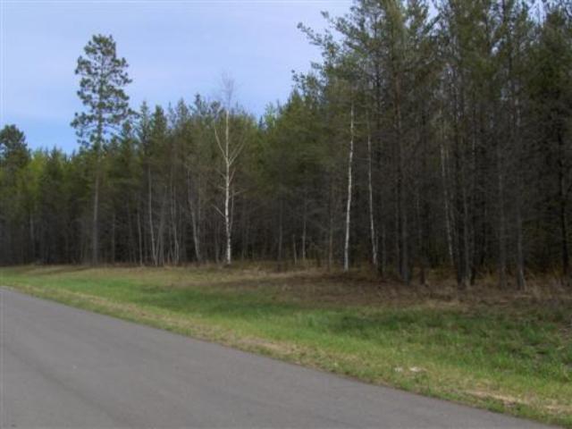
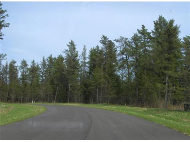
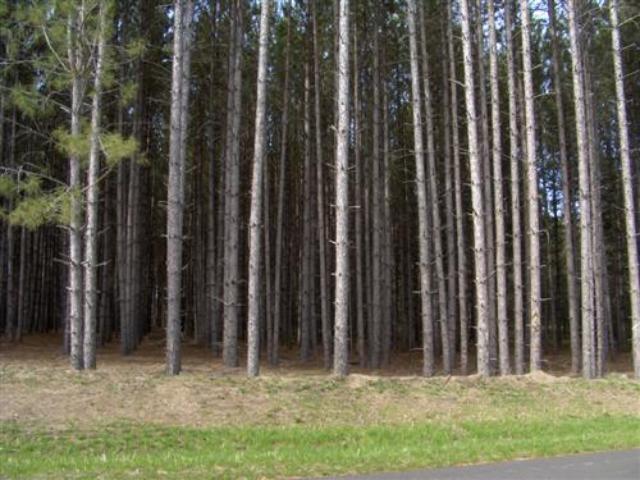
Large, wooded lot conveniently located minutes west of Pequot Lakes in the heart of the Brainerd Lakes Area. Site is level, surveyed, on a paved road, and ready for your new home! Conservation easement protects natural features of the neighborhood. The area is saturated with lakes and trails so you can enjoy the great outdoors all year long. Hundreds of acres of public land less than a mile away for hunting. Experience superb country living in this highly-desirable location. Owner/broker.
Main Property Info
Property ID
224010105
224010105
MLS Number
5506053
5506053
Status
Sold
Sold
List Price
$29,500
$29,500
Selling Price
$28,500
$28,500
Acres
2.52
2.52
Zoning
Rural Residential 2.5
Rural Residential 2.5
City
Pequot Lakes
Pequot Lakes
Township
Loon Lake Twp
Loon Lake Twp
State
MN
MN
Zip Code
56472
56472
County
Cass
Cass
Legal Description
Lot 1, Block 1, Mayo Creek First Addition. Subject to Declaration of Covenants, Easements and Restrictions recorded as Doc# A000496908; Perpetual Wetland Conservation Easement recorded as Doc# A000496368; and any other easements, restrictions, or reservations of record.
Lot 1, Block 1, Mayo Creek First Addition. Subject to Declaration of Covenants, Easements and Restrictions recorded as Doc# A000496908; Perpetual Wetland Conservation Easement recorded as Doc# A000496368; and any other easements, restrictions, or reservations of record.
Property Location
Directions
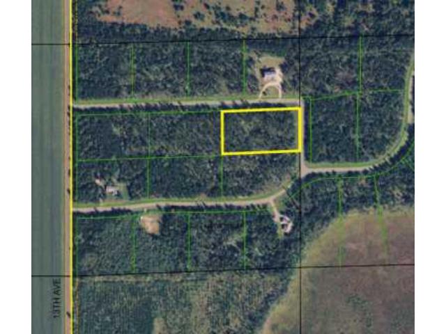
From State Hwy 371 & CR 17 intersection on the north edge of Pequot Lakes, W on CR 17 for 2 miles. Left on 13th Ave SW 8/10 mile. Left on Mayo Dr SW 2/10 mile to lot on the right.
From State Hwy 371 & CR 17 intersection on the north edge of Pequot Lakes, W on CR 17 for 2 miles. Left on 13th Ave SW 8/10 mile. Left on Mayo Dr SW 2/10 mile to lot on the right.
Access
Access is via Mayo Dr SW which runs along the north and east sides of the lot.
Access is via Mayo Dr SW which runs along the north and east sides of the lot.
GPS Coordinates
Coordinates to approximate corners/points based on county mapping: NW corner along Mayo Dr SW = 46.5974, -94.3482; NE corner along Mayo Dr SW = 46.5974, -94.3465; SE corner along Mayo Dr SW = 46.5968, -94.3465; SW corner = 46.5967, -94.3482
Coordinates to approximate corners/points based on county mapping: NW corner along Mayo Dr SW = 46.5974, -94.3482; NE corner along Mayo Dr SW = 46.5974, -94.3465; SE corner along Mayo Dr SW = 46.5968, -94.3465; SW corner = 46.5967, -94.3482
Address
L1B1 Mayo Drive SW
L1B1 Mayo Drive SW
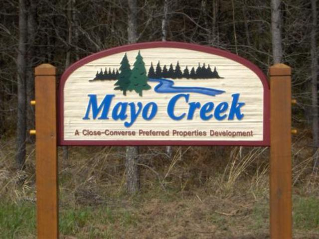
Neighborhood
Mayo Creek
Mayo Creek
School District
Pequot Lakes - 186
Pequot Lakes - 186
Property Details
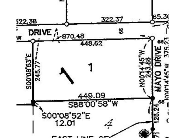
Dimensions (approx)
448x449x243x245
448x449x243x245
Utilities
Available Utilities
Electric,Telephone
Electric,Telephone
On Site Utilities
None
None
Power Company
Crow Wing Power (1-800-648-9401)
Crow Wing Power (1-800-648-9401)
Taxes & Fees
Association Fee
$0
$0
Tax Amount
$244
$244
Tax With Assessments
$244
$244
Tax Year
2020
2020
Other Details
Section Number
16
16
Township Number
136
136
Range Number
29
29
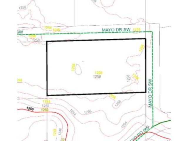
Estimated Upland %
99
99
Estimated Wetland %
1
1
Additional Comments
Hunting Comments
The lot is near public land in MN firearms deer zone 246. There are hundreds of acres of public land less than a mile south plus much more within a short drive for whitetail deer, big game, and upland bird hunting.
The lot is near public land in MN firearms deer zone 246. There are hundreds of acres of public land less than a mile south plus much more within a short drive for whitetail deer, big game, and upland bird hunting.
Disclosures
Owner/broker. The land is subdivided and is subject to Declaration of Covenants, Easements and Restrictions recorded as Doc# A000496908 and Perpetual Wetland Conservation Easement recorded as Doc# A000496368. See plat for exact dimensions. Acreage based on county data and mapping; county disclaimers included by reference. Photos/maps for convenience only and not guaranteed; tree cover may be different than depicted; physically inspect prior to purchase.
Owner/broker. The land is subdivided and is subject to Declaration of Covenants, Easements and Restrictions recorded as Doc# A000496908 and Perpetual Wetland Conservation Easement recorded as Doc# A000496368. See plat for exact dimensions. Acreage based on county data and mapping; county disclaimers included by reference. Photos/maps for convenience only and not guaranteed; tree cover may be different than depicted; physically inspect prior to purchase.


