
MLS Number : 4612378
Sold $133,000 - Hunting & Recreation
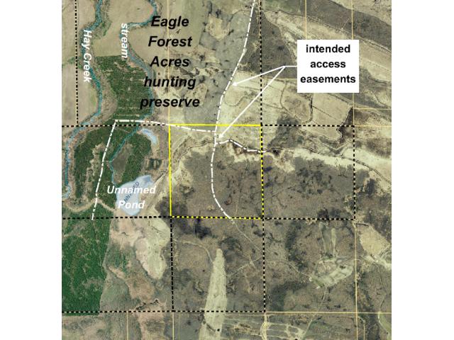
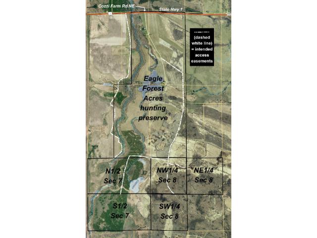
Approx 163 acres adjacent to Eagle Forest Acres hunting preserve just off the shores of Red Lake. Primarily heavily-wooded gently-rolling/sloping upland w/ easement access & trails throughout. Easements will provide access to adjoining tracts.
Main Property Info
Property ID
Pt of 330003900
Pt of 330003900
MLS Number
4612378
4612378
Status
Sold
Sold
List Price
$151,000
$151,000
Selling Price
$133,000
$133,000
Acres
163.000
163.000
Zoning
not zoned
not zoned
City
Blackduck
Blackduck
Township
O'Brien Twp
O'Brien Twp
State
MN
MN
Zip Code
56630
56630
County
Beltrami
Beltrami
Legal Description
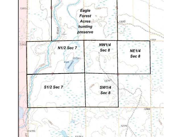
NW1/4, 8-150-32. Together with and subject to EASEMENT D (see Supplements). Subject to easement providing access to adjoining NE1/4 and SW1/4 of said Sec 8 (easements not yet described). Subject to any other easements, restrictions, or reservations of record. (Legal description of record to govern.)
NW1/4, 8-150-32. Together with and subject to EASEMENT D (see Supplements). Subject to easement providing access to adjoining NE1/4 and SW1/4 of said Sec 8 (easements not yet described). Subject to any other easements, restrictions, or reservations of record. (Legal description of record to govern.)
Property Location
Directions
From US Hwy 71/State Hwy 72 in Blackduck, N on State Hwy 72 for 10 mi. Left on State Hwy 1 for 11 3/4 mi. Left on Cozzi Farm Rd NE for 7/10 mi. Left on trail for 9/10 mi. Cont straight on trl 7/10 mi.
From US Hwy 71/State Hwy 72 in Blackduck, N on State Hwy 72 for 10 mi. Left on State Hwy 1 for 11 3/4 mi. Left on Cozzi Farm Rd NE for 7/10 mi. Left on trail for 9/10 mi. Cont straight on trl 7/10 mi.
Access
Access is via EASEMENT D (see Supplements) from Cozzi Farm Rd NE over existing trails through land to the north.
Access is via EASEMENT D (see Supplements) from Cozzi Farm Rd NE over existing trails through land to the north.
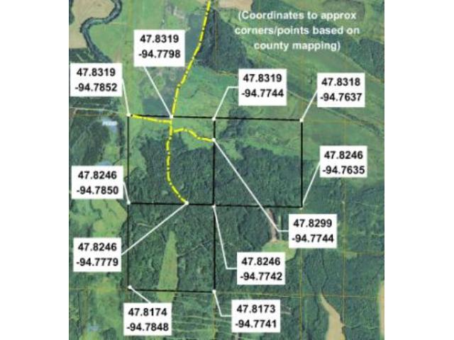
GPS Coordinates
See map for coordinates to approximate corners/points based on county mapping.
See map for coordinates to approximate corners/points based on county mapping.
Address
NW1/4Sec8 Cozzi Farm Road
NW1/4Sec8 Cozzi Farm Road
Neighborhood
Eagle Forest Acres
Eagle Forest Acres
School District
Blackduck - 32
Blackduck - 32
Property Details
Dimensions (approx)
2648x2651x2663x2663
2648x2651x2663x2663
Utilities
Available Utilities
None
None
On Site Utilities
None
None
Power Company
Beltrami Electric (1-800-955-6083)
Beltrami Electric (1-800-955-6083)
Taxes & Fees
Association Fee
$0
$0
Tax Amount
$1,239
$1,239
Assessment Amount
0
0
Tax With Assessments
$1,239
$1,239
Tax Year
2016
2016
Other Details
Section Number
8
8
Township Number
150
150
Range Number
32
32
Estimated Upland %
78
78
Estimated Wetland %
22
22
Additional Comments
Hunting Comments
The subject property is near public land in MN Firearms Deer Zone 110. It ajoins Eagle Forest Acres hunting preserve, a premiere destination for pheasant, bear, and whitetail deer hunts. Ducks and partridge are also plentiful in the area.
The subject property is near public land in MN Firearms Deer Zone 110. It ajoins Eagle Forest Acres hunting preserve, a premiere destination for pheasant, bear, and whitetail deer hunts. Ducks and partridge are also plentiful in the area.
Disclosures
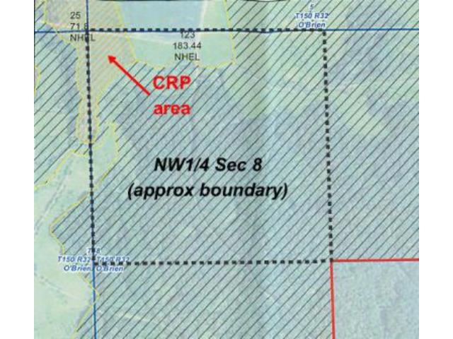
Parcel split; taxes estimated; subject to approval by Beltrami County. County tax description for the parent parcel indicates 480 total acres; however, the county's parcel information for the parent parcel indicates total calculated acreage of 483.47. Not surveyed; acreage and dimensions are approximate based on county data and mapping; county disclaimers are included by reference. Together with and subject to access easements and any other easements, restrictions, and reservations of record. Small portion in northwest corner subject to CRP/farming lease agreements; see map of CRP areas and contact agent for details. Photos/maps are for convenience only and not guaranteed; tree cover may be different than depicted; physically inspect prior to purchase.
Parcel split; taxes estimated; subject to approval by Beltrami County. County tax description for the parent parcel indicates 480 total acres; however, the county's parcel information for the parent parcel indicates total calculated acreage of 483.47. Not surveyed; acreage and dimensions are approximate based on county data and mapping; county disclaimers are included by reference. Together with and subject to access easements and any other easements, restrictions, and reservations of record. Small portion in northwest corner subject to CRP/farming lease agreements; see map of CRP areas and contact agent for details. Photos/maps are for convenience only and not guaranteed; tree cover may be different than depicted; physically inspect prior to purchase.

