

MLS Number : 4290955
Sold $33,000 - Home & Cabin Sites
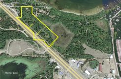
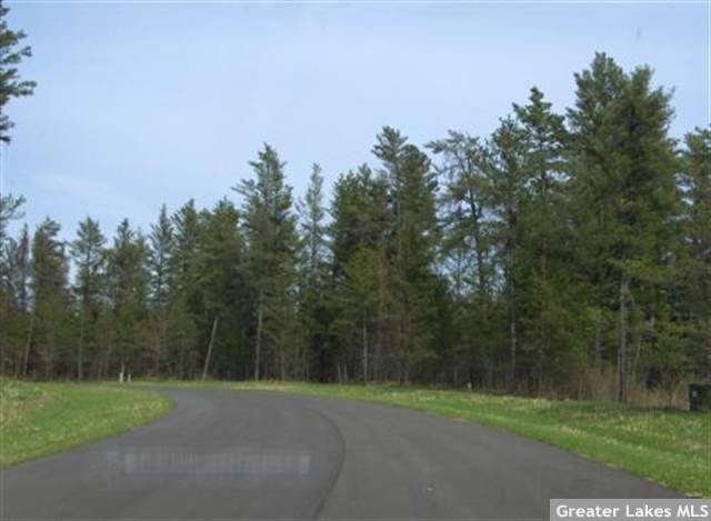
Large, wooded lot on a paved road just minutes west of Pequot Lakes. Approx 171 ft of Mayo Creek frontage along the east side. Public land less than a mile south for hunting & recreation. Owner/broker.
Main Property Info
Property ID
224010385
224010385
MLS Number
4290955
4290955
Status
Sold
Sold
List Price
$44,900
$44,900
Selling Price
$33,000
$33,000
Acres
2.060
2.060
Zoning
Shoreland Residential
Shoreland Residential
City
Pequot Lakes
Pequot Lakes
Township
Loon Lake Twp
Loon Lake Twp
State
MN
MN
Zip Code
56472
56472
County
Cass
Cass
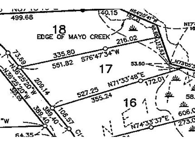
Legal Description
Lot 17, Block 3, Mayo Creek First Addition. Subject to Declaration of Covenants, Easements and Restrictions recorded as Doc# A000496908; Perpetual Wetland Conservation Easement recorded as Doc# A000496368; and any other easements, restrictions, or reservations of record.
Lot 17, Block 3, Mayo Creek First Addition. Subject to Declaration of Covenants, Easements and Restrictions recorded as Doc# A000496908; Perpetual Wetland Conservation Easement recorded as Doc# A000496368; and any other easements, restrictions, or reservations of record.
Property Location
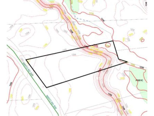
Directions
From State Hwy 371 & CR 17 intersection on the north edge of Pequot Lakes, W on CR 17 for 2 miles. Left on 13th Ave SW 9/10 mile. Left on Mayo Rd SW 7/10 mile to NW corner of the lot on the left.
From State Hwy 371 & CR 17 intersection on the north edge of Pequot Lakes, W on CR 17 for 2 miles. Left on 13th Ave SW 9/10 mile. Left on Mayo Rd SW 7/10 mile to NW corner of the lot on the left.
Access
Access is via Mayo Rd SW which runs along the west side of the lot.
Access is via Mayo Rd SW which runs along the west side of the lot.
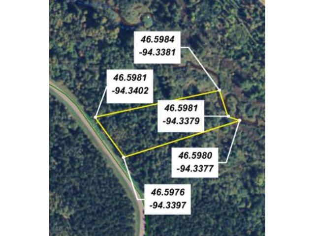
GPS Coordinates
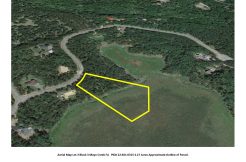
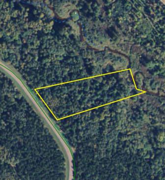
See attached map for coordinates to approx corners and points based on county mapping.
See attached map for coordinates to approx corners and points based on county mapping.
Address
L17B3 Mayo Road
L17B3 Mayo Road
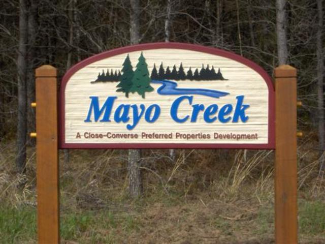
Neighborhood
Mayo Creek
Mayo Creek
School District
Pequot Lakes - 186
Pequot Lakes - 186
Property Details
Dimensions (approx)
209x171x551x527
209x171x551x527
Utilities
Available Utilities
Electric,Telephone
Electric,Telephone
On Site Utilities
None
None
Power Company
Crow Wing Power (1-800-648-9401)
Crow Wing Power (1-800-648-9401)
Waterfront
Waterfront Name
Mayo Creek
Mayo Creek
Waterfront Number
S9991054
S9991054
Waterfront Feet (approx)
171
171
Taxes & Fees
Association Fee
$0
$0
Tax Amount
$268
$268
Tax With Assessments
$268
$268
Tax Year
2015
2015
Other Details
Section Number
16
16
Township Number
136
136
Range Number
29
29
Estimated Upland %
95
95
Estimated Wetland %
5
5
Additional Comments
Timber Comments
This property has been managed according to Forest Stewardship Council (FSC) standards. If timber value is important to you, seek the advice of a competent forester to determine species, volumes and values.
This property has been managed according to Forest Stewardship Council (FSC) standards. If timber value is important to you, seek the advice of a competent forester to determine species, volumes and values.
Disclosures
Owner/broker. The land is subdivided and is subject to Declaration of Covenants, Easements and Restrictions recorded as Doc# A000496908 and Perpetual Wetland Conservation Easement recorded as Doc# A000496368. See plat for exact dimensions. Acreage based on county data and mapping; county disclaimers included by reference. Photos/maps for convenience only and not guaranteed; tree cover may be different than depicted; physically inspect prior to purchase.
Owner/broker. The land is subdivided and is subject to Declaration of Covenants, Easements and Restrictions recorded as Doc# A000496908 and Perpetual Wetland Conservation Easement recorded as Doc# A000496368. See plat for exact dimensions. Acreage based on county data and mapping; county disclaimers included by reference. Photos/maps for convenience only and not guaranteed; tree cover may be different than depicted; physically inspect prior to purchase.