MLS Number : 4283645
Sold $22,000 - Home & Cabin Sites
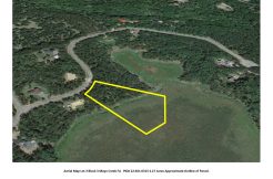
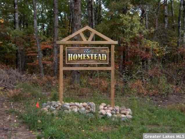
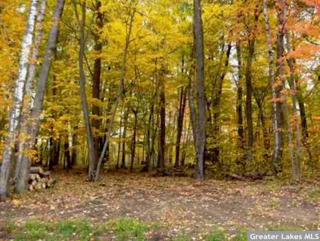
Generously-sized lot in the Homestead neighborhood, a country setting close to all of the amenities of the Brainerd Lakes Area. Rolling to sloping lot, wooded & open areas, and paved rd access. Owner/broker.
Main Property Info
Property ID
531260020020009
531260020020009
MLS Number
4283645
4283645
Status
Sold
Sold
List Price
$33,500
$33,500
Selling Price
$22,000
$22,000
Acres
7.100
7.100
Zoning
Rural Residential 2.5
Rural Residential 2.5
City
Merrifield
Merrifield
Township
Center Twp
Center Twp
State
MN
MN
Zip Code
56465
56465
County
Crow Wing
Crow Wing
Legal Description
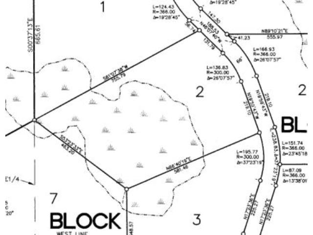
Lot 2, Block 2, HOMESTEAD FIRST ADDITION, 29-135-27. Subject to Buckhorn Trl; Declaration of Covenants, Easements, and Restrictions in Doc# 0698041; and any other easements, restrictions, or reservations of record.
Lot 2, Block 2, HOMESTEAD FIRST ADDITION, 29-135-27. Subject to Buckhorn Trl; Declaration of Covenants, Easements, and Restrictions in Doc# 0698041; and any other easements, restrictions, or reservations of record.
Property Location
Directions
From Brainerd, north on CR3 for 9 mi. Right on Sorenson Lake Rd 1 1/4 mi. Left on Rebel Rd 1 mi. Right on Settler Trail 1/2 mi. Right on Buckhorn Trl 3/10 mi to SE corner of prop on west side of rd.
From Brainerd, north on CR3 for 9 mi. Right on Sorenson Lake Rd 1 1/4 mi. Left on Rebel Rd 1 mi. Right on Settler Trail 1/2 mi. Right on Buckhorn Trl 3/10 mi to SE corner of prop on west side of rd.
Access
The lot is located on paved Buckhorn Trl.
The lot is located on paved Buckhorn Trl.
GPS Coordinates
Coordinates to approximate corners/points based on county mapping: SE corner along Buckhorn Trl = 46.4766, -94.1171; SW corner = 46.4760, -94.1192; NW corner = 46.4768, -94.1207; NE corner along Buckhorn Trl = 46.4778, -94.1180
Coordinates to approximate corners/points based on county mapping: SE corner along Buckhorn Trl = 46.4766, -94.1171; SW corner = 46.4760, -94.1192; NW corner = 46.4768, -94.1207; NE corner along Buckhorn Trl = 46.4778, -94.1180
Address
L2B2 Buckhorn Trail
L2B2 Buckhorn Trail
Neighborhood
Homestead
Homestead
School District
Brainerd - 181
Brainerd - 181
Property Details
Dimensions (approx)
487x463x581x755
487x463x581x755
Utilities
Available Utilities
Electric,Telephone
Electric,Telephone
On Site Utilities
None
None
Power Company
Crow Wing Power (1-800-648-9401)
Crow Wing Power (1-800-648-9401)
Taxes & Fees
Association Fee
$0
$0
Tax Amount
$303
$303
Assessment Amount
510.86
510.86
Tax With Assessments
$814
$814
Assessment Description
road improvements (see Disclosures for details)
road improvements (see Disclosures for details)
Tax Year
2016
2016
Other Details
Section Number
29
29
Township Number
135
135
Range Number
27
27
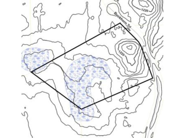
Estimated Upland %
50
50
Estimated Wetland %
50
50
Additional Comments
Timber Comments
This property has been managed according to Forest Stewardship Council (FSC) standards. If timber value is important to you, seek the advice of a competent forester to determine species, volumes and values.
This property has been managed according to Forest Stewardship Council (FSC) standards. If timber value is important to you, seek the advice of a competent forester to determine species, volumes and values.
Disclosures
Owner/broker. Subject to special assessments of $510.85/year for road improvements ($122/year through 2031 for Rebel Rd/Sorenson Rd paving and $388.85/year through 2030 for Settler Trl/Buckhorn Trl paving). This property is registered subdivided land and is subject to Declaration of Covenants, Easements, and Restrictions in Doc# 0698041. See plat for exact dimensions. Acreage based on county data and mapping; county disclaimers included by reference. Photos/maps for convenience only and not guaranteed; tree cover may be different than depicted; physically inspect prior to purchase.
Owner/broker. Subject to special assessments of $510.85/year for road improvements ($122/year through 2031 for Rebel Rd/Sorenson Rd paving and $388.85/year through 2030 for Settler Trl/Buckhorn Trl paving). This property is registered subdivided land and is subject to Declaration of Covenants, Easements, and Restrictions in Doc# 0698041. See plat for exact dimensions. Acreage based on county data and mapping; county disclaimers included by reference. Photos/maps for convenience only and not guaranteed; tree cover may be different than depicted; physically inspect prior to purchase.