

MLS Number : 5506159
Sold $34,375 - Home & Cabin Sites
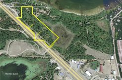
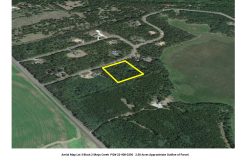
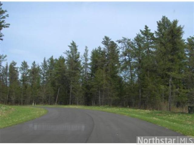
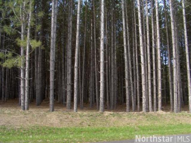
Large, wooded lot located minutes from Pequot Lakes in heart of the Brainerd Lakes Area. Site is gently-sloping, surveyed, at the end of a cul-de-sac on a paved road, and ready for your new home! Conservation easement protects natural features of the neighborhood. The area is saturated with lakes and trails so you can enjoy the great outdoors all year long. Hundreds of acres of public land less than a mile away for hunting. Superb country living in this highly-desirable location. Owner/broker.
Main Property Info
Property ID
224010350
224010350
MLS Number
5506159
5506159
Status
Sold
Sold
List Price
$37,500
$37,500
Selling Price
$34,375
$34,375
Acres
3.29
3.29
Zoning
Rural Residential 2.5 & Shoreland Residential
Rural Residential 2.5 & Shoreland Residential
City
Pequot Lakes
Pequot Lakes
Township
Loon Lake Twp
Loon Lake Twp
State
MN
MN
Zip Code
56472
56472
County
Cass
Cass
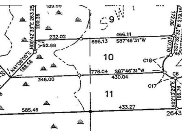
Legal Description
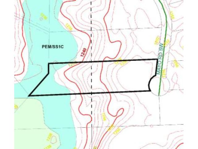
Lot 10, Block 3, Mayo Creek First Addition. Subject to Declaration of Covenants, Easements and Restrictions recorded as Doc# A000496908; Perpetual Wetland Conservation Easement recorded as Doc# A000496368; and any other easements, restrictions, or reservations of record.
Lot 10, Block 3, Mayo Creek First Addition. Subject to Declaration of Covenants, Easements and Restrictions recorded as Doc# A000496908; Perpetual Wetland Conservation Easement recorded as Doc# A000496368; and any other easements, restrictions, or reservations of record.
Property Location
Directions
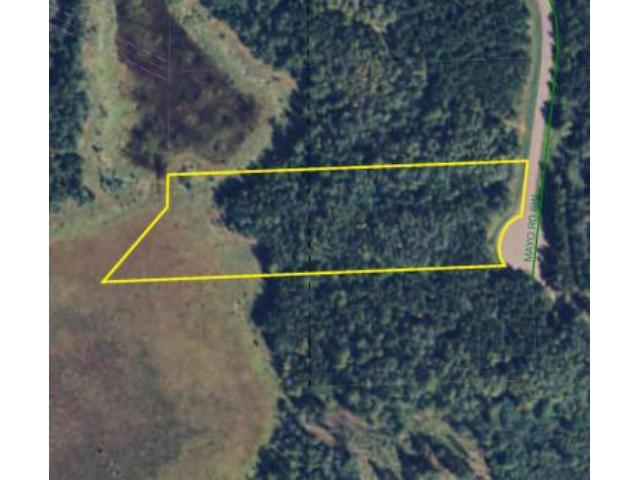
From State Hwy 371 & CR 17 intersection on the north edge of Pequot, W on CR 17 for 2 mi. Left on 13th Ave SW 9/10 mi. Left on Mayo Rd SW 8/10 mi to NE corner of lot on right @ end of cul-de-sac.
From State Hwy 371 & CR 17 intersection on the north edge of Pequot, W on CR 17 for 2 mi. Left on 13th Ave SW 9/10 mi. Left on Mayo Rd SW 8/10 mi to NE corner of lot on right @ end of cul-de-sac.
Access
Access is via Mayo Rd SW which runs along the east side of the lot.
Access is via Mayo Rd SW which runs along the east side of the lot.
GPS Coordinates
See attached map for coordinates to approximate corners and points based on county mapping.
See attached map for coordinates to approximate corners and points based on county mapping.
Address
L10B3 Mayo Road SW
L10B3 Mayo Road SW
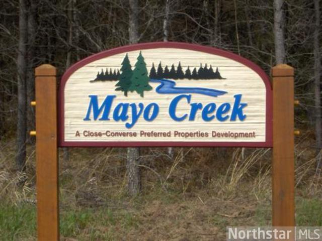
Neighborhood
Mayo Creek
Mayo Creek
School District
Pequot Lakes - 186
Pequot Lakes - 186
Property Details
Dimensions (approx)
221x251x778x698
221x251x778x698
Utilities
Available Utilities
Electric
Electric
On Site Utilities
None
None
Power Company
Crow Wing Power (1-800-648-9401)
Crow Wing Power (1-800-648-9401)
Taxes & Fees
Tax Amount
$244
$244
Tax With Assessments
$244
$244
Tax Year
2020
2020
Other Details
Section Number
16
16
Township Number
136
136
Range Number
29
29
Estimated Upland %
75
75
Estimated Wetland %
25
25
Additional Comments
Disclosures
Owner/broker. The land is subdivided and is subject to Declaration of Covenants, Easements and Restrictions recorded as Doc# A000496908 and Perpetual Wetland Conservation Easement recorded as Doc# A000496368. See plat for exact dimensions. Acreage based on county data and mapping; county disclaimers included by reference. Photos/maps for convenience only and not guaranteed; tree cover may be different than depicted; physically inspect prior to purchase.
Owner/broker. The land is subdivided and is subject to Declaration of Covenants, Easements and Restrictions recorded as Doc# A000496908 and Perpetual Wetland Conservation Easement recorded as Doc# A000496368. See plat for exact dimensions. Acreage based on county data and mapping; county disclaimers included by reference. Photos/maps for convenience only and not guaranteed; tree cover may be different than depicted; physically inspect prior to purchase.