


MLS Number : 5544339
Sold $412,500 - Hunting & Recreation
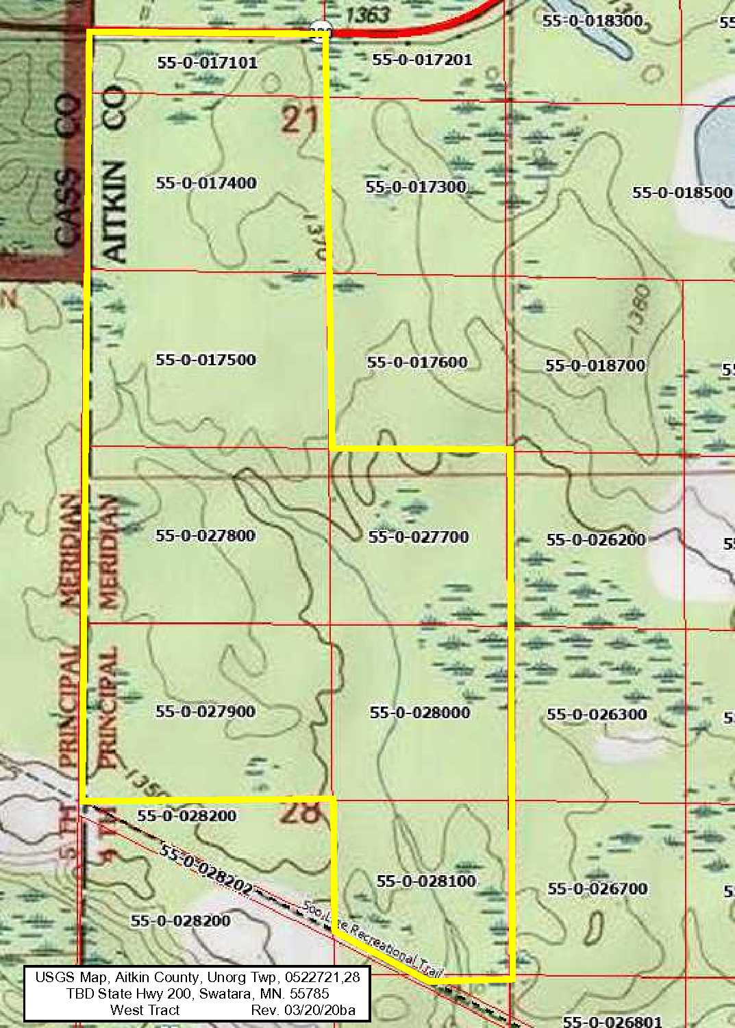
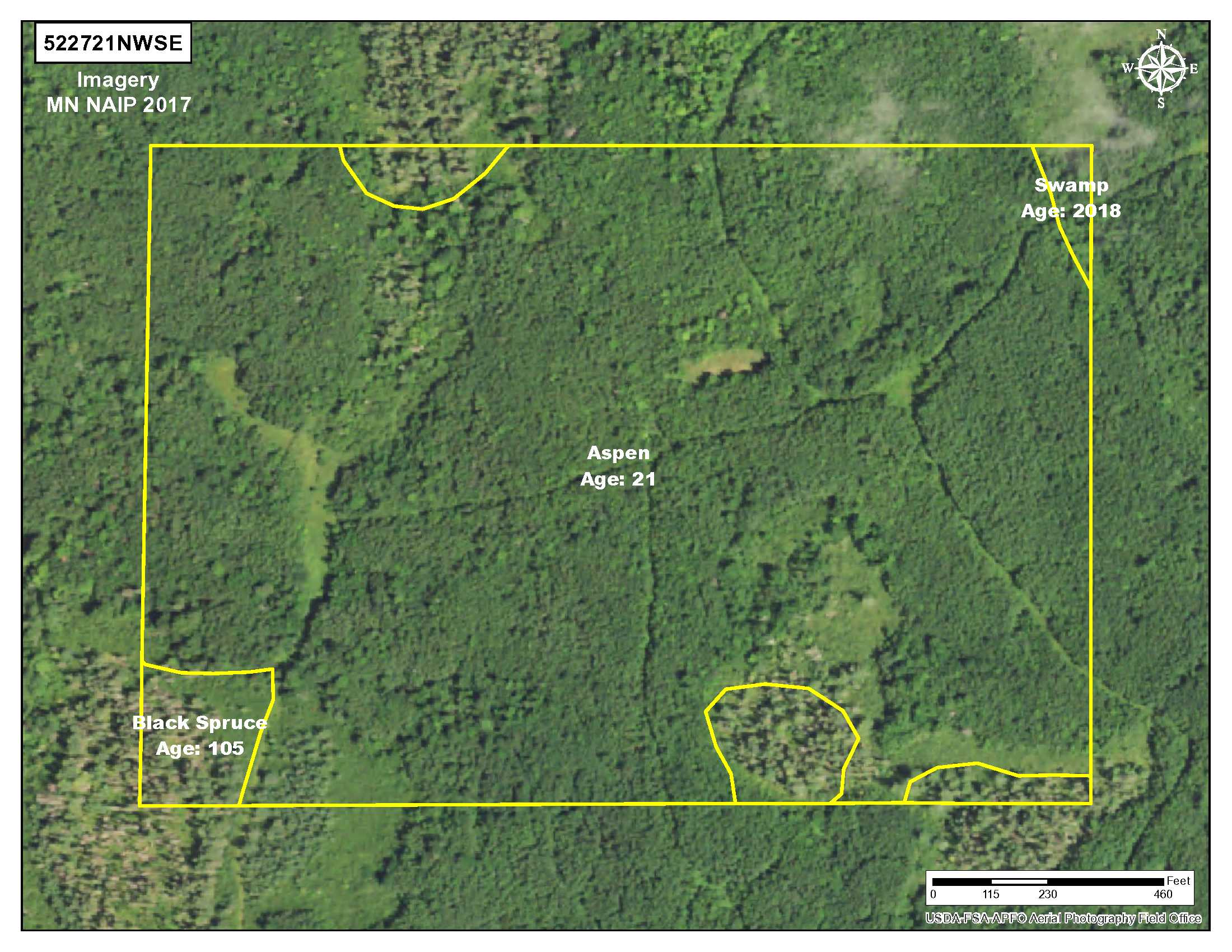
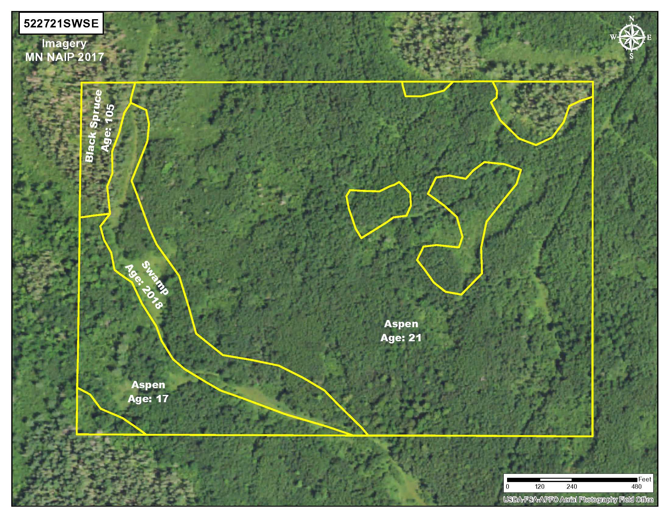
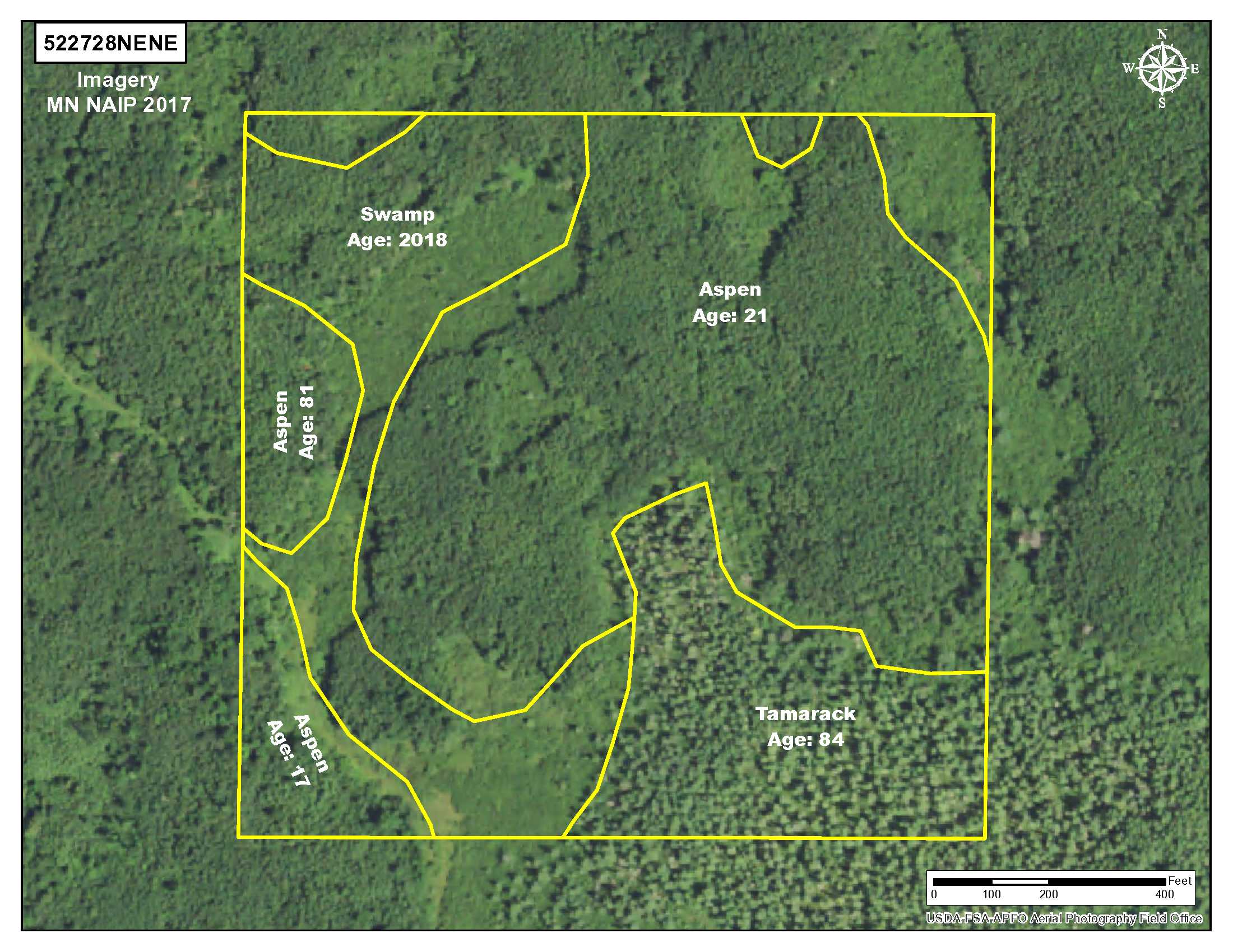
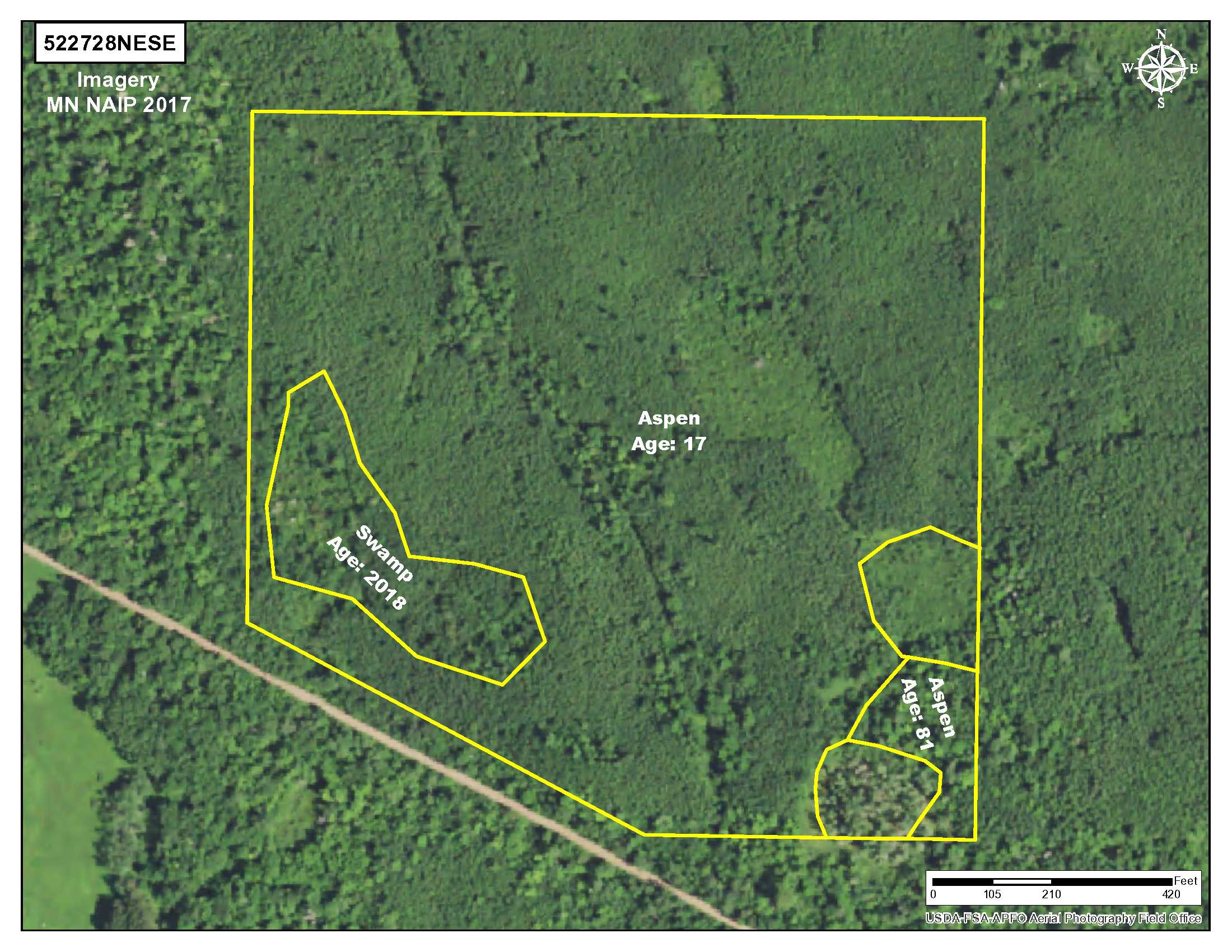
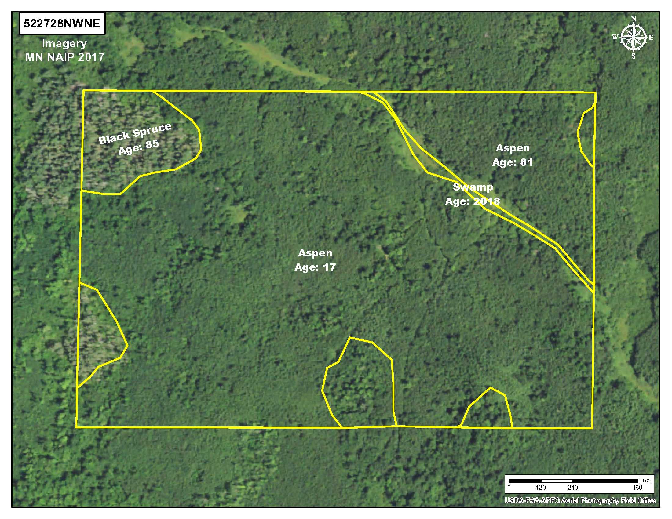
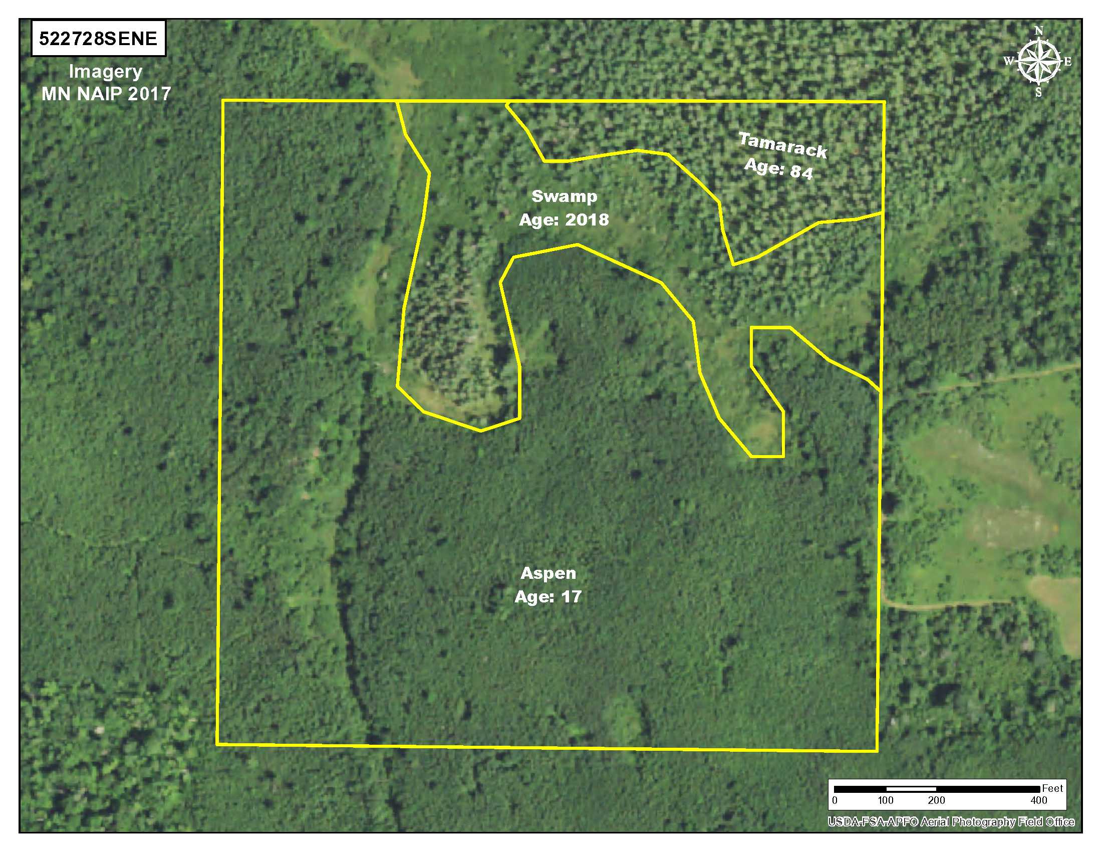
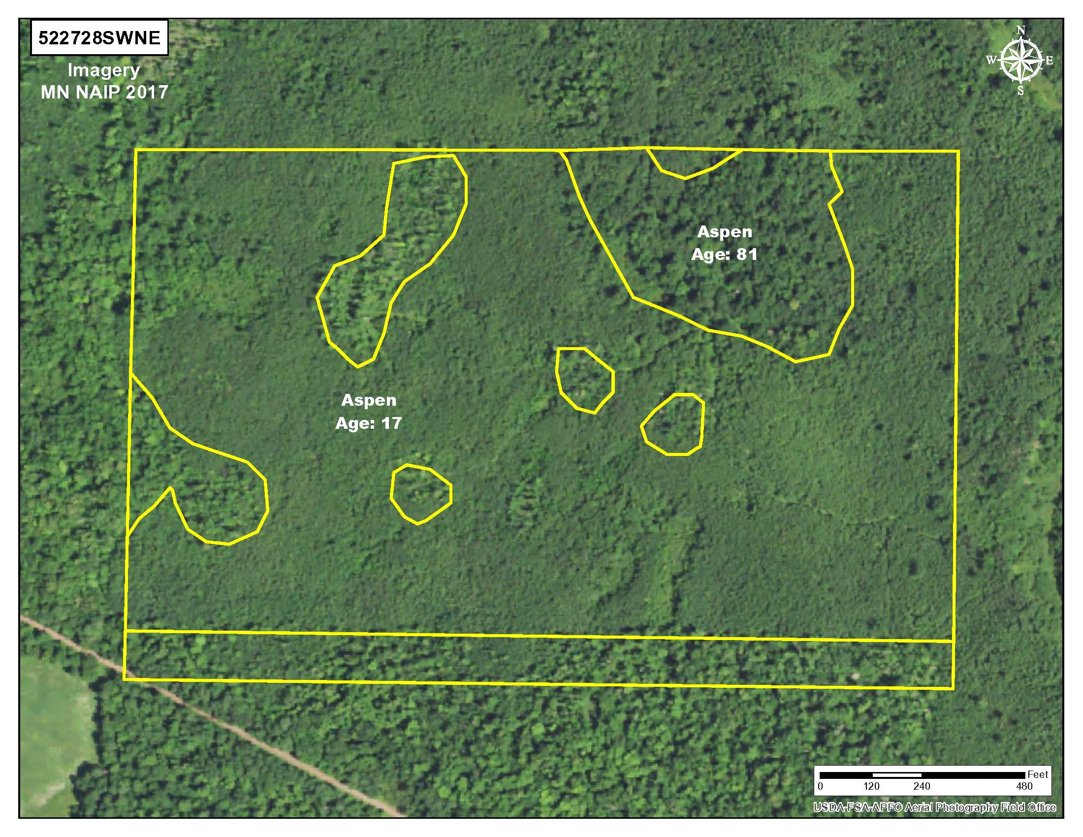
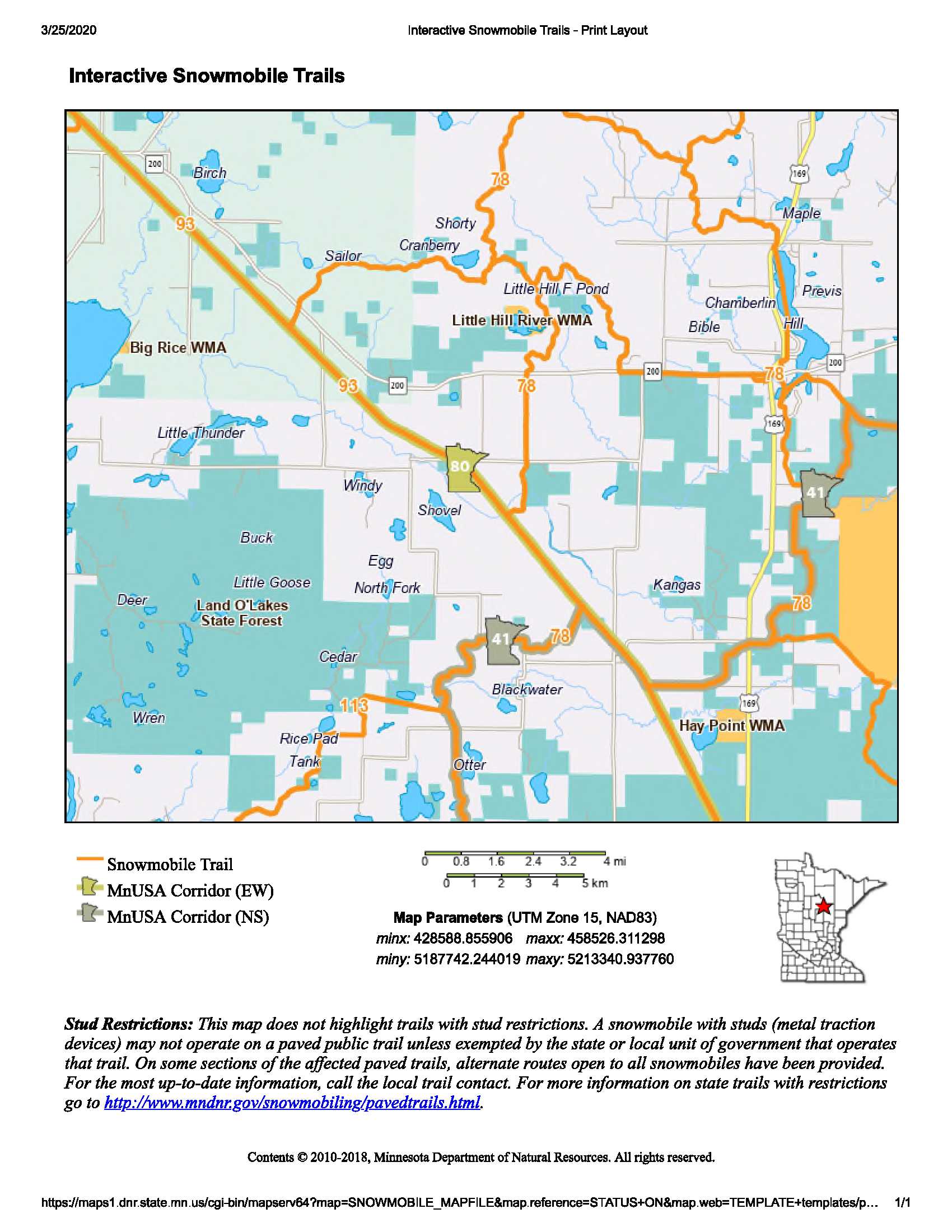
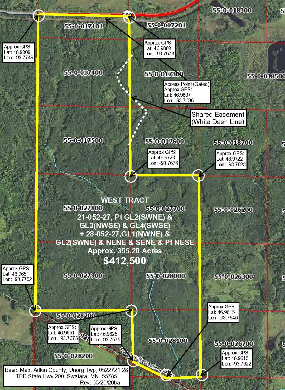
This large 355-acre tract of land’s southerly line runs along the ATV and snowmobile Soo Line Recreational Trail just 7+ miles west of Hill City. The parcel has gently rolling topography, is largely upland accented by both small and large wetland areas with approximately 4,990 ft. of creek/stream meandering throughout. The variety of timber includes mixed-age aspen, black spruce, and tamarack. There is easy access to the property via an existing trail (gated) off State Hwy 200. The public land on the north side of the highway connects to thousands of acres of the Hill River State Forest for additional hunting and recreation potential. This is a great property for a hunting group or family to not only enjoy the property itself, but also enjoy the surrounding area too. There is fishing on Holy Water Lake to the north and boat access on Taylor Lake and Hill Lake to the west. Taylor Lake has brook and rainbow trout. Little Hill River WMA and Morrison Brook AMA are just a few miles away. Large tracts like this are difficult to find so get your group together today!
Main Property Info
55-0-017101, 55-0-017400, 55-0-017500, 55-0-027800, 55-0-027900, 55-0-027700, 55-0-028000, 55-0-028100
5544339
Sold
$412,500
$412,500
355.20
Open
Swatara
Unorg (052-27) Twp
MN
55785
Aitkin
0522721,Pt GL2(SWNE),GL3(NWSE), GL4(SWSE)+0522728, GL1(NWNE),GL2(SWNE),NENE,SENE,&PtNESE less right-of-way and less part lying south and west of right-of-way now Moose Lake to Cass Lake Soo Line Trail. Subject to any easements, restrictions, or reservations of record. Easements granted and reserved/retained will include terms governing shared use of the easements.
Property Location
From the intersection of State Hwy 169 and State Hwy 200 in Hill City, west on State Hwy 200 for 7.7 miles to trail with gate on the left. (South). Approx GPS Access Point: 46.9807, -93.7696.
Access trail off of Paved State Hwy #200. (Approx GPS Access Point: 46.9807, -93.7696.) Gated.
Coordinates to approximate corners/points based on county mapping: NW: 46.9809, -93.7749 NE: 46.9808, -93.7678 SE: 46.9615, -93.7622 SW: 46.9651, -93.7752
TBD State Hwy 200, NW Aitkin Unorg. Territory, Swatara, MN 55785
Hill City - 2
Property Details
0
0
272
1766’ X 7140’ X 3446’ X 5756’ (Irregular)
Utilities
None
None
Lake Country Power (1-800-421-9959)
Waterfront
None
None
None
There is an un-named creek that meanders throughout the property.
Taxes & Fees
No
$0
N/A
$3,176
0
$3,176
No
N/A
2020
Other Details
21 & 28
052
27
76
24
Additional Comments
17 to 81-yr old Aspen, 85 to 105-yr old Black Spruce, 84-yr old Tamarack This property has been managed according to Forest Stewardship Council (FSC) standards. If Timber value is important to you, seek the advice of a competent forester to determine species, volumes and values.
Deer Permit Area: #171
Trail is gated at State Hwy 200; contact agent for instructions on viewing the property. Easement(s) affect this property. Shared easements affect this property and easements granted and reserved/retained will include terms governing shared use of the easements. See legal description and maps for details. Acreage, dimensions, and taxes estimated based on county data and mapping or seller data; county disclaimers included by reference; subject to split approval if necessary. Not surveyed. Photos/maps and GPS coordinates for convenience only and not guaranteed; physically inspect prior to purchase. Any deer stands on the land are not property of seller and are not included in sale. Use seller-approved PA and Addendum; closing dates the 3rd Wednesday each month. Seller is Potlatch Minnesota Timberlands LLC, a business entity under the laws of the State of Delaware.


