
MLS Number : 4202797
Sold $76,500 - Hunting & Recreation, Price Reduced
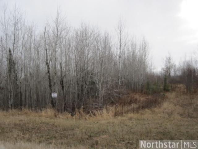
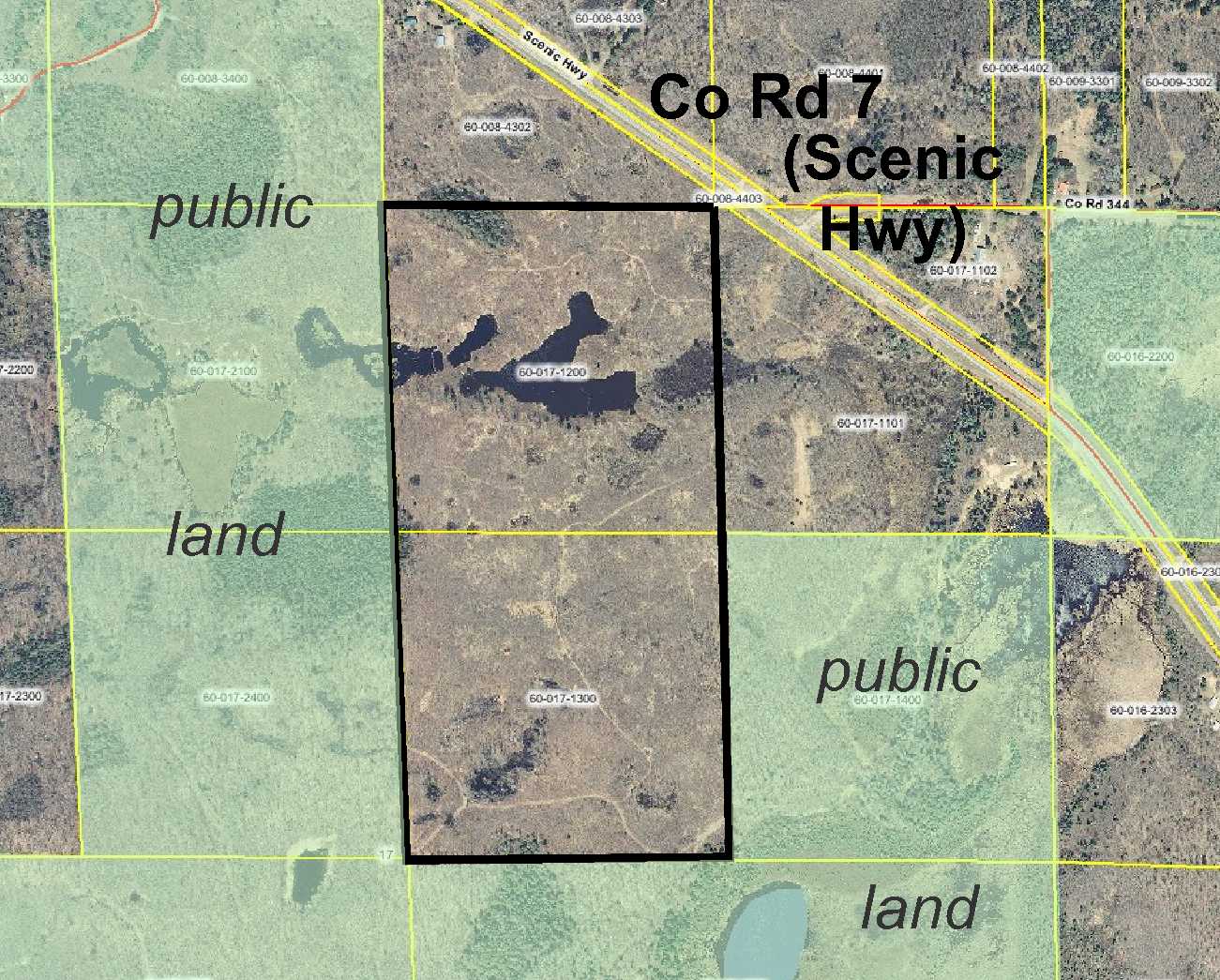
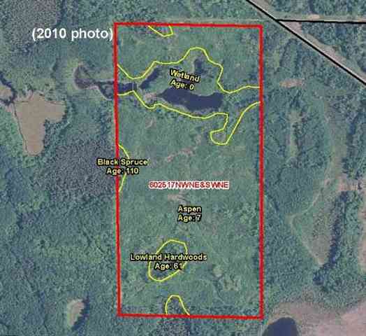
Price lowered from $97,900 to $81,500! Over 78 acres of Potlatch land just over 7 miles southeast of Bigfork. Nearly all wooded with young Aspen and dotted with stands of more mature Swamp Hardwood and 110+ year old Black Spurce. Mostly sloped high ground with an open-water wetland in the northerly half.
Main Property Info
Property ID
600171200 & 600171300
600171200 & 600171300
MLS Number
4202797
4202797
Status
Sold
Sold
List Price
$81,500
$81,500
Selling Price
$76,500
$76,500
Acres
78.300
78.300
Zoning
Farm Residential
Farm Residential
City
Bigfork
Bigfork
Township
Unorg (060-25) Twp
Unorg (060-25) Twp
State
MN
MN
Zip Code
56628
56628
County
Itasca
Itasca
Legal Description
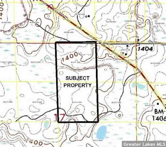
NWNE & SWNE, 17-060-25. Subject to any easements, restrictions, or reservations of record.
NWNE & SWNE, 17-060-25. Subject to any easements, restrictions, or reservations of record.
Property Location
Directions
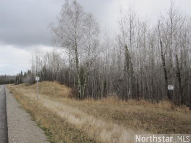
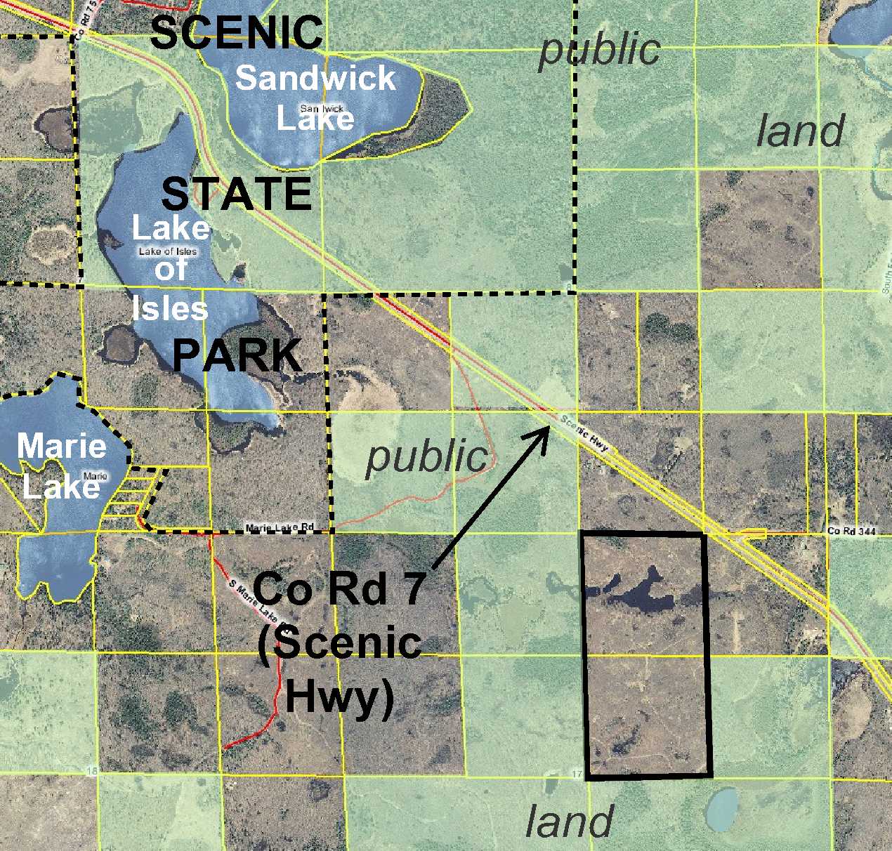
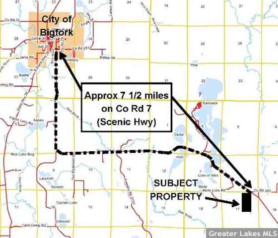
From Bigfork, south and then east on Co Rd 7 (Scenic Hwy) approximately 7 1/2 miles. Property is on the right through privately-owned land; buyer is responsible for securing easement(s) for access.
From Bigfork, south and then east on Co Rd 7 (Scenic Hwy) approximately 7 1/2 miles. Property is on the right through privately-owned land; buyer is responsible for securing easement(s) for access.
Access
The northeast corner of the tract is within feet of Co Rd 7 (Scenic Hwy) but is separated from the public road by privately-owned land. Buyer will be responsible for securing ingress-egress easement(s) for deeded access.
The northeast corner of the tract is within feet of Co Rd 7 (Scenic Hwy) but is separated from the public road by privately-owned land. Buyer will be responsible for securing ingress-egress easement(s) for deeded access.
GPS Coordinates
Coordinates to approximate corners/points based on county mapping: NE corner = 47.6884, -93.5400; SE corner = 47.6812, -93.5396; SW corner = 47.6812, -93.5449; NW corner = 47.6884, -93.5453
Coordinates to approximate corners/points based on county mapping: NE corner = 47.6884, -93.5400; SE corner = 47.6812, -93.5396; SW corner = 47.6812, -93.5449; NW corner = 47.6884, -93.5453
Address
TBD County Road 7
TBD County Road 7
School District
Grand Rapids - 318
Grand Rapids - 318
Property Details
Dimensions (approx)
1320x1320x2640x2640
1320x1320x2640x2640
Utilities
Available Utilities
None
None
On Site Utilities
None
None
Power Company
Itasca-Mantrap Co-op (1-888-713-3377)
Itasca-Mantrap Co-op (1-888-713-3377)
Taxes & Fees
Association Fee
$0
$0
Tax Amount
$786
$786
Assessment Amount
0
0
Tax With Assessments
$786
$786
Tax Year
2017
2017
Other Details
Section Number
17
17
Township Number
60
60
Range Number
25
25
Estimated Upland %
85
85
Estimated Wetland %
15
15
Additional Comments
Timber Comments
This property has been managed according to Forest Stewardship Council (FSC) standards. Mostly covered with Aspen; spots of Black Spruce on the north, west, and east boundaries; and an area of Swamp Hardwood in the southwest corner. If timber value is important to you, seek the advice of a competent forester to determine species, volumes and values.
This property has been managed according to Forest Stewardship Council (FSC) standards. Mostly covered with Aspen; spots of Black Spruce on the north, west, and east boundaries; and an area of Swamp Hardwood in the southwest corner. If timber value is important to you, seek the advice of a competent forester to determine species, volumes and values.
Hunting Comments
Growing trees, spots of older timber, and low wetland area make this an excellent tract for hunting whitetail deer, small game, and waterfowl. The tract adjoins public land on three sides for thousands of acres of additional hunting opportunity. This property is located in MN deer firearm hunting zone 169.
Growing trees, spots of older timber, and low wetland area make this an excellent tract for hunting whitetail deer, small game, and waterfowl. The tract adjoins public land on three sides for thousands of acres of additional hunting opportunity. This property is located in MN deer firearm hunting zone 169.
Disclosures
Property may not touch Co Rd 7 (Scenic Hwy); buyer responsible for securing easement(s) for deeded access. Not surveyed; acreage and dimensions approximate based on county data and mapping; county disclaimers included by reference. Photos/maps for convenience only and not guaranteed; tree cover may be different than depicted; physically inspect prior to purchase. Any deer stands on the land are not property of seller and are not included in sale. Use seller-approved PA and addendum; closing dates the 2nd Wednesday each month.
Property may not touch Co Rd 7 (Scenic Hwy); buyer responsible for securing easement(s) for deeded access. Not surveyed; acreage and dimensions approximate based on county data and mapping; county disclaimers included by reference. Photos/maps for convenience only and not guaranteed; tree cover may be different than depicted; physically inspect prior to purchase. Any deer stands on the land are not property of seller and are not included in sale. Use seller-approved PA and addendum; closing dates the 2nd Wednesday each month.


