

MLS Number : 4763621
Sold $178,500 - Hunting & Recreation
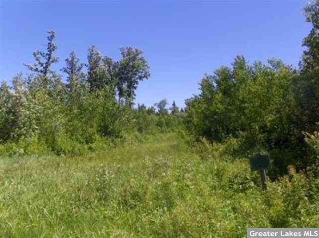
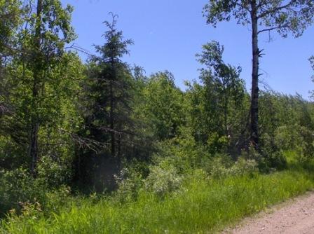
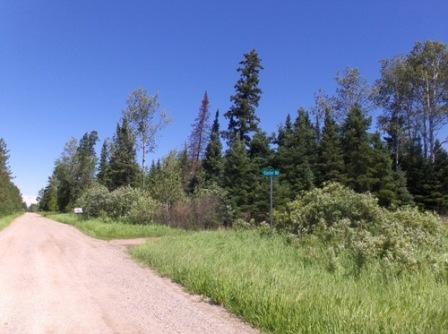
Potlatch land in the midst of the Bigfork State Forest and Chippewa National Forest. Level to gently rolling terrain. Gravel road along the west side of the southwesterly portion of the acreage with an easement trail providing access through it. Northeasterly portion of the acreage is bisected from the southwesterly “tract” by privately-owned land; buyer responsible for securing easement(s) for access.
Main Property Info
Property ID
441193200 & 441193300 & 441191100 & 441191400 & 441202200
441193200 & 441193300 & 441191100 & 441191400 & 441202200
MLS Number
4763621
4763621
Status
Sold
Sold
List Price
$189,900
$189,900
Selling Price
$178,500
$178,500
Acres
210.96
210.96
Zoning
Farm Residential
Farm Residential
City
Bigfork
Bigfork
Township
Liberty Twp
Liberty Twp
State
MN
MN
Zip Code
56628
56628
County
Itasca
Itasca
Legal Description
GL3(NWSW) & GL4(SWSW) & NENE & SENE, 19-150-25 AND NWNW, 20-150-25. Subject to easement over GL3(NWSW) and any other easements, restrictions, or reservations of record.
GL3(NWSW) & GL4(SWSW) & NENE & SENE, 19-150-25 AND NWNW, 20-150-25. Subject to easement over GL3(NWSW) and any other easements, restrictions, or reservations of record.
Property Location
Directions
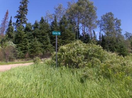
From Bigfork, W on CR 14 +/- 5 1/2 mi to intersect with State Hwy 6. Left/S +/- 1 mi. Right/W continue on CR 14 +/- 6 mi. Right/N onto CR 150 +/- 2 mi to trl on right going into the tract along CR 150.
From Bigfork, W on CR 14 +/- 5 1/2 mi to intersect with State Hwy 6. Left/S +/- 1 mi. Right/W continue on CR 14 +/- 6 mi. Right/N onto CR 150 +/- 2 mi to trl on right going into the tract along CR 150.
Access
The west side of the southwesterly portion (GL3(NWSW) & GL4(SWSW), Sec 19) fronts Co Rd 150 (gravel) and there is an easement trail leading diagonally through it. Buyer responsible for securing easeement(s) for access to northeasterly tract (NENE & SENE, Sec 19 & NWNW, Sec 20).
The west side of the southwesterly portion (GL3(NWSW) & GL4(SWSW), Sec 19) fronts Co Rd 150 (gravel) and there is an easement trail leading diagonally through it. Buyer responsible for securing easeement(s) for access to northeasterly tract (NENE & SENE, Sec 19 & NWNW, Sec 20).
Address
TBD County Road 150
TBD County Road 150
School District
Grand Rapids - 318
Grand Rapids - 318
Property Details
Dimensions (approx)
2640x1320x2640x1320 & 2640x2640x1320x1320x1320x1320
2640x1320x2640x1320 & 2640x2640x1320x1320x1320x1320
Utilities
Available Utilities
None
None
On Site Utilities
None
None
Power Company
Minnesota Power (1-800-228-4966)
Minnesota Power (1-800-228-4966)
Taxes & Fees
Association Fee
$0
$0
Tax Amount
$1,846
$1,846
Assessment Amount
0
0
Tax With Assessments
$1,846
$1,846
Tax Year
2016
2016
Other Details
Section Number
19 & 20
19 & 20
Township Number
150
150
Range Number
25
25
Estimated Upland %
70
70
Estimated Wetland %
30
30
Additional Comments
Timber Comments
This property has been managed according to Forest Stewardship Council (FSC) standards. If timber value is important to you, seek the advice of a competent forester to determine species, volumes and values.
This property has been managed according to Forest Stewardship Council (FSC) standards. If timber value is important to you, seek the advice of a competent forester to determine species, volumes and values.
Disclosures
Subject to easement through GL3(NWSW). Buyer responsible for securing easement(s) for access to northeasterly portion (NENE & SENE (Sec 19) & NWNW (Sec 20)). Not surveyed; acreage and dimensions approximate based on county data and mapping; county disclaimers included by reference. Photos/maps for convenience only and not guaranteed; tree cover may be different than depicted; physically inspect prior to purchase. Any deer stands on the land are not property of seller and are not included in sale. Use seller-approved PA and addendum; closing dates the 2nd Wednesday each month.
Subject to easement through GL3(NWSW). Buyer responsible for securing easement(s) for access to northeasterly portion (NENE & SENE (Sec 19) & NWNW (Sec 20)). Not surveyed; acreage and dimensions approximate based on county data and mapping; county disclaimers included by reference. Photos/maps for convenience only and not guaranteed; tree cover may be different than depicted; physically inspect prior to purchase. Any deer stands on the land are not property of seller and are not included in sale. Use seller-approved PA and addendum; closing dates the 2nd Wednesday each month.


