

MLS Number : 4698471
Sold $68,900 - Home & Cabin Sites, Hunting & Recreation
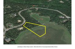
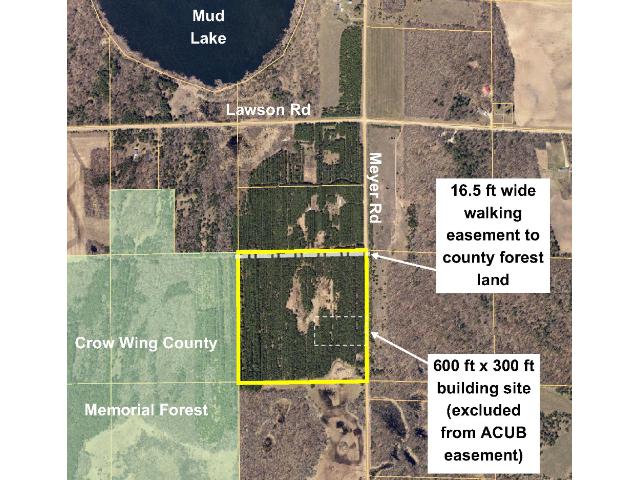
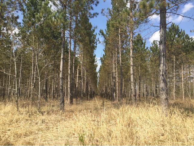
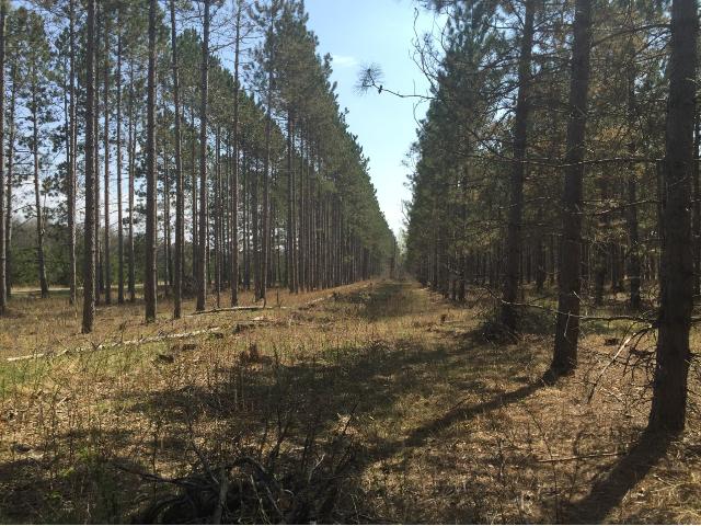
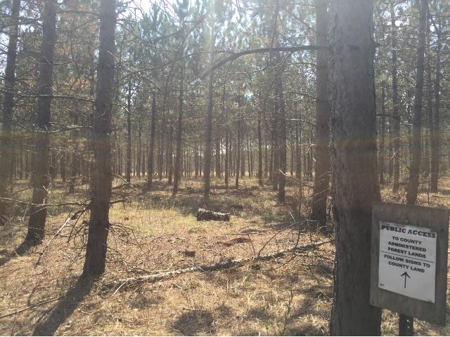
Beautiful acreage adjoining Crow Wing County Memorial Forest north of Fort Ripley. Mud Lake and Crow Wing Lake to the north. Level upland terrain with small wetland in SE corner. Wooded with red pine. Good gravel twp road access. There is a gated walking easement over north 16.5 ft, and a conservation easement covers the rest of the tract except a 600′ x 300′ building site (contact listing agent for details). Excellent opportunity to secure acreage near the Brainerd/Baxter Lakes Area.
Main Property Info
Property ID
610141400000009
610141400000009
MLS Number
4698471
4698471
Status
Sold
Sold
List Price
$73,900
$73,900
Selling Price
$68,900
$68,900
Acres
40.000
40.000
Zoning
Ag/Forestry
Ag/Forestry
City
Fort Ripley
Fort Ripley
Township
Fort Ripley Twp
Fort Ripley Twp
State
MN
MN
Zip Code
56449
56449
County
Crow Wing
Crow Wing
Legal Description
SENE, 14-043-32. Subject to Meyer Rd, easement over the north 16.5 ft, ACUB easement in Doc# A-867415, and any other easements, restrictions, or reservations of record.
SENE, 14-043-32. Subject to Meyer Rd, easement over the north 16.5 ft, ACUB easement in Doc# A-867415, and any other easements, restrictions, or reservations of record.
Property Location
Directions
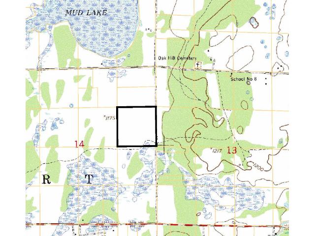
From the intersection of State Hwy 371 and Co Rd 2 approx 2 1/2 miles north of Fort Ripley (or approx 12 1/2 miles south of Baxter), east on Co Rd 2 for 1 1/2 miles. Left on Meyer Rd 1/2 mile to southeast corner of the tract.
From the intersection of State Hwy 371 and Co Rd 2 approx 2 1/2 miles north of Fort Ripley (or approx 12 1/2 miles south of Baxter), east on Co Rd 2 for 1 1/2 miles. Left on Meyer Rd 1/2 mile to southeast corner of the tract.
Access
Meyer Rd, a gravel township road, runs along the east side of the property. There is also a gated walking easement trail along the north 16.5 feet and a drive/trail in the SE corner (that adjoining landowner to the south uses to access adjoining property, although there is no easement for adjoiner's use of this drive/trail).
Meyer Rd, a gravel township road, runs along the east side of the property. There is also a gated walking easement trail along the north 16.5 feet and a drive/trail in the SE corner (that adjoining landowner to the south uses to access adjoining property, although there is no easement for adjoiner's use of this drive/trail).
GPS Coordinates
Coordinates to approx corners/points based on county mapping: SE corner along Meyer Rd = 46.2081, -94.3345; point where drive/trail enters east side near SE corner = 46.2085, -94.3345; point where drive/trail exits south boundary near SE corner = 46.2081, -94.3363; SW corner = 46.2081, -94.3398; NW corner = 46.2118, -94.3398; NE corner along Meyer Rd = 46.2118, -94.3346.
Coordinates to approx corners/points based on county mapping: SE corner along Meyer Rd = 46.2081, -94.3345; point where drive/trail enters east side near SE corner = 46.2085, -94.3345; point where drive/trail exits south boundary near SE corner = 46.2081, -94.3363; SW corner = 46.2081, -94.3398; NW corner = 46.2118, -94.3398; NE corner along Meyer Rd = 46.2118, -94.3346.
Address
SENE Meyer Road
SENE Meyer Road
School District
Brainerd - 181
Brainerd - 181
Property Details
Dimensions (approx)
1320x1320x1320x1320
1320x1320x1320x1320
Utilities
Available Utilities
Electric
Electric
On Site Utilities
None
None
Power Company
Crow Wing Power (1-800-648-9401)
Crow Wing Power (1-800-648-9401)
Taxes & Fees
Association Fee
$0
$0
Tax Amount
$540
$540
Tax With Assessments
$540
$540
Tax Year
2016
2016
Other Details
Section Number
14
14
Township Number
043
043
Range Number
32
32
Estimated Upland %
97
97
Estimated Wetland %
3
3
Additional Comments
Timber Comments
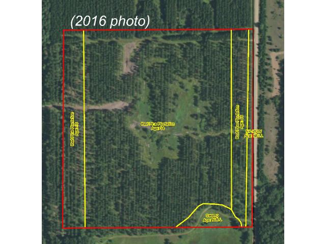
This property has been managed according to Forest Stewardship Council (FSC) standards. Timber includes mature red pine. If timber value is important to you, seek the advice of a competent forester to determine species, volumes and values.
This property has been managed according to Forest Stewardship Council (FSC) standards. Timber includes mature red pine. If timber value is important to you, seek the advice of a competent forester to determine species, volumes and values.
Hunting Comments
This property adjoins public land in MN Firearms Deer Zone 249. The area is well-known for hunting whitetail deer and small game.
This property adjoins public land in MN Firearms Deer Zone 249. The area is well-known for hunting whitetail deer and small game.
Disclosures
Subject to gated walking easement over the north 16.5 feet and subject to ACUB conservation easement in Doc# A-867415 (available from listing agent). Adjoining property owner to the south uses drive/trail in SE corner to access adjoining parcel; however, there is no easement for use of this trail/drive. Not surveyed; acreage and dimensions approximate based on county data and mapping; county disclaimers included by reference. Photos/maps for convenience only and not guaranteed; tree cover may be different than depicted; physically inspect prior to purchase. Any deer stands on the land are not property of seller and are not included in sale. Use seller-approved PA and addendum; closing dates the 2nd Wednesday each month.
Subject to gated walking easement over the north 16.5 feet and subject to ACUB conservation easement in Doc# A-867415 (available from listing agent). Adjoining property owner to the south uses drive/trail in SE corner to access adjoining parcel; however, there is no easement for use of this trail/drive. Not surveyed; acreage and dimensions approximate based on county data and mapping; county disclaimers included by reference. Photos/maps for convenience only and not guaranteed; tree cover may be different than depicted; physically inspect prior to purchase. Any deer stands on the land are not property of seller and are not included in sale. Use seller-approved PA and addendum; closing dates the 2nd Wednesday each month.