

MLS Number : 4712393
Sold $83,000 - Hunting & Recreation
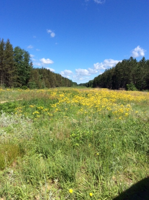
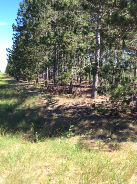
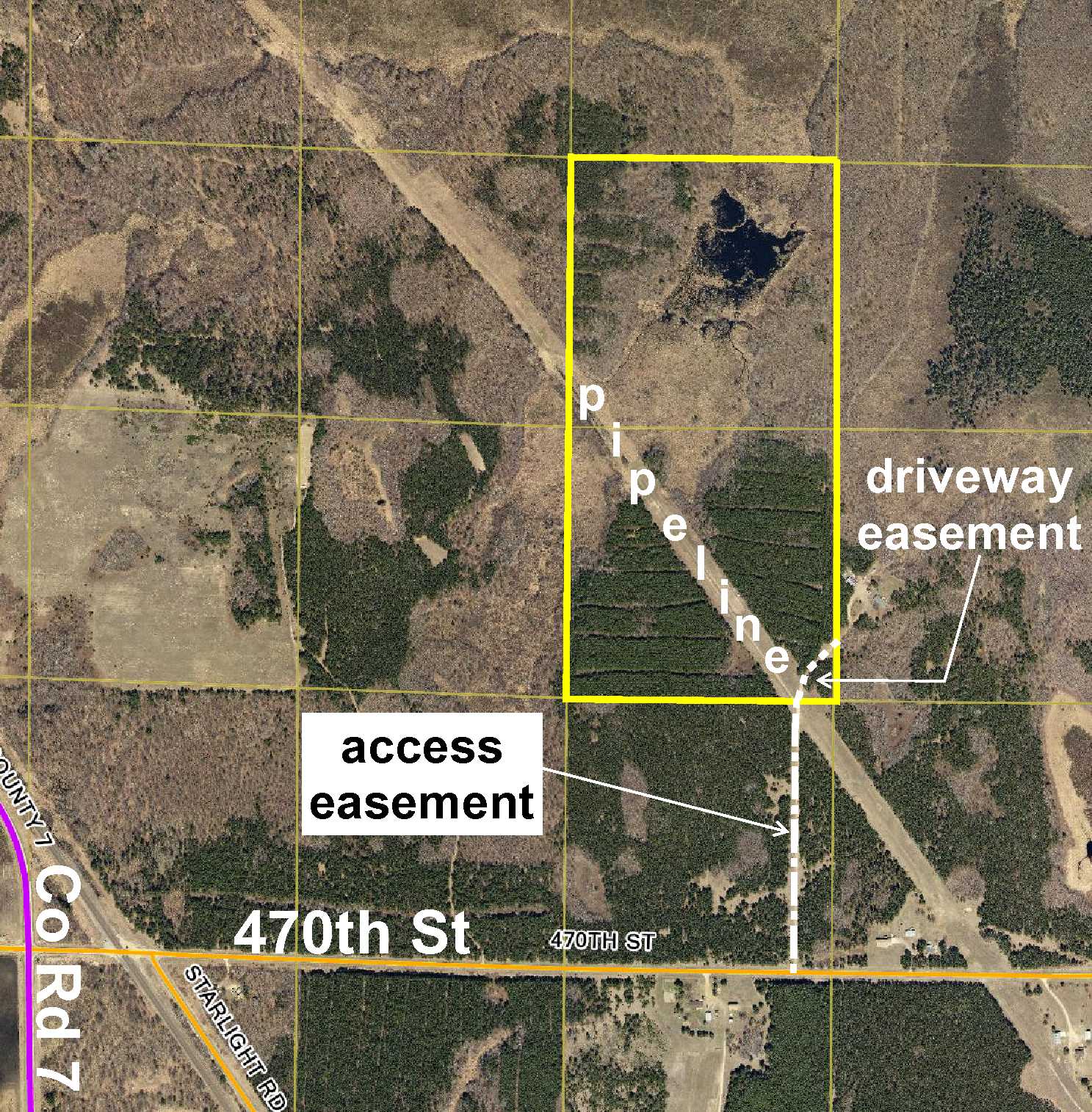
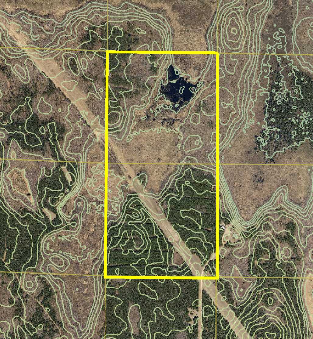
Potlatch land by Lawrence Lake five miles southeast of Staples. Level to gently-rolling topography with a combination of wooded and open upland and open wetland area. Timber includes red pine and aspen that could be thinned or harvested for potential future timber income. Open pipeline easement diagonally across the acreage gives great shooting lanes for hunting. Access via an easement off a paved county road. Lawrence Lake public access and Lawrence Lake State Wildlife Management Area (North East Unit) are only 1 1/2 miles to the west (Click HERE for more information.).
Main Property Info
Property ID
250021500 & 250021700
250021500 & 250021700
MLS Number
4712393
4712393
Status
Sold
Sold
List Price
$89,900
$89,900
Selling Price
$83,000
$83,000
Acres
80
80
Zoning
AF-2 (Agriculture/Forestry - 2)
AF-2 (Agriculture/Forestry - 2)
City
Motley
Motley
Township
Villard Twp
Villard Twp
State
MN
MN
Zip Code
56466
56466
County
Todd
Todd
Legal Description
NWSW & SWNW, 21-133-32. Together with and subject to easements in Doc# 488061; subject to pipeline easements; and subject to any other easements, restrictions, or reservations of record.
NWSW & SWNW, 21-133-32. Together with and subject to easements in Doc# 488061; subject to pipeline easements; and subject to any other easements, restrictions, or reservations of record.
Property Location
Directions
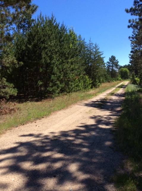
From the intersection of US Hwy 10 and State Hwy 210 (6th St SE) in Staples, south on State Hwy 210 (6th St SE) 1 3/10 miles. Left on Co Rd 7 for 3 miles. Left on 470th St (aka Co Rd 83 and Twp Rd 318) 7/10 mile. Left on easement trail 1/4 mile into southeast corner of the tract and continues across the southeast corner.
From the intersection of US Hwy 10 and State Hwy 210 (6th St SE) in Staples, south on State Hwy 210 (6th St SE) 1 3/10 miles. Left on Co Rd 7 for 3 miles. Left on 470th St (aka Co Rd 83 and Twp Rd 318) 7/10 mile. Left on easement trail 1/4 mile into southeast corner of the tract and continues across the southeast corner.
Access
Access is via an easement trail off paved 470th St (aka Co Rd 83 and Twp Rd 318). The easement trail provides access to the subject property and continues across the southeast corner of this property to benefit adjoining property to the east.
Access is via an easement trail off paved 470th St (aka Co Rd 83 and Twp Rd 318). The easement trail provides access to the subject property and continues across the southeast corner of this property to benefit adjoining property to the east.
GPS Coordinates
Coordinates to approx corners and points based on Google Earth mapping: point where easement trail enters south boundary near SE corner = 46.3147, -94.7328; SE corner = 46.3147, -94.7318; SW corner = 46.3147, -94.7372; point where pipeline easement crosses west boundary = 46.3188, -94.7373; NW corner = 46.3218, -94.7374; NE corner = 46.3219, -94.7320; point where easement trail exits east boundary = 46.3157, -94.7318.
Coordinates to approx corners and points based on Google Earth mapping: point where easement trail enters south boundary near SE corner = 46.3147, -94.7328; SE corner = 46.3147, -94.7318; SW corner = 46.3147, -94.7372; point where pipeline easement crosses west boundary = 46.3188, -94.7373; NW corner = 46.3218, -94.7374; NE corner = 46.3219, -94.7320; point where easement trail exits east boundary = 46.3157, -94.7318.
Address
470th Street
470th Street
School District
Staples-Motley - 2170
Staples-Motley - 2170
Property Details
Dimensions (approx)
1320x1320x2640x2640
1320x1320x2640x2640
Utilities
Power Company
Todd-Wadena Electric (1-800-320-8932)
Todd-Wadena Electric (1-800-320-8932)
Taxes & Fees
Tax Amount
$1,306
$1,306
Tax With Assessments
$1,306
$1,306
Assessment Pending
No
No
Tax Year
2016
2016
Other Details
Section Number
21
21
Township Number
133
133
Range Number
32
32
Estimated Upland %
70
70
Estimated Wetland %
30
30
Additional Comments
Timber Comments
This property has been managed according to Forest Stewardship Council (FSC) standards and is wooded with red pine and aspen that could be thinned or harvested for potential future timber income. If timber value is important to you, seek the advice of a competent forester to determine species, volumes and values.
This property has been managed according to Forest Stewardship Council (FSC) standards and is wooded with red pine and aspen that could be thinned or harvested for potential future timber income. If timber value is important to you, seek the advice of a competent forester to determine species, volumes and values.
Hunting Comments
This property is in MN Firearms Deer Zone 214.
This property is in MN Firearms Deer Zone 214.
Disclosures
Not surveyed; acreage and dimensions approximate based on county data and mapping; county disclaimers included by reference. Photos/maps for convenience only and not guaranteed; tree cover may be different than depicted; physically inspect prior to purchase. Any deer stands on the land are not property of seller and are not included in sale. Use seller-approved PA and addendum; closing dates the 2nd Wednesday each month.
Not surveyed; acreage and dimensions approximate based on county data and mapping; county disclaimers included by reference. Photos/maps for convenience only and not guaranteed; tree cover may be different than depicted; physically inspect prior to purchase. Any deer stands on the land are not property of seller and are not included in sale. Use seller-approved PA and addendum; closing dates the 2nd Wednesday each month.


