
MLS Number : 4859676
Sold $46,300 - Hunting & Recreation
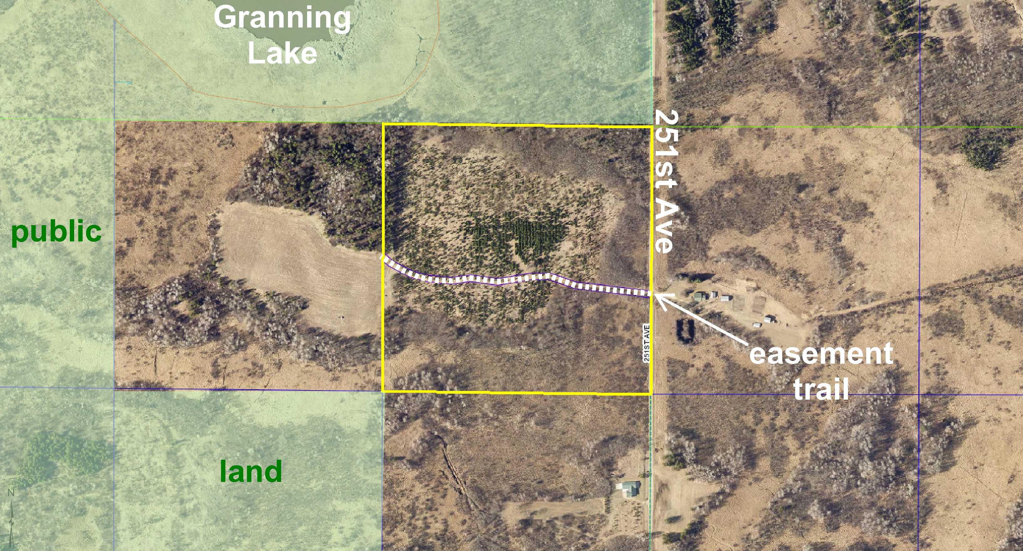
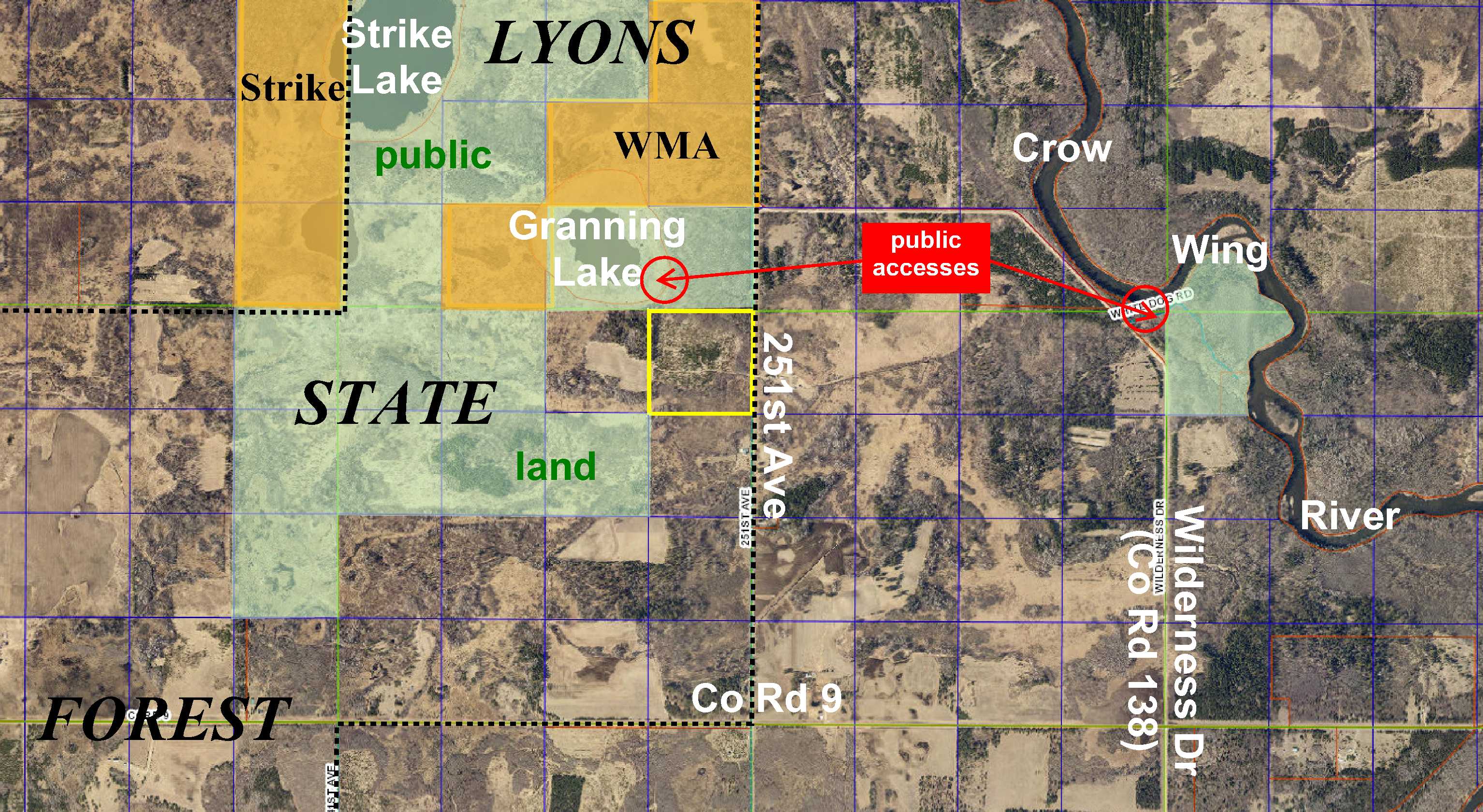
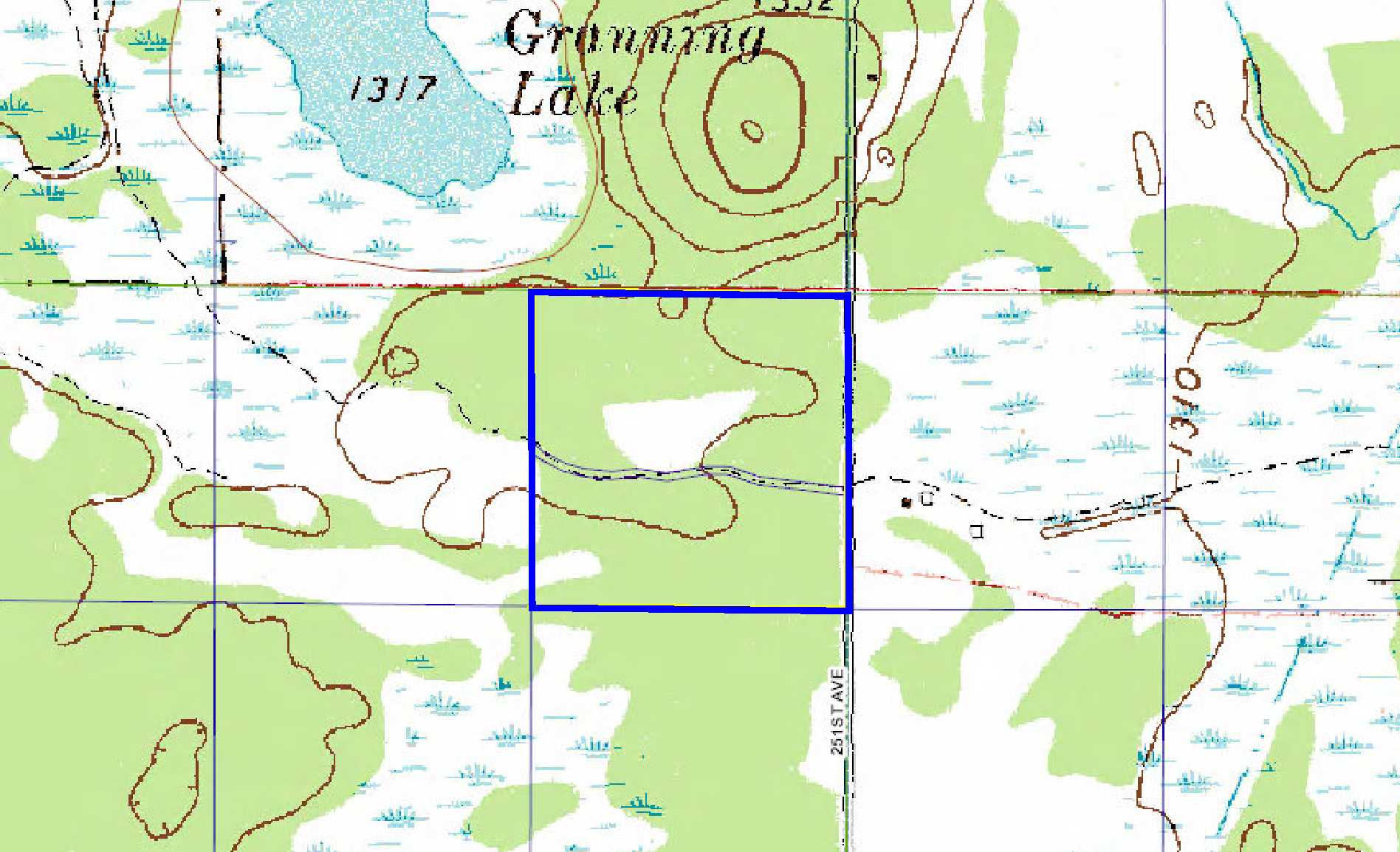
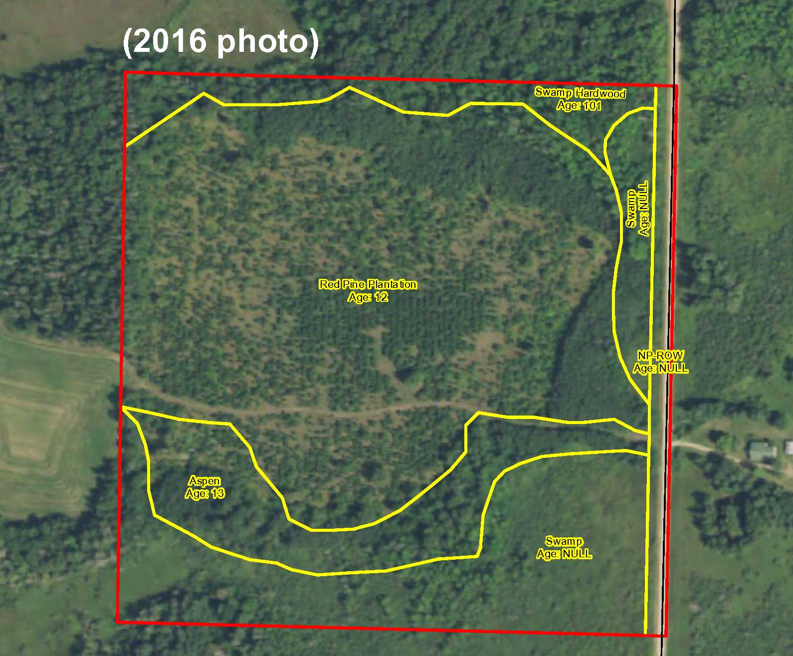
Potlatch land just off the shores of Granning Lake south of Nimrod. Fairly level upland with some lower wetland along the south side and in the northeast corner. Wooded with red pine, aspen, and swamp hardwood. Gravel township road along the east side; an easement trail to the adjoining property to the west makes interior areas accessible. Public Lyons State Forest land adjoins the north side and southwest corner. Strike WMA is only 1/4 mile north for additional deer, bear, small game, forest upland birds, and waterfowl hunting. Public access to Granning Lake is just feet from the property, and public access to the Crow Wing River is only about 1 mile away for fishing and water recreation. With power available at the road, this could be a good rural home or cabin site as well.
Main Property Info
060211010
4859676
Sold
$49,900
$46,300
40
A-2 Mixed Agriculture
Verndale
Lyons Twp
MN
56481
Wadena
NENE, 21-136-33. Subject to 251st Ave, easement benefitting NWNE, and any other easements, restrictions, or reservations of record.
Property Location
From the intersection of State Hwy 227 and Co Rd 26 in Nimrod, south on Co Rd 26 for 1 mile. Left on 270th St (Co Rd 138) for 2 miles. Right on 251st Ave (Co Rd 138) for 2 2/10 miles to easement trail leading into the property (across from address #24822).
The east side is along 251st Ave, a gravel township road, and an easement trail leads east-west through the property.
Coordinates to approximate corners/points based on flagging and county mapping: Point where easement trail enters east side of the property = 46.5842, -94.8431; NE corner = 46.5865, -94.8430; SE corner = 46.5829, -94.8430; SW corner = 46.5829, -94.8783; NW corner = 46.5865, -94.8483.
251st Ave
Sebeka - 820
Property Details
1320 x 1320 x 1320 x 1320
Utilities
Todd-Wadena Electric (1-800-320-8932)
Taxes & Fees
$432
0
$432
2017
Other Details
21
136
33
90
10
Additional Comments
This property has been managed according to Forest Stewardship Council (FSC) standards. It is wooded with red pine, aspen, and swamp hardwood. If timber value is important to you, seek the advice of a competent forester to determine species, volumes and values.
This property adjoins public land in MN Firearms Deer Zone 246. Strike WMA is only 1/4 mile north for additional deer, bear, small game, forest upland birds, and waterfowl hunting.
Not surveyed; acreage and dimensions approximate based on county data and mapping; county disclaimers included by reference. Photos/maps for convenience only and not guaranteed; physically inspect prior to purchase. Any deer stands on the land are not property of seller and are not included in sale. Use seller-approved PA and addendum; closing dates the 3rd Wednesday each month.


