

MLS Number : 5348940
Sold $140,000 - Home & Cabin Sites, Hunting & Recreation
This 80 acre, nicely wooded Potlatch acreage is the perfect setting for your next hunting or recreation adventure. Just minutes away from Akeley , Nevis and area lakes recreation. This parcel is at the corner of two county roads giving easy access onto the property. East Crooked and Crow Wing lakes are just a short drive away with public boat access on each. The Heartland State Trail is also nearby for very nice biking or hiking. This could be a great opportunity for a cabin or homestead with utilities nearby, as well as the potential for timber income if desired.
Main Property Info
Property ID
011800700 & 011800800
011800700 & 011800800
MLS Number
5348940
5348940
Status
Sold
Sold
List Price
$147,000
$147,000
Selling Price
$140,000
$140,000
Acres
80.29
80.29
Zoning
Hubbard County does not zone non-shoreland districts.
Hubbard County does not zone non-shoreland districts.
City
Nevis
Nevis
Township
Akeley Twp
Akeley Twp
State
MN
MN
Zip Code
56467
56467
County
Hubbard
Hubbard
Legal Description
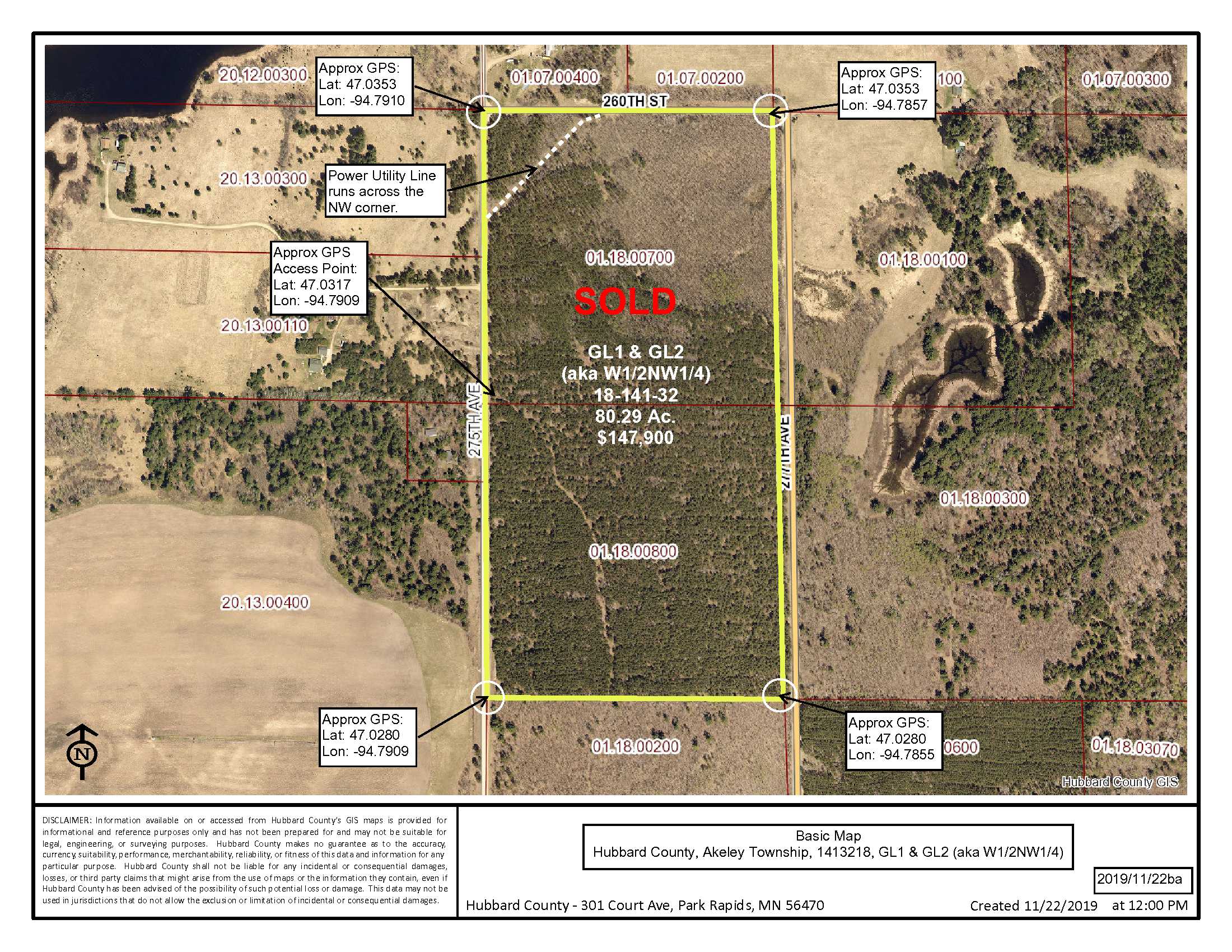
GL1 & GL2 (aka W1/2NW1/4) 18-141-32, subject to 260th St, 275th Ave, the power line utility in the NW corner, and any easements, restrictions, or reservations of record.
GL1 & GL2 (aka W1/2NW1/4) 18-141-32, subject to 260th St, 275th Ave, the power line utility in the NW corner, and any easements, restrictions, or reservations of record.
Property Location
Directions
From Nevis, head N on Co Rd 2 for 3.6 mi. Turn Right (E) on Hillview Rd (Twp Rd 14) & go 2.1 mi. Turn Left (N) on 275th Ave (Twp Rd 15) and go 0.8 mi to access on the Right (E). (Approx. GPS Access Point Lat: 47.0317 Lon: -94.7909)
From Nevis, head N on Co Rd 2 for 3.6 mi. Turn Right (E) on Hillview Rd (Twp Rd 14) & go 2.1 mi. Turn Left (N) on 275th Ave (Twp Rd 15) and go 0.8 mi to access on the Right (E). (Approx. GPS Access Point Lat: 47.0317 Lon: -94.7909)
Access
Approx. GPS Access Point off east side of 275th Ave. Lat: 47.0317 Lon: -94.7909
Approx. GPS Access Point off east side of 275th Ave. Lat: 47.0317 Lon: -94.7909
GPS Coordinates
Coordinates to approximate corners/points based on county mapping: NW: 47.0353, -94.7910 NE: 47.0353, -94.7857 SE: 47.0280, -94.7855 SW: 47.0280, -94.7909
Coordinates to approximate corners/points based on county mapping: NW: 47.0353, -94.7910 NE: 47.0353, -94.7857 SE: 47.0280, -94.7855 SW: 47.0280, -94.7909
Address
TBD 275th Ave., Nevis, MN 56467
TBD 275th Ave., Nevis, MN 56467
School District
Walker-Hackensack-Akeley - 113
Walker-Hackensack-Akeley - 113
Property Details
Pasture Acres
0
0
Tillable Acres
0
0
Wooded Acres
74.8
74.8
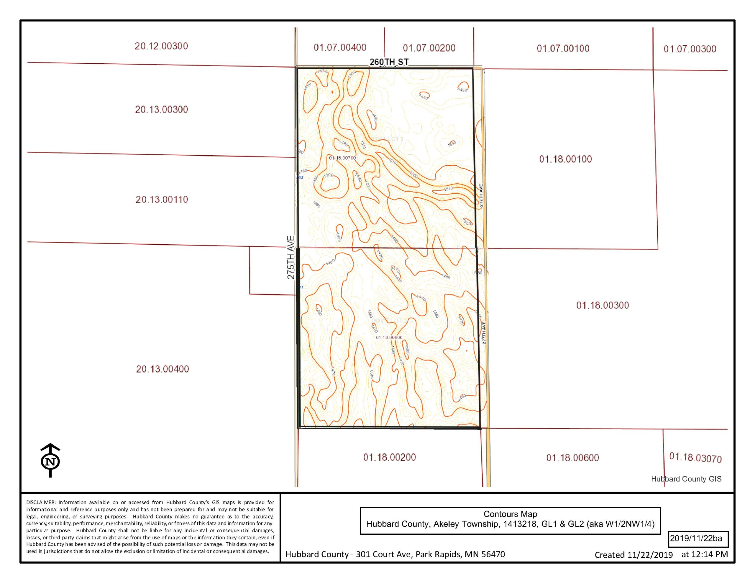
Dimensions (approx)
1320 x 2640 x 1320 x 2640
1320 x 2640 x 1320 x 2640
Utilities
Available Utilities
Nearby utility available
Nearby utility available
On Site Utilities
None
None
Power Company
Itasca-Mantrap Co-op (1-888-713-3377)
Itasca-Mantrap Co-op (1-888-713-3377)
Waterfront
Waterfront Name
N/A
N/A
Waterfront Number
N/A
N/A
Waterfront Feet (approx)
N/A
N/A
Taxes & Fees
Has Association Fee
No
No
Association Fee
$0
$0
Association Fee Includes
0
0
Tax Amount
$978
$978
Assessment Amount
0
0
Tax With Assessments
$978
$978
Assessment Pending
No
No
Assessment Description
N/A
N/A
Tax Year
2019
2019
Other Details
Section Number
18
18
Township Number
141
141
Range Number
32
32
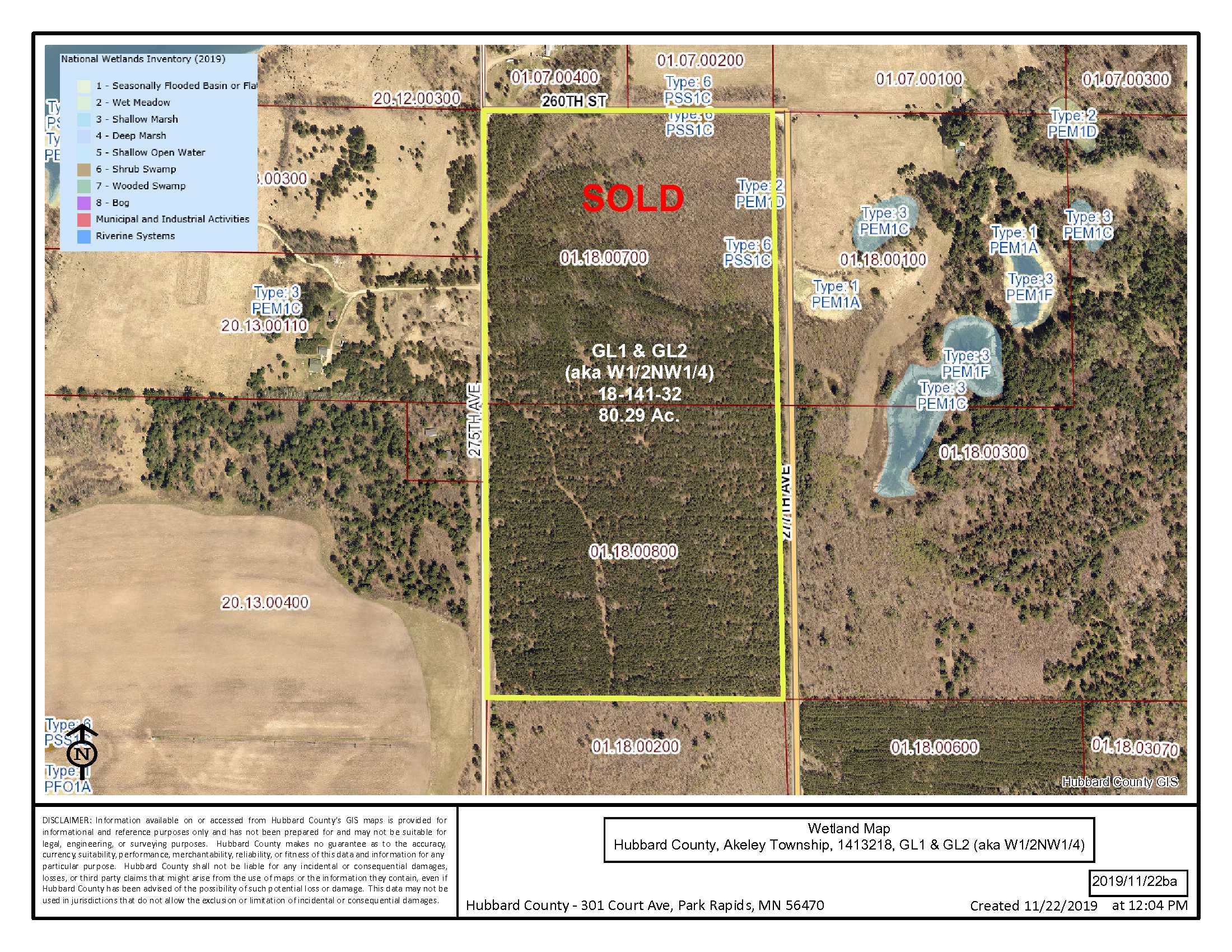
Estimated Upland %
99
99
Estimated Wetland %
1
1
Additional Comments
Timber Comments
This property has been managed according to Forest Stewardship Council (FSC) standards. If Timber value is important to you, seek the advice of a competent forester to determine species, volumes and values.
This property has been managed according to Forest Stewardship Council (FSC) standards. If Timber value is important to you, seek the advice of a competent forester to determine species, volumes and values.
Hunting Comments
Deer Permit Area: # 259
Deer Permit Area: # 259
Disclosures
There is a power line utility running across the NW corner. There has been some recent timber harvested, along with some unimproved interior trails following this recent logging activity. It is being released for sale in its “as is” condition and is subject to a land lease occupancy until May 2020. Acreage, dimensions, and taxes estimated based on county data and mapping or seller data; county disclaimers included by reference; subject to split approval if necessary. Not surveyed. Photos/maps and GPS coordinates for convenience only and not guaranteed; physically inspect prior to purchase. Any deer stands on the land are not property of seller and are not included in sale. Use seller-approved PA and addendum; closing dates the 3rd Wednesday each month. Seller is Potlatch Minnesota Timberlands LLC, a business entity under the laws of the State of Delaware.
There is a power line utility running across the NW corner. There has been some recent timber harvested, along with some unimproved interior trails following this recent logging activity. It is being released for sale in its “as is” condition and is subject to a land lease occupancy until May 2020. Acreage, dimensions, and taxes estimated based on county data and mapping or seller data; county disclaimers included by reference; subject to split approval if necessary. Not surveyed. Photos/maps and GPS coordinates for convenience only and not guaranteed; physically inspect prior to purchase. Any deer stands on the land are not property of seller and are not included in sale. Use seller-approved PA and addendum; closing dates the 3rd Wednesday each month. Seller is Potlatch Minnesota Timberlands LLC, a business entity under the laws of the State of Delaware.


